

List of Pennsylvania state historical markers in Allegheny County
Encyclopedia
This is intended to be a complete list of the official state historical markers placed in Allegheny County, Pennsylvania
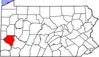
Allegheny County, Pennsylvania
Allegheny County is a county in the southwestern part of the U.S. state of Pennsylvania. As of the 2010 census, the population was 1,223,348; making it the second most populous county in Pennsylvania, following Philadelphia County. The county seat is Pittsburgh...
by the Pennsylvania Historical and Museum Commission
Pennsylvania Historical and Museum Commission
The Pennsylvania Historical and Museum Commission is the governmental agency of the Commonwealth of Pennsylvania responsible for the collection, conservation and interpretation of Pennsylvania's historic heritage...
(PHMC). The locations of the historical markers, as well as the latitude and longitude coordinates as provided by the PHMC's database, are included below when available. There are 142 historical markers located in Allegheny County.
Historical markers
| Marker title | Image | Date dedicated | Location | Marker type | Topics |
|---|---|---|---|---|---|
| 1909 McKee's Rocks Strike Pressed Steel Car Strike of 1909 The Pressed Steel Car Strike of 1909, also known as the "1909 McKees Rocks Strike," was an American labor strike which lasted from July 13 through September 8. The walkout drew national attention when it climaxed on Sunday August 22 in a bloody battle between strikers, private security agents, and... |
812 Island Ave. at McKees Rocks Bridge, Stowe Twp. 40.47372°N 80.06258°W |
Roadside | Labor | ||
| 1st Drive-In Filling Station | Near intersection of Baum & St. Clair Sts., at Spnning Plate Lofts lot, E Liberty/Friendship (Pittsburgh) 40.45934°N 79.93066°W |
City | Business & Industry, Oil & Gas, Transportation | ||
| Allegheny Arsenal Allegheny Arsenal The Allegheny Arsenal, established in 1814, was an important supply and manufacturing center for the Union Army during the American Civil War, and the site of the single largest civilian disaster during the war.... |
n/a | 40th St. near Davidson at Arsenal Park, opposite #257, Lawrenceville 40.46719°N 79.9605°W |
City | Civil War, French & Indian War, Military | |
| Allegheny Cotton Mill Strikes | Allegheny Landing, north side, near river at 6th St. Bridge, Pittsburgh 40.44706°N 80.00258°W |
City | Government & Politics 19th Century, Labor, Mills | ||
| Allegheny County Allegheny County, Pennsylvania Allegheny County is a county in the southwestern part of the U.S. state of Pennsylvania. As of the 2010 census, the population was 1,223,348; making it the second most populous county in Pennsylvania, following Philadelphia County. The county seat is Pittsburgh... |
 |
County Courthouse Allegheny County Courthouse Allegheny County Courthouse is a government building of Allegheny County located in the county seat, Pittsburgh, Pennsylvania.- Early structures:... , Grant St. between 5th & Forbes Aves., Pittsburgh 40.43812°N 79.99575°W |
City | Business & Industry, Government & Politics, Government & Politics 18th Century, Iron, Steel | |
| Allegheny Observatory Allegheny Observatory The Allegheny Observatory is an American astronomical research institution, a part of the Department of Physics and Astronomy at the University of Pittsburgh. The facility is listed on the National Register of Historical Places The Allegheny Observatory is an American astronomical research... |
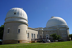 |
Riverview Ave. in Riverview Park (off US 19) near Observatory, Observatory Hill, Pittsburgh 40.48274°N 80.01831°W |
City | Education, Medicine & Science, Transportation | |
| Andrew Carnegie (1835-1919) Andrew Carnegie Andrew Carnegie was a Scottish-American industrialist, businessman, and entrepreneur who led the enormous expansion of the American steel industry in the late 19th century... |
Carnegie Library, 4400 Forbes Ave., Oakland (Pittsburgh) 40.44277°N 79.95168°W |
City | Business & Industry, Education, Ethnic & Immigration, Professions & Vocations, Steel | ||
| Art Blakey (1919-1990) Art Blakey Arthur "Art" Blakey , known later as Abdullah Ibn Buhaina, was an American Grammy Award-winning jazz drummer and bandleader. He was a member of the Ahmadiyya Muslim Community.... |
28 Chauncey St. (altho. appears to be in 600 block of Carmel Way), Hill District (Pittsburgh) 40.4479°N 79.97358°W |
City | African American, Music & Theater, Performers | ||
| Arthur J. Rooney Art Rooney Arthur Joseph "Art" Rooney, Sr. , often referred to as "The Chief", was the founding owner of the Pittsburgh Steelers American football franchise in the National Football League.-Family history:... |
TBD - marker dedicated, but not installed °N °W |
Roadside | Ethnic & Immigration, Football, Sports | ||
| August Wilson (1945-2005) August Wilson August Wilson was an American playwright whose work included a series of ten plays, The Pittsburgh Cycle, for which he received two Pulitzer Prizes for Drama... |
 |
1727 Bedford Ave., Pittsburgh 40.44521°N 79.98542°W |
Roadside | African American, Music & Theater, Writers | |
| Avery College | 619 Ohio St., North Side, Pittsburgh 40.45389°N 79.9986°W |
City | African American, Education, Religion | ||
| Barney Dreyfuss (1865-1932) Barney Dreyfuss Bernhard "Barney" Dreyfuss was an executive in Major League Baseball who owned the Pittsburgh Pirates franchise from 1900 to 1932.... |
Posvar Hall, University of Pittsburgh University of Pittsburgh The University of Pittsburgh, commonly referred to as Pitt, is a state-related research university located in Pittsburgh, Pennsylvania, United States. Founded as Pittsburgh Academy in 1787 on what was then the American frontier, Pitt is one of the oldest continuously chartered institutions of... , Oakland section 40.4416°N 79.95296°W |
City | Baseball, Entrepreneurs, Sports | ||
| Bethel A.M.E. Church | 405 1st Ave., at Smithfield St., Pittsburgh 40.43716°N 80.0005°W |
City | African American, Civil Rights, Education, Religion | ||
| Bethel Presbyterian Church | 2977 Bethel Church Rd. (county highway) between PA 88 & US 19, Bethel Park Bethel Park, Pennsylvania Bethel Park is a home rule municipality in Allegheny County, Pennsylvania, United States, and is part of the Pittsburgh Metro Area, approximately 7 miles southwest of Pittsburgh... 40.33658°N 80.04797°W |
Roadside | Buildings, Education, Religion | ||
| Billy Eckstein (1914-1993) Billy Eckstine William Clarence Eckstine was an American singer of ballads and a bandleader of the swing era. Eckstine's smooth baritone and distinctive vibrato broke down barriers throughout the 1940s, first as leader of the original bop big-band, then as the first romantic black male in popular... |
5913 Bryant St., Highland Park (Pittsburgh) 40.47584°N 79.91912°W |
City | African American, Performers | ||
| Bost Building Bost Building The Bost Building, also known as Columbia Hotel, is located on East Eighth Avenue in Homestead, Pennsylvania, United States. Built just before the 1892 Homestead Strike, it was used as headquarters by the Amalgamated Association of Iron and Steel Workers and for reporters covering the confrontation... |
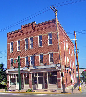 |
617-623 E 8th Ave. near Heisel St., Homestead 40.45905°N 79.90451°W |
City | Buildings, Iron, Labor, Publishing, Steel | |
| Bouquet Camp | Saltsburg Rd. (PA 380) & Frankstown Ave. (Petermans Corner), Penn Hills Twp. 40.48414°N 79.81905°W |
Roadside | Forts, French & Indian War, Military, Roads | ||
| Bower Hill | 292 Kane Blvd., Scott Twp., NE of Bridgeville 40.37434°N 80.08614°W |
Roadside | African American, American Revolution, George Washington, Mansions & Manors, Military, Whiskey Rebellion | ||
| Braddock's Crossing Battle of the Monongahela The Battle of the Monongahela, also known as the Battle of the Wilderness, took place on 9 July 1755, at the beginning of the French and Indian War, at Braddock's Field in what is now Braddock, Pennsylvania, east of Pittsburgh... |
Hoffman & Kennywood (PA 837) Blvds. at Kennywood Park, West Mifflin 40.38524°N 79.86292°W |
Roadside | French & Indian War, Military, Native American | ||
| Braddock's Defeat Battle of the Monongahela The Battle of the Monongahela, also known as the Battle of the Wilderness, took place on 9 July 1755, at the beginning of the French and Indian War, at Braddock's Field in what is now Braddock, Pennsylvania, east of Pittsburgh... |
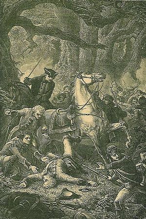 |
562 Jones Ave., east side, near Braddock Lib., Braddock 40.40296°N 79.86343°W |
Roadside | Forts, French & Indian War, Military, Native American | |
| Braddock's Defeat Battle of the Monongahela The Battle of the Monongahela, also known as the Battle of the Wilderness, took place on 9 July 1755, at the beginning of the French and Indian War, at Braddock's Field in what is now Braddock, Pennsylvania, east of Pittsburgh... |
|
US 30, north side, S of I-376 exit 10, Forest Hills (Missing) °N °W |
Roadside | French & Indian War, Military, Native American | |
| Braddock's Field Braddock's Field Braddock's Field is a historic battlefield on the banks of the Monongahela River, at Braddock, Pennsylvania, near the junction of Turtle Creek , about nine miles southeast of the "Forks of the Ohio" in Pittsburgh, Pennsylvania... |
549 Jones Ave., Washington Statue Park, Braddock 40.40305°N 79.86337°W |
Roadside | Government & Politics, Military, Whiskey Rebellion | ||
| Carnegie Hero Fund Commission Carnegie Hero Fund The Carnegie Hero Fund Commission, also known as Carnegie Hero Fund, was established to recognize persons who perform extraordinary acts of heroism in civilian life in the United States and Canada, and to provide financial assistance for those disabled and the dependents of those killed saving or... |
n/a | 301 Pittsburgh St. (SR 1001, old PA 28), Springdale 40.54106°N 79.79061°W |
Roadside | Business & Industry | |
| Carnegie Library of Homestead Swim Team | Homestead Library, 536 10th Avenue, Munhall 40.40733°N 79.90314°W |
City | Sports, Women | ||
| Charles Martin Hall Charles Martin Hall Charles Martin Hall was an American inventor, music enthusiast, and chemist. He is best known for his invention in 1886 of an inexpensive method for producing aluminium, which became the first metal to attain widespread use since the prehistoric discovery of iron.-Early years:Charles Martin Hall... |
 |
3200 Smallman St., Pittsburgh (MISSING) °N °W |
City | Business & Industry, Electricity, Entrepreneurs, Invention | |
| Charles Taze Russell (1852-1916) Charles Taze Russell Charles Taze Russell , or Pastor Russell, was a prominent early 20th century Christian restorationist minister from Pittsburgh, Pennsylvania, USA, and founder of what is now known as the Bible Student movement, from which Jehovah's Witnesses and numerous independent Bible Student groups emerged... |
 |
Allegheny Center Allegheny Center (Pittsburgh) Allegheny Center is a neighborhood on Pittsburgh's North Side. Its zip code is 15212, and it has representation on Pittsburgh City Council by both council members for District 6 and District 1 .-History:... , E Commons, at New Hazlett Theater (formerly Carnegie Hall), Pittsburgh 40.45274°N 80.00488°W |
City | Buildings, Houses & Homesteads, Religion | |
| Chartier's Town | PA 28 at Tarentum (Missing) °N °W |
City | Business & Industry, Cities & Towns, Early Settlement, Native American | ||
| Clinton Furnace |  |
Bessemer Ct. at Station Sq. Station Square Station Square is a indoor and outdoor shopping, dining and entertainment complex located in the South Shore neighborhood of Pittsburgh, Pennsylvania, United States.... , Pittsburgh 40.43398°N 80.00469°W |
Roadside | Business & Industry, Furnaces, Iron | |
| Crawford Grill Crawford Grill Crawford Grill was a renowned jazz club in Pittsburgh, Pennsylvania, USA's Hill District. Its heyday was the 1930s to 1950s.The club was founded by Gus Greenlee, who first made his reputation as a numbers runner and racketeer, then later as the owner of the Negro League baseball team the Pittsburgh... |
Wylie Ave. at Elmore St., Pittsburgh 40.46953°N 79.96358°W |
City | African American, Music & Theater | ||
| Daisy E. Lampkin Daisy Elizabeth Adams Lampkin Daisy Elizabeth Adams Lampkin was an American suffragette, civil rights activist, organization executive, and community practitioner whose career spanned over half a century... |
2519 Webster Ave. at Watt Ln., Hill District (Pittsburgh) 40.44991°N 79.97201°W |
City | African American, Government & Politics, Government & Politics 20th Century, Women | ||
| David L. Lawrence David L. Lawrence David Leo Lawrence was an American politician who served as the 37th Governor of Pennsylvania from 1959 to 1963. He is to date the only mayor of Pittsburgh to be elected Governor of Pennsylvania. Previously, he had been the mayor of Pittsburgh from 1946 through 1959... |
Point State Park, Pittsburgh 40.44199°N 80.00989°W |
City | Government & Politics, Government & Politics 19th Century, Governors | ||
| Davis Island Lock & Dam Davis Island (Pennsylvania) Davis Island is a small island located on the Ohio River in Stowe Township, just upstream of Neville Island near Pittsburgh, Pennsylvania, USA.... |
 |
1050 Ohio River Blvd. (PA 65) at E borough line, at Eat 'n' Park, Avalon 40.494°N 80.06416°W |
Roadside | Environment | |
| Dravo Corporation Shipyard Dravo Corporation Dravo Corporation was a shipbuilding company with shipyards in Pittsburgh, Pennsylvania and Wilmington, Delaware. It was founded by Frank and Ralph Dravo in Pittsburgh during the 1890s.-Facilities:... |
Neville Island Blvd. & Grand Ave., at Twp. Park, beside fire station, Neville Twp. 40.51182°N 80.12971°W |
Roadside | Business & Industry, Entrepreneurs | ||
| Duquesne Steel Works | E Grant Ave. & Linden St. (PA 837), Duquesne 40.37407°N 79.84241°W |
City | Business & Industry, Entrepreneurs | ||
| Duquesne University Duquesne University Duquesne University of the Holy Spirit is a private Catholic university in Pittsburgh, Pennsylvania, United States. Founded by members of the Congregation of the Holy Spirit, Duquesne first opened its doors as the Pittsburgh Catholic College of the Holy Ghost in October 1878 with an enrollment of... |
 |
Bluff St. at Univ. Administration Bldg., Pittsburgh 40.4355°N 79.99285°W |
City | Education, Ethnic & Immigration, Religion | |
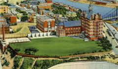
| Elizabeth | 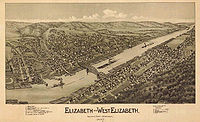 |
Between exit ramp of PA 51 and Elizabeth Bridge, Elizabeth 40.2724°N 79.88489°W |
Roadside | Business & Industry, Transportation | |
| Ethelbert Nevin |  |
PA 65 at Edgeworth Ln., east side, Edgeworth 40.54917°N 80.19664°W |
Roadside | Music & Theater, Writers | |
| Ethelbert Nevin | Pa. 65, west side, at Edgeworth (MISSING) °N °W |
Roadside | Music & Theater | ||
| Ferris Wheel Inventor George Washington Gale Ferris, Jr. George Washington Gale Ferris, Jr. was an American engineer. He is most famous for creating the original Ferris Wheel for the 1893 Chicago World's Columbian Exposition.-Early life:... |
 |
West Commons, Arch St. near S Diamond (MARKER NOT YET REINSTALLED) °N °W |
City | George Washington, Invention, Professions & Vocations, Sports | |
| First Aluminum Observatory Dome | West View Ave. near McKnight Rd. (Truck U.S. 19), Ross Township °N °W |
Roadside | Education, Environment, Invention, Medicine & Science | ||
| First Mining of Pittsburgh Coal | Grandview Ave. between Ulysses & Bertha Sts., Mt. Washington (Pittsburgh) Mount Washington (Pittsburgh) Mount Washington is a neighborhood in Pittsburgh, Pennsylvania's south city area. It has a zip code of 15211 and has representation on Pittsburgh City Council by both the council members for District 3 and District 2 .It is known for its steep hill overlooking the Pittsburgh skyline, which was... 40.43438°N 80.01127°W |
City | Business & Industry, Coal | ||
| First Professional Football Game | 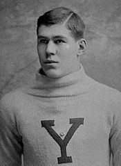 |
Near Heinz Field Heinz Field Heinz Field is a stadium located in Pittsburgh, Pennsylvania. It primarily serves as the home to the Pittsburgh Steelers and University of Pittsburgh Panthers American football teams, members of the National Football League and National Collegiate Athletic Association respectively... , North Shore (Pittsburgh) North Shore (Pittsburgh) The North Shore is a neighborhood in Pittsburgh, Pennsylvania's North Side. It has a zip code of 15212, and has representation on Pittsburgh City Council by both the council members for District 1 and 6... 40.44546°N 80.0137°W |
Roadside | Football, Sports | |
| First World Series 1903 World Series The 1903 World Series was the first modern World Series to be played in Major League Baseball. It matched the Boston Americans of the American League against the Pittsburgh Pirates of the National League in a best-of-nine series, with Boston prevailing five games to three, winning the last... |
Riverwalk near PNC Park PNC Park PNC Park is a baseball park located in Pittsburgh, Pennsylvania. It is the fifth home of the Pittsburgh Pirates, the city's Major League Baseball franchise. It opened during the 2001 Major League Baseball season, after the controlled implosion of the Pirates' previous home, Three Rivers Stadium... and the water wall, North Shore (Pittsburgh) North Shore (Pittsburgh) The North Shore is a neighborhood in Pittsburgh, Pennsylvania's North Side. It has a zip code of 15212, and has representation on Pittsburgh City Council by both the council members for District 1 and 6... 40.44543°N 80.00861°W |
Roadside | Baseball, Sports | ||
| Forbes Field Forbes Field Forbes Field was a baseball park in the Oakland neighborhood of Pittsburgh, Pennsylvania, from 1909 to 1971. It was the third home of the Pittsburgh Pirates Major League Baseball team, and the first home of the Pittsburgh Steelers, the city's National Football League franchise... |
 |
Roberto Clemente Dr. near S Bouquet St., by remaining Forbes Field wall, Pitt campus, Oakland (Pittsburgh) Oakland (Pittsburgh) Oakland is the academic, cultural, and healthcare center of Pittsburgh and is Pennsylvania's third largest "Downtown". Only Center City Philadelphia and Downtown Pittsburgh can claim more economic and social activity than Oakland... 40.44146°N 79.95282°W |
Roadside | Baseball, Football, Sports | |
| Forbes Road (Bouquet's Breastworks) | SR 2066 (Old Frankstown Rd.), at Boyce Park Admin. Bldg., Monroeville 40.45997°N 79.7528°W |
Roadside | French & Indian War, Military | ||
| Forbes Road, 1758, Fort Bedford to Fort Duquesne - Fort Duquesne End (PLAQUE) Forbes Road The Forbes Road was a historic military roadway in what was then British America, that was constructed in 1758 from Carlisle, Pennsylvania, to the French Fort Duquesne at the junction of the Allegheny and Monongahela rivers in what is now downtown Pittsburgh... |
 |
n/a | Point State Park, between Fort Pitt Museum & Blockhouse, Pittsburgh 40.44109°N 80.00967°W |
Plaque | Forts, French & Indian War, Military, Roads |
| Forbes Road, 1758, Fort Bedford to Fort Duquesne - The Bouquet Encampment (PLAQUE) | n/a | PA 380 (Saltsburg & Frankstown Rds.), Petermans Corner, Penn Hills Twp. 40.4842°N 79.81918°W |
Plaque | French & Indian War, Military, Roads | |
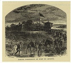
| Fort Duquesne Fort Duquesne Fort Duquesne was a fort established by the French in 1754, at the junction of the Allegheny and Monongahela rivers in what is now downtown Pittsburgh in the state of Pennsylvania.... |
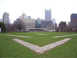 |
Point State Park Point State Park Point State Park is a Pennsylvania state park on in Downtown Pittsburgh, Allegheny County, Pennsylvania, USA, at the confluence of the Allegheny and Monongahela rivers, forming the Ohio River.... , main entrance at Commonwealth Pl., Pittsburgh °N °W |
City | Forts, French & Indian War, Military | |
| Fort Lafayette Fort Lafayette (Pennsylvania) Fort Lafayette, sometimes called Fort Fayette, was an American fort in Pittsburgh, Pennsylvania, United States.It was sited near present-day Penn Avenue and Ninth Street in the Cultural District of Downtown Pittsburgh.-History:... |
9th St. just N of Penn Ave., Pittsburgh 40.4437°N 79.99834°W |
City | Forts, Military, Native American, War of 1812 | ||
| Fort Pitt Fort Pitt (Pennsylvania) Fort Pitt was a fort built at the location of Pittsburgh, Allegheny County, Pennsylvania.-French and Indian War:The fort was built from 1759 to 1761 during the French and Indian War , next to the site of former Fort Duquesne, at the confluence the Allegheny River and the Monongahela River... |
 |
Point State Park Point State Park Point State Park is a Pennsylvania state park on in Downtown Pittsburgh, Allegheny County, Pennsylvania, USA, at the confluence of the Allegheny and Monongahela rivers, forming the Ohio River.... , main entrance Commonwealth Place, Pittsburgh °N °W |
City | Forts, French & Indian War, Military | |
| Fort Pitt Blockhouse Fort Pitt Blockhouse The Fort Pitt Blockhouse is a historic building in Point State Park in the city of Pittsburgh... |
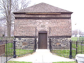 |
Point State Park, main entrance Commonwealth Place, Pittsburgh °N °W |
City | Forts, French & Indian War, Military | |
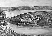
| Fort Prince George Fort Prince George Fort Prince George was an uncompleted fort on what is now the site of Pittsburgh, at the confluence of the Allegheny and Monongahela Rivers in Allegheny County, Pennsylvania. The site was originally a trading post established by Ohio Company trader William Trent in the 1740s... |
Point State Park, main entrance Commonwealth Place, Pittsburgh °N °W |
City | Forts, French & Indian War, George Washington, Military | ||
| Founding Convention of the AFL | NW corner of Mellon Park Mellon Square Mellon Square is an urban park in Downtown Pittsburgh, Pennsylvania. It is the first Modernist park built above a parking garage. With its distinctive black-and-white geometric pavement, it is a prominent feature and gathering spot of Downtown Pittsburgh.... , between 5th & 6th, opposite Wm Penn Hotel, Pittsburgh 40.4409°N 79.9975°W |
City | Labor | ||
| Founding Convention of the CIO | North Commons Drive, at MLK Elementary, near Allegheny Center, Pittsburgh 40.45433°N 80.00448°W |
City | Labor | ||
| Founding of Ironworkers Union | Grant St., betw. Blvd. of the Allies and 1st Ave., Pittsburgh 40.43665°N 79.99854°W |
City | Iron, Labor | ||
| Frances Perkins Frances Perkins Frances Perkins , born Fannie Coralie Perkins, was the U.S. Secretary of Labor from 1933 to 1945, and the first woman appointed to the U.S. Cabinet. As a loyal supporter of her friend, Franklin D. Roosevelt, she helped pull the labor movement into the New Deal coalition... |
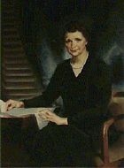 |
SW corner of 9th Ave. & Amity St., at police station, Homestead Homestead, Pennsylvania Homestead is a borough in Allegheny County, Pennsylvania, USA, in the "Mon Valley," southeast of downtown Pittsburgh and directly across the river from the city limit line. The borough is known for the Homestead Strike of 1892, an important event in the history of labor relations in the United... 40.40628°N 79.91019°W |
City | Government & Politics 20th Century, Labor, Steel, Women | |
| Frank Conrad Frank Conrad Frank Conrad was a radio broadcasting pioneer who worked as the Assistant Chief Engineer for the Westinghouse Electric Corporation in Pittsburgh, Pennsylvania,... |
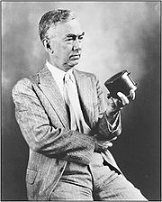 |
Pa. 8 (Penn Ave.) & Peebles St., W end Wilkinsburg °N °W |
City | Business & Industry, Entrepreneurs | |
| Frank E. Bolden (1912-2003) | 2621 Centre Ave., across from YMCA, Hill District (Pittsburgh) 40.4468°N 79.96774°W |
City | African American, Military Post-Civil War, Publishing, Writers | ||
| Frank Vittor Frank Vittor Frank Vittor was an American sculptor, known for his "preference for the heroic and colossal" - Early life :... (1888-1968) |
At Columbus statue in Schenley Park Schenley Park Schenley Park is a large municipal park located in Pittsburgh, Pennsylvania, between the neighborhoods of Oakland, Greenfield, and Squirrel Hill. It is also listed on the National Register of Historic Places as a historic district... , One Schenley Dr., Oakland, Pittsburgh °N °W |
Roadside | Artists, Ethnic & Immigration | ||
| Gen. Matthew B. Ridgway (1895-1993) Matthew Ridgway Matthew Bunker Ridgway was a United States Army General. He held several major commands and was most famous for resurrecting the United Nations war effort during the Korean War. Several historians have credited Ridgway for turning around the war in favor of the UN side... |
 |
611 Field Club Rd., at high school, Fox Chapel 40.51775°N 79.86756°W |
Roadside | Military, Military Post-Civil War | |
| George Westinghouse George Westinghouse George Westinghouse, Jr was an American entrepreneur and engineer who invented the railway air brake and was a pioneer of the electrical industry. Westinghouse was one of Thomas Edison's main rivals in the early implementation of the American electricity system... |
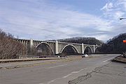 |
US 30 at W end of George Westinghouse Bridge George Westinghouse Bridge George Westinghouse Memorial Bridge in East Pittsburgh, Pennsylvania carries U.S. Route 30, The Lincoln Highway, over the Turtle Creek Valley where it joins the Monongahela River Valley east of Pittsburgh.... over Turtle Creek Turtle Creek Watershed According to the Turtle Creek Watershed Association, "The Turtle Creek watershed is situated in western Westmoreland County and eastern Allegheny County in southwestern Pennsylvania. Sixty-six percent of the watershed is situated in Westmoreland County, 34 percent in Allegheny County... , Turtle Creek 40.39487°N 79.83875°W |
Roadside | Business & Industry, Electricity, Entrepreneurs, Invention | |
| George Westinghouse George Westinghouse George Westinghouse, Jr was an American entrepreneur and engineer who invented the railway air brake and was a pioneer of the electrical industry. Westinghouse was one of Thomas Edison's main rivals in the early implementation of the American electricity system... |
 |
US 30 at E end of George Westinghouse Bridge George Westinghouse Bridge George Westinghouse Memorial Bridge in East Pittsburgh, Pennsylvania carries U.S. Route 30, The Lincoln Highway, over the Turtle Creek Valley where it joins the Monongahela River Valley east of Pittsburgh.... over Turtle Creek Turtle Creek Watershed According to the Turtle Creek Watershed Association, "The Turtle Creek watershed is situated in western Westmoreland County and eastern Allegheny County in southwestern Pennsylvania. Sixty-six percent of the watershed is situated in Westmoreland County, 34 percent in Allegheny County... , Turtle Creek (MISSING) °N °W |
Roadside | Business & Industry, Electricity, Entrepreneurs, Invention | |
| Great Steel Strike of 1919, The Steel strike of 1919 The Steel Strike of 1919 was an attempt by the weakened Amalgamated Association of Iron, Steel and Tin Workers to organize the United States steel industry in the wake of World War I. The strike began on September 22, 1919, and collapsed on January 8, 1920.The AA had formed in 1876. It was a... |
Braddock Ave. at 14th St., across from Edgar Thompson Works, Braddock 40.39852°N 79.8622°W |
City | Government & Politics, Labor, Steel | ||
| Greenlee Field Greenlee Field Greenlee Field in Pittsburgh, Pennsylvania, USA, was the first black-built and black-owned major league baseball field in the United States.The field was the dream of Gus Greenlee, owner of the Pittsburgh Crawfords. In 1931, construction started on Bedford Avenue between Chauncy and Duff in... |
Bedford Ave. & Junilla St., Hill Dist., Pittsburgh 40.4506°N 79.973°W |
City | African American, Football, Sports | ||
| Hand's Hospital | PA 60 (Steuben St.) at Linden St., across from Crafton Park, Crafton 40.43913°N 80.07339°W |
Roadside | French & Indian War, Military | ||
| Helen Richey (1909-1947) Helen Richey Helen Richey was a pioneering female aviator and the first woman to be hired as a pilot by a commercial airline in the United States.... |
Renzie Park, Eden Park Blvd. & Tulip Dr., McKeesport 40.34063°N 79.82724°W |
Roadside | Education, Military, Military Post-Civil War, Professions & Vocations, Transportation, Women | ||
| Henry Clay Frick (1848-1919) Henry Clay Frick Henry Clay Frick was an American industrialist, financier, and art patron. He founded the H. C. Frick & Company coke manufacturing company, was chairman of the Carnegie Steel Company, and played a major role in the formation of the giant U.S. Steel steel manufacturing concern... |
 |
Grant St. near 5th Ave., in median at Frick Bldg. Frick Building The Frick Building is one of the major distinctive and recognizable features of Downtown Pittsburgh, Pennsylvania, United States. The tower was built by and is named for Henry Clay Frick, an industrialist coke producer who created a portfolio of commercial buildings in Pittsburgh... , Pittsburgh 40.43987°N 79.99564°W |
City | Business & Industry, Coal | |
| Henry J. Heinz (1844-1919) Henry J. Heinz Henry John Heinz was an American businessman who founded the H. J. Heinz Company.-Early life:Heinz was one of eight children born to John Henry Heinz and Anna Margaretha Heinz... |
 |
16th St. Bridge, North Side, Pittsburgh 40.45329°N 79.99268°W |
City | Business & Industry, Entrepreneurs | |
| Homestead Grays Homestead Grays The Homestead Grays were a professional baseball team that played in the Negro leagues in the United States. The team was formed in 1912 by Cumberland Posey, and would remain in continuous operation for 38 seasons. The team was based in Homestead, Pennsylvania, adjacent to Pittsburgh.-Franchise... |
Amity St. at The Waterfront, at Filene's Basement lot and RR tracks, Homestead 40.40919°N 79.91212°W |
Roadside | African American, Baseball, Sports | ||
| Homestead Strike Homestead Strike The Homestead Strike was an industrial lockout and strike which began on June 30, 1892, culminating in a battle between strikers and private security agents on July 6, 1892. It was one of the most serious disputes in U.S. labor history... |
 |
880 E Waterfront Dr., Munhall 40.41285°N 79.89711°W |
City | Government & Politics, Labor | |
| Homestead Strike Victims | 102 E 22nd St., near Main St., Munhall 40.39762°N 79.9019°W |
Roadside | Labor | ||
| Honus Wagner (1874-1955) Honus Wagner -Louisville Colonels:Recognizing his talent, Barrow recommended Wagner to the Louisville Colonels. After some hesitation about his awkward figure, Wagner was signed by the Colonels, where he hit .338 in 61 games.... |
.jpg) |
Mansfield Blvd. & Chartiers St., Carnegie 40.40747°N 80.08895°W |
Roadside | Baseball, Ethnic & Immigration, Sports | |
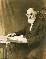
| James Hay Reed James Hay Reed James Hay Reed, Sr. was a United States federal judge.Born in Allegheny, Pennsylvania, Reed received an A.M. from the Western University of Pennsylvania in 1872 and read law to enter the bar in 1875... |
Carnegie Science Center Carnegie Science Center The Carnegie Science Center, located in the Chateau neighborhood of Pittsburgh, Pennsylvania, opened in 1991.With a history that dates to October 24, 1939, the Carnegie Science Center is the most visited museum in Pittsburgh... (1 Allegheny Ave., S of North Commons), North Side (Pittsburgh) 40.45321°N 80.00587°W |
City | Business & Industry, Professions & Vocations | ||
| Jane Grey Swisshelm Jane Swisshelm Jane Grey Cannon Swisshelm was an American journalist, abolitionist, and women's rights advocate.-Life:... |
 |
Braddock & Greendale Aves., Edgewood, just N of I-376 exit 9 40.42867°N 79.89134°W |
Roadside | Civil Rights, Civil War, Medicine & Science, Women, Writers | |
| Jane Holmes (1805-1885) | W PA School for Blind Children, Bayard St. at N Bellefield Ave., Schenley Farms (Pittsburgh) 40.44823°N 79.95295°W |
City | Women | ||
| John A. Roebling (1806-1869) John A. Roebling John Augustus Roebling was a German-born American civil engineer. He is famous for his wire rope suspension bridge designs, in particular, the design of the Brooklyn Bridge.-Early life:... |
 |
n/a | Smithfield St. Bridge Smithfield Street Bridge The Smithfield Street Bridge is a lenticular truss bridge crossing the Monongahela River in Pittsburgh, Pennsylvania, USA.The bridge was designed by Gustav Lindenthal, the engineer who later designed the Hell Gate Bridge. The bridge was built between 1881–83, opening for traffic on March 19, 1883.... at West Carson St., Pittsburgh 40.43335°N 80.00328°W |
City | Bridges, Transportation |
| John M. Phillips (1861-1953) | St. Pius X Byzantine Catholic Church, 2336 Brownsville Rd., Pittsburgh 40.3884°N 79.9852°W |
City | Government & Politics 19th Century, Government & Politics 20th Century, Professions & Vocations | ||
| John Scull (1765-1828) | Blvd. of the Allies, just W of Market St., Pittsburgh 40.43902°N 80.00376°W |
City | Business & Industry, Professions & Vocations, Publishing | ||
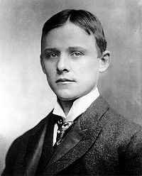
| Johnny Unitas (1933-2002) Johnny Unitas John Constantine Unitas , known as Johnny Unitas or "Johnny U", and nicknamed "The Golden Arm", was a professional American football player in the 1950s through the 1970s, spending the majority of his career with the Baltimore Colts. He was a record-setting quarterback, and the National Football... |
 |
Arsenal Middle School Field, 40th and Butler Sts., Lawrenceville section, Pittsburgh 40.46827°N 79.96268°W |
City | Football, Sports | |
| Joshua (Josh) Gibson (1911-1947) Josh Gibson Joshua Gibson was an American catcher in baseball's Negro leagues. He played for the Homestead Grays from 1930 to 1931, moved to the Pittsburgh Crawfords from 1932 to 1936, and returned to the Grays from 1937 to 1939 and 1942 to 1946... |
2217 Bedford Ave., Hill District (Pittsburgh) 40.44861°N 79.97754°W |
City | African American, Baseball, Sports | ||
| Joshua Meeks (1731-1818) | along Beaver Grade Rd. at entrance to Forest Glen Condos, Moon Twp. 40.509622°N 80.212178°W |
Roadside | American Revolution, Early Settlement, Education, Government & Politics 18th Century, Military | ||
| K. Leroy Irvis (1916-2006) K. Leroy Irvis K. Leroy Irvis was the first African American to serve as a speaker of the house in any state legislature in the United States since Reconstruction. John Roy Lynch of Mississippi was the first African American to hold that position. Mr... |
2170 Centre Ave., Hill Dist., Pittsburgh °N °W |
Roadside | African American, Civil Rights, Education, Government & Politics 20th Century, Labor | ||
| Kennywood Park Kennywood Kennywood is an amusement park located in West Mifflin, Pennsylvania, a suburb of Pittsburgh. The park first opened in 1898 as a "trolley park" at the end of the Monongahela Street Railway. The park was purchased in 1906 by F. W. Henninger and Andrew McSwigan and thus began the Kennywood... |
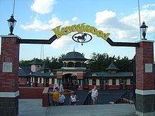 |
4800 Kennywood Boulevard behind park office, West Mifflin 40.3857°N 79.86564°W |
Roadside | Sports | |
| Kier Refinery | small park near Chatham/Bigelow Sq., betw. Bigelow Blvd. & 7th Ave., Pittsburgh 40.44145°N 79.99405°W |
City | Business & Industry, Entrepreneurs | ||
| Kuskusky Path | 2500 Brandt School Rd., at Trinity Luth. Church, Wexford (Franklin Park) °N °W |
Roadside | Early Settlement, Military, Native American, Paths & Trails, Transportation | ||
| Lewis and Clark Expedition Lewis and Clark Expedition The Lewis and Clark Expedition, or ″Corps of Discovery Expedition" was the first transcontinental expedition to the Pacific Coast by the United States. Commissioned by President Thomas Jefferson and led by two Virginia-born veterans of Indian wars in the Ohio Valley, Meriwether Lewis and William... |
1 block N of 10th St. Bypass & Waterfront Dr. intersection, Pittsburgh 40.447°N 79.9952°W |
City | Exploration | ||
| Martha Graham (1894-1991) Martha Graham Martha Graham was an American modern dancer and choreographer whose influence on dance has been compared with the influence Picasso had on modern visual arts, Stravinsky had on music, or Frank Lloyd Wright had on architecture.She danced and choreographed for over seventy years... |
 |
California Ave. & Brighton Rd., North Side, (Pittsburgh) °N °W |
City | Education, Music & Theater, Performers, Women | |
| Martin R. Delany (1812-1885) Martin Delany Martin Robinson Delany was an African-American abolitionist, journalist, physician, and writer, arguably the first proponent of American black nationalism. He was one of the first three blacks admitted to Harvard Medical School. He became the first African-American field officer in the United... |
 |
5 PPG Place, 3rd Ave. & Market St., Pittsburgh 40.43948°N 80.00325°W |
City | African American, Civil War, Military, Professions & Vocations, Publishing | |
| Mary Cassatt (1844-1926) Mary Cassatt Mary Stevenson Cassatt was an American painter and printmaker. She lived much of her adult life in France, where she first befriended Edgar Degas and later exhibited among the Impressionists... |
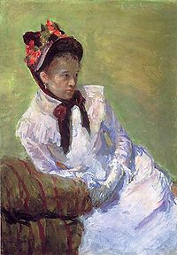 |
Allegheny and Ridge Aves., in park betw. Rt. 65 on and off ramps, McKees Rocks (Pittsburgh) 40.44937°N 80.01809°W |
City | Artists, Women | |
| Mary Harris "Mother" Jones | NE corner of 9th and Amity Sts., (at former municipal bldg.), Homestead 40.40654°N 79.91016°W |
City | Government & Politics 20th Century, Labor, Steel, Women | ||
| Mary Lou Williams (1910-1981) Mary Lou Williams Mary Lou Williams was an American jazz pianist, composer, and arranger. Williams wrote hundreds of compositions and arrangements, and recorded more than one hundred records... |
328 Lincoln Ave., Lincoln Elementary School, Larimer (Pittsburgh) 40.46°N 79.91209°W |
City | African American, Music & Theater, Performers, Women | ||
| McClurg Iron Foundry | Boulevard of the Allies, just W of Market St. (MISSING) °N °W |
City | Buildings, Business & Industry, Military, War of 1812 | ||
| McKees Rocks Mound | Rangers Field, Shingiss & Sproul Streets. The Bottoms, McKees Rocks 40.47301°N 80.05156°W |
City | Native American | ||
| Mercy Hospital UPMC Mercy UPMC Mercy is a main hospital facility of the University of Pittsburgh Medical Center and is located in the Uptown section of the city of Pittsburgh, Pennsylvania, adjacent to downtown Pittsburgh and a few blocks from the Mellon Arena... |
 |
1400 Locust St., Pittsburgh 40.43665°N 79.98489°W |
City | Education, Professions & Vocations, Religion, Women | |
| Michael A. Musmanno (1897-1968) Michael Musmanno Michael Angelo Musmanno was an American jurist, politician, and naval officer of Italian heritage.Musmanno was born in Stowe Township, in Allegheny County, Pennsylvania, an industrial neighborhood a few miles west of Pittsburgh.Musmanno rose to the rank of Rear Admiral in the United States Navy... |
1321 Island Ave. (Pa. 51), Stowe Twp. 40.48241°N 80.06998°W |
Roadside | Government & Politics, Government & Politics 20th Century, Writers | ||
| Mooncrest | Mooncrest Dr. at Old Thorn Run Rd., Moon Twp. 40.521625°N 80.191103°W |
City | Business & Industry, Government & Politics 20th Century, Labor, Military, Military Post-Civil War | ||
| National Negro Opera Company National Negro Opera Company The National Negro Opera Company was the first African-American opera company in the United States.Organized in Pittsburgh, Pennsylvania, under the direction of Mary Cardwell Dawson, the company was resident in a Queen Anne-style house at 7101 Apple Street in the city's Homewood... |
7101 Apple St., Homewood (Pittsburgh) 40.4642°N 79.89571°W |
City | African American, Music & Theater | ||
| National Tube Works | 575 Lysle Blvd. (PA 148), at subway entrance to plant, McKeesport 40.35215°N 79.8604°W |
City | Business & Industry, Oil & Gas | ||
| Neville House Woodville (Heidelberg, Pennsylvania) Woodville, also known as the Neville House or John Neville House, is a house on Washington Pike south of Heidelberg, Pennsylvania. It is significant for its association with John Neville, a tax collector whose other house was burned in the Whiskey Rebellion in 1794. The oldest portion of the house... |
 |
Pa. 50 just S of Woodville, Pittsburgh 40.37939°N 80.09621°W |
Roadside | American Revolution, Houses & Homesteads, Military, Whiskey Rebellion | |
| Old St. Luke's Church | 330 Old Washington Pike, Scott Twp. 40.38449°N 80.09067°W |
Roadside | Buildings, Early Settlement, French & Indian War, Military, Religion, Whiskey Rebellion | ||
| Pennsylvania Canal Pennsylvania Canal Pennsylvania Canal refers generally to a complex system of canals, dams, locks, tow paths, aqueducts, and other infrastructure including, in some cases, railroads in Pennsylvania... |
Liberty Ave. /Grant St. at 10th St. (at the Pennsylvanian), Pittsburgh 40.44398°N 79.99289°W |
City | Canals, Navigation, Transportation | ||
| Pioneer Short-Wave Station | Barclay Ave., off Greensburg Pike, Forest Hills 40.41831°N 79.84138°W |
City | Business & Industry | ||
| Pittsburgh | Pa. 51 at S city line, near Stewart Ave. (MISSING) °N °W |
Roadside | Cities & Towns, Early Settlement, Forts, Government & Politics, Steel | ||
| Pittsburgh | 4675 Steubenville Pike (PA 60) at W Steuben St., at bridge and Sharp Edge Creekhouse restaurant, Thornburg 40.44041°N 80.08066°W |
Roadside | Cities & Towns, Early Settlement, Forts, Government & Politics, Steel | ||
| Pittsburgh | 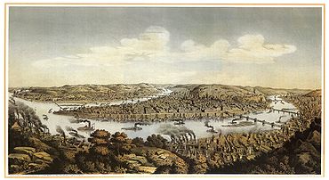 |
Pa. 65 (Ohio River Blvd.), N city line (MISSING) °N °W |
Roadside | Cities & Towns, Early Settlement, Forts, Government & Politics, Steel | |
| Pittsburgh | US 30 westbound, at W end of Forest Hills (MISSING) °N °W |
Roadside | Cities & Towns, Early Settlement, Forts, Government & Politics, Steel | ||
| Pittsburgh | PA 8 & PA 28, Millvale (MISSING) °N °W |
Roadside | Cities & Towns, Early Settlement, Forts, Government & Politics, Steel | ||
| Pittsburgh | 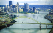 |
Perrysville Rd. (US 19), near St. Benedict's Academy, N of city line (MISSING) °N °W |
Roadside | Cities & Towns | |
| Pittsburgh | PA 65 at north city line (MISSING) °N °W |
Roadside | Cities & Towns | ||
| Pittsburgh | 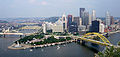 |
US 19 north of city line (MISSING) °N °W |
Roadside | Cities & Towns | |
| Pittsburgh Agreement (The) Pittsburgh Agreement The Pittsburgh Agreement paved the way for the creation of the state of Czechoslovakia and was signed by a group of 20 Czechs, Slovaks, and Rusyns on May 31, 1918... |
Penn Avenue & 7th Street, Pittsburgh 40.4429°N 80.00034°W |
City | Ethnic & Immigration, Government & Politics 20th Century | ||
| Pittsburgh Glass Works | Foot of Duquesne Incline, West Carson St., Pittsburgh 40.43986°N 80.0174°W |
City | Business & Industry, Glass | ||
| Pittsburgh Grease Plant | 33rd St. & Smallman St., Strip Dist. (Pittsburgh) 40.46258°N 79.96909°W |
City | Business & Industry, Military, Military Post-Civil War, Oil & Gas, Transportation | ||
| Pittsburgh Plate Glass Company PPG Industries PPG Industries is a global supplier of paints, coatings, optical products, specialty materials, chemicals, glass and fiber glass. With headquarters in Pittsburgh, Pennsylvania, PPG operates in more than 60 countries around the globe. Sales in 2010 were $13.4 billion... |
Plaza of PPG Place PPG Place PPG Place is a complex in downtown Pittsburgh, Pennsylvania, consisting of six buildings within three city blocks and five and a half acres. Named for its anchor tenant, PPG Industries, who initiated the project for its headquarters, the buildings are all of matching glass design consisting of... , between 4th Ave. & Market Sq., Pittsburgh 40.44017°N 80.00288°W |
City | Business & Industry, Glass | ||
| Pittsburgh Platform Pittsburgh Platform The Pittsburgh Platform is a pivotal 19th century document in the history of the American Reform Movement in Judaism that called for Jews to adopt a modern approach to the practice of their faith... |
Stockton Ave. at Concordia Club, East Park (north side), Pittsburgh 40.4509°N 80.0019 °W |
City | Religion | ||
| Polish Army Polish Falcons The Polish Falcons of America is a Polish fraternal organization founded in 1887 in Chicago, Illinois, USA, as the American branch of the Polish Gymnastic Society Sokół. It quickly expanded among the Polish community in North America, its local lodges called nests... |
97 S. 18th St., South Side Flats, Pittsburgh 40.428158°N 79.980289°W |
City | Ethnic & Immigration, Military, Military Post-Civil War | ||
| Presston | Ohio & Nichols Sts., Presston, Stowe Twp. 40.4831°N 80.0628°W |
Roadside | Ethnic & Immigration, Government & Politics 20th Century, Labor, Steel | ||
| Queen Aliquippa | 2928 Highland Ave., Highland Grove Park, near 2918 Bowman Ave., McKeesport 40.35983°N 79.83326°W |
Roadside | French & Indian War, George Washington, Government & Politics 18th Century, Military, Native American, Women | ||
| Rachel Carson Rachel Carson Rachel Louise Carson was an American marine biologist and conservationist whose writings are credited with advancing the global environmental movement.... |
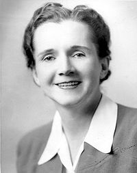 |
Pittsburgh St. (SR 1001, old PA 28) at Colfax St., Springdale Springdale, Pennsylvania Springdale is a borough in Allegheny County, Pennsylvania, northeast of Pittsburgh along the Allegheny River. The population was 3,405 at the 2010 census.-Geography:Springdale is located at .... 40.54105°N 79.78399°W |
City | Environment, Medicine & Science, Women, Writers | |
| Radio Station KDKA KDKA (AM) KDKA is a radio station licensed to Pittsburgh, Pennsylvania, USA. Created by the Westinghouse Electric Corporation on November 2, 1920, it is one of the world's first modern radio stations , a distinction that has also been challenged by other stations, although it has claimed to be the first in... |
KDKA Headquarters, 1 Gateway Center, Pittsburgh 40.44255°N 80.00543°W |
City | Business & Industry | ||
| Railroad Strike of 1877 Great railroad strike of 1877 The Great Railroad Strike of 1877 began on July 14 in Martinsburg, West Virginia, United States and ended some 45 days later after it was put down by local and state militias, and federal troops.-Economic conditions in the 1870s:... |
 |
Liberty Ave. at 28th St. (on traffic island), Pittsburgh 40.45618°N 79.97491°W |
City | Labor, Railroads, Transportation | |
| Robert Lee Vann (1879-1940) | 2621 Center Ave., at Frances St., Hill District (Pittsburgh) 40.44087°N 79.96767°W |
City | African American, Government & Politics, Government & Politics 20th Century, Professions & Vocations, Publishing | ||
| Salk Polio Vaccine Polio vaccine Two polio vaccines are used throughout the world to combat poliomyelitis . The first was developed by Jonas Salk and first tested in 1952. Announced to the world by Salk on April 12, 1955, it consists of an injected dose of inactivated poliovirus. An oral vaccine was developed by Albert Sabin... |
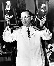 |
Salk Hall Salk Hall Jonas Salk Hall at the University of Pittsburgh is a Pennsylvania state and Pittsburgh History and Landmarks Foundation Historic Landmark. The Art Deco building is named after Jonas Salk, who conducted his research on the first polio vaccine in a basement laboratory while on the faculty at the... , Univ. of Pitt University of Pittsburgh The University of Pittsburgh, commonly referred to as Pitt, is a state-related research university located in Pittsburgh, Pennsylvania, United States. Founded as Pittsburgh Academy in 1787 on what was then the American frontier, Pitt is one of the oldest continuously chartered institutions of... , Terrace St. at Sutherland Dr. (across fr. Peterson Events Ctr.), Oakland (Pittsburgh) Oakland (Pittsburgh) Oakland is the academic, cultural, and healthcare center of Pittsburgh and is Pennsylvania's third largest "Downtown". Only Center City Philadelphia and Downtown Pittsburgh can claim more economic and social activity than Oakland... 40.44318°N 79.96209°W |
Roadside | Invention, Medicine & Science | |
| Shadyside Iron Furnace | SE corner of Bayard St. & Amberson Ave., at Winchester-Thurston H.S. field, Pittsburgh 40.4521°N 79.94173°W |
City | Business & Industry, Furnaces, Iron | ||
| Shannopin Town | 40th St. at GW bridge (west side), Lawrenceville (Pittsburgh) 40.46953°N 79.96358°W |
City | Early Settlement, Native American | ||
| Shousetown Boatyard | 81 McGovern Blvd. (PA 51) near Spring Run Rd., Honor Roll Park, near fire dept., Glenwillard/Crescent Twp. 40.55716°N 80.22081°W |
City | Business & Industry, Transportation | ||
| Sisters of Mercy Sisters of Mercy The Religious Order of the Sisters of Mercy is an order of Catholic women founded by Catherine McAuley in Dublin, Ireland, in 1831. , the order has about 10,000 members worldwide, organized into a number of independent congregations.... |
800 Penn Ave., Cultural Dist., (Pittsburgh) 40.44376°N 79.99928°W |
City | Ethnic & Immigration, Religion, Women | ||
| Site of the Western Penitentiary - PLAQUE | 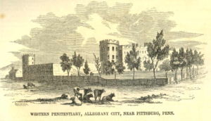 |
n/a | Eagle enclosure at the National Aviary National Aviary The National Aviary, located in Pittsburgh, Pennsylvania, is America's only independent indoor nonprofit aviary. It is also America's largest aviary, and the only accorded honorary "National" status by the United States Congress.-Location and features:... , North Side (Pittsburgh) 40.4532°N 80.01015°W |
Plaque | Civil War, Military, Police and Safety |
| Station WQED WQED (TV) WQED is a Public Broadcasting Service member Public television station based in Pittsburgh, Pennsylvania. Established April 1, 1954, it was the first community-sponsored television station in the United States as well as the fifth public TV station... |
 |
4802 5th Ave., Oakland (Pittsburgh) Oakland (Pittsburgh) Oakland is the academic, cultural, and healthcare center of Pittsburgh and is Pennsylvania's third largest "Downtown". Only Center City Philadelphia and Downtown Pittsburgh can claim more economic and social activity than Oakland... 40.44717°N 79.94453°W |
City | Business & Industry, Education, Motion Pictures & Television | |
| Stephen C. Foster Stephen Foster Stephen Collins Foster , known as the "father of American music", was the pre-eminent songwriter in the United States of the 19th century... |
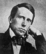 |
3600 Penn Ave., at homestead (behind fence), Lawrenceville (Pittsburgh) 40.46415°N 79.96374°W |
Roadside | Music & Theater | |
| Stephen C. Foster Memorial Stephen Foster Memorial The Stephen Collins Foster Memorial is a performing arts center, museum and archive at the University of Pittsburgh in Pittsburgh, Pennsylvania, USA.... |
 |
Forbes Ave. just E of Bigelow Blvd., Oakland (Pittsburgh) Oakland (Pittsburgh) Oakland is the academic, cultural, and healthcare center of Pittsburgh and is Pennsylvania's third largest "Downtown". Only Center City Philadelphia and Downtown Pittsburgh can claim more economic and social activity than Oakland... 40.44354°N 79.95256°W |
City | Music & Theater, Writers | |
| Three Rivers Stadium Three Rivers Stadium Three Rivers Stadium was a multi-purpose stadium located in Pittsburgh, Pennsylvania from 1970 to 2000. It was home to the Pittsburgh Pirates and the Pittsburgh Steelers, the city's Major League Baseball franchise and National Football League franchise respectively.Built as a replacement to... |
 |
Art Rooney Ave., near North Shore Dr., Heinz Field Heinz Field Heinz Field is a stadium located in Pittsburgh, Pennsylvania. It primarily serves as the home to the Pittsburgh Steelers and University of Pittsburgh Panthers American football teams, members of the National Football League and National Collegiate Athletic Association respectively... , North Shore (Pittsburgh) North Shore (Pittsburgh) The North Shore is a neighborhood in Pittsburgh, Pennsylvania's North Side. It has a zip code of 15212, and has representation on Pittsburgh City Council by both the council members for District 1 and 6... 40.44602°N 80.01387°W |
Roadside | Baseball, Football, Sports | |
| United Steelworkers of America Steel Workers Organizing Committee The Steel Workers Organizing Committee was one of two precursor labor organizations to the United Steelworkers. It was formed by the CIO in 1936. It disbanded in 1942 to become the United Steel Workers of America.... |
Grant St. between 3rd & 4th Aves., Pittsburgh 40.4381°N 79.99812°W |
City | Government & Politics 20th Century, Labor, Steel | ||
| University of Pittsburgh University of Pittsburgh The University of Pittsburgh, commonly referred to as Pitt, is a state-related research university located in Pittsburgh, Pennsylvania, United States. Founded as Pittsburgh Academy in 1787 on what was then the American frontier, Pitt is one of the oldest continuously chartered institutions of... |
 |
SE corner, 5th Ave. & Bigelow Blvd., Oakland (Pittsburgh) Oakland (Pittsburgh) Oakland is the academic, cultural, and healthcare center of Pittsburgh and is Pennsylvania's third largest "Downtown". Only Center City Philadelphia and Downtown Pittsburgh can claim more economic and social activity than Oakland... 40.44444°N 79.95452°W |
City | Education | |
| V.F.W. Veterans of Foreign Wars The Veterans of Foreign Wars of the United States is a congressionally chartered war veterans organization in the United States. Headquartered in Kansas City, Missouri, VFW currently has 1.5 million members belonging to 7,644 posts, and is the largest American organization of combat... |
 |
5th Ave. & Bigelow Blvd., at Wm. Pitt Union William Pitt Union The William Pitt Union is the student union building of the University of Pittsburgh main campus and is a Pennsylvania and Pittsburgh History and Landmarks Foundation Historic Landmark... by bus stop, Oakland, Pittsburgh 40.44416°N 79.95458°W |
City | Military, Military Post-Civil War | |
| Victor Herbert (1859-1924) Victor Herbert Victor August Herbert was an Irish-born, German-raised American composer, cellist and conductor. Although Herbert enjoyed important careers as a cello soloist and conductor, he is best known for composing many successful operettas that premiered on Broadway from the 1890s to World War I... |
 |
4400 Forbes Ave., at Carnegie Mus. Carnegie Museums of Pittsburgh Carnegie Museums of Pittsburgh are four museums that are operated by the Carnegie Institute headquartered in the Oakland neighborhood of Pittsburgh, Pennsylvania... near Shakespeare statue, Oakland (Pittsburgh) Oakland (Pittsburgh) Oakland is the academic, cultural, and healthcare center of Pittsburgh and is Pennsylvania's third largest "Downtown". Only Center City Philadelphia and Downtown Pittsburgh can claim more economic and social activity than Oakland... 40.44393°N 79.95138°W |
City | Ethnic & Immigration, Performers | |
| Westinghouse Electric Corporation Westinghouse Electric (1886) Westinghouse Electric was an American manufacturing company. It was founded in 1886 as Westinghouse Electric Company and later renamed Westinghouse Electric Corporation by George Westinghouse. The company purchased CBS in 1995 and became CBS Corporation in 1997... |
Westinghouse Plaza, 6 Gateway Center, Pittsburgh 40.4396°N 80.0062°W |
City | Business & Industry, Electricity | ||
| William "Billy" Strayhorn (1915-1967) Billy Strayhorn William Thomas "Billy" Strayhorn was an American composer, pianist and arranger, best known for his successful collaboration with bandleader and composer Duke Ellington lasting nearly three decades. His compositions include "Chelsea Bridge", "Take the "A" Train" and "Lush Life".-Early... |
1101 N. Murtland St., at Westinghouse High School Westinghouse High School (Pittsburgh) Westinghouse High School is a public school in the Homewood neighborhood of Pittsburgh, Pennsylvania, USA, or The Academy at Westinghouse named for Pittsburgh resident George Westinghouse.... , Homewood (Pittsburgh) Homewood (Pittsburgh) Homewood is a predominantly African American neighborhood of Pittsburgh, Pennsylvania, United States, officially divided into three neighborhoods: Homewood North, Homewood South and Homewood West.... 40.4606°N 79.9003°W |
City | African American, Music & Theater | ||
| William D. Boyce (1858-1929) William D. Boyce William Dickson "W. D." Boyce was an American newspaper man, entrepreneur, magazine publisher, and explorer. He was the founder of the Boy Scouts of America and the short-lived Lone Scouts of America . Born in Allegheny County, Pennsylvania, he acquired a love for the outdoors early in his life... |
 |
595 Beatty Rd., Boyce Campus of County community college, N end of Monroeville 40.45407°N 79.75371°W |
Roadside | Education | |
| William T. Kerr (1868-1953) | 4 Columbia Ave. at Noblestown Rd. (SR 3048), at bus stop, Rennersdale 40.39809°N 80.14012°W |
Roadside | Government & Politics, Government & Politics 20th Century | ||
| Work Accidents and the Law (1910) |  |
Market Sq. Market Square, Pittsburgh Pittsburgh's Market Square is located in Downtown Pittsburgh at the intersection of Forbes Avenue and Market Street. It has traditionally been the heart of the city and is currently undergoing a revival with several new apartments and retail spaces planned.... , Pittsburgh °N °W |
City | Business & Industry, Government & Politics 20th Century, Labor, Women, Writers | |
| Yohogania Courthouse Lobb's Cemetery and Yohogania County Courthouse Site Lobb's Cemetery, aka Lobb's Run Cemetery, is a historic cemetery in Allegheny County, Pennsylvania. It takes its name from Lobb's Run, a minor tributary of the Monongahela River, which flows by the entrance to the cemetery.... |
Pa. 837 SW of West Elizabeth (MISSING) °N °W |
Roadside | Government & Politics, Government & Politics 18th Century |
See also
- List of Pennsylvania state historical markers
- National Register of Historic Places listings in Allegheny County, Pennsylvania
- National Register of Historic Places listings in Pittsburgh, PennsylvaniaNational Register of Historic Places listings in Pittsburgh, PennsylvaniaThis is a list of the National Register of Historic Places listings in Pittsburgh, Pennsylvania.This is intended to be a complete list of the properties and districts on National Register of Historic Places in the city of Pittsburgh, Pennsylvania, United States...
- List of City of Pittsburgh historic designations
- List of Pittsburgh History and Landmarks Foundation Historic Landmarks