
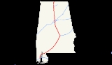
Interstate 65 in Alabama
Encyclopedia
Interstate 65, beginning in Mobile
at an interchange with Interstate 10
, meanders across 367 miles (590.6 km) of the Alabama countryside linking six of the state's ten largest cities. The highway links together many important roadways that make commerce inside and outside of the state's boundaries possible. The interstate exits at the Alabama
/Tennessee
state line, north of Athens
.
. From there it runs northeast, intersecting with Interstate 165 in Prichard, Alabama
and crossing the Mobile River
delta at the General W.K. Wilson Jr. Bridge
. En route to Montgomery
, it passes county seats Evergreen
(Conecuh County
) and Greenville
(Butler County
). At Montgomery, it intersects the southern terminus of Interstate 85 and crosses the Alabama River
north of the city.
At Chilton County
, I-65 enters the Birmingham
-Hoover
-Cullman
Combined Statistical Area. Approximately halfway between Montgomery and Birmingham, it passes Clanton
(Chilton County seat), where the water tower, visible from the road, is shaped and painted to resemble a huge peach
.
From mile marker 246 to 290 I-65 carries at least 6 lanes of traffic. I-65 intersects Interstate 459 in Hoover, then passes through the cities of Vestavia Hills
and Homewood
, which often generate heavy traffic. As the interstate passes by downtown Birmingham, south-bound travelers have a view of the Vulcan statue atop Red Mountain. At the north edge of downtown, I-65 intersects Interstates 20 and 59 with a cross-over interchange, often called Malfunction Junction.
North of Birmingham, I-65 performs a unique scrape-intersection with US-31. The incomplete Interstate 22 from Memphis, Tennessee
is expected to intersect there with the most expensive interchange in Alabama history, consisting of approximately 14 bridges. The interstate then continues 98 miles (157.7 km) in the general direction of Huntsville
, passing the city of Cullman on the way. After entering the Decatur Metropolitan Area
, in southern Morgan County
, the interstate passes Decatur
. The highway connects the Decatur and Huntsville Metropolitan Areas
as it crosses Wheeler Lake
(Tennessee River
) on a 2.6 miles (4.2 km) bridge. The interstate emerges again into the fringes of Decatur, in an open area of seemingly "endless" cotton fields where it intersects, inside Decatur, with Alabama 20 , Alternate 72, and the spur-route, Interstate 565 to Huntsville.
Between Walkers Chapel Road in Fultondale
and the Tennessee River in Decatur (Limestone County
), I-65 has been designated the "Ronald Reagan Memorial Highway". The sign designating the north end of this portion of road cites Reagan's speech in Decatur on July 4, 1984. The interstate then continues towards the state line, passing Athens and intersecting with U.S. Highway 72. At the state line, the southbound lanes receive a welcome center, complete with a Saturn I rocket.
In the Birmingham/Hoover vicinity, a plan to widen the interstate from North Birmingham to Alabaster
has been proposed. The project is to widen the interstate by adding a HOV
lane and keeping the original 3 lanes making it four lanes in each direction. This is planned to stretch to the Pelham
area. From there on the interstate will widen from 2 lanes each way to 3 lanes each way into the Helena
/Alabaster area.
Mobile, Alabama
Mobile is the third most populous city in the Southern US state of Alabama and is the county seat of Mobile County. It is located on the Mobile River and the central Gulf Coast of the United States. The population within the city limits was 195,111 during the 2010 census. It is the largest...
at an interchange with Interstate 10
Interstate 10
Interstate 10 is the fourth-longest Interstate Highway in the United States, after I-90, I-80, and I-40. It is the southernmost east–west, coast-to-coast Interstate Highway, although I-4 and I-8 are further south. It stretches from the Pacific Ocean at State Route 1 in Santa Monica,...
, meanders across 367 miles (590.6 km) of the Alabama countryside linking six of the state's ten largest cities. The highway links together many important roadways that make commerce inside and outside of the state's boundaries possible. The interstate exits at the Alabama
Alabama
Alabama is a state located in the southeastern region of the United States. It is bordered by Tennessee to the north, Georgia to the east, Florida and the Gulf of Mexico to the south, and Mississippi to the west. Alabama ranks 30th in total land area and ranks second in the size of its inland...
/Tennessee
Tennessee
Tennessee is a U.S. state located in the Southeastern United States. It has a population of 6,346,105, making it the nation's 17th-largest state by population, and covers , making it the 36th-largest by total land area...
state line, north of Athens
Athens, Alabama
Athens is a city in Limestone County, Alabama, United States. As of the 2000 census, the population of the city is 18,967. According to the 2009 U.S. Census estimates, the city had a population of 24,234...
.
Route description
I-65 starts in Mobile at Interstate 10, not far from the Gulf of MexicoGulf of Mexico
The Gulf of Mexico is a partially landlocked ocean basin largely surrounded by the North American continent and the island of Cuba. It is bounded on the northeast, north and northwest by the Gulf Coast of the United States, on the southwest and south by Mexico, and on the southeast by Cuba. In...
. From there it runs northeast, intersecting with Interstate 165 in Prichard, Alabama
Prichard, Alabama
Prichard is a city in Mobile County, Alabama, in the United States.Prichard borders the north side of Mobile, as well as the Mobile suburbs of Chickasaw, Alabama, Saraland, Alabama, and the unincorporated sections of Eight Mile, Alabama. As of 2005 Census Bureau estimates, the population of the...
and crossing the Mobile River
Mobile River
The Mobile River is located in southern Alabama in the United States. Formed out of the confluence of the Tombigbee and Alabama rivers, the approximately river drains an area of of Alabama, with a watershed extending into Mississippi, Georgia, and Tennessee. Its drainage basin is the...
delta at the General W.K. Wilson Jr. Bridge
General W.K. Wilson Jr. Bridge
The General W.K. Wilson Jr. Bridge consists of two parallel tied arch bridges and adjoining concrete viaduct bridges that carry 4 lanes of Interstate 65 across the Mobile-Tensaw River delta northeast of the U.S. city of Mobile, Alabama. It was named in honor of Walter K. Wilson, a Chief of...
. En route to Montgomery
Montgomery, Alabama
Montgomery is the capital of the U.S. state of Alabama, and is the county seat of Montgomery County. It is located on the Alabama River southeast of the center of the state, in the Gulf Coastal Plain. As of the 2010 census, Montgomery had a population of 205,764 making it the second-largest city...
, it passes county seats Evergreen
Evergreen, Alabama
Evergreen is a city in Conecuh County, Alabama, United States. As of the 2010 census the population was 3,944. The city is the county seat of Conecuh County.-History:Early settlers to the area came from Georgia and South Carolina beginning in 1818...
(Conecuh County
Conecuh County, Alabama
-2010:Whereas according to the 2010 U.S. Census Bureau:*51.3% White*46.5% Black*0.3% Native American*0.1% Asian*0.0% Native Hawaiian or Pacific Islander*1.0% Two or more races*1.2% Hispanic or Latino -2000:...
) and Greenville
Greenville, Alabama
Greenville is a city in Butler County, Alabama, United States. At the 2000 census, the population was 7,228. The city is the county seat of Butler County and is known as the Camellia City. The movement to change the Official Alabama State Flower from the goldenrod to the camellia originated in...
(Butler County
Butler County, Alabama
Butler County is a county of the U.S. state of Alabama. Its name is in honor of Captain William Butler, who was born in Virginia and fought in the Creek War, and who was killed in May 1818. As of 2010 the population was 20,947...
). At Montgomery, it intersects the southern terminus of Interstate 85 and crosses the Alabama River
Alabama River
The Alabama River, in the U.S. state of Alabama, is formed by the Tallapoosa and Coosa rivers, which unite about north of Montgomery.The river flows west to Selma, then southwest until, about from Mobile, it unites with the Tombigbee, forming the Mobile and Tensaw rivers, which discharge into...
north of the city.
At Chilton County
Chilton County, Alabama
-2010:Whereas according to the 2010 U.S. Census Bureau:*84.1% White*9.7% Black*0.4% Native American*0.3% Asian*0.0% Native Hawaiian or Pacific Islander*1.2% Two or more races*7.8% Hispanic or Latino -2000:...
, I-65 enters the Birmingham
Birmingham, Alabama
Birmingham is the largest city in Alabama. The city is the county seat of Jefferson County. According to the 2010 United States Census, Birmingham had a population of 212,237. The Birmingham-Hoover Metropolitan Area, in estimate by the U.S...
-Hoover
Hoover, Alabama
Hoover is a city in Jefferson and Shelby Counties in north central Alabama, in the United States. The largest suburb of Birmingham, the population of the city was 62,742 as of the 2000 census and 81,619 in the 2010 census. Hoover is part of the Birmingham-Hoover, AL MSA and is also included in the...
-Cullman
Cullman, Alabama
Cullman is a city in Cullman County, State of Alabama. Cullman is located along Interstate 65, about north of Birmingham, and about south of Huntsville. According to the U.S...
Combined Statistical Area. Approximately halfway between Montgomery and Birmingham, it passes Clanton
Clanton, Alabama
Clanton is a city in Chilton County, Alabama, United States. It is part of the Birmingham–Hoover–Cullman Combined Statistical Area. At the 2000 census the population was 7,800. The city is the county seat of Chilton County.-History:...
(Chilton County seat), where the water tower, visible from the road, is shaped and painted to resemble a huge peach
Peach
The peach tree is a deciduous tree growing to tall and 6 in. in diameter, belonging to the subfamily Prunoideae of the family Rosaceae. It bears an edible juicy fruit called a peach...
.
From mile marker 246 to 290 I-65 carries at least 6 lanes of traffic. I-65 intersects Interstate 459 in Hoover, then passes through the cities of Vestavia Hills
Vestavia Hills, Alabama
Vestavia Hills is a city in Jefferson and Shelby Counties in the U.S. state of Alabama. It is a suburb of the city of Birmingham.-History:Vestavia Hills is named for the estate of former Birmingham mayor George B. Ward. It was situated on the crest of Shades Mountain in what is now the northern...
and Homewood
Homewood, Alabama
Homewood is a city in southeastern Jefferson County, Alabama, United States. It is a suburb of Birmingham, located on the other side of Red Mountain due south of the city center. It has one of the highest population densities in Alabama. As of 2009 Census Bureau estimates, the population of the...
, which often generate heavy traffic. As the interstate passes by downtown Birmingham, south-bound travelers have a view of the Vulcan statue atop Red Mountain. At the north edge of downtown, I-65 intersects Interstates 20 and 59 with a cross-over interchange, often called Malfunction Junction.
North of Birmingham, I-65 performs a unique scrape-intersection with US-31. The incomplete Interstate 22 from Memphis, Tennessee
Memphis, Tennessee
Memphis is a city in the southwestern corner of the U.S. state of Tennessee, and the county seat of Shelby County. The city is located on the 4th Chickasaw Bluff, south of the confluence of the Wolf and Mississippi rivers....
is expected to intersect there with the most expensive interchange in Alabama history, consisting of approximately 14 bridges. The interstate then continues 98 miles (157.7 km) in the general direction of Huntsville
Huntsville, Alabama
Huntsville is a city located primarily in Madison County in the central part of the far northern region of the U.S. state of Alabama. Huntsville is the county seat of Madison County. The city extends west into neighboring Limestone County. Huntsville's population was 180,105 as of the 2010 Census....
, passing the city of Cullman on the way. After entering the Decatur Metropolitan Area
Decatur Metropolitan Area
The Decatur Metropolitan Area is a moderately urban region of North-Central Alabama. The 2008 estimate population is 150,125, one third of which resides within the boundaries of its core city, Decatur, Alabama....
, in southern Morgan County
Morgan County, Alabama
Morgan County is the most populous county in the Decatur Metropolitan Area, and the second most populous county in the Huntsville-Decatur Combined Statistical Area in the U.S. State of Alabama. It was created by the Alabama Territorial legislature on February 6, 1818 from land acquired from the...
, the interstate passes Decatur
Decatur, Alabama
Decatur is a city in Limestone and Morgan Counties in the U.S. state of Alabama. The city, affectionately known as "The River City", is located in Northern Alabama on the banks of Wheeler Lake, along the Tennessee River. It is the largest city and county seat of Morgan County...
. The highway connects the Decatur and Huntsville Metropolitan Areas
Huntsville-Decatur Combined Statistical Area
The Huntsville-Decatur Combined Statistical Area is the most populated sub-region of North Alabama, and is the second fastest growing region in the State of Alabama, with 510,088 living within the CSA...
as it crosses Wheeler Lake
Wheeler Lake
Wheeler Lake is located in the northern part of the United States state of Alabama, between Rogersville and Huntsville. Created by Wheeler Dam along the Tennessee River, it stretches 60 miles from Wheeler Dam to Guntersville Dam...
(Tennessee River
Tennessee River
The Tennessee River is the largest tributary of the Ohio River. It is approximately 652 miles long and is located in the southeastern United States in the Tennessee Valley. The river was once popularly known as the Cherokee River, among other names...
) on a 2.6 miles (4.2 km) bridge. The interstate emerges again into the fringes of Decatur, in an open area of seemingly "endless" cotton fields where it intersects, inside Decatur, with Alabama 20 , Alternate 72, and the spur-route, Interstate 565 to Huntsville.
Between Walkers Chapel Road in Fultondale
Fultondale, Alabama
Fultondale is a city in Jefferson County, Alabama, United States and a northern suburb of Birmingham. As of the 2000 census, the population of the city is 6,595 and, as of 2006, was estimated to be 6,905. Fultondale was a relatively stagnant community until the last decade...
and the Tennessee River in Decatur (Limestone County
Limestone County, Alabama
Limestone County is a county of the U.S. state of Alabama, and is included in the Huntsville Metropolitan Area.It is also included in the merged Huntsville-Decatur Metro Area. Its name comes from Limestone Creek, a local stream. In 2000, the population was 65,676. As of 2010 the county's...
), I-65 has been designated the "Ronald Reagan Memorial Highway". The sign designating the north end of this portion of road cites Reagan's speech in Decatur on July 4, 1984. The interstate then continues towards the state line, passing Athens and intersecting with U.S. Highway 72. At the state line, the southbound lanes receive a welcome center, complete with a Saturn I rocket.
In the Birmingham/Hoover vicinity, a plan to widen the interstate from North Birmingham to Alabaster
Alabaster, Alabama
Alabaster is a city and southern suburb of Birmingham in Shelby County, Alabama, United States. At the 2000 census the population was 22,619. According to the 2005 U.S. Census estimates, the city had a population of 27,517. At the 2010 census the population was 30,352. Alabaster is still a growing...
has been proposed. The project is to widen the interstate by adding a HOV
HOV
HOV may refer to:* High-occupancy vehicle lane* Ørsta-Volda Airport, Hovden in Hovden, Norway* Hovig* A small street gang located in Naperville* see Hov...
lane and keeping the original 3 lanes making it four lanes in each direction. This is planned to stretch to the Pelham
Pelham, Alabama
Pelham is a city and suburb of Birmingham in Shelby County, Alabama, United States. At the 2000 census the population was 14,369, but has grown to 21,352 recorded by the 2010 census. It was named for famed Confederate American Civil War officer John Pelham...
area. From there on the interstate will widen from 2 lanes each way to 3 lanes each way into the Helena
Helena, Alabama
Helena is a city in Jefferson and Shelby Counties in the U.S. state of Alabama. Helena is considered a suburb of Birmingham and part of the Greater Birmingham-Hoover Metropolitan area. It is also one of three cities, along with Alabaster and Pelham, that make up the area known as "North Shelby" or...
/Alabaster area.
Exit list
| County | Location | Mile | # Exit number An exit number is a number assigned to a road junction, usually an exit from a freeway. It is usually marked on the same sign as the destinations of the exit, as well as a sign in the gore.... |
Destinations | Notes |
|---|---|---|---|---|---|
| Mobile Mobile County, Alabama Mobile County[p] is a county of the U.S. state of Alabama. Its name is in honor of a tribe of Indians, the Maubila tribe . As of 2011, its population was 415,704. Its county seat is Mobile, Alabama... |
Mobile | 0A-B | - Mississippi Mississippi Mississippi is a U.S. state located in the Southern United States. Jackson is the state capital and largest city. The name of the state derives from the Mississippi River, which flows along its western boundary, whose name comes from the Ojibwe word misi-ziibi... , Florida Florida Florida is a state in the southeastern United States, located on the nation's Atlantic and Gulf coasts. It is bordered to the west by the Gulf of Mexico, to the north by Alabama and Georgia and to the east by the Atlantic Ocean. With a population of 18,801,310 as measured by the 2010 census, it... |
Southbound exit and northbound entrance | |
| 1 | |||||
| 3 | Airport Boulevard Airport Boulevard (Mobile, Alabama) Airport Boulevard is one of the main thoroughfares in Mobile County, Alabama, and is one of the few non-federal roads in the county that enters the city of Mobile, having entered Mobile County at the Mississippi state line. It is an east–west highway.... |
Serves Mobile Regional Airport Mobile Regional Airport Mobile Regional Airport is a joint public and military use airport located 11 nautical miles west of the central business district of Mobile, a city in Mobile County, Alabama, United States. It is also near Pascagoula, Mississippi.... |
|||
| 4 | Dauphin Street | ||||
| 5A | Springhill Avenue | ||||
| 5B | |||||
| Prichard | 8 | ||||
| 9 | |||||
| Chickasaw Chickasaw, Alabama Chickasaw is a city in Mobile County, Alabama, United States. As of July 2007, the population was 5,979. It is included in the Mobile metropolitan statistical area.-Geography:Chickasaw is located at . According to the U.S... |
10 | West Lee Street | |||
| Saraland | 13 | ||||
| 15 | Saraland Saraland, Alabama Saraland is a city in Mobile County, Alabama, in the United States, and a suburb of Mobile, Alabama. As of the 2010 census, the population of the city is 13,405. It is a part of the Mobile metropolitan area. Saraland is the third largest city in Mobile County.... , Citronelle Citronelle, Alabama Citronelle is a city in Mobile County, Alabama, United States. At the 2000 census the population was 3,659. It is included in the Mobile metropolitan statistical area.-History:This was long part of the territory of thousands of years of indigenous peoples... |
||||
| 19 | |||||
| 22 | Creola Creola, Alabama Creola is a city in Mobile County, Alabama, United States. The population was 2,002 at the 2000 census, at which time it was still a town. It is included in the Mobile metropolitan statistical area.-Geography:Creola is located at .... |
||||
| General W.K. Wilson Jr. Bridge General W.K. Wilson Jr. Bridge The General W.K. Wilson Jr. Bridge consists of two parallel tied arch bridges and adjoining concrete viaduct bridges that carry 4 lanes of Interstate 65 across the Mobile-Tensaw River delta northeast of the U.S. city of Mobile, Alabama. It was named in honor of Walter K. Wilson, a Chief of... over the Mobile River Mobile River The Mobile River is located in southern Alabama in the United States. Formed out of the confluence of the Tombigbee and Alabama rivers, the approximately river drains an area of of Alabama, with a watershed extending into Mississippi, Georgia, and Tennessee. Its drainage basin is the... and Tensaw River Tensaw River The Tensaw River is a distributary of the Mobile River, approximately 36 mi long, in southern Alabama in the United States. It is formed as a bayou of the Mobile approximately 6 mi south of the formation of the Mobile by the confluence of the Tombigbee and Alabama rivers... |
|||||
| Baldwin | |||||
| 31 | |||||
| 34 | |||||
| 37 | |||||
| 45 | Rabun, Perdido | ||||
| Escambia | 54 | ||||
| 57 | |||||
| 69 | |||||
| Conecuh | 77 | ||||
| 83 | Castleberry Castleberry, Alabama Castleberry is a town in Conecuh County, Alabama, United States. At the 2000 census the population was 590. Castleberry is known as the "Strawberry Capital of Alabama" and is home to the annual Castleberry Strawberry Festival.-Geography:... , Lenox |
||||
| 93 | |||||
| 96 | |||||
| 101 | Owassa | ||||
| Butler | 107 | Grace, Garland | |||
| 114 | |||||
| Greenville | 128 | South end of SR-10 Truck overlap | |||
| 130 | North end of SR-10 Truck overlap | ||||
| Lowndes | 142 | ||||
| 151 | |||||
| 158 | |||||
| Montgomery Montgomery County, Alabama Montgomery County is a county in the U.S. state of Alabama. It is the most populous county in the Montgomery Metropolitan Statistical Area; its population in 2010 was 229,363 .- History :... |
164 | ||||
| Montgomery Montgomery, Alabama Montgomery is the capital of the U.S. state of Alabama, and is the county seat of Montgomery County. It is located on the Alabama River southeast of the center of the state, in the Gulf Coastal Plain. As of the 2010 census, Montgomery had a population of 205,764 making it the second-largest city... |
167 | South end of US-80/SR-8 overlap | |||
| 168 | North end of US-80/SR-8 overlap; south end of US-82/SR-6 overlap | ||||
| 169 | Edgemont Avenue | Southbound exit and northbound entrance | |||
| 170 | Fairview Avenue | ||||
| 171 | - Atlanta | ||||
| 172 | Herron Street, Clay Street - Downtown Montgomery | ||||
| Bridge over the Alabama River Alabama River The Alabama River, in the U.S. state of Alabama, is formed by the Tallapoosa and Coosa rivers, which unite about north of Montgomery.The river flows west to Selma, then southwest until, about from Mobile, it unites with the Tombigbee, forming the Mobile and Tensaw rivers, which discharge into... |
|||||
| 173 | |||||
| Elmore Elmore County, Alabama Elmore County is a county of the State of Alabama. Its name is in honor of General John A. Elmore. As of 2010 its population was 79,303. Its county seat is Wetumpka.This county is part of the Montgomery Metropolitan Statistical Area.- History :... |
|||||
| Millbrook Millbrook, Alabama Millbrook is a city in Autauga and Elmore counties in the U.S. state of Alabama. The population was 14,640 at the 2010 census. It is part of the Montgomery Metropolitan Statistical Area.-Geography:Millbrook is located at .... |
176 | Northbound exit and southbound entrance | |||
| Millbrook Millbrook, Alabama Millbrook is a city in Autauga and Elmore counties in the U.S. state of Alabama. The population was 14,640 at the 2010 census. It is part of the Montgomery Metropolitan Statistical Area.-Geography:Millbrook is located at .... /Prattville Prattville, Alabama Prattville is a city in Autauga and Elmore counties in the U.S. state of Alabama. As of the 2010 Census, the population of the city is 33,960. Nicknamed "The Fountain City" due to the many artesian wells in the area, Prattville is part of the Montgomery metropolitan statistical area and serves as... |
179 | North end of US-82/SR-6 overlap | |||
| Prattville Prattville, Alabama Prattville is a city in Autauga and Elmore counties in the U.S. state of Alabama. As of the 2010 Census, the population of the city is 33,960. Nicknamed "The Fountain City" due to the many artesian wells in the area, Prattville is part of the Montgomery metropolitan statistical area and serves as... |
181 | ||||
| Autauga Autauga County, Alabama Autauga County is a county in the U.S. state of Alabama. As of the 2010 census the population was 54,571. Its county seat is Prattville.Autauga County is part of the Montgomery Metropolitan Statistical Area.-History:... |
|||||
| 186 | |||||
| Chilton Chilton County, Alabama -2010:Whereas according to the 2010 U.S. Census Bureau:*84.1% White*9.7% Black*0.4% Native American*0.3% Asian*0.0% Native Hawaiian or Pacific Islander*1.2% Two or more races*7.8% Hispanic or Latino -2000:... |
200 | Verbena Verbena, Alabama Verbena is an unincorporated community in southeastern Chilton County, Alabama, United States. Named for the indigenous flower, Verbena developed into a popular resort location for the more affluent citizenry of Montgomery, the state's capital, during the yellow fever outbreaks of the late 19th... |
|||
| Clanton Clanton, Alabama Clanton is a city in Chilton County, Alabama, United States. It is part of the Birmingham–Hoover–Cullman Combined Statistical Area. At the 2000 census the population was 7,800. The city is the county seat of Chilton County.-History:... |
|||||
| 205 | |||||
| 208 | Clanton Clanton, Alabama Clanton is a city in Chilton County, Alabama, United States. It is part of the Birmingham–Hoover–Cullman Combined Statistical Area. At the 2000 census the population was 7,800. The city is the county seat of Chilton County.-History:... , Lake Mitchell |
||||
| 212 | Peach Tower exit | ||||
| 219 | Jemison Jemison, Alabama Jemison is a town in Chilton County, Alabama, United States. At the 2000 census the population was 2,248. The center of population of Alabama is located outside of Jemison, an area known as Jemison Division. .-Geography:... , Thorsby Thorsby, Alabama Thorsby is a town in Chilton County, Alabama, United States. As of the 2000 census, the population of the town was 1,820. The town mayor is Dearl Hilyer. The Swede-founded town's name, "Thorsby" is Swedish for "Thor's Village."-Geography:... |
||||
| Shelby Shelby County, Alabama Shelby County is a county of the U.S. state of Alabama and a part of the Birmingham–Hoover–Cullman Combined Statistical Area. It is named in honor of Isaac Shelby, Governor of Kentucky. The county seat of Shelby County is Columbiana. As of 2010 U.S. Census the population was 195,085. Shelby... |
Calera Calera, Alabama Calera is a city in Chilton and Shelby counties in the U.S. state of Alabama. It is the location of Birmingham's Shelby County Airport. Its population was 3,158 at the 2000 census, but as of 2010 the population had nearly quadrupled to 11,620 making it the fastest growing city in... |
228 | |||
| 231 | |||||
| 234 | Shelby County Airport Shelby County Airport (Alabama) Shelby County Airport is a public use airport located four nautical miles southeast of the central business district of Alabaster, a city in Shelby County, Alabama, United States. It is owned by the Shelby County Commission... |
||||
| 238 | |||||
| Pelham Pelham, Alabama Pelham is a city and suburb of Birmingham in Shelby County, Alabama, United States. At the 2000 census the population was 14,369, but has grown to 21,352 recorded by the 2010 census. It was named for famed Confederate American Civil War officer John Pelham... |
242 | Pelham Pelham, Alabama Pelham is a city and suburb of Birmingham in Shelby County, Alabama, United States. At the 2000 census the population was 14,369, but has grown to 21,352 recorded by the 2010 census. It was named for famed Confederate American Civil War officer John Pelham... , Helena Helena, Alabama Helena is a city in Jefferson and Shelby Counties in the U.S. state of Alabama. Helena is considered a suburb of Birmingham and part of the Greater Birmingham-Hoover Metropolitan area. It is also one of three cities, along with Alabaster and Pelham, that make up the area known as "North Shelby" or... |
Tank Farm exit | ||
| 246 | |||||
| Hoover Hoover, Alabama Hoover is a city in Jefferson and Shelby Counties in north central Alabama, in the United States. The largest suburb of Birmingham, the population of the city was 62,742 as of the 2000 census and 81,619 in the 2010 census. Hoover is part of the Birmingham-Hoover, AL MSA and is also included in the... |
247 | ||||
| Jefferson Jefferson County, Alabama Jefferson County is the most populous county in the U.S. state of Alabama, with its county seat being located in Birmingham.As of the 2010 U.S. Census, the population of Jefferson County was 658,466... |
250 | - Atlanta, Gadsden, Tuscaloosa | |||
| 252 | |||||
| 254 | Alford Avenue | ||||
| Homewood Homewood, Alabama Homewood is a city in southeastern Jefferson County, Alabama, United States. It is a suburb of Birmingham, located on the other side of Red Mountain due south of the city center. It has one of the highest population densities in Alabama. As of 2009 Census Bureau estimates, the population of the... |
255 | Lakeshore Drive | |||
| 256 | Oxmoor Road - Homewood Homewood, Alabama Homewood is a city in southeastern Jefferson County, Alabama, United States. It is a suburb of Birmingham, located on the other side of Red Mountain due south of the city center. It has one of the highest population densities in Alabama. As of 2009 Census Bureau estimates, the population of the... |
Signed as exits 256A (west) and 256B (east) southbound | |||
| Birmingham Birmingham, Alabama Birmingham is the largest city in Alabama. The city is the county seat of Jefferson County. According to the 2010 United States Census, Birmingham had a population of 212,237. The Birmingham-Hoover Metropolitan Area, in estimate by the U.S... |
258 | Green Springs Avenue | |||
| 259A | University Boulevard (SR-149) (northbound), 6th Avenue South (southbound) | Signed as exit 259 northbound | |||
| 259B | 4th Avenue South | Southbound exit and northbound entrance | |||
| 260 | South end of Sr-4 overlap; signed as exit 260B northbound | ||||
| 261 | , Atlanta, Tuscaloosa | North end of SR-4 overlap; signed as exits 261A (east/north) and 261B (west/south) | |||
| 262A | 16th Street | Northbound exit and southbound entrance | |||
| 262B | Finley Boulevard | ||||
| 263 | 32nd Avenue, 33rd Avenue | ||||
| 264 | Daniel Payne Drive | ||||
| Fultondale Fultondale, Alabama Fultondale is a city in Jefferson County, Alabama, United States and a northern suburb of Birmingham. As of the 2000 census, the population of the city is 6,595 and, as of 2006, was estimated to be 6,905. Fultondale was a relatively stagnant community until the last decade... |
266 | ||||
| 267 | Walker Chapel Road | ||||
| Gardendale Gardendale, Alabama Gardendale is a city in Jefferson County, Alabama, United States, and a northern suburb of Birmingham. The population was 11,626 at the 2000 census. 2009 Census estimates propose a population of 13,720.-History:... |
271 | Fieldstown Road | |||
| 272 | Mt. Olive Road | ||||
| 275 | |||||
| Warrior Warrior, Alabama Warrior is a city in Jefferson and Blount County in the U.S. state of Alabama. At the 2000 census the population was 3,169.-History:The city takes its name from the Warrior coal fields, which J. T. Pierce opened in 1872 in the vicinity. The coal fields were named, in turn, after the Black Warrior... |
280 | ||||
| 281 | Warrior Warrior, Alabama Warrior is a city in Jefferson and Blount County in the U.S. state of Alabama. At the 2000 census the population was 3,169.-History:The city takes its name from the Warrior coal fields, which J. T. Pierce opened in 1872 in the vicinity. The coal fields were named, in turn, after the Black Warrior... |
||||
| 282 | Robbins, Warrior Warrior, Alabama Warrior is a city in Jefferson and Blount County in the U.S. state of Alabama. At the 2000 census the population was 3,169.-History:The city takes its name from the Warrior coal fields, which J. T. Pierce opened in 1872 in the vicinity. The coal fields were named, in turn, after the Black Warrior... |
||||
| Blount Blount County, Alabama Blount County is a county located in the U.S. state of Alabama. As of the 2010 United States Census, the population was 57,322. Its county seat is Oneonta.Blount County is a dry county.-History:... |
Smoke Rise Smoke Rise, Alabama Smoke Rise is a census-designated place in Blount County, Alabama, United States. At the 2000 census the population was 1,750.-History:... |
284 | South end of US-31/SR-3 overlap | ||
| 287 | North end of US-31/SR-3 overlap | ||||
| 289 | Empire, Blount Springs Blount Springs, Alabama -History:Blount Springs's mineral springs and rural setting made it a summer resort for thousands of wealthy people from Alabama and elsewhere in the late 19th and early 20th centuries. The sulfur springs were renowned for their curative properties... |
||||
| Cullman Cullman County, Alabama Cullman County is a county of the U.S. state of Alabama. Its name is in honor of Colonel John G. Cullmann. As of 2010, the population was 80,406. Its county seat is the town of the same name, Cullman, Alabama. It is a "moist" county in terms of availablity of alcoholic beverages, which means... |
291 | ||||
| 299 | South end of SR-69 overlap | ||||
| 304 | North end of SR-69 overlap | ||||
| Cullman Cullman, Alabama Cullman is a city in Cullman County, State of Alabama. Cullman is located along Interstate 65, about north of Birmingham, and about south of Huntsville. According to the U.S... |
308 | ||||
| 310 | |||||
| Morgan Morgan County, Alabama Morgan County is the most populous county in the Decatur Metropolitan Area, and the second most populous county in the Huntsville-Decatur Combined Statistical Area in the U.S. State of Alabama. It was created by the Alabama Territorial legislature on February 6, 1818 from land acquired from the... |
318 | ||||
| 322 | Falkville Falkville, Alabama Falkville is a town in Morgan County, Alabama, in the United States, and is included in the Decatur Metropolitan Area, as well as the Huntsville-Decatur Combined Statistical Area. As of the 2000 census, the population of the town is 1,202.-Geography:... , Eva Eva, Alabama Eva is a town in Morgan County, Alabama, and is included in the Decatur Metropolitan Area, as well as the Huntsville-Decatur Combined Statistical Area. As of the 2000 census, the population of the town is 491.- Geography :... |
||||
| Hartselle Hartselle, Alabama Hartselle is the second largest city in Morgan County, Alabama, United States, about south of Decatur, and is included in the Decatur Metropolitan Area, and the Huntsville-Decatur Combined Statistical Area. As of the 2006 census estimates, the population of the city is 13,479. Hartselle was... |
325 | Thompson Road | |||
| 328 | |||||
| Decatur Decatur, Alabama Decatur is a city in Limestone and Morgan Counties in the U.S. state of Alabama. The city, affectionately known as "The River City", is located in Northern Alabama on the banks of Wheeler Lake, along the Tennessee River. It is the largest city and county seat of Morgan County... , Priceville Priceville, Alabama Priceville is the third largest municipality in Morgan County, Alabama, and is included in the Decatur Metropolitan Area, as well as the Huntsville-Decatur Combined Statistical Area. As of the 2006 census estimate, the population of the town is 2,380.... |
334 | ||||
| Bridge over the Wheeler Lake Wheeler Lake Wheeler Lake is located in the northern part of the United States state of Alabama, between Rogersville and Huntsville. Created by Wheeler Dam along the Tennessee River, it stretches 60 miles from Wheeler Dam to Guntersville Dam... and Tennessee River Tennessee River The Tennessee River is the largest tributary of the Ohio River. It is approximately 652 miles long and is located in the southeastern United States in the Tennessee Valley. The river was once popularly known as the Cherokee River, among other names... |
|||||
| Limestone Limestone County, Alabama Limestone County is a county of the U.S. state of Alabama, and is included in the Huntsville Metropolitan Area.It is also included in the merged Huntsville-Decatur Metro Area. Its name comes from Limestone Creek, a local stream. In 2000, the population was 65,676. As of 2010 the county's... |
|||||
| Decatur Decatur, Alabama Decatur is a city in Limestone and Morgan Counties in the U.S. state of Alabama. The city, affectionately known as "The River City", is located in Northern Alabama on the banks of Wheeler Lake, along the Tennessee River. It is the largest city and county seat of Morgan County... |
340 | Signed as exits 340A (west) and 340B (east) southbound | |||
| Tanner Tanner, Alabama Tanner is a small town in central southern Limestone County, Alabama, United States, and is included in the Huntsville-Decatur Combined Statistical Area. It lies along the Tennessee River, next to the city of Athens.... |
347 | Huntsville-Browns Ferry Road | |||
| Athens Athens, Alabama Athens is a city in Limestone County, Alabama, United States. As of the 2000 census, the population of the city is 18,967. According to the 2009 U.S. Census estimates, the city had a population of 24,234... |
351 | ||||
| 354 | South end of US-31 overlap | ||||
| 361 | Elkmont Elkmont, Alabama Elkmont is a town in Limestone County, Alabama, United States, and is included in the Huntsville-Decatur Combined Statistical Area. As of the 2000 census, the population of the town is 470.-Geography:Elkmont is located at 1.... |
||||
| 365 | |||||
Lane configurations
- Total Mileage in Alabama-366.00 miles
- From Interstate 10Interstate 10Interstate 10 is the fourth-longest Interstate Highway in the United States, after I-90, I-80, and I-40. It is the southernmost east–west, coast-to-coast Interstate Highway, although I-4 and I-8 are further south. It stretches from the Pacific Ocean at State Route 1 in Santa Monica,...
Exit 0 to Exit 13 (SaralandSaraland, AlabamaSaraland is a city in Mobile County, Alabama, in the United States, and a suburb of Mobile, Alabama. As of the 2010 census, the population of the city is 13,405. It is a part of the Mobile metropolitan area. Saraland is the third largest city in Mobile County....
) (3-4 lanes each way, 4th lane exit only) - From Exit 13 to Exit 167 U.S. Highway 80 west (SelmaSelma, AlabamaSelma is a city in and the county seat of Dallas County, Alabama, United States, located on the banks of the Alabama River. The population was 20,512 at the 2000 census....
) (2 lanes each way) - From Exit 167 to Exit 171 Interstate 85Interstate 85Interstate 85 is a major interstate highway in the Southeastern United States. Its current southern terminus is at an interchange with Interstate 65 in Montgomery, Alabama; its northern terminus interchanges with Interstate 95 in Petersburg, Virginia, near Richmond...
(3 lanes each way, currently being widened in Interstate 85 vicinity) - From Interstate 85Interstate 85Interstate 85 is a major interstate highway in the Southeastern United States. Its current southern terminus is at an interchange with Interstate 65 in Montgomery, Alabama; its northern terminus interchanges with Interstate 95 in Petersburg, Virginia, near Richmond...
to exit 181 (PrattvillePrattville, AlabamaPrattville is a city in Autauga and Elmore counties in the U.S. state of Alabama. As of the 2010 Census, the population of the city is 33,960. Nicknamed "The Fountain City" due to the many artesian wells in the area, Prattville is part of the Montgomery metropolitan statistical area and serves as...
)/(WetumpkaWetumpka, AlabamaWetumpka is a city in Elmore County, Alabama, United States. At the 2000 census the population was 5,726.The city is the county seat of Elmore County, one of the fastest growing counties in the state....
) (3 lanes each way) - From Exit 181 to Exit 242 County Road 52 (PelhamPelham, AlabamaPelham is a city and suburb of Birmingham in Shelby County, Alabama, United States. At the 2000 census the population was 14,369, but has grown to 21,352 recorded by the 2010 census. It was named for famed Confederate American Civil War officer John Pelham...
) (2 lanes each way) - From Exit 242 to Exit 261 Interstate 20Interstate 20Interstate 20 is a major east–west Interstate Highway in the Southern United States. I‑20 runs 1,535 miles from near Kent, Texas, at Interstate 10 to Florence, South Carolina, at Interstate 95...
/Interstate 59Interstate 59Interstate 59 is an Interstate Highway in the southern United States. Its southern terminus is near Slidell, Louisiana, a suburb of New Orleans, at an intersection with Interstate 10 and Interstate 12, its northern terminus is at Wildwood, Georgia, at an intersection with Interstate 24.The road's...
(3-4 lanes each way, 5 lanes at Malfunction Junction) - From Exit 261 to Exit 264 Daniel Payne Drive (BirminghamBirmingham, AlabamaBirmingham is the largest city in Alabama. The city is the county seat of Jefferson County. According to the 2010 United States Census, Birmingham had a population of 212,237. The Birmingham-Hoover Metropolitan Area, in estimate by the U.S...
) (4 lanes each way) - From Exit 264 to Blount CountyBlount County, AlabamaBlount County is a county located in the U.S. state of Alabama. As of the 2010 United States Census, the population was 57,322. Its county seat is Oneonta.Blount County is a dry county.-History:...
/Cullman CountyCullman County, AlabamaCullman County is a county of the U.S. state of Alabama. Its name is in honor of Colonel John G. Cullmann. As of 2010, the population was 80,406. Its county seat is the town of the same name, Cullman, Alabama. It is a "moist" county in terms of availablity of alcoholic beverages, which means...
line Mile marker 291 (3 lanes each way) - From Mile marker 291 to Tennessee state line (2 lanes each way)
- From Interstate 10