
Alabaster, Alabama
Encyclopedia
Alabaster is a city and southern suburb of Birmingham
in Shelby County
, Alabama
, United States
. At the 2000 census the population was 22,619. According to the 2005 U.S. Census estimates, the city had a population of 27,517. At the 2010 census the population was 30,352. Alabaster is still a growing population. Alabaster was ranked number 85 on Money Magazine's 100 Best Places To Live in 2009.http://money.cnn.com/magazines/moneymag/bplive/2009/snapshots/PL0100820.html
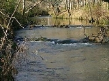
According to the U.S. Census Bureau, the city has a total area of 20.6 square miles (53.4 km²), of which, 20.5 square miles (53.1 km²) of it is land and 0.1 square mile (0.258998811 km²) of it (0.24%) is water.
, the geographic center of the state of Alabama, was created 7 February 1818 by an act of the Alabama Territorial General Assembly. Alabama gained statehood on 14 December 1819. The county was named for Isaac Shelby
, a hero of the King's Mountain Battle during the American Revolutionary War
.
Many of the first settlers came from South Carolina
, Tennessee
, and Kentucky
. Many came to this region after Battle of Horseshoe Bend in 1814. As indicated in the 1820 census records, Shelby County contained 2,492 people; 2,044 whites and 448 Africans.
Today, it is the fastest growing county in Alabama and among the fastest in the United States. U.S. Highway 31, a two-lane highway at that time, was the main artery from Birmingham
to Montgomery
and played an important part in the growth of the community.
George L. Scott, Sr., an Alabaster pioneer, owned and operated Alabaster Lime Co. His shipping point, named for him, was known as “Scott Rock”. Later, housing was built to accommodate some of the employees, and the community acquired its name Alabaster from the "white calcium carbonate mineral". The First Bank of Alabaster opened in 1952, and its president was George L. Scott, Jr., who later became the first mayor of Alabaster. The first attempt in 1952 to incorporate Alabaster failed. In January 1953, the petition was again filed, and on 23 February 1953, Alabaster was officially incorporated with a favorable vote of 79 to 23, and 427 residing inhabitants. Other Alabaster pioneers were Kenton B. Nickerson and William J. Maxwell. In 1955, the Alabaster Water and Gas Board was formed.
of 2000, there were 22,619 people, 8,164 households, and 6,482 families residing in the city. The population density
was 1,104.8 people per square mile (426.6/km²). There were 8,594 housing units at an average density of 419.8 per square mile (162.1/km²). The racial makeup of the city was 87.71% White
, 9.95% Black
or African American
, 0.31% Native American
, 0.64% Asian
, 0.02% Pacific Islander
, 0.69% from other races
, and 0.69% from two or more races. 1.54% of the population were Hispanic
or Latino
of any race.
There were 8,164 households out of which 41.9% had children under the age of 18 living with them, 68.0% were married couples
living together, 8.9% had a female householder with no husband present, and 20.6% were non-families. 17.1% of all households were made up of individuals and 3.6% had someone living alone who was 65 years of age or older. The average household size was 2.73 and the average family size was 3.09.
In the city the population was spread out with 27.7% under the age of 18, 6.5% from 18 to 24, 37.7% from 25 to 44, 20.3% from 45 to 64, and 7.7% who were 65 years of age or older. The median age was 33 years. For every 100 females there were 94.7 males. For every 100 females age 18 and over, there were 90.7 males.
The median income for a household in the city was $58,940, and the median income for a family was $78,940. Males had a median income of $41,690 versus $31,901 for females. The per capita income
for the city was $22,466. About 4.8% of families and 5.9% of the population were below the poverty line, including 7.0% of those under age 18 and 12.3% of those age 65 or over.
http://www.ca11.uscourts.gov/opinions/ops/200416230.pdf http://www.donnabeaulieu.com
In 2003 attorney Jim Pino filed suit against the City of Alabaster on behalf of his clients. The lawsuit was initiated to stop Alabaster "from taking action against the plaintiffs' property including taking the property by eminent domain, citing first and foremost, the U.S. Constitution's 5th Amendment right to property."
http://www.shelbycountyreporter.com/articles/2003/09/10/news/news04.txt
Birmingham, Alabama
Birmingham is the largest city in Alabama. The city is the county seat of Jefferson County. According to the 2010 United States Census, Birmingham had a population of 212,237. The Birmingham-Hoover Metropolitan Area, in estimate by the U.S...
in Shelby County
Shelby County, Alabama
Shelby County is a county of the U.S. state of Alabama and a part of the Birmingham–Hoover–Cullman Combined Statistical Area. It is named in honor of Isaac Shelby, Governor of Kentucky. The county seat of Shelby County is Columbiana. As of 2010 U.S. Census the population was 195,085. Shelby...
, Alabama
Alabama
Alabama is a state located in the southeastern region of the United States. It is bordered by Tennessee to the north, Georgia to the east, Florida and the Gulf of Mexico to the south, and Mississippi to the west. Alabama ranks 30th in total land area and ranks second in the size of its inland...
, United States
United States
The United States of America is a federal constitutional republic comprising fifty states and a federal district...
. At the 2000 census the population was 22,619. According to the 2005 U.S. Census estimates, the city had a population of 27,517. At the 2010 census the population was 30,352. Alabaster is still a growing population. Alabaster was ranked number 85 on Money Magazine's 100 Best Places To Live in 2009.http://money.cnn.com/magazines/moneymag/bplive/2009/snapshots/PL0100820.html
Geography
Alabaster is located at 33°13′52"N 86°49′26"W (33.231162, -86.823829).According to the U.S. Census Bureau, the city has a total area of 20.6 square miles (53.4 km²), of which, 20.5 square miles (53.1 km²) of it is land and 0.1 square mile (0.258998811 km²) of it (0.24%) is water.
History
Shelby CountyShelby County, Alabama
Shelby County is a county of the U.S. state of Alabama and a part of the Birmingham–Hoover–Cullman Combined Statistical Area. It is named in honor of Isaac Shelby, Governor of Kentucky. The county seat of Shelby County is Columbiana. As of 2010 U.S. Census the population was 195,085. Shelby...
, the geographic center of the state of Alabama, was created 7 February 1818 by an act of the Alabama Territorial General Assembly. Alabama gained statehood on 14 December 1819. The county was named for Isaac Shelby
Isaac Shelby
Isaac Shelby was the first and fifth Governor of the U.S. state of Kentucky and served in the state legislatures of Virginia and North Carolina. He was also a soldier in Lord Dunmore's War, the Revolutionary War, and the War of 1812...
, a hero of the King's Mountain Battle during the American Revolutionary War
American Revolutionary War
The American Revolutionary War , the American War of Independence, or simply the Revolutionary War, began as a war between the Kingdom of Great Britain and thirteen British colonies in North America, and ended in a global war between several European great powers.The war was the result of the...
.
Many of the first settlers came from South Carolina
South Carolina
South Carolina is a state in the Deep South of the United States that borders Georgia to the south, North Carolina to the north, and the Atlantic Ocean to the east. Originally part of the Province of Carolina, the Province of South Carolina was one of the 13 colonies that declared independence...
, Tennessee
Tennessee
Tennessee is a U.S. state located in the Southeastern United States. It has a population of 6,346,105, making it the nation's 17th-largest state by population, and covers , making it the 36th-largest by total land area...
, and Kentucky
Kentucky
The Commonwealth of Kentucky is a state located in the East Central United States of America. As classified by the United States Census Bureau, Kentucky is a Southern state, more specifically in the East South Central region. Kentucky is one of four U.S. states constituted as a commonwealth...
. Many came to this region after Battle of Horseshoe Bend in 1814. As indicated in the 1820 census records, Shelby County contained 2,492 people; 2,044 whites and 448 Africans.
Today, it is the fastest growing county in Alabama and among the fastest in the United States. U.S. Highway 31, a two-lane highway at that time, was the main artery from Birmingham
Birmingham, Alabama
Birmingham is the largest city in Alabama. The city is the county seat of Jefferson County. According to the 2010 United States Census, Birmingham had a population of 212,237. The Birmingham-Hoover Metropolitan Area, in estimate by the U.S...
to Montgomery
Montgomery, Alabama
Montgomery is the capital of the U.S. state of Alabama, and is the county seat of Montgomery County. It is located on the Alabama River southeast of the center of the state, in the Gulf Coastal Plain. As of the 2010 census, Montgomery had a population of 205,764 making it the second-largest city...
and played an important part in the growth of the community.
George L. Scott, Sr., an Alabaster pioneer, owned and operated Alabaster Lime Co. His shipping point, named for him, was known as “Scott Rock”. Later, housing was built to accommodate some of the employees, and the community acquired its name Alabaster from the "white calcium carbonate mineral". The First Bank of Alabaster opened in 1952, and its president was George L. Scott, Jr., who later became the first mayor of Alabaster. The first attempt in 1952 to incorporate Alabaster failed. In January 1953, the petition was again filed, and on 23 February 1953, Alabaster was officially incorporated with a favorable vote of 79 to 23, and 427 residing inhabitants. Other Alabaster pioneers were Kenton B. Nickerson and William J. Maxwell. In 1955, the Alabaster Water and Gas Board was formed.
2000 Census data
As of the censusCensus
A census is the procedure of systematically acquiring and recording information about the members of a given population. It is a regularly occurring and official count of a particular population. The term is used mostly in connection with national population and housing censuses; other common...
of 2000, there were 22,619 people, 8,164 households, and 6,482 families residing in the city. The population density
Population density
Population density is a measurement of population per unit area or unit volume. It is frequently applied to living organisms, and particularly to humans...
was 1,104.8 people per square mile (426.6/km²). There were 8,594 housing units at an average density of 419.8 per square mile (162.1/km²). The racial makeup of the city was 87.71% White
Race (United States Census)
Race and ethnicity in the United States Census, as defined by the Federal Office of Management and Budget and the United States Census Bureau, are self-identification data items in which residents choose the race or races with which they most closely identify, and indicate whether or not they are...
, 9.95% Black
Race (United States Census)
Race and ethnicity in the United States Census, as defined by the Federal Office of Management and Budget and the United States Census Bureau, are self-identification data items in which residents choose the race or races with which they most closely identify, and indicate whether or not they are...
or African American
Race (United States Census)
Race and ethnicity in the United States Census, as defined by the Federal Office of Management and Budget and the United States Census Bureau, are self-identification data items in which residents choose the race or races with which they most closely identify, and indicate whether or not they are...
, 0.31% Native American
Race (United States Census)
Race and ethnicity in the United States Census, as defined by the Federal Office of Management and Budget and the United States Census Bureau, are self-identification data items in which residents choose the race or races with which they most closely identify, and indicate whether or not they are...
, 0.64% Asian
Race (United States Census)
Race and ethnicity in the United States Census, as defined by the Federal Office of Management and Budget and the United States Census Bureau, are self-identification data items in which residents choose the race or races with which they most closely identify, and indicate whether or not they are...
, 0.02% Pacific Islander
Race (United States Census)
Race and ethnicity in the United States Census, as defined by the Federal Office of Management and Budget and the United States Census Bureau, are self-identification data items in which residents choose the race or races with which they most closely identify, and indicate whether or not they are...
, 0.69% from other races
Race (United States Census)
Race and ethnicity in the United States Census, as defined by the Federal Office of Management and Budget and the United States Census Bureau, are self-identification data items in which residents choose the race or races with which they most closely identify, and indicate whether or not they are...
, and 0.69% from two or more races. 1.54% of the population were Hispanic
Race (United States Census)
Race and ethnicity in the United States Census, as defined by the Federal Office of Management and Budget and the United States Census Bureau, are self-identification data items in which residents choose the race or races with which they most closely identify, and indicate whether or not they are...
or Latino
Race (United States Census)
Race and ethnicity in the United States Census, as defined by the Federal Office of Management and Budget and the United States Census Bureau, are self-identification data items in which residents choose the race or races with which they most closely identify, and indicate whether or not they are...
of any race.
There were 8,164 households out of which 41.9% had children under the age of 18 living with them, 68.0% were married couples
Marriage
Marriage is a social union or legal contract between people that creates kinship. It is an institution in which interpersonal relationships, usually intimate and sexual, are acknowledged in a variety of ways, depending on the culture or subculture in which it is found...
living together, 8.9% had a female householder with no husband present, and 20.6% were non-families. 17.1% of all households were made up of individuals and 3.6% had someone living alone who was 65 years of age or older. The average household size was 2.73 and the average family size was 3.09.
In the city the population was spread out with 27.7% under the age of 18, 6.5% from 18 to 24, 37.7% from 25 to 44, 20.3% from 45 to 64, and 7.7% who were 65 years of age or older. The median age was 33 years. For every 100 females there were 94.7 males. For every 100 females age 18 and over, there were 90.7 males.
The median income for a household in the city was $58,940, and the median income for a family was $78,940. Males had a median income of $41,690 versus $31,901 for females. The per capita income
Per capita income
Per capita income or income per person is a measure of mean income within an economic aggregate, such as a country or city. It is calculated by taking a measure of all sources of income in the aggregate and dividing it by the total population...
for the city was $22,466. About 4.8% of families and 5.9% of the population were below the poverty line, including 7.0% of those under age 18 and 12.3% of those age 65 or over.
| Year | Population |
|---|---|
| 1960 | 1,600 |
| 1970 | 2,600 |
| 1980 | 7,100 |
| 1990 | 14,600 |
| 2000 | 22,619 |
Government
The government consists of mayor who is elected at large and a seven member city council. One member is elected from each of the seven wards.Schools
- Creek View Elementary School
- Meadow View Elementary School
- Thompson Intermediate School
- Thompson Sixth Grade Center
- Thompson Middle School
- Thompson High School
- Kingwood Christian School
Veterans Skate Park
On April 1, 2006, Veterans Skate Park was opened to skateboarders from across the nation. Veterans Skate Park, a joint effort between RideSkateboards and the City of Alabaster, is a newly-constructed concrete skate park specifically designed with the skateboarder enthusiast in mind. As one of few such facilities in the south, the park has drawn considerable praise from skateboarders throughout the nation.Federal Lawsuits Against Alabaster in violation of the Constitution
In 2004 Attorney Donna Beaulieu filed a federal suit against Alabaster for violating her 1st Amendment right to Freedom of Speech. Mrs. Beaulieu ran for circuit judge in 2004. The City would not allow Mrs. Beaulieu to place a campaign sign on her own office building and threatened her with arrest if she did not remove the one she had placed. The City was found to have violated her 1st Amendment rights by the Federal District Court. The City appealed the Federal District Court ruling to the 11th Circuit Court of Appeals, where they once again lost. Alabaster then appealed to the Supreme Court of the United States, where they were denied Cert. Beaulieu's case is now binding case law in the 11th Circuit.http://www.ca11.uscourts.gov/opinions/ops/200416230.pdf http://www.donnabeaulieu.com
In 2003 attorney Jim Pino filed suit against the City of Alabaster on behalf of his clients. The lawsuit was initiated to stop Alabaster "from taking action against the plaintiffs' property including taking the property by eminent domain, citing first and foremost, the U.S. Constitution's 5th Amendment right to property."
http://www.shelbycountyreporter.com/articles/2003/09/10/news/news04.txt
Notable people
- In 1966, Nathan Johnson was shot by James Bonard FowlerJames Bonard FowlerJames Bonard Fowler became a significant player in escalating the acute racial conflict that led to the Selma to Montgomery marches in the American Civil Rights Movement...
at the Alabaster Police Department. - Wendy Holcombe (1963-1987) Country/Bluegrass banjoist and actress.
External links
- City of Alabaster
- http://money.cnn.com/magazines/moneymag/bplive/2009/snapshots/PL0100820.html