

Autauga County, Alabama
Encyclopedia
Autauga County is a county
in the U.S. state
of Alabama
. As of the 2010 census
the population was 54,571. Its county seat
is Prattville
.
Autauga County is part of the Montgomery
Metropolitan Statistical Area
.
and Chilton County
. At the time, Autauga (aka, Tawasa) Indians
lived here, primarily in a village named Atagi (meaning "pure water") situated on the banks of a creek by the same name (called "Pearl Water Creek" by settlers). Autaugas were members of the Alibamu
tribe. They sent many warriors to resist Andrew Jackson
's invasion in the Creek War. This county was part of the territory ceded by the Creeks in the Treaty of Fort Jackson
in 1814. The first county seat was at Jackson's Mill, but the court only met there long enough to select a permanent seat at Washington, built on the former site of Atagi in the southeast corner of the county. In 1830 the county seat was moved to a more central location at Kingston and the town of Washington dwindled until it was completely deserted in the late 1830s.
Daniel Pratt
arrived in Autauga County in 1833 and founded the new town of Prattville, north of Atagi on the fall line of Autauga Creek. His cotton gin
factory quickly became the largest manufacturer of gins in the world and the first major industry in Alabama. It was at his factory, and with his financial backing, that the Prattville Dragoons
, a fighting unit for the Confederacy
was organized in anticipation of Civil War. Other units formed in Autauga County included the Autauga Rifles (Autaugaville), The John Steele Guards (western Autauga Co.) and the Varina Rifles (northern Autauga Co.). None of the fighting of the Civil War reached Autauga County and Pratt was able to secure payment of debts from Northern accounts soon after the war, lessening the disabling effects of the Reconstruction period in the county.
Charles Atwood, a former slave belonging to Daniel Pratt, bought a house in the center of Prattville immediately after emancipation
and was one of the founding investors in Pratt's South and North Railroad. The presence of such a prominent African-American family owning land in an Alabama city as early as the 1860s is exceptional.
In 1866 and 1868, Elmore
and Chilton
counties were split off from Autauga County, and the county seat was moved to the population center of Prattville, where a new courthouse was completed by local builder George L. Smith in 1870. In 1906, a new and larger courthouse was erected in a modified Richardsonian Romanesque
style a block north of the older one. The building was designed by Bruce Architectural Co. of Birmingham
and built by Dobson & Bynum of Montgomery
.
of 2000, there were 43,671 people, 16,003 households, and 12,354 families residing in the county. The population density
was 73 people per square mile (28/km2). There were 17,662 housing units at an average density of 30 per square mile (11/km2). The racial makeup of the county was 80.65% White
, 17.11% Black
or African American
, 0.44% Native American
, 0.46% Asian
, 0.03% Pacific Islander
, 0.38% from other races
, and 0.93% from two or more races. 1.40% of the population were Hispanic
or Latino
of any race.
There were 16,003 households out of which 39.10% had children under the age of 18 living with them, 60.30% were married couples
living together, 13.10% had a female householder with no husband present, and 22.80% were non-families. 19.90% of all households were made up of individuals, and 7.60% had someone living alone who was 65 years of age or older. The average household size was 2.71, and the average family size was 3.12.
In the county the population was spread out with 28.60% under the age of 18, 8.00% from 18 to 24, 30.70% from 25 to 44, 22.50% from 45 to 64, and 10.20% who were 65 years of age or older. The median age was 35 years. For every 100 females, there were 94.50 males. For every 100 females age 18 and over, there were 90.60 males.
The median income for a household in the county was $42,013, and the median income for a family was $48,458. Males had a median income of $35,168 versus $22,859 for females. The per capita income
for the county was $18,518. About 8.20% of families and 10.90% of the population were below the poverty line, including 13.60% of those under age 18 and 14.40% of those age 65 or over.
In 2000, the largest denominational groups were Evangelical Protestants (with 18,893 adherents) and Mainline Protestants (with 3,657 adherents). The largest religious bodies were The Southern Baptist Convention
(with 14,727 members) and The United Methodist Church
(with 3,305 members).
County (United States)
In the United States, a county is a geographic subdivision of a state , usually assigned some governmental authority. The term "county" is used in 48 of the 50 states; Louisiana is divided into parishes and Alaska into boroughs. Parishes and boroughs are called "county-equivalents" by the U.S...
in the U.S. state
U.S. state
A U.S. state is any one of the 50 federated states of the United States of America that share sovereignty with the federal government. Because of this shared sovereignty, an American is a citizen both of the federal entity and of his or her state of domicile. Four states use the official title of...
of Alabama
Alabama
Alabama is a state located in the southeastern region of the United States. It is bordered by Tennessee to the north, Georgia to the east, Florida and the Gulf of Mexico to the south, and Mississippi to the west. Alabama ranks 30th in total land area and ranks second in the size of its inland...
. As of the 2010 census
United States Census, 2010
The Twenty-third United States Census, known as Census 2010 or the 2010 Census, is the current national census of the United States. National Census Day was April 1, 2010 and is the reference date used in enumerating individuals...
the population was 54,571. Its county seat
County seat
A county seat is an administrative center, or seat of government, for a county or civil parish. The term is primarily used in the United States....
is Prattville
Prattville, Alabama
Prattville is a city in Autauga and Elmore counties in the U.S. state of Alabama. As of the 2010 Census, the population of the city is 33,960. Nicknamed "The Fountain City" due to the many artesian wells in the area, Prattville is part of the Montgomery metropolitan statistical area and serves as...
.
Autauga County is part of the Montgomery
Montgomery, Alabama
Montgomery is the capital of the U.S. state of Alabama, and is the county seat of Montgomery County. It is located on the Alabama River southeast of the center of the state, in the Gulf Coastal Plain. As of the 2010 census, Montgomery had a population of 205,764 making it the second-largest city...
Metropolitan Statistical Area
Montgomery Metropolitan Area
The Montgomery, Alabama Metropolitan Statistical Area is a metropolitan statistical area in central Alabama...
.
History
Autauga County was established on November 21, 1818, by an act of Alabama Territorial Legislature (one year before Alabama was admitted as a State). As established, the county included present-day Autauga County, as well as Elmore CountyElmore County, Alabama
Elmore County is a county of the State of Alabama. Its name is in honor of General John A. Elmore. As of 2010 its population was 79,303. Its county seat is Wetumpka.This county is part of the Montgomery Metropolitan Statistical Area.- History :...
and Chilton County
Chilton County, Alabama
-2010:Whereas according to the 2010 U.S. Census Bureau:*84.1% White*9.7% Black*0.4% Native American*0.3% Asian*0.0% Native Hawaiian or Pacific Islander*1.2% Two or more races*7.8% Hispanic or Latino -2000:...
. At the time, Autauga (aka, Tawasa) Indians
Native Americans in the United States
Native Americans in the United States are the indigenous peoples in North America within the boundaries of the present-day continental United States, parts of Alaska, and the island state of Hawaii. They are composed of numerous, distinct tribes, states, and ethnic groups, many of which survive as...
lived here, primarily in a village named Atagi (meaning "pure water") situated on the banks of a creek by the same name (called "Pearl Water Creek" by settlers). Autaugas were members of the Alibamu
Alabama (people)
The Alabama or Alibamu are a Southeastern culture people of Native Americans, originally from Mississippi...
tribe. They sent many warriors to resist Andrew Jackson
Andrew Jackson
Andrew Jackson was the seventh President of the United States . Based in frontier Tennessee, Jackson was a politician and army general who defeated the Creek Indians at the Battle of Horseshoe Bend , and the British at the Battle of New Orleans...
's invasion in the Creek War. This county was part of the territory ceded by the Creeks in the Treaty of Fort Jackson
Treaty of Fort Jackson
The Treaty of Fort Jackson was signed on August 9, 1814 at Fort Jackson near Wetumpka, Alabama following the defeat of the Red Stick resistance by United States allied forces at the Battle of Horseshoe Bend. It occurred on the banks of the Tallapoosa River near the present city of Alexander City,...
in 1814. The first county seat was at Jackson's Mill, but the court only met there long enough to select a permanent seat at Washington, built on the former site of Atagi in the southeast corner of the county. In 1830 the county seat was moved to a more central location at Kingston and the town of Washington dwindled until it was completely deserted in the late 1830s.
Daniel Pratt
Daniel Pratt
Daniel Pratt pioneered ventures that opened the door for industry in the U.S. state of Alabama. Prattville in Autauga County and Birmingham's Pratt City in Jefferson County are both named for him...
arrived in Autauga County in 1833 and founded the new town of Prattville, north of Atagi on the fall line of Autauga Creek. His cotton gin
Cotton gin
A cotton gin is a machine that quickly and easily separates cotton fibers from their seeds, a job formerly performed painstakingly by hand...
factory quickly became the largest manufacturer of gins in the world and the first major industry in Alabama. It was at his factory, and with his financial backing, that the Prattville Dragoons
Prattville Dragoons
The Prattville Dragoons were the first Company of men from the city of Prattville, and Autauga County, Alabama to form for service in the impending American Civil War of 1861-1865. The idea for forming a Company was originally suggested by Samuel D. Oliver, from nearby Robinson Springs, Alabama. ...
, a fighting unit for the Confederacy
Confederate States of America
The Confederate States of America was a government set up from 1861 to 1865 by 11 Southern slave states of the United States of America that had declared their secession from the U.S...
was organized in anticipation of Civil War. Other units formed in Autauga County included the Autauga Rifles (Autaugaville), The John Steele Guards (western Autauga Co.) and the Varina Rifles (northern Autauga Co.). None of the fighting of the Civil War reached Autauga County and Pratt was able to secure payment of debts from Northern accounts soon after the war, lessening the disabling effects of the Reconstruction period in the county.
Charles Atwood, a former slave belonging to Daniel Pratt, bought a house in the center of Prattville immediately after emancipation
Emancipation Proclamation
The Emancipation Proclamation is an executive order issued by United States President Abraham Lincoln on January 1, 1863, during the American Civil War using his war powers. It proclaimed the freedom of 3.1 million of the nation's 4 million slaves, and immediately freed 50,000 of them, with nearly...
and was one of the founding investors in Pratt's South and North Railroad. The presence of such a prominent African-American family owning land in an Alabama city as early as the 1860s is exceptional.
In 1866 and 1868, Elmore
Elmore County, Alabama
Elmore County is a county of the State of Alabama. Its name is in honor of General John A. Elmore. As of 2010 its population was 79,303. Its county seat is Wetumpka.This county is part of the Montgomery Metropolitan Statistical Area.- History :...
and Chilton
Chilton County, Alabama
-2010:Whereas according to the 2010 U.S. Census Bureau:*84.1% White*9.7% Black*0.4% Native American*0.3% Asian*0.0% Native Hawaiian or Pacific Islander*1.2% Two or more races*7.8% Hispanic or Latino -2000:...
counties were split off from Autauga County, and the county seat was moved to the population center of Prattville, where a new courthouse was completed by local builder George L. Smith in 1870. In 1906, a new and larger courthouse was erected in a modified Richardsonian Romanesque
Richardsonian Romanesque
Richardsonian Romanesque is a style of Romanesque Revival architecture named after architect Henry Hobson Richardson, whose masterpiece is Trinity Church, Boston , designated a National Historic Landmark...
style a block north of the older one. The building was designed by Bruce Architectural Co. of Birmingham
Birmingham, Alabama
Birmingham is the largest city in Alabama. The city is the county seat of Jefferson County. According to the 2010 United States Census, Birmingham had a population of 212,237. The Birmingham-Hoover Metropolitan Area, in estimate by the U.S...
and built by Dobson & Bynum of Montgomery
Montgomery, Alabama
Montgomery is the capital of the U.S. state of Alabama, and is the county seat of Montgomery County. It is located on the Alabama River southeast of the center of the state, in the Gulf Coastal Plain. As of the 2010 census, Montgomery had a population of 205,764 making it the second-largest city...
.
Climate
The county has a prevailing humid subtropical climate dominated by its location in the Southern Plains ecological sub-region of the United States.Geography
According to the 2000 census, the county has a total area of 604.45 square miles (1,565.5 km²), of which 595.97 square miles (1,543.6 km²) (or 98.60%) is land and 8.48 square miles (22 km²) (or 1.40%) is water.Major highways
.svg.png) Interstate 65Interstate 65Interstate 65 is a major Interstate Highway in the United States. The southern terminus is located at an intersection with Interstate 10 in Mobile, Alabama, and its northern terminus is at an interchange with Interstate 90 , U.S. Route 12, and U.S...
Interstate 65Interstate 65Interstate 65 is a major Interstate Highway in the United States. The southern terminus is located at an intersection with Interstate 10 in Mobile, Alabama, and its northern terminus is at an interchange with Interstate 90 , U.S. Route 12, and U.S... U.S. Highway 31
 U.S. Highway 82
 State Route 14State Route 14 (Alabama)State Route 14 in Alabama, also known as SR-14, is a public highway maintained by the state of Alabama. SR-14 runs from west to east through the central portion of the state...
 State Route 143
Adjacent counties
- Chilton County, AlabamaChilton County, Alabama-2010:Whereas according to the 2010 U.S. Census Bureau:*84.1% White*9.7% Black*0.4% Native American*0.3% Asian*0.0% Native Hawaiian or Pacific Islander*1.2% Two or more races*7.8% Hispanic or Latino -2000:...
- north - Elmore County, AlabamaElmore County, AlabamaElmore County is a county of the State of Alabama. Its name is in honor of General John A. Elmore. As of 2010 its population was 79,303. Its county seat is Wetumpka.This county is part of the Montgomery Metropolitan Statistical Area.- History :...
- east - Montgomery County, AlabamaMontgomery County, AlabamaMontgomery County is a county in the U.S. state of Alabama. It is the most populous county in the Montgomery Metropolitan Statistical Area; its population in 2010 was 229,363 .- History :...
- southeast - Lowndes County, AlabamaLowndes County, AlabamaLowndes County is a county of the U.S. state of Alabama. It is named in honor of William Lowndes, a member of the United States Congress from South Carolina. As of the 2010 census, the population was 11,299...
- south - Dallas County, AlabamaDallas County, AlabamaDallas County is a county of the U.S. state of Alabama. Its name is in honor of United States Secretary of the Treasury Alexander J. Dallas. The county seat is Selma.- History :...
- west
Demographics
As of the censusCensus
A census is the procedure of systematically acquiring and recording information about the members of a given population. It is a regularly occurring and official count of a particular population. The term is used mostly in connection with national population and housing censuses; other common...
of 2000, there were 43,671 people, 16,003 households, and 12,354 families residing in the county. The population density
Population density
Population density is a measurement of population per unit area or unit volume. It is frequently applied to living organisms, and particularly to humans...
was 73 people per square mile (28/km2). There were 17,662 housing units at an average density of 30 per square mile (11/km2). The racial makeup of the county was 80.65% White
Race (United States Census)
Race and ethnicity in the United States Census, as defined by the Federal Office of Management and Budget and the United States Census Bureau, are self-identification data items in which residents choose the race or races with which they most closely identify, and indicate whether or not they are...
, 17.11% Black
Race (United States Census)
Race and ethnicity in the United States Census, as defined by the Federal Office of Management and Budget and the United States Census Bureau, are self-identification data items in which residents choose the race or races with which they most closely identify, and indicate whether or not they are...
or African American
Race (United States Census)
Race and ethnicity in the United States Census, as defined by the Federal Office of Management and Budget and the United States Census Bureau, are self-identification data items in which residents choose the race or races with which they most closely identify, and indicate whether or not they are...
, 0.44% Native American
Race (United States Census)
Race and ethnicity in the United States Census, as defined by the Federal Office of Management and Budget and the United States Census Bureau, are self-identification data items in which residents choose the race or races with which they most closely identify, and indicate whether or not they are...
, 0.46% Asian
Race (United States Census)
Race and ethnicity in the United States Census, as defined by the Federal Office of Management and Budget and the United States Census Bureau, are self-identification data items in which residents choose the race or races with which they most closely identify, and indicate whether or not they are...
, 0.03% Pacific Islander
Race (United States Census)
Race and ethnicity in the United States Census, as defined by the Federal Office of Management and Budget and the United States Census Bureau, are self-identification data items in which residents choose the race or races with which they most closely identify, and indicate whether or not they are...
, 0.38% from other races
Race (United States Census)
Race and ethnicity in the United States Census, as defined by the Federal Office of Management and Budget and the United States Census Bureau, are self-identification data items in which residents choose the race or races with which they most closely identify, and indicate whether or not they are...
, and 0.93% from two or more races. 1.40% of the population were Hispanic
Race (United States Census)
Race and ethnicity in the United States Census, as defined by the Federal Office of Management and Budget and the United States Census Bureau, are self-identification data items in which residents choose the race or races with which they most closely identify, and indicate whether or not they are...
or Latino
Race (United States Census)
Race and ethnicity in the United States Census, as defined by the Federal Office of Management and Budget and the United States Census Bureau, are self-identification data items in which residents choose the race or races with which they most closely identify, and indicate whether or not they are...
of any race.
There were 16,003 households out of which 39.10% had children under the age of 18 living with them, 60.30% were married couples
Marriage
Marriage is a social union or legal contract between people that creates kinship. It is an institution in which interpersonal relationships, usually intimate and sexual, are acknowledged in a variety of ways, depending on the culture or subculture in which it is found...
living together, 13.10% had a female householder with no husband present, and 22.80% were non-families. 19.90% of all households were made up of individuals, and 7.60% had someone living alone who was 65 years of age or older. The average household size was 2.71, and the average family size was 3.12.
In the county the population was spread out with 28.60% under the age of 18, 8.00% from 18 to 24, 30.70% from 25 to 44, 22.50% from 45 to 64, and 10.20% who were 65 years of age or older. The median age was 35 years. For every 100 females, there were 94.50 males. For every 100 females age 18 and over, there were 90.60 males.
The median income for a household in the county was $42,013, and the median income for a family was $48,458. Males had a median income of $35,168 versus $22,859 for females. The per capita income
Per capita income
Per capita income or income per person is a measure of mean income within an economic aggregate, such as a country or city. It is calculated by taking a measure of all sources of income in the aggregate and dividing it by the total population...
for the county was $18,518. About 8.20% of families and 10.90% of the population were below the poverty line, including 13.60% of those under age 18 and 14.40% of those age 65 or over.
In 2000, the largest denominational groups were Evangelical Protestants (with 18,893 adherents) and Mainline Protestants (with 3,657 adherents). The largest religious bodies were The Southern Baptist Convention
Southern Baptist Convention
The Southern Baptist Convention is a United States-based Christian denomination. It is the world's largest Baptist denomination and the largest Protestant body in the United States, with over 16 million members...
(with 14,727 members) and The United Methodist Church
United Methodist Church
The United Methodist Church is a Methodist Christian denomination which is both mainline Protestant and evangelical. Founded in 1968 by the union of The Methodist Church and the Evangelical United Brethren Church, the UMC traces its roots back to the revival movement of John and Charles Wesley...
(with 3,305 members).
Cities
- Millbrook (part - some of Millbrook is in Elmore CountyElmore County, AlabamaElmore County is a county of the State of Alabama. Its name is in honor of General John A. Elmore. As of 2010 its population was 79,303. Its county seat is Wetumpka.This county is part of the Montgomery Metropolitan Statistical Area.- History :...
) - PrattvillePrattville, AlabamaPrattville is a city in Autauga and Elmore counties in the U.S. state of Alabama. As of the 2010 Census, the population of the city is 33,960. Nicknamed "The Fountain City" due to the many artesian wells in the area, Prattville is part of the Montgomery metropolitan statistical area and serves as...
(part - some of Prattville is in Elmore CountyElmore County, AlabamaElmore County is a county of the State of Alabama. Its name is in honor of General John A. Elmore. As of 2010 its population was 79,303. Its county seat is Wetumpka.This county is part of the Montgomery Metropolitan Statistical Area.- History :...
)
Unincorporated communities
- BoothBooth, AlabamaBooth is an unincorporated community in Autauga County, Alabama, United States. It was named after the family of Charles Booth who moved to Autauga Alabama in the 1830's. He sent six of his sons to fight for the Confederacy. One of his sons, Jesse H Booth, became Probate judge for Autauga County...
- JonesJones, AlabamaJones, originally Jones Switch, is an unincorporated community in Autauga County, Alabama, United States. The name was officially shortened on May 1, 1903. The community has a post office, with postmasters appointed from 1878 to 2006...
- MarburyMarbury, AlabamaMarbury an unincorporated community in Autauga County, Alabama, United States.-Geography:Marbury is located at . It lies 522 feet above sea level.-Education:...
- Pine Level
Places of interest
Autauga County is home to several parks, such as Wilderness Park, Heritage Park, and Overlook Memorial Park.Notable residents
- Samuel Smith Harris, (1841–1888), born in Autauga County, Presbyterian clergyman, founder and editor of Living Word magazine, and bishopBishopA bishop is an ordained or consecrated member of the Christian clergy who is generally entrusted with a position of authority and oversight. Within the Catholic Church, Eastern Orthodox, Oriental Orthodox Churches, in the Assyrian Church of the East, in the Independent Catholic Churches, and in the...
of the Diocese of Michigan. - Wilson PickettWilson PickettWilson Pickett was an American R&B/Soul singer and songwriter.A major figure in the development of American soul music, Pickett recorded over 50 songs which made the US R&B charts, and frequently crossed over to the US Billboard Hot 100...
, born in Prattville, AlabamaPrattville, AlabamaPrattville is a city in Autauga and Elmore counties in the U.S. state of Alabama. As of the 2010 Census, the population of the city is 33,960. Nicknamed "The Fountain City" due to the many artesian wells in the area, Prattville is part of the Montgomery metropolitan statistical area and serves as...
, American recording artist best known for singing In the Midnight HourIn the Midnight Hour"In the Midnight Hour" is a song originally performed by Wilson Pickett in 1965 and released on the 1966 album The Exciting Wilson Pickett. It was composed by Pickett and Steve Cropper at the historic Lorraine Motel in Memphis where Martin Luther King, Jr. would later be murdered in April 1968...
and Mustang SallyMustang Sally (song)"Mustang Sally" is an R&B/straightforward blues first recorded by Mack Rice in 1965. It gained greater popularity when it was covered by Wilson Pickett on a single the following year. Pickett's version was also included on his 1967 album The Wicked Pickett....
.
Local government
The sheriff of Autauga County is Herbie Johnson (R) http://www.alabamasheriffs.com/?PageID=131&IsNav=true The legislature is the county commission which consists of five members all of whom are elected from single member districts.See also
- National Register of Historic Places listings in Autauga County, Alabama
- Properties on the Alabama Register of Landmarks and Heritage in Autauga County, AlabamaProperties on the Alabama Register of Landmarks and Heritage by county (Autauga–Choctaw)This is a list of properties on the Alabama Register of Landmarks and Heritage, sorted alphabetically by county. This list contains all entries for Autauga County through Choctaw County, the other listings may be found here...
External links
- Autauga County's Official Website
- Autauga County Clerk of Court
- Autauga County Heritage Association
- Alabama Historical Association Markers in Autauga County
- Autauga County Genealogical Information at Rootsweb.com
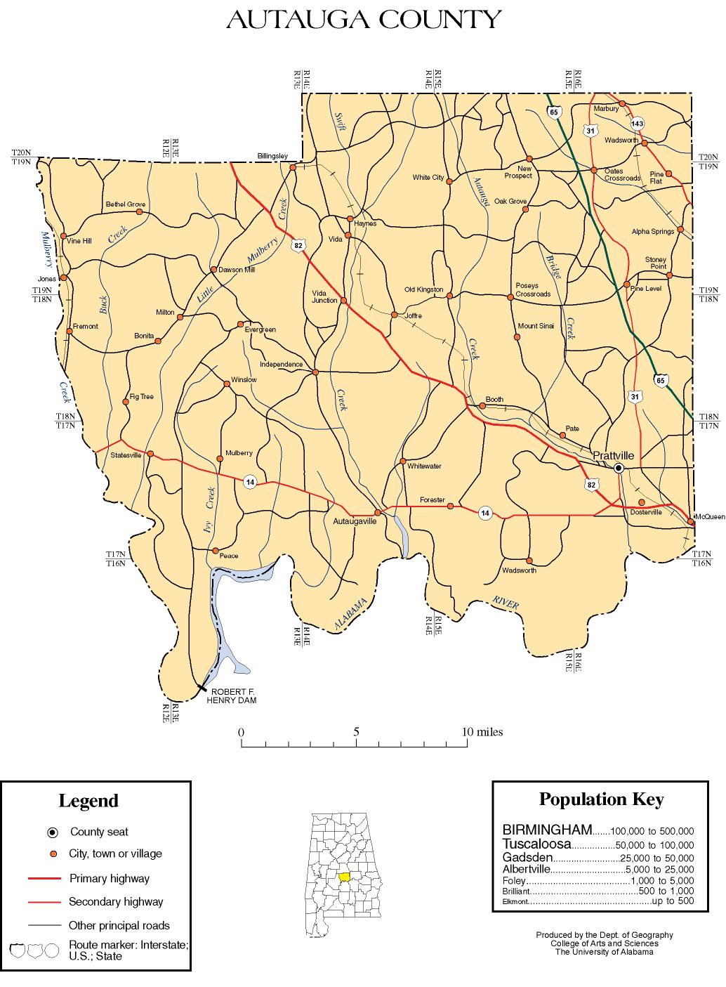
- Autauga County map of roads/towns (map © 2007 Univ. of AlabamaUniversity of AlabamaThe University of Alabama is a public coeducational university located in Tuscaloosa, Alabama, United States....
). - River Region Tourism Site