

Cullman County, Alabama
Encyclopedia
Cullman County is a county
of the U.S. state
of Alabama
. Its name is in honor of Colonel John G. Cullmann
. As of 2010, the population was 80,406. Its county seat
is the town of the same name, Cullman, Alabama
. It is a "moist" county in terms of availablity of alcoholic beverages, which means that the city of Cullman is wet and the rest of the county is dry
. Cullman is served by TV stations and FM radio stations from both Huntsville and Birmingham. Cullman County is a part of the designated market area, or "DMA," of Birmingham. Electricity in Cullman County is provided by the Tennessee Valley Authority
and by the Alabama Power Company
. For a long time, telephone service in this county was provided by the Southern Bell Company.
There is no commercial air transportation service in Cullman County, and this county is no longer served by intercity commercial buses.
The entirety of Cullman County forms the Cullman micropolitan area
, and apart of the Birmingham–Hoover–Cullman Combined Statistical Area
.
and Choctaw
lived here at the time of European encounter. The Cherokee who remained in the county after Indian Removal
in the 1830s have worked at reviving their culture in the last thirty years. The Echota Cherokee are a recognized tribe.
Cullman County was established by German American
immigrants from Cincinnati, Ohio, in 1877. They founded an agricultural community and sought to create an agricultural revolution in what had been a frontier area, in the best traditions of innovation in the New South. However, hard geographical and social realties clashed with the often impractical vision of colonizer John G. Cullmann. His Germans, with their traditional work ethic and willingness to experiment with such new products as wine and strawberries, did try to make practical changes in southern farming. The Germans were however outnumbered by more traditional families from neighboring, who replicated the traditional southern cotton culture.
of 2000, there were 77,483 people, 30,706 households, and 22,476 families residing in the county. The population density
was 105 people per square mile (41/km2). There were 35,233 housing units at an average density of 48 per square mile (18/km2). The racial makeup of the county was 96.81% White
, 0.96% Black
or African American
, 0.37% Native American
, 0.18% Asian
, 0.03% Pacific Islander
, 0.62% from other races
, and 1.03% from two or more races. 2.18% of the population were Hispanic
or Latino
of any race.
There were 30,706 households out of which 32.10% had children under the age of 18 living with them, 60.80% were married couples
living together, 8.70% had a female householder with no husband present, and 26.80% were non-families. 24.00% of all households were made up of individuals and 10.40% had someone living alone who was 65 years of age or older. The average household size was 2.49 and the average family size was 2.94.
In the county the population was spread out with 24.30% under the age of 18, 8.80% from 18 to 24, 28.30% from 25 to 44, 24.00% from 45 to 64, and 14.60% who were 65 years of age or older. The median age was 38 years. For every 100 females there were 97.30 males. For every 100 females age 18 and over, there were 94.20 males.
The median income for a household in the county was $32,256, and the median income for a family was $39,341. Males had a median income of $30,444 versus $20,436 for females. The per capita income
for the county was $16,922. About 9.50% of families and 13.00% of the population were below the poverty line, including 14.50% of those under age 18 and 16.80% of those age 65 or over.
Private educational institutions in the county include:
Cullman is also the home of the state-owned and operated Wallace State Community College
in Hanceville
. It was named for the former Governor of Alabama, George C. Wallace. His father and his wife, Governor Lurleen B. Wallace, also had junior colleges named for them.
County (United States)
In the United States, a county is a geographic subdivision of a state , usually assigned some governmental authority. The term "county" is used in 48 of the 50 states; Louisiana is divided into parishes and Alaska into boroughs. Parishes and boroughs are called "county-equivalents" by the U.S...
of the U.S. state
U.S. state
A U.S. state is any one of the 50 federated states of the United States of America that share sovereignty with the federal government. Because of this shared sovereignty, an American is a citizen both of the federal entity and of his or her state of domicile. Four states use the official title of...
of Alabama
Alabama
Alabama is a state located in the southeastern region of the United States. It is bordered by Tennessee to the north, Georgia to the east, Florida and the Gulf of Mexico to the south, and Mississippi to the west. Alabama ranks 30th in total land area and ranks second in the size of its inland...
. Its name is in honor of Colonel John G. Cullmann
John G. Cullmann
John Gottfried Cullmann was a German businessman and political activist who emigrated to the United States as a result of his financial ruin related to participation in the Revolution of 1848. Born in Frankweiler in the Rheinpfalz in what was then the Kingdom of Bavaria, Cullmann was the son of a...
. As of 2010, the population was 80,406. Its county seat
County seat
A county seat is an administrative center, or seat of government, for a county or civil parish. The term is primarily used in the United States....
is the town of the same name, Cullman, Alabama
Cullman, Alabama
Cullman is a city in Cullman County, State of Alabama. Cullman is located along Interstate 65, about north of Birmingham, and about south of Huntsville. According to the U.S...
. It is a "moist" county in terms of availablity of alcoholic beverages, which means that the city of Cullman is wet and the rest of the county is dry
Dry
Dry or dryness may refer to:* Lack of water* Prohibiting alcohol * Dryness , the lack of sugar in a drink, especially an alcoholic one * Dryness * Dryness...
. Cullman is served by TV stations and FM radio stations from both Huntsville and Birmingham. Cullman County is a part of the designated market area, or "DMA," of Birmingham. Electricity in Cullman County is provided by the Tennessee Valley Authority
Tennessee Valley Authority
The Tennessee Valley Authority is a federally owned corporation in the United States created by congressional charter in May 1933 to provide navigation, flood control, electricity generation, fertilizer manufacturing, and economic development in the Tennessee Valley, a region particularly affected...
and by the Alabama Power Company
Alabama Power Company
Alabama Power Company, headquartered in Birmingham, Alabama, is a company in the southern United States that provides electricity service to 1.3 million homes, businesses, and industries in the southern two-thirds of Alabama. It is one of four U.S...
. For a long time, telephone service in this county was provided by the Southern Bell Company.
There is no commercial air transportation service in Cullman County, and this county is no longer served by intercity commercial buses.
The entirety of Cullman County forms the Cullman micropolitan area
Cullman micropolitan area
Cullman Micropolitan Statistical Area covers all of Cullman County, which is located in North Alabama. As of 2007, the population was 81,324. It consists of Cullman and the surrounding area....
, and apart of the Birmingham–Hoover–Cullman Combined Statistical Area
Birmingham–Hoover–Cullman Combined Statistical Area
The Birmingham-Hoover-Cullman, AL CSA sometimes known as Greater Birmingham, is made up of 8 counties in Central Alabama....
.
History
This area was inhabited for thousands of years by varying cultures of indigenous peoples. The historic CherokeeCherokee
The Cherokee are a Native American people historically settled in the Southeastern United States . Linguistically, they are part of the Iroquoian language family...
and Choctaw
Choctaw
The Choctaw are a Native American people originally from the Southeastern United States...
lived here at the time of European encounter. The Cherokee who remained in the county after Indian Removal
Indian Removal
Indian removal was a nineteenth century policy of the government of the United States to relocate Native American tribes living east of the Mississippi River to lands west of the river...
in the 1830s have worked at reviving their culture in the last thirty years. The Echota Cherokee are a recognized tribe.
Cullman County was established by German American
German American
German Americans are citizens of the United States of German ancestry and comprise about 51 million people, or 17% of the U.S. population, the country's largest self-reported ancestral group...
immigrants from Cincinnati, Ohio, in 1877. They founded an agricultural community and sought to create an agricultural revolution in what had been a frontier area, in the best traditions of innovation in the New South. However, hard geographical and social realties clashed with the often impractical vision of colonizer John G. Cullmann. His Germans, with their traditional work ethic and willingness to experiment with such new products as wine and strawberries, did try to make practical changes in southern farming. The Germans were however outnumbered by more traditional families from neighboring, who replicated the traditional southern cotton culture.
Geography
According to the 2000 census, the county has a total area of 754.82 square miles (1,955 km²), of which 738.43 square miles (1,912.5 km²) (or 97.83%) is land and 16.39 square miles (42.4 km²) (or 2.17%) is water.Major highways
.svg.png) Interstate 65Interstate 65Interstate 65 is a major Interstate Highway in the United States. The southern terminus is located at an intersection with Interstate 10 in Mobile, Alabama, and its northern terminus is at an interchange with Interstate 90 , U.S. Route 12, and U.S...
Interstate 65Interstate 65Interstate 65 is a major Interstate Highway in the United States. The southern terminus is located at an intersection with Interstate 10 in Mobile, Alabama, and its northern terminus is at an interchange with Interstate 90 , U.S. Route 12, and U.S... U.S. Highway 31
 U.S. Highway 278
 U.S. Highway 231
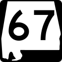 State Route 67State Route 67 (Alabama)State Route 67 is a state highway in Alabama that connects the city of Decatur to U.S. Highway 231 at Rainbow Crossing in Blount County. This road serves as a link between Decatur and Gadsden.-Route description:...
 State Route 69State Route 69 (Alabama)State Route 69 is a long route that extends from the southwestern to the northeastern parts of the state. The southern terminus of the route is at a junction with State Route 177 at Jackson. The northern terminus of the route is at its junction with U.S...
 State Route 91
 State Route 157
Adjacent counties
- Morgan CountyMorgan County, AlabamaMorgan County is the most populous county in the Decatur Metropolitan Area, and the second most populous county in the Huntsville-Decatur Combined Statistical Area in the U.S. State of Alabama. It was created by the Alabama Territorial legislature on February 6, 1818 from land acquired from the...
(north) - Marshall CountyMarshall County, AlabamaMarshall County is a county of the U.S. state of Alabama, and is included in the Huntsville-Decatur Combined Statistical Area. Its name is in honor of John Marshall, famous Chief Justice of the United States. As of 2010 the population was 93,019...
(northeast) - Blount CountyBlount County, AlabamaBlount County is a county located in the U.S. state of Alabama. As of the 2010 United States Census, the population was 57,322. Its county seat is Oneonta.Blount County is a dry county.-History:...
(east) - Walker CountyWalker County, AlabamaWalker County is a county of the U.S. state of Alabama.Its name is in honor of John Williams Walker, a member of the United States Senate. As of 2010 the population was 67,023...
(southwest) - Winston CountyWinston County, AlabamaWinston County is a county of the U.S. state of Alabama, formerly known as Hancock County before 1858.Its name is in honor of John A. Winston, the 15th Governor of Alabama. As of 2010, the population was 24,484. Its county seat is Double Springs....
(west) - Lawrence CountyLawrence County, AlabamaLawrence County is a county of the U.S. state of Alabama, and is included in the Decatur Metropolitan Area, as well as the Huntsville-Decatur Combined Statistical Area. It was named after James Lawrence, a captain in the United States Navy from New Jersey. As of the 2010 census, the population was...
(northwest)
Demographics
As of the censusCensus
A census is the procedure of systematically acquiring and recording information about the members of a given population. It is a regularly occurring and official count of a particular population. The term is used mostly in connection with national population and housing censuses; other common...
of 2000, there were 77,483 people, 30,706 households, and 22,476 families residing in the county. The population density
Population density
Population density is a measurement of population per unit area or unit volume. It is frequently applied to living organisms, and particularly to humans...
was 105 people per square mile (41/km2). There were 35,233 housing units at an average density of 48 per square mile (18/km2). The racial makeup of the county was 96.81% White
Race (United States Census)
Race and ethnicity in the United States Census, as defined by the Federal Office of Management and Budget and the United States Census Bureau, are self-identification data items in which residents choose the race or races with which they most closely identify, and indicate whether or not they are...
, 0.96% Black
Race (United States Census)
Race and ethnicity in the United States Census, as defined by the Federal Office of Management and Budget and the United States Census Bureau, are self-identification data items in which residents choose the race or races with which they most closely identify, and indicate whether or not they are...
or African American
Race (United States Census)
Race and ethnicity in the United States Census, as defined by the Federal Office of Management and Budget and the United States Census Bureau, are self-identification data items in which residents choose the race or races with which they most closely identify, and indicate whether or not they are...
, 0.37% Native American
Race (United States Census)
Race and ethnicity in the United States Census, as defined by the Federal Office of Management and Budget and the United States Census Bureau, are self-identification data items in which residents choose the race or races with which they most closely identify, and indicate whether or not they are...
, 0.18% Asian
Race (United States Census)
Race and ethnicity in the United States Census, as defined by the Federal Office of Management and Budget and the United States Census Bureau, are self-identification data items in which residents choose the race or races with which they most closely identify, and indicate whether or not they are...
, 0.03% Pacific Islander
Race (United States Census)
Race and ethnicity in the United States Census, as defined by the Federal Office of Management and Budget and the United States Census Bureau, are self-identification data items in which residents choose the race or races with which they most closely identify, and indicate whether or not they are...
, 0.62% from other races
Race (United States Census)
Race and ethnicity in the United States Census, as defined by the Federal Office of Management and Budget and the United States Census Bureau, are self-identification data items in which residents choose the race or races with which they most closely identify, and indicate whether or not they are...
, and 1.03% from two or more races. 2.18% of the population were Hispanic
Race (United States Census)
Race and ethnicity in the United States Census, as defined by the Federal Office of Management and Budget and the United States Census Bureau, are self-identification data items in which residents choose the race or races with which they most closely identify, and indicate whether or not they are...
or Latino
Race (United States Census)
Race and ethnicity in the United States Census, as defined by the Federal Office of Management and Budget and the United States Census Bureau, are self-identification data items in which residents choose the race or races with which they most closely identify, and indicate whether or not they are...
of any race.
There were 30,706 households out of which 32.10% had children under the age of 18 living with them, 60.80% were married couples
Marriage
Marriage is a social union or legal contract between people that creates kinship. It is an institution in which interpersonal relationships, usually intimate and sexual, are acknowledged in a variety of ways, depending on the culture or subculture in which it is found...
living together, 8.70% had a female householder with no husband present, and 26.80% were non-families. 24.00% of all households were made up of individuals and 10.40% had someone living alone who was 65 years of age or older. The average household size was 2.49 and the average family size was 2.94.
In the county the population was spread out with 24.30% under the age of 18, 8.80% from 18 to 24, 28.30% from 25 to 44, 24.00% from 45 to 64, and 14.60% who were 65 years of age or older. The median age was 38 years. For every 100 females there were 97.30 males. For every 100 females age 18 and over, there were 94.20 males.
The median income for a household in the county was $32,256, and the median income for a family was $39,341. Males had a median income of $30,444 versus $20,436 for females. The per capita income
Per capita income
Per capita income or income per person is a measure of mean income within an economic aggregate, such as a country or city. It is calculated by taking a measure of all sources of income in the aggregate and dividing it by the total population...
for the county was $16,922. About 9.50% of families and 13.00% of the population were below the poverty line, including 14.50% of those under age 18 and 16.80% of those age 65 or over.
Cities and towns
- ArabArab, AlabamaArab is a city in both Cullman County, Alabama and Marshall County, Alabama in the northeastern part of the U.S. state of Alabama, located ten miles from Guntersville Lake and Guntersville Dam, and is included in the Huntsville-Decatur Combined Statistical Area...
(part - most of Arab is in Marshall CountyMarshall County, AlabamaMarshall County is a county of the U.S. state of Alabama, and is included in the Huntsville-Decatur Combined Statistical Area. Its name is in honor of John Marshall, famous Chief Justice of the United States. As of 2010 the population was 93,019...
) - Ardell
- ArkadelphiaArkadelphia, AlabamaArkadelphia is an unincorporated community located in far southern Cullman County, Alabama, United States. It is situated just a few miles southwest of the town of Colony.-History:...
- BaileytonBaileyton, AlabamaBaileyton is a town in Cullman County, Alabama, United States. At the 2000 census the population was 684. According to the 2005 U.S. Census estimates, the town had a population of 703. -History:...
- BattlegroundBattleground, AlabamaBattleground is an unincorporated community in Cullman County, Alabama, United States.- Geography :Battleground is located at in the Northwestern section of Cullman County, bordering Morgan County...
- BerlinBerlin, AlabamaBerlin is an unincorporated community in Cullman County, Alabama, United States. It is located roughly five miles east of the city of Cullman. The center of Berlin is considered to be at the intersection of U.S. Route 278 and Cullman County Road 747 at Walker's Corner. The Berlin Community Center...
- Bethel
- BremenBremen, AlabamaBremen is an unincorporated town in Cullman County, Alabama, United States.-History:The Bremen community was founded with the name Empire in 1860. In order to prevent confusion with another Empire community in the state, the name was changed in 1879 by the town's first postmaster, James Macentepe...
- Birdsong
- Bolte
- Brooklyn
- Brushy Pond
- Bug TussleBug Tussle, AlabamaBug Tussle is a small community in rural Cullman County, Alabama. It is located near the Cullman County and Walker County border. It is situated near Bremen, Alabama and the Lewis Smith Lake, along Alabama Highway 69 and Alabama State Route 91, and is southwest of the city of Cullman.-Geography:Bug...
- Central
- Clifty
- ColonyColony, AlabamaColony is a town in Cullman County, Alabama, United States. At the 2000 census the population was 385. Colony is a historically African-American town. In its early days it was a safe-haven for African Americans in the Deep South.-Geography:...
- Corinth
- Crane Hill
- CullmanCullman, AlabamaCullman is a city in Cullman County, State of Alabama. Cullman is located along Interstate 65, about north of Birmingham, and about south of Huntsville. According to the U.S...
- Dodge CityDodge City, AlabamaDodge City is a town in Cullman County, Alabama, United States. At the 2000 census the population was 612.-Geography:Dodge City is located at .According to the U.S...
- East Point
- Etha
- FairviewFairview, AlabamaFairview is a town in Cullman County, Alabama, United States. At the 2000 census the population was 522.-Geography:Fairview is located at .According to the U.S...
- Garden CityGarden City, AlabamaGarden City is a town in Blount and Cullman Counties in the U.S. state of Alabama. At the 2000 census the population was 564. In spite of its name, Garden City is not a city , but merely a village...
(part - part of Garden City is in Blount CountyBlount County, AlabamaBlount County is a county located in the U.S. state of Alabama. As of the 2010 United States Census, the population was 57,322. Its county seat is Oneonta.Blount County is a dry county.-History:...
) - Goldridge
- Good HopeGood Hope, AlabamaGood Hope is a town in Cullman County, Alabama, United States. As of the 2000 census, the population of the town is 1,966.-Geography:Good Hope is located at 34°6'32" North, 86°52'2" West .According to the U.S...
- Goodwin
- HancevilleHanceville, AlabamaHanceville is a city in Cullman County, Alabama, United States. At the 2000 census the population was 2,951.-Geography:Hanceville is located at .According to the U.S. Census Bureau, the city has a total area of , all of it land....
- Harmony
- Holly PondHolly Pond, AlabamaHolly Pond is a town in Cullman County, Alabama, United States. As of 2000 the town's population was 645.-People from Holly Pond, Alabama:*Guy Hunt, former Governor of Alabama and Primitive Baptist pastor...
- Jones ChapelJones Chapel, AlabamaJones Chapel is a community in Cullman County, Alabama.It's a location on google maps....
- JoppaJoppa, AlabamaJoppa is an unincorporated community in Cullman County, Alabama, United States. On April 27, 2011, a tornado reportedly hit ground in the Joppa area as part of the April 25–28, 2011 tornado outbreak....
- Logan
- Panama
- ProvidenceProvidence, AlabamaProvidence is a town in Marengo County, Alabama, United States. At the 2000 census the population was 311.-Geography:Providence is located at .According to the U.S. Census Bureau, the town has a total area of , all of it land....
- RiversideRiverside, AlabamaRiverside is a town in St. Clair County, Alabama, United States. At the 2000 census the population was 1,564.-Geography:Riverside is located at .According to the U.S...
- Simcoe
- South VinemontSouth Vinemont, AlabamaSouth Vinemont is a town in Cullman County, Alabama, United States. At the 2000 census the population was 425.-Geography:South Vinemont is located at .According to the U.S...
- Thrasher Crossroads
- Trade
- Trimble
- Walter
- Welti
- West PointWest Point, AlabamaWest Point is a town in Cullman County, Alabama, United States. At the 2000 census the population was 295.-Geography:West Point is located at .According to the U.S. Census Bureau, the town has a total area of , all of it land....
- Wheat
- WilburnWilburn, AlabamaWilburn is an unincorporated community in Cullman County, Alabama, United States. On April 27, 2011, a tornado reportedly hit ground in the Wilburn area, blowing down trees onto a truck and home, trapping people in both ....
Education
Public education in Cullman County is provided by two systems: the Cullman City School Board and the Cullman County School Board, which governs all municipalities except the City of Cullman.- Cullman High SchoolCullman High SchoolCullman High School is the largest public high school in the city of Cullman, Alabama as well as Cullman County, Alabama. The school is classified as a 5A school and belongs to the Cullman City School District....
- under the governance of the Cullman City School Board
Private educational institutions in the county include:
- Christ Covenant School - located in Cullman (Grades K-2)
- Cullman Christian School - located in Cullman (Grades K-12)
- Sacred Heart of Jesus CatholicCatholicThe word catholic comes from the Greek phrase , meaning "on the whole," "according to the whole" or "in general", and is a combination of the Greek words meaning "about" and meaning "whole"...
Elementary School - located in Cullman (Grades PreK-6) - St. Bernard Preparatory School - located in Cullman (Grades 7-12)
- St. Paul's Lutheran School - located in Cullman (Grades K-6)
- Vinemont Christian Academy - located in South Vinemont (Grades PreK-12)
Cullman is also the home of the state-owned and operated Wallace State Community College
Wallace State Community College
Wallace State Community College is a community college located in Hanceville, Alabama. Wallace State offers a variety of associate's degrees. It is named for former Alabama governor George C. Wallace, who greatly expanded Alabama's community college system...
in Hanceville
Hanceville, Alabama
Hanceville is a city in Cullman County, Alabama, United States. At the 2000 census the population was 2,951.-Geography:Hanceville is located at .According to the U.S. Census Bureau, the city has a total area of , all of it land....
. It was named for the former Governor of Alabama, George C. Wallace. His father and his wife, Governor Lurleen B. Wallace, also had junior colleges named for them.
See also
- National Register of Historic Places listings in Cullman County, Alabama
- Properties on the Alabama Register of Landmarks and Heritage in Cullman County, Alabama
External links
Further reading
- Davis, Robert S., “The Old World in the New South: Entrepreneurial Ventures and the Agricultural History of Cullman County, Alabama,” Agricultural History, 79 (Fall 2005), 439–61.