
Interstate 20
Encyclopedia
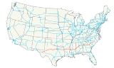
Interstate 20 is a major east–west Interstate Highway in the Southern United States
. I‑20 runs 1,535 miles (2,470 km) from near Kent, Texas
, at Interstate 10
to Florence, South Carolina
, at Interstate 95
. Between Texas and South Carolina, I‑20 runs through northern Louisiana
, central Mississippi
, western and north-central Alabama
, and north-central Georgia
. I‑20 intersects with seven of the 10 primary north–south interstates (all except I‑5
, I‑15
and I‑25
) and also with the major Interstate routes I‑10
, and I‑30
.
From its terminus at I‑95, the highway continues about two miles (3 km) eastward into the city of Florence as Business Spur 20.
|TX
|| 636.08 || 1023.67
|-
|LA
|| 189.87 || 305.57
|-
|MS
|| 154.61 || 248.82
|-
|AL
|| 214.7 || 345.5
|-
|GA
|| 202.61 || 326.07
|-
|SC
|| 141.51 || 227.74
|-
|Total || 1539.4 || 2477.4
|}
Interstate 20 begins 10 miles (16.1 km) east of Kent at a fork with Interstate 10. From there, the highway travels east-northeastward through Odessa
, Midland
, and Abilene
before turning eastward towards Dallas/Fort Worth. The La Entrada al Pacifico
corridor runs along I-20 between U.S. Route 385 and FM 1788. Between Monahans
and I-10, I-20 has an 80 mph (130 km/h) speed limit. The same stretch may go up to 85 miles per hour.
From the highway's opening in the 1960s through 1971, I-20 originally went through the heart of the Metroplex via the Dallas-Fort Worth Turnpike. This old route is now signed Interstate 30
(Dallas-Fort Worth Turnpike), U.S. Route 80
(former stretch between I-635 and Terrell
) and Texas Spur 557 (bypass around Terrell).
In 1987, I-20 was rerouted to go through the southern sections of Fort Worth, Arlington
, Grand Prairie
, Dallas, and Mesquite
before rejoining its original route at Terrell. Part of I-20 in Dallas is named the Lyndon B. Johnson Freeway and used to be signed as I-635.
Interstate 20 continues eastward from Terrell, bypassing Tyler
, Marshall
, and Longview
, before crossing the Louisiana border near Waskom.
, I-20 roughly parallels U.S. Route 80
through the northern part of the state.
Entering the state from near Waskom, Texas
, the highway immediately enters the Shreveport
-Bossier City
metropolitan area, intersecting Interstate 49
near downtown Shreveport and passing close to Barksdale Air Force Base
in Bossier city.
From that area, the highway traverses mainly rural, hilly terrain, bypassing Minden
, Ruston
and Grambling
before reaching Monroe
.
From Monroe, I-20 enters flatter terrain as it approaches the Mississippi River
. Before crossing the Mississippi, the highway passes Tallulah
. At the Mississippi River, I-20 leaves Louisiana and enters Vicksburg, Mississippi
.
, I-20 immediately enters Vicksburg
. Between Edwards and Clinton
, the highway mostly follows the original two-lane routing of U.S. Route 80
. In Jackson, I-20 sees a short concurrency with both Interstate 55
and U.S. Route 49
. Also in Jackson is an unusually expansive stack interchange
, at the junction
of I-20, I-55 North and U.S. 49 South. The interchange replaces a former directional interchange at I-55 North and a cloverleaf at Highway 49. From the Stack, I-20 continues eastward to Meridian
, where it begins the nearly 160 miles (257.5 km) overlap with Interstate 59
.
The route of the Mississippi section of Interstate 20 is defined in Mississippi Code § 65-3-3.
. At Birmingham
, the two highways pass through downtown together before splitting at Exit 130 just east of the Birmingham airport. I-20 continues eastward through Oxford
/Anniston, Alabama
, and the Talladega National Forest, passing by the Talladega Superspeedway
in the process, which is visible from the highway.
Also in Birmingham, the intersection of I-20/I-59 and Interstate 65
is known as a Malfunction Junction
because of the interchange's somewhat-confusing design, and the number of traffic accidents that occur there.
and after passing through western Georgia, it enters the Atlanta metropolitan area. On clear days, eastbound motorists get their first view of downtown Atlanta as they come over the top of the Six Flags Hill
. The Six Flags Over Georgia
amusement park is easily visible off exit 47 eastbound. In Atlanta
, the highway passes through the heart of the city, crossing Interstate 75
and Interstate 85
, which share a common expressway (the "Downtown Connector
"). It continues though Metropolitan Atlanta eastward and through the eastern half of Georgia until it exits the state, crossing the Savannah River
at Augusta, Ga.
.
Throughout the state, I-20 is conjoined with unsigned Georgia Highway 402. Also, I-20 from the Alabama state line to Interstate 285
in Atlanta is named the "Tom Murphy Freeway", but it is called the "Ralph David Abernathy Freeway" within I-285. The Interstate Highway is also named the Purple Heart Highway from I-285 in DeKalb County to U.S. 441 in Madison, Georgia
; and it is called the Carl Sanders Highway from U.S. 441 to the South Carolina state line.
and enters the Palmetto State and heads northeastward, bypassing Aiken
and Lexington
before reaching the state capital of Columbia
, which can be reached most directly by taking I-26
east at Exit 64 ("Malfunction Junction"), then, almost immediately, I-126/U.S. Route 76
.
At Columbia, Interstate 20 bypasses the city to the north and again turns northeastward, bypassing Fort Jackson
and Camden
. After crossing the Wateree River
, it turns due east, passes by tiny Bishopville, before reaching the Florence
area. It is near Florence where I-20 sees its eastern terminus at Interstate 95
. However, for about two miles (3 km), the highway continues into Florence as Business Spur 20.
I-20 in the Palmetto State is known as either the J. Strom Thurmond Freeway or John C. West Freeway. The first section to be completed was the bridge
over the Savannah River in 1965, the last, the section between U.S. Route 401
and I-95 (including the business spur), opened in August 1975.
In 2003, the North Carolina
Department of Transportation proposed extending I-20 eastward from Florence to Wilmington
at the behest of North Carolina Governor Mike Easley and his 'Strategic Transportation Plan' for the southeast portion of the state. The proposed route would follow U.S. 76 east from Florence to Whiteville, North Carolina
, then parallel U.S. 74/U.S. 76 into Wilmington. Part of this route is already designated the future eastern extension of Interstate 74
. As part of the 2005 SAFETEA-LU transportation legislation, North Carolina received $5 million for a feasibility study for this extension. While this extension has considerable support among towns in southeastern North Carolina, the South Carolina DOT has stated that they have no interest in upgrading their portion of U.S. 76 to an interstate. This is likely due, in no small part, to encourage eastbound vacationers to travel to Myrtle Beach, South Carolina
rather than Wilmington and that they are concentrating their efforts on plans to build Interstate 73
that will terminate near Myrtle Beach. This proposed extension has not been approved by the Federal Highway Administration or the AASHTO, so any construction remains far in the future, but NCDOT maintains the routing in its Strategic Highway Corridors maps.
, but was never built. The other I-420 was planned as a bypass to the south of downtown Atlanta. Due to anti-freeway sentiments, this I-420 was never completed, and the already-built portion has been signed as GA 154/GA 166, named Langford Parkway
(formerly the Lakewood Freeway).
Southern United States
The Southern United States—commonly referred to as the American South, Dixie, or simply the South—constitutes a large distinctive area in the southeastern and south-central United States...
. I‑20 runs 1,535 miles (2,470 km) from near Kent, Texas
Kent, Texas
Kent is an unincorporated village in Culberson County, in West Texas, United States. It lies just north of Interstate 10 at Exit 176, ten miles west of the beginning of Interstate 20 and four miles west of the eastern Culberson County boundary. It is sandwiched between the railroad, immediately...
, at Interstate 10
Interstate 10
Interstate 10 is the fourth-longest Interstate Highway in the United States, after I-90, I-80, and I-40. It is the southernmost east–west, coast-to-coast Interstate Highway, although I-4 and I-8 are further south. It stretches from the Pacific Ocean at State Route 1 in Santa Monica,...
to Florence, South Carolina
Florence, South Carolina
-Municipal government and politics:The City of Florence has a council-manager form of government. The mayor and city council are elected every four years, with no term limits...
, at Interstate 95
Interstate 95 in South Carolina
Interstate 95 is a major Interstate Highway, running along the East Coast of the United States from Florida to Maine. In South Carolina, I-95 runs approximately parallel to the Atlantic Ocean shore although about inland, from Hardeeville in the south to Dillon in the northeast.-Route...
. Between Texas and South Carolina, I‑20 runs through northern Louisiana
Louisiana
Louisiana is a state located in the southern region of the United States of America. Its capital is Baton Rouge and largest city is New Orleans. Louisiana is the only state in the U.S. with political subdivisions termed parishes, which are local governments equivalent to counties...
, central Mississippi
Mississippi
Mississippi is a U.S. state located in the Southern United States. Jackson is the state capital and largest city. The name of the state derives from the Mississippi River, which flows along its western boundary, whose name comes from the Ojibwe word misi-ziibi...
, western and north-central Alabama
Alabama
Alabama is a state located in the southeastern region of the United States. It is bordered by Tennessee to the north, Georgia to the east, Florida and the Gulf of Mexico to the south, and Mississippi to the west. Alabama ranks 30th in total land area and ranks second in the size of its inland...
, and north-central Georgia
Georgia (U.S. state)
Georgia is a state located in the southeastern United States. It was established in 1732, the last of the original Thirteen Colonies. The state is named after King George II of Great Britain. Georgia was the fourth state to ratify the United States Constitution, on January 2, 1788...
. I‑20 intersects with seven of the 10 primary north–south interstates (all except I‑5
Interstate 5
Interstate 5 is the main Interstate Highway on the West Coast of the United States, running largely parallel to the Pacific Ocean coastline from Canada to Mexico . It serves some of the largest cities on the U.S...
, I‑15
Interstate 15
Interstate 15 is the fourth-longest north–south Interstate Highway in the United States, traveling through the states of California, Nevada, Arizona, Utah, Idaho, and Montana from San Diego to the Canadian border...
and I‑25
Interstate 25
Interstate 25 is an Interstate Highway in the western United States. It is primarily a north–south highway. I-25 stretches from Interstate 10 at Las Cruces, New Mexico, , to Interstate 90 in Buffalo, Wyoming, .Interstate 25 is the main north–south expressway through...
) and also with the major Interstate routes I‑10
Interstate 10
Interstate 10 is the fourth-longest Interstate Highway in the United States, after I-90, I-80, and I-40. It is the southernmost east–west, coast-to-coast Interstate Highway, although I-4 and I-8 are further south. It stretches from the Pacific Ocean at State Route 1 in Santa Monica,...
, and I‑30
Interstate 30
Interstate 30 is an Interstate Highway in the southern United States. I-30 runs from Interstate 20 west of Fort Worth, Texas, northeast via Dallas, Texas, and Texarkana, Texas, to Interstate 40 in North Little Rock, Arkansas. The route parallels U.S. Route 67 except for the portion west of...
.
From its terminus at I‑95, the highway continues about two miles (3 km) eastward into the city of Florence as Business Spur 20.
Texas
|-|TX
Interstate 20 in Texas
Interstate 20 in Texas is a major east–west Interstate Highway in the Southern United States, running east from a junction with Interstate 10 east of Kent, Texas, through the Dallas-Fort Worth Metroplex to the border with Louisiana near Waskom, Texas...
|| 636.08 || 1023.67
|-
|LA
Interstate 20 in Louisiana
Interstate 420 was to be a bypass of Monroe, Louisiana. Initially proposed in the late 1950s, this route was to have been only two lanes wide at a cost $29 million with a projected 2,500 to 3,000 ADT in 1964. The project was effectively canceled on October 12, 1964, when then Louisiana...
|| 189.87 || 305.57
|-
|MS
Interstate 20 in Mississippi
Interstate 20 is a major thoroughfare through central Mississippi, connecting the area with major metropolitan areas, including Dallas, Texas, Atlanta, Georgia and Birmingham, Alabama.-Route description:...
|| 154.61 || 248.82
|-
|AL
Interstate 20 in Alabama
In Alabama, Interstate 20 travels 214.7 miles through the center of the state. It enters the state from Mississippi near York, and travels northeastward through Tuscaloosa and Birmingham...
|| 214.7 || 345.5
|-
|GA
Interstate 20 in Georgia
In Georgia, Interstate 20 runs from the Alabama border to the Savannah River, which the Georgia-South Carolina border straddles. It passes through the heavily congested Atlanta metropolitan area and exits the state at Augusta...
|| 202.61 || 326.07
|-
|SC
Interstate 20 in South Carolina
Interstate 20 is a major thoroughfare cutting across the state of South Carolina, linking the state with important transportation and business hubs to the north, west and south, including Atlanta, Georgia, Charlotte, North Carolina , Savannah, Georgia and Washington, D.C...
|| 141.51 || 227.74
|-
|Total || 1539.4 || 2477.4
|}
Interstate 20 begins 10 miles (16.1 km) east of Kent at a fork with Interstate 10. From there, the highway travels east-northeastward through Odessa
Odessa, Texas
Odessa is a city in and the county seat of Ector County, Texas, United States. It is located primarily in Ector County, although a small portion of the city extends into Midland County. Odessa's population was 99,940 at the 2010 census. It is the principal city of the Odessa, Texas Metropolitan...
, Midland
Midland, Texas
Midland is a city in and the county seat of Midland County, Texas, United States, on the Southern Plains of the state's western area. A small portion of the city extends into Martin County. As of 2010, the population of Midland was 111,147. It is the principal city of the Midland, Texas...
, and Abilene
Abilene, Texas
Abilene is a city in Taylor and Jones counties in west central Texas. The population was 117,063 at the 2010 census. It is the principal city of the Abilene Metropolitan Statistical Area, which had a 2006 estimated population of 158,063. It is the county seat of Taylor County...
before turning eastward towards Dallas/Fort Worth. The La Entrada al Pacifico
La Entrada al Pacífico
The La Entrada al Pacífico trade corridor was designated as "Trade Corridor 56" by the Intermodal Surface Transportation Efficiency Act. The corridor is an international project between Mexico and the United States as a route from the Pacific Ocean port of Topolobampo in the Mexican state of...
corridor runs along I-20 between U.S. Route 385 and FM 1788. Between Monahans
Monahans, Texas
Monahans is a city in and the county seat of Ward County, Texas, United States. A very small portion of the city extends into Winkler County. The population was 6,821 at the 2000 census.-History:...
and I-10, I-20 has an 80 mph (130 km/h) speed limit. The same stretch may go up to 85 miles per hour.
From the highway's opening in the 1960s through 1971, I-20 originally went through the heart of the Metroplex via the Dallas-Fort Worth Turnpike. This old route is now signed Interstate 30
Interstate 30
Interstate 30 is an Interstate Highway in the southern United States. I-30 runs from Interstate 20 west of Fort Worth, Texas, northeast via Dallas, Texas, and Texarkana, Texas, to Interstate 40 in North Little Rock, Arkansas. The route parallels U.S. Route 67 except for the portion west of...
(Dallas-Fort Worth Turnpike), U.S. Route 80
U.S. Route 80
U.S. Route 80 is an east–west United States highway, much of which was once part of the early auto trail known as the Dixie Overland Highway. As the "0" in the route number indicates, it was originally a cross-country route, from the Atlantic to the Pacific...
(former stretch between I-635 and Terrell
Terrell, Texas
Terrell is a city in Kaufman County, Texas, United States, and a southeastern suburb of Dallas. As of the 2000 census, the city population was 13,606...
) and Texas Spur 557 (bypass around Terrell).
In 1987, I-20 was rerouted to go through the southern sections of Fort Worth, Arlington
Arlington, Texas
Arlington is a city in Tarrant County, Texas within the Dallas–Fort Worth metropolitan area. According to the 2010 census results, the city had a population of 365,438, making it the third largest municipality in the Metroplex...
, Grand Prairie
Grand Prairie, Texas
Grand Prairie is a city in Dallas, Ellis, and Tarrant counties in the U.S. state of Texas and is a part of the Mid-Cities region in the Dallas–Fort Worth metroplex. Grand Prairie is a suburb of both Dallas and Fort Worth and had a population of 175,396 at the 2010 census.- History :The city of...
, Dallas, and Mesquite
Mesquite, Texas
Mesquite is a city located within the Dallas/Ft.Worth area of Texas. As of the 2010 US Census, the population was 139,824.-History:The city was founded May 22, 1873, by a Texas & Pacific Railway engineer who purchased land along the Texas & Pacific line outside of Dallas...
before rejoining its original route at Terrell. Part of I-20 in Dallas is named the Lyndon B. Johnson Freeway and used to be signed as I-635.
Interstate 20 continues eastward from Terrell, bypassing Tyler
Tyler, Texas
Tyler is a city in and the county seat of Smith County, Texas, in the United States. It takes its name from President John Tyler . The city had a population of 109,000 in 2010, according to the United States Census Bureau...
, Marshall
Marshall, Texas
Marshall is a city in Harrison County in the northeastern corner of Texas. Marshall is a major cultural and educational center in East Texas and the tri-state area. As of the 2010 U.S. Census, the population of Marshall was about 23,523...
, and Longview
Longview, Texas
Longview is a city in Gregg and Harrison Counties in the U.S. state of Texas. As of the 2010 Census, the population was 80,455. Most of the city is located in Gregg County, of which it is the county seat; only a small part extends into the western part of neighboring Harrison County. It is...
, before crossing the Louisiana border near Waskom.
Louisiana
In LouisianaLouisiana
Louisiana is a state located in the southern region of the United States of America. Its capital is Baton Rouge and largest city is New Orleans. Louisiana is the only state in the U.S. with political subdivisions termed parishes, which are local governments equivalent to counties...
, I-20 roughly parallels U.S. Route 80
U.S. Route 80
U.S. Route 80 is an east–west United States highway, much of which was once part of the early auto trail known as the Dixie Overland Highway. As the "0" in the route number indicates, it was originally a cross-country route, from the Atlantic to the Pacific...
through the northern part of the state.
Entering the state from near Waskom, Texas
Waskom, Texas
Waskom is a city in Harrison County, Texas, United States. It lies about east of the county seat, Marshall, on U.S. Route 80. To the east is Shreveport, Louisiana...
, the highway immediately enters the Shreveport
Shreveport, Louisiana
Shreveport is the third largest city in Louisiana. It is the principal city of the fourth largest metropolitan area in the state of Louisiana and is the 109th-largest city in the United States....
-Bossier City
Bossier City, Louisiana
Bossier City is a city in Bossier Parish, Louisiana, United States.As of the 2010 Census, the city had a total population of 61,315. Bossier City is closely tied to its larger sister city Shreveport, located on the western bank of the Red River. The Shreveport-Bossier City metropolitan area is the...
metropolitan area, intersecting Interstate 49
Interstate 49
Interstate 49 is currently an intrastate Interstate Highway located entirely within the state of Louisiana in the southern United States. Its southern terminus is in Lafayette, Louisiana, at Interstate 10 while its northern terminus is in Shreveport, Louisiana, at Interstate 20.-Route...
near downtown Shreveport and passing close to Barksdale Air Force Base
Barksdale Air Force Base
Barksdale Air Force Base is a United States Air Force base located approximately east-southeast of Bossier City, Louisiana.The host unit at Barksdale is the 2d Bomb Wing , the oldest Bomb Wing in the Air Force. It is assigned to the Air Force Global Strike Command's Eighth Air Force...
in Bossier city.
From that area, the highway traverses mainly rural, hilly terrain, bypassing Minden
Minden, Louisiana
Minden is a city in the American state of Louisiana. It serves as the parish seat of Webster Parish and is located twenty-eight miles east of Shreveport, the seat of Caddo Parish. The population, which has been stable since 1960, was 13,027 at the 2000 census...
, Ruston
Ruston, Louisiana
Ruston is a city in and the parish seat of Lincoln Parish, Louisiana, United States. The population was 20,546 at the 2000 census. Ruston is near the eastern border of the Ark-La-Tex and is the home of Louisiana Tech University. Its economy caters to its college population...
and Grambling
Grambling, Louisiana
Grambling is a city in Lincoln Parish, Louisiana, United States. The population was 4,693 at the 2000 census. The city is home to Grambling State University and is part of the Ruston Micropolitan Statistical Area....
before reaching Monroe
Monroe, Louisiana
Monroe is a city in and the parish seat of Ouachita Parish, Louisiana, United States. As of the 2000 census, the city had a total population of 53,107, making it the eighth largest city in Louisiana. A July 1, 2007, United States Census Bureau estimate placed the population at 51,208, but 51,636...
.
From Monroe, I-20 enters flatter terrain as it approaches the Mississippi River
Mississippi River
The Mississippi River is the largest river system in North America. Flowing entirely in the United States, this river rises in western Minnesota and meanders slowly southwards for to the Mississippi River Delta at the Gulf of Mexico. With its many tributaries, the Mississippi's watershed drains...
. Before crossing the Mississippi, the highway passes Tallulah
Tallulah, Louisiana
Tallulah is a city in and the parish seat of Madison Parish, Louisiana, United States. The population was 9,189 at the 2000 census...
. At the Mississippi River, I-20 leaves Louisiana and enters Vicksburg, Mississippi
Vicksburg, Mississippi
Vicksburg is a city in Warren County, Mississippi, United States. It is the only city in Warren County. It is located northwest of New Orleans on the Mississippi and Yazoo rivers, and due west of Jackson, the state capital. In 1900, 14,834 people lived in Vicksburg; in 1910, 20,814; in 1920,...
.
Mississippi
Upon entering Mississippi by crossing the Mississippi RiverMississippi River
The Mississippi River is the largest river system in North America. Flowing entirely in the United States, this river rises in western Minnesota and meanders slowly southwards for to the Mississippi River Delta at the Gulf of Mexico. With its many tributaries, the Mississippi's watershed drains...
, I-20 immediately enters Vicksburg
Vicksburg, Mississippi
Vicksburg is a city in Warren County, Mississippi, United States. It is the only city in Warren County. It is located northwest of New Orleans on the Mississippi and Yazoo rivers, and due west of Jackson, the state capital. In 1900, 14,834 people lived in Vicksburg; in 1910, 20,814; in 1920,...
. Between Edwards and Clinton
Clinton, Mississippi
Clinton is a city in Hinds County, Mississippi, United States. Situated in the Jackson metropolitan area, it is the tenth largest city in Mississippi. The population was 23,347 at the 2000 United States Census.-History:...
, the highway mostly follows the original two-lane routing of U.S. Route 80
U.S. Route 80
U.S. Route 80 is an east–west United States highway, much of which was once part of the early auto trail known as the Dixie Overland Highway. As the "0" in the route number indicates, it was originally a cross-country route, from the Atlantic to the Pacific...
. In Jackson, I-20 sees a short concurrency with both Interstate 55
Interstate 55
Interstate 55 is an Interstate Highway in the central United States. Its odd number indicates that it is a north–south Interstate Highway. I-55 goes from LaPlace, Louisiana at Interstate 10 to Chicago at U.S. Route 41 , at McCormick Place. A common nickname for the highway is "double...
and U.S. Route 49
U.S. Route 49
U.S. Route 49 is a north–south United States highway. The highway's northern terminus is in Piggott, Arkansas, at an intersection with U.S. Route 62. Its southern terminus is in Gulfport, Mississippi, at an intersection with U.S. Route 90. US 49 is approximately 516 miles in length.It...
. Also in Jackson is an unusually expansive stack interchange
Stack interchange
A stack interchange is a free-flowing grade separated junction between two roads.In countries where one drives on the right, left turns are handled by semi-directional flyover/under ramps...
, at the junction
Interchange (road)
In the field of road transport, an interchange is a road junction that typically uses grade separation, and one or more ramps, to permit traffic on at least one highway to pass through the junction without directly crossing any other traffic stream. It differs from a standard intersection, at which...
of I-20, I-55 North and U.S. 49 South. The interchange replaces a former directional interchange at I-55 North and a cloverleaf at Highway 49. From the Stack, I-20 continues eastward to Meridian
Meridian, Mississippi
Meridian is the county seat of Lauderdale County, Mississippi. It is the sixth largest city in the state and the principal city of the Meridian, Mississippi Micropolitan Statistical Area...
, where it begins the nearly 160 miles (257.5 km) overlap with Interstate 59
Interstate 59
Interstate 59 is an Interstate Highway in the southern United States. Its southern terminus is near Slidell, Louisiana, a suburb of New Orleans, at an intersection with Interstate 10 and Interstate 12, its northern terminus is at Wildwood, Georgia, at an intersection with Interstate 24.The road's...
.
The route of the Mississippi section of Interstate 20 is defined in Mississippi Code § 65-3-3.
Alabama
Interstate 20 (along with Interstate 59) crosses the Alabama state line near York, and it stays conjoined as it passes through western Alabama and TuscaloosaTuscaloosa, Alabama
Tuscaloosa is a city in and the seat of Tuscaloosa County in west central Alabama . Located on the Black Warrior River, it is the fifth-largest city in Alabama, with a population of 90,468 in 2010...
. At Birmingham
Birmingham, Alabama
Birmingham is the largest city in Alabama. The city is the county seat of Jefferson County. According to the 2010 United States Census, Birmingham had a population of 212,237. The Birmingham-Hoover Metropolitan Area, in estimate by the U.S...
, the two highways pass through downtown together before splitting at Exit 130 just east of the Birmingham airport. I-20 continues eastward through Oxford
Oxford, Alabama
Oxford is a city in Calhoun and Talladega counties in the U.S. state of Alabama. The population was 14,592 at the 2000 census. Oxford is one of two principal cities of and included in the Anniston-Oxford Metropolitan Statistical Area...
/Anniston, Alabama
Anniston, Alabama
Anniston is a city in Calhoun County in the state of Alabama, United States.As of the 2000 census, the population of the city is 24,276. According to the 2005 U.S. Census estimates, the city had a population of 23,741...
, and the Talladega National Forest, passing by the Talladega Superspeedway
Talladega Superspeedway
Talladega Superspeedway is a motorsports complex located north of Talladega, Alabama, United States. It is located on the former Anniston Air Force Base just outside the small city of Lincoln. It was constructed by International Speedway Corporation, a business controlled by the France Family, in...
in the process, which is visible from the highway.
Also in Birmingham, the intersection of I-20/I-59 and Interstate 65
Interstate 65
Interstate 65 is a major Interstate Highway in the United States. The southern terminus is located at an intersection with Interstate 10 in Mobile, Alabama, and its northern terminus is at an interchange with Interstate 90 , U.S. Route 12, and U.S...
is known as a Malfunction Junction
Malfunction Junction
Malfunction Junction is a derisive nickname given by motorists to a confusing, dangerous, or otherwise problematic interchange.-Alabama:*Interstates in Birmingham. This interchange is the busiest in Alabama, and has been the site of many accidents, including roadway punctures and two fiery...
because of the interchange's somewhat-confusing design, and the number of traffic accidents that occur there.
Georgia
I-20 enters the Peach State near TallapoosaTallapoosa, Georgia
Tallapoosa is a city in Haralson County, Georgia, United States. The population was 2,789 at the 2000 census.-Geography:Tallapoosa, incorporated in 1860, is located in Haralson County, in northwest Georgia, about west of Atlanta, just north of Interstate 20 and east of the Alabama state line...
and after passing through western Georgia, it enters the Atlanta metropolitan area. On clear days, eastbound motorists get their first view of downtown Atlanta as they come over the top of the Six Flags Hill
Six flags hill
Six Flags Hill is a hill located on Interstate 20 west of Atlanta, Georgia. It is about a mile west of the Six Flags Over Georgia theme park, and is a major reference point for Atlanta radio and television traffic reporters....
. The Six Flags Over Georgia
Six Flags Over Georgia
Six Flags Over Georgia is a theme park located west of Atlanta, in unincorporated Cobb County. Opened in 1967, it is the second park in the Six Flags chain, after the original opening in 1961 in Texas....
amusement park is easily visible off exit 47 eastbound. In Atlanta
Atlanta, Georgia
Atlanta is the capital and most populous city in the U.S. state of Georgia. According to the 2010 census, Atlanta's population is 420,003. Atlanta is the cultural and economic center of the Atlanta metropolitan area, which is home to 5,268,860 people and is the ninth largest metropolitan area in...
, the highway passes through the heart of the city, crossing Interstate 75
Interstate 75
Interstate 75 is a major north–south Interstate Highway in the Great Lakes and Southeastern regions of the United States. It travels from State Road 826 and State Road 924 in Hialeah, Florida to Sault Ste. Marie, Michigan, at the Ontario, Canada, border...
and Interstate 85
Interstate 85
Interstate 85 is a major interstate highway in the Southeastern United States. Its current southern terminus is at an interchange with Interstate 65 in Montgomery, Alabama; its northern terminus interchanges with Interstate 95 in Petersburg, Virginia, near Richmond...
, which share a common expressway (the "Downtown Connector
Downtown Connector
In Atlanta, Georgia, the Downtown Connector or 75/85 is the concurrent section of Interstate 75 and Interstate 85 through the core of the city. Beginning at the I-85/Langford Parkway interchange, the Downtown Connector runs generally due north, meeting the east-west Interstate 20 in the middle....
"). It continues though Metropolitan Atlanta eastward and through the eastern half of Georgia until it exits the state, crossing the Savannah River
Savannah River
The Savannah River is a major river in the southeastern United States, forming most of the border between the states of South Carolina and Georgia. Two tributaries of the Savannah, the Tugaloo River and the Chattooga River, form the northernmost part of the border...
at Augusta, Ga.
Augusta, Georgia
Augusta is a consolidated city in the U.S. state of Georgia, located along the Savannah River. As of the 2010 census, the Augusta–Richmond County population was 195,844 not counting the unconsolidated cities of Hephzibah and Blythe.Augusta is the principal city of the Augusta-Richmond County...
.
Throughout the state, I-20 is conjoined with unsigned Georgia Highway 402. Also, I-20 from the Alabama state line to Interstate 285
Interstate 285
Interstate 285 is an Interstate Highway loop encircling Atlanta, Georgia, for . I-285 is also known as unsigned State Route 407 and is colloquially referred to as the Perimeter. Suburban sprawl has made it one of the most heavily traveled roadways in the United States, and portions of the highway...
in Atlanta is named the "Tom Murphy Freeway", but it is called the "Ralph David Abernathy Freeway" within I-285. The Interstate Highway is also named the Purple Heart Highway from I-285 in DeKalb County to U.S. 441 in Madison, Georgia
Madison, Georgia
Madison is a city in Morgan County, Georgia, United States. The population was 3,636 at the 2000 census. The city is the county seat of Morgan County....
; and it is called the Carl Sanders Highway from U.S. 441 to the South Carolina state line.
South Carolina
Upon leaving Augusta, I-20 crosses the Savannah RiverSavannah River
The Savannah River is a major river in the southeastern United States, forming most of the border between the states of South Carolina and Georgia. Two tributaries of the Savannah, the Tugaloo River and the Chattooga River, form the northernmost part of the border...
and enters the Palmetto State and heads northeastward, bypassing Aiken
Aiken, South Carolina
Aiken is a city in and the county seat of Aiken County, South Carolina, United States. With Augusta, Georgia, it is one of the two largest cities of the Central Savannah River Area. It is part of the Augusta-Richmond County Metropolitan Statistical Area. Aiken is home to the University of South...
and Lexington
Lexington, South Carolina
Lexington is a town in and the county seat of Lexington County, South Carolina, United States. The population was 17,870 at the 2010 census.-Geography:Lexington is located at ....
before reaching the state capital of Columbia
Columbia, South Carolina
Columbia is the state capital and largest city in the U.S. state of South Carolina. The population was 129,272 according to the 2010 census. Columbia is the county seat of Richland County, but a portion of the city extends into neighboring Lexington County. The city is the center of a metropolitan...
, which can be reached most directly by taking I-26
Interstate 26
Interstate 26 is a nominally east–west main route of the Interstate Highway System in the Southeastern United States. I-26 runs from the junction of U.S. Route 11W and U.S. Route 23 in Kingsport, Tennessee, generally southeastward to U.S. Route 17 in Charleston, South Carolina...
east at Exit 64 ("Malfunction Junction"), then, almost immediately, I-126/U.S. Route 76
U.S. Route 76
U.S. Route 76 is an east–west United States highway that runs for from Chattanooga, Tennessee to Wrightsville Beach, North Carolina.-Tennessee:...
.
At Columbia, Interstate 20 bypasses the city to the north and again turns northeastward, bypassing Fort Jackson
Fort Jackson, South Carolina
Fort Jackson is a United States Army installation, which TRADOC operates on for Basic Combat Training , and is located in Columbia, South Carolina. This installation is named for Andrew Jackson, a United States Army General and 7th President of the United States.-Overview:Fort Jackson was created...
and Camden
Camden, South Carolina
Camden is the fourth oldest city in the U.S. state of South Carolina and is also the county seat of Kershaw County, South Carolina, United States. The population was an estimated 7,103 in 2009...
. After crossing the Wateree River
Wateree River
The Wateree River, about 75 mi long, is a tributary of the Santee River in central South Carolina in the United States, which flows to the Atlantic Ocean...
, it turns due east, passes by tiny Bishopville, before reaching the Florence
Florence, South Carolina
-Municipal government and politics:The City of Florence has a council-manager form of government. The mayor and city council are elected every four years, with no term limits...
area. It is near Florence where I-20 sees its eastern terminus at Interstate 95
Interstate 95 in South Carolina
Interstate 95 is a major Interstate Highway, running along the East Coast of the United States from Florida to Maine. In South Carolina, I-95 runs approximately parallel to the Atlantic Ocean shore although about inland, from Hardeeville in the south to Dillon in the northeast.-Route...
. However, for about two miles (3 km), the highway continues into Florence as Business Spur 20.
I-20 in the Palmetto State is known as either the J. Strom Thurmond Freeway or John C. West Freeway. The first section to be completed was the bridge
Bridge
A bridge is a structure built to span physical obstacles such as a body of water, valley, or road, for the purpose of providing passage over the obstacle...
over the Savannah River in 1965, the last, the section between U.S. Route 401
U.S. Route 401
U.S. Route 401 is an north–south United States highway, a spur of U.S. Route 1, that traverses along the fall line from Sumter, South Carolina to Interstate 85 near Wise, North Carolina.-Route description:...
and I-95 (including the business spur), opened in August 1975.
Future
 |
 |
In 2003, the North Carolina
North Carolina
North Carolina is a state located in the southeastern United States. The state borders South Carolina and Georgia to the south, Tennessee to the west and Virginia to the north. North Carolina contains 100 counties. Its capital is Raleigh, and its largest city is Charlotte...
Department of Transportation proposed extending I-20 eastward from Florence to Wilmington
Wilmington, North Carolina
Wilmington is a port city in and is the county seat of New Hanover County, North Carolina, United States. The population is 106,476 according to the 2010 Census, making it the eighth most populous city in the state of North Carolina...
at the behest of North Carolina Governor Mike Easley and his 'Strategic Transportation Plan' for the southeast portion of the state. The proposed route would follow U.S. 76 east from Florence to Whiteville, North Carolina
Whiteville, North Carolina
Whiteville is a city in Columbus County, North Carolina, United States. The population was 5,148 at the 2000 census. It is the only city of Columbus County and is the county seat....
, then parallel U.S. 74/U.S. 76 into Wilmington. Part of this route is already designated the future eastern extension of Interstate 74
Interstate 74
Interstate 74 is an Interstate Highway in the Midwestern and Southeastern United States. Its western end is at an intersection with Interstate 80 in Davenport, Iowa; the eastern end of its Midwest segment is at an intersection with Interstate 75 in Cincinnati, Ohio...
. As part of the 2005 SAFETEA-LU transportation legislation, North Carolina received $5 million for a feasibility study for this extension. While this extension has considerable support among towns in southeastern North Carolina, the South Carolina DOT has stated that they have no interest in upgrading their portion of U.S. 76 to an interstate. This is likely due, in no small part, to encourage eastbound vacationers to travel to Myrtle Beach, South Carolina
Myrtle Beach, South Carolina
Myrtle Beach is a coastal city on the east coast of the United States in Horry County, South Carolina. It is situated on the center of a large and continuous stretch of beach known as the Grand Strand in northeastern South Carolina. It is considered to be a major tourist destination in the...
rather than Wilmington and that they are concentrating their efforts on plans to build Interstate 73
Interstate 73
Interstate 73 is a main route of the Interstate Highway System, currently located entirely within the U.S. state of North Carolina. It is part of a longer planned corridor, defined by various Federal laws to run from Myrtle Beach, South Carolina, to Grayling, Michigan, but only the part south of...
that will terminate near Myrtle Beach. This proposed extension has not been approved by the Federal Highway Administration or the AASHTO, so any construction remains far in the future, but NCDOT maintains the routing in its Strategic Highway Corridors maps.
Major intersections
.svg.png) Interstate 10Interstate 10 in TexasInterstate 10 is the major east–west Interstate Highway in the Southern United States. In the U.S. state of Texas, it runs east from El Paso, near the border with New Mexico, through San Antonio and Houston to the border with Louisiana in Orange, Texas....
Interstate 10Interstate 10 in TexasInterstate 10 is the major east–west Interstate Highway in the Southern United States. In the U.S. state of Texas, it runs east from El Paso, near the border with New Mexico, through San Antonio and Houston to the border with Louisiana in Orange, Texas....
in Kent, TexasKent, TexasKent is an unincorporated village in Culberson County, in West Texas, United States. It lies just north of Interstate 10 at Exit 176, ten miles west of the beginning of Interstate 20 and four miles west of the eastern Culberson County boundary. It is sandwiched between the railroad, immediately....svg.png) Interstate 30 near Fort Worth, TexasFort Worth, TexasFort Worth is the 16th-largest city in the United States of America and the fifth-largest city in the state of Texas. Located in North Central Texas, just southeast of the Texas Panhandle, the city is a cultural gateway into the American West and covers nearly in Tarrant, Parker, Denton, and...
Interstate 30 near Fort Worth, TexasFort Worth, TexasFort Worth is the 16th-largest city in the United States of America and the fifth-largest city in the state of Texas. Located in North Central Texas, just southeast of the Texas Panhandle, the city is a cultural gateway into the American West and covers nearly in Tarrant, Parker, Denton, and....svg.png) Interstate 820Interstate 820Interstate 820 is a loop of Interstate 20 in Fort Worth, Texas of approximately around the city and some of its suburbs. Exit numbers begin at its intersection with I-20 in southwest Fort Worth, and continue in a clockwise direction around the city until it ends at its intersection with I-20 in...
Interstate 820Interstate 820Interstate 820 is a loop of Interstate 20 in Fort Worth, Texas of approximately around the city and some of its suburbs. Exit numbers begin at its intersection with I-20 in southwest Fort Worth, and continue in a clockwise direction around the city until it ends at its intersection with I-20 in...
in Fort Worth, TexasFort Worth, TexasFort Worth is the 16th-largest city in the United States of America and the fifth-largest city in the state of Texas. Located in North Central Texas, just southeast of the Texas Panhandle, the city is a cultural gateway into the American West and covers nearly in Tarrant, Parker, Denton, and...
(twice).svg.png) Interstate 35WInterstate 35W (Texas)Interstate 35W , an Interstate Highway, is the western half of Interstate 35 where it splits to serve different cities in Texas. I-35 splits into two branch routes, I-35W and I-35E at Hillsboro. I-35W runs north for , carrying its own separate sequence of exit numbers. It runs through Fort Worth...
Interstate 35WInterstate 35W (Texas)Interstate 35W , an Interstate Highway, is the western half of Interstate 35 where it splits to serve different cities in Texas. I-35 splits into two branch routes, I-35W and I-35E at Hillsboro. I-35W runs north for , carrying its own separate sequence of exit numbers. It runs through Fort Worth...
in Fort Worth, TexasFort Worth, TexasFort Worth is the 16th-largest city in the United States of America and the fifth-largest city in the state of Texas. Located in North Central Texas, just southeast of the Texas Panhandle, the city is a cultural gateway into the American West and covers nearly in Tarrant, Parker, Denton, and....svg.png) Interstate 35EInterstate 35E (Texas)Interstate 35E , an Interstate Highway, is the eastern half of Interstate 35 where it splits to serve different cities in Texas. I-35 splits into two branch routes, I-35W and I-35E at Hillsboro. I-35E runs north for , maintaining I-35's sequence of exit numbers. It runs through Dallas before...
Interstate 35EInterstate 35E (Texas)Interstate 35E , an Interstate Highway, is the eastern half of Interstate 35 where it splits to serve different cities in Texas. I-35 splits into two branch routes, I-35W and I-35E at Hillsboro. I-35E runs north for , maintaining I-35's sequence of exit numbers. It runs through Dallas before...
in Dallas, TexasDallas, TexasDallas is the third-largest city in Texas and the ninth-largest in the United States. The Dallas-Fort Worth Metroplex is the largest metropolitan area in the South and fourth-largest metropolitan area in the United States....svg.png) Interstate 45Interstate 45Interstate 45 is an intrastate Interstate Highway located entirely within the U.S. state of Texas. It connects the cities of Dallas and Houston, continuing southeast from Houston to Galveston over the Galveston Causeway to the Gulf of Mexico...
Interstate 45Interstate 45Interstate 45 is an intrastate Interstate Highway located entirely within the U.S. state of Texas. It connects the cities of Dallas and Houston, continuing southeast from Houston to Galveston over the Galveston Causeway to the Gulf of Mexico...
in Dallas, TexasDallas, TexasDallas is the third-largest city in Texas and the ninth-largest in the United States. The Dallas-Fort Worth Metroplex is the largest metropolitan area in the South and fourth-largest metropolitan area in the United States....svg.png) Interstate 635Interstate 635 (Texas)Interstate 635 or the Lyndon B. Johnson Freeway is a partial loop around Dallas, Texas between Interstate 20 in Balch Springs, Texas and State Highway 121 at the north entrance of the Dallas-Fort Worth International Airport in Grapevine, Texas. The route is long...
Interstate 635Interstate 635 (Texas)Interstate 635 or the Lyndon B. Johnson Freeway is a partial loop around Dallas, Texas between Interstate 20 in Balch Springs, Texas and State Highway 121 at the north entrance of the Dallas-Fort Worth International Airport in Grapevine, Texas. The route is long...
in Dallas, TexasDallas, TexasDallas is the third-largest city in Texas and the ninth-largest in the United States. The Dallas-Fort Worth Metroplex is the largest metropolitan area in the South and fourth-largest metropolitan area in the United States... Interstate 220Interstate 220 (Louisiana)Interstate 220 in Louisiana is an east–west bypass route around Shreveport, Louisiana in the northwestern corner of the state.-Route description:...
in Shreveport, LouisianaShreveport, LouisianaShreveport is the third largest city in Louisiana. It is the principal city of the fourth largest metropolitan area in the state of Louisiana and is the 109th-largest city in the United States....
(western terminus) Interstate 49Interstate 49Interstate 49 is currently an intrastate Interstate Highway located entirely within the state of Louisiana in the southern United States. Its southern terminus is in Lafayette, Louisiana, at Interstate 10 while its northern terminus is in Shreveport, Louisiana, at Interstate 20.-Route...
in Shreveport, LouisianaShreveport, LouisianaShreveport is the third largest city in Louisiana. It is the principal city of the fourth largest metropolitan area in the state of Louisiana and is the 109th-largest city in the United States....- Interstate 220Interstate 220 (Louisiana)Interstate 220 in Louisiana is an east–west bypass route around Shreveport, Louisiana in the northwestern corner of the state.-Route description:...
in Bossier City, LouisianaBossier City, LouisianaBossier City is a city in Bossier Parish, Louisiana, United States.As of the 2010 Census, the city had a total population of 61,315. Bossier City is closely tied to its larger sister city Shreveport, located on the western bank of the Red River. The Shreveport-Bossier City metropolitan area is the...
(eastern terminus) - Interstate 220Interstate 220 (Mississippi)Interstate 220 in Mississippi is a loop around Jackson that provides an interstate connection for Interstate 55 and Interstate 20. The northern terminus for the route is in the northern suburb of Ridgeland, at Interstate 55 exit 104...
in Jackson, MississippiJackson, MississippiJackson is the capital and the most populous city of the US state of Mississippi. It is one of two county seats of Hinds County ,. The population of the city declined from 184,256 at the 2000 census to 173,514 at the 2010 census...  Interstate 55Interstate 55 in MississippiInterstate 55 is a major north–south Interstate Highway that serves the middle of the United States. It runs from Interstate 10 in Laplace, Louisiana - about west of New Orleans to U.S. 41 in Chicago, Illinois.-Route description:...
in Jackson, MississippiJackson, MississippiJackson is the capital and the most populous city of the US state of Mississippi. It is one of two county seats of Hinds County ,. The population of the city declined from 184,256 at the 2000 census to 173,514 at the 2010 census...
(I-20 and I-55 briefly run together here) Interstate 59 in Meridian, MississippiMeridian, MississippiMeridian is the county seat of Lauderdale County, Mississippi. It is the sixth largest city in the state and the principal city of the Meridian, Mississippi Micropolitan Statistical Area...
(Map). I-20 and I-59 stay connected until Birmingham, AlabamaBirmingham, AlabamaBirmingham is the largest city in Alabama. The city is the county seat of Jefferson County. According to the 2010 United States Census, Birmingham had a population of 212,237. The Birmingham-Hoover Metropolitan Area, in estimate by the U.S...
.- Interstate 359Interstate 359Interstate 359 is a part of the Interstate Highway System in the US state of Alabama. It is a spur route that runs for entirely within the city limits of Tuscaloosa. Its termini are just south of I-20/I-59 interchange on the south side of town and U.S. Highway 43 in downtown Tuscaloosa. The...
in Tuscaloosa, AlabamaTuscaloosa, AlabamaTuscaloosa is a city in and the seat of Tuscaloosa County in west central Alabama . Located on the Black Warrior River, it is the fifth-largest city in Alabama, with a population of 90,468 in 2010... .svg.png) Interstate 65Interstate 65 in AlabamaInterstate 65, beginning in Mobile at an interchange with Interstate 10, meanders across of the Alabama countryside linking six of the state's ten largest cities. The highway links together many important roadways that make commerce inside and outside of the state's boundaries possible...
Interstate 65Interstate 65 in AlabamaInterstate 65, beginning in Mobile at an interchange with Interstate 10, meanders across of the Alabama countryside linking six of the state's ten largest cities. The highway links together many important roadways that make commerce inside and outside of the state's boundaries possible...
in Birmingham, AlabamaBirmingham, AlabamaBirmingham is the largest city in Alabama. The city is the county seat of Jefferson County. According to the 2010 United States Census, Birmingham had a population of 212,237. The Birmingham-Hoover Metropolitan Area, in estimate by the U.S...
("Malfunction JunctionMalfunction JunctionMalfunction Junction is a derisive nickname given by motorists to a confusing, dangerous, or otherwise problematic interchange.-Alabama:*Interstates in Birmingham. This interchange is the busiest in Alabama, and has been the site of many accidents, including roadway punctures and two fiery...
").svg.png) Interstate 59 in Birmingham, AlabamaBirmingham, AlabamaBirmingham is the largest city in Alabama. The city is the county seat of Jefferson County. According to the 2010 United States Census, Birmingham had a population of 212,237. The Birmingham-Hoover Metropolitan Area, in estimate by the U.S...
Interstate 59 in Birmingham, AlabamaBirmingham, AlabamaBirmingham is the largest city in Alabama. The city is the county seat of Jefferson County. According to the 2010 United States Census, Birmingham had a population of 212,237. The Birmingham-Hoover Metropolitan Area, in estimate by the U.S....svg.png) Interstate 459Interstate 459Interstate 459 is a bypass highway of Interstate 59 that is an alternate Interstate Highway around the southern sides of Birmingham, Alabama, Bessemer, Alabama, and several other cities and towns in Jefferson County. Interstate 459 lies entirely within Jefferson County, without exception...
Interstate 459Interstate 459Interstate 459 is a bypass highway of Interstate 59 that is an alternate Interstate Highway around the southern sides of Birmingham, Alabama, Bessemer, Alabama, and several other cities and towns in Jefferson County. Interstate 459 lies entirely within Jefferson County, without exception...
in Birmingham, AlabamaBirmingham, AlabamaBirmingham is the largest city in Alabama. The city is the county seat of Jefferson County. According to the 2010 United States Census, Birmingham had a population of 212,237. The Birmingham-Hoover Metropolitan Area, in estimate by the U.S...
(twice)- Interstate 285 in Atlanta, GeorgiaAtlanta, GeorgiaAtlanta is the capital and most populous city in the U.S. state of Georgia. According to the 2010 census, Atlanta's population is 420,003. Atlanta is the cultural and economic center of the Atlanta metropolitan area, which is home to 5,268,860 people and is the ninth largest metropolitan area in...
(twice) -
.svg.png) Interstate 75Interstate 75 in GeorgiaIn the U.S. state of Georgia, Interstate 75 runs north–south along the U.S. Route 41 corridor on the western side of the state, passing through the cities of Valdosta, Macon and Atlanta. It is also designated — but not signed — as State Route 401...
Interstate 75Interstate 75 in GeorgiaIn the U.S. state of Georgia, Interstate 75 runs north–south along the U.S. Route 41 corridor on the western side of the state, passing through the cities of Valdosta, Macon and Atlanta. It is also designated — but not signed — as State Route 401...
/Interstate 85Interstate 85 in GeorgiaIn the U.S. state of Georgia, the major Interstate Highway, Interstate 85, runs northeast-southwest from the Alabama border near West Point, and Lanett, Ala., running through Metropolitan Atlanta, and traveling to the border with South Carolina, where it crosses the Savannah River near Lake Hartwell...
in Atlanta, GeorgiaAtlanta, GeorgiaAtlanta is the capital and most populous city in the U.S. state of Georgia. According to the 2010 census, Atlanta's population is 420,003. Atlanta is the cultural and economic center of the Atlanta metropolitan area, which is home to 5,268,860 people and is the ninth largest metropolitan area in...
. Both follow the same stretch of freeway known as the Downtown ConnectorDowntown ConnectorIn Atlanta, Georgia, the Downtown Connector or 75/85 is the concurrent section of Interstate 75 and Interstate 85 through the core of the city. Beginning at the I-85/Langford Parkway interchange, the Downtown Connector runs generally due north, meeting the east-west Interstate 20 in the middle....
. .svg.png) Interstate 520Interstate 520Interstate 520 is a auxiliary Interstate Highway that encircles Augusta, Georgia and North Augusta, South Carolina as a three quarter beltway around the western, southern and eastern parts of the Augusta area. It begins at Interstate 20 in the northwest part of Augusta, and ends at Interstate 20...
Interstate 520Interstate 520Interstate 520 is a auxiliary Interstate Highway that encircles Augusta, Georgia and North Augusta, South Carolina as a three quarter beltway around the western, southern and eastern parts of the Augusta area. It begins at Interstate 20 in the northwest part of Augusta, and ends at Interstate 20...
in Augusta, GeorgiaAugusta, GeorgiaAugusta is a consolidated city in the U.S. state of Georgia, located along the Savannah River. As of the 2010 census, the Augusta–Richmond County population was 195,844 not counting the unconsolidated cities of Hephzibah and Blythe.Augusta is the principal city of the Augusta-Richmond County...
(western terminus).svg.png) Interstate 520Interstate 520Interstate 520 is a auxiliary Interstate Highway that encircles Augusta, Georgia and North Augusta, South Carolina as a three quarter beltway around the western, southern and eastern parts of the Augusta area. It begins at Interstate 20 in the northwest part of Augusta, and ends at Interstate 20...
Interstate 520Interstate 520Interstate 520 is a auxiliary Interstate Highway that encircles Augusta, Georgia and North Augusta, South Carolina as a three quarter beltway around the western, southern and eastern parts of the Augusta area. It begins at Interstate 20 in the northwest part of Augusta, and ends at Interstate 20...
near North Augusta, South CarolinaNorth Augusta, South CarolinaNorth Augusta is a city in Aiken County, South Carolina, United States, on the north bank of the Savannah River. The population was 21,348 at the 2010 census. The city is included in the Central Savannah River Area and is also part of the Augusta, Georgia metropolitan area.- History :North...
(eastern terminus).svg.png) Interstate 26Interstate 26Interstate 26 is a nominally east–west main route of the Interstate Highway System in the Southeastern United States. I-26 runs from the junction of U.S. Route 11W and U.S. Route 23 in Kingsport, Tennessee, generally southeastward to U.S. Route 17 in Charleston, South Carolina...
Interstate 26Interstate 26Interstate 26 is a nominally east–west main route of the Interstate Highway System in the Southeastern United States. I-26 runs from the junction of U.S. Route 11W and U.S. Route 23 in Kingsport, Tennessee, generally southeastward to U.S. Route 17 in Charleston, South Carolina...
in Columbia, South CarolinaColumbia, South CarolinaColumbia is the state capital and largest city in the U.S. state of South Carolina. The population was 129,272 according to the 2010 census. Columbia is the county seat of Richland County, but a portion of the city extends into neighboring Lexington County. The city is the center of a metropolitan....svg.png) Interstate 77Interstate 77 in South CarolinaInterstate 77 is a north - south interstate highway, extending in the state of South Carolina, extending from the national southern terminus at an interchange with Interstate 26 near Columbia, north to the North Carolina state line near Rock Hill and Charlotte, NC.-Route description:Interstate 77...
Interstate 77Interstate 77 in South CarolinaInterstate 77 is a north - south interstate highway, extending in the state of South Carolina, extending from the national southern terminus at an interchange with Interstate 26 near Columbia, north to the North Carolina state line near Rock Hill and Charlotte, NC.-Route description:Interstate 77...
in Columbia, South CarolinaColumbia, South CarolinaColumbia is the state capital and largest city in the U.S. state of South Carolina. The population was 129,272 according to the 2010 census. Columbia is the county seat of Richland County, but a portion of the city extends into neighboring Lexington County. The city is the center of a metropolitan....svg.png) Interstate 95Interstate 95 in South CarolinaInterstate 95 is a major Interstate Highway, running along the East Coast of the United States from Florida to Maine. In South Carolina, I-95 runs approximately parallel to the Atlantic Ocean shore although about inland, from Hardeeville in the south to Dillon in the northeast.-Route...
Interstate 95Interstate 95 in South CarolinaInterstate 95 is a major Interstate Highway, running along the East Coast of the United States from Florida to Maine. In South Carolina, I-95 runs approximately parallel to the Atlantic Ocean shore although about inland, from Hardeeville in the south to Dillon in the northeast.-Route...
in Florence, South CarolinaFlorence, South Carolina-Municipal government and politics:The City of Florence has a council-manager form of government. The mayor and city council are elected every four years, with no term limits...
(Map)
Auxiliary routes
Two Interstate 420s were planned, but never completed or built. One was to be a bypass around Monroe, LouisianaMonroe, Louisiana
Monroe is a city in and the parish seat of Ouachita Parish, Louisiana, United States. As of the 2000 census, the city had a total population of 53,107, making it the eighth largest city in Louisiana. A July 1, 2007, United States Census Bureau estimate placed the population at 51,208, but 51,636...
, but was never built. The other I-420 was planned as a bypass to the south of downtown Atlanta. Due to anti-freeway sentiments, this I-420 was never completed, and the already-built portion has been signed as GA 154/GA 166, named Langford Parkway
Langford Parkway
Arthur E. Langford Jr. Parkway , formerly known as the Lakewood Freeway, is a six-mile freeway through the northern portion of East Point and southwestern Atlanta, Georgia, USA...
(formerly the Lakewood Freeway).
- Shreveport, LouisianaShreveport, LouisianaShreveport is the third largest city in Louisiana. It is the principal city of the fourth largest metropolitan area in the state of Louisiana and is the 109th-largest city in the United States....
- I-220Interstate 220 (Louisiana)Interstate 220 in Louisiana is an east–west bypass route around Shreveport, Louisiana in the northwestern corner of the state.-Route description:... - Jackson, MississippiJackson, MississippiJackson is the capital and the most populous city of the US state of Mississippi. It is one of two county seats of Hinds County ,. The population of the city declined from 184,256 at the 2000 census to 173,514 at the 2010 census...
- I-220Interstate 220 (Mississippi)Interstate 220 in Mississippi is a loop around Jackson that provides an interstate connection for Interstate 55 and Interstate 20. The northern terminus for the route is in the northern suburb of Ridgeland, at Interstate 55 exit 104... - Augusta, GeorgiaAugusta, GeorgiaAugusta is a consolidated city in the U.S. state of Georgia, located along the Savannah River. As of the 2010 census, the Augusta–Richmond County population was 195,844 not counting the unconsolidated cities of Hephzibah and Blythe.Augusta is the principal city of the Augusta-Richmond County...
- I-520Interstate 520Interstate 520 is a auxiliary Interstate Highway that encircles Augusta, Georgia and North Augusta, South Carolina as a three quarter beltway around the western, southern and eastern parts of the Augusta area. It begins at Interstate 20 in the northwest part of Augusta, and ends at Interstate 20... - Fort Worth, TexasFort Worth, TexasFort Worth is the 16th-largest city in the United States of America and the fifth-largest city in the state of Texas. Located in North Central Texas, just southeast of the Texas Panhandle, the city is a cultural gateway into the American West and covers nearly in Tarrant, Parker, Denton, and...
- I-820Interstate 820Interstate 820 is a loop of Interstate 20 in Fort Worth, Texas of approximately around the city and some of its suburbs. Exit numbers begin at its intersection with I-20 in southwest Fort Worth, and continue in a clockwise direction around the city until it ends at its intersection with I-20 in...