
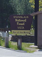
Stanislaus National Forest
Encyclopedia
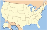
Stanislaus National Forest contains 898099 acre (1,403.3 sq mi; 3,634.5 km²) in four counties in the Sierra Nevada Mountains of Northern California
. It was established on February 22, 1897, making it one of the oldest national forests. It was named after the Stanislaus River
.
, adjacent to the northwestern part of Yosemite National Park
, but parts of it extend (in descending order of forestland area) into southern Alpine
, northern Mariposa
, and eastern Calaveras
counties.
The Emigrant Wilderness
is located entirely within its boundaries. Portions of the Carson-Iceberg Wilderness
, including the Dardanelles Cone
, and the Mokelumne Wilderness
are also within the Stanislaus National Forest.
 The Forest contains some 139000 acres (562.5 km²) of old growth, which includes Lodgepole Pine
(Pinus contorta), Jeffrey Pine
(Pinus jeffreyi), and White Fir
(Abies concolor).
are somewhat marred by the heavy cattle grazing, a shock to many backpackers. Exceptional whitewater rafting
and kayaking
can be found in the wild and scenic Tuolumne River
and Cherry Creek
. Other beautiful rivers flowing out of the Stanislaus include the Clavey River
the Stanislaus River
, and the Merced River
along the southern boundary.
Two ski resorts Dodge Ridge
and Bear Valley
operate here under a special use permit. Forest headquarters are located in Sonora, California
. There are local ranger
district offices in Groveland
, Hathaway Pines
, Mi-Wuk Village
, and Pinecrest.
Index: Fauna of the Sierra Nevada (U.S.)
California
California is a state located on the West Coast of the United States. It is by far the most populous U.S. state, and the third-largest by land area...
. It was established on February 22, 1897, making it one of the oldest national forests. It was named after the Stanislaus River
Stanislaus River
The Stanislaus River in California is one of the largest tributaries of the San Joaquin River. The river is long and has north, middle and south forks...
.
Geography
It is located primarily in eastern Tuolumne CountyTuolumne County, California
Tuolumne County is a county in the Sierra Nevada of the U.S. state of California. The northern half of Yosemite National Park is located in the eastern part of the county. As of the 2010 census, the population was 55,365, up from 54,501 at the 2000 census...
, adjacent to the northwestern part of Yosemite National Park
Yosemite National Park
Yosemite National Park is a United States National Park spanning eastern portions of Tuolumne, Mariposa and Madera counties in east central California, United States. The park covers an area of and reaches across the western slopes of the Sierra Nevada mountain chain...
, but parts of it extend (in descending order of forestland area) into southern Alpine
Alpine County, California
Alpine County is the smallest county, by population, in the U.S. state of California. As of 2010, it had a population of 1,175, all rural. There are no incorporated cities in the county. The county seat is Markleeville...
, northern Mariposa
Mariposa County, California
Mariposa County is a county in the U.S. state of California, located in the western foothills of the Sierra Nevada mountains. It lies north of Fresno, east of Merced, and southeast of Stockton. As of the 2010 census, the population was 18,251 up from 17,130 at the 2000 census...
, and eastern Calaveras
Calaveras County, California
Calaveras County is a county located in the Gold Country of the U.S. state of California. Calaveras is the Spanish word for skulls; the county was reportedly named for the remains of Native Americans discovered by the Spanish explorer Captain Gabriel Moraga. As of the 2010 census, the county had a...
counties.
The Emigrant Wilderness
Emigrant Wilderness
The Emigrant Wilderness of Stanislaus National Forest is a wilderness area in the Sierra Nevada mountains of California, USA. It is bordered by Yosemite National Park on the south, the Toiyabe National Forest on the east, and State Route 108 on the north. It is an elongated area that extends...
is located entirely within its boundaries. Portions of the Carson-Iceberg Wilderness
Carson-Iceberg Wilderness
The Carson-Iceberg Wilderness is a federal wilderness area located northeast of Stockton, California. It encompasses and was designated by the California Wilderness Act of 1984. It protects an area of High Sierra landscape with elevations from to along the Sierra Mountains from Ebbetts Pass...
, including the Dardanelles Cone
Dardanelles Cone
Dardanelles Cone is a mountain peak in the Carson-Iceberg Wilderness on the Stanislaus National Forest. It lies near Sonora Pass in the Sierra Nevada of California. It is between State Route 4 and State Route 108....
, and the Mokelumne Wilderness
Mokelumne Wilderness
The Mokelumne Wilderness is a federally designated wilderness area located east of Sacramento, California. It is within the boundaries of three national forests: Stanislaus, Eldorado and Toiyabe. First protected under the Wilderness Act of 1964, the Mokelumne’s borders were expanded under the...
are also within the Stanislaus National Forest.
Features
It contains 78 lakes, and 811 miles (1,305.2 km) of rivers and streams. It has 1100 miles (1,770.3 km) of non-motorized trails, and 2859 miles (4,601.1 km) of roads, 188 miles (302.6 km) of which are paved.Lodgepole Pine
Lodgepole Pine, Pinus contorta, also known as Shore Pine, is a common tree in western North America. Like all pines, it is evergreen.-Subspecies:...
(Pinus contorta), Jeffrey Pine
Jeffrey Pine
The Jeffrey Pine, Pinus jeffreyi, named in honor of its botanist documenter John Jeffrey, is a North American pine related to Ponderosa Pine.-Distribution and habitat:...
(Pinus jeffreyi), and White Fir
White Fir
White Fir is a fir native to the mountains of western North America, occurring at altitudes of 900-3,400 m. It is a medium to large evergreen coniferous tree growing to 25–60 m tall and with a trunk diameter of up to 2 m . It is popular as an ornamental landscaping tree and as a Christmas Tree...
(Abies concolor).
Recreation
The proximity of the Stanislaus National Forest to the San Francisco Bay area makes it a popular recreation destination. The stunning volcanic and granite formations in the wildernessWilderness
Wilderness or wildland is a natural environment on Earth that has not been significantly modified by human activity. It may also be defined as: "The most intact, undisturbed wild natural areas left on our planet—those last truly wild places that humans do not control and have not developed with...
are somewhat marred by the heavy cattle grazing, a shock to many backpackers. Exceptional whitewater rafting
Rafting
Rafting or white water rafting is a challenging recreational outdoor activity using an inflatable raft to navigate a river or other bodies of water. This is usually done on white water or different degrees of rough water, in order to thrill and excite the raft passengers. The development of this...
and kayaking
Kayaking
Kayaking is the use of a kayak for moving across water. Kayaking and canoeing are also known as paddling. Kayaking is distinguished from canoeing by the sitting position of the paddler and the number of blades on the paddle...
can be found in the wild and scenic Tuolumne River
Tuolumne River
The Tuolumne River is a California river that flows nearly from the central Sierra Nevada to the San Joaquin River in the Central Valley...
and Cherry Creek
Cherry Creek
Cherry Creek may refer to a location in the United States:*Cherry Creek , a stream in California*Cherry Creek , a tributary of the South Platte River*Cherry Creek, Denver, Colorado, a neighborhood**Cherry Creek Shopping Center...
. Other beautiful rivers flowing out of the Stanislaus include the Clavey River
Clavey River
The Clavey River is a tributary of the Tuolumne River, about long, located in Tuolumne County, California. The Clavey's headwaters originate in the Emigrant Wilderness in the Stanislaus National Forest. Uniquely, it flows north-south, which is exceptional for a west-slope river in the Sierra...
the Stanislaus River
Stanislaus River
The Stanislaus River in California is one of the largest tributaries of the San Joaquin River. The river is long and has north, middle and south forks...
, and the Merced River
Merced River
The Merced River , in the central part of the U.S. state of California, is a -long tributary of the San Joaquin River flowing from the Sierra Nevada into the Central Valley. It is most well known for its swift and steep course through the southern part of Yosemite National Park, and the...
along the southern boundary.
Two ski resorts Dodge Ridge
Dodge Ridge Ski Area
Dodge Ridge Wintersports Area is a ski area near Pinecrest, California in Tuolumne County, off of Highway 108, east of Sonora. The resort in located in the Stanislaus National Forest and operates under a special use permit. Many skiers in Northern California use Dodge Ridge because of its...
and Bear Valley
Bear Valley (resort)
Bear Valley is a ski area located on highway 4 between Lake Tahoe and Yosemite—about three hours southeast of Sacramento, California. It is about one hour from Angels Camp, California. It has been owned by Canadian company Dundee Realty since 2005....
operate here under a special use permit. Forest headquarters are located in Sonora, California
Sonora, California
Sonora is the county seat of Tuolumne County, California. As of the 2010 census, the city population was 4,903, up from 4,423 at the 2000 census. Sonora is the only incorporated community in Tuolumne County.-Geography:...
. There are local ranger
National Park Ranger
National Park Service Rangers are among the uniformed employees charged with protecting and preserving areas set aside in the National Park System by the United States Congress and/or the President of the United States...
district offices in Groveland
Groveland, California
Groveland is a census-designated place in Tuolumne County, California. Groveland sits at an elevation of . The 2010 United States census reported Groveland's population was 601....
, Hathaway Pines
Hathaway Pines, California
Hathaway Pines is an unincorporated community in Calaveras County, California, 8 km south of Arnold and 20 km northeast of Angels Camp. It lies at an elevation of 3323 feet . Hathaway Pines' post office was established in 1943; it has the zip code 95233.The place's name honors Robert B. Hathaway,...
, Mi-Wuk Village
Mi-Wuk Village, California
Mi-Wuk Village is a census-designated place in Tuolumne County, California, United States. The population was 941 at the 2010 census, down from 1,485 at the 2000 census...
, and Pinecrest.
See also
- Ecology of the Sierra Nevada
- List of plants of the Sierra Nevada (U.S.)
Index: Fauna of the Sierra Nevada (U.S.)
- Calaveras Big Tree National ForestCalaveras Big Tree National ForestCalaveras Big Tree National Forest, in the Sierra Nevada, was established in California on May 11, 1954 with to protect a grove of Sugar Pines, although it had been authorized since February 18, 1909.-Combined:...
- historical