

Whitman County, Washington
Encyclopedia
Whitman County is a county
located in the U.S. state
of Washington. As of the 2010 census, the population was 44,776, with the majority living in its largest city, Pullman
, home to Washington State University
, the state's land-grant
university
. The county seat
is at Colfax
.
Whitman County was formed out of Stevens County on November 29, 1871. It is named after Marcus Whitman
, a Presbyterian missionary
who, with his wife Narcissa, was killed in 1847 by members of the Cayuse
tribe
.
, the county has a total area of 2178 square miles (5,641 km²), of which 2159 square miles (5,591.8 km²) is land and 18 square miles (46.6 km²) (0.84%) is water. Whitman County is part of the Palouse
, a wide and rolling prairie-like region of the middle Columbia basin
.
Lakes and reservoirs
Summits and peaks
Notable parks
of 2000, there were 40,740 people, 15,257 households, and 8,055 families residing in the county. The population density
was 19 people per square mile (7/km²). There were 16,676 housing units at an average density of 8 per square mile (3/km²). The racial makeup of the county was 88.07% White
, 1.53% Black
or African American
, 0.73% Native American
, 5.55% Asian
, 0.27% Pacific Islander
, 1.22% from other races
, and 2.63% from two or more races. 2.99% of the population were Hispanic
or Latino
of any race. 21.9% were of German, 9.8% English
, 8.6% Irish
, 8.3% United States
or American and 6.6% Norwegian ancestry according to Census 2000.
There were 15,257 households out of which 24.60% had children under the age of 18 living with them, 44.20% were married couples
living together, 6.20% had a female householder with no husband present, and 47.20% were non-families. 29.40% of all households were made up of individuals and 7.10% had someone living alone who was 65 years of age or older. The average household size was 2.31 and the average family size was 2.91.
In the county, the population was spread out with 18.10% under the age of 18, 32.60% from 18 to 24, 24.00% from 25 to 44, 16.00% from 45 to 64, and 9.20% who were 65 years of age or older. The median age was 25 years. For every 100 females there were 102.50 males. For every 100 females age 18 and over, there were 101.90 males.
The median income for a household in the county was $28,584, and the median income for a family was $44,830. Males had a median income of $33,381 versus $27,046 for females. The per capita income
for the county was $15,298. About 11.00% of families and 25.60% of the population were below the poverty line, including 16.50% of those under age 18 and 5.50% of those age 65 or over.
. According to Heart of Washington, Whitman County produces more barley
, wheat
, dry peas
, and lentils than any other county in the United States.
The county is also home to Schweitzer Engineering Laboratories
in Pullman.
, and as part of Washington's 5th congressional district
it is represented by Republican Cathy McMorris Rodgers. Whitman was one of only three counties in the state to be won by Barry Goldwater
in 1964
. Since that election, the county has been won by the winning candidate in all but one presidential election, 1976
. Richard Nixon
, Ronald Reagan
, Bill Clinton
, and George W. Bush
all won the county twice. In 2008
, Barack Obama
received 51.57% of the Whitman County vote.
County (United States)
In the United States, a county is a geographic subdivision of a state , usually assigned some governmental authority. The term "county" is used in 48 of the 50 states; Louisiana is divided into parishes and Alaska into boroughs. Parishes and boroughs are called "county-equivalents" by the U.S...
located in the U.S. state
U.S. state
A U.S. state is any one of the 50 federated states of the United States of America that share sovereignty with the federal government. Because of this shared sovereignty, an American is a citizen both of the federal entity and of his or her state of domicile. Four states use the official title of...
of Washington. As of the 2010 census, the population was 44,776, with the majority living in its largest city, Pullman
Pullman, Washington
Pullman is the largest city in Whitman County, Washington, United States. The population was 24,675 at the 2000 census and 29,799 according to the 2010 census...
, home to Washington State University
Washington State University
Washington State University is a public research university based in Pullman, Washington, in the Palouse region of the Pacific Northwest. Founded in 1890, WSU is the state's original and largest land-grant university...
, the state's land-grant
Land-grant university
Land-grant universities are institutions of higher education in the United States designated by each state to receive the benefits of the Morrill Acts of 1862 and 1890....
university
University
A university is an institution of higher education and research, which grants academic degrees in a variety of subjects. A university is an organisation that provides both undergraduate education and postgraduate education...
. The county seat
County seat
A county seat is an administrative center, or seat of government, for a county or civil parish. The term is primarily used in the United States....
is at Colfax
Colfax, Washington
Colfax is the county seat of Whitman County, Washington, United States.The population was 2,805 at the 2010 census.It is situated amidst wheat-covered hills in a valley at the confluence of the north and south forks of the Palouse River. U.S...
.
Whitman County was formed out of Stevens County on November 29, 1871. It is named after Marcus Whitman
Marcus Whitman
Marcus Whitman was an American physician and Oregon missionary in the Oregon Country. Along with his wife Narcissa Whitman he started a mission in what is now southeastern Washington state in 1836, which would later become a stop along the Oregon Trail...
, a Presbyterian missionary
Missionary
A missionary is a member of a religious group sent into an area to do evangelism or ministries of service, such as education, literacy, social justice, health care and economic development. The word "mission" originates from 1598 when the Jesuits sent members abroad, derived from the Latin...
who, with his wife Narcissa, was killed in 1847 by members of the Cayuse
Cayuse
The Cayuse are a Native American tribe in the state of Oregon in the United States. The Cayuse tribe shares a reservation in northeastern Oregon with the Umatilla and the Walla Walla tribes as part of the Confederated Tribes of the Umatilla Indian Reservation...
tribe
Native Americans in the United States
Native Americans in the United States are the indigenous peoples in North America within the boundaries of the present-day continental United States, parts of Alaska, and the island state of Hawaii. They are composed of numerous, distinct tribes, states, and ethnic groups, many of which survive as...
.
Geography
According to the U.S. Census BureauUnited States Census Bureau
The United States Census Bureau is the government agency that is responsible for the United States Census. It also gathers other national demographic and economic data...
, the county has a total area of 2178 square miles (5,641 km²), of which 2159 square miles (5,591.8 km²) is land and 18 square miles (46.6 km²) (0.84%) is water. Whitman County is part of the Palouse
Palouse
The Palouse is a region of the northwestern United States, encompassing parts of southeastern Washington, north central Idaho and, in some definitions, extending south into northeast Oregon. It is a major agricultural area, primarily producing wheat and legumes...
, a wide and rolling prairie-like region of the middle Columbia basin
Columbia River
The Columbia River is the largest river in the Pacific Northwest region of North America. The river rises in the Rocky Mountains of British Columbia, Canada, flows northwest and then south into the U.S. state of Washington, then turns west to form most of the border between Washington and the state...
.
Geographic features
Rivers- Snake RiverSnake RiverThe Snake is a major river of the greater Pacific Northwest in the United States. At long, it is the largest tributary of the Columbia River, the largest North American river that empties into the Pacific Ocean...
- Palouse RiverPalouse RiverThe Palouse River is a tributary of the Snake River located in the U.S. states of Washington and Idaho. It flows for southwestwards, primarily through the Palouse region of southeastern Washington...
- Union Flat Creek
- Rock Creek
- Pine Creek
Lakes and reservoirs
- Lake Herbert G. WestLake Herbert G. WestLake Herbert G. West is a reservoir formed by the Lower Monumental Dam. It extends up the Snake River for 28 miles to the tailwater of Little Goose Dam...
, formed from Lower Monumental DamLower Monumental Lock and DamLower Monumental Lock and Dam is a hydroelectric, concrete, run-of-the-river dam on the Snake River, and bridges Franklin County and Walla Walla County, in the state of Washington. The dam is located six miles south of the town of Kahlotus, and 43 miles north of the town of Walla...
(elevation: 540') - Lake Bryan, named for Dr. Enoch A. Bryan, behind the Little Goose DamLittle Goose Lock and DamLittle Goose Lock and Dam is a hydroelectric, concrete, run-of-the-river dam in Columbia and Whitman counties in the state of Washington, on the Snake River. The dam is located northeast of the town of Starbuck, and north of Dayton....
(elevation: 640') - Lower Granite Lake, behind the Lower Granite DamLower Granite Lock and DamLower Granite Lock and Dam is a concrete gravity run-of-the-river dam on the Snake River, and bridges Whitman County and Garfield County, in the U.S. state of Washington. The dam is located 22 miles south of the town of Colfax, and 35 miles north of Pomeroy.Lower Granite Dam is part of the...
(elevation: 730') - Rock Lake (47°11'03"N 117°40'55"W ; elevation: 1729')
Summits and peaks
- Tekoa Mountain (47°15'30"N 117°05'23"W ; elevation: 4009') - highest point
- Kamiak ButteKamiak ButteKamiak Butte County Park is located in Whitman County, Washington between the towns of Palouse and Pullman in Eastern Washington, near the border of Idaho. It is named after Chief Kamiakin of the Yakama tribe....
(46°51'44"N 117°10'00"W ; elevation: 3641') - Steptoe ButteSteptoe ButteSteptoe Butte is a quartzite island jutting out of the silty loess of the Palouse hills in Whitman County, Washington. It is contained by Steptoe Butte State Park. The rock that forms the butte is over 400 million years old, in contrast with the 15–7 million year old Columbia River basalts that...
(47°01'56"N 117°17'49"W ; elevation: 3612') - Bald Butte (46°38'00"N 117°05'16"W ; Elevation: 3369)
Notable parks
- Steptoe Butte State ParkSteptoe ButteSteptoe Butte is a quartzite island jutting out of the silty loess of the Palouse hills in Whitman County, Washington. It is contained by Steptoe Butte State Park. The rock that forms the butte is over 400 million years old, in contrast with the 15–7 million year old Columbia River basalts that...
(47°01'56"N 117°17'54"W ; elevation: 3573') - Kamiak Butte County Park (46°51'55"N 117°09'48"W ; elevation: 3150')
- Palouse Falls State ParkPalouse FallsThe Palouse Falls lies on the Palouse River, about upstream of the confluence with the Snake River in southeast Washington, United States. The falls are in height...
(46°40'00"N 118°13'25"W ; elevation: 925') - Central Ferry State Park (46°37'46"N 117°48'32"W ; elevation: 650')
Adjacent counties
- Spokane CountySpokane County, WashingtonSpokane County is a county located in the U.S. state of Washington, named after the Spokane tribe. As of the 2010 census the population was 471,221, making it the fourth most populous county in Washington state. The largest city and county seat is Spokane, the second largest city in the state,...
- north - Benewah CountyBenewah County, IdahoBenewah County is a county located in the U.S. state of Idaho. Established on January 23, 1915, from sections of Kootenai County, it was named for a chief of the Coeur d'Alene Tribe. As of the 2010 census the county had a population of 9,285. The county seat and largest city is St...
, IdahoIdahoIdaho is a state in the Rocky Mountain area of the United States. The state's largest city and capital is Boise. Residents are called "Idahoans". Idaho was admitted to the Union on July 3, 1890, as the 43rd state....
- northeast - Latah CountyLatah County, IdahoLatah County is a county located in the north central region of the U.S. state of Idaho. The population was 37,244 at the 2010 census. The county seat and largest city is Moscow, which is the home of the University of Idaho, the state's flagship and land-grant university...
, IdahoIdahoIdaho is a state in the Rocky Mountain area of the United States. The state's largest city and capital is Boise. Residents are called "Idahoans". Idaho was admitted to the Union on July 3, 1890, as the 43rd state....
- east - Nez Perce CountyNez Perce County, IdahoNez Perce County [Eng. pron. Nezz Purse] is a county located in the U.S. state of Idaho. The population was 39,265 at the 2010 Census. The county seat is Lewiston. The county is named for the Nez Percé tribe....
, IdahoIdahoIdaho is a state in the Rocky Mountain area of the United States. The state's largest city and capital is Boise. Residents are called "Idahoans". Idaho was admitted to the Union on July 3, 1890, as the 43rd state....
- southeast - Asotin County - south/southeast
- Garfield County - south
- Columbia County - south
- Franklin County - southwest
- Adams County - west
- Lincoln County - northwest
Highways
|
 - State Route 127 - State Route 127Washington State Route 127 State Route 127 is a state highway in the U.S. state of Washington, running from U.S. Route 12 near Pomeroy north to a junction with State Route 26 near Lacrosse.- Route description :...  - State Route 270 - State Route 270Washington State Route 270 State Route 270 is a road connecting U.S. Route 195 and Pullman, Washington with the Idaho state line at Moscow. SR 270 provides a connection to U.S. Route 95 in Moscow via a junction with Idaho State Highway 8 at the state line.-Route description:...  - State Route 271 - State Route 271Washington State Route 271 State Route 271 is a long state highway located entirely in Whitman County, Washington, Washington, United States. The highway begins at a y-intersection with SR 27 in the northern outskirts of Oakesdale north to an interchange with U.S. Route 195 southeast of Rosalia...  - State Route 272 - State Route 272Washington State Route 272 State Route 272 is a state highway in the U.S. state of Washington, running from US 195 at Colfax to ID-6 on the Idaho border near Palouse.-Major intersections:* US 195* SR 27* ID-6... |
 - State Route 23
 -
-  - State Route 27
Demographics
As of the censusCensus
A census is the procedure of systematically acquiring and recording information about the members of a given population. It is a regularly occurring and official count of a particular population. The term is used mostly in connection with national population and housing censuses; other common...
of 2000, there were 40,740 people, 15,257 households, and 8,055 families residing in the county. The population density
Population density
Population density is a measurement of population per unit area or unit volume. It is frequently applied to living organisms, and particularly to humans...
was 19 people per square mile (7/km²). There were 16,676 housing units at an average density of 8 per square mile (3/km²). The racial makeup of the county was 88.07% White
Race (United States Census)
Race and ethnicity in the United States Census, as defined by the Federal Office of Management and Budget and the United States Census Bureau, are self-identification data items in which residents choose the race or races with which they most closely identify, and indicate whether or not they are...
, 1.53% Black
Race (United States Census)
Race and ethnicity in the United States Census, as defined by the Federal Office of Management and Budget and the United States Census Bureau, are self-identification data items in which residents choose the race or races with which they most closely identify, and indicate whether or not they are...
or African American
Race (United States Census)
Race and ethnicity in the United States Census, as defined by the Federal Office of Management and Budget and the United States Census Bureau, are self-identification data items in which residents choose the race or races with which they most closely identify, and indicate whether or not they are...
, 0.73% Native American
Race (United States Census)
Race and ethnicity in the United States Census, as defined by the Federal Office of Management and Budget and the United States Census Bureau, are self-identification data items in which residents choose the race or races with which they most closely identify, and indicate whether or not they are...
, 5.55% Asian
Race (United States Census)
Race and ethnicity in the United States Census, as defined by the Federal Office of Management and Budget and the United States Census Bureau, are self-identification data items in which residents choose the race or races with which they most closely identify, and indicate whether or not they are...
, 0.27% Pacific Islander
Race (United States Census)
Race and ethnicity in the United States Census, as defined by the Federal Office of Management and Budget and the United States Census Bureau, are self-identification data items in which residents choose the race or races with which they most closely identify, and indicate whether or not they are...
, 1.22% from other races
Race (United States Census)
Race and ethnicity in the United States Census, as defined by the Federal Office of Management and Budget and the United States Census Bureau, are self-identification data items in which residents choose the race or races with which they most closely identify, and indicate whether or not they are...
, and 2.63% from two or more races. 2.99% of the population were Hispanic
Race (United States Census)
Race and ethnicity in the United States Census, as defined by the Federal Office of Management and Budget and the United States Census Bureau, are self-identification data items in which residents choose the race or races with which they most closely identify, and indicate whether or not they are...
or Latino
Race (United States Census)
Race and ethnicity in the United States Census, as defined by the Federal Office of Management and Budget and the United States Census Bureau, are self-identification data items in which residents choose the race or races with which they most closely identify, and indicate whether or not they are...
of any race. 21.9% were of German, 9.8% English
English people
The English are a nation and ethnic group native to England, who speak English. The English identity is of early mediaeval origin, when they were known in Old English as the Anglecynn. England is now a country of the United Kingdom, and the majority of English people in England are British Citizens...
, 8.6% Irish
Irish American
Irish Americans are citizens of the United States who can trace their ancestry to Ireland. A total of 36,278,332 Americans—estimated at 11.9% of the total population—reported Irish ancestry in the 2008 American Community Survey conducted by the U.S. Census Bureau...
, 8.3% United States
United States
The United States of America is a federal constitutional republic comprising fifty states and a federal district...
or American and 6.6% Norwegian ancestry according to Census 2000.
There were 15,257 households out of which 24.60% had children under the age of 18 living with them, 44.20% were married couples
Marriage
Marriage is a social union or legal contract between people that creates kinship. It is an institution in which interpersonal relationships, usually intimate and sexual, are acknowledged in a variety of ways, depending on the culture or subculture in which it is found...
living together, 6.20% had a female householder with no husband present, and 47.20% were non-families. 29.40% of all households were made up of individuals and 7.10% had someone living alone who was 65 years of age or older. The average household size was 2.31 and the average family size was 2.91.
In the county, the population was spread out with 18.10% under the age of 18, 32.60% from 18 to 24, 24.00% from 25 to 44, 16.00% from 45 to 64, and 9.20% who were 65 years of age or older. The median age was 25 years. For every 100 females there were 102.50 males. For every 100 females age 18 and over, there were 101.90 males.
The median income for a household in the county was $28,584, and the median income for a family was $44,830. Males had a median income of $33,381 versus $27,046 for females. The per capita income
Per capita income
Per capita income or income per person is a measure of mean income within an economic aggregate, such as a country or city. It is calculated by taking a measure of all sources of income in the aggregate and dividing it by the total population...
for the county was $15,298. About 11.00% of families and 25.60% of the population were below the poverty line, including 16.50% of those under age 18 and 5.50% of those age 65 or over.
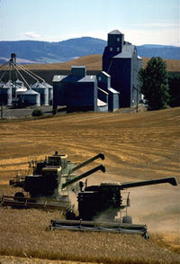
Agriculture & Business
Whitman County has highly productive agricultureAgriculture
Agriculture is the cultivation of animals, plants, fungi and other life forms for food, fiber, and other products used to sustain life. Agriculture was the key implement in the rise of sedentary human civilization, whereby farming of domesticated species created food surpluses that nurtured the...
. According to Heart of Washington, Whitman County produces more barley
Barley
Barley is a major cereal grain, a member of the grass family. It serves as a major animal fodder, as a base malt for beer and certain distilled beverages, and as a component of various health foods...
, wheat
Wheat
Wheat is a cereal grain, originally from the Levant region of the Near East, but now cultivated worldwide. In 2007 world production of wheat was 607 million tons, making it the third most-produced cereal after maize and rice...
, dry peas
PEAS
P.E.A.S. is an acronym in artificial intelligence that stands for Performance, Environment, Actuators, Sensors.-Performance:Performance is a function that measures the quality of the actions the agent did....
, and lentils than any other county in the United States.
The county is also home to Schweitzer Engineering Laboratories
Schweitzer Engineering Laboratories
Schweitzer Engineering Laboratories, Inc. designs, manufactures, and supports products and services ranging from generator and transmission protection to distribution automation and control systems. Founded in 1982 by Edmund O. Schweitzer III, SEL shipped the world's first digital protective relay...
in Pullman.
Census-recognized communities
- AlbionAlbion, WashingtonAlbion is a town in Whitman County, Washington, United States. The population was 579 at the 2010 census.-History:Albion was first settled in 1871 by Levi Reynolds, and was platted in 1883...
- ColfaxColfax, WashingtonColfax is the county seat of Whitman County, Washington, United States.The population was 2,805 at the 2010 census.It is situated amidst wheat-covered hills in a valley at the confluence of the north and south forks of the Palouse River. U.S...
- ColtonColton, WashingtonColton is a town in Whitman County, Washington, United States. The population was 418 at the 2010 census.- History :Colton was first settled in 1879 by J.A. Cole, and was founded in 1882 by J.B. Stanley. Colton was incorporated in 1890 however it was not recorded until 1893.-Notable natives:*...
- EndicottEndicott, WashingtonEndicott is a town in Whitman County, Washington, United States. The population was 289 at the 2010 census.-History:Endicott was platted in 1882 and named for William Endicott Jr of the Oregon Improvement Company. Endicott was officially incorporated on February 11, 1905.-Population:The population...
- FarmingtonFarmington, WashingtonFarmington is a town in Whitman County, Washington, United States. The population was 146 at the 2010 census.-History:Farmington was first settled in 1871, and was founded and named by G.W.Truax in 1878. Farmington was officially incorporated in 1888. At Farmington's peak the town boasted a...
- GarfieldGarfield, WashingtonGarfield is a city in Whitman County, Washington, United States. The population was 597 at the 2010 census.-History:Garfield was founded in the early 1880s by Samuel J. Tant, who named the town after the president James A...
- La CrosseLa Crosse, WashingtonLa Crosse is a town in Whitman County, Washington, United States. The population was 313 at the 2010 census.-History:LaCrosse was incorporated on February 19, 1917....
- LamontLamont, WashingtonLamont is a town in Whitman County, Washington, United States. The population was 70 at the 2010 census.-History:Lamont was named for former vice president of the Northern Pacific Railroad, Daniel Lamont. Lamont was officially incorporated on October 22, 1910.-Historical population:Population...
- MaldenMalden, WashingtonMalden is a town in Whitman County, Washington, United States. The population was 203 at the 2010 census.-History:Malden was officially incorporated on December 20, 1909...
- OakesdaleOakesdale, WashingtonOakesdale is a town in Whitman County, Washington, United States. The population was 422 at the 2010 census.-Historical population:* 1890...528* 1900...928* 1910...882* 1920...816* 1930...637* 1940...590* 1950...576* 1960...474* 1970...447...
- PalousePalouse, WashingtonPalouse is a city in Whitman County, Washington, United States. The population was 998 at the 2010 census. Palouse is named for the region of farmland in which it is situated, and was incorporated in 1888.-History:...
- PullmanPullman, WashingtonPullman is the largest city in Whitman County, Washington, United States. The population was 24,675 at the 2000 census and 29,799 according to the 2010 census...
- RosaliaRosalia, WashingtonRosalia is a town in Whitman County, Washington, U.S.A. It is an agricultural community in the Palouse region, at an elevation of 2238 feet above sea level. Its population was 550 at the 2010 census.-History:...
- Saint JohnSt. John, WashingtonSt. John is a town in Whitman County, Washington, United States. The population was 537 at the 2010 census. St. John is the birthplace of the twentieth governor of Washington, Mike Lowry.-History:...
- SteptoeSteptoe, WashingtonSteptoe is a small unincorporated rural community in Whitman County, Washington, United States. Steptoe is 11 miles north of the county seat, Colfax and is 43 miles south of Spokane. It is named after Colonel Edward Steptoe for a battle located north of Steptoe near Rosalia, Washington...
- TekoaTekoa, WashingtonTekoa is a city in Whitman County, Washington, United States. The population was 778 at the 2010 census.-History:Tekoa was first settled in 1886 by David A. Huffman and George T. Huffman. The townsite was platted in 1888 and was named after the Biblical town.Tekoa was incorporated in 1889 with...
- UniontownUniontown, WashingtonUniontown is a town in Whitman County, Washington, United States. The population was 294 at the 2010 census.-History:Uniontown was first settled in 1878 by Thomas Montgomery. Uniontown was incorporated in 1890.-Geography:...
Other communities
- BelmontBelmont, WashingtonBelmont is an unincorporated community in Whitman County, Washington, United States. Because it is not tracked by the U.S. Census, a Census population estimate is not available. First settled in 1886, there are only about seven houses in Belmont, which is assigned the ZIP code 99104.-References:...
- Diamond
- DustyDusty, WashingtonDusty is an unincorporated community in Whitman County, Washington, United States. It lies on Secondary State Highway 11A.-Geography:The community is located in the Palouse Region, which is known for its rolling hills and agricultural production...
- Ewan
- HayHay, WashingtonHay is an unincorporated community in Whitman County, Washington, United States. Hay is south of La Crosse. Hay has a post office with ZIP code 99136....
- HooperHooper, WashingtonHooper is an unincorporated community in Whitman County, Washington, United States.-History:Hooper was named around 1883 for early settler Albert J. Hooper....
- Johnson
- ThorntonThornton, WashingtonThornton is an unincorporated community in Whitman County, Washington, United States. Founded in 1889 by P.M. Sheehan, Thornton is located near U.S. Route 195 west of Oakesdale. Thornton has a post office with ZIP code 99176....
- Winona
Politics
The county is traditionally RepublicanRepublican Party (United States)
The Republican Party is one of the two major contemporary political parties in the United States, along with the Democratic Party. Founded by anti-slavery expansion activists in 1854, it is often called the GOP . The party's platform generally reflects American conservatism in the U.S...
, and as part of Washington's 5th congressional district
Washington's 5th congressional district
Washington's 5th congressional district encompasses the Eastern Washington counties of Okanogan, Ferry, Stevens, Pend Oreille, Lincoln, Spokane, Adams, Whitman, Walla Walla, Columbia, Garfield, and Asotin. It is centered around Spokane, the state's second largest city.Since 2005, the 5th District...
it is represented by Republican Cathy McMorris Rodgers. Whitman was one of only three counties in the state to be won by Barry Goldwater
Barry Goldwater
Barry Morris Goldwater was a five-term United States Senator from Arizona and the Republican Party's nominee for President in the 1964 election. An articulate and charismatic figure during the first half of the 1960s, he was known as "Mr...
in 1964
United States presidential election, 1964
The United States presidential election of 1964 was held on November 3, 1964. Incumbent President Lyndon B. Johnson had come to office less than a year earlier following the assassination of his predecessor, John F. Kennedy. Johnson, who had successfully associated himself with Kennedy's...
. Since that election, the county has been won by the winning candidate in all but one presidential election, 1976
United States presidential election, 1976
The United States presidential election of 1976 followed the resignation of President Richard Nixon in the wake of the Watergate scandal. It pitted incumbent President Gerald Ford, the Republican candidate, against the relatively unknown former governor of Georgia, Jimmy Carter, the Democratic...
. Richard Nixon
Richard Nixon
Richard Milhous Nixon was the 37th President of the United States, serving from 1969 to 1974. The only president to resign the office, Nixon had previously served as a US representative and senator from California and as the 36th Vice President of the United States from 1953 to 1961 under...
, Ronald Reagan
Ronald Reagan
Ronald Wilson Reagan was the 40th President of the United States , the 33rd Governor of California and, prior to that, a radio, film and television actor....
, Bill Clinton
Bill Clinton
William Jefferson "Bill" Clinton is an American politician who served as the 42nd President of the United States from 1993 to 2001. Inaugurated at age 46, he was the third-youngest president. He took office at the end of the Cold War, and was the first president of the baby boomer generation...
, and George W. Bush
George W. Bush
George Walker Bush is an American politician who served as the 43rd President of the United States, from 2001 to 2009. Before that, he was the 46th Governor of Texas, having served from 1995 to 2000....
all won the county twice. In 2008
United States presidential election, 2008
The United States presidential election of 2008 was the 56th quadrennial presidential election. It was held on November 4, 2008. Democrat Barack Obama, then the junior United States Senator from Illinois, defeated Republican John McCain, the senior U.S. Senator from Arizona. Obama received 365...
, Barack Obama
Barack Obama
Barack Hussein Obama II is the 44th and current President of the United States. He is the first African American to hold the office. Obama previously served as a United States Senator from Illinois, from January 2005 until he resigned following his victory in the 2008 presidential election.Born in...
received 51.57% of the Whitman County vote.
External links
- Whitman County official website
- Whitman County Genealogical Society
- Whitman County Historical Society
- Whitman County Library with branches in 14 communities throughout Whitman County.
- Whitman County Heritage A collection of historic materials from the Whitman County Library and local partners.
- Whitman County @ State of Washington Office of Financial Management
- Port of Whitman County and Green IT Alliance (GITA)