

Water resources management in Mexico
Encyclopedia
Water resources
management is one of Mexico
's pressing concerns, and it is imposing heavy costs to the economy
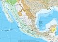
. The arid northwest and central regions contain 77% of Mexico's population and generate 87% of the gross domestic product (GDP). Poor southern regions have abundant water resources. Surface and groundwater are overexploited and polluted
, leading to insufficient water availability to support economic development and environmental sustainability. The country has put in place a system of water resources management that includes both central (federal) and decentral (basin and local) institutions.
The 1934 Código Agrario, promulgated during the Cárdenas
administration (1934–1940), granted the federal government powers to define the “public interest” to which water could be harnessed. By virtue of such legislation, between the 1930s and 1970s, the rural community and ejido
sector were subject to direct federal control over water. Private landowners, on the other hand, enjoyed the benefits of federally subsidized irrigation infrastructure and guaranteed market prices. Over time, large landowners became highly capitalized, while small land owners, by the 1970s, were suffering from the effects of water monopolies.
In the 1970s, the Mexican government entered into a tripartite agreement with the World Bank
and the United Nations Development Program to prepare the 1975 National Water Plan (NWP), which identified the need to enact a New Water Law (NWL) and a National Water Authority (ANA) as well as decentralize responsibilities and promote water user participation in operational and maintenance (O&M). The NWP spurred a significant institutional development and infrastructural achievements: (i) the federal government transfer responsibilities for water supply and sanitation to municipalities and states in 1983, (ii) the Mexican Institute of Water Technology was established in 1986, (iii) the National Commission on Water (http://www.cna.gob.mx/conagua/Default.aspx CONAGUA) was established in 1988, and (iv) in 1989, the first Basin Council was created in Lerma Chapala, incorporating water users from multiple sectors.
During the 1990s, there was a rapid groundwater development and aquifer pumping for combined agricultural, urban, and industrial demand. Also the federal government decentralized responsibility for large irrigation infrastructure to autonomous agencies (irrigation districts).
In 1992, Mexico adopted the Ley de Aguas Nacionales (LAN), which contained specific provisions for the role of the CONAGUA, the structure and functioning of river basin councils, public participation in water management, etc. In 1993 the Cutzamala system, one of the largest pumping schemes in the world, was completed. The Cutzamala system pumps 19 m3/s of water into the Mexico City
metropolitan area.
In 1997 the first technical groundwater committee was created to manage an overexploited aquifer in the state of Guanajuato
.
With the 2004 Revision of the National Water Law, the thirteen decentralized CNA regions would become basin organizations serving as the technical arm of more broad-based basin councils that incorporate civil society interests including the private sector and citizens’ groups.
 Mexico's internal renewable water resources per capita is 4016 cubic metres (141,823.7 cu ft), which is below the average in the Central American and the Caribbean region, 6645 cubic metres (234,666 cu ft).
A volume of 396 cubic kilometres (95 cu mi) of water per year flows through Mexico's rivers, including imports from other countries and excluding exports. A total of 65% of this surface runoff occurs in seven rivers: Grijalva
, Usumacinta
, Papaloapan
, Coatzacoalcos, Balsas
, Panuco
, Santiago and Tonala, whose total watershed area represents 22% of the country's total land area. The Balsas and Santiago rivers empty on the Pacific Ocean, while the other five empty into the Gulf of Mexico.
The historical mean annual precipitation (1941–2004) is 773 mm (30.4 in), with 77% of all precipitation accruing between June and October.
A little over 70% of rainwater in Mexico is evapotranspirated and returns to the atmosphere. The rest runs off rivers and streams or infiltrates into the subsoil and recharges groundwater.
Mexico shares three watersheds (Colorado
, Bravo
and Tijuana
) with the United States of America
(U.S.), four with Guatemala
(Grijalva, Usumacintam Suchiate, Coatan, and Candelaria) and one with Belize
and Guatemala (Rio Hondo
). The waters are shared with the U.S. in accordance with the stipulations included in the Treaty on the Utilization of the Waters of the Colorado
, Tijuana and Rio Grande Rivers, signed in 1944.
Groundwater
accounts for 64% of the volume for public water supply, 33% of all water used for agriculture and livestock, and 24% of water utilized by self-supplied industry. There are 653 groundwater aquifers in Mexico. CONAGUA estimates the total amount of groundwater recharge to be around 77 cubic kilometres (18.5 cu mi) per year, 36.4% of which, (around 28 km³ (6.7 cu mi) per year) are actually used. This average rate does not fully represent the situation of the arid region, where a negative balance is threatening the sustainable use of groundwater resources.
Groundwater is a key water supplier for several users in the arid region or in some cities where groundwater is most of the time the sole water resource available. About 71% of the groundwater is used for agriculture, 20% for water urban supply and 3% for domestic and animal use.
(20,217 km2), Nezahualcóyotl (14,0298 km2), Chicoasén
(11,883 km2), and Infiernillo
(11,860 km2).
Mexico has approximately 70 lakes with a storage capacity of 14 km³ (3.4 cu mi). The largest lake, the Chapala Lake, has a storage capacity of 8126 cubic hectometres (1.9 cu mi).
Source: CONAGUA
. OECD estimates the economic cost of water pollution in Mexico at US$6 billion per year. The problem is most serious in the Valle de Mexico region where 100% of the water bodies have different levels of contamination, 18% of which are highly polluted. Low water quality is due to untreated discharge of industrial effluents and municipal wastewater into rivers and lakes, solid waste deposits along river banks, uncontrolled seepage from unsanitary landfills, and non-point pollution mainly from agricultural production.
CONAGUA has also detected infiltration of untreated municipal wastewater in 8 aquifers, iron and manganese in 2, arsenic in 1 aquifer of the Lagunera region. In overexploited aquifers, contamination tends to worsen over time as the groundwater reservoir is depleted. This is the case of the Lagunera region, where concentration of 0.09 to 0.59 mg/L of arsenic found in the drinking water, are above of the permissible level of 0.05 mg/L.
In addition, information regarding water quality, available by the Public Water Rights and Registry, is scarce and often unreliable.
and sanitation
sector made major strides in service coverage. In urban areas almost 100% of the population is estimated to have access to improved water supply and 91% to adequate sanitation. In rural areas, the respective shares are 87% for water and 41% for sanitation. Coverage levels are particularly low in the southern regions. (See also Water supply and sanitation in Mexico
)
)
. This is the world’s fourth most productive hydroelectric plant. (See also Electricity sector in Mexico
)
.jpg) There are approximately 70 lakes in Mexico, covering a total area of 3700 square kilometres (914,289.1 acre). Some of these lakes, especially in the Eastern side, have a volcanic origin and count with numerous endemic species. Lake Chapala
There are approximately 70 lakes in Mexico, covering a total area of 3700 square kilometres (914,289.1 acre). Some of these lakes, especially in the Eastern side, have a volcanic origin and count with numerous endemic species. Lake Chapala
, the largest Mexican lake, is considered a hydrological priority region for biodiversity conservation due to its 39 local species, 19 of which are endemic. The Lake Catemaco
, located in Veracruz
, has 12 native species 9 of which are endemic.
Wetlands in Mexico are dynamic, complex and productive ecosystems. Six major wetland are registered in the RAMSAR Convention on Wetlands
: Lagartos River (Yucatan Peninsula
), Cuatrocienagas (Coahuila
), La Encrucijada (Chiapas
), Marsh
Nayarit
and Sinaloa
, Centla Swamp
(Tabasco
), and the Colorado River
(Baja California
).
Cenote
s, sinkholes on the Yucatan peninsula that are filled with groundwater, host a number of unique species from bacteria, algae and protozoa (i.e. copepoda, cladocera
and rotifera) to vertebrates (i.e.lepisosteus
). Cenotes are the main water source for many ancient and contemporary Maya
people, as there are no rivers and very few lakes on the peninsula.
According to the LAN key functions in the sector are the responsibility of the federal government, through the National Water Commission (CNA or CONAGUA). The LAN made possible to implement a regulatory framework that seeks to encourage greater efficiency and a more accurate perception of the social, economic, and environmental value of water resources. Therefore, waters users operate within a framework of rights and obligations that are clearly defined in three basic instruments:
The 2004 amended National Water Law (NWL) aims to restructure CONAGUA key functions through the transfer of responsibilities from the central level to subnational entities: the basin agencies (Organismos de Cuenca – BA) and Basin Councils (Consejos de Cuenca – BC). BA and BCs are expected to play an increasing role in the sector limiting CONAGUA’s role to the administration of the NWL, the conduct of national water policy, and planning, supervision, support and regulatory activities.
The NWL also introduced a Water Financing System (Sistema Finaciero del Agua – SFA). CONAGUA will create together with the Ministry of Finance appropriate instruments to determine funding sources, spending guidelines, cost recovery, settling of accounts and management indicators.
CONAGUA is the highest institution for water resource management in Mexico, including water policy, water rights, planning, irrigation and drainage development, water supply and sanitation, and emergency and disaster management (with an emphasis on flooding). CONAGUA’s mission is to manage and preserve national water resources, with the participation of the society, to reach a sustainable use of the resource.
CONAGUA is formally under the authority of the Ministry of Environment and Natural Resources (Secretaria del Medio Ambiente y Recursos Naturales – SEMARNAT) but it enjoys considerable de facto autonomy. It employs 17,000 professionals, has 13 regional offices and 32 state offices and had an annual budget of US$1.2 billion in 2005. It also directly manages certain key hydraulic facilities such as the Cutzamala
Pipeline that supplies a large share of the water used in the Metropolitan Area of Mexico City. CONAGUA also owns and operates most dams in Mexico and operates the country’s water monitoring network.
The CEAs are autonomous entities that usually are under the authority of the State Ministry of Public Works. Their attributions are different among states and can include water resources management, irrigation and the provision of water supply and sanitation services.
The recently created Basin Authorities (BAs) will develop from the 13 existing Regional Offices of CONAGUA and are expected to be responsible for formulating regional policy, designing programs to implement such policies, conducting studies to estimate the value of the financial resources generated within their boundaries (water user fees and service fees), recommending specific rates for water user fees and collecting them. Basin Councils (BCs) are expected to guide, together with CONAGUA, BAs work. There are a total of 25 BCs that have been established with the same basin boundaries as the BAs.
Each objective has a strategy and a set of goals associated. The NWP has a total budget of 227,130 million pesos (about US$21.9 billion), which does not include operational and maintenance costs of hydraulic infrastructure.
Water service providers charge industrial and commercial user tariffs that are close to full recovery cost, and cross subsidize residential users. The average tariff across users, US$0.32 per cubic meter ($0.24/cu yd), is half the Latin American and the Caribbean average, US$0.65/m³ ($0.50/cu yd).
The level of collection efficiency in Mexico has been estimated at 72%, far below the levels achieved in developed countries (OECD 95%). Water tariff collections in water supply and sanitation have been estimated at US$1.54 billion in 2002. Billed revenues were estimated at between US$2.14 billion and US$2.9 billion.
Approximately 31% of water customers are not metered and are charged a flat rate, independent of consumption, differentiated by neighborhood.
 Mexico is prone to several weather events including hurricanes on both Pacific and Caribbean coasts. Hurricanes contribute to recharge surface and groundwater reservoirs with increases water supply for cities, irrigation and electricity generation. Hurricanes pose also a threat to service delivery, infrastructure and ultimately to ecosystems and human life. This situation is aggravated by deforestation upstream as well as human settlements located in flood prone areas.
With more than 85% of the Mexican land area defined as arid or semi-arid and a highly variable interannual rainfall Mexico is also prone to droughts, especially in the northern areas.
The most severe droughts in Mexico in recent decades coincide with the variations in Pacific sea-surface temperatures associated with El Niño. The economic and social and environmental impacts of droughts in Mexico are notable. In 1996, four years of below normal rainfall produced farms losses estimated at US$1 billion and interstate political between Sonora and Sinaloa.
 In parts of Mexico climate change is projected to produce a decrease in water flow. Furthermore, an increase on water demand is expected due to increasing temperature and extreme weather conditions such as droughts and floods due to El Niño Southern Oscillation and La Niña
are expected to become more frequent.
The IPCC
considers various scenarios with increases in temperatures ranging between 1 and 6 degrees Celsius. By 2050, the Mexican Institute of Water Technology expects a 7-12 % decrease in precipitation in the southern basins, 3% in the Mexican Golf basin, and 11% in the central basin. Precipitation is estimated to continue to decrease over the next 50 years. An increase in category 5 hurricanes is also expected.
During some El Niño/La Niña years, winter precipitation may be so great that stream flow and water levels in dams may exceed those observed during summer. In contrast, summer droughts during these events can lead to serious deficits in reservoir levels and in rain-fed maize production. In Mexico during 1997, the estimated costs of climate anomalies associated with El Niño were 900 million US dollars, particularly in agricultural activities, when 20,000 km² (5 million acres) were affected by a severe drought.
In 2007, SEMARNAT together with the Instituto Mexicano de Tecnología del Agua published a study “Climate Change Effects on Water Resources in Mexico.” The main findings are summarized below.
Qualitative vulnerability to climate change by hydrologic-administrative region
Source: SERMANAT (2007)
is currently contributing with US$28.5 million, to an Adaptation to Climate Change Project in the Gulf of Mexico (http://www-wds.worldbank.org/external/default/WDSContentServer/WDSP/IB/2007/09/24/000021271_20070925143034/Rendered/PDF/Project0Inform1ment010Concept0Stage.pdf). This project aims at formulating and implementing adaptation policy actions and specific measures in representative systems of Gulf of Mexico wetlands in order to protect their environmental functions and their rich biodiversity from climate change related impacts, and improving the knowledge base to ascertain with a higher level of certainty the anticipated impacts from climate change on the country’s water resources, with a primary focus on coastal wetlands and associated inland basins.
The
In November 2007, the Inter-American Development Bank
approved a US$200,000 project to support a program for flood emergency in Tabasco. In September 2007 it approved a US$200,000 project to support a program to relief damages caused by Hurricane Dean.
Water resources
Water resources are sources of water that are useful or potentially useful. Uses of water include agricultural, industrial, household, recreational and environmental activities. Virtually all of these human uses require fresh water....
management is one of Mexico
Mexico
The United Mexican States , commonly known as Mexico , is a federal constitutional republic in North America. It is bordered on the north by the United States; on the south and west by the Pacific Ocean; on the southeast by Guatemala, Belize, and the Caribbean Sea; and on the east by the Gulf of...
's pressing concerns, and it is imposing heavy costs to the economy
Economy of Mexico
The economy of Mexico is the 13th largest in the world in nominal terms and the 11th by purchasing power parity, according to the World Bank.Since the 1994 crisis, administrations have improved the country's macroeconomic fundamentals...
. The arid northwest and central regions contain 77% of Mexico's population and generate 87% of the gross domestic product (GDP). Poor southern regions have abundant water resources. Surface and groundwater are overexploited and polluted
Water pollution
Water pollution is the contamination of water bodies . Water pollution occurs when pollutants are discharged directly or indirectly into water bodies without adequate treatment to remove harmful compounds....
, leading to insufficient water availability to support economic development and environmental sustainability. The country has put in place a system of water resources management that includes both central (federal) and decentral (basin and local) institutions.
Water management history and recent developments
Mexico has a long and well-established tradition on water resources management (WRM) which started approximately in the 1930s when the country began investing heavily in water storage facilities and groundwater development to expand irrigation and supply water to the rapidly increasing population.The 1934 Código Agrario, promulgated during the Cárdenas
Lázaro Cárdenas
Lázaro Cárdenas del Río was President of Mexico from 1934 to 1940.-Early life:Lázaro Cárdenas was born on May 21, 1895 in a lower-middle class family in the village of Jiquilpan, Michoacán. He supported his family from age 16 after the death of his father...
administration (1934–1940), granted the federal government powers to define the “public interest” to which water could be harnessed. By virtue of such legislation, between the 1930s and 1970s, the rural community and ejido
Ejido
The ejido system is a process whereby the government promotes the use of communal land shared by the people of the community. This use of community land was a common practice during the time of Aztec rule in Mexico...
sector were subject to direct federal control over water. Private landowners, on the other hand, enjoyed the benefits of federally subsidized irrigation infrastructure and guaranteed market prices. Over time, large landowners became highly capitalized, while small land owners, by the 1970s, were suffering from the effects of water monopolies.
In the 1970s, the Mexican government entered into a tripartite agreement with the World Bank
International Bank for Reconstruction and Development
The International Bank for Reconstruction and Development is one of five institutions that compose the World Bank Group. The IBRD is an international organization whose original mission was to finance the reconstruction of nations devastated by World War II. Now, its mission has expanded to fight...
and the United Nations Development Program to prepare the 1975 National Water Plan (NWP), which identified the need to enact a New Water Law (NWL) and a National Water Authority (ANA) as well as decentralize responsibilities and promote water user participation in operational and maintenance (O&M). The NWP spurred a significant institutional development and infrastructural achievements: (i) the federal government transfer responsibilities for water supply and sanitation to municipalities and states in 1983, (ii) the Mexican Institute of Water Technology was established in 1986, (iii) the National Commission on Water (http://www.cna.gob.mx/conagua/Default.aspx CONAGUA) was established in 1988, and (iv) in 1989, the first Basin Council was created in Lerma Chapala, incorporating water users from multiple sectors.
During the 1990s, there was a rapid groundwater development and aquifer pumping for combined agricultural, urban, and industrial demand. Also the federal government decentralized responsibility for large irrigation infrastructure to autonomous agencies (irrigation districts).
In 1992, Mexico adopted the Ley de Aguas Nacionales (LAN), which contained specific provisions for the role of the CONAGUA, the structure and functioning of river basin councils, public participation in water management, etc. In 1993 the Cutzamala system, one of the largest pumping schemes in the world, was completed. The Cutzamala system pumps 19 m3/s of water into the Mexico City
Mexico City
Mexico City is the Federal District , capital of Mexico and seat of the federal powers of the Mexican Union. It is a federal entity within Mexico which is not part of any one of the 31 Mexican states but belongs to the federation as a whole...
metropolitan area.
In 1997 the first technical groundwater committee was created to manage an overexploited aquifer in the state of Guanajuato
Guanajuato
Guanajuato officially Estado Libre y Soberano de Guanajuato is one of the 31 states which, with the Federal District, comprise the 32 Federal Entities of Mexico. It is divided in 46 municipalities and its capital city is Guanajuato....
.
With the 2004 Revision of the National Water Law, the thirteen decentralized CNA regions would become basin organizations serving as the technical arm of more broad-based basin councils that incorporate civil society interests including the private sector and citizens’ groups.
Surface and ground water resources
A volume of 396 cubic kilometres (95 cu mi) of water per year flows through Mexico's rivers, including imports from other countries and excluding exports. A total of 65% of this surface runoff occurs in seven rivers: Grijalva
Grijalva River
Grijalva River, formerly known as Tabasco River. is a 480 km long river in southeastern Mexico. It is named after Juan de Grijalva who visited the area in 1518. The river rises in Chiapas highlands and flows from Chiapas to the state of Tabasco through the Sumidero Canyon into the Bay of...
, Usumacinta
Usumacinta River
The Usumacinta River is a river in southeastern Mexico and northwestern Guatemala. It is formed by the junction of the Pasión River, which arises in the Sierra de Santa Cruz and the Salinas River, also known as the Chixoy, or the Negro, which descends from the Sierra Madre de Guatemala...
, Papaloapan
Papaloapan River
The Papaloapan River is one of the main rivers of the Mexican state of Veracruz. Its name is derived from the Nahuatl papalotl and apan ....
, Coatzacoalcos, Balsas
Balsas River
The Balsas River is a major river of south-central Mexico. The basin flows through the states of Puebla, Morelos, Guerrero, and Mexico. The river empties into the Pacific Ocean at Mangrove Point, adjacent to the city of Lázaro Cárdenas, Michoacán...
, Panuco
Pánuco River
The Pánuco River is a river in Mexico that flows from the River Moctezuma in the Valley of Mexico to the Gulf of Mexico.At its source, it serves as a channel for water-drainage for Mexico City. From there, it becomes the state border between Hidalgo and Querétaro as it moves towards San Luis...
, Santiago and Tonala, whose total watershed area represents 22% of the country's total land area. The Balsas and Santiago rivers empty on the Pacific Ocean, while the other five empty into the Gulf of Mexico.
The historical mean annual precipitation (1941–2004) is 773 mm (30.4 in), with 77% of all precipitation accruing between June and October.
A little over 70% of rainwater in Mexico is evapotranspirated and returns to the atmosphere. The rest runs off rivers and streams or infiltrates into the subsoil and recharges groundwater.
Mexico shares three watersheds (Colorado
Colorado River
The Colorado River , is a river in the Southwestern United States and northwestern Mexico, approximately long, draining a part of the arid regions on the western slope of the Rocky Mountains. The watershed of the Colorado River covers in parts of seven U.S. states and two Mexican states...
, Bravo
Rio Grande
The Rio Grande is a river that flows from southwestern Colorado in the United States to the Gulf of Mexico. Along the way it forms part of the Mexico – United States border. Its length varies as its course changes...
and Tijuana
Tijuana River
The Tijuana River is an intermittent river, 120 mi long, on the Pacific coast of northern Baja California in Mexico and southern California in the United States.-Location:...
) with the United States of America
United States
The United States of America is a federal constitutional republic comprising fifty states and a federal district...
(U.S.), four with Guatemala
Guatemala
Guatemala is a country in Central America bordered by Mexico to the north and west, the Pacific Ocean to the southwest, Belize to the northeast, the Caribbean to the east, and Honduras and El Salvador to the southeast...
(Grijalva, Usumacintam Suchiate, Coatan, and Candelaria) and one with Belize
Belize
Belize is a constitutional monarchy and the northernmost country in Central America. Belize has a diverse society, comprising many cultures and languages. Even though Kriol and Spanish are spoken among the population, Belize is the only country in Central America where English is the official...
and Guatemala (Rio Hondo
Hondo River (Belize)
The Rio Hondo is a river of Central America, approximately 150 km in length, which flows in a northeasterly direction to discharge into Chetumal Bay on the Caribbean Sea...
). The waters are shared with the U.S. in accordance with the stipulations included in the Treaty on the Utilization of the Waters of the Colorado
International Boundary and Water Commission
The International Boundary and Water Commission is an international body created in 1889 by the United States and Mexico to administer the many boundary and water-rights treaties and agreements between the two nations....
, Tijuana and Rio Grande Rivers, signed in 1944.
Groundwater
Groundwater
Groundwater is water located beneath the ground surface in soil pore spaces and in the fractures of rock formations. A unit of rock or an unconsolidated deposit is called an aquifer when it can yield a usable quantity of water. The depth at which soil pore spaces or fractures and voids in rock...
accounts for 64% of the volume for public water supply, 33% of all water used for agriculture and livestock, and 24% of water utilized by self-supplied industry. There are 653 groundwater aquifers in Mexico. CONAGUA estimates the total amount of groundwater recharge to be around 77 cubic kilometres (18.5 cu mi) per year, 36.4% of which, (around 28 km³ (6.7 cu mi) per year) are actually used. This average rate does not fully represent the situation of the arid region, where a negative balance is threatening the sustainable use of groundwater resources.
Groundwater is a key water supplier for several users in the arid region or in some cities where groundwater is most of the time the sole water resource available. About 71% of the groundwater is used for agriculture, 20% for water urban supply and 3% for domestic and animal use.
Storage capacity and infrastructure
Mexico counts with 4,000 dams and other hydraulic infrastructure with a storage capacity of 180 cubic kilometres (43.2 cu mi), which account for 44% of the annual flow. In the arid regions, dams are mostly used for irrigation. In the humid areas, dams are mostly used for electricity generation. Dams are also considered a means for flood protection in Mexico. Approximately 63 dams have a storage capacity of over 100000000 cubic metre, and account for 95% of Mexico's storage capacity. The largest reservoirs are La AngosturaAngostura Dam
The Angostura Dam is an embankment dam and hydroelectric power station on the Grijalva River near Venustiano Carranza in Chiapas, Mexico. The dam's power plant contains 5 x 180 MW, 3 x 310 MW Francis turbine-generators. The tall dam withholds one of the largest reservoirs in Mexico of...
(20,217 km2), Nezahualcóyotl (14,0298 km2), Chicoasén
Chicoasén Dam
The Chicoasén Dam is an embankment dam and hydroelectric power station on the Grijalva River near Chicoasén in Chiapas, Mexico. The dam's power plant, known as "Manuel Moreno Torres" contains 5 x 300 MW, 3 x 310 MW Francis turbine-generators. Torres was Comisión Federal de Electricidad's Director...
(11,883 km2), and Infiernillo
Infiernillo Dam
The Infiernillo Dam , also known as Adolfo Lopez Mateos Dam, is an embankment dam on the Balsas River near La Unión, Guerrero, Mexico. The dam supports a hydroelectric power station containing six turbine-generators for a total installed capacity of 1,120 MW. The dam is high, long and is owned by...
(11,860 km2).
Mexico has approximately 70 lakes with a storage capacity of 14 km³ (3.4 cu mi). The largest lake, the Chapala Lake, has a storage capacity of 8126 cubic hectometres (1.9 cu mi).
| Main lakes and storage capacity | |||||
|---|---|---|---|---|---|
| Lake | River basin area | Storage capacity | Federal Entity | ||
| km² | sq mi | hm³ | acre feet | ||
| Chapala | 1116 | 430.9 | 8126 cubic hectometre | Jalisco and Michoacan | |
| Cuitzeo | 306 | 118.1 | 920 cubic hectometre | Michoacan | |
| Patzcuaro | 97 | 37.5 | 550 cubic hectometre | Michoacan | |
| Yuriria | 80 | 30.9 | 188 cubic hectometre | Guanajuato | |
| Catemaco | 75 | 29 | 454 cubic hectometre | Veracruz | |
| Tequesquitengo | 8 | 3.1 | 16 cubic hectometre | Morelos | |
| Nabor Carrillo | 10 | 3.9 | 12 cubic hectometre | Mexico | |
Source: CONAGUA
Water quality
According to the Water Quality Index, 96% of Mexico's surface water bodies have different levels of pollutionWater pollution
Water pollution is the contamination of water bodies . Water pollution occurs when pollutants are discharged directly or indirectly into water bodies without adequate treatment to remove harmful compounds....
. OECD estimates the economic cost of water pollution in Mexico at US$6 billion per year. The problem is most serious in the Valle de Mexico region where 100% of the water bodies have different levels of contamination, 18% of which are highly polluted. Low water quality is due to untreated discharge of industrial effluents and municipal wastewater into rivers and lakes, solid waste deposits along river banks, uncontrolled seepage from unsanitary landfills, and non-point pollution mainly from agricultural production.
CONAGUA has also detected infiltration of untreated municipal wastewater in 8 aquifers, iron and manganese in 2, arsenic in 1 aquifer of the Lagunera region. In overexploited aquifers, contamination tends to worsen over time as the groundwater reservoir is depleted. This is the case of the Lagunera region, where concentration of 0.09 to 0.59 mg/L of arsenic found in the drinking water, are above of the permissible level of 0.05 mg/L.
In addition, information regarding water quality, available by the Public Water Rights and Registry, is scarce and often unreliable.
Water resources management by sector
| Water withdrawal per sector in 2005 | ||||||||
|---|---|---|---|---|---|---|---|---|
| Withdrawal | Freshwater | Groundwater | Total | % | ||||
| hm³ | acre feet | hm³ | acre feet | hm³ | acre feet | |||
| Agriculture (a) | 39545 cubic hectometre | 19176 cubic hectometre | 58721.3 cubic hectometre | 76.8 | ||||
| Domestic | 3879 cubic hectometre | 6824.5 cubic hectometre | 10703.5 cubic hectometre | 14.0 | ||||
| Industrial (d) | 5347.2 cubic hectometre | 1736.4 cubic hectometre | 7083.6 cubic hectometre | 9.3 | ||||
| Total | 48771.5 cubic hectometre | 27736.9 cubic hectometre | 76508.4 cubic hectometre | 100 | ||||
| Source: CONAGUA (a) Including livestock and aquaculture (b) Including hydropower |
||||||||
Drinking water and sanitation
In 1998, domestic consumption accounted for 17% of surface water withdrawals in Mexico. During the past decade, the Mexican water supplyWater supply
Water supply is the provision of water by public utilities, commercial organisations, community endeavours or by individuals, usually via a system of pumps and pipes...
and sanitation
Sanitation
Sanitation is the hygienic means of promoting health through prevention of human contact with the hazards of wastes. Hazards can be either physical, microbiological, biological or chemical agents of disease. Wastes that can cause health problems are human and animal feces, solid wastes, domestic...
sector made major strides in service coverage. In urban areas almost 100% of the population is estimated to have access to improved water supply and 91% to adequate sanitation. In rural areas, the respective shares are 87% for water and 41% for sanitation. Coverage levels are particularly low in the southern regions. (See also Water supply and sanitation in Mexico
Water supply and sanitation in Mexico
Water supply and sanitation in Mexico is characterized by achievements and challenges. Among the achievements is a significant increase in access to piped water supply in urban areas as well as in rural areas between 1990 and 2006; a strong nationwide increase in access to improved sanitation ...
)
Irrigation and drainage
In 1998, agriculture accounted for 78% of surface water withdrawals in Mexico. A total of 62,000 km² (15.3 million acre) count with irrigation infrastructure (22.9% of the total cultivated area), 55,000 km² (13.6 million acres) of which are actually irrigated. In 1997, 58,000 km² (14.3 million acres) use surface irrigation, 3,000 km² use sprinkler irrigation and 1,000 km² localized irrigation. Ineffective irrigation has generated salinization and drainage problems in 3841.63 square kilometres (949,286.6 acre) of a total irrigated area of 62560 square kilometres (15,458,899 acre). (See also Irrigation in MexicoIrrigation in Mexico
Mexico, a classified arid and semi-arid country, has a total land area of 2 million square kilometres, 23% of which is equipped for irrigated agriculture. The agricultural sector plays an important role in the economic development of the country accounting for 8.4 of agricultural gross domestic...
)
Hydropower
The electricity sector in Mexico relies heavily on thermal sources (74% of total installed capacity), followed by hydropower generation (22%). The largest hydro plant in Mexico is the 2,300 MW Manuel Moreno Torres in Chicoasén, ChiapasChiapas
Chiapas officially Estado Libre y Soberano de Chiapas is one of the 31 states that, with the Federal District, comprise the 32 Federal Entities of Mexico. It is divided in 118 municipalities and its capital city is Tuxtla Gutierrez. Other important cites in Chiapas include San Cristóbal de las...
. This is the world’s fourth most productive hydroelectric plant. (See also Electricity sector in Mexico
Electricity sector in Mexico
The energy sector in Mexico has certain limitations in terms of private participation and foreign companies are allowed to operate in the country only through specific service contracts. As required by the Constitution, the electricity sector is federally owned, with the Federal Electricity...
)
Aquatic ecosystems
Lake Chapala
Lake Chapala is Mexico's largest freshwater lake. It lies in the municipalities of Chapala, Jocotepec , Poncitlán, and Jamay, in Jalisco, and in Venustiano Carranza and Cojumatlán de Régules, in Michoacán.- Geographic Features :...
, the largest Mexican lake, is considered a hydrological priority region for biodiversity conservation due to its 39 local species, 19 of which are endemic. The Lake Catemaco
Laguna Catemaco
Laguna Catemaco is a freshwater lake located at the center of the Sierra de Los Tuxtlas in south central Veracruz, in east central Mexico. In English the word lagoon generally describes a body of water exposed to the sea. In Mexican Spanish laguna seems to be used to refer to lagoons plus lakes in...
, located in Veracruz
Veracruz
Veracruz, formally Veracruz de Ignacio de la Llave officially Estado Libre y Soberano de Veracruz de Ignacio de la Llave , is one of the 31 states that, along with the Federal District, comprise the 32 federative entities of Mexico. It is divided in 212 municipalities and its capital city is...
, has 12 native species 9 of which are endemic.
Wetlands in Mexico are dynamic, complex and productive ecosystems. Six major wetland are registered in the RAMSAR Convention on Wetlands
Ramsar Convention
The Ramsar Convention is an international treaty for the conservation and sustainable utilization of wetlands, i.e., to stem the progressive encroachment on and loss of wetlands now and in the future, recognizing the fundamental ecological functions of wetlands and their economic, cultural,...
: Lagartos River (Yucatan Peninsula
Yucatán Peninsula
The Yucatán Peninsula, in southeastern Mexico, separates the Caribbean Sea from the Gulf of Mexico, with the northern coastline on the Yucatán Channel...
), Cuatrocienagas (Coahuila
Coahuila
Coahuila, formally Coahuila de Zaragoza , officially Estado Libre y Soberano de Coahuila de Zaragoza is one of the 31 states which, with the Federal District, comprise the 32 Federal Entities of Mexico...
), La Encrucijada (Chiapas
Chiapas
Chiapas officially Estado Libre y Soberano de Chiapas is one of the 31 states that, with the Federal District, comprise the 32 Federal Entities of Mexico. It is divided in 118 municipalities and its capital city is Tuxtla Gutierrez. Other important cites in Chiapas include San Cristóbal de las...
), Marsh
Marsh
In geography, a marsh, or morass, is a type of wetland that is subject to frequent or continuous flood. Typically the water is shallow and features grasses, rushes, reeds, typhas, sedges, other herbaceous plants, and moss....
Nayarit
Nayarit
Nayarit officially Estado Libre y Soberano de Nayarit is one of the 31 states which, with the Federal District, comprise the 32 Federal Entities of Mexico. It is divided in 20 municipalities and its capital city is Tepic.It is located in Western Mexico...
and Sinaloa
Sinaloa
Sinaloa officially Estado Libre y Soberano de Sinaloa is one of the 31 states which, with the Federal District, comprise the 32 Federal Entities of Mexico. It is divided in 18 municipalities and its capital city is Culiacán Rosales....
, Centla Swamp
Pantanos de Centla
The Pantanos de Centla is a tropical moist forest ecoregion in southern Mexico, which includes seasonally flooded forests and wetlands.-Setting:The ecoregion covers an area of in the states of Tabasco and Campeche...
(Tabasco
Tabasco
Tabasco officially Estado Libre y Soberano de Tabasco is one of the 31 states which, with the Federal District, comprise the 32 Federal Entities of Mexico. It is divided in 17 municipalities and its capital city is Villahermosa....
), and the Colorado River
Colorado River
The Colorado River , is a river in the Southwestern United States and northwestern Mexico, approximately long, draining a part of the arid regions on the western slope of the Rocky Mountains. The watershed of the Colorado River covers in parts of seven U.S. states and two Mexican states...
(Baja California
Baja California
Baja California officially Estado Libre y Soberano de Baja California is one of the 31 states which, with the Federal District, comprise the 32 Federal Entities of Mexico. It is both the northernmost and westernmost state of Mexico. Before becoming a state in 1953, the area was known as the North...
).
Cenote
Cenote
A cenote is a deep natural pit, or sinkhole, characteristic of Mexico and Central America, resulting from the collapse of limestone bedrock that exposes groundwater underneath...
s, sinkholes on the Yucatan peninsula that are filled with groundwater, host a number of unique species from bacteria, algae and protozoa (i.e. copepoda, cladocera
Cladocera
Cladocera is an order of small crustaceans commonly called water fleas. Around 620 species have been recognised so far, with many more undescribed. They are ubiquitous in inland aquatic habitats, but rare in the oceans. Most are long, with a down-turned head, and a carapace covering the apparently...
and rotifera) to vertebrates (i.e.lepisosteus
Lepisosteus
Lepisosteus is a genus of gars in the family Lepisosteidae.There are four species:* Lepisosteus oculatus Winchell, 1864 * Lepisosteus osseus...
). Cenotes are the main water source for many ancient and contemporary Maya
Maya peoples
The Maya people constitute a diverse range of the Native American people of southern Mexico and northern Central America. The overarching term "Maya" is a collective designation to include the peoples of the region who share some degree of cultural and linguistic heritage; however, the term...
people, as there are no rivers and very few lakes on the peninsula.
Legal framework
The main law governing water resources management in Mexico is the National Water Law of 1992 (Ley de Aguas Nacionales -LAN), revised on April 29, 2004.According to the LAN key functions in the sector are the responsibility of the federal government, through the National Water Commission (CNA or CONAGUA). The LAN made possible to implement a regulatory framework that seeks to encourage greater efficiency and a more accurate perception of the social, economic, and environmental value of water resources. Therefore, waters users operate within a framework of rights and obligations that are clearly defined in three basic instruments:
- Titles of concession or allocation, which establish the right to withdraw, use or enjoy in usufruct a specific volume of water
- Permits for wastewater discharges. This instrument establishes the concession under which permittees must dispose of resulting wastewater
- Enrollment in the Public Registry of the Water Rights (Registro Publico de Derechos de Agua – REDPA) of both titles of concession or allocation and permits for discharging wastewater, which affords the rights granted to water users greater certainty and assistance form a legal standpoint.
The 2004 amended National Water Law (NWL) aims to restructure CONAGUA key functions through the transfer of responsibilities from the central level to subnational entities: the basin agencies (Organismos de Cuenca – BA) and Basin Councils (Consejos de Cuenca – BC). BA and BCs are expected to play an increasing role in the sector limiting CONAGUA’s role to the administration of the NWL, the conduct of national water policy, and planning, supervision, support and regulatory activities.
The NWL also introduced a Water Financing System (Sistema Finaciero del Agua – SFA). CONAGUA will create together with the Ministry of Finance appropriate instruments to determine funding sources, spending guidelines, cost recovery, settling of accounts and management indicators.
Institutional framework
Three groups of institutions have been assigned with the main responsibilities for WRM: (i) the National Water Commission (Comision Nacional del Agua –CONAGUA), at the federal level; (ii) Water Commissions (Comisiones Estatales del Agua – CEAs), at the State level; and (iii) basin authorities and basin councils.CONAGUA is the highest institution for water resource management in Mexico, including water policy, water rights, planning, irrigation and drainage development, water supply and sanitation, and emergency and disaster management (with an emphasis on flooding). CONAGUA’s mission is to manage and preserve national water resources, with the participation of the society, to reach a sustainable use of the resource.
CONAGUA is formally under the authority of the Ministry of Environment and Natural Resources (Secretaria del Medio Ambiente y Recursos Naturales – SEMARNAT) but it enjoys considerable de facto autonomy. It employs 17,000 professionals, has 13 regional offices and 32 state offices and had an annual budget of US$1.2 billion in 2005. It also directly manages certain key hydraulic facilities such as the Cutzamala
Cutzamala
Cutzamala may refer to:*Cutzamala de Pinzón, municipality and township in the state of Guerrero, Mexico*Cutzamala , a pre-Columbian Mesoamerican archaeological site, a fortified garrison settlement in the Postclassic-era Tarascan state...
Pipeline that supplies a large share of the water used in the Metropolitan Area of Mexico City. CONAGUA also owns and operates most dams in Mexico and operates the country’s water monitoring network.
The CEAs are autonomous entities that usually are under the authority of the State Ministry of Public Works. Their attributions are different among states and can include water resources management, irrigation and the provision of water supply and sanitation services.
The recently created Basin Authorities (BAs) will develop from the 13 existing Regional Offices of CONAGUA and are expected to be responsible for formulating regional policy, designing programs to implement such policies, conducting studies to estimate the value of the financial resources generated within their boundaries (water user fees and service fees), recommending specific rates for water user fees and collecting them. Basin Councils (BCs) are expected to guide, together with CONAGUA, BAs work. There are a total of 25 BCs that have been established with the same basin boundaries as the BAs.
Government strategy
The National Water Plan 2007-2012, linked to the National Development Plan, aims at ensuring water quality and quantity, recognizing the strategic value of water and promoting sustainable water use and water resources conservation. The Plan has eight objectives, namely: (i) increasing agricultural productivity, (ii) increasing access and quality of water supply and sanitation services, (iii) promoting integrated water resources management at the river basin level, (iv) improving technical, administrative and financial development of the water sector, (v) increase participation of water users and society in general in the management of water resources, (vi) reduce water risks, (vii) evaluate climate change impacts on water resources, and (viii) promote compliance with the National Water Law, especially on administrative matters.Each objective has a strategy and a set of goals associated. The NWP has a total budget of 227,130 million pesos (about US$21.9 billion), which does not include operational and maintenance costs of hydraulic infrastructure.
Water pricing, cost recovery and subsidies
Mexico lacks a coherent national policy framework for setting and linking water and sanitation tariffs, subsidies and cost-recovery goals. The absence of overarching policies produces a wide variation in the degree of cost recovery and subsidies across regions. Tariffs are set below costs – the most common form of user subsidy in water supply and sanitation.Water service providers charge industrial and commercial user tariffs that are close to full recovery cost, and cross subsidize residential users. The average tariff across users, US$0.32 per cubic meter ($0.24/cu yd), is half the Latin American and the Caribbean average, US$0.65/m³ ($0.50/cu yd).
The level of collection efficiency in Mexico has been estimated at 72%, far below the levels achieved in developed countries (OECD 95%). Water tariff collections in water supply and sanitation have been estimated at US$1.54 billion in 2002. Billed revenues were estimated at between US$2.14 billion and US$2.9 billion.
Approximately 31% of water customers are not metered and are charged a flat rate, independent of consumption, differentiated by neighborhood.
Water-related risks
With more than 85% of the Mexican land area defined as arid or semi-arid and a highly variable interannual rainfall Mexico is also prone to droughts, especially in the northern areas.
The most severe droughts in Mexico in recent decades coincide with the variations in Pacific sea-surface temperatures associated with El Niño. The economic and social and environmental impacts of droughts in Mexico are notable. In 1996, four years of below normal rainfall produced farms losses estimated at US$1 billion and interstate political between Sonora and Sinaloa.
Potential climate change impacts
La Niña
La Niña is a coupled ocean-atmosphere phenomenon that is the counterpart of El Niño as part of the broader El Niño-Southern Oscillation climate pattern. During a period of La Niña, the sea surface temperature across the equatorial Eastern Central Pacific Ocean will be lower than normal by 3–5 °C...
are expected to become more frequent.
The IPCC
IPCC
IPCC may refer to:*Intergovernmental Panel on Climate Change, of the United Nations*Independent Police Complaints Commission, of England and Wales*Irish Peatland Conservation Council...
considers various scenarios with increases in temperatures ranging between 1 and 6 degrees Celsius. By 2050, the Mexican Institute of Water Technology expects a 7-12 % decrease in precipitation in the southern basins, 3% in the Mexican Golf basin, and 11% in the central basin. Precipitation is estimated to continue to decrease over the next 50 years. An increase in category 5 hurricanes is also expected.
During some El Niño/La Niña years, winter precipitation may be so great that stream flow and water levels in dams may exceed those observed during summer. In contrast, summer droughts during these events can lead to serious deficits in reservoir levels and in rain-fed maize production. In Mexico during 1997, the estimated costs of climate anomalies associated with El Niño were 900 million US dollars, particularly in agricultural activities, when 20,000 km² (5 million acres) were affected by a severe drought.
In 2007, SEMARNAT together with the Instituto Mexicano de Tecnología del Agua published a study “Climate Change Effects on Water Resources in Mexico.” The main findings are summarized below.
Qualitative vulnerability to climate change by hydrologic-administrative region
| Hydrological Region | Change in demand | Change in availability | Scarcity | Hurricane, storms | Droughts | Change in sea level | Observations |
|---|---|---|---|---|---|---|---|
| Baja California Baja California Peninsula The Baja California peninsula , is a peninsula in northwestern Mexico. Its land mass separates the Pacific Ocean from the Gulf of California. The Peninsula extends from Mexicali, Baja California in the north to Cabo San Lucas, Baja California Sur in the south.The total area of the Baja California... |
Major | Decrease | Very vulnerable | Not very vulnerable | Vulnerable | Not very vulnerable | The basin depends on water flowing from the US, which is expected to reduce |
| Northeast | Major, agriculture biggest water use | Decrease | Very vulnerable | Not very vulnerable | Vulnerable | Sea intrusion on coastal aquifers | One of the most vulnerable regions in Mexico |
| North Pacific | Major, agriculture biggest water use | Unknown | Vulnerable | Vulnerable | Unknown | Sea intrusion on coastal aquifers | Need further studies |
| Balsas Balsas River The Balsas River is a major river of south-central Mexico. The basin flows through the states of Puebla, Morelos, Guerrero, and Mexico. The river empties into the Pacific Ocean at Mangrove Point, adjacent to the city of Lázaro Cárdenas, Michoacán... |
Major | Probable decrease | Vulnerable | Very vulnerable in the coastal region Guerrero and Michoacan | Vulnerable | Sea intrusion on Rio Balsas | Severe effects on agriculture in Tlaxcala and highlands |
| South Pacific | Major | Unknown. Some models expect increased precipitation | Specially on high mountain | Very vulnerable, coastal region | Not very vulnerable | Not very vulnerable | One of the most vulnerable to storms |
| Rio Bravo Rio Grande The Rio Grande is a river that flows from southwestern Colorado in the United States to the Gulf of Mexico. Along the way it forms part of the Mexico – United States border. Its length varies as its course changes... |
High due to increased population and temperature | Expected decrease on flows and aquifer recharge | Very vulnerable | Not very vulnerable | Very vulnerable | N/A | One of the most important basins and most vulnerable to scarcity and droughts |
| Central north basins | High, due to increased temperature | Expected decrease on flows and aquifer recharge | Very vulnerable | N/A | Very vulnerable | N/A | On of the most vulnerable basins to scarcity and droughts |
| Lerma-Santiago-Pacifico Lerma River The Lerma Santiago River is Mexico's second longest river. It is a river in west-central Mexico that begins in Mexican Plateau at an altitude over above sea level, and ends where it empties into Lake Chapala, Mexico's largest lake, near Guadalajara, Jalisco... |
Medium | Unknown, models predict few changes | Very vulnerable due to high use | Not very vulnerable | Vulnerable, high natural variability | Not very vulnerable | Need further research due to high vulnerability and uncertain models |
| North Gulf Gulf of Mexico The Gulf of Mexico is a partially landlocked ocean basin largely surrounded by the North American continent and the island of Cuba. It is bounded on the northeast, north and northwest by the Gulf Coast of the United States, on the southwest and south by Mexico, and on the southeast by Cuba. In... |
High, due to increased temperature | High probability of increasing, according to most of the models | Not very vulnerable | Vulnerable | Not very vulnerable | High vulnerability on several rivers’ mouths | Probable need to revise design of hydraulic infrastructure, dams, and flooding control. |
| Center Gulf Gulf of Mexico The Gulf of Mexico is a partially landlocked ocean basin largely surrounded by the North American continent and the island of Cuba. It is bounded on the northeast, north and northwest by the Gulf Coast of the United States, on the southwest and south by Mexico, and on the southeast by Cuba. In... |
High, due to increased temperature | High probability of increasing, according to most of the models | Not very vulnerable | Vulnerable | Not very vulnerable | High vulnerability on several rivers’ mouths | Probable need to revise design of hydraulic infrastructure, dams, flooding control, and landslide |
| South frontier | High, due to increased temperature | Few changes due to high availability | Not very vulnerable | Very vulnerable, especially on coastal Chiapas | Not very vulnerable, but need for new regulation works | High vulnerability especially on Grivalda and Campoton estuaries | Probable need to revise design of hydraulic infrastructure, dams, flooding control, and landslide |
| Yucatán Yucatán Yucatán officially Estado Libre y Soberano de Yucatán is one of the 31 states which, with the Federal District, comprise the 32 Federal Entities of Mexico. It is divided in 106 municipalities and its capital city is Mérida.... |
High, due to increased temperature | Vulnerable due to lack of regulation | Vulnerable due to lack of regulation | Very vulnerable, especially on coastal area | Vulnerable due to seasonal droughts | Vulnerable, due to sea intrusion on aquifers | Need of detailed research due to unique geology |
| Valley of Mexico Valley of Mexico The Valley of Mexico is a highlands plateau in central Mexico roughly coterminous with the present-day Distrito Federal and the eastern half of the State of Mexico. Surrounded by mountains and volcanoes, the Valley of Mexico was a centre for several pre-Columbian civilizations, including... |
Low | Low | Very vulnerable | Vulnerable | Not very vulnerable | N/A |
Source: SERMANAT (2007)
External cooperation
The World BankInternational Bank for Reconstruction and Development
The International Bank for Reconstruction and Development is one of five institutions that compose the World Bank Group. The IBRD is an international organization whose original mission was to finance the reconstruction of nations devastated by World War II. Now, its mission has expanded to fight...
is currently contributing with US$28.5 million, to an Adaptation to Climate Change Project in the Gulf of Mexico (http://www-wds.worldbank.org/external/default/WDSContentServer/WDSP/IB/2007/09/24/000021271_20070925143034/Rendered/PDF/Project0Inform1ment010Concept0Stage.pdf). This project aims at formulating and implementing adaptation policy actions and specific measures in representative systems of Gulf of Mexico wetlands in order to protect their environmental functions and their rich biodiversity from climate change related impacts, and improving the knowledge base to ascertain with a higher level of certainty the anticipated impacts from climate change on the country’s water resources, with a primary focus on coastal wetlands and associated inland basins.
The
In November 2007, the Inter-American Development Bank
Inter-American Development Bank
The Inter-American Development Bank is the largest source of development financing for Latin America and the Caribbean...
approved a US$200,000 project to support a program for flood emergency in Tabasco. In September 2007 it approved a US$200,000 project to support a program to relief damages caused by Hurricane Dean.
See also
- Electricity sector in MexicoElectricity sector in MexicoThe energy sector in Mexico has certain limitations in terms of private participation and foreign companies are allowed to operate in the country only through specific service contracts. As required by the Constitution, the electricity sector is federally owned, with the Federal Electricity...
- Water supply and sanitation in MexicoWater supply and sanitation in MexicoWater supply and sanitation in Mexico is characterized by achievements and challenges. Among the achievements is a significant increase in access to piped water supply in urban areas as well as in rural areas between 1990 and 2006; a strong nationwide increase in access to improved sanitation ...
- Irrigation in MexicoIrrigation in MexicoMexico, a classified arid and semi-arid country, has a total land area of 2 million square kilometres, 23% of which is equipped for irrigated agriculture. The agricultural sector plays an important role in the economic development of the country accounting for 8.4 of agricultural gross domestic...
- Water resources in MexicoWater resources in MexicoWater resources in many parts of Mexico are under stress, especially in the arid northwest and central regions where most of the population lives and most of the economic activities are located...