

Tryal Rocks
Encyclopedia
Reef
In nautical terminology, a reef is a rock, sandbar, or other feature lying beneath the surface of the water ....
of rock located in the Indian Ocean
Indian Ocean
The Indian Ocean is the third largest of the world's oceanic divisions, covering approximately 20% of the water on the Earth's surface. It is bounded on the north by the Indian Subcontinent and Arabian Peninsula ; on the west by eastern Africa; on the east by Indochina, the Sunda Islands, and...
off the northwest coast of Australia
Australia
Australia , officially the Commonwealth of Australia, is a country in the Southern Hemisphere comprising the mainland of the Australian continent, the island of Tasmania, and numerous smaller islands in the Indian and Pacific Oceans. It is the world's sixth-largest country by total area...
, about 16 kilometres (10 mi) northwest of the outer edge of the Montebello Islands
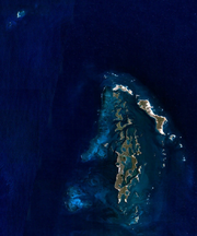
Montebello Islands
The Montebello Islands, also known as the Monte Bello Islands, are an archipelago of around 174 small islands lying north of Barrow Island and off the Pilbara coast of north-western Australia. Montebello is Italian for "beautiful mountain"...
group. It is named for the Tryall
Tryall
The Tryall was a British East India Company owned East Indiaman of approximately 500 tons. She was under the command of John Brooke when she was wrecked on the Tryal Rocks off the north-west coast of Western Australia in 1622...
, the first known shipwreck
Shipwreck
A shipwreck is what remains of a ship that has wrecked, either sunk or beached. Whatever the cause, a sunken ship or a wrecked ship is a physical example of the event: this explains why the two concepts are often overlapping in English....
in Australian waters, which sunk after striking the then-uncharted rocks in 1622. Described as "the theme and dread of every voyager to the eastern islands for the last two centuries", their location was sought for over three centuries before finally being determined in the 1960s.
Location and description
According to the Gazetteer of AustraliaGazetteer of Australia
The Gazetteer of Australia is a register of the location and spelling of geographical names across Australia. It is compiled by the Intergovernmental Committee on Surveying and Mapping and derived from state, territory, and Australian government agencies....
, the Australian Hydrographic Service places them at 20°16′S 115°21′E, whereas Western Australia
Western Australia
Western Australia is a state of Australia, occupying the entire western third of the Australian continent. It is bounded by the Indian Ocean to the north and west, the Great Australian Bight and Indian Ocean to the south, the Northern Territory to the north-east and South Australia to the south-east...
's Department of Land Information places them two minutes farther east at 20°16′S 115°23′E. They are about 16 kilometres (10 mi) north west of the Montebello Islands, and around 100 kilometres (60 mi) off the Australian mainland. Politically, they are part of Western Australia.
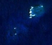
Another source places the rocks at 20°17′S 115°22′E and describes them and the immediate locale as: "two coral reefs, close together, about 1.25 miles (2 km) in length NE-SW; the S reef dries 2.7m. The rocks are located about 9 miles (14.5 km) NW of Montebello Islands. Depths of less than 20m lie within 6 miles (9.7 km) SW and 4 miles (6.4 km) NW of Tryal Rocks; the sea breaks on these shallower depths in bad weather. A 5.5m patch lies 3 miles (4.8 km) W of North West Island Light. The channel between Tryal Rocks and Montebello Islands is 7 miles (11.3 km) wide, with depths of 31 to 40m, and may be used by vessels proceeding to the E side of Barrow Island."
Wreck of the Tryall
The Tryall was only the second EnglishKingdom of England
The Kingdom of England was, from 927 to 1707, a sovereign state to the northwest of continental Europe. At its height, the Kingdom of England spanned the southern two-thirds of the island of Great Britain and several smaller outlying islands; what today comprises the legal jurisdiction of England...
ship to attempt to sail from the Cape of Good Hope
Cape of Good Hope
The Cape of Good Hope is a rocky headland on the Atlantic coast of the Cape Peninsula, South Africa.There is a misconception that the Cape of Good Hope is the southern tip of Africa, because it was once believed to be the dividing point between the Atlantic and Indian Oceans. In fact, the...
to Batavia (now Jakarta
Jakarta
Jakarta is the capital and largest city of Indonesia. Officially known as the Special Capital Territory of Jakarta, it is located on the northwest coast of Java, has an area of , and a population of 9,580,000. Jakarta is the country's economic, cultural and political centre...
, Indonesia
Indonesia
Indonesia , officially the Republic of Indonesia , is a country in Southeast Asia and Oceania. Indonesia is an archipelago comprising approximately 13,000 islands. It has 33 provinces with over 238 million people, and is the world's fourth most populous country. Indonesia is a republic, with an...
) along the Brouwer Route
Brouwer Route
The Brouwer Route was a route for sailing from the Cape of Good Hope to Java. The Route took ships south from the Cape into the Roaring Forties, then east across the Indian Ocean, before turning northwest for Java...
, a route pioneered by the Dutch
Dutch Empire
The Dutch Empire consisted of the overseas territories controlled by the Dutch Republic and later, the modern Netherlands from the 17th to the 20th century. The Dutch followed Portugal and Spain in establishing an overseas colonial empire, but based on military conquest of already-existing...
and used routinely by them since 1616. The Brouwer Route drastically shortened voyage times by keeping ships sailing eastwards in the Roaring Forties
Roaring Forties
The Roaring Forties is the name given to strong westerly winds found in the Southern Hemisphere, generally between the latitudes of 40 and 49 degrees. Air displaced from the Equator towards the South Pole, which travels close to the surface between the latitudes of 30 and 60 degrees south, combines...
for as long as possible before turning north. The captain of the Tryall, John Brookes
John Brookes
John Brookes is a retired English football forward who played in both the North American Soccer League.In 1968, he played for the Cleveland Stokers in the North American Soccer League. He spent the 1970-1971 season with Stockport County FC before transferring to Matlock Town. He played for...
, grossly underestimated the longitude
Longitude
Longitude is a geographic coordinate that specifies the east-west position of a point on the Earth's surface. It is an angular measurement, usually expressed in degrees, minutes and seconds, and denoted by the Greek letter lambda ....
of the ship, and ended up around 1000 kilometres (600 mi) farther east than the route specified. On turning north, the Tryall found itself skirting the west coast of Australia. Around 11pm on 25 May 1622, it struck the Tryal Rocks and sunk. 46 of 139 lives were saved, including Brookes'.
Brookes' subsequent report was extremely vague; it did not even give a position for the wreck. James Henderson characterises this as deliberate obfuscation, an attempt to avoid the blame for being so far off course. Consequently, the Tryal Rocks were originally thought to be well to the west of their actual location. Concerned for the threat to their own ships, the Dutch placed the reef on their charts, but "exactly south of the western extremity of Java
Java
Java is an island of Indonesia. With a population of 135 million , it is the world's most populous island, and one of the most densely populated regions in the world. It is home to 60% of Indonesia's population. The Indonesian capital city, Jakarta, is in west Java...
according to the statements made by the English sailors". This represents an error of around ten degrees of longitude.
Searches
.jpg)
Hessel Gerritsz
Hessel Gerritsz was a Dutch engraver, cartographer and publisher. Despite strong competition, he is considered by some “unquestionably the chief Dutch cartographer of the 17th century”...
published his Caert van't Landt van d'Eendracht
Caert van't Landt van d'Eendracht
Caert van't Landt van d'Eendracht is a 1627 map by Hessel Gerritsz. One of the earliest maps of Australia, it shows what little was then known of the west coast, based on a number of voyages beginning with the 1616 voyage of Dirk Hartog...
("Chart of the Land of Eendracht"). In the extreme bottom left corner of this map is a feature labelled Hier ist Engels schip de Trial vergaen in Iunias, A° 1622 ("Here the English ship Trial was wrecked in June 1622").
Numerous Dutch and English sailors searched for the rocks over the centuries. The first attempt was in 1636, when two Dutch ships were sent to search for the Tryal Rocks at their purported location. Sickness prevented William Dampier
William Dampier
William Dampier was an English buccaneer, sea captain, author and scientific observer...
from searching for the rocks in 1700; on 11 June of that year he wrote: "I kept on my course to the westward till the 15th, and then altered it. My design was to seek for the Tryal Rocks; but, having been sick 5 or 6 days without any fresh provision or other good nourishment aboard, and seeing no likelihood of my recovery, I rather chose to go to some port in time than to beat here any longer."
The Tryal Rocks continued to be marked on charts, but gradually sailors began to doubt their existence. In 1705, the captain of the Jane wrote in his journal: "Hove to, according to custom, on account of the Tryal Rocks (if they exist), for although they are reported to extend 20 league in length I was informed by the Commodore of the Dutch Ships... that he had never heard of these rocks being seen." He went on to correctly surmise that "If they exist they must lie much farther east than in the route toward Java Head."
Matthew Flinders
Matthew Flinders
Captain Matthew Flinders RN was one of the most successful navigators and cartographers of his age. In a career that spanned just over twenty years, he sailed with Captain William Bligh, circumnavigated Australia and encouraged the use of that name for the continent, which had previously been...
undertook a thorough search for the Tryal Rocks in April 1803, but found nothing, and concluded that "It should appear from our examination, that the Trial Rocks do not lie in the space comprehended between the latitudes 20° 15' and 21° south, and the longitudes 103° 25' and 106° 30' east." Consequently, the British Admiralty
Admiralty
The Admiralty was formerly the authority in the Kingdom of England, and later in the United Kingdom, responsible for the command of the Royal Navy...
declared that they didn't exist.
In 1818, the British brig Greyhound, captained by Lieutenant Ritchie, encountered the true Tryal Rocks. They were not recognised as such, however, as the Tryal Rocks were then thought not to exist, and they had previously been thought to be well to the west of Ritchie's reef. In 1920, Ritchie's discovery was published as "Ritchie's Reef"; it was also sometimes referred to as "the Greyhound's Shoal".
In October 1820, Phillip Parker King suggested that the Tryal Rocks were the Montebello Islands: "May not the Tryal Rocks also be some of the low islands that skirt the coast? ...There remains no doubt in my mind but that Barrow's Island and Trimouille Island, and the numerous reefs around them, are the identical Tryal Rocks which have been the theme and dread of every voyager to the eastern islands for the two last centuries... the only argument against the probability of this supposition is their longitude; but during the month of July the current sets with great strength to the westward and might occasion considerable errors in ships' reckoning, which, in former days, were so imperfectly kept that no dependence can be placed upon them." This error was repeated in 1846, when John Lort Stokes
John Lort Stokes
Admiral John Lort Stokes, RN was an officer in the Royal Navy who travelled on HMS Beagle for close to eighteen years.Stokes grew up in Scotchwell near Haverfordwest, Pembrokeshire. He joined the Navy on 20 September 1824...
placed the Tryal Rocks between the Montebello Islands and Barrow Island
Barrow Island (Western Australia)
Barrow Island is a island located northwest off the coast of Western Australia. The island is the second largest in Western Australia after Dirk Hartog Island.-Discovery and early history:...
. Admiralty Sailing Directions of 1917 further claimed that "Tryal Rocks awash at high water are near the outer edge of the S.W. part of Monte Bello Islands reef and five miles (8 km) off the North extreme of Barrow Island".
In 1928, Commander Rupert Gould
Rupert Gould
Rupert Thomas Gould , was a Lieutenant Commander in the British Royal Navy noted for his contributions to horology .-Life:...
made a survey of the area and declared that Ritchie Reef was definitely the Tryal Rocks. Final confirmation of this came in 1969, when an exploration team found the wreck of the Tryall there.