
Toshka Lakes
Encyclopedia
Endorheic
An endorheic basin is a closed drainage basin that retains water and allows no outflow to other bodies of water such as rivers or oceans...
lake
Lake
A lake is a body of relatively still fresh or salt water of considerable size, localized in a basin, that is surrounded by land. Lakes are inland and not part of the ocean and therefore are distinct from lagoons, and are larger and deeper than ponds. Lakes can be contrasted with rivers or streams,...
s in the Sahara Desert of Egypt
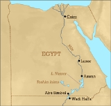
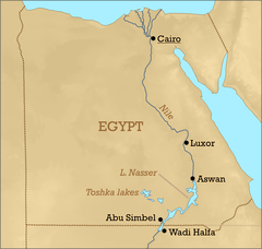
Egypt
Egypt , officially the Arab Republic of Egypt, Arabic: , is a country mainly in North Africa, with the Sinai Peninsula forming a land bridge in Southwest Asia. Egypt is thus a transcontinental country, and a major power in Africa, the Mediterranean Basin, the Middle East and the Muslim world...
.
History
The Aswan High Dam, constructed in Egypt in 1964-1968, created Lake NasserLake Nasser
Lake Nasser is a vast reservoir in southern Egypt, and northern Sudan, and is one of the largest man-made lakes in the world. Strictly, "Lake Nasser" refers only to the much larger portion of the lake that is in Egyptian territory , with the Sudanese preferring to call their smaller body of water...
, with a maximum water level of 183 metres (600.4 ft)above sea level
Sea level
Mean sea level is a measure of the average height of the ocean's surface ; used as a standard in reckoning land elevation...
. In 1978 Egypt began building the Sadat Canal NW from Lake Nasser
Lake Nasser
Lake Nasser is a vast reservoir in southern Egypt, and northern Sudan, and is one of the largest man-made lakes in the world. Strictly, "Lake Nasser" refers only to the much larger portion of the lake that is in Egyptian territory , with the Sudanese preferring to call their smaller body of water...
through Wadi Toshka to allow water levels higher than 178 metres (584 ft) to be drained off into a depression at the south end of the Eocene
Eocene
The Eocene Epoch, lasting from about 56 to 34 million years ago , is a major division of the geologic timescale and the second epoch of the Paleogene Period in the Cenozoic Era. The Eocene spans the time from the end of the Palaeocene Epoch to the beginning of the Oligocene Epoch. The start of the...
limestone
Limestone
Limestone is a sedimentary rock composed largely of the minerals calcite and aragonite, which are different crystal forms of calcium carbonate . Many limestones are composed from skeletal fragments of marine organisms such as coral or foraminifera....
plateau. In the late 1990s, water began flowing through the Sadat Canal into the Western Desert. This feeder canal from Lake Nasser is concrete lined, to reduce seepage losses. The water of Lake Nasser does not overflow naturally into the canal, but must be pumped by the vast Mubarak Pumping Station, situated north of Abu Simbel.
Formation
Astronauts began noticing the first, easternmost lake growing in November 1998. By late 1999, three additional lakes formed successively westward, and the westernmost lake started forming sometime between September 2000 and March 2001. These lakes are not yet named individually. In total, the Toshka Lakes cover approximately 1300 square kilometers (502 mi²). As of the levels of the lakes are lower than in 2001, and areas of wetlands and sand dunes have formed between the former and present shorelines. A minor lake downstream of the three larger lakes has completely dried out. The levels of the lakes vary between 175 metres (574.1 ft) for the one closest Lake Nasser to 144 metres (472.4 ft) for the one furthest downstreams.Geography
- The new lake system is endorheic, that is, the waters can never flow on to the sea. The Nile-sourced water creates the lakes and helps to recharge the underlying aquifer; but desert temperatures cause very high levels of evaporation. Although the new lakes already contain an impressive amount of fish, these high evaporation levels will make the waters become increasingly saline over time, reducing fish stocks and harming the newly-established flora and fauna.
- The Toshka Depression lies within the seismically active Nubian SwellNubian SwellThe Nubian Swell is a geologic structural uplift in northern Africa that trends east-west and separates the lower Nile of Egypt from the Sudan basin. The Nubian Swell has been geologically active since early Mesozoic times, and portions are still active...
. The Egyptian government is developing the surrounding region, also known as the "New Valley ProjectNew Valley ProjectThe New Valley Project consists of building a system of canals to carry water from Lake Nasser to irrigate the sandy wastes of the Western Desert of Egypt, which is part of the Sahara Desert. In 1997 the Egyptian government decided to develop a "new" valley where agricultural and industrial...
". The plan is to extend the waterway to the Kharga oasis. - Use of Nile resources is governed by the Nile Basin InitiativeNile Basin InitiativeThe Nile Basin Initiative is a partnership among the Nile riparian states that “seeks to develop the river in a cooperative manner, share substantial socioeconomic benefits, and promote regional peace and security”...
; but the Toshka project does not breach the agreement as water is diverted from Lake Nasser only after heavy water flows upstream have raised lake levels above 178 metres (584 ft) (see above).
Related Projects
- SudanSudanSudan , officially the Republic of the Sudan , is a country in North Africa, sometimes considered part of the Middle East politically. It is bordered by Egypt to the north, the Red Sea to the northeast, Eritrea and Ethiopia to the east, South Sudan to the south, the Central African Republic to the...
's Gezira SchemeGezira SchemeThe Gezira Scheme is one of the largest irrigation projects in the world. It is centered on the Sudanese state of Al Jazirah, just southeast of the confluence of the Blue and White Nile rivers at the city of Khartoum. The economy of Sudan was historically based on agriculture prior to the...
, south of KhartoumKhartoumKhartoum is the capital and largest city of Sudan and of Khartoum State. It is located at the confluence of the White Nile flowing north from Lake Victoria, and the Blue Nile flowing west from Ethiopia. The location where the two Niles meet is known as "al-Mogran"...
, at the confluence of the Blue NileBlue NileThe Blue Nile is a river originating at Lake Tana in Ethiopia. With the White Nile, the river is one of the two major tributaries of the Nile...
and the White NileWhite NileThe White Nile is a river of Africa, one of the two main tributaries of the Nile from Egypt, the other being the Blue Nile. In the strict meaning, "White Nile" refers to the river formed at Lake No at the confluence of the Bahr al Jabal and Bahr el Ghazal rivers...
. - The Qattara DepressionQattara DepressionThe Qattara Depression is a depression in the north west of Egypt in the Matruh Governorate and is part of the Libyan Desert. It lies below sea level and is covered with salt pans, sand dunes and salt marshes. The region extends between latitudes of 28°35' and 30°25' North and longitudes of 26°20'...
, north of the Kharga oasis and west of Cairo, is a large area of Egypt that lies below sea level. It has long been mooted to divert waters, either from the fresh Nile or from the saline Mediterranean Sea, to generate hydro-electric power. Much of this water would then evaporate. Ideally fresh Nile water would be used, to recharge the aquifer and to allow irrigation for agriculture; use of sea water would create a "second Dead SeaDead SeaThe Dead Sea , also called the Salt Sea, is a salt lake bordering Jordan to the east and Israel and the West Bank to the west. Its surface and shores are below sea level, the lowest elevation on the Earth's surface. The Dead Sea is deep, the deepest hypersaline lake in the world...
". - In May 2009 JordanJordanJordan , officially the Hashemite Kingdom of Jordan , Al-Mamlaka al-Urduniyya al-Hashemiyya) is a kingdom on the East Bank of the River Jordan. The country borders Saudi Arabia to the east and south-east, Iraq to the north-east, Syria to the north and the West Bank and Israel to the west, sharing...
announced its plans to construct the "Jordan National Red Sea Development Project" (JRSP). This is a plan to convey seawater from the Red SeaRed SeaThe Red Sea is a seawater inlet of the Indian Ocean, lying between Africa and Asia. The connection to the ocean is in the south through the Bab el Mandeb strait and the Gulf of Aden. In the north, there is the Sinai Peninsula, the Gulf of Aqaba, and the Gulf of Suez...
near AqabaAqabaAqaba is a coastal city in the far south of Jordan, the capital of Aqaba Governorate at the head of the Gulf of Aqaba. Aqaba is strategically important to Jordan as it is the country's only seaport. Aqaba is best known today as a diving and beach resort, but industrial activity remains important...
to the Dead Sea. Water would be desalinated along the route to provide freshwater to Jordan, with the brine discharge sent to the Dead Sea for replenishment. - Further related projects include: (i) diverting and/or damming the River Niger to help irrigation and hydro-electric power in MaliMaliMali , officially the Republic of Mali , is a landlocked country in Western Africa. Mali borders Algeria on the north, Niger on the east, Burkina Faso and the Côte d'Ivoire on the south, Guinea on the south-west, and Senegal and Mauritania on the west. Its size is just over 1,240,000 km² with...
and NigerNigerNiger , officially named the Republic of Niger, is a landlocked country in Western Africa, named after the Niger River. It borders Nigeria and Benin to the south, Burkina Faso and Mali to the west, Algeria and Libya to the north and Chad to the east...
; and (ii) diverting water from the Mediterranean Sea to form an inland sea in TunisiaTunisiaTunisia , officially the Tunisian RepublicThe long name of Tunisia in other languages used in the country is: , is the northernmost country in Africa. It is a Maghreb country and is bordered by Algeria to the west, Libya to the southeast, and the Mediterranean Sea to the north and east. Its area...
's Chott Djerid salt panDry lakeDry lakes are ephemeral lakebeds, or a remnant of an endorheic lake. Such flats consist of fine-grained sediments infused with alkali salts. Dry lakes are also referred to as alkali flats, sabkhas, playas or mud flats...
, near Tozeur;
External links
- http://earthobservatory.nasa.gov/Newsroom/NewImages/images.php3?img_id=4495 Astronaut photography of Sara Lake formation 1998-1999.
- http://visibleearth.nasa.gov/view_rec.php?vev1id=16059 March 2002 MODISMODISThe Moderate-resolution Imaging Spectroradiometer is a payload scientific instrument launched into Earth orbit by NASA in 1999 on board the Terra Satellite, and in 2002 on board the Aqua satellite...
'true color' image of Toshka Lakes and vicinity. - http://rapidfire.sci.gsfc.nasa.gov/gallery/?2003026-0126/Egypt.A2003026.1110.721.500m.jpg Jan. 2003 MODISMODISThe Moderate-resolution Imaging Spectroradiometer is a payload scientific instrument launched into Earth orbit by NASA in 1999 on board the Terra Satellite, and in 2002 on board the Aqua satellite...
false color image of the Toshka Lakes. - http://www.utdallas.edu/~allie/flythrough2.html This fly-through is of the area imaged by satellites before the lakes formed.
- http://www.gesource.ac.uk/worldguide/html/image_469.html Astronaut photography documenting the formation of the westernmost lake in 2001.
- http://earthobservatory.nasa.gov/Newsroom/NewImages/images.php3?img_id=17147 Astronaut photography documenting shrinking of the lakes in late 2005.
- http://eol.jsc.nasa.gov/scripts/sseop/LLSearch.pl?lrlat=22.0&ullat=23.0&ullon=31.4&lrlon=32.4&filters=simple CEO (Crew Earth Observation) on the Gateway to Astronaut Photography of Earth (Toshka, Egypt)