
Toll roads in the United States
Encyclopedia
A toll road
in the United States
, especially near the east coast, is often called a turnpike. The term turnpike originated from pikes, which were long sticks that blocked passage until the fare was paid and the pike turned at a toll house (or toll booth in current terminology).
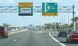
Some states have an RF tag that automatically bills the commuters account electronically for tolls. Examples of this are the E-ZPass
electronic toll collection
system used on most toll bridge
s, toll tunnels, and toll roads in the eastern U.S. from Virginia
to the south, to Maine
to the north, to Illinois
to the west; California
's FasTrak
; Florida
's SunPass
; Kansas
's K-Tag; Oklahoma
's Pikepass; Houston's EZ Tag
; Texas
's TxTag
; Texas's TollTag
; Louisiana
's GeauxPass; and Georgia
's Peach Pass and Cruise Card.
 Traffic in these special lanes can move well with minimal slowing. Toll roads are only in 26 states as of 2006. The majority of states without any turnpikes are in the West
and South
.
The first major toll road in the United States
was the Philadelphia and Lancaster Turnpike
, built in the 1790s, within Pennsylvania
, connecting Philadelphia
and Lancaster
. In New York State, the Great Western Turnpike
was started in Albany
in 1799 and eventually extended, by several alternate routes, to the Finger Lakes
region.
Prior to the American Revolution, some smaller toll roads organized by local governments existed, such as the Little River Turnpike which connected Alexandria, Virginia
with the farmland of Western Virginia
.
In the mid to late nineteenth century, private toll road building was particularly active in the West including California
and Nevada
. In Nevada, over 100 private toll roads were laid out between the 1850s and 1880s, some of them nearly 200 miles (321.9 km) long. The owners included stage companies, miners, and ranchers who built the roads, at least in part, to attract business for their primary investments.
By the turn of the twentieth century most toll roads were taken over by state highway departments. In some instances, a quasi-governmental authority was formed, and toll revenue bond
s were issued to raise funds for construction and/or operation of the facility.
With the development, mass production, and popular embrace of the automobile, faster and higher capacity roads were needed. In the 1920s limited access highways appeared. Their main characteristics were dual roadways with access points limited to (but not always) grade-separated interchanges. Their dual roadways allowed high volumes of traffic
, the need for no or few traffic light
s along with relatively gentle grades and curves allowed higher speeds.
The first limited access highways were Parkways, so called because of their often park-like landscaping
and, in the metropolitan New York City
area, they connected the region's system of parks. Most of the parkways in the New York metropolitan area were not fully access-controlled. While access to most portions of New York's parkway system was through interchange
s, there were still numerous segments with at-grade intersections. The nation's first fully controlled-access expressway, the Merritt Parkway
in Connecticut opened in stages between 1938 and 1940. The Merritt Parkway, along with the adjoining Hutchinson River Parkway
to the west and Wilbur Cross Parkway
to the east, provided an uninterrupted expressway link between New York City
and Hartford
. The Merritt Parkway used a barrier system: one toll plaza was located at the New York/Connecticut state line and the other was located at the Merritt's east end, just east of the Igor I. Sikorsky Memorial Bridge
in Milford, Connecticut
, where the Wilbur Cross Parkway continues northeast to Hartford. Tolls were removed from the parkway in 1989. When the German Autobahns built in the 1930s introduced higher design standards and speeds, road planners and road-builders in the United States started developing and building toll roads to similar high standards. The Pennsylvania Turnpike
, which largely followed the path of a partially built railroad, was the first of these, opening in 1940 and starting a resurgence of toll collection, this time to fund limited access highways.
In the late 1940s and early 1950s, after an interruption by World War II
, the US resumed building toll roads, but to even higher standards. One of these roads, the New York State Thruway
, had standards that became the prototype for the U.S. Interstate Highway System. Several other major toll-roads and toll-road systems, based on the model of the Pennsylvania Turnpike, were established before the creation of the Interstate Highway System. These were the Illinois State Toll Highway Commission (now the Illinois State Toll Highway Authority
), Indiana Toll Road
, Massachusetts Turnpike
, Ohio Turnpike
, Connecticut Turnpike
(whose tolls were stopped in 1985), Florida's Turnpike
and New Jersey Turnpike
. In Illinois, three such roads, which had all been constructed simultaneously, were opened in 1958: the present-day Tri-State Tollway
, Northwest Tollway
and the Ronald Reagan Memorial Tollway (originally named the east–west Tollway). Kentucky
has an extensive system of parkways, built in the 1960s and 1970s, which began as toll roads. However, Kentucky state law requires toll collection to cease once the road's construction bonds are paid off. As a result, the last two Kentucky parkways to charge tolls were de-tolled in November 2006. Oklahoma
also has an extensive system of turnpikes, built about the same time as Kentucky's parkways.
Occasionally it is mooted that some of the Interstate highways, for example, those in the sparsely populated states just east of the Rocky Mountains, should have been turnpikes. The reason is to have those cross-country trucking firms that use them pay for them. But there is no movement to do this, especially since trucking companies already pay a fuel tax
in each state they drive through.
In 2005, Indiana's Governor Mitch Daniels
sought to lease the Indiana Toll Road to a private company. His initiative, referred to as "Major Moves
" was passed the Indiana General Assembly
in March 2006. Following a legal challenge that upheld the deal, the Indiana Finance Authority received the $3.8 billion payment in a series of wire transfers on June 29, 2006, from the Indiana Toll Road Concession Company
, the joint-venture between Cintra and Macquarie Infrastructure Group
. At noon local time on June 29, the toll road lease deal was signed and went into effect.
on Interstate 64
at the Hampton Roads Bridge-Tunnel
when a second parallel roadway to the regional 1958 bridge-tunnel was completed in 1976.
Since the completion of the initial portion of the interstate highway system, regulations were changed, and portions of toll facilities have been added to the system. Some states are again looking at toll financing for new roads and maintenance, to supplement limited federal funding. In some areas, new road projects have been completed and later maintained with public-private partnerships funded by tolls, also known as build-operate-transfer
systems. One such public-private partnership was the constructions of the Pocahontas Parkway near Richmond, Virginia
, which features a costly high level bridge over the shipping channel of the James River
and connects Interstate 95
with Interstate 295
to the south of the city.
(not to be confused with toll evasion, which is the non-payment of tolls at a toll booth or concealment of a toll RFID tag at a toll reader, both violations) evolved which entails finding another route for the specific purpose of avoiding payment of tolls.
In some situations where the tolls were increased or felt to be unreasonably high, informal shunpiking by individuals escalated into a form of boycott
by regular users, with the goal of applying the financial stress of lost toll revenue to the authority determining the levy.
One such example of shunpiking as a form of boycott occurred at the James River Bridge
in eastern Virginia
. After years of lower than anticipated revenues on the narrow privately funded structure built in 1928, the Commonwealth of Virginia finally purchased the facility in 1949. However, rather than announcing a long-expected decrease in tolls, the state officials increased the rates in 1955 without visibly improving the roadway, with the notable exception of building a new toll plaza.
The increased toll rates incensed the public and business users alike. In a well-publicized example of shunpiking
, Joseph W. Luter Jr., head of Smithfield Packing Company
, the producer of world-famous Smithfield Hams
, ordered his truck drivers to take a different route and cross a smaller and cheaper bridge. Despite the boycott by Luter and others, tolls continued for 20 more years. They were finally removed from the old bridge in 1975 when construction began on a toll-free replacement structure.
Toll road
A toll road is a privately or publicly built road for which a driver pays a toll for use. Structures for which tolls are charged include toll bridges and toll tunnels. Non-toll roads are financed using other sources of revenue, most typically fuel tax or general tax funds...
in the United States
United States
The United States of America is a federal constitutional republic comprising fifty states and a federal district...
, especially near the east coast, is often called a turnpike. The term turnpike originated from pikes, which were long sticks that blocked passage until the fare was paid and the pike turned at a toll house (or toll booth in current terminology).
Some states have an RF tag that automatically bills the commuters account electronically for tolls. Examples of this are the E-ZPass
E-ZPass
E-ZPass is an electronic toll-collection system used on most tolled roads, bridges, and tunnels in the northeastern US, south to Virginia and West Virginia, and west to Illinois. Currently, there are 25 agencies spread across 14 states that make up the . All member agencies use the same technology,...
electronic toll collection
Electronic toll collection
Electronic toll collection , an adaptation of military "identification friend or foe" technology, aims to eliminate the delay on toll roads by collecting tolls electronically. It is thus a technological implementation of a road pricing concept...
system used on most toll bridge
Toll bridge
A toll bridge is a bridge over which traffic may pass upon payment of a toll, or fee.- History :The practice of collecting tolls on bridges probably harks back to the days of ferry crossings where people paid a fee to be ferried across stretches of water. As boats became impractical to carry large...
s, toll tunnels, and toll roads in the eastern U.S. from Virginia
Virginia
The Commonwealth of Virginia , is a U.S. state on the Atlantic Coast of the Southern United States. Virginia is nicknamed the "Old Dominion" and sometimes the "Mother of Presidents" after the eight U.S. presidents born there...
to the south, to Maine
Maine
Maine is a state in the New England region of the northeastern United States, bordered by the Atlantic Ocean to the east and south, New Hampshire to the west, and the Canadian provinces of Quebec to the northwest and New Brunswick to the northeast. Maine is both the northernmost and easternmost...
to the north, to Illinois
Illinois
Illinois is the fifth-most populous state of the United States of America, and is often noted for being a microcosm of the entire country. With Chicago in the northeast, small industrial cities and great agricultural productivity in central and northern Illinois, and natural resources like coal,...
to the west; California
California
California is a state located on the West Coast of the United States. It is by far the most populous U.S. state, and the third-largest by land area...
's FasTrak
FasTrak
FasTrak is the electronic toll collection system used in the state of California in the United States. The system is used statewide on all of the toll roads, toll bridges, and high occupancy/toll and express toll lanes along the California Freeway and Expressway System.As with other ETC systems,...
; Florida
Florida
Florida is a state in the southeastern United States, located on the nation's Atlantic and Gulf coasts. It is bordered to the west by the Gulf of Mexico, to the north by Alabama and Georgia and to the east by the Atlantic Ocean. With a population of 18,801,310 as measured by the 2010 census, it...
's SunPass
SunPass
SunPass is an electronic toll collection system in use by the State of Florida and was originally created by the Florida Department of Transportation's Florida's Turnpike...
; Kansas
Kansas
Kansas is a US state located in the Midwestern United States. It is named after the Kansas River which flows through it, which in turn was named after the Kansa Native American tribe, which inhabited the area. The tribe's name is often said to mean "people of the wind" or "people of the south...
's K-Tag; Oklahoma
Oklahoma
Oklahoma is a state located in the South Central region of the United States of America. With an estimated 3,751,351 residents as of the 2010 census and a land area of 68,667 square miles , Oklahoma is the 28th most populous and 20th-largest state...
's Pikepass; Houston's EZ Tag
EZ TAG
EZ TAG is an electronic toll collection system in Houston, Texas, United States that allows motorists to pay tolls without stopping at toll booths. Motorists with the Tags are allowed to use lanes reserved exclusively for them on all Harris County Toll Road Authority roads...
; Texas
Texas
Texas is the second largest U.S. state by both area and population, and the largest state by area in the contiguous United States.The name, based on the Caddo word "Tejas" meaning "friends" or "allies", was applied by the Spanish to the Caddo themselves and to the region of their settlement in...
's TxTag
TxTAG
TxTag , operated by the Texas Department of Transportation , is one of three interoperable electronic toll collection systems in Texas.-Current system status:The TxTag brand name is used on the following highways:* Operated by TxDOT:...
; Texas's TollTag
TollTag
TollTag is the electronic toll collection system used by the North Texas Tollway Authority in the Dallas / Fort Worth metro area. It was North America’s first electronic toll collection system when it was installed on the Dallas North Tollway in 1989. There are currently over 2,000,000 TollTags in...
; Louisiana
Louisiana
Louisiana is a state located in the southern region of the United States of America. Its capital is Baton Rouge and largest city is New Orleans. Louisiana is the only state in the U.S. with political subdivisions termed parishes, which are local governments equivalent to counties...
's GeauxPass; and Georgia
Georgia (U.S. state)
Georgia is a state located in the southeastern United States. It was established in 1732, the last of the original Thirteen Colonies. The state is named after King George II of Great Britain. Georgia was the fourth state to ratify the United States Constitution, on January 2, 1788...
's Peach Pass and Cruise Card.
Western United States
.The Western United States, commonly referred to as the American West or simply "the West," traditionally refers to the region comprising the westernmost states of the United States. Because the U.S. expanded westward after its founding, the meaning of the West has evolved over time...
and South
Southern United States
The Southern United States—commonly referred to as the American South, Dixie, or simply the South—constitutes a large distinctive area in the southeastern and south-central United States...
.
History, funding through toll
In early US history, many individual citizens would gravel nearby stretches of road and collect a fee from people who used that specific stretch. Eventually, companies were formed to build, improve, and maintain a particular section of roadway, and tolls were collected from users to finance the enterprise. The enterprise was usually named to indicate the location of its roadway, often including the name of one or both of the termini. The word turnpike came into common use in the names of these roadways and companies, and is essentially used interchangeably with toll road in current terminology.The first major toll road in the United States
United States
The United States of America is a federal constitutional republic comprising fifty states and a federal district...
was the Philadelphia and Lancaster Turnpike
Philadelphia and Lancaster Turnpike
The Philadelphia and Lancaster Turnpike, first used in 1795, is the first long-distance paved road built in the United States, according to engineered plans and specifications. It links Lancaster, Pennsylvania, and Philadelphia at 34th Street, stretching for sixty-two miles. However, the western...
, built in the 1790s, within Pennsylvania
Pennsylvania
The Commonwealth of Pennsylvania is a U.S. state that is located in the Northeastern and Mid-Atlantic regions of the United States. The state borders Delaware and Maryland to the south, West Virginia to the southwest, Ohio to the west, New York and Ontario, Canada, to the north, and New Jersey to...
, connecting Philadelphia
Philadelphia, Pennsylvania
Philadelphia is the largest city in the Commonwealth of Pennsylvania and the county seat of Philadelphia County, with which it is coterminous. The city is located in the Northeastern United States along the Delaware and Schuylkill rivers. It is the fifth-most-populous city in the United States,...
and Lancaster
Lancaster, Pennsylvania
Lancaster is a city in the south-central part of the Commonwealth of Pennsylvania. It is the county seat of Lancaster County and one of the older inland cities in the United States, . With a population of 59,322, it ranks eighth in population among Pennsylvania's cities...
. In New York State, the Great Western Turnpike
Great Western Turnpike
The Great Western Turnpike was a series of east–west toll roads that crossed part of New York in the United States. The toll roads that carried this name were:...
was started in Albany
Albany, New York
Albany is the capital city of the U.S. state of New York, the seat of Albany County, and the central city of New York's Capital District. Roughly north of New York City, Albany sits on the west bank of the Hudson River, about south of its confluence with the Mohawk River...
in 1799 and eventually extended, by several alternate routes, to the Finger Lakes
Finger Lakes
The Finger Lakes are a pattern of lakes in the west-central section of Upstate New York in the United States. They are a popular tourist destination. The lakes are long and thin , each oriented roughly on a north-south axis. The two longest, Cayuga Lake and Seneca Lake, are among the deepest in...
region.
Prior to the American Revolution, some smaller toll roads organized by local governments existed, such as the Little River Turnpike which connected Alexandria, Virginia
Alexandria, Virginia
Alexandria is an independent city in the Commonwealth of Virginia. As of 2009, the city had a total population of 139,966. Located along the Western bank of the Potomac River, Alexandria is approximately six miles south of downtown Washington, D.C.Like the rest of northern Virginia, as well as...
with the farmland of Western Virginia
Virginia
The Commonwealth of Virginia , is a U.S. state on the Atlantic Coast of the Southern United States. Virginia is nicknamed the "Old Dominion" and sometimes the "Mother of Presidents" after the eight U.S. presidents born there...
.
In the mid to late nineteenth century, private toll road building was particularly active in the West including California
California
California is a state located on the West Coast of the United States. It is by far the most populous U.S. state, and the third-largest by land area...
and Nevada
Nevada
Nevada is a state in the western, mountain west, and southwestern regions of the United States. With an area of and a population of about 2.7 million, it is the 7th-largest and 35th-most populous state. Over two-thirds of Nevada's people live in the Las Vegas metropolitan area, which contains its...
. In Nevada, over 100 private toll roads were laid out between the 1850s and 1880s, some of them nearly 200 miles (321.9 km) long. The owners included stage companies, miners, and ranchers who built the roads, at least in part, to attract business for their primary investments.
By the turn of the twentieth century most toll roads were taken over by state highway departments. In some instances, a quasi-governmental authority was formed, and toll revenue bond
Toll revenue bond
A toll revenue bond is a financial promissory note usually issued to generate funds for the construction and/or operation of a public accommodation such as an expressway, bridge, or tunnel...
s were issued to raise funds for construction and/or operation of the facility.
With the development, mass production, and popular embrace of the automobile, faster and higher capacity roads were needed. In the 1920s limited access highways appeared. Their main characteristics were dual roadways with access points limited to (but not always) grade-separated interchanges. Their dual roadways allowed high volumes of traffic
Traffic
Traffic on roads may consist of pedestrians, ridden or herded animals, vehicles, streetcars and other conveyances, either singly or together, while using the public way for purposes of travel...
, the need for no or few traffic light
Traffic light
Traffic lights, which may also be known as stoplights, traffic lamps, traffic signals, signal lights, robots or semaphore, are signalling devices positioned at road intersections, pedestrian crossings and other locations to control competing flows of traffic...
s along with relatively gentle grades and curves allowed higher speeds.
The first limited access highways were Parkways, so called because of their often park-like landscaping
Landscaping
Landscaping refers to any activity that modifies the visible features of an area of land, including:# living elements, such as flora or fauna; or what is commonly referred to as gardening, the art and craft of growing plants with a goal of creating a beautiful environment within the landscape.#...
and, in the metropolitan New York City
New York City
New York is the most populous city in the United States and the center of the New York Metropolitan Area, one of the most populous metropolitan areas in the world. New York exerts a significant impact upon global commerce, finance, media, art, fashion, research, technology, education, and...
area, they connected the region's system of parks. Most of the parkways in the New York metropolitan area were not fully access-controlled. While access to most portions of New York's parkway system was through interchange
Interchange (road)
In the field of road transport, an interchange is a road junction that typically uses grade separation, and one or more ramps, to permit traffic on at least one highway to pass through the junction without directly crossing any other traffic stream. It differs from a standard intersection, at which...
s, there were still numerous segments with at-grade intersections. The nation's first fully controlled-access expressway, the Merritt Parkway
Merritt Parkway
The Merritt Parkway is a historic limited-access parkway in Fairfield County, Connecticut. The parkway is known for its scenic layout, its uniquely styled signage, and the architecturally elaborate overpasses along the route. It is designated as a National Scenic Byway and is also listed in the...
in Connecticut opened in stages between 1938 and 1940. The Merritt Parkway, along with the adjoining Hutchinson River Parkway
Hutchinson River Parkway
The Hutchinson River Parkway is a north–south parkway in southern New York, United States. It extends for from the massive Bruckner Interchange in the Throgs Neck section of the Bronx to the New York – Connecticut state line at Rye Brook...
to the west and Wilbur Cross Parkway
Wilbur Cross Parkway
The Wilbur Cross Parkway is a limited access road in Connecticut, comprising the portion of Route 15 between Milford and Meriden. It is named after Wilbur Lucius Cross, a former governor of the state...
to the east, provided an uninterrupted expressway link between New York City
New York City
New York is the most populous city in the United States and the center of the New York Metropolitan Area, one of the most populous metropolitan areas in the world. New York exerts a significant impact upon global commerce, finance, media, art, fashion, research, technology, education, and...
and Hartford
Hartford, Connecticut
Hartford is the capital of the U.S. state of Connecticut. The seat of Hartford County until Connecticut disbanded county government in 1960, it is the second most populous city on New England's largest river, the Connecticut River. As of the 2010 Census, Hartford's population was 124,775, making...
. The Merritt Parkway used a barrier system: one toll plaza was located at the New York/Connecticut state line and the other was located at the Merritt's east end, just east of the Igor I. Sikorsky Memorial Bridge
Igor I. Sikorsky Memorial Bridge
The Igor I. Sikorsky Memorial Bridge carries the limited-access Connecticut Route 15 over the Housatonic River, between Stratford and Milford, Connecticut. The bridge was first referred to as the Sikorsky Bridge because Sikorsky Aircraft is headquartered just north of the bridge...
in Milford, Connecticut
Milford, Connecticut
Milford is a coastal city in southwestern New Haven County, Connecticut, United States, located between Bridgeport and New Haven. The population was 52,759 at the 2010 census...
, where the Wilbur Cross Parkway continues northeast to Hartford. Tolls were removed from the parkway in 1989. When the German Autobahns built in the 1930s introduced higher design standards and speeds, road planners and road-builders in the United States started developing and building toll roads to similar high standards. The Pennsylvania Turnpike
Pennsylvania Turnpike
The Pennsylvania Turnpike is a toll highway system operated by the Pennsylvania Turnpike Commission in the Commonwealth of Pennsylvania, United States. The three sections of the turnpike system total . The main section extends from Ohio to New Jersey and is long...
, which largely followed the path of a partially built railroad, was the first of these, opening in 1940 and starting a resurgence of toll collection, this time to fund limited access highways.
In the late 1940s and early 1950s, after an interruption by World War II
World War II
World War II, or the Second World War , was a global conflict lasting from 1939 to 1945, involving most of the world's nations—including all of the great powers—eventually forming two opposing military alliances: the Allies and the Axis...
, the US resumed building toll roads, but to even higher standards. One of these roads, the New York State Thruway
New York State Thruway
The New York State Thruway is a system of limited-access highways located within the state of New York in the United States. The system, known officially as the Governor Thomas E. Dewey Thruway for former New York Governor Thomas E. Dewey, is operated by the New York State Thruway Authority and...
, had standards that became the prototype for the U.S. Interstate Highway System. Several other major toll-roads and toll-road systems, based on the model of the Pennsylvania Turnpike, were established before the creation of the Interstate Highway System. These were the Illinois State Toll Highway Commission (now the Illinois State Toll Highway Authority
Illinois State Toll Highway Authority
The Illinois State Toll Highway Authority is an instrumentality and administrative agency of the State of Illinois, United States. The roads, as well as the Authority itself, are sometimes referred to as the Illinois Tollway...
), Indiana Toll Road
Indiana Toll Road
The Indiana Toll Road, officially the Indiana East–West Toll Road, is a toll road that runs for east–west across northern Indiana from the Illinois state line to the Ohio state line...
, Massachusetts Turnpike
Massachusetts Turnpike
The Massachusetts Turnpike is the easternmost stretch of Interstate 90. The Turnpike begins at the western border of Massachusetts in West Stockbridge connecting with the Berkshire Connector portion of the New York State Thruway...
, Ohio Turnpike
Ohio Turnpike
The Ohio Turnpike, officially the James W. Shocknessy Ohio Turnpike, is a -long, limited-access toll highway in the U.S. state of Ohio, serving as a primary corridor to Chicago and Pittsburgh...
, Connecticut Turnpike
Connecticut Turnpike
The Connecticut Turnpike, known now as the Governor John Davis Lodge Turnpike, is a freeway in Connecticut that runs from Greenwich to Killingly. It is signed as Interstate 95 from the New York state line at Greenwich to East Lyme, and then as Interstate 395 from East Lyme to Plainfield...
(whose tolls were stopped in 1985), Florida's Turnpike
Florida's Turnpike
Florida's Turnpike , designated as the Ronald Reagan Turnpike, and originally known as the Sunshine State Parkway is a north–south toll road that runs through 11 counties in the Florida peninsula, from U.S...
and New Jersey Turnpike
New Jersey Turnpike
The New Jersey Turnpike is a toll road in New Jersey, maintained by the New Jersey Turnpike Authority. According to the International Bridge, Tunnel and Turnpike Association, the Turnpike is the nation's sixth-busiest toll road and is among one of the most heavily traveled highways in the United...
. In Illinois, three such roads, which had all been constructed simultaneously, were opened in 1958: the present-day Tri-State Tollway
Tri-State Tollway
The Tri-State Tollway is a U.S. toll road maintained by the Illinois State Toll Highway Authority in northeastern Illinois which is considered one of the most heavily traveled highways in the country...
, Northwest Tollway
Northwest Tollway
The Jane Addams Memorial Tollway in Illinois is a 79-mile segment of Interstate 90 from Interstate 190 in far northwest Chicago to Illinois Route 75, one mile south of the Wisconsin state line. For 16 miles , Interstate 90 is concurrent with Interstate 39 and U.S. Route 51...
and the Ronald Reagan Memorial Tollway (originally named the east–west Tollway). Kentucky
Kentucky
The Commonwealth of Kentucky is a state located in the East Central United States of America. As classified by the United States Census Bureau, Kentucky is a Southern state, more specifically in the East South Central region. Kentucky is one of four U.S. states constituted as a commonwealth...
has an extensive system of parkways, built in the 1960s and 1970s, which began as toll roads. However, Kentucky state law requires toll collection to cease once the road's construction bonds are paid off. As a result, the last two Kentucky parkways to charge tolls were de-tolled in November 2006. Oklahoma
Oklahoma
Oklahoma is a state located in the South Central region of the United States of America. With an estimated 3,751,351 residents as of the 2010 census and a land area of 68,667 square miles , Oklahoma is the 28th most populous and 20th-largest state...
also has an extensive system of turnpikes, built about the same time as Kentucky's parkways.
Occasionally it is mooted that some of the Interstate highways, for example, those in the sparsely populated states just east of the Rocky Mountains, should have been turnpikes. The reason is to have those cross-country trucking firms that use them pay for them. But there is no movement to do this, especially since trucking companies already pay a fuel tax
Fuel tax
A fuel tax is an excise tax imposed on the sale of fuel. In most countries the fuel tax is imposed on fuels which are intended for transportation...
in each state they drive through.
In 2005, Indiana's Governor Mitch Daniels
Mitch Daniels
Mitchell Elias "Mitch" Daniels, Jr. is the 49th and current Governor of the U.S. state of Indiana. A Republican, he began his first four-year term as governor on January 10, 2005, and was elected to his second term by an 18-point margin on November 4, 2008. Previously, he was the Director of the...
sought to lease the Indiana Toll Road to a private company. His initiative, referred to as "Major Moves
Major Moves
Major Moves is a studio album by American country music artist Hank Williams, Jr. It was released by Warner Bros. Records in May 1984. "Attitude Adjustment," "All My Rowdy Friends Are Coming Over Tonight" and the title track were released as singles...
" was passed the Indiana General Assembly
Indiana General Assembly
The Indiana General Assembly is the state legislature, or legislative branch, of the state of Indiana. It is a bicameral legislature that consists of a lower house, the Indiana House of Representatives, and an upper house, the Indiana Senate...
in March 2006. Following a legal challenge that upheld the deal, the Indiana Finance Authority received the $3.8 billion payment in a series of wire transfers on June 29, 2006, from the Indiana Toll Road Concession Company
Indiana Toll Road Concession Company
The ITR Concession Company LLC , is the subsidiary of the Macquarie Atlas Roads, Macquarie Infrastructure Partners and Cintra Concesiones de Infraestructuras de Transporte joint-venture that operates and maintains the Indiana East-West Toll Road...
, the joint-venture between Cintra and Macquarie Infrastructure Group
Macquarie Infrastructure Group
Intoll Group, formerly Macquarie Infrastructure Group currently owns and manages a 25.0% interest in the Westlink M7 to the west of Sydney in Australia and a 30% interest in the 108 km-long Highway 407/ETR in the Greater Toronto Area of Canada,...
. At noon local time on June 29, the toll road lease deal was signed and went into effect.
Interstate Highway System
By 1956, most limited-access highways in the eastern United States were toll roads. In that year, the federal Interstate Highway program was established, funding non-toll roads with 90% federal dollars and 10% state match, giving little incentive for states to expand their turnpike systems. Funding rules initially restricted collections of tolls on newly funded roadways, bridges, and tunnels. In some situations, expansion or rebuilding of a toll facility using Interstate Highway Program funding resulted in the removal of existing tolls. This occurred in VirginiaVirginia
The Commonwealth of Virginia , is a U.S. state on the Atlantic Coast of the Southern United States. Virginia is nicknamed the "Old Dominion" and sometimes the "Mother of Presidents" after the eight U.S. presidents born there...
on Interstate 64
Interstate 64
Interstate 64 is an Interstate Highway in the Midwestern and Southeastern United States. Its western terminus is at I-70, U.S. 40, and U.S. 61 in Wentzville, Missouri. Its eastern terminus is at an interchange with I-264 and I-664 at Bowers Hill in Chesapeake, Virginia. As I-64 is concurrent with...
at the Hampton Roads Bridge-Tunnel
Hampton Roads Bridge-Tunnel
The Hampton Roads Bridge-Tunnel is the -long Hampton Roads crossing for Interstate 64 and U.S. Route 60. It is a four-lane facility comprising bridges, trestles, man-made islands, and tunnels under the main shipping channels for Hampton Roads harbor in the southeastern portion of Virginia in the...
when a second parallel roadway to the regional 1958 bridge-tunnel was completed in 1976.
Since the completion of the initial portion of the interstate highway system, regulations were changed, and portions of toll facilities have been added to the system. Some states are again looking at toll financing for new roads and maintenance, to supplement limited federal funding. In some areas, new road projects have been completed and later maintained with public-private partnerships funded by tolls, also known as build-operate-transfer
Build-Operate-Transfer
Build-own-operate-transfer or build-operate-transfer is a form of project financing, wherein a private entity receives a concession from the private or public sector to finance, design, construct, and operate a facility stated in the concession contract...
systems. One such public-private partnership was the constructions of the Pocahontas Parkway near Richmond, Virginia
Richmond, Virginia
Richmond is the capital of the Commonwealth of Virginia, in the United States. It is an independent city and not part of any county. Richmond is the center of the Richmond Metropolitan Statistical Area and the Greater Richmond area...
, which features a costly high level bridge over the shipping channel of the James River
James River (Virginia)
The James River is a river in the U.S. state of Virginia. It is long, extending to if one includes the Jackson River, the longer of its two source tributaries. The James River drains a catchment comprising . The watershed includes about 4% open water and an area with a population of 2.5 million...
and connects Interstate 95
Interstate 95 in Virginia
In the Commonwealth of Virginia, Interstate 95 runs through the state. It runs concurrently for with Interstate 64 in Richmond, and meets the northern terminus of Interstate 85 in Petersburg. Though Interstate 95 was originally planned to go straight through Washington, D.C., it was instead...
with Interstate 295
Interstate 295 (Virginia)
Interstate 295 is an eastern and northern bypass of the cities of Richmond and Petersburg in the U.S. state of Virginia. The southern terminus is a junction with Interstate 95 southeast of Petersburg...
to the south of the city.
Toll avoidance: shunpiking
A practice known as shunpikingShunpiking
The term shunpiking comes from the word shun, meaning "to avoid", and pike, a term referring to turnpikes, which are roads that require payment of a toll to travel on them...
(not to be confused with toll evasion, which is the non-payment of tolls at a toll booth or concealment of a toll RFID tag at a toll reader, both violations) evolved which entails finding another route for the specific purpose of avoiding payment of tolls.
In some situations where the tolls were increased or felt to be unreasonably high, informal shunpiking by individuals escalated into a form of boycott
Boycott
A boycott is an act of voluntarily abstaining from using, buying, or dealing with a person, organization, or country as an expression of protest, usually for political reasons...
by regular users, with the goal of applying the financial stress of lost toll revenue to the authority determining the levy.
One such example of shunpiking as a form of boycott occurred at the James River Bridge
James River Bridge
The James River Bridge is a four-lane divided highway lift bridge across the James River in the U.S. state of Virginia. Owned and operated by the Virginia Department of Transportation, it carries U.S. Route 17, U.S. Route 258, and State Route 32 across the river near its mouth at Hampton Roads...
in eastern Virginia
Virginia
The Commonwealth of Virginia , is a U.S. state on the Atlantic Coast of the Southern United States. Virginia is nicknamed the "Old Dominion" and sometimes the "Mother of Presidents" after the eight U.S. presidents born there...
. After years of lower than anticipated revenues on the narrow privately funded structure built in 1928, the Commonwealth of Virginia finally purchased the facility in 1949. However, rather than announcing a long-expected decrease in tolls, the state officials increased the rates in 1955 without visibly improving the roadway, with the notable exception of building a new toll plaza.
The increased toll rates incensed the public and business users alike. In a well-publicized example of shunpiking
Shunpiking
The term shunpiking comes from the word shun, meaning "to avoid", and pike, a term referring to turnpikes, which are roads that require payment of a toll to travel on them...
, Joseph W. Luter Jr., head of Smithfield Packing Company
Smithfield Packing Company
Smithfield Packing Company was founded in 1936 by Joseph W. Luter and his son Joseph W. Luter, Jr., in the Town of Smithfield along the Pagan River, a tributary of the James River in Isle of Wight County, Virginia, USA, to produce Smithfield hams...
, the producer of world-famous Smithfield Hams
Smithfield ham
Smithfield ham is a specific form of the country ham, a product which originated in the town of Smithfield in Isle of Wight County in the Hampton Roads region of Virginia, USA.-Legal definition:...
, ordered his truck drivers to take a different route and cross a smaller and cheaper bridge. Despite the boycott by Luter and others, tolls continued for 20 more years. They were finally removed from the old bridge in 1975 when construction began on a toll-free replacement structure.
External links
- International Bridge,Tunnel and Turnpike Association (Association of User Financed Transportation Organizations)
- Turnpikes and Toll Roads in Nineteenth-Century America (EH.Net Economic History encyclopedia)
- National Alliance Against Tolls (British anti toll group, but "News" pages includes USA and other countries.)