

Connecticut Turnpike
Encyclopedia
The Connecticut Turnpike, known now as the Governor John Davis Lodge Turnpike, is a freeway in Connecticut
that runs from Greenwich
to Killingly
. It is signed as Interstate 95 from the New York
state line at Greenwich to East Lyme
, and then as Interstate 395
from East Lyme to Plainfield
. A short unnumbered section (unsigned State Road 695) continues the Turnpike where it officially ends at Killingly, continuing as U.S. 6 East at the Rhode Island
state line. The Turnpike is 128.47 miles (206.8 km) long (88.48 miles (142.4 km) on Interstate 95, 35.5 miles (57.1 km) on Interstate 395, and 4.49 miles (7.2 km) on State Road 695) and carries an annual average daily traffic of over 150,000 in some sections west of New Haven.
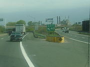
Most of the signage identifying the route as a "unified road" has been taken down in recent years. The easternmost section of the turnpike (SR 695) is not signed except as a connection between I-395 North and U.S. Route 6. Connecticut Turnpike trailblazers can still be found, although there are very few in existence today. One of the original Connecticut Turnpike trailblazers can be seen while driving along Center Street in Southport.
at the New York
state line. The Connecticut Turnpike stretches for 128 miles (206 km) across the state, but only the first 88 miles (141.6 km) of the Connecticut Turnpike is signed as I-95. The Turnpike portion of I-95 passes through the most heavily urbanized section of Connecticut along the shoreline between Greenwich and New Haven, going through the cities of Stamford
, Norwalk
, Bridgeport
, and New Haven
, with daily traffic volumes of 120,000 to over 150,000 throughout the entire 48 miles (77.2 km) length between the New York state line and the junction with I-91 in New Haven. The Turnpike intersects with several major expressways, namely U.S. Route 7
at Exit 15 in Norwalk, Route 8
at Exit 27A in Bridgeport, the Merritt
and Wilbur Cross Parkway
s at Exit 38 (via the Milford Parkway
) in Milford
, and Interstate 91
at Exit 48 in New Haven.
North (east) of I-91, the Turnpike continues along the Connecticut shoreline with a smaller amount of volume. The six-lane highway is reduced to four lanes in Branford
, interchanges with Route 9
at Exit 69 in Old Saybrook
, crosses the Connecticut River
on the Baldwin Bridge and continues until the interchange with Interstate 395
at Exit 76 near the East Lyme-Waterford line.
, Jewett City
and Plainfield until Exit 90, where the Governor John Davis Lodge Turnpike & I-395 split. I-395 continues north towards Worcester, Massachusetts
, ending at Interstate 290
and the Massachusetts Turnpike
. The Connecticut Turnpike officially ends at U.S. 6 (Danielson Pike) in Killingly, which continues on towards Providence, Rhode Island
.
to US 6 at the Rhode Island state line in Killingly
. The road is not signed as Route 695 but eastbound as "To US 6 East" and westbound as "To I-395 South". SR 695 would have become part of the now-defunct I-84
freeway between Hartford, Connecticut
and Providence, Rhode Island
, had that freeway been built. (Present-day Interstate 84 continues eastbound from Hartford into Massachusetts where it ends at Interstate 90, the Massachusetts Turnpike). There are two partial exits on SR 695. The sole numbered exit is Exit 90 (Squaw Rock Road) which is only accessible westbound. The unnumbered easternmost exit, located 1500 feet (457.2 m) east of the Squaw Rock Road onramp and accessible only eastbound, is for Ross Road, and the only onramp provided from Ross Road is for SR 695 westbound. The intersection with I-395
is only partial: there is no access provided from SR 695 westbound to I-395 northbound and no access from I-395 southbound to SR 695 eastbound.
(the Merritt
and Wilbur Cross
parkway
s), design work began in 1954. The Connecticut Turnpike opened on January 2, 1958; however, the westernmost portion of the highway (the three miles (5 km) connecting Greenwich
with the New England Thruway
) opened ten months later. Tolls were originally collected through a series of eight toll booths along the route. The state stopped collecting tolls on all portions of the Turnpike by December 31, 1985.
Local legend is the initial phase of Turnpike construction in 1954 was so disruptive in heavily Republican Fairfield County
that local voters there turned on incumbent Republican Governor John Davis Lodge
, leading to his defeat by Abraham Ribicoff.
toll plaza, killing seven people and injuring several others. The investigation following the crash determined that the truck driver fell asleep at the wheel just before the crash took place.
The turnpike was renamed after former Connecticut Governor John Davis Lodge
on December 31, 1985, two months after the tolls were removed.
In June 1983, a section of the Turnpike's northbound Mianus River Bridge
in Greenwich collapsed due to corrosion of its substructure, killing three motorists crossing it at the time.
On March 25, 2004 a tanker truck carrying fuel swerved to avoid a car that cut the truck off and subsequently overturned, dumping 8,000 gallons of home heating oil onto the Howard Avenue overpass in Bridgeport
. Passing vehicles kicked up the oil which ignited a towering inferno that subsequently melted the bridge structure and caused the southbound lanes to sag several feet. The northbound lanes, which received less damage from the fire, were opened five days later after being reinforced with temporary scaffolding. The southbound lanes opened on April 1, after a temporary bridge was erected.
and New Haven
counties. The Turnpike became a primary commuter route to New York City
. With additional segments of I-95 opening in the 1960s connecting to Providence
and Boston
, the Turnpike became an essential route for transporting people and goods throughout the Northeast
. As a result, much of the Turnpike had become functionally obsolete by 1965, with traffic exceeding its design capacity. Originally designed to carry 60,000 vehicles per day (VPD) on the 4-lane sections and 90,000 VPD on the 6-lane portion west of New Haven, the Turnpike carries 75,000-100,000 VPD east of New Haven, and 130,000-200,000 VPD between New Haven and the New York State line as of 2006.
There were dozens of plans discussed to alleviate traffic congestion and improve safety on the Turnpike for nearly 30 years, but most of these plans languished amid political infighting and lawsuits brought on by special-interest groups. Still, traffic and deadly accidents continued to increase each year on the Turnpike, and by the 1990s the Connecticut Turnpike had started to become known as "The Highway of Death."
Furthermore, while most of the Turnpike is signed as Interstate 95 or 395, the highway was designed and built before the Interstate Highway System
was established. As a result, much of the Turnpike does not meet Interstate standards, particularly with underpasses ranging from 13.5 feet (4.1 m) to 15 feet (Interstate standards require 16 feet (4.9 m) of vertical clearance). Interchanges are too closely spaced; ramps and acceleration/deceleration lanes need to be lengthened. In some areas, median and shoulder widths and curve radii also fall short of Interstate standards.
Complicating efforts to upgrade the Turnpike to Interstate standards is the fact that engineers did not acquire enough right-of-way to accommodate future expansion when the Connecticut Turnpike was built during the late 1950s. This means adjacent land must be seized to upgrade the Turnpike, resulting in lengthy and costly eminent domain
battles between the State of Connecticut and landowners refusing to give up their property. Additionally the Turnpike passes through areas with some of the highest property values in the country, making land acquisition for expanding the highway extremely expensive. Finally, the Turnpike was built through environmentally-sensitive ecosystems and wetlands associated with Long Island Sound
, meaning most expansion projects require lengthy environmental impact studies that are able to withstand constant litigation by environmental groups. Air pollution laws also cause conflict, since Connecticut is grouped into the federal statistical areas around New York City and it suffers from consequences and special regulations applied to non-complaint air quality areas. An example of this would be that it is easier to lengthen an entrance or exit ramp than to add a full lane, since adding any capacity to a road, by definition, will increase the pollution created by the road, further violating federal air quality standards. In 2000 one CONNDOT official commented during a public meeting on expanding Interstate 84
, "If we had tried to build I-95 today, it would be impossible because of the sensitive ecosystems it passes through. It would never get approved."
on June 28, 1983. Following the collapse, governor William A. O'Neill
initiated an $8 billion program to rehabilitate Connecticut's highways. Included in this program was the inspection and repair of the Turnpike's nearly 300 bridges and overpasses. Furthermore, Governor O'Neill directed the Connecticut Department of Transportation to develop a viable plan for addressing safety and congestion on the state's roads.
developed a comprehensive plan to improve the Turnpike through Fairfield and New Haven counties. In 1993 CONNDOT embarked on a 25-year multibillion dollar program to upgrade the Connecticut Turnpike from the Connecticut River
at Old Saybrook
to the New York state line at Greenwich
. The program included the complete reconstruction of several Turnpike segments, including replacing bridges, adding travel lanes, reconfiguring interchanges, upgrading lighting and signage, and implementing the Intelligent Transportation System
with traffic cameras, a variety of embedded roadway sensors, and variable-message signs. Since the start of the program, a 6 miles (9.7 km) section through Bridgeport
was completely rebuilt to Interstate standards. Work is currently underway on a long-term $2 billion program to rebuild 12 miles (19.3 km) of turnpike between West Haven
and Branford
including a new extradosed Pearl Harbor Memorial Bridge
over the Quinnipiac River
and New Haven Harbor
.
Plans to upgrade the Turnpike received a boost in 2005 when federal legislation known as SAFETEA-LU designated the I-95 portion of the Connecticut Turnpike from the New York state line to Waterford
as High Priority Corridor 65. Corridor 65 also includes the 24 miles (38.6 km) section of I-95 from Waterford to the Rhode Island state line that was built in 1964, which is not part of the Turnpike.
, a project completed in 2009. Aside from minor spot improvements, no other major projects are anticipated for this portion of the Turnpike.
(or open system), unlike toll roads in neighboring states, which used a ticket system
(closed system) for collecting tolls. Tolls on the Connecticut Turnpike were $0.35 and the toll barriers were located in the following locations, Greenwich, Norwalk, Stratford, West Haven, Branford, Madison, Montville, and Plainfield. Tolls also were collected until the early 1970s in Old Saybrook at the west end of the Baldwin Bridge over the Connecticut River. Additionally, unlike other toll roads which featured widely-spaced interchanges, the Connecticut Turnpike has over 90 interchanges along its 129 miles (207.6 km) length—50 of which are along the 50 miles (80.5 km) stretch between the New York State line and New Haven.
riders discovered that tokens purchased for use in the Connecticut Turnpike toll booths were of the same size and weight as New York City subway tokens. Since they cost less than one third as much, they began showing up in subway collection boxes regularly. Connecticut authorities initially agreed to change the size of their tokens, but later reneged, and the problem went unsolved until 1985, when Connecticut discontinued the tolls on its turnpike. At that time, the MTA was paid 17.5 cents for each of more than two million tokens that had been collected during the three year "token war."
and Glastonbury
). While the 1983 Stratford accident was cited as the main reason for abolishing tolls in Connecticut, the underlying reason was the fact that federal legislation at that time forbade states with toll roads from using federal funds for road projects. Because the Mianus River Bridge
was rebuilt with federal highway funds following its June 1983 collapse, Connecticut was required by Section 113(c) of the Federal Aid Highway Act of 1956
to remove tolls from the Turnpike once its construction bonds were paid off.
The debate over tolls on the Turnpike did not end in 1988 with the abolition of tolls in Connecticut. Prior to their removal in 1985, tolls on the Connecticut Turnpike generated over $65 million annually. Since their removal in the late 1980s, Connecticut lawmakers have continuously discussed reinstating tolls, but have balked at bringing tolls back out of fear of having to repay $2.6 billion in federal highway funds that Connecticut received for Turnpike construction projects following the abolition of tolls.
During the economic recession of the early 1990s, legislators studied reinstating tolls on parts of the Connecticut Turnpike and portions of highways around Hartford to make up for huge budget deficits. Proposals for reinstating tolls were scrapped in lieu of implementing an income tax
and increasing the state gasoline tax and sales tax, and imposing a new tax on corporate windfall profits.
. They replaced sit-down dining originally featured in some plazas. Some have small gift shops. The three easternmost plazas do not have food service, only gas stations and convenience stores. All plazas have pay phones and restrooms.
The former northbound Montville service area has been turned into a State Police barracks.
In addition to the Service Areas listed above, there is also a Rest Area, with restrooms, phone, picnic area, and seasonal tourist info located northbound at MP 74 between exits 65 and 66.
There are three State Police stations located on the turnpike:
Troop F — Westbrook at MP 74 on southbound side of turnpike.
Troop E — Montville at MP 96 on northbound side of turnpike (at former service plaza).
Troop G — Bridgeport at MP 29 and the junction with Routes 8 and 25.
There is one weigh station located northbound at MP 2 in Greenwich. Weigh stations on both sides of the Turnpike used to exist near Exit 18 in Westport; these were removed during the 1990s. The former southbound weigh station in Westport is now used by CONNDOT to store construction materials, while the northbound station was demolished; the grounds returned to their natural state.
The administration building for the former West Haven toll plaza can still be seen driving between Exits 42 and 43. Today, CONNDOT uses the old toll building as a maintenance facility.
Connecticut
Connecticut is a state in the New England region of the northeastern United States. It is bordered by Rhode Island to the east, Massachusetts to the north, and the state of New York to the west and the south .Connecticut is named for the Connecticut River, the major U.S. river that approximately...
that runs from Greenwich
Greenwich, Connecticut
Greenwich is a town in Fairfield County, Connecticut, United States. As of the 2010 census, the town had a total population of 61,171. It is home to many hedge funds and other financial service companies. Greenwich is the southernmost and westernmost municipality in Connecticut and is 38+ minutes ...
to Killingly
Killingly, Connecticut
Killingly is a town in Windham County, Connecticut, United States. The population was 16,472 at the 2000 census. It consists of the borough of Danielson and the villages of Attawaugan, Ballouville, Dayville, East Killingly, Rogers, and South Killingly....
. It is signed as Interstate 95 from the New York
New York
New York is a state in the Northeastern region of the United States. It is the nation's third most populous state. New York is bordered by New Jersey and Pennsylvania to the south, and by Connecticut, Massachusetts and Vermont to the east...
state line at Greenwich to East Lyme
East Lyme, Connecticut
East Lyme is a town in New London County, Connecticut, United States. The population was 18,118 at the 2000 census. The latitude of East Lyme is 41.353N...
, and then as Interstate 395
Interstate 395 (Connecticut)
Interstate 395 is a 67-mile-long north–south Interstate Highway that begins at Interstate 95 in East Lyme, Connecticut and ends at Interstate 90 in Auburn, Massachusetts, where it becomes Interstate 290. The original designation for the freeway was Route 52...
from East Lyme to Plainfield
Plainfield, Connecticut
Plainfield is a town in Windham County, Connecticut, United States. The population was 14,619 at the 2000 census. The town comprises four villages: Plainfield , Moosup , Wauregan , and Central Village . Each village has their own respective United States Post Office and fire department...
. A short unnumbered section (unsigned State Road 695) continues the Turnpike where it officially ends at Killingly, continuing as U.S. 6 East at the Rhode Island
Rhode Island
The state of Rhode Island and Providence Plantations, more commonly referred to as Rhode Island , is a state in the New England region of the United States. It is the smallest U.S. state by area...
state line. The Turnpike is 128.47 miles (206.8 km) long (88.48 miles (142.4 km) on Interstate 95, 35.5 miles (57.1 km) on Interstate 395, and 4.49 miles (7.2 km) on State Road 695) and carries an annual average daily traffic of over 150,000 in some sections west of New Haven.
Most of the signage identifying the route as a "unified road" has been taken down in recent years. The easternmost section of the turnpike (SR 695) is not signed except as a connection between I-395 North and U.S. Route 6. Connecticut Turnpike trailblazers can still be found, although there are very few in existence today. One of the original Connecticut Turnpike trailblazers can be seen while driving along Center Street in Southport.
Route description
I-95
Interstate 95 enters Connecticut as the Connecticut Turnpike in GreenwichGreenwich, Connecticut
Greenwich is a town in Fairfield County, Connecticut, United States. As of the 2010 census, the town had a total population of 61,171. It is home to many hedge funds and other financial service companies. Greenwich is the southernmost and westernmost municipality in Connecticut and is 38+ minutes ...
at the New York
New York
New York is a state in the Northeastern region of the United States. It is the nation's third most populous state. New York is bordered by New Jersey and Pennsylvania to the south, and by Connecticut, Massachusetts and Vermont to the east...
state line. The Connecticut Turnpike stretches for 128 miles (206 km) across the state, but only the first 88 miles (141.6 km) of the Connecticut Turnpike is signed as I-95. The Turnpike portion of I-95 passes through the most heavily urbanized section of Connecticut along the shoreline between Greenwich and New Haven, going through the cities of Stamford
Stamford, Connecticut
Stamford is a city in Fairfield County, Connecticut, United States. According to the 2010 census, the population of the city is 122,643, making it the fourth largest city in the state and the eighth largest city in New England...
, Norwalk
Norwalk, Connecticut
Norwalk is a city in Fairfield County, Connecticut, United States. According to the 2010 U.S. Census, the population of the city is 85,603, making Norwalk sixth in population in Connecticut, and third in Fairfield County...
, Bridgeport
Bridgeport, Connecticut
Bridgeport is the most populous city in the U.S. state of Connecticut. Located in Fairfield County, the city had an estimated population of 144,229 at the 2010 United States Census and is the core of the Greater Bridgeport area...
, and New Haven
New Haven, Connecticut
New Haven is the second-largest city in Connecticut and the sixth-largest in New England. According to the 2010 Census, New Haven's population increased by 5.0% between 2000 and 2010, a rate higher than that of the State of Connecticut, and higher than that of the state's five largest cities, and...
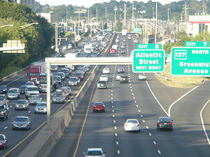
, with daily traffic volumes of 120,000 to over 150,000 throughout the entire 48 miles (77.2 km) length between the New York state line and the junction with I-91 in New Haven. The Turnpike intersects with several major expressways, namely U.S. Route 7
U.S. Route 7
U.S. Route 7 is a north–south United States highway in western New England that runs for from Norwalk, Connecticut, to Highgate, Vermont. The highway's southern terminus is at Interstate 95 in Norwalk, Connecticut...
at Exit 15 in Norwalk, Route 8
Route 8 (Connecticut)
Route 8 is the portion of the multistate New England Route 8 within the state of Connecticut. It is a state highway running north–south from Bridgeport, through Waterbury, all the way to the Massachusetts state line where it continues as Route 8...
at Exit 27A in Bridgeport, the Merritt
Merritt Parkway
The Merritt Parkway is a historic limited-access parkway in Fairfield County, Connecticut. The parkway is known for its scenic layout, its uniquely styled signage, and the architecturally elaborate overpasses along the route. It is designated as a National Scenic Byway and is also listed in the...
and Wilbur Cross Parkway
Wilbur Cross Parkway
The Wilbur Cross Parkway is a limited access road in Connecticut, comprising the portion of Route 15 between Milford and Meriden. It is named after Wilbur Lucius Cross, a former governor of the state...
s at Exit 38 (via the Milford Parkway
Milford Parkway (Connecticut)
The Milford Parkway, officially the Daniel S. Wasson Connector, is a long freeway between U.S. Route 1 and the Wilbur Cross Parkway in the city of Milford, Connecticut. The highway has one intermediate exit to Interstate 95. The highway is officially designated by the Connecticut Department of...
) in Milford
Milford, Connecticut
Milford is a coastal city in southwestern New Haven County, Connecticut, United States, located between Bridgeport and New Haven. The population was 52,759 at the 2010 census...
, and Interstate 91
Interstate 91
Interstate 91 is an Interstate Highway in the New England region of the United States. It provides the primary north–south thoroughfare in the western part of New England...
at Exit 48 in New Haven.
North (east) of I-91, the Turnpike continues along the Connecticut shoreline with a smaller amount of volume. The six-lane highway is reduced to four lanes in Branford
Branford, Connecticut
-Landmarks and attractions:Branford has six historic districts that are listed on the U.S. National Register of Historic Places . These include buildings in Federal, Arts and Crafts, and Queen Anne styles of architecture...
, interchanges with Route 9
Route 9 (Connecticut)
Route 9 is a , 4-lane freeway beginning in Old Saybrook and ending at the Farmington-West Hartford town line.-Route description:Route 9 begins at an interchange with I-95/U.S. 1, on the west banks of the Connecticut River...
at Exit 69 in Old Saybrook
Old Saybrook, Connecticut
Old Saybrook is a town in Middlesex County, Connecticut, United States. The population was 10,367 at the 2000 census. It contains the incorporated borough of Fenwick, as well as the census-designated places of Old Saybrook Center and Saybrook Manor.-History:...
, crosses the Connecticut River
Connecticut River
The Connecticut River is the largest and longest river in New England, and also an American Heritage River. It flows roughly south, starting from the Fourth Connecticut Lake in New Hampshire. After flowing through the remaining Connecticut Lakes and Lake Francis, it defines the border between the...
on the Baldwin Bridge and continues until the interchange with Interstate 395
Interstate 395 (Connecticut)
Interstate 395 is a 67-mile-long north–south Interstate Highway that begins at Interstate 95 in East Lyme, Connecticut and ends at Interstate 90 in Auburn, Massachusetts, where it becomes Interstate 290. The original designation for the freeway was Route 52...
at Exit 76 near the East Lyme-Waterford line.
I-395
The Turnpike leaves I-95 at Exit 76 in East Lyme continuing on as I-395 North heading towards NorwichNorwich, Connecticut
Regular steamship service between New York and Boston helped Norwich to prosper as a shipping center through the early part of the 20th century. During the Civil War, Norwich once again rallied and saw the growth of its textile, armaments, and specialty item manufacturing...
, Jewett City
Jewett City, Connecticut
Jewett City is a borough in New London County, Connecticut, in the town of Griswold. The population was 3,053 people at the 2000 census.-Geography:...
and Plainfield until Exit 90, where the Governor John Davis Lodge Turnpike & I-395 split. I-395 continues north towards Worcester, Massachusetts
Worcester, Massachusetts
Worcester is a city and the county seat of Worcester County, Massachusetts, United States. Named after Worcester, England, as of the 2010 Census the city's population is 181,045, making it the second largest city in New England after Boston....
, ending at Interstate 290
Interstate 290 (Massachusetts)
Interstate 290 runs for from Auburn, Massachusetts to Marlborough, Massachusetts. It is a continuation of I-395 north of I-90 and runs through downtown Worcester, Massachusetts, I-190 splits off, and I-290 runs across Lake Quinsigamond and east to I-495 in Marlborough...
and the Massachusetts Turnpike
Massachusetts Turnpike
The Massachusetts Turnpike is the easternmost stretch of Interstate 90. The Turnpike begins at the western border of Massachusetts in West Stockbridge connecting with the Berkshire Connector portion of the New York State Thruway...
. The Connecticut Turnpike officially ends at U.S. 6 (Danielson Pike) in Killingly, which continues on towards Providence, Rhode Island
Providence, Rhode Island
Providence is the capital and most populous city of Rhode Island and was one of the first cities established in the United States. Located in Providence County, it is the third largest city in the New England region...
.
SR 695
State Road 695 (SR 695) is the 4.49 miles (7.2 km) unsigned portion of the Turnpike from I-395 in PlainfieldPlainfield, Connecticut
Plainfield is a town in Windham County, Connecticut, United States. The population was 14,619 at the 2000 census. The town comprises four villages: Plainfield , Moosup , Wauregan , and Central Village . Each village has their own respective United States Post Office and fire department...
to US 6 at the Rhode Island state line in Killingly
Killingly, Connecticut
Killingly is a town in Windham County, Connecticut, United States. The population was 16,472 at the 2000 census. It consists of the borough of Danielson and the villages of Attawaugan, Ballouville, Dayville, East Killingly, Rogers, and South Killingly....
. The road is not signed as Route 695 but eastbound as "To US 6 East" and westbound as "To I-395 South". SR 695 would have become part of the now-defunct I-84
Interstate 84 in Connecticut
Interstate 84 is an East–West Interstate highway across the state of Connecticut into Danbury, Waterbury, Hartford and Union.-Route description:...
freeway between Hartford, Connecticut
Hartford, Connecticut
Hartford is the capital of the U.S. state of Connecticut. The seat of Hartford County until Connecticut disbanded county government in 1960, it is the second most populous city on New England's largest river, the Connecticut River. As of the 2010 Census, Hartford's population was 124,775, making...
and Providence, Rhode Island
Providence, Rhode Island
Providence is the capital and most populous city of Rhode Island and was one of the first cities established in the United States. Located in Providence County, it is the third largest city in the New England region...
, had that freeway been built. (Present-day Interstate 84 continues eastbound from Hartford into Massachusetts where it ends at Interstate 90, the Massachusetts Turnpike). There are two partial exits on SR 695. The sole numbered exit is Exit 90 (Squaw Rock Road) which is only accessible westbound. The unnumbered easternmost exit, located 1500 feet (457.2 m) east of the Squaw Rock Road onramp and accessible only eastbound, is for Ross Road, and the only onramp provided from Ross Road is for SR 695 westbound. The intersection with I-395
Interstate 395 (Connecticut)
Interstate 395 is a 67-mile-long north–south Interstate Highway that begins at Interstate 95 in East Lyme, Connecticut and ends at Interstate 90 in Auburn, Massachusetts, where it becomes Interstate 290. The original designation for the freeway was Route 52...
is only partial: there is no access provided from SR 695 westbound to I-395 northbound and no access from I-395 southbound to SR 695 eastbound.
History
The general route and construction of the Turnpike were both mandated by state law. Intended to relieve congestion on U.S. Route 1 and Route 15Route 15 (Connecticut)
Route 15 is a state highway in the U.S. state of Connecticut that runs from a connection with New York's Hutchinson River Parkway in Greenwich, Connecticut to its northern terminus intersecting with Interstate 84 in East Hartford, Connecticut...
(the Merritt
Merritt Parkway
The Merritt Parkway is a historic limited-access parkway in Fairfield County, Connecticut. The parkway is known for its scenic layout, its uniquely styled signage, and the architecturally elaborate overpasses along the route. It is designated as a National Scenic Byway and is also listed in the...
and Wilbur Cross
Wilbur Cross Parkway
The Wilbur Cross Parkway is a limited access road in Connecticut, comprising the portion of Route 15 between Milford and Meriden. It is named after Wilbur Lucius Cross, a former governor of the state...
parkway
Parkway
The term parkway has several distinct principal meanings and numerous synonyms around the world, for either a type of landscaped area or a type of road.Type of landscaped area:...
s), design work began in 1954. The Connecticut Turnpike opened on January 2, 1958; however, the westernmost portion of the highway (the three miles (5 km) connecting Greenwich
Greenwich, Connecticut
Greenwich is a town in Fairfield County, Connecticut, United States. As of the 2010 census, the town had a total population of 61,171. It is home to many hedge funds and other financial service companies. Greenwich is the southernmost and westernmost municipality in Connecticut and is 38+ minutes ...
with the New England Thruway
New England Thruway
The New England Thruway is a portion of the U.S. Interstate highway system and of the New York State Thruway, within and operated by the New York State Thruway Authority, linking New York City with New England, specifically with southwestern Connecticut...
) opened ten months later. Tolls were originally collected through a series of eight toll booths along the route. The state stopped collecting tolls on all portions of the Turnpike by December 31, 1985.
Local legend is the initial phase of Turnpike construction in 1954 was so disruptive in heavily Republican Fairfield County
Fairfield County, Connecticut
Fairfield County is a county located in the southwestern corner of the U.S. state of Connecticut. The county population is 916,829 according to the 2010 Census. There are currently 1,465 people per square mile in the county. It is the most populous county in the State of Connecticut and contains...
that local voters there turned on incumbent Republican Governor John Davis Lodge
John Davis Lodge
John Davis Lodge , was an American politician, and 79th Governor of Connecticut from 1951 to 1955. He was also an actor and U.S. Ambassador to Spain, Argentina and Switzerland.-Early life:Lodge was born in Washington, D.C....
, leading to his defeat by Abraham Ribicoff.
Accidents
Several accidents prompted the state to eliminate tolls along the turnpike altogether. Arguably the most notorious of these was a serious incident on January 19, 1983, in which a truck collided with four cars at the StratfordStratford, Connecticut
Stratford is a town in Fairfield County, Connecticut, United States, located on Long Island Sound at the mouth of the Housatonic River. It was founded by Puritans in 1639....
toll plaza, killing seven people and injuring several others. The investigation following the crash determined that the truck driver fell asleep at the wheel just before the crash took place.
The turnpike was renamed after former Connecticut Governor John Davis Lodge
John Davis Lodge
John Davis Lodge , was an American politician, and 79th Governor of Connecticut from 1951 to 1955. He was also an actor and U.S. Ambassador to Spain, Argentina and Switzerland.-Early life:Lodge was born in Washington, D.C....
on December 31, 1985, two months after the tolls were removed.
In June 1983, a section of the Turnpike's northbound Mianus River Bridge
Mianus River Bridge
The Mianus River Bridge carries Interstate 95 over the Mianus River in the Cos Cob section of Greenwich, Connecticut. The bridge suffered a 1983 collapse, killing several motorists. The replacement span is officially named the Michael L...
in Greenwich collapsed due to corrosion of its substructure, killing three motorists crossing it at the time.
On March 25, 2004 a tanker truck carrying fuel swerved to avoid a car that cut the truck off and subsequently overturned, dumping 8,000 gallons of home heating oil onto the Howard Avenue overpass in Bridgeport
Bridgeport, Connecticut
Bridgeport is the most populous city in the U.S. state of Connecticut. Located in Fairfield County, the city had an estimated population of 144,229 at the 2010 United States Census and is the core of the Greater Bridgeport area...
. Passing vehicles kicked up the oil which ignited a towering inferno that subsequently melted the bridge structure and caused the southbound lanes to sag several feet. The northbound lanes, which received less damage from the fire, were opened five days later after being reinforced with temporary scaffolding. The southbound lanes opened on April 1, after a temporary bridge was erected.
Relieving gridlock
Turnpike upgrades stalled by budget deficits, lawsuits
The Connecticut Turnpike opened southwest Connecticut to a mass migration of New Yorkers, leading to substantial residential and economic growth in FairfieldFairfield County, Connecticut
Fairfield County is a county located in the southwestern corner of the U.S. state of Connecticut. The county population is 916,829 according to the 2010 Census. There are currently 1,465 people per square mile in the county. It is the most populous county in the State of Connecticut and contains...
and New Haven
New Haven County, Connecticut
New Haven County is a county located in the south central part of the U.S. state of Connecticut. As of the 2010 Census, the county population is 862,477 making it the third most populated county in Connecticut. There are 1,340 people per square mile...
counties. The Turnpike became a primary commuter route to New York City
New York City
New York is the most populous city in the United States and the center of the New York Metropolitan Area, one of the most populous metropolitan areas in the world. New York exerts a significant impact upon global commerce, finance, media, art, fashion, research, technology, education, and...
. With additional segments of I-95 opening in the 1960s connecting to Providence
Providence, Rhode Island
Providence is the capital and most populous city of Rhode Island and was one of the first cities established in the United States. Located in Providence County, it is the third largest city in the New England region...
and Boston
Boston
Boston is the capital of and largest city in Massachusetts, and is one of the oldest cities in the United States. The largest city in New England, Boston is regarded as the unofficial "Capital of New England" for its economic and cultural impact on the entire New England region. The city proper had...
, the Turnpike became an essential route for transporting people and goods throughout the Northeast
Northeastern United States
The Northeastern United States is a region of the United States as defined by the United States Census Bureau.-Composition:The region comprises nine states: the New England states of Connecticut, Maine, Massachusetts, New Hampshire, Rhode Island and Vermont; and the Mid-Atlantic states of New...
. As a result, much of the Turnpike had become functionally obsolete by 1965, with traffic exceeding its design capacity. Originally designed to carry 60,000 vehicles per day (VPD) on the 4-lane sections and 90,000 VPD on the 6-lane portion west of New Haven, the Turnpike carries 75,000-100,000 VPD east of New Haven, and 130,000-200,000 VPD between New Haven and the New York State line as of 2006.
There were dozens of plans discussed to alleviate traffic congestion and improve safety on the Turnpike for nearly 30 years, but most of these plans languished amid political infighting and lawsuits brought on by special-interest groups. Still, traffic and deadly accidents continued to increase each year on the Turnpike, and by the 1990s the Connecticut Turnpike had started to become known as "The Highway of Death."
Furthermore, while most of the Turnpike is signed as Interstate 95 or 395, the highway was designed and built before the Interstate Highway System
Interstate Highway System
The Dwight D. Eisenhower National System of Interstate and Defense Highways, , is a network of limited-access roads including freeways, highways, and expressways forming part of the National Highway System of the United States of America...
was established. As a result, much of the Turnpike does not meet Interstate standards, particularly with underpasses ranging from 13.5 feet (4.1 m) to 15 feet (Interstate standards require 16 feet (4.9 m) of vertical clearance). Interchanges are too closely spaced; ramps and acceleration/deceleration lanes need to be lengthened. In some areas, median and shoulder widths and curve radii also fall short of Interstate standards.
Complicating efforts to upgrade the Turnpike to Interstate standards is the fact that engineers did not acquire enough right-of-way to accommodate future expansion when the Connecticut Turnpike was built during the late 1950s. This means adjacent land must be seized to upgrade the Turnpike, resulting in lengthy and costly eminent domain
Eminent domain
Eminent domain , compulsory purchase , resumption/compulsory acquisition , or expropriation is an action of the state to seize a citizen's private property, expropriate property, or seize a citizen's rights in property with due monetary compensation, but without the owner's consent...
battles between the State of Connecticut and landowners refusing to give up their property. Additionally the Turnpike passes through areas with some of the highest property values in the country, making land acquisition for expanding the highway extremely expensive. Finally, the Turnpike was built through environmentally-sensitive ecosystems and wetlands associated with Long Island Sound
Long Island Sound
Long Island Sound is an estuary of the Atlantic Ocean, located in the United States between Connecticut to the north and Long Island, New York to the south. The mouth of the Connecticut River at Old Saybrook, Connecticut, empties into the sound. On its western end the sound is bounded by the Bronx...
, meaning most expansion projects require lengthy environmental impact studies that are able to withstand constant litigation by environmental groups. Air pollution laws also cause conflict, since Connecticut is grouped into the federal statistical areas around New York City and it suffers from consequences and special regulations applied to non-complaint air quality areas. An example of this would be that it is easier to lengthen an entrance or exit ramp than to add a full lane, since adding any capacity to a road, by definition, will increase the pollution created by the road, further violating federal air quality standards. In 2000 one CONNDOT official commented during a public meeting on expanding Interstate 84
Interstate 84 (east)
Interstate 84 is an Interstate Highway extending from Dunmore, Pennsylvania at an interchange with Interstate 81 to Sturbridge, Massachusetts, at an interchange with the Massachusetts Turnpike . I-84 has mile-log junction numbering in Pennsylvania; otherwise, exit numbers are roughly sequential...
, "If we had tried to build I-95 today, it would be impossible because of the sensitive ecosystems it passes through. It would never get approved."
Bridge collapse jumpstarts turnpike upgrades
A comprehensive plan to address safety and capacity issues on the Connecticut Turnpike did not progress beyond the initial planning stages until the collapse of the Mianus River BridgeMianus River Bridge
The Mianus River Bridge carries Interstate 95 over the Mianus River in the Cos Cob section of Greenwich, Connecticut. The bridge suffered a 1983 collapse, killing several motorists. The replacement span is officially named the Michael L...
on June 28, 1983. Following the collapse, governor William A. O'Neill
William O'Neill (Connecticut politician)
William Atchison O'Neill was a twentieth century U.S. political figure, most notably as the 84th Governor of Connecticut from 1980 to 1991....
initiated an $8 billion program to rehabilitate Connecticut's highways. Included in this program was the inspection and repair of the Turnpike's nearly 300 bridges and overpasses. Furthermore, Governor O'Neill directed the Connecticut Department of Transportation to develop a viable plan for addressing safety and congestion on the state's roads.
High-priority status for Connecticut Turnpike
Throughout the late 1980s and early 1990s the Connecticut Department of TransportationConnecticut Department of Transportation
The Connecticut Department of Transportation is responsible for the development and operation of highways, railroads, mass transit systems, ports, waterways and aviation facilities in the U.S. state of Connecticut. The current Commissioner of ConnDOT is Jeffrey Parker...
developed a comprehensive plan to improve the Turnpike through Fairfield and New Haven counties. In 1993 CONNDOT embarked on a 25-year multibillion dollar program to upgrade the Connecticut Turnpike from the Connecticut River
Connecticut River
The Connecticut River is the largest and longest river in New England, and also an American Heritage River. It flows roughly south, starting from the Fourth Connecticut Lake in New Hampshire. After flowing through the remaining Connecticut Lakes and Lake Francis, it defines the border between the...
at Old Saybrook
Old Saybrook, Connecticut
Old Saybrook is a town in Middlesex County, Connecticut, United States. The population was 10,367 at the 2000 census. It contains the incorporated borough of Fenwick, as well as the census-designated places of Old Saybrook Center and Saybrook Manor.-History:...
to the New York state line at Greenwich
Greenwich, Connecticut
Greenwich is a town in Fairfield County, Connecticut, United States. As of the 2010 census, the town had a total population of 61,171. It is home to many hedge funds and other financial service companies. Greenwich is the southernmost and westernmost municipality in Connecticut and is 38+ minutes ...
. The program included the complete reconstruction of several Turnpike segments, including replacing bridges, adding travel lanes, reconfiguring interchanges, upgrading lighting and signage, and implementing the Intelligent Transportation System
Intelligent transportation system
The term intelligent transportation systems refers to information and communication technology that improve transport outcomes such as transport safety, transport productivity, travel reliability, informed travel choices, social equity, environmental performance and network operation...
with traffic cameras, a variety of embedded roadway sensors, and variable-message signs. Since the start of the program, a 6 miles (9.7 km) section through Bridgeport
Bridgeport, Connecticut
Bridgeport is the most populous city in the U.S. state of Connecticut. Located in Fairfield County, the city had an estimated population of 144,229 at the 2010 United States Census and is the core of the Greater Bridgeport area...
was completely rebuilt to Interstate standards. Work is currently underway on a long-term $2 billion program to rebuild 12 miles (19.3 km) of turnpike between West Haven
West Haven, Connecticut
West Haven is a city in New Haven County, Connecticut, United States. According to 2006 Census Bureau estimates, the population of the city is 52,721.-History:...
and Branford
Branford, Connecticut
-Landmarks and attractions:Branford has six historic districts that are listed on the U.S. National Register of Historic Places . These include buildings in Federal, Arts and Crafts, and Queen Anne styles of architecture...
including a new extradosed Pearl Harbor Memorial Bridge
Pearl Harbor Memorial Bridge (Connecticut)
-Bridge plans bring controversy:The existing Q-Bridge opened with a design capacity of 90,000 vehicles per day , but as of 2006 more than 150,000 vehicles cross the span daily...
over the Quinnipiac River
Quinnipiac River
The Quinnipiac River is a river in the New England region of the United States, located entirely in the state of Connecticut.It rises in west central Connecticut from Dead Wood Swamp west of the city of New Britain...
and New Haven Harbor
New Haven Harbor
New Haven Harbor is an inlet on the north side of Long Island Sound in the state of Connecticut in the United States. The harbor area is an inlet carved by the retreat of the glaciers during the last ice age approximately 13,000 years ago....
.
Plans to upgrade the Turnpike received a boost in 2005 when federal legislation known as SAFETEA-LU designated the I-95 portion of the Connecticut Turnpike from the New York state line to Waterford
Waterford, Connecticut
Waterford is a town in New London County, Connecticut, United States. It is named after Waterford, Ireland. The population was 19,152 at the 2000 census. The town center is listed as a census-designated place .-Geography:...
as High Priority Corridor 65. Corridor 65 also includes the 24 miles (38.6 km) section of I-95 from Waterford to the Rhode Island state line that was built in 1964, which is not part of the Turnpike.
Plans for the I-395/CT-695 section
Traffic is relatively light on the rural I-395 section and the northeast leg (Connecticut Route 695) in Killingly; this section is largely unchanged from its original 1958 profile. The only major project on this section is the reconstruction of the northbound on and off ramps at Exit 80 in NorwichNorwich, Connecticut
Regular steamship service between New York and Boston helped Norwich to prosper as a shipping center through the early part of the 20th century. During the Civil War, Norwich once again rallied and saw the growth of its textile, armaments, and specialty item manufacturing...
, a project completed in 2009. Aside from minor spot improvements, no other major projects are anticipated for this portion of the Turnpike.
Improvement projects
- Raymond E. Baldwin BridgeRaymond E. Baldwin BridgeThe Baldwin Bridge is a concrete segmental bridge composed of eleven spans crossing the Connecticut River between Old Saybrook, Connecticut and Old Lyme, Connecticut. The bridge carries Interstate 95 and U.S. Route 1, with an average daily traffic of 82,500....
Replacement (Connecticut River), Old Saybrook (to Old Lyme): $460 million, completed in 1994 - Saugatuck RiverSaugatuck RiverThe Saugatuck River is a river in southwestern Connecticut in the United States. It drains part of suburban and rural Fairfield County west of Bridgeport, emptying into Long Island Sound.-Description:...
Bridge Replacement, Westport: $65 million, completed in 1996 - Lake SaltonstallLake SaltonstallLake Saltonstall is a long narrow lake located in south-central Connecticut. It covers an area of approximately and is nestled in the center of the trap rock Saltonstall Mountain...
Bridge Widening, East Haven: $50 million, completed in 1997 - Widening/reconstruction Exits 8-10, Stamford: $80 million, completed in 2000
- Reconstruction of Interchange 40, Milford: $30 million, completed in 2002
- Reconstruction of Interchange 41, Orange: $60 million, completed in 2000
- Reconstruction/widening Exits 23-30, Bridgeport: $570 million, completed in 2006 (two years behind schedule and $170 million over budget) (NOTE 1)
- Widening between Exits 51 to 54, East Haven/Branford: $86 million, completed in 2006
- Reconfigure northbound ramps at Exit 80, Norwich: $8 million, started in April 2009, estimated completion in November 2009.
- Widening between Exits 51 and 49 (NOTE 2), East Haven/New Haven: $70 million, started in 2005, completed in 2008
- Pearl Harbor Memorial BridgePearl Harbor Memorial Bridge (Connecticut)-Bridge plans bring controversy:The existing Q-Bridge opened with a design capacity of 90,000 vehicles per day , but as of 2006 more than 150,000 vehicles cross the span daily...
Replacement, New Haven: $490 million, started in 2008, expected completion 2015 (NOTE 3) - I-91Interstate 91 in ConnecticutInterstate 91 is a north–south Interstate Highway in the state of Connecticut. The interstate's southern end is in New Haven, Connecticut at Interstate 95.-Route description:...
/Route 34 Interchange Reconstruction, New Haven: $270 million, initial phases started in 2004, expected completion in 2016 - Interchange 42 reconstruction, West Haven: $36 million, started in 2003, completed in 2007
- Housatonic RiverHousatonic RiverThe Housatonic River is a river, approximately long, in western Massachusetts and western Connecticut in the United States. It flows south to southeast, and drains about of southwestern New England into Long Island Sound...
Bridge replacement, Milford/Stratford: $300 million, work started in September 2009, expected completion in 2015 - West RiverWest River (Connecticut)The West River is a freshwater stream in southern Connecticut. It flows through the towns of Bethany, Woodbridge, and New Haven before discharging into the West Haven Harbor....
Bridge replacement and widening (including reconstructing Exit 44 and removing Exit 45), New Haven: $200 million, expected start in 2011, expected completion in 2015 - Widening between Exits 10 and 13, Darien: $35 million, started in 2008, completed in 2010
- Widening between Exits 13 and 16 (including replacement of the Yankee Doodle Bridge over the Norwalk River), Norwalk: Cost TBD, start time TBD, expected completion TBD
- Widening/reconstruction Exits 45 to 47 (Long Wharf Section), New Haven: $200–500 million, started in 2009, expected completion 2013
- Reconfigure the I-95/I-395/US 1 interchange to accommodate the future Route 11Route 11 (Connecticut)Route 11 is a state highway in east-central Connecticut, serving traffic between the Hartford and New London areas . It was originally planned to be a freeway from Colchester to Waterford. However, only about half of the freeway was constructed and it ends in Salem...
expressway, Waterford: Cost TBD, start time TBD, expected completion TBD. - Add a travel lane in each direction from Branford to Waterford: $1.0 billion, start time TBD, expected completion TBD.
- Reconstruction and widening Exits 6-8, Stamford: Cost TBD, expected start TBD, expected completion TBD.
- In addition CONNDOT has been reconstructing the median of the Turnpike in stages, replacing the pre-existing steel guiderail and grass divider with a 6 feet (1.8 m) wide, 48-inch tall Jersey barrierJersey barrierA Jersey barrier or Jersey wall is a modular concrete barrier employed to separate lanes of traffic. It is designed to both minimize vehicle damage in cases of incidental contact while still preventing crossover in the case of head-on accidents....
along the highway's length from the Baldwin Bridge to the New York State line.
- Exit 49 was permanently closed in October 2006 as part of this project. Access to Stiles Street is now provided at Exit 50 via the newly-constructed Waterfront Connector. The Southbound On-ramp still exists onto the Pearl Harbor Memorial Bridge.
- The southbound offramp and northbound onramp for Exit 28 were removed in 2000 during reconstruction of the Connecticut Turnpike in Bridgeport.
- Replacement of the Pearl Harbor Memorial Bridge in New Haven was planned to start in 2007. Due to the rising cost of materials however, there were no contractors interested in the project when it was advertised for bid in 2006. CONNDOT has since broken the project up into several smaller contracts, with the first contracts scheduled for bid in October 2007.
Tolls
Tolls on the Turnpike have been a source of controversy from the Turnpike's opening in 1958 to the removal of tolls in 1985, and the debate continues today. The Connecticut Turnpike originally opened with a barrier toll systemBarrier toll system
A barrier toll system is a method of collecting tolls on highways using toll barriers at regularly spaced intervals on the toll road's mainline. Motorists are typically charged a flat-rate toll, unlike toll roads with a ticket system where the toll rate is determined by the distance traveled or...
(or open system), unlike toll roads in neighboring states, which used a ticket system
Ticket system
A ticket system toll road A ticket system toll road A ticket system toll road (also known as closed toll collection system, as opposed to a flat-rate toll road, is utilized by some state toll road or highway agencies that allows a motorist to pay a toll rate based on the number of miles traveled...
(closed system) for collecting tolls. Tolls on the Connecticut Turnpike were $0.35 and the toll barriers were located in the following locations, Greenwich, Norwalk, Stratford, West Haven, Branford, Madison, Montville, and Plainfield. Tolls also were collected until the early 1970s in Old Saybrook at the west end of the Baldwin Bridge over the Connecticut River. Additionally, unlike other toll roads which featured widely-spaced interchanges, the Connecticut Turnpike has over 90 interchanges along its 129 miles (207.6 km) length—50 of which are along the 50 miles (80.5 km) stretch between the New York State line and New Haven.
Token War with New York City Subway
There was some controversy in the early 1980s when New York City SubwayNew York City Subway
The New York City Subway is a rapid transit system owned by the City of New York and leased to the New York City Transit Authority, a subsidiary agency of the Metropolitan Transportation Authority and also known as MTA New York City Transit...
riders discovered that tokens purchased for use in the Connecticut Turnpike toll booths were of the same size and weight as New York City subway tokens. Since they cost less than one third as much, they began showing up in subway collection boxes regularly. Connecticut authorities initially agreed to change the size of their tokens, but later reneged, and the problem went unsolved until 1985, when Connecticut discontinued the tolls on its turnpike. At that time, the MTA was paid 17.5 cents for each of more than two million tokens that had been collected during the three year "token war."
Connecticut abolishes tolls
After the 1983 truck crash that killed 7 people at the Stratford toll plaza, toll opponents pressured the State of Connecticut to remove tolls from the Turnpike in 1985. Three years later, these same opponents successfully lobbied the Connecticut General Assembly to pass legislation abolishing tolls on all of Connecticut's highways (with the exception of two car ferries across the Connecticut River in ChesterChester, Connecticut
Chester is a town in Middlesex County, Connecticut, United States. The population was 3,743 at the 2000 census. The town center is also defined by the U.S. Census Bureau as a census-designated place .-Geography:...
and Glastonbury
Glastonbury, Connecticut
Glastonbury is a town in Hartford County, Connecticut, United States, founded in 1693. The population was 31,876 at the 2000 census. The town was named after Glastonbury in Somerset, England. Glastonbury is located on the banks of the Connecticut River, 7 miles southeast of Hartford. The town...
). While the 1983 Stratford accident was cited as the main reason for abolishing tolls in Connecticut, the underlying reason was the fact that federal legislation at that time forbade states with toll roads from using federal funds for road projects. Because the Mianus River Bridge
Mianus River Bridge
The Mianus River Bridge carries Interstate 95 over the Mianus River in the Cos Cob section of Greenwich, Connecticut. The bridge suffered a 1983 collapse, killing several motorists. The replacement span is officially named the Michael L...
was rebuilt with federal highway funds following its June 1983 collapse, Connecticut was required by Section 113(c) of the Federal Aid Highway Act of 1956
Federal Aid Highway Act of 1956
The Federal-Aid Highway Act of 1956, popularly known as the National Interstate and Defense Highways Act , was enacted on June 29, 1956, when Dwight D. Eisenhower signed the bill into law...
to remove tolls from the Turnpike once its construction bonds were paid off.
The debate over tolls on the Turnpike did not end in 1988 with the abolition of tolls in Connecticut. Prior to their removal in 1985, tolls on the Connecticut Turnpike generated over $65 million annually. Since their removal in the late 1980s, Connecticut lawmakers have continuously discussed reinstating tolls, but have balked at bringing tolls back out of fear of having to repay $2.6 billion in federal highway funds that Connecticut received for Turnpike construction projects following the abolition of tolls.
During the economic recession of the early 1990s, legislators studied reinstating tolls on parts of the Connecticut Turnpike and portions of highways around Hartford to make up for huge budget deficits. Proposals for reinstating tolls were scrapped in lieu of implementing an income tax
Income tax
An income tax is a tax levied on the income of individuals or businesses . Various income tax systems exist, with varying degrees of tax incidence. Income taxation can be progressive, proportional, or regressive. When the tax is levied on the income of companies, it is often called a corporate...
and increasing the state gasoline tax and sales tax, and imposing a new tax on corporate windfall profits.
Toll debate continues
With continual budget woes in Hartford, the idea of reinstating tolls resurfaced in January 2010. State Rep. Tony Guerrera, D-Rocky Hill, estimates a $5 toll at Connecticut's borders could generate $600 million in revenue. Gov. Dannel P. Malloy has expressed pessimism that toll revenue would be spent exclusively on infrastructure repairs, but a need to generate additional revenue, paired with decreases in traditional highway funding sources (such as federal aid and gas tax revenue) means the idea could receive serious consideration in the state legislature.Service plazas and rest areas
The turnpike has 13 service plazas (officially called service stations). All are open 24 hours and have fuel service. Most have fast-food service; all of these have a McDonald'sMcDonald's
McDonald's Corporation is the world's largest chain of hamburger fast food restaurants, serving around 64 million customers daily in 119 countries. Headquartered in the United States, the company began in 1940 as a barbecue restaurant operated by the eponymous Richard and Maurice McDonald; in 1948...
. They replaced sit-down dining originally featured in some plazas. Some have small gift shops. The three easternmost plazas do not have food service, only gas stations and convenience stores. All plazas have pay phones and restrooms.
- DarienDarien, ConnecticutDarien is a town in Fairfield County, Connecticut, United States. A relatively small community on Connecticut's "Gold Coast", the population was 20,732 at the 2010 census. Darien was listed at #9 at CNN Money's list of "top-earning towns" in the United States as of 2011...
southbound — MP 9 between Exits 10 and 9 - Food and Fuel - DarienDarien, ConnecticutDarien is a town in Fairfield County, Connecticut, United States. A relatively small community on Connecticut's "Gold Coast", the population was 20,732 at the 2010 census. Darien was listed at #9 at CNN Money's list of "top-earning towns" in the United States as of 2011...
northbound — MP 12 between Exits 12 and 13 - Food and Fuel — Connecticut Welcome Center. The McDonald'sMcDonald'sMcDonald's Corporation is the world's largest chain of hamburger fast food restaurants, serving around 64 million customers daily in 119 countries. Headquartered in the United States, the company began in 1940 as a barbecue restaurant operated by the eponymous Richard and Maurice McDonald; in 1948...
restaurant at this service area claims to be the busiest in the country. - FairfieldFairfield, ConnecticutFairfield is a town located in Fairfield County, Connecticut, United States. It is bordered by the towns of Bridgeport, Trumbull, Easton, Redding and Westport along the Gold Coast of Connecticut. As of the 2010 census, the town had a population of 59,404...
northbound and southbound — MP 25 between Exits 21 and 22 - Food and Fuel - MilfordMilford, ConnecticutMilford is a coastal city in southwestern New Haven County, Connecticut, United States, located between Bridgeport and New Haven. The population was 52,759 at the 2010 census...
northbound and southbound — MP 41 between Exits 40 and 41 - Food and Fuel - BranfordBranford, Connecticut-Landmarks and attractions:Branford has six historic districts that are listed on the U.S. National Register of Historic Places . These include buildings in Federal, Arts and Crafts, and Queen Anne styles of architecture...
northbound and southbound — MP 52 between Exits 53 and 54 - Food and Fuel - MadisonMadison, ConnecticutMadison is a town in the southeastern corner of New Haven County, Connecticut, occupying a central location on Connecticut's Long Island Sound shoreline. The population was 18,812 at the 2000 census....
northbound and southbound — MP 65 between Exits 61 and 62 - Food and Fuel - MontvilleMontville, ConnecticutMontville is a town in New London County, Connecticut, United States. The population was 18,546 at the 2000 census and 19,571 at the 2010 census....
southbound only — MP 96 between Exits 79A and 79 - Fuel and Convenience Store - PlainfieldPlainfield, ConnecticutPlainfield is a town in Windham County, Connecticut, United States. The population was 14,619 at the 2000 census. The town comprises four villages: Plainfield , Moosup , Wauregan , and Central Village . Each village has their own respective United States Post Office and fire department...
northbound and southbound — MP 123 between exits 89 and 90 - Fuel and Convenience Store
The former northbound Montville service area has been turned into a State Police barracks.
In addition to the Service Areas listed above, there is also a Rest Area, with restrooms, phone, picnic area, and seasonal tourist info located northbound at MP 74 between exits 65 and 66.
There are three State Police stations located on the turnpike:
Troop F — Westbrook at MP 74 on southbound side of turnpike.
Troop E — Montville at MP 96 on northbound side of turnpike (at former service plaza).
Troop G — Bridgeport at MP 29 and the junction with Routes 8 and 25.
There is one weigh station located northbound at MP 2 in Greenwich. Weigh stations on both sides of the Turnpike used to exist near Exit 18 in Westport; these were removed during the 1990s. The former southbound weigh station in Westport is now used by CONNDOT to store construction materials, while the northbound station was demolished; the grounds returned to their natural state.
The administration building for the former West Haven toll plaza can still be seen driving between Exits 42 and 43. Today, CONNDOT uses the old toll building as a maintenance facility.
Exit list
| Town New England town The New England town is the basic unit of local government in each of the six New England states. Without a direct counterpart in most other U.S. states, New England towns are conceptually similar to civil townships in other states, but are incorporated, possessing powers like cities in other... |
Mile | # Exit number An exit number is a number assigned to a road junction, usually an exit from a freeway. It is usually marked on the same sign as the destinations of the exit, as well as a sign in the gore.... |
Destinations | Notes |
|---|---|---|---|---|
 I-95 continues in New York as the New England Thruway I-95 continues in New York as the New England ThruwayNew England Thruway The New England Thruway is a portion of the U.S. Interstate highway system and of the New York State Thruway, within and operated by the New York State Thruway Authority, linking New York City with New England, specifically with southwestern Connecticut... |
||||
| Greenwich Greenwich, Connecticut Greenwich is a town in Fairfield County, Connecticut, United States. As of the 2010 census, the town had a total population of 61,171. It is home to many hedge funds and other financial service companies. Greenwich is the southernmost and westernmost municipality in Connecticut and is 38+ minutes ... |
0.78 | 2 | Delavan Avenue – Byram | |
| 2 | Former toll plaza | |||
| 2.54 | 3 | Arch Street – Greenwich Greenwich, Connecticut Greenwich is a town in Fairfield County, Connecticut, United States. As of the 2010 census, the town had a total population of 61,171. It is home to many hedge funds and other financial service companies. Greenwich is the southernmost and westernmost municipality in Connecticut and is 38+ minutes ... |
||
| 3.73 | 4 | Indian Field Road – Cos Cob Cos Cob, Connecticut Cos Cob is a neighborhood and census-designated place in the town of Greenwich, Connecticut. It is located at 41.033 north, 73.6 west, on the Connecticut shoreline in southern Fairfield County. It had a population of 6,770 at the 2010 census.... |
||
| 5.53 | 5 | |||
| Stamford Stamford, Connecticut Stamford is a city in Fairfield County, Connecticut, United States. According to the 2010 census, the population of the city is 122,643, making it the fourth largest city in the state and the eighth largest city in New England... |
6.50 | 6 | Harvard Avenue | Northbound exit and southbound entrance |
| 6.62 | 6 | West Avenue | Southbound exit and northbound entrance | |
| 7.30 | 7 | Greenwich Avenue | Access to Route 137 via Washington Boulevard (SSR 493) Northbound exit and southbound entrance |
|
| 7.67 | 8 | Atlantic Street | Southbound signed as Exit 7 to Route 137 (Connecticut) Route 137 (Connecticut) Route 137 is a main highway running north/south through the city of Stamford, Connecticut. It runs for about from Downtown Stamford to the New York state line in the town of Pound Ridge, New York.-Route description:... (via SSR 493) |
|
| 8.20 | 8 | Elm Street | Southbound exit and northbound entrance | |
| 9.28 | 9 | |||
| Darien Darien, Connecticut Darien is a town in Fairfield County, Connecticut, United States. A relatively small community on Connecticut's "Gold Coast", the population was 20,732 at the 2010 census. Darien was listed at #9 at CNN Money's list of "top-earning towns" in the United States as of 2011... |
10.75 | 10 | Norton Rd., Ledge Ave. – Noroton | |
| 11.61 | 11 | |||
| 12.23 | 12 | Northbound exit and southbound entrance | ||
| 13.14 | 13 | |||
| Norwalk Norwalk, Connecticut Norwalk is a city in Fairfield County, Connecticut, United States. According to the 2010 U.S. Census, the population of the city is 85,603, making Norwalk sixth in population in Connecticut, and third in Fairfield County... |
14.83 | 14 | No northbound exit | |
| 15.49 | 15 | South Norwalk South Norwalk, Connecticut South Norwalk is a neighborhood in Norwalk, Connecticut. SoNo features a high density of bars and eateries and is the center of Norwalk's nightlife and restaurant culture... |
Split northbound into Exit 14 (South Norwalk) and Exit 15 (US 7) | |
| 15.91 | Yankee Doodle Bridge over the Norwalk River Norwalk River The Norwalk River is a river in southwestern Connecticut, approximately long. The word "Norwalk" comes from the Algonquian word "noyank" meaning "point of land".-Description:... |
|||
| 16.24 | 16 | East Ave. – E. Norwalk | ||
| 18 | Former toll plaza | |||
| Westport Westport, Connecticut -Neighborhoods:* Saugatuck – around the Westport railroad station near the southwestern corner of the town – a built-up area with some restaurants, stores and offices.... |
18.13 | 17 | ||
| 20.36 | 18 | Sherwood Island Connector (SSR 476) to  US 1 – Sherwood Island State Park US 1 – Sherwood Island State ParkSherwood Island State Park Sherwood Island State Park is a park on the shore of Long Island Sound, in the Greens Farms section of Westport, Connecticut.It covers of beach, wetlands and woodlands... |
||
| Fairfield Fairfield, Connecticut Fairfield is a town located in Fairfield County, Connecticut, United States. It is bordered by the towns of Bridgeport, Trumbull, Easton, Redding and Westport along the Gold Coast of Connecticut. As of the 2010 census, the town had a population of 59,404... |
22.88 | 19 | Center Street – Southport Southport, Connecticut Southport is a section and census-designated place of the town of Fairfield, Connecticut, located along Long Island Sound between the Mill River and Sasco Brook . As of the 2010 census it had a population of 1,585... |
Northbound exit and southbound entrance |
| 23.12 | 19 | Southbound exit and northbound entrance | ||
| 23.72 | 20 | Bronson Road | Southbound exit and northbound entrance | |
| 24.38 | 21 | Mill Plain Road | ||
| 25.03 | 22 | Round Hill Road | Northbound exit and southbound entrance | |
| 25.21 | 22 | Southbound exit and northbound entrance | ||
| 25.83 | 23 | |||
| 26.72 | 24 | Black Rock Turnpike (US 1) | Connects to Routes 58 and 59 Connecticut Route 59 Route 59 is a north–south state highway in Connecticut, running from Bridgeport to Monroe. Between Bridgeport and Easton, Route 59 used to be the Stratfield and Weston Turnpike, which operated from 1797 to 1886... |
|
| Bridgeport Bridgeport, Connecticut Bridgeport is the most populous city in the U.S. state of Connecticut. Located in Fairfield County, the city had an estimated population of 144,229 at the 2010 United States Census and is the core of the Greater Bridgeport area... |
27.43 | 25 | Commerce Drive, State Street | Northbound exit and southbound entrance Off-ramp is within Fairfield |
| 27.64 | 25 | Southbound exit and northbound entrance | ||
| 28.29 | 26 | Wordin Avenue | ||
| 29.00 | 27 | Lafayette Boulevard – Downtown Bridgeport | Northbound exit and southbound entrance | |
| 29.03 | 27A | |||
| 29.14 | 27 | Lafayette Boulevard – Downtown Bridgeport | Southbound exit and northbound entrance | |
| 29.33 | P.T. Barnum Bridge over the Pequonnock River Pequonnock River The Pequonnock River is a waterway in eastern Fairfield County, Connecticut, flowing through the city of Bridgeport. The river has a penchant for flooding, particularly in spring since the removal of a retention dam in Trumbull in the 1950s. There seems to be a sharp difference of opinion among... |
|||
| 29.86 | 28 | Northbound exit and southbound entrance | ||
| 30.07 | 29 | |||
| 31.07 | 30 | Northbound exit and southbound entrance | ||
| Stratford Stratford, Connecticut Stratford is a town in Fairfield County, Connecticut, United States, located on Long Island Sound at the mouth of the Housatonic River. It was founded by Puritans in 1639.... |
31.30 | 30 | Surf Avenue – Stratford Stratford, Connecticut Stratford is a town in Fairfield County, Connecticut, United States, located on Long Island Sound at the mouth of the Housatonic River. It was founded by Puritans in 1639.... |
Southbound exit and northbound entrance |
| 32.11 | 31 | Honeyspot Road | Northbound exit and southbound entrance | |
| 32.29 | 31 | South Avenue | Southbound exit and northbound entrance | |
| 32.86 | 32 | West Broad Street – Stratford Stratford, Connecticut Stratford is a town in Fairfield County, Connecticut, United States, located on Long Island Sound at the mouth of the Housatonic River. It was founded by Puritans in 1639.... |
||
| 33 | Former toll plaza | |||
| 33.91 | 33 | Northbound exit and southbound entrance | ||
| 34.54 | Moses Wheeler Bridge Moses Wheeler Bridge Moses Wheeler Bridge carries Interstate 95 over the Housatonic River between Stratford and the Devon section of Milford. The bridge is a 34-span plate girder structure with a concrete deck with three 12-foot travel lanes in each direction. The central span over the river's navigation channel... over the Housatonic River Housatonic River The Housatonic River is a river, approximately long, in western Massachusetts and western Connecticut in the United States. It flows south to southeast, and drains about of southwestern New England into Long Island Sound... |
|||
| Milford Milford, Connecticut Milford is a coastal city in southwestern New Haven County, Connecticut, United States, located between Bridgeport and New Haven. The population was 52,759 at the 2010 census... |
||||
| 35.37 | 34 | |||
| 35.85 | 35 | School House Road, Bic Drive | ||
| 36.69 | 36 | Plains Road | ||
| 37.45 | 37 | High Street | Northbound exit and southbound entrance | |
| 37.58 | 38 | |||
| 39.12 | 39 | Signed as exits 39A (south) and 39B (north) | ||
| 40.25 | 40 | Old Gate Lane (SR 708), Woodmont Road | ||
| Orange Orange, Connecticut Orange is a town in New Haven County, Connecticut, United States. The population was 13,233 at the 2000 census. A 2007 Census Bureau estimate puts the population at 13,813. The town is governed by a Board of Selectmen.-History:... |
41.80 | 41 | Marsh Hill Road – Orange Orange, Connecticut Orange is a town in New Haven County, Connecticut, United States. The population was 13,233 at the 2000 census. A 2007 Census Bureau estimate puts the population at 13,813. The town is governed by a Board of Selectmen.-History:... |
|
| W. Haven West Haven, Connecticut West Haven is a city in New Haven County, Connecticut, United States. According to 2006 Census Bureau estimates, the population of the city is 52,721.-History:... |
43.91 | 42 | ||
| 44 | Former toll plaza | |||
| 44.87 | 43 | Campbell Ave. – Downtown West Haven West Haven, Connecticut West Haven is a city in New Haven County, Connecticut, United States. According to 2006 Census Bureau estimates, the population of the city is 52,721.-History:... |
Northbound exit and southbound entrance | |
| 45.19 | 43 | Southbound exit and northbound entrance | ||
| New Haven New Haven, Connecticut New Haven is the second-largest city in Connecticut and the sixth-largest in New England. According to the 2010 Census, New Haven's population increased by 5.0% between 2000 and 2010, a rate higher than that of the State of Connecticut, and higher than that of the state's five largest cities, and... |
45.90 | 44 | Downtown West Haven (SR 745) | Southbound exit and northbound entrance |
| 46.05 | 45 | Northbound exit signed as Exit 44 (Route 10 via Kimberly Avenue) | ||
| 46.82 47.26 |
46 | Long Wharf Drive, Sargent Drive | ||
| 47.46 47.75 |
47 | |||
| 47.58 47.91 |
48 | |||
| 47.83 | Pearl Harbor Memorial Bridge Pearl Harbor Memorial Bridge (Connecticut) -Bridge plans bring controversy:The existing Q-Bridge opened with a design capacity of 90,000 vehicles per day , but as of 2006 more than 150,000 vehicles cross the span daily... over the Quinnipiac River Quinnipiac River The Quinnipiac River is a river in the New England region of the United States, located entirely in the state of Connecticut.It rises in west central Connecticut from Dead Wood Swamp west of the city of New Britain... |
|||
| 49.20 | 50 | Woodward Avenue – Lighthouse Point | Access to Port Area and Route 337 Northbound exit and southbound entrance |
|
| East Haven East Haven, Connecticut East Haven is a town in New Haven County, Connecticut, in the United States. As of the 2000 census, the town population was 28,189. The town is just 3 minutes from downtown New Haven... |
49.79 50.18 |
51 | Southbound is also signed for Lighthouse Point Park | |
| 50.53 | 52 | Southbound exit and northbound entrance | ||
| Branford Branford, Connecticut -Landmarks and attractions:Branford has six historic districts that are listed on the U.S. National Register of Historic Places . These include buildings in Federal, Arts and Crafts, and Queen Anne styles of architecture... |
51 | Former toll plaza | ||
| 52.33 | 53 | Northbound exit and southbound entrance | ||
| 53.23 | 54 | Cedar Street (SR 740) – Branford Branford, Connecticut -Landmarks and attractions:Branford has six historic districts that are listed on the U.S. National Register of Historic Places . These include buildings in Federal, Arts and Crafts, and Queen Anne styles of architecture... |
||
| 55.18 | 55 | |||
| 56.25 | 56 | Leetes Island Road – Stony Creek Stony Creek, Connecticut Stony Creek is an affluent, shorefront section of Branford, Connecticut, centered on a harbor on Long Island Sound, in the southeast corner of the town. Stony Creek residents feel it has its own distinct feeling, that of a small village with a traditional timeless and quaint charm... |
||
| Guilford Guilford, Connecticut Guilford is a town in New Haven County, Connecticut, United States, that borders Madison, Branford, North Branford and Durham, and is situated on I-95 and the coast. The population was 21,398 at the 2000 census... |
59.32 | 57 | ||
| 60.23 | 58 | |||
| 61.49 | 59 | Goose Lane (SR 718) | ||
| Madison Madison, Connecticut Madison is a town in the southeastern corner of New Haven County, Connecticut, occupying a central location on Connecticut's Long Island Sound shoreline. The population was 18,812 at the 2000 census.... |
63 | Former toll plaza | ||
| 63.48 | 60 | Mungertown Road | Southbound exit and northbound entrance | |
| 64.73 | 61 | |||
| 66.43 | 62 | Hammonasset Connector Hammonasset Connector The Hammonasset Connector is a short freeway from the Governor John Davis Lodge Turnpike to US 1. The Hammonasset Connector begins as a continuation of Duck Hole Road at Interchange 62 of I-95 in the town of Madison. The connector is designated as part of Special Service Road 450 , a designation... – Madison Madison, Connecticut Madison is a town in the southeastern corner of New Haven County, Connecticut, occupying a central location on Connecticut's Long Island Sound shoreline. The population was 18,812 at the 2000 census.... |
Exit to Hammonasset State Park | |
| Clinton Clinton, Connecticut Clinton is a town located on Long Island Sound in Middlesex County, Connecticut, United States. The population was 13,094 at the 2000 census. The town center along the shore line was listed as a census-designated place by the U.S... |
68.61 | 63 | ||
| Westbrook Westbrook, Connecticut Westbrook is a town in Middlesex County, Connecticut, United States. The population was 6,292 at the 2000 census. The town center is also classified by the U.S. Census Bureau as a census-designated place .-Geography:... |
70.78 | 64 | ||
| 73.14 | 65 | |||
| Old Saybrook Old Saybrook, Connecticut Old Saybrook is a town in Middlesex County, Connecticut, United States. The population was 10,367 at the 2000 census. It contains the incorporated borough of Fenwick, as well as the census-designated places of Old Saybrook Center and Saybrook Manor.-History:... |
74.40 | 66 | ||
| 75.92 | 67 | Elm Street | Southbound exit and northbound entrance | |
| 76.73 | 67 | Northbound exit and southbound entrance | ||
| 77.80 | 68 | South end of US 1 overlap | ||
| 78.06 | 69 | |||
| 78 | Former toll plaza | |||
| 78.68 | Baldwin Bridge Raymond E. Baldwin Bridge The Baldwin Bridge is a concrete segmental bridge composed of eleven spans crossing the Connecticut River between Old Saybrook, Connecticut and Old Lyme, Connecticut. The bridge carries Interstate 95 and U.S. Route 1, with an average daily traffic of 82,500.... over the Connecticut River Connecticut River The Connecticut River is the largest and longest river in New England, and also an American Heritage River. It flows roughly south, starting from the Fourth Connecticut Lake in New Hampshire. After flowing through the remaining Connecticut Lakes and Lake Francis, it defines the border between the... |
|||
| Old Lyme Old Lyme, Connecticut Old Lyme is a town in New London County, Connecticut, United States. The Main Street of the town is a historic district. The town has long been a popular summer resort and artists' colony... |
||||
| 79.15 | 70 | North end of US 1 overlap | ||
| 83.49 | 71 | Four Mile River Road – Old Lyme Old Lyme, Connecticut Old Lyme is a town in New London County, Connecticut, United States. The Main Street of the town is a historic district. The town has long been a popular summer resort and artists' colony... , East Lyme East Lyme, Connecticut East Lyme is a town in New London County, Connecticut, United States. The population was 18,118 at the 2000 census. The latitude of East Lyme is 41.353N... |
||
| East Lyme East Lyme, Connecticut East Lyme is a town in New London County, Connecticut, United States. The population was 18,118 at the 2000 census. The latitude of East Lyme is 41.353N... |
84.02 | 72 | Rocky Neck Connector (SSR 449) – E. Lyme East Lyme, Connecticut East Lyme is a town in New London County, Connecticut, United States. The population was 18,118 at the 2000 census. The latitude of East Lyme is 41.353N... |
|
| 85.79 | 73 | Society Road – E. Lyme East Lyme, Connecticut East Lyme is a town in New London County, Connecticut, United States. The population was 18,118 at the 2000 census. The latitude of East Lyme is 41.353N... |
||
| 87.27 | 74 | |||
| 88.05 | 75 | |||
| 88.48 | 76 | Northbound exit and southbound entrance | ||
| North end of overlap; south end of (I-395 mileposts in parentheses) |
||||
| Waterford Waterford, Connecticut Waterford is a town in New London County, Connecticut, United States. It is named after Waterford, Ireland. The population was 19,152 at the 2000 census. The town center is listed as a census-designated place .-Geography:... |
90.61 (2.13) | 77 | ||
| Montville Montville, Connecticut Montville is a town in New London County, Connecticut, United States. The population was 18,546 at the 2000 census and 19,571 at the 2010 census.... |
93.82 (5.34) | 78 | Southbound exit and northbound entrance | |
| 94.78 (6.30) | 79 | |||
| 98 | Former toll plaza | |||
| 97.98 (9.50) | 79A | South end of Route 2A overlap | ||
| Norwich Norwich, Connecticut Regular steamship service between New York and Boston helped Norwich to prosper as a shipping center through the early part of the 20th century. During the Civil War, Norwich once again rallied and saw the growth of its textile, armaments, and specialty item manufacturing... |
99.56 (11.08) | 80 | ||
| 102.19 (13.71) | 81 | North end of Route 2A overlap; signed as exits 81E (east/south) and 81W (west/north) northbound; southbound exit to Route 2 west/Route 32 north is via exit 82 | ||
| 102.71 (14.23) | 82 | Yantic, Norwichtown (SR 642) | ||
| 106.65 (18.17) | 83 | |||
| Lisbon Lisbon, Connecticut Lisbon is a town in New London County, Connecticut, United States. The population was 4,069 at the 2000 census. The town center is also known as the village of Newent... |
108.01 (19.53) | 83A | Northbound exit and southbound entrance | |
| 109.64 (21.16) | 84 | Signed as exits 84S (south) and 84N (north) southbound | ||
| Griswold Griswold, Connecticut Griswold is a town in New London County, Connecticut, United States. The population was 10,807 at the 2000 census. Griswold contains one borough, Jewett City, and also contains the villages of Doaneville,Rixtown, Glasgo, Hopeville, and Pachaug... |
110.43-110.76 (21.95-22.28) |
85 | ||
| 112.74 (24.26) | 86 | |||
| Plainfield Plainfield, Connecticut Plainfield is a town in Windham County, Connecticut, United States. The population was 14,619 at the 2000 census. The town comprises four villages: Plainfield , Moosup , Wauregan , and Central Village . Each village has their own respective United States Post Office and fire department... |
116.71 (28.23) | 87 | Lathrop Road (SR 647) | |
| 118.13 (29.65) | 88 | |||
| 120.49 (32.01) | 89 | |||
| 121 | Former toll plaza | |||
| 123.98 (35.50) | 90 | Northbound exit and southbound entrance | ||
| North end of I-395 overlap; south end of SR 695 (SR 695 mileposts in parentheses) |
||||
| Killingly Killingly, Connecticut Killingly is a town in Windham County, Connecticut, United States. The population was 16,472 at the 2000 census. It consists of the borough of Danielson and the villages of Attawaugan, Ballouville, Dayville, East Killingly, Rogers, and South Killingly.... |
124.24 (0.26) | 90 | Squaw Rock Road | Southbound exit and northbound entrance |
| 124.94 (0.96) | 91 | Ross Road | Northbound exit and southbound entrance | |
| 128.47 (4.49) | – Providence | Northbound exit and southbound entrance | ||
External links
- nycroads.com – Connecticut Turnpike
- Unofficial Connecticut Turnpike page
- I-95 (Greater New York Roads)