
Sandisfield, Massachusetts
Encyclopedia
Sandisfield is a town
in Berkshire County
, Massachusetts
, United States
. It is part of the Pittsfield
, Massachusetts
Metropolitan Statistical Area. The population was 824 at the 2000 census.
, the town has a total area of 53 square miles (137.3 km²), of which, 52.3 square miles (135.5 km²) of it is land and 0.7 square miles (1.8 km²) of it (1.34%) is water. The town is the largest by land area in Berkshire County, and eighth largest in the state. Sandisfield lies at the southeast corner of Berkshire County along the Connecticut Border, with Hampden County
to the east and Litchfield County
, Connecticut
to the south. Sandisfield is bordered by Otis
to the north and northeast, Tolland
to the east, Colebrook
and Norfolk
, Connecticut
to the south, New Marlborough
to the west, and Monterey
to the northwest. Sandisfield lies 28 miles south-southeast of Pittsfield
, 32 miles west of Springfield
, and 118 miles west-southwest of Boston.
Sandisfield lies in the southeastern part of the Berkshire Mountains, along the western banks of the Farmington River
. The town lies on a plateau, with the Buck and Clam Rivers flowing through town towards the Farmington, as well as several small, marshy brooks and small ponds and lakes. The town is dotted by pieces of the Sandisfield State Forest, with the highest point in town, Abbey Hill (1,810 ft) lying in the northwest section of the forest. A small portion of Otis State Forest also crosses the northern border of town.
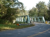
The town lies along Route 8, which passes along the banks of the Farmington River on the eastern part of town. Route 57
crosses through the center of town from west to east, crossing the river into Tolland at the village of New Boston. Additionally, Route 183 cuts through the southwest corner of town, crossing into Connecticut to become Connecticut Highway 183. The nearest interstate, Interstate 90
(the Massachusetts Turnpike
) passes north of the town through Otis, with the nearest access being in Lee and Westfield.
There is no rail service in town, with the nearest rail and bus service being in Great Barrington
. The nearest local airport is in Great Barrington, and the nearest national air service can be found at Bradley International Airport
in Windsor Locks
, Connecticut
.
of 2000, there were 824 people, 327 households, and 212 families residing in the town. By population, Sandisfield ranks 23rd out of the 32 cities and towns in Berkshire, and 330th out of the 351 cities and towns in Massachusetts. The population density
was 15.7 people per square mile (6.1/km²), which rank third to last in the county, and eighth to last in the Commonwealth. There were 647 housing units at an average density of 12.4 per square mile (4.8/km²). The racial makeup of the town was 96.84% White, 0.49% African American, 0.12% Native American, 0.12% Asian, 0.36% from other races
, and 2.06% from two or more races. Hispanic or Latino of any race were 0.97% of the population.
There were 327 households out of which 24.8% had children under the age of 18 living with them, 58.4% were married couples
living together, 4.0% had a female householder with no husband present, and 34.9% were non-families. 30.0% of all households were made up of individuals and 11.9% had someone living alone who was 65 years of age or older. The average household size was 2.37 and the average family size was 2.99.
In the town the population was spread out with 20.1% under the age of 18, 4.1% from 18 to 24, 26.1% from 25 to 44, 31.7% from 45 to 64, and 18.0% who were 65 years of age or older. The median age was 45 years. For every 100 females there were 115.7 males. For every 100 females age 18 and over, there were 117.9 males.
The median income for a household in the town was $45,972, and the median income for a family was $57,083. Males had a median income of $36,875 versus $24,271 for females. The per capita income
for the town was $27,628. About 1.3% of families and 2.4% of the population were below the poverty line, including none of those under age 18 and 3.5% of those age 65 or over.
form of government, and is led by a board of selectmen
. The town has its own small police station, as well as a post office and two volunteer fire stations (in New Boston and west of the town center). The town's library is connected to the regional library systems. The nearest hospitals are in Great Barrington and Westfield.
On the state level, Sandisfield is represented in the Massachusetts House of Representatives
by the Fourth Berkshire district, which covers southern Berkshire County, as well as the westernmost towns in Hampden County. In the Massachusetts Senate
, the town is represented by the Berkshire, Hampshire and Franklin district, which includes all of Berkshire County and western Hampshire and Franklin Counties. The town is patrolled by the First (Lee) Station of Barracks "B" of the Massachusetts State Police
.
On the national level, Sandisfield is represented in the United States House of Representatives
as part of Massachusetts's 1st congressional district
, and has been represented by John Olver
of Amherst
since June 1991. Massachusetts is currently represented in the United States Senate
by senior Senator John Kerry
and junior Senator Scott Brown
.
The nearest community college is Berkshire Community College
in Pittsfield and Great Barrington. The nearest state college is Westfield State College
, and the nearest state university is the University of Massachusetts Amherst
. The nearest private college is Bard College at Simon's Rock in Great Barrington, with other private colleges in Springfield.
New England town
The New England town is the basic unit of local government in each of the six New England states. Without a direct counterpart in most other U.S. states, New England towns are conceptually similar to civil townships in other states, but are incorporated, possessing powers like cities in other...
in Berkshire County
Berkshire County, Massachusetts
Berkshire County is a non-governmental county located on the western edge of the U.S. state of Massachusetts. As of the 2010 census, the population was 131,219. Its largest city and traditional county seat is Pittsfield...
, Massachusetts
Massachusetts
The Commonwealth of Massachusetts is a state in the New England region of the northeastern United States of America. It is bordered by Rhode Island and Connecticut to the south, New York to the west, and Vermont and New Hampshire to the north; at its east lies the Atlantic Ocean. As of the 2010...
, United States
United States
The United States of America is a federal constitutional republic comprising fifty states and a federal district...
. It is part of the Pittsfield
Pittsfield, Massachusetts
Pittsfield is the largest city and the county seat of Berkshire County, Massachusetts, United States. It is the principal city of the Pittsfield, Massachusetts Metropolitan Statistical Area which encompasses all of Berkshire County. Its area code is 413. Its ZIP code is 01201...
, Massachusetts
Massachusetts
The Commonwealth of Massachusetts is a state in the New England region of the northeastern United States of America. It is bordered by Rhode Island and Connecticut to the south, New York to the west, and Vermont and New Hampshire to the north; at its east lies the Atlantic Ocean. As of the 2010...
Metropolitan Statistical Area. The population was 824 at the 2000 census.
History
Sandisfield was first settled in 1750 as Housatonic Township Number 4, and was officially incorporated in 1762. It was most likely named for the Sandy Family, one of the original families in the town and namesake of the town's Sandy Brook. The town was mostly an agricultural setting in the earliest times, with rye fields and orchards filling the land. Sawmills grew up along the rivers, but most industry failed in the late nineteenth century, when a planned railway along the Farmington River fell through. The Record, a bi-weekly regional newspaper covering town news in Sandisfield and four neighboring towns, was published in Sandisfield from 1981 to 1985. Today the picturesque town is mostly rural, with some of the least densely populated parts of the state.Geography
According to the United States Census BureauUnited States Census Bureau
The United States Census Bureau is the government agency that is responsible for the United States Census. It also gathers other national demographic and economic data...
, the town has a total area of 53 square miles (137.3 km²), of which, 52.3 square miles (135.5 km²) of it is land and 0.7 square miles (1.8 km²) of it (1.34%) is water. The town is the largest by land area in Berkshire County, and eighth largest in the state. Sandisfield lies at the southeast corner of Berkshire County along the Connecticut Border, with Hampden County
Hampden County, Massachusetts
-Demographics:As of the census of 2004, there were 461,228 people, 175,288 households, and 115,690 families residing in the county. The population density was 738 people per square mile . There were 185,876 housing units at an average density of 301 per square mile...
to the east and Litchfield County
Litchfield County, Connecticut
Litchfield County is a county located in the northwestern corner of the U.S. state of Connecticut. Litchfield County has the lowest population density of any county in Connecticut but is geographically the state's largest county. As of 2010 the population was 189,927...
, Connecticut
Connecticut
Connecticut is a state in the New England region of the northeastern United States. It is bordered by Rhode Island to the east, Massachusetts to the north, and the state of New York to the west and the south .Connecticut is named for the Connecticut River, the major U.S. river that approximately...
to the south. Sandisfield is bordered by Otis
Otis, Massachusetts
Otis is a town in Berkshire County, Massachusetts, United States. It is part of the Pittsfield, Massachusetts Metropolitan Statistical Area. The population was 1,365 at the 2000 census....
to the north and northeast, Tolland
Tolland, Massachusetts
Tolland is a town in Hampden County, Massachusetts, United States. The population was 485 at the 2010 census, making it the smallest town in Hampden County by population. It is part of the Springfield, Massachusetts Metropolitan Statistical Area. Tolland formerly had a popular "Black Fly Day"...
to the east, Colebrook
Colebrook, Connecticut
Colebrook is a town in Litchfield County, Connecticut, United States. The population was 1,471 at the 2000 census. Colebrook was named after Colebrooke, in the English county of Devon.-Geography:...
and Norfolk
Norfolk, Connecticut
Norfolk is a town in Litchfield County, Connecticut, United States. The population was 1,660 at the 2000 census.Norfolk is perhaps best known as the site of the Yale Summer School of Music – Norfolk Chamber Music Festival, which hosts an annual chamber music concert series in "the Music Shed," a...
, Connecticut
Connecticut
Connecticut is a state in the New England region of the northeastern United States. It is bordered by Rhode Island to the east, Massachusetts to the north, and the state of New York to the west and the south .Connecticut is named for the Connecticut River, the major U.S. river that approximately...
to the south, New Marlborough
New Marlborough, Massachusetts
New Marlborough is a town in Berkshire County, Massachusetts, United States. It is part of the Pittsfield, Massachusetts Metropolitan Statistical Area. The population was 1,494 at the 2000 census...
to the west, and Monterey
Monterey, Massachusetts
Monterey is a town in Berkshire County, Massachusetts, United States. It is part of the Pittsfield, Massachusetts Metropolitan Statistical Area. The population was 934 at the 2000 census.- History :...
to the northwest. Sandisfield lies 28 miles south-southeast of Pittsfield
Pittsfield, Massachusetts
Pittsfield is the largest city and the county seat of Berkshire County, Massachusetts, United States. It is the principal city of the Pittsfield, Massachusetts Metropolitan Statistical Area which encompasses all of Berkshire County. Its area code is 413. Its ZIP code is 01201...
, 32 miles west of Springfield
Springfield, Massachusetts
Springfield is the most populous city in Western New England, and the seat of Hampden County, Massachusetts, United States. Springfield sits on the eastern bank of the Connecticut River near its confluence with three rivers; the western Westfield River, the eastern Chicopee River, and the eastern...
, and 118 miles west-southwest of Boston.
Sandisfield lies in the southeastern part of the Berkshire Mountains, along the western banks of the Farmington River
Farmington River
The Farmington River is a river located in northwest Connecticut, with major tributaries extending into southwest Massachusetts. Via its longest branch , the Farmington's length increases to , making it the Connecticut River's longest tributary by a mere over the major river directly to its...
. The town lies on a plateau, with the Buck and Clam Rivers flowing through town towards the Farmington, as well as several small, marshy brooks and small ponds and lakes. The town is dotted by pieces of the Sandisfield State Forest, with the highest point in town, Abbey Hill (1,810 ft) lying in the northwest section of the forest. A small portion of Otis State Forest also crosses the northern border of town.
The town lies along Route 8, which passes along the banks of the Farmington River on the eastern part of town. Route 57
Massachusetts Route 57
Route 57 is an east–west Massachusetts state route that runs from Monterey to Agawam. The eastern 5.0 miles in Agawam is a freeway that runs from Route 187 to the route's eastern terminus at U.S. Route 5.- Route description :...
crosses through the center of town from west to east, crossing the river into Tolland at the village of New Boston. Additionally, Route 183 cuts through the southwest corner of town, crossing into Connecticut to become Connecticut Highway 183. The nearest interstate, Interstate 90
Interstate 90
Interstate 90 is the longest Interstate Highway in the United States at . It is the northernmost coast-to-coast interstate, and parallels US 20 for the most part. Its western terminus is in Seattle, at Edgar Martinez Drive S. near Safeco Field and CenturyLink Field, and its eastern terminus is in...
(the Massachusetts Turnpike
Massachusetts Turnpike
The Massachusetts Turnpike is the easternmost stretch of Interstate 90. The Turnpike begins at the western border of Massachusetts in West Stockbridge connecting with the Berkshire Connector portion of the New York State Thruway...
) passes north of the town through Otis, with the nearest access being in Lee and Westfield.
There is no rail service in town, with the nearest rail and bus service being in Great Barrington
Great Barrington, Massachusetts
Great Barrington is a town in Berkshire County, Massachusetts, United States. It is part of the Pittsfield, Massachusetts Metropolitan Statistical Area. The population was 7,104 at the 2010 census. Both a summer resort and home to Ski Butternut, Great Barrington includes the villages of Van...
. The nearest local airport is in Great Barrington, and the nearest national air service can be found at Bradley International Airport
Bradley International Airport
Bradley International Airport is a joint civil-military public airport located in Windsor Locks on the border with East Granby and Suffield, in Hartford County, Connecticut, United States. It is owned by the State of Connecticut....
in Windsor Locks
Windsor Locks, Connecticut
Windsor Locks is a town located in Hartford County, Connecticut, United States. As of the 2000 census, its population was 12,043. It is the site of Bradley International Airport, which serves the Greater Hartford-Springfield region. It is also the site of the New England Air Museum...
, Connecticut
Connecticut
Connecticut is a state in the New England region of the northeastern United States. It is bordered by Rhode Island to the east, Massachusetts to the north, and the state of New York to the west and the south .Connecticut is named for the Connecticut River, the major U.S. river that approximately...
.
Demographics
As of the censusCensus
A census is the procedure of systematically acquiring and recording information about the members of a given population. It is a regularly occurring and official count of a particular population. The term is used mostly in connection with national population and housing censuses; other common...
of 2000, there were 824 people, 327 households, and 212 families residing in the town. By population, Sandisfield ranks 23rd out of the 32 cities and towns in Berkshire, and 330th out of the 351 cities and towns in Massachusetts. The population density
Population density
Population density is a measurement of population per unit area or unit volume. It is frequently applied to living organisms, and particularly to humans...
was 15.7 people per square mile (6.1/km²), which rank third to last in the county, and eighth to last in the Commonwealth. There were 647 housing units at an average density of 12.4 per square mile (4.8/km²). The racial makeup of the town was 96.84% White, 0.49% African American, 0.12% Native American, 0.12% Asian, 0.36% from other races
Race (United States Census)
Race and ethnicity in the United States Census, as defined by the Federal Office of Management and Budget and the United States Census Bureau, are self-identification data items in which residents choose the race or races with which they most closely identify, and indicate whether or not they are...
, and 2.06% from two or more races. Hispanic or Latino of any race were 0.97% of the population.
There were 327 households out of which 24.8% had children under the age of 18 living with them, 58.4% were married couples
Marriage
Marriage is a social union or legal contract between people that creates kinship. It is an institution in which interpersonal relationships, usually intimate and sexual, are acknowledged in a variety of ways, depending on the culture or subculture in which it is found...
living together, 4.0% had a female householder with no husband present, and 34.9% were non-families. 30.0% of all households were made up of individuals and 11.9% had someone living alone who was 65 years of age or older. The average household size was 2.37 and the average family size was 2.99.
In the town the population was spread out with 20.1% under the age of 18, 4.1% from 18 to 24, 26.1% from 25 to 44, 31.7% from 45 to 64, and 18.0% who were 65 years of age or older. The median age was 45 years. For every 100 females there were 115.7 males. For every 100 females age 18 and over, there were 117.9 males.
The median income for a household in the town was $45,972, and the median income for a family was $57,083. Males had a median income of $36,875 versus $24,271 for females. The per capita income
Per capita income
Per capita income or income per person is a measure of mean income within an economic aggregate, such as a country or city. It is calculated by taking a measure of all sources of income in the aggregate and dividing it by the total population...
for the town was $27,628. About 1.3% of families and 2.4% of the population were below the poverty line, including none of those under age 18 and 3.5% of those age 65 or over.
Government
Sandisfield employs the open town meetingOpen town meeting
An open town meeting is a form of town meeting in which all registered voters of a town may vote . This form of government is typical of smaller municipalities in the New England region of the United States....
form of government, and is led by a board of selectmen
Board of selectmen
The board of selectmen is commonly the executive arm of the government of New England towns in the United States. The board typically consists of three or five members, with or without staggered terms.-History:...
. The town has its own small police station, as well as a post office and two volunteer fire stations (in New Boston and west of the town center). The town's library is connected to the regional library systems. The nearest hospitals are in Great Barrington and Westfield.
On the state level, Sandisfield is represented in the Massachusetts House of Representatives
Massachusetts House of Representatives
The Massachusetts House of Representatives is the lower house of the Massachusetts General Court, the state legislature of the Commonwealth of Massachusetts. It is composed of 160 members elected from single-member electoral districts across the Commonwealth. Representatives serve two-year terms...
by the Fourth Berkshire district, which covers southern Berkshire County, as well as the westernmost towns in Hampden County. In the Massachusetts Senate
Massachusetts Senate
The Massachusetts Senate is the upper house of the Massachusetts General Court, the bicameral state legislature of the Commonwealth of Massachusetts. The Senate comprises 40 elected members from 40 single-member senatorial districts in the state...
, the town is represented by the Berkshire, Hampshire and Franklin district, which includes all of Berkshire County and western Hampshire and Franklin Counties. The town is patrolled by the First (Lee) Station of Barracks "B" of the Massachusetts State Police
Massachusetts State Police
The Massachusetts State Police is an agency of the Commonwealth of Massachusetts' Executive Office of Public Safety and Security responsible for criminal law enforcement and traffic vehicle regulation across the state...
.
On the national level, Sandisfield is represented in the United States House of Representatives
United States House of Representatives
The United States House of Representatives is one of the two Houses of the United States Congress, the bicameral legislature which also includes the Senate.The composition and powers of the House are established in Article One of the Constitution...
as part of Massachusetts's 1st congressional district
Massachusetts's 1st congressional district
Massachusetts's 1st congressional district is in western and central Massachusetts. The largest Massachusetts district in area, it covers about one-third of the state and is more rural than the rest. It has the state's highest point, Mount Greylock...
, and has been represented by John Olver
John Olver
John Walter Olver is the U.S. Representative for , serving since 1991. He is a member of the Democratic Party. Early in his career, he was a chemistry professor and served in both chambers of the Massachusetts General Court....
of Amherst
Amherst, Massachusetts
Amherst is a town in Hampshire County, Massachusetts, United States in the Connecticut River valley. As of the 2010 census, the population was 37,819, making it the largest community in Hampshire County . The town is home to Amherst College, Hampshire College, and the University of Massachusetts...
since June 1991. Massachusetts is currently represented in the United States Senate
United States Senate
The United States Senate is the upper house of the bicameral legislature of the United States, and together with the United States House of Representatives comprises the United States Congress. The composition and powers of the Senate are established in Article One of the U.S. Constitution. Each...
by senior Senator John Kerry
John Kerry
John Forbes Kerry is the senior United States Senator from Massachusetts, the 10th most senior U.S. Senator and chairman of the Senate Foreign Relations Committee. He was the presidential nominee of the Democratic Party in the 2004 presidential election, but lost to former President George W...
and junior Senator Scott Brown
Scott Brown
Scott Brown is a United States senator.Scott Brown may also refer to:-Sportsmen:*Scott Brown , American college football coach of Kentucky State...
.
Education
Sandisfield, along with neighboring Otis, is part of the Farmington River Regional School District. Until recently, the town ran its own school, but budget cuts closed it. The district's only school, Farmington River Elementary School, is in Otis, and houses students from pre-kindergarten through sixth grades. For the upper grades, most students attend Monument Valley Regional Middle School, Monument Mountain Regional High School in Great Barrington, and Lee Public School Districts. The nearest private schools are in Great Barrington, Lee and Westfield.The nearest community college is Berkshire Community College
Berkshire Community College
Berkshire Community College is a two-year community college in Berkshire County, Massachusetts, United States. It offers associate degrees as well as a transfer program for students to earn credits for transfer to other colleges...
in Pittsfield and Great Barrington. The nearest state college is Westfield State College
Westfield State College
Westfield State University is a comprehensive, coeducational, four-year public university in Westfield, Massachusetts. It was founded in 1838 by noted educator and social reformer Horace Mann as the first public co-educational college in America without barrier to race, gender and economic class...
, and the nearest state university is the University of Massachusetts Amherst
University of Massachusetts Amherst
The University of Massachusetts Amherst is a public research and land-grant university in Amherst, Massachusetts, United States and the flagship of the University of Massachusetts system...
. The nearest private college is Bard College at Simon's Rock in Great Barrington, with other private colleges in Springfield.