

Saint Lawrence Seaway
Encyclopedia
Lock (water transport)
A lock is a device for raising and lowering boats between stretches of water of different levels on river and canal waterways. The distinguishing feature of a lock is a fixed chamber in which the water level can be varied; whereas in a caisson lock, a boat lift, or on a canal inclined plane, it is...
, canal
Canal
Canals are man-made channels for water. There are two types of canal:#Waterways: navigable transportation canals used for carrying ships and boats shipping goods and conveying people, further subdivided into two kinds:...
s and channels that permits ocean-going vessels to travel from the Atlantic Ocean
Atlantic Ocean
The Atlantic Ocean is the second-largest of the world's oceanic divisions. With a total area of about , it covers approximately 20% of the Earth's surface and about 26% of its water surface area...
to the North America
North America
North America is a continent wholly within the Northern Hemisphere and almost wholly within the Western Hemisphere. It is also considered a northern subcontinent of the Americas...
n Great Lakes
Great Lakes
The Great Lakes are a collection of freshwater lakes located in northeastern North America, on the Canada – United States border. Consisting of Lakes Superior, Michigan, Huron, Erie, and Ontario, they form the largest group of freshwater lakes on Earth by total surface, coming in second by volume...
, as far as Lake Superior
Lake Superior
Lake Superior is the largest of the five traditionally-demarcated Great Lakes of North America. It is bounded to the north by the Canadian province of Ontario and the U.S. state of Minnesota, and to the south by the U.S. states of Wisconsin and Michigan. It is the largest freshwater lake in the...
. Legally it extends from Montreal
Montreal
Montreal is a city in Canada. It is the largest city in the province of Quebec, the second-largest city in Canada and the seventh largest in North America...
to Lake Erie
Lake Erie
Lake Erie is the fourth largest lake of the five Great Lakes in North America, and the tenth largest globally. It is the southernmost, shallowest, and smallest by volume of the Great Lakes and therefore also has the shortest average water residence time. It is bounded on the north by the...
, including the Welland Canal
Welland Canal
The Welland Canal is a ship canal in Canada that extends from Port Weller, Ontario, on Lake Ontario, to Port Colborne, Ontario, on Lake Erie. As a part of the St...
. The seaway is named after the Saint Lawrence River
Saint Lawrence River
The Saint Lawrence is a large river flowing approximately from southwest to northeast in the middle latitudes of North America, connecting the Great Lakes with the Atlantic Ocean. It is the primary drainage conveyor of the Great Lakes Basin...
, which it follows from Lake Ontario
Lake Ontario
Lake Ontario is one of the five Great Lakes of North America. It is bounded on the north and southwest by the Canadian province of Ontario, and on the south by the American state of New York. Ontario, Canada's most populous province, was named for the lake. In the Wyandot language, ontarío means...
to the Atlantic Ocean
Atlantic Ocean
The Atlantic Ocean is the second-largest of the world's oceanic divisions. With a total area of about , it covers approximately 20% of the Earth's surface and about 26% of its water surface area...
. This section of the seaway is not a continuous canal, but rather comprises stretches of navigable channels within the river
River
A river is a natural watercourse, usually freshwater, flowing towards an ocean, a lake, a sea, or another river. In a few cases, a river simply flows into the ground or dries up completely before reaching another body of water. Small rivers may also be called by several other names, including...
, a number of locks, as well as canals made to bypass rapid
Rapid
A rapid is a section of a river where the river bed has a relatively steep gradient causing an increase in water velocity and turbulence. A rapid is a hydrological feature between a run and a cascade. A rapid is characterised by the river becoming shallower and having some rocks exposed above the...
s and dam
Dam
A dam is a barrier that impounds water or underground streams. Dams generally serve the primary purpose of retaining water, while other structures such as floodgates or levees are used to manage or prevent water flow into specific land regions. Hydropower and pumped-storage hydroelectricity are...
s in the waterway. A number of locks are managed by the Canadian Saint Lawrence Seaway Management Corporation
Saint Lawrence Seaway Management Corporation
The St. Lawrence Seaway Management Corporation is a not-for-profit Crown corporation owned by the Government of Canada.It is responsible for the safe and efficient movement of marine traffic through the Canadian-owned and operated facilities of the Saint Lawrence Seaway, which consists of 13 of the...
and others by the U.S. Saint Lawrence Seaway Development Corporation
Saint Lawrence Seaway Development Corporation
The Saint Lawrence Seaway Development Corporation is an agency of the United States Department of Transportation. The SLSDC is responsible for the safe and efficient movement of marine traffic through the U.S.-owned and operated facilities of the Saint Lawrence Seaway, which consists of 2 of the...
.
History
The Saint Lawrence Seaway was preceded by a number of other canals. In 1871, locks on the Saint Lawrence allowed transit of vessels 186 ft (56.7 m) long, 44 inch wide, and 9 ft (2.7 m) deep. The Welland Canal at that time allowed transit of vessels 142 ft (43.3 m) long, 26 ft (7.9 m) wide, and 10 ft (3 m) deep, but was generally too small to allow passage of larger ocean-going ships.The first proposals for a binational comprehensive deep waterway along the St. Lawrence came in the 1890s. In the following decades the idea of a power project became inseparable from the seaway - in fact, the various governments involved believed that the deeper water created by the hydro project were necessary to make the seaway channels feasible. American proposals for development up to and including the First World War met with little interest from the Canadian federal government. But the two national governments submitted St. Lawrence plans, and the Wooten-Bowden Report and the International Joint Commission both recommended the project in the early 1920s. Although the Liberal Mackenzie King was reluctant to proceed, in part of because of opposition to the project in Quebec, in 1932 the two countries inked a treaty. This failed to receive the assent of Congress. Subsequent attempts to forge an agreement in the 1930s came to naught as the Ontario government of Mitchell Hepburn, along with Quebec, got in the way. By 1941, President Roosevelt and Prime Minister King made an executive agreement to build the joint hydro and navigation works, but this too failed to receive the assent of Congress. Proposals for the seaway were met with resistance from railway and port
Port
A port is a location on a coast or shore containing one or more harbors where ships can dock and transfer people or cargo to or from land....
lobbyists in the United States
United States
The United States of America is a federal constitutional republic comprising fifty states and a federal district...
.
In the post-1945 years, proposals to introduce tolls still could not induce the U.S. Congress to approve the project. Growing impatient, and with Ontario desperate for hydro-electricity, Canada began to consider "going it alone." This seized the imagination of Canadians, engendering a groundswell of St. Lawrence nationalism. Fueled by this support, the Canadian Louis St. Laurent government decided over the course of 1951 and 1952 to construct the waterway alone, combined with a hydro project (which would prove to be the joint responsibility of Ontario and New York - as a power dam would change the water levels, it required bilateral cooperation). However, the Truman and Eisenhower administrations considered it a national security threat for Canada to alone control the deep waterway, and used various means - such as delaying and stalling the Federal Power Commission license for the power aspect - until Congress in early 1954 approved an American seaway role via the Wiley act. Canada, out of concern for the ramifications of the bilateral relationship, reluctantly acquiesced.
In the United States, Dr. N.R. Danelian (who was the Director of the 13 volume St. Lawrence Seaway Survey in the U.S. Department of Navigation (1932-1963)), worked with the U.S. Secretary of State on Canadian-United States issues regarding the Seaway and worked for over 15 years on passage of the Seaway Act. He later became President of the Great Lakes St. Lawrence Association to further the interests of the Seaway development to benefit the American Heartland.
The seaway opened in 1959 and cost $638 million in Canadian dollars, $336.2 million of which was paid by the U.S. government. Queen Elizabeth II
Elizabeth II of the United Kingdom
Elizabeth II is the constitutional monarch of 16 sovereign states known as the Commonwealth realms: the United Kingdom, Canada, Australia, New Zealand, Jamaica, Barbados, the Bahamas, Grenada, Papua New Guinea, the Solomon Islands, Tuvalu, Saint Lucia, Saint Vincent and the Grenadines, Belize,...
and President Dwight D. Eisenhower
Dwight D. Eisenhower
Dwight David "Ike" Eisenhower was the 34th President of the United States, from 1953 until 1961. He was a five-star general in the United States Army...
formally opened the Seaway with a short cruise aboard Royal Yacht
Royal Yacht
A royal yacht is a ship used by a monarch or a royal family. If the monarch is an emperor the proper term is imperial yacht. Most of them are financed by the government of the country of which the monarch is head...
Britannia
HMY Britannia
Her Majesty's Yacht Britannia is the former Royal Yacht of the British monarch, Queen Elizabeth II. She was the 83rd such vessel since the restoration of King Charles II in 1660. She is the second Royal yacht to bear the name, the first being the famous racing cutter built for The Prince of Wales...
after addressing the crowds in St. Lambert
Saint-Lambert, Quebec
Saint-Lambert is a Canadian city in the province of Quebec located opposite Montreal on the south shore of the St. Lawrence River. Saint-Lambert was named for either the early French Canadian hunter Lambert Closse or for Roman Catholic Bishop Lambert of Maastricht...
, Quebec
Quebec
Quebec or is a province in east-central Canada. It is the only Canadian province with a predominantly French-speaking population and the only one whose sole official language is French at the provincial level....
.
The seaway's opening is often credited with making the Erie Canal
Erie Canal
The Erie Canal is a waterway in New York that runs about from Albany, New York, on the Hudson River to Buffalo, New York, at Lake Erie, completing a navigable water route from the Atlantic Ocean to the Great Lakes. The canal contains 36 locks and encompasses a total elevation differential of...
obsolete, thus setting off the severe economic decline of several cities in Upstate New York
Upstate New York
Upstate New York is the region of the U.S. state of New York that is located north of the core of the New York metropolitan area.-Definition:There is no clear or official boundary between Upstate New York and Downstate New York...
.
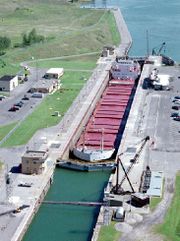
Locks in the Saint Lawrence River
There are six locksLock (water transport)
A lock is a device for raising and lowering boats between stretches of water of different levels on river and canal waterways. The distinguishing feature of a lock is a fixed chamber in which the water level can be varied; whereas in a caisson lock, a boat lift, or on a canal inclined plane, it is...
in the Saint Lawrence River portion of the Seaway. From downstream to upstream they are:
- St. Lambert Lock - Saint Lambert, QCQuebecQuebec or is a province in east-central Canada. It is the only Canadian province with a predominantly French-speaking population and the only one whose sole official language is French at the provincial level....
- Côte Ste. Catherine Lock - Sainte-CatherineSainte-Catherine, QuebecSainte-Catherine is an off-island suburb of Montreal, in southwestern Quebec, Canada on the St. Lawrence River in the Regional County Municipality of Roussillon...
, QC - Beauharnois Locks (2 locks) - Melocheville, QC - at 45°18′12.6"N 73°55′36.5"W and 45°19′0.1"N 73°55′6.6"W
- Snell Lock - MassenaMassena (town), New YorkMassena is a town in St. Lawrence County, New York, United States. The town is on the northern border of the county and is nicknamed "The Gateway to the Fourth Coast". The population was 13,121 at the 2000 census. The town of Massena contains a village also called Massena...
, NYNew YorkNew York is a state in the Northeastern region of the United States. It is the nation's third most populous state. New York is bordered by New Jersey and Pennsylvania to the south, and by Connecticut, Massachusetts and Vermont to the east... - Eisenhower Lock - MassenaMassena (town), New YorkMassena is a town in St. Lawrence County, New York, United States. The town is on the northern border of the county and is nicknamed "The Gateway to the Fourth Coast". The population was 13,121 at the 2000 census. The town of Massena contains a village also called Massena...
, NY - Iroquois Lock - IroquoisSouth Dundas, OntarioSouth Dundas is a township in eastern Ontario, Canada, in the United Counties of Stormont, Dundas and Glengarry along the north shore of the St. Lawrence River...
, ONOntarioOntario is a province of Canada, located in east-central Canada. It is Canada's most populous province and second largest in total area. It is home to the nation's most populous city, Toronto, and the nation's capital, Ottawa....
- at 44°49′48"N 75°18′46.8"W
Locks in the Welland Canal
There are 8 locks on the Welland CanalWelland Canal
The Welland Canal is a ship canal in Canada that extends from Port Weller, Ontario, on Lake Ontario, to Port Colborne, Ontario, on Lake Erie. As a part of the St...
.
- St. Catharines, OntarioSt. Catharines, OntarioSt. Catharines is the largest city in Canada's Niagara Region and the sixth largest urban area in Ontario, Canada, with 97.11 square kilometres of land...
- St. Catharines
- St. Catharines
- Thorold, OntarioThorold, OntarioThorold is a city in Ontario, Canada, located on the Niagara Escarpment. It is also the seat of the Regional Municipality of Niagara....
- Thorold
- Thorold
- Thorold
- Port Colborne, OntarioPort Colborne, OntarioPort Colborne is a city on Lake Erie, at the southern end of the Welland Canal, in the Niagara Region of southern Ontario, Canada...
Lock and channel dimensions
The size of vessels that can traverse the seaway is limited by the size of locks. Locks on the St. Lawrence and on the Welland Canal are 766 ft (233.5 m) long, 80 ft (24.4 m) wide, and 30 ft (9.14 m) deep. The maximum allowed vessel size is slightly smaller: 740 ft (225.6 m) long, 78 ft (23.8 m) wide, and 26.5 ft (8.1 m) deep; many vessels designed for use on the Great Lakes following the opening of the seaway were built to the maximum size permissible by the locks, known informally as Seawaymax or Seaway-Max. Large vessels of the lake freighterLake freighter
Lake freighters, or Lakers, are bulk carrier vessels that ply the Great Lakes. The best known was the , the most recent and largest major vessel to be wrecked on the Lakes. These vessels are traditionally called boats, although classified as ships. In the mid-20th century, 300 lakers worked the...
fleet are built on the lakes and cannot travel downstream beyond the Welland Canal. On the remaining Great Lakes, these ships are constrained only by the largest lock on the Great Lakes Waterway
Great Lakes Waterway
The Great Lakes Waterway is a system of channels and canals that makes all of the Great Lakes accessible to oceangoing vessels. Its principal civil engineering components are the Welland Canal, bypassing Niagara Falls between Lake Ontario and Lake Erie, and the Soo Locks, bypassing the rapids of...
, the Poe Lock at the Soo Locks
Soo Locks
The Soo Locks are a set of parallel locks which enable ships to travel between Lake Superior and the lower Great Lakes. They are located on the St. Marys River between Lake Superior and Lake Huron, between the Upper Peninsula of the US state of Michigan and the Canadian province of Ontario...
, which is 1200 ft (365.8 m) long, 110 ft (33.5 m) wide and 32 ft (9.8 m) deep.
A vessel's draft
Draft (hull)
The draft of a ship's hull is the vertical distance between the waterline and the bottom of the hull , with the thickness of the hull included; in the case of not being included the draft outline would be obtained...
is another obstacle to passage on the seaway, particularly in connecting waterways such as the St. Lawrence River. The depth in the channels of the seaway is 41 ft (12.5 m) (Panamax
Panamax
Panamax and New Panamax are popular terms for the size limits for ships traveling through the Panama Canal. Formally, the limits and requirements are published by the Panama Canal Authority titled "Vessel Requirements"...
-depth) downstream of Quebec City
Quebec City
Quebec , also Québec, Quebec City or Québec City is the capital of the Canadian province of Quebec and is located within the Capitale-Nationale region. It is the second most populous city in Quebec after Montreal, which is about to the southwest...
, 35 ft (10.7 m) between Quebec City and Deschaillons
Deschaillons-sur-Saint-Laurent, Quebec
Deschaillons-sur-Saint-Laurent is a municipality in the Centre-du-Québec region of the province of Quebec in Canada....
, 37 ft (11.3 m) to Montreal, and 27 ft (8.2 m) upstream of Montreal. Channel depths and limited lock sizes mean that only 10% of ocean-going ships can traverse the entire seaway. Proposals to expand the seaway, dating from as early as the 1960s, have been rejected as too costly, and environmentally and economically unsound. Lower water levels in the Great Lakes have also posed problems for some vessels in recent years.
While the seaway is currently (2010) mostly used for shipping bulk cargo
Bulk cargo
Bulk cargo is commodity cargo that is transported unpackaged in large quantities. This cargo is usually dropped or poured, with a spout or shovel bucket, as a liquid or as a mass of relatively small solids , into a bulk carrier ship's hold, railroad car, or tanker truck/trailer/semi-trailer body...
, the possibility of its use for large-scale container shipping
Containerization
Containerization is a system of freight transport based on a range of steel intermodal containers...
is under consideration as well. If the project goes ahead, feeder ship
Feeder ship
Feeder vessels or feeder ships are ships of various sizes, but mostly understood to be sea going vessels with an average capacity of carrying to . Feeders collect shipping containers from different ports and transport them to central container terminals where they are loaded to bigger vessels. In...
s would take containers from the port of Oswego
Oswego, New York
Oswego is a city in Oswego County, New York, United States. The population was 18,142 at the 2010 census. Oswego is located on Lake Ontario in north-central New York and promotes itself as "The Port City of Central New York"...
on Lake Ontario in upstate New York
New York
New York is a state in the Northeastern region of the United States. It is the nation's third most populous state. New York is bordered by New Jersey and Pennsylvania to the south, and by Connecticut, Massachusetts and Vermont to the east...
to Melford International Terminal
Melford International Terminal
Melford International Terminal is a proposed marine terminal to be built in the community of Middle Melford, Nova Scotia.If constructed, Melford Terminal would be the closest deep-water terminal in mainland North America to Europe and the Suez Canal....
in Nova Scotia
Nova Scotia
Nova Scotia is one of Canada's three Maritime provinces and is the most populous province in Atlantic Canada. The name of the province is Latin for "New Scotland," but "Nova Scotia" is the recognized, English-language name of the province. The provincial capital is Halifax. Nova Scotia is the...
for transfer to larger ocean-going ships.
Ecology
To create a navigable channel through the Long SaultLong Sault
This article refers to the rapid on the St. Lawrence River, for the once named Long Sault Rapids on the Ottawa River which was involved in the Battle of Long Sault and the Beaver War, please see Carillon, Quebec or Carillon Canal...
rapids and to allow hydroelectric stations to be established immediately upriver from Cornwall, Ontario
Cornwall, Ontario
Cornwall is a city in Eastern Ontario, Canada and the seat of the United Counties of Stormont, Dundas and Glengarry, Ontario. Cornwall is Ontario's easternmost city, located on the St...
and Massena, New York
Massena (town), New York
Massena is a town in St. Lawrence County, New York, United States. The town is on the northern border of the county and is nicknamed "The Gateway to the Fourth Coast". The population was 13,121 at the 2000 census. The town of Massena contains a village also called Massena...
, Lake St. Lawrence was created through the flooding on July 1, 1958 of six villages and three hamlets in Ontario, now collectively known as "The Lost Villages
The Lost Villages
The Lost Villages are ten communities in the Canadian province of Ontario, in the former townships of Cornwall and Osnabruck near Cornwall, which were permanently submerged by the creation of the Saint Lawrence Seaway in 1958....
." There was also inundation on the New York side, but no communities were affected. The creation of the seaway also led to the introduction of invasive species
Invasive species
"Invasive species", or invasive exotics, is a nomenclature term and categorization phrase used for flora and fauna, and for specific restoration-preservation processes in native habitats, with several definitions....
of aquatic animals, most notably the zebra mussel
Zebra mussel
The zebra mussel, Dreissena polymorpha, is a small freshwater mussel. This species was originally native to the lakes of southeast Russia being first described in 1769 by a German zoologist Peter Simon Pallas in the Ural, Volga and Dnieper rivers. They are still found nearby, as Pontic and Caspian...
into the Great Lakes Basin
Great Lakes Basin
The Great Lakes Basin consists of the Great Lakes and the surrounding lands of the states of Illinois, Indiana, Michigan, Minnesota, New York, Ohio, Pennsylvania, and Wisconsin in the United States, and the province of Ontario in Canada, whose direct surface runoff and watersheds form a large...
.
The seaway provides significant entertainment and recreation such as boating
Boating
Boating is the leisurely activity of travelling by boat, or the recreational use of a boat whether powerboats, sailboats, or man-powered vessels , focused on the travel itself, as well as sports activities, such as fishing or water skiing...
, camping
Camping
Camping is an outdoor recreational activity. The participants leave urban areas, their home region, or civilization and enjoy nature while spending one or several nights outdoors, usually at a campsite. Camping may involve the use of a tent, caravan, motorhome, cabin, a primitive structure, or no...
, fishing
Fishing
Fishing is the activity of trying to catch wild fish. Fish are normally caught in the wild. Techniques for catching fish include hand gathering, spearing, netting, angling and trapping....
, and scuba diving
Scuba diving
Scuba diving is a form of underwater diving in which a diver uses a scuba set to breathe underwater....
. Of particular note, the Seaway provides a number of divable shipwreck
Shipwreck
A shipwreck is what remains of a ship that has wrecked, either sunk or beached. Whatever the cause, a sunken ship or a wrecked ship is a physical example of the event: this explains why the two concepts are often overlapping in English....
s within recreational scuba limits (shallower than 130 ft (39.6 m)) The region also offers technical diving with some wrecks lying at 240 ft (73.2 m). Surprisingly, the water temperature can be as warm as 75 °F (24 °C) during the mid to late summer months. The first 10 ft (3 m) of Lake Ontario is warmed and enters the St. Lawrence river as the fast moving water body has no thermocline
Thermocline
A thermocline is a thin but distinct layer in a large body of fluid , in which temperature changes more rapidly with depth than it does in the layers above or below...
circulation.
On 12 July 2010, Richelieu (owned by Canada Steamship Lines) ran aground after losing power near the Côte-Sainte-Catherine lock. The grounding punctured a fuel tank, spilling an estimated 200 tonnes of diesel fuel, covering approximately 500m2. The seaway and the lock were shut down to help contain the spill.
See also
- Great Lakes WaterwayGreat Lakes WaterwayThe Great Lakes Waterway is a system of channels and canals that makes all of the Great Lakes accessible to oceangoing vessels. Its principal civil engineering components are the Welland Canal, bypassing Niagara Falls between Lake Ontario and Lake Erie, and the Soo Locks, bypassing the rapids of...
- Erie CanalErie CanalThe Erie Canal is a waterway in New York that runs about from Albany, New York, on the Hudson River to Buffalo, New York, at Lake Erie, completing a navigable water route from the Atlantic Ocean to the Great Lakes. The canal contains 36 locks and encompasses a total elevation differential of...
- Lachine CanalLachine CanalThe Lachine Canal is a canal passing through the southwestern part of the Island of Montreal, Quebec, Canada, running 14.5 kilometres from the Old Port of Montreal to Lake Saint-Louis, through the boroughs of Lachine, Lasalle and Sud-Ouest.The canal gets its name from the French word for China...
- Soulanges CanalSoulanges CanalThe Soulanges Canal is an abandoned shipping canal in Quebec, Canada. It follows the north shore of the Saint Lawrence River between Pointe-des-Cascades and Coteaux-Landing, bypassing the rapids between Lake Saint-Louis and Lake Saint-Francis. In between, it passes through the towns of Les Cèdres...
- Lake Champlain SeawayLake Champlain SeawayThe Lake Champlain Seaway was a canal project proposed in the late 19th century and considered as late as the 1960s to connect New York State's Hudson River and Canada's St. Lawrence River with a deep-water canal...
Further reading
- Seaway Handbook issued by the St. Lawrence Seaway Management Corporation, (Head Office, 202 Pitt Street, Cornwall, Ontario, Canada K6J 3P7) 2006.
- Macfarlane, Daniel. To the Heart of the Continent: Canada and the Negotiation of the St. Lawrence Seaway and Power Project. PhD dissertation, University of Ottawa, 2010.
External links
- Great Lakes St Lawrence Seaway System web site
- The St Lawrence Seaway Development Corporation
- Documents and Photographs relating to the Saint Lawrence Seaway, Dwight D. Eisenhower Presidential Library
- The Lost Villages Historical Society
- Excerpt from the Illustrated London News, January 11, 1862 describing the Canals of Canada.
- The Great Waterway: a site dedicated to tourism along the waterway from Lake Ontario to Cornwall and the Seaway Valley
- Exchange of Notes, amending 1959 Agreement of Application of Tolls
- CBC Digital Archives — The St Lawrence Seaway: Gateway to the world
- Bibliography on Water Resources and International Law See Great Lakes; St. Lawrence River and Seaway. Peace Palace Library
- Channel Depth and Width information