

Saginaw trail
Encyclopedia
Saginaw Trail is the collective name for a set of connected roads in Southeastern Michigan that runs from Detroit
to Saginaw
through Pontiac
and Flint
. It was originally a tribal foot trail. On December 7, 1818 the Michigan Territorial government
authorized the building of a road from Detroit to Saginaw along the trail. The road has gone through a number of designation changes in the last two centuries, both in name and number. Since the Michigan portion of Interstate 75
(I-75) was completed in 1973, it has been a secondary route.
Today, drivers can follow the path of the Saginaw Trail starting with Woodward Avenue in Detroit north to Genesee Avenue in Saginaw. It is currently state-maintained as different sections of state trunkline highways
bearing the designations M-1
, US Highway 24 (US 24) and M-54
. Other sections are maintained as county roads or city streets. Several landmarks can be found on these roads, and numerous historical events have taken place on them. The road has also been featured in some films and TV shows.
around Saginaw Bay
. Due to the yellow clay soils found around Saginaw Bay, their self-designation became Oθaakiiwaki which is often interpreted to mean "yellow-earth". The Ojibwe
and Ottawa
name for the tribe is Ozaagii, meaning "Those at the Outlet", whence they were known by the French as "Sac" or by the English as "Sauk". With the Anishinaabe
expansion and Hurons attempts at gaining regional stability, the Sauks were driven away by the Hurons armed with French weapons. The Sauk then occupied territory in parts of what are now northern Illinois
and Wisconsin
.
The Sauk tribe created an unnamed foot trail from Detroit to Saginaw. When European settlers arrived, they too began using the trail, which they dubbed the Saginaw Trail. These settlers determined the government should modernize it for the use of their horses and carriages. The name Saginaw is believed to mean "where the Sauk were" in the Ojibwe language
, which is used by the Chippewa tribe.
According to a historical marker near the John Almon Starr House in Royal Oak, the trail was one of peaceful intentions. Native inhabitants of the area used the trail to travel between homes during the change of seasons. They also used the trail to carry food and provisions. The trail may have played a role in the Siege of Fort Detroit
by Chief Pontiac
.
established by proclamation on December 15, 1819 the building of the section from Saginaw to Pontiac. The Legislature approved the request to build the southern half, from Pontiac to Detroit, on June 22, 1822. However, the Michigan government could not find the needed money in its budget to do so. Therefore, in 1826, the Michigan Territory asked for federal money to do so. After months of consideration, the federal government approved the request on March 2, 1827. The Detroit to Flint section was finished in 1833, and the Flint to Saginaw section was finished in 1841.
Tolls on the road were regulated by the state legislature. A charge of two cents a mile was made for a wagon or carriage drawn by two horses, and one cent a mile for every sled or sleigh so drawn. If more than two horses were used, an additional charge of three-quarters of a cent per mile for each additional animal was levied. A toll of one cent per mile was made for a vehicle drawn by one horse, as well as for a horse and rider. Tolls of one-half cent a mile were levied for every score of sheep or swine; for every score of "neat cattle," two cents a mile. Sixty years later in 1910, the leases expired and the road was turned back over to state control, at which time all fees were lifted.
from 1915 to 1927. From 1919 to 1926, the trail was designated M-10
.
Starting in 1926, when the U.S. Highway System
was created, US 10
ran along the trail. The section between Downtown Flint and Saginaw also carried US 23
. In 1928, the segment between Dort Highway's northern terminus and Dort Highway's former southern terminus was changed to M-10
, which was the second incarnation of M-10. In 1941 or 1942, that designation of M-10 was changed to Business US 10 (BUS US 10). In 1957, US 23 was moved from the trail to its current route.
Several changes were made to the Saginaw Trail in 1962. US 10 and BUS US 10 were removed from I-75 exit 106 to Dort Highway's northern terminus. M-54 opened, running along Saginaw Street between I-75 exit 106, through Grand Blanc to Dort Highway's former southern terminus. Saginaw Street between Dort Highway's former southern terminus and northern terminus was renamed BUS M-54. The designation of US 10 between the former southern terminus of M-54 and Clarkston was moved to the new I-75 freeway.
In 1970, US 10 was moved between Pontiac and Detroit, and Woodward Avenue was redesignated as M-1. US 10 was routed along the Lodge Freeway
and Telegraph Road
. The BUS M-54 signs were removed in 1984 along Saginaw Street. US 10 was truncated in 1986, removing the designation from the highway system south of Bay City. The section of M-54 from Dort Highway's former southern terminus was rerouted along a new extension and M-54 no longer ran along Saginaw Street through Grand Blanc like it did previously, making its current southern terminus at I-75 exit 109 in 1987.
is visible in places. Property adjacent to the John Almon Starr House, now the home of the law firm Chisholm and Shuttie, contains a section of the trail, sunken into the ground. The Starr house, located at 3123 Crooks Road, is approximately 1 mile (1.6 km) east of Woodward Avenue. The road was constructed along, but not always over, the original trail by order of the Michigan government. A Michigan Historical Marker for the Saginaw Trail is co-located with that of the John Almon Starr House.
In Waterford, there is a dry cleaners on Dixie Highway called "Saginaw Trail Cleaners".
There is a 1953 film starring Gene Autry
named Saginaw Trail, set in Michigan during 19th century fur trading days.
 The old Saginaw Trail is known as Woodward Avenue (M-1) in Wayne County
. Woodward Avenue starts in Downtown Detroit
at Jefferson Avenue near the Renaissance Center
, the world headquarters of the General Motors Corporation. From this starting point, the street runs northwesterly through Downtown Detroit, passing through Campus Martius Park
and Grand Circus Park. The north side of the latter park is on Adams Avenue, which marks the start of the M-1
designation and state maintenance. The historic Fox Theatre, which was built in 1928, is on Woodward Avenue, and next door to it is The Fillmore Detroit
, a concert venue. Across the street is Comerica Park
, home of the Detroit Tigers
. Next to it is Ford Field
, home of the Detroit Lions
. Both sports venues are west of Woodward Avenue, between Adams and the I-75
freeway. Further north is the Detroit Institute of Arts
.
Woodward Avenue continues northwesterly crossing through the campus of Wayne State University
and the city of Highland Park
before re-entering Detroit at McNichols Road, which occupies the 6 Mile location in the Mile Road System in Detroit. At 8 Mile Road, Woodward Avenue crosses out of Detroit for the final time near the State Fairgrounds into Ferndale
and Oakland County
.
Woodward Avenue in Detroit has been mentioned in popular culture several times, such as in the season-6 episode of the Detroit-based 1990s sitcom Home Improvement titled "My Son, the Driver". The character Brad mentions he was "rear-ended over on Woodward". Woodward is also known internationally for its annual "Woodward Dream Cruise" in which classic car enthusiasts showcase their vehicles.
, Birmingham
and Bloomfield Hills
. Royal Oak is the location of the John Almon Starr House which is adjacent to the original trail. In Bloomfield Hills, the M-1 designation ends at Square Lake Road. Woodward Avenue continues north into downtown Pontiac
as part of Business Loop I-75 (BL I-75) and BUS US 24. Through downtown, the highway splits along two streets of a one-way pair
, using Woodward Avenue northbound and Wide Track Drive southbound. BL I-75 turns off along Perry Street, and BUS US 24 continues north along Oakland Avenue northbound and Cass Avenue southbound. The two streets merge together along Oakland Avenue north of Montcalm Street. North of Kennett Road, the street name changes to Dixie Highway.
Dixie Highway was named as a part of the original auto trail
of the same name
. When the road meets Telegraph Road
, it loses the BUS US 24 designation in favor of US 24. Dixie Highway, and the Saginaw Trail, pass a number of lakes north of Pontiac before meeting I-75 in Independence Township
at exit 93. This is the eastern end of US 24, which runs 2478 miles (3,988 km), all the way from Colorado Springs, Colorado
. Dixie Highway continues northwesterly and parallels I-75, using roadway that was once US 10. The grounds for the annual Michigan Renaissance Festival
, which is unofficially dubbed "Hollygrove" for the festival, are located on Dixie Highway in both Holly Township
and Groveland Township
. The festival grounds was the primary shooting location of the 2009 romantic comedy film
All's Faire in Love
. Mount Holly Ski Area is also located on Dixie Highway in Holly Township. Groveland Oaks County Park, which features a spiraling water-slide, is also on the roadway in Groveland Township. The Michigan State Police
's Satellite Office 21 is located next to Dixie Highway in Groveland Township.
 In Genesee County
, it is known as Saginaw Road or Saginaw Street. South of the Flint River
, it is designated South Saginaw Street or South Saginaw Road, and north of the river, it is designated North Saginaw Street or North Saginaw Road. In Grand Blanc Township
, Warwick Hills Golf and Country Club
, former home of the PGA's Buick Open
(which has now been discontinued) is on Saginaw Road. Also on Saginaw Road in Grand Blanc Township is a branch office of the 67th District Court and Grand Blanc Township's Administrative Offices. In southern Flint, on Saginaw Street between Atherton and Hemphill Roads, is the Fisher Body
Plant #1, which is now the Great Lakes Technology Center. This plant was the site of the Flint Sit-Down Strike
, a pivotal event in the development of the United Auto Workers
.
In Downtown Flint several government buildings are on Saginaw Street, including the historic 1917 Genesee County Circuit Courthouse, Flint City Hall, the Genesee County Administration Building, the Genesee County Jail, the Genesee County Sheriff's Department headquarters, the headquarters of the 67th and 68th District Courts, and the Genesee County Health Department. The headquarters of Citizens Republic Bancorp which was founded as Citizens Commercial & Savings Bank in Flint in 1871 are on Saginaw Street in Downtown Flint, as is the historic First National Bank of Flint which was founded in 1864. The current building was constructed in 1924.
Another popular culture reference to the Saginaw Trail came In the 2008 movie Semi-Pro
, which was filmed partially in Flint. The main character Jackie Moon, played by Will Ferrell
, was shown driving on Saginaw Street at the Flint River
bridge in Downtown Flint.
Continuing north through the county, in Mount Morris
, a branch office of the 67th District Court is on Saginaw Street, as well as the Mount Morris City Administration Offices. Auto City Speedway is on Saginaw Road between Mount Morris
and Clio
. Between Dort Highway's northern terminus and Clio Road in Genesee County, Saginaw Road is part of M-54.
, it is also known as Dixie Highway, except in the City of Saginaw, where it is known as Genesee Avenue. In this segment, the road mostly runs through farmlands and rural residential areas. The Michigan State Police
has 2 offices on the trail in Saginaw County: Post 37 is on Dixie Highway in Bridgeport Township, and the District 3 headquarters are on Genesee Avenue in Saginaw.
Dixie Motor Speedway is on Dixie Highway in Birch Run Township
. and a few miles north in Bridgeport Township is the Bridgeport Township Administration Office. Also in Bridgeport is the Junction Valley Railroad, the world's largest quarter scale railroad system. The trail ends at Washington Avenue in Downtown Saginaw.
Detroit, Michigan
Detroit is the major city among the primary cultural, financial, and transportation centers in the Metro Detroit area, a region of 5.2 million people. As the seat of Wayne County, the city of Detroit is the largest city in the U.S. state of Michigan and serves as a major port on the Detroit River...
to Saginaw
Saginaw, Michigan
Saginaw is a city in the U.S. state of Michigan and the seat of Saginaw County. The city of Saginaw was once a thriving lumber town and manufacturing center. Saginaw and Saginaw County lie in the Flint/Tri-Cities region of Michigan...
through Pontiac
Pontiac, Michigan
Pontiac is a city in the U.S. state of Michigan named after the Ottawa Chief Pontiac, located within the Detroit metropolitan area. As of the 2010 census, the city had a total population of 59,515. It is the county seat of Oakland County...
and Flint
Flint, Michigan
Flint is a city in the U.S. state of Michigan and is located along the Flint River, northwest of Detroit. The U.S. Census Bureau reports the 2010 population to be placed at 102,434, making Flint the seventh largest city in Michigan. It is the county seat of Genesee County which lies in the...
. It was originally a tribal foot trail. On December 7, 1818 the Michigan Territorial government
Michigan Territory
The Territory of Michigan was an organized incorporated territory of the United States that existed from June 30, 1805, until January 26, 1837, when the final extent of the territory was admitted to the Union as the State of Michigan...
authorized the building of a road from Detroit to Saginaw along the trail. The road has gone through a number of designation changes in the last two centuries, both in name and number. Since the Michigan portion of Interstate 75
Interstate 75 in Michigan
Interstate 75 is a part of the Interstate Highway System and runs from Miami, Florida to Sault Ste. Marie in the Upper Peninsula of Michigan. I-75 enters the state from Ohio in the south, just to the north of Toledo. It runs generally north through Detroit, Pontiac and Bay City, crossing the...
(I-75) was completed in 1973, it has been a secondary route.
Today, drivers can follow the path of the Saginaw Trail starting with Woodward Avenue in Detroit north to Genesee Avenue in Saginaw. It is currently state-maintained as different sections of state trunkline highways
Michigan Highway System
The Michigan State Trunkline Highway System is made up of all the highways designated as Interstates, U.S. Highways and State Highways in the US state of Michigan. The system is maintained by the Michigan Department of Transportation and comprises of trunklines in all 83 counties of Michigan on...
bearing the designations M-1
M-1 (Michigan highway)
M-1, commonly known as Woodward Avenue, named for Augustus B. Woodward, is a north–south state trunkline in the US state of Michigan. Until a few years ago, the northern terminus of M-1 was at BL I-75 and BUS US 24 in Bloomfield Township between the city limits of Bloomfield Hills and...
, US Highway 24 (US 24) and M-54
M-54 (Michigan highway)
M-54 is a state trunkline highway approximately long in the US state of Michigan that bypasses the city of Flint. It is named "Dort Highway" in much of its length, in honor of Flint carriage and automobile pioneer Josiah Dallas Dort, the business partner of General Motors founder William C. Durant...
. Other sections are maintained as county roads or city streets. Several landmarks can be found on these roads, and numerous historical events have taken place on them. The road has also been featured in some films and TV shows.
Sauk Tribal foot path
The Sauk tribe may have had their original territory along the St. Lawrence River. However, migration patterns of other tribes drove them to MichiganMichigan
Michigan is a U.S. state located in the Great Lakes Region of the United States of America. The name Michigan is the French form of the Ojibwa word mishigamaa, meaning "large water" or "large lake"....
around Saginaw Bay
Saginaw Bay
Saginaw Bay is a bay within Lake Huron located on the eastern side of the U.S. state of Michigan. It forms the space between Michigan's Thumb region and the rest of the Lower Peninsula of Michigan. Saginaw Bay is in area...
. Due to the yellow clay soils found around Saginaw Bay, their self-designation became Oθaakiiwaki which is often interpreted to mean "yellow-earth". The Ojibwe
Ojibwa
The Ojibwe or Chippewa are among the largest groups of Native Americans–First Nations north of Mexico. They are divided between Canada and the United States. In Canada, they are the third-largest population among First Nations, surpassed only by Cree and Inuit...
and Ottawa
Ottawa (tribe)
The Odawa or Ottawa, said to mean "traders," are a Native American and First Nations people. They are one of the Anishinaabeg, related to but distinct from the Ojibwe nation. Their original homelands are located on Manitoulin Island, near the northern shores of Lake Huron, on the Bruce Peninsula in...
name for the tribe is Ozaagii, meaning "Those at the Outlet", whence they were known by the French as "Sac" or by the English as "Sauk". With the Anishinaabe
Anishinaabe
Anishinaabe or Anishinabe—or more properly Anishinaabeg or Anishinabek, which is the plural form of the word—is the autonym often used by the Odawa, Ojibwe, and Algonquin peoples. They all speak closely related Anishinaabemowin/Anishinaabe languages, of the Algonquian language family.The meaning...
expansion and Hurons attempts at gaining regional stability, the Sauks were driven away by the Hurons armed with French weapons. The Sauk then occupied territory in parts of what are now northern Illinois
Illinois
Illinois is the fifth-most populous state of the United States of America, and is often noted for being a microcosm of the entire country. With Chicago in the northeast, small industrial cities and great agricultural productivity in central and northern Illinois, and natural resources like coal,...
and Wisconsin
Wisconsin
Wisconsin is a U.S. state located in the north-central United States and is part of the Midwest. It is bordered by Minnesota to the west, Iowa to the southwest, Illinois to the south, Lake Michigan to the east, Michigan to the northeast, and Lake Superior to the north. Wisconsin's capital is...
.
The Sauk tribe created an unnamed foot trail from Detroit to Saginaw. When European settlers arrived, they too began using the trail, which they dubbed the Saginaw Trail. These settlers determined the government should modernize it for the use of their horses and carriages. The name Saginaw is believed to mean "where the Sauk were" in the Ojibwe language
Ojibwe language
Ojibwe , also called Anishinaabemowin, is an indigenous language of the Algonquian language family. Ojibwe is characterized by a series of dialects that have local names and frequently local writing systems...
, which is used by the Chippewa tribe.
According to a historical marker near the John Almon Starr House in Royal Oak, the trail was one of peaceful intentions. Native inhabitants of the area used the trail to travel between homes during the change of seasons. They also used the trail to carry food and provisions. The trail may have played a role in the Siege of Fort Detroit
Siege of Fort Detroit
The Siege of Fort Detroit was an ultimately unsuccessful attempt by North American Indians to capture Fort Detroit during Pontiac's Rebellion. The siege was led primarily by Pontiac, an Ottawa war leader.-Background:...
by Chief Pontiac
Chief Pontiac
Pontiac or Obwandiyag , was an Ottawa leader who became famous for his role in Pontiac's Rebellion , an American Indian struggle against the British military occupation of the Great Lakes region following the British victory in the French and Indian War. Historians disagree about Pontiac's...
.
Government builds a road
The Michigan Territorial Legislature approved the building of the Saginaw Turnpike (also called the Detroit–Saginaw Turnpike) on December 7, 1818. Michigan Territory Governor Lewis CassLewis Cass
Lewis Cass was an American military officer and politician. During his long political career, Cass served as a governor of the Michigan Territory, an American ambassador, a U.S. Senator representing Michigan, and co-founder as well as first Masonic Grand Master of the Grand Lodge of Michigan...
established by proclamation on December 15, 1819 the building of the section from Saginaw to Pontiac. The Legislature approved the request to build the southern half, from Pontiac to Detroit, on June 22, 1822. However, the Michigan government could not find the needed money in its budget to do so. Therefore, in 1826, the Michigan Territory asked for federal money to do so. After months of consideration, the federal government approved the request on March 2, 1827. The Detroit to Flint section was finished in 1833, and the Flint to Saginaw section was finished in 1841.
Private ownership
In 1848 and 1850, the Michigan government determined it was too expensive to maintain the road, and therefore turned it over to a private plank company who kept it up, in return for tolls to travel on it.Tolls on the road were regulated by the state legislature. A charge of two cents a mile was made for a wagon or carriage drawn by two horses, and one cent a mile for every sled or sleigh so drawn. If more than two horses were used, an additional charge of three-quarters of a cent per mile for each additional animal was levied. A toll of one cent per mile was made for a vehicle drawn by one horse, as well as for a horse and rider. Tolls of one-half cent a mile were levied for every score of sheep or swine; for every score of "neat cattle," two cents a mile. Sixty years later in 1910, the leases expired and the road was turned back over to state control, at which time all fees were lifted.
State controls the road again
In 1909, Woodward Avenue between Six Mile Road and Seven Mile Road became the first mile (1.6 km) of paved highway in the United States. In 1916, the 27 miles (43.5 km) portion of Woodward from Detroit to Pontiac was paved. The nation's first tri-colored traffic light was installed on Woodward in 1919. Portions of the trail were part of the Dixie HighwayDixie Highway
The Dixie Highway was a United States automobile highway, first planned in 1914 to connect the US Midwest with the Southern United States. It was part of the National Auto Trail system, and grew out of an earlier Miami to Montreal highway. The final result is better understood as a small network of...
from 1915 to 1927. From 1919 to 1926, the trail was designated M-10
M-10 (Michigan highway)
M-10, is a state trunkline route in the US state of Michigan. The southernmost portion follows Jefferson Avenue in downtown Detroit, and the southern terminus is at the intersection of Jefferson and Randolph Street leading to the entrance to the Detroit–Windsor Tunnel...
.
Starting in 1926, when the U.S. Highway System
United States Numbered Highways
The system of United States Numbered Highways is an integrated system of roads and highways in the United States numbered within a nationwide grid...
was created, US 10
U.S. Route 10 in Michigan
US Highway 10 is a part of the United States Numbered Highway System that runs from West Fargo, North Dakota, to the Lower Peninsula of the US state of Michigan. The highway enters the state on the SS Badger crossing Lake Michigan at Ludington and ends at Bay City.US 10 was created as part of...
ran along the trail. The section between Downtown Flint and Saginaw also carried US 23
U.S. Route 23 in Michigan
US Highway 23 is a United States Numbered Highway that runs from Jacksonville, Florida to Mackinaw City, Michigan. In the US state of Michigan, it is a major north–south state trunkline highway that runs through the Lower Peninsula...
. In 1928, the segment between Dort Highway's northern terminus and Dort Highway's former southern terminus was changed to M-10
M-10 (Michigan highway)
M-10, is a state trunkline route in the US state of Michigan. The southernmost portion follows Jefferson Avenue in downtown Detroit, and the southern terminus is at the intersection of Jefferson and Randolph Street leading to the entrance to the Detroit–Windsor Tunnel...
, which was the second incarnation of M-10. In 1941 or 1942, that designation of M-10 was changed to Business US 10 (BUS US 10). In 1957, US 23 was moved from the trail to its current route.
Several changes were made to the Saginaw Trail in 1962. US 10 and BUS US 10 were removed from I-75 exit 106 to Dort Highway's northern terminus. M-54 opened, running along Saginaw Street between I-75 exit 106, through Grand Blanc to Dort Highway's former southern terminus. Saginaw Street between Dort Highway's former southern terminus and northern terminus was renamed BUS M-54. The designation of US 10 between the former southern terminus of M-54 and Clarkston was moved to the new I-75 freeway.
In 1970, US 10 was moved between Pontiac and Detroit, and Woodward Avenue was redesignated as M-1. US 10 was routed along the Lodge Freeway
M-10 (Michigan highway)
M-10, is a state trunkline route in the US state of Michigan. The southernmost portion follows Jefferson Avenue in downtown Detroit, and the southern terminus is at the intersection of Jefferson and Randolph Street leading to the entrance to the Detroit–Windsor Tunnel...
and Telegraph Road
Telegraph Road (Michigan)
In the U.S. state of Michigan, US Highway 24 , also known as Telegraph Road, is a major north–south state trunkline highway; it is mostly divided highway. The total length is approximately and is signed as US 24 in its entirety...
. The BUS M-54 signs were removed in 1984 along Saginaw Street. US 10 was truncated in 1986, removing the designation from the highway system south of Bay City. The section of M-54 from Dort Highway's former southern terminus was rerouted along a new extension and M-54 no longer ran along Saginaw Street through Grand Blanc like it did previously, making its current southern terminus at I-75 exit 109 in 1987.
Modern indications
The original Saginaw Trail through Royal OakRoyal Oak, Michigan
Royal Oak is a city in Oakland County of the U.S. state of Michigan. It is a suburb of Detroit. As of the 2010 census, the city had a total population of 57,236. It should not be confused with Royal Oak Charter Township, a separate community located nearby....
is visible in places. Property adjacent to the John Almon Starr House, now the home of the law firm Chisholm and Shuttie, contains a section of the trail, sunken into the ground. The Starr house, located at 3123 Crooks Road, is approximately 1 mile (1.6 km) east of Woodward Avenue. The road was constructed along, but not always over, the original trail by order of the Michigan government. A Michigan Historical Marker for the Saginaw Trail is co-located with that of the John Almon Starr House.
In Waterford, there is a dry cleaners on Dixie Highway called "Saginaw Trail Cleaners".
There is a 1953 film starring Gene Autry
Gene Autry
Orvon Grover Autry , better known as Gene Autry, was an American performer who gained fame as The Singing Cowboy on the radio, in movies and on television for more than three decades beginning in the 1930s...
named Saginaw Trail, set in Michigan during 19th century fur trading days.
Wayne County
Wayne County, Michigan
-History:Wayne County was one of the first counties formed when the Northwest Territory was organized. It was named for the American general "Mad Anthony" Wayne. It originally encompassed the entire area of the Lower Peninsula of Michigan, as well as small sections that are now part of northern...
. Woodward Avenue starts in Downtown Detroit
Downtown Detroit
Downtown Detroit is the central business district and a residential area of Detroit, Michigan, United States. Downtown is bordered by the Lodge Freeway to the west, the Fisher Freeway to the north, Interstate 375 to the east, and the Detroit River to the south.Downtown contains much historic...
at Jefferson Avenue near the Renaissance Center
Renaissance Center
Renaissance Center is a group of seven interconnected skyscrapers in Downtown Detroit, Michigan, United States. Located on the International Riverfront, the Renaissance Center complex is owned by General Motors as its world headquarters...
, the world headquarters of the General Motors Corporation. From this starting point, the street runs northwesterly through Downtown Detroit, passing through Campus Martius Park
Campus Martius Park
Campus Martius Park is a re-established park in downtown Detroit, Michigan. After the fire of 1805, Campus Martius was the focal point of judge Augustus Woodward's plans to rebuild the city. It is where the "point of origin" of Detroit's coordinate system is located...
and Grand Circus Park. The north side of the latter park is on Adams Avenue, which marks the start of the M-1
M-1 (Michigan highway)
M-1, commonly known as Woodward Avenue, named for Augustus B. Woodward, is a north–south state trunkline in the US state of Michigan. Until a few years ago, the northern terminus of M-1 was at BL I-75 and BUS US 24 in Bloomfield Township between the city limits of Bloomfield Hills and...
designation and state maintenance. The historic Fox Theatre, which was built in 1928, is on Woodward Avenue, and next door to it is The Fillmore Detroit
The Fillmore Detroit
The Fillmore Detroit is a mixed-use entertainment venue operated by Live Nation. The Detroit Music Awards are held annually at The Fillmore Detroit in April. Built in 1925, the Fillmore Detroit was known for most of its history as the State Theatre, and prior to that as the Palms Theatre...
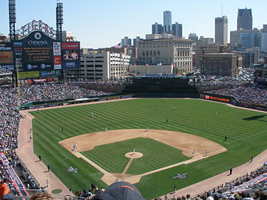
, a concert venue. Across the street is Comerica Park
Comerica Park
Comerica Park is an open-air ballpark located in downtown Detroit, Michigan. It serves as the home of the Detroit Tigers of Major League Baseball's American League, replacing historic Tiger Stadium in 2000....
, home of the Detroit Tigers
Detroit Tigers
The Detroit Tigers are a Major League Baseball team located in Detroit, Michigan. One of the American League's eight charter franchises, the club was founded in Detroit in as part of the Western League. The Tigers have won four World Series championships and have won the American League pennant...
. Next to it is Ford Field
Ford Field
Ford Field is an indoor American football stadium located in Detroit, Michigan, USA, that is the current home field of the NFL's Detroit Lions. It is owned by the Detroit/Wayne County Stadium Authority. It regularly seats 65,000, though it is expandable up to 70,000 for football and 80,000 for...
, home of the Detroit Lions
Detroit Lions
The Detroit Lions are a professional American football team based in Detroit, Michigan. They are members of the North Division of the National Football Conference in the National Football League , and play their home games at Ford Field in Downtown Detroit.Originally based in Portsmouth, Ohio and...
. Both sports venues are west of Woodward Avenue, between Adams and the I-75
Interstate 75 in Michigan
Interstate 75 is a part of the Interstate Highway System and runs from Miami, Florida to Sault Ste. Marie in the Upper Peninsula of Michigan. I-75 enters the state from Ohio in the south, just to the north of Toledo. It runs generally north through Detroit, Pontiac and Bay City, crossing the...
freeway. Further north is the Detroit Institute of Arts
Detroit Institute of Arts
The Detroit Institute of Arts is a renowned art museum in the city of Detroit. In 2003, the DIA ranked as the second largest municipally owned museum in the United States, with an art collection valued at more than one billion dollars...
.
Woodward Avenue continues northwesterly crossing through the campus of Wayne State University
Wayne State University
Wayne State University is a public research university located in Detroit, Michigan, United States, in the city's Midtown Cultural Center Historic District. Founded in 1868, WSU consists of 13 schools and colleges offering more than 400 major subject areas to over 32,000 graduate and...
and the city of Highland Park
Highland Park, Michigan
- Geography :According to the United States Census Bureau, the city has a total area of , all land.- Demographics :As of the census of 2000, there were 16,746 people, 6,199 households, and 3,521 families residing in the city. The population density was 5,622.9 per square mile . There were 7,249...
before re-entering Detroit at McNichols Road, which occupies the 6 Mile location in the Mile Road System in Detroit. At 8 Mile Road, Woodward Avenue crosses out of Detroit for the final time near the State Fairgrounds into Ferndale
Ferndale, Michigan
Ferndale is adjacent to the cities of Detroit to the south, Oak Park to the west, Hazel Park to the east, Pleasant Ridge to the north, Royal Oak Township to the southwest, and Royal Oak to the north....
and Oakland County
Oakland County, Michigan
-Demographics:As of the 2010 Census, there were 1,202,362 people, 471,115 households, and 315,175 families residing in the county. The population density as of the 2000 census was 1,369 people per square mile . There were 492,006 housing units at an average density of 564 per square mile...
.
Woodward Avenue in Detroit has been mentioned in popular culture several times, such as in the season-6 episode of the Detroit-based 1990s sitcom Home Improvement titled "My Son, the Driver". The character Brad mentions he was "rear-ended over on Woodward". Woodward is also known internationally for its annual "Woodward Dream Cruise" in which classic car enthusiasts showcase their vehicles.
Oakland County
Woodward Avenue continues north toward Pontiac. It passes through the suburbs of Ferndale, Royal OakRoyal Oak, Michigan
Royal Oak is a city in Oakland County of the U.S. state of Michigan. It is a suburb of Detroit. As of the 2010 census, the city had a total population of 57,236. It should not be confused with Royal Oak Charter Township, a separate community located nearby....
, Birmingham
Birmingham, Michigan
Birmingham is a city in Oakland County of the U.S. state of Michigan and an affluent suburb of Detroit. As of the 2010 census, the population was 20,103...
and Bloomfield Hills
Bloomfield Hills, Michigan
Bloomfield Hills is a city in Oakland County of the U.S. state of Michigan, northwest of downtown Detroit. As of the 2010 census, the city population was 3,869...
. Royal Oak is the location of the John Almon Starr House which is adjacent to the original trail. In Bloomfield Hills, the M-1 designation ends at Square Lake Road. Woodward Avenue continues north into downtown Pontiac
Pontiac, Michigan
Pontiac is a city in the U.S. state of Michigan named after the Ottawa Chief Pontiac, located within the Detroit metropolitan area. As of the 2010 census, the city had a total population of 59,515. It is the county seat of Oakland County...
as part of Business Loop I-75 (BL I-75) and BUS US 24. Through downtown, the highway splits along two streets of a one-way pair
One-way pair
A one-way pair, one-way couple, or just couplet is a pair of parallel, usually one-way streets that carry opposite directions of a signed route or major traffic flow, or sometimes opposite directions of a bus or streetcar route....
, using Woodward Avenue northbound and Wide Track Drive southbound. BL I-75 turns off along Perry Street, and BUS US 24 continues north along Oakland Avenue northbound and Cass Avenue southbound. The two streets merge together along Oakland Avenue north of Montcalm Street. North of Kennett Road, the street name changes to Dixie Highway.
Dixie Highway was named as a part of the original auto trail
Auto trail
The system of auto trails was an informal network of marked routes that existed in the United States and Canada in the early part of the 20th century. Marked with colored bands on telephone poles, the trails were intended to help travellers in the early days of the automobile.Auto trails were...
of the same name
Dixie Highway
The Dixie Highway was a United States automobile highway, first planned in 1914 to connect the US Midwest with the Southern United States. It was part of the National Auto Trail system, and grew out of an earlier Miami to Montreal highway. The final result is better understood as a small network of...
. When the road meets Telegraph Road
Telegraph Road (Michigan)
In the U.S. state of Michigan, US Highway 24 , also known as Telegraph Road, is a major north–south state trunkline highway; it is mostly divided highway. The total length is approximately and is signed as US 24 in its entirety...
, it loses the BUS US 24 designation in favor of US 24. Dixie Highway, and the Saginaw Trail, pass a number of lakes north of Pontiac before meeting I-75 in Independence Township
Independence Township, Michigan
Independence Charter Township is a charter township of Oakland County in the U.S. state of Michigan. The population was 34,681 at the 2010 census. The township was named by one of its earliest settlers, Joseph Van Sycle, who came to the area in 1834 from Independence, New Jersey.- History :John W...
at exit 93. This is the eastern end of US 24, which runs 2478 miles (3,988 km), all the way from Colorado Springs, Colorado
Colorado Springs, Colorado
Colorado Springs is a Home Rule Municipality that is the county seat and most populous city of El Paso County, Colorado, United States. Colorado Springs is located in South-Central Colorado, in the southern portion of the state. It is situated on Fountain Creek and is located south of the Colorado...
. Dixie Highway continues northwesterly and parallels I-75, using roadway that was once US 10. The grounds for the annual Michigan Renaissance Festival
Michigan Renaissance Festival
The Michigan Renaissance Festival is a Renaissance fair, an interactive outdoor event that focuses on recreating the look and feel of a fictional English village called Hollygrove during the reign of Queen Elizabeth I in the latter half of the 16th Century...
, which is unofficially dubbed "Hollygrove" for the festival, are located on Dixie Highway in both Holly Township
Holly Township, Michigan
Holly Township is a civil township of north Oakland County in the U.S. state of Michigan. The population was 11,362 at the 2010 census.- Communities :* The village of Holly is located within the township....
and Groveland Township
Groveland Township, Michigan
Groveland Township is a civil township of Oakland County in the U.S. state of Michigan. The population was 5,476 at the 2010 census.- Communities :...
. The festival grounds was the primary shooting location of the 2009 romantic comedy film
Romantic comedy film
Romantic comedy films are films with light-hearted, humorous plotlines, centered on romantic ideals such as that true love is able to surmount most obstacles. One dictionary definition is "a funny movie, play, or television program about a love story that ends happily"...
All's Faire in Love
All's Faire in Love
All Faire in Love is a 2009 romantic comedy film directed by Scott Marshall and written by R. A. White and Jeffrey Ray Wine. The film stars Owen Benjamin as Will, a college student who is assigned to work at a renaissance fair by his professor after missing several classes, and Christina...
. Mount Holly Ski Area is also located on Dixie Highway in Holly Township. Groveland Oaks County Park, which features a spiraling water-slide, is also on the roadway in Groveland Township. The Michigan State Police
Michigan State Police
The Michigan State Police is the state police agency for the state of Michigan. The MSP is a full service law enforcement agency with its sworn members having full police powers statewide....
's Satellite Office 21 is located next to Dixie Highway in Groveland Township.
Genesee County
Genesee County, Michigan
-Interstates:* I-69* I-75* I-475-Michigan State Trunklines:* M-13* M-15* M-21* M-54* M-57-Demographics:As of the census of 2000, there were 436,141 people, 169,825 households, and 115,990 families residing in the county. The population density was 682 people per square mile . There were 183,630...
, it is known as Saginaw Road or Saginaw Street. South of the Flint River
Flint River (Michigan)
The Flint River is a river in the Flint/Tri-Cities region of Michigan in the United States. It flows through the city of Flint and the counties of Genesee, Lapeer and Saginaw.- Course :...
, it is designated South Saginaw Street or South Saginaw Road, and north of the river, it is designated North Saginaw Street or North Saginaw Road. In Grand Blanc Township
Grand Blanc Township, Michigan
Grand Blanc Charter Township is a charter township of Genesee County in the U.S. state of Michigan. The population was 35,705 at the 2010 census. The city of Grand Blanc is situated within the township, but is administratively autonomous...
, Warwick Hills Golf and Country Club
Warwick Hills Golf and Country Club
Warwick Hills Golf and Country Club is a private country club located on South Saginaw Road in Grand Blanc Township, Michigan, a suburb of Flint, Michigan, United States. From 1958 to 2009, Warwick Hills was home to the PGA Tour's Buick Open tournament. The course was opened in June 1957...
, former home of the PGA's Buick Open
Buick Open
The Buick Open was a PGA Tour golf tournament from 1958 to 2009. In 2007, the tournament was held at the end of June, a change from its traditional spot between The Open Championship and the PGA Championship...
(which has now been discontinued) is on Saginaw Road. Also on Saginaw Road in Grand Blanc Township is a branch office of the 67th District Court and Grand Blanc Township's Administrative Offices. In southern Flint, on Saginaw Street between Atherton and Hemphill Roads, is the Fisher Body
Fisher Body
Fisher Body is an automobile coachbuilder founded by the Fisher brothers in 1908 in Detroit, Michigan; it is now an operating division of General Motors Company...
Plant #1, which is now the Great Lakes Technology Center. This plant was the site of the Flint Sit-Down Strike
Flint Sit-Down Strike
The 1936–1937 Flint Sit-Down Strike changed the United Automobile Workers from a collection of isolated locals on the fringes of the industry into a major labor union and led to the unionization of the domestic United States automobile industry....
, a pivotal event in the development of the United Auto Workers
United Auto Workers
The International Union, United Automobile, Aerospace and Agricultural Implement Workers of America, better known as the United Auto Workers , is a labor union which represents workers in the United States and Puerto Rico, and formerly in Canada. Founded as part of the Congress of Industrial...
.
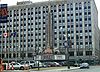
In Downtown Flint several government buildings are on Saginaw Street, including the historic 1917 Genesee County Circuit Courthouse, Flint City Hall, the Genesee County Administration Building, the Genesee County Jail, the Genesee County Sheriff's Department headquarters, the headquarters of the 67th and 68th District Courts, and the Genesee County Health Department. The headquarters of Citizens Republic Bancorp which was founded as Citizens Commercial & Savings Bank in Flint in 1871 are on Saginaw Street in Downtown Flint, as is the historic First National Bank of Flint which was founded in 1864. The current building was constructed in 1924.
Another popular culture reference to the Saginaw Trail came In the 2008 movie Semi-Pro
Semi-Pro
Semi-Pro is a 2008 American sports screwball comedy film from New Line Cinema. The film was directed by Kent Alterman and stars Will Ferrell, Woody Harrelson, André Benjamin and Maura Tierney. The film was shot in Los Angeles near Dodger Stadium , in Detroit and in Flint, Michigan...
, which was filmed partially in Flint. The main character Jackie Moon, played by Will Ferrell
Will Ferrell
John William "Will" Ferrell is an American comedian, impressionist, actor, and writer. Ferrell first established himself in the late 1990s as a cast member on the NBC sketch comedy show Saturday Night Live, and has subsequently starred in the comedy films Old School, Elf, Anchorman, Talladega...
, was shown driving on Saginaw Street at the Flint River
Flint River (Michigan)
The Flint River is a river in the Flint/Tri-Cities region of Michigan in the United States. It flows through the city of Flint and the counties of Genesee, Lapeer and Saginaw.- Course :...
bridge in Downtown Flint.
Continuing north through the county, in Mount Morris
Mount Morris, Michigan
Mount Morris is a city in Genesee County in the U.S. state of Michigan. The population was 3,194 at the 2000 census. The city is adjacent to Mount Morris Township, but is politically independent.- History:...
, a branch office of the 67th District Court is on Saginaw Street, as well as the Mount Morris City Administration Offices. Auto City Speedway is on Saginaw Road between Mount Morris
Mount Morris, Michigan
Mount Morris is a city in Genesee County in the U.S. state of Michigan. The population was 3,194 at the 2000 census. The city is adjacent to Mount Morris Township, but is politically independent.- History:...
and Clio
Clio, Michigan
Clio is a city in Genesee County in the U.S. state of Michigan.As of the 2000 census, the city had a population of 2,483. Clio is home to Michigan's second tallest construction, the WEYI Tower...
. Between Dort Highway's northern terminus and Clio Road in Genesee County, Saginaw Road is part of M-54.
Saginaw County
In Saginaw CountySaginaw County, Michigan
-Demographics:As of the census of 2000, there were 210,039 people, 80,430 households, and 55,818 families residing in the county. The population density was 260 people per square mile . There were 85,505 housing units at an average density of 106 per square mile...
, it is also known as Dixie Highway, except in the City of Saginaw, where it is known as Genesee Avenue. In this segment, the road mostly runs through farmlands and rural residential areas. The Michigan State Police
Michigan State Police
The Michigan State Police is the state police agency for the state of Michigan. The MSP is a full service law enforcement agency with its sworn members having full police powers statewide....
has 2 offices on the trail in Saginaw County: Post 37 is on Dixie Highway in Bridgeport Township, and the District 3 headquarters are on Genesee Avenue in Saginaw.
Dixie Motor Speedway is on Dixie Highway in Birch Run Township
Birch Run Township, Michigan
Birch Run Township is a civil township of Saginaw County in the U.S. state of Michigan. As of the 2000 census, the township population was 6,191...
. and a few miles north in Bridgeport Township is the Bridgeport Township Administration Office. Also in Bridgeport is the Junction Valley Railroad, the world's largest quarter scale railroad system. The trail ends at Washington Avenue in Downtown Saginaw.
Major intersections
See also
- Michigan State Trunkline Highway System
- Sauk TrailSauk TrailSauk Trail began as a Native American trail running through Illinois, Indiana and Michigan in the United States. From west to east, the trail ran from Rock Island on the Mississippi River to the Illinois River near modern Peru then along the north bank of that river to Joliet, and on to Valparaiso,...
- Mackinac TrailMackinac TrailMackinac Trail, or Mackinaw Trail is the name for two related, but separate, roadways in the US state of Michigan. The original Mackinac Trail was an Indian Trail that lent its name to the roadways that replaced it. The trail ran from the modern Saginaw to Mackinaw City in the Lower Peninsula with...