

U.S. Route 23 in Michigan
Encyclopedia
US Highway 23 is a United States Numbered Highway that runs from Jacksonville, Florida
to Mackinaw City, Michigan
. In the US state of Michigan
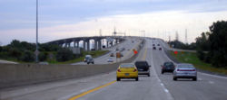
, it is a major 362.33 miles (583.11 km) north–south state trunkline highway
that runs through the Lower Peninsula
(LP). The trunkline is a freeway from the Michigan–Ohio
state line near Lambertville
to the city of Standish
, and it follows the Lake Huron
shoreline from there to its northern terminus. The non-freeway section was designated the Sunrise Side Coastal Highway by the Michigan Department of Transportation
(MDOT) in 2004 as a part of the Michigan Heritage Route
program. Serving the cities of Ann Arbor
and Flint
, US 23 acts as a freeway bypass of the Metro Detroit
area. The section from Flint north to Standish also carries Interstate 75
(I-75) including a segment that carries almost 70,000 vehicles on a daily basis.
The first transportation routes along US 23 in the state were sections of two Indian
trails. When the United States Numbered Highway System was first designated on November 11, 1926, the new highway replaced two previous designations along its route. Since creation, the road was been moved and realigned several times. Through the 1930s and 1940s, the lakeshore routing was created to replace a path that run further inland through the northern portion
of the state. Starting in the early 1950s, various sections in the southeastern and central areas of the LP were upgraded to freeways, bypassing several major cities in the area. These improvements were completed by the end of the 1960s. Since then a new crossing of the Saginaw River
at Zilwaukee
was built to carry the I-75/US 23 freeway. The Zilwaukee Bridge
was delayed by an August 1982 construction accident. Originally scheduled for completion in 1983, the structure opened to traffic in September 1988.
and a scenic highway through the northern portion
of the state along Lake Huron. Between Flint
and Standish
, US 23 runs concurrently with I-75. Like other state trunkline highways, it is maintained by the Michigan Department of Transportation
(MDOT). All of US 23 in the state south of the M-32
junction in Alpena
has been listed on the National Highway System
, a network of roads important to the country's economy, defense, and mobility. From the Standish
area north, the highway is also a part of the Lake Huron Circle Tour and the Sunrise Side Coastal Highway, a Michigan Heritage Route.
, concurrent with US 223
. This freeway runs north through farm fields in rural western Monroe County
near Lambertville
. about 5 miles (8 km) north of the state line, US 223 turns westerly on St. Anthony Road, leaving the freeway. South of Dundee
, US 23 crosses the River Raisin
before coming to an interchange with M-50
next to the Cabela's
store west of town. North of town, the freeway passes near a cement plant. Farther north, it crosses a line of the Ann Arbor Railroad near Azalia
as the trunkline runs to the east of Milan
at the Monroe-Washtenaw
county line. North of Milan, the freeway crosses a line of the Norfolk Southern Railway
.
The landscape takes on a more suburban residential character as the freeway approaches the Ann Arbor area. There are separate interchanges for US 12
(Michigan Avenue) and I-94
. Between the latter interchange and the one for Washtenaw Avenue, US 23 carries the Business Loop I-94 (BL I-94) moniker as well. That secondary designation leaves the freeway and runs west on Washtenaw Avenue into downtown Ann Arbor and the campus of the University of Michigan
along with the Business US 23 (BUS US 23) designation; east of US 23, M-17 connects the freeway with Ypsilanti. North of this interchange, US 23 crosses the Huron River
near the campus of Washtenaw Community College
and continues north to a junction with the M-14
freeway. The two merge and run westward along the north side of the city before US 23 turns north and M-14 turns south.
North of Ann Arbor, the freeway runs through woodlands and near several lakes. US 23 crosses into Livingston County
in Whitmore Lake
near the water body of the same name. East of Brighton
, the freeway intersects I-96
and continues north to an intersection with M-59
south of Hartland. The freeway turns northeasterly by Runyon Lake and runs toward the city of Fenton
. The trunkline passes through town and turns back toward the northwest, running between lakes Ponemah and Fenton. Continuing north, US 23 runs through fields as it approaches the Flint area.
 Southwest of Grand Blanc
, US 23 meets I-75, and the two freeways merge together near the Bishop International Airport
. The freeway has an interchange with I-69
near the crossing with the Canadian National Railway
line. I-75/US 23 runs along the west side of Flint, crossing the Flint River
. In Mount Morris Township
, the freeway intersects the northern end of I-475
before meeting M-57
near Clio
. The highest traffic totals along US 23 in the state of Michigan were recorded by MDOT near the M-57 interchange; in 2009 an average 68,800 vehicles used that section of freeway daily. These traffic counts are expressed in terms of annual average daily traffic
(AADT), which is a statistical calculation of the average daily number of vehicles on a segment of roadway.
Near Birch Run
, the highway turns northwesterly next to a large outlet mall. Between here and the Saginaw area,the trunkline runs through more wooded lands, crossing the Cass River
near Bridgeport
. I-75/US 23 enters the Tri-Cities (named for Saginaw
, Bay City
and Midland
) when it bypasses Saginaw on the east. The freeway intersects M-46
in the suburb of Buena Vista
south of the junction with I-675
. North of downtown, the freeway crosses the Saginaw River
on the Zilwaukee Bridge
, a "post-tensioned, segmental, [concrete] box girder bridge
" that is "infamous" for a series of "construction mishaps, cost overruns, and government foibles."
Past the bridge, I-75/US 23 meets the northern end of I-675 and continues through fields and woods to the Bay City area. At exit 162, the freeway meets the eastern terminus of US 10
and the western terminus of M-25
west of downtown. The next interchange north is with the M-13 connector
freeway, and I-65/US 23 turns northwesterly to bypass around Kawkawlin. The trunkline turns north, crosses the Kawkawlin River
and the Pinconning Creek before coming to exit 188. There, US 23 turns east, separating from I-75. The trunkline continues for about 3 miles (4.8 km) as a freeway which ends at the intersection with M-13
south of Standish. The lowest AADT along any freeway section of US 23 in Michigan is the section immediately east of I-75; here the traffic levels drop from 20,763 vehicles per day to 4,466 vehicles after US 23 separates from I-75.
. Northeast of this intersection, the highest, non-freeway AADT level on US 23 was recorded by MDOT at 16,757 vehicles daily. Running through Omer
, the highway crosses the Rifle River
and a line of the Lake State Railway
. In between the two crossings, it turns due east on its way out of town. At Hale Road, US 23 meets the southern end of M-65
before it continues east to Au Gres
. There it runs along the Saginaw Bay
and crosses the Au Gres River
. Huron Road turns northward along the lakeshore, staying inland near Point Lookout. US 23 runs through woods as it follows Saginaw Bay through Alabaster to Tawas City
. The highway intersects the eastern terminus of M-55
, runs around Tawas Bay to East Tawas
and follows the Lake Huron shoreline to Oscoda
. Through this area, US 23 runs parallel to the Lake State Railway and crosses into the Huron National Forest.
Oscoda is the location of the eastern termini of both the River Road National Scenic Byway
, County Road F-41. In between those two junctions, the highway crosses the Au Sable River
near its mouth, and the trunkline passes by the former Wurtsmith Air Force Base
. Huron Road continues north, running next to Van Etten Lake as it leaves the national forest. Further north, it runs along Cedar Lake when it crosses into Alcona County
. The highway meets the eastern termini of F-30 and M-72
in Greenbush and Harrisville
respectively. It also passes the Harrisville State Park
in the latter community. The highway shifts a bit further inland north of Harrisville, continuing to parallel the rail road through the Mackinaw State Forest
. Near Ossineke
, the trunkline turns back toward the lake, running along the shoreline of Thunder Bay
.
When US 23 enters Alpena, it follows State Street through town and turns northwesterly on Chisholm Street. The intersection of Chisholm and Washington streets marks the eastern terminus of M-32
. Chisholm Street runs along the Thunder Bay River
and crosses the river near Lake Besser. The highway leaves town and runs through rural woodlands to the south shore of Long Lake, curving around the eastern side of the lake. Near the northern end of the lake, US 23 crosses into Presque Isle County
and runs along the west shore of Grand Lake. At the north end of that lake, the highway turns west along the Lake Huron shoreline near Thompson's Harbor State Park
. The trunkline continues to Rogers City
where it bypasses town to the south and west, intersecting F-21 and M-68
in the process; BUS US 23 runs through downtown. On the other side of Rogers City, US 23 runs along the lake past Hoeft State Park
and along Hammond Bay before crossing into Cheboygan County
. This area had the lowest AADT levels in 2009 at 1,097 vehicles per day.
US 23 follows the Lake Huron shoreline through Cheboygan County through woodlands past Cheboygan State Park
and Duncan Bay. On the eastern edge of the city, the highway intersects F-05 before following State Street through a commercial district. State Street crosses the Cheboygan River
on the Cheboygan Bascule Bridge near the mouth of the river and the dock for the USCGC Mackinaw
. On the west side of the river, US 23 meets the northern terminus of M-27
at the intersection with Main Street. State Street continues westerly as C-66, and US 23 turns north on Main Street for a block before resuming west on Mackinaw Avenue. The highway continues along the lake toward Mackinaw City
. As it approaches the village, it passes Historic Mill Creek State Park
and several motels. At Nicolet Street in town, the highway crosses into Emmet County
for the short distance to the highway's national northern terminus at I-75's exit 338.
trails. The original Shore Trail ran roughly parallel to the route of the modern US 23 from the Bay City area to Cheboygan; another section followed the Saginaw Trail
between Flint and Saginaw. Later, during the auto trail
era, the modern US 23 also coincided with the east branch of the Dixie Highway
and the Theodore Roosevelt International Highway
north of Standish. The first state highways along the US 23 corridor were numbered M-65
from the Ohio line north to the Flint area and M-10
from Flint north to Mackinaw City by July 1, 1919. When originally designated, M-65 was in two sections: the southern segment ran from the Ohio state line north to the Dundee area; the northern section ran between Ann Arbor and Flint by way of Brighton and Fenton. The gap between the two segments was eliminated by the middle of 1926.
and ran north to Ypsilanti
via Maybee
. Once the highway entered Ann Arbor, it followed the roads that preceded the modern freeway up to Flint. From Flint to Saginaw, US 23 ran concurrently with US 10. On the way north to Bay City, the highway ran on the west side of the Saginaw River before turning north to the Standish area. From Standish to Mackinaw City, US 23 initially took a more inland route through the northeastern LP.
Starting in 1929, MSHD started updating the route that US 23 followed through the Lower Peninsula. Late that year, the routing was moved to the east side of the Saginaw River, and M-47
was extended along the former course on the west side of the river. During 1930, a set of changes realigned the highway's route through the southeast corner of the state. Near Ida, US 23 was rerouted along M-50 to Dundee and north through Milan to Ann Arbor, bypassing Maybee and Whittaker. US 23 was moved from its inland routing between Omer and Tawas City via Whittemore
to follow a shoreline alignment by way of Au Gres along Saginaw Bay around 1932; the former route through Twining
and Whittemore became an extension of M-65 and the section from Whittemore east to Tawas City was added to M-55 as a part of these changes.
In 1932, US 23 was moved closer to the lakeshore between Spruce and Alpena; the former routing was redesignated M-171
. The highway was also moved to a route closer to the lakeshore between Tawas City and Oscoda, with part of the old inland route taking the designation Old US 23. A few years later in 1936, US 23 replaced M-72 between Oscoda and Harrisville and followed a new roadway north to the Spruce area. The M-171 designation was applied to the former routing by way of Mikado and Lincoln
. In the middle of 1937, US 27 was extended concurrently along US 23 between Cheboygan and Mackinaw City. Around the end of the decade, US 23's routing was moved in another location to follow the lakeshore; this time the highway was rerouted between Alpena and Rogers City. M-65 was extended northwards from Lachine through Posen to terminate over the former US 23 routing.
US 23 was moved to its current lakeshore routing between Rogers City and Cheboygan in 1940, and M-33
was extended westerly from Onaway to Afton and north to Cheboygan over the former US 23 roadway while M-68 was extended eastward through Onaway to Rogers City. In early 1941, a bridge
across the Saginaw River connecting Salzburg and Lafayette avenues in Bay City was added to the route of US 23 in the city; at the same time the former routing was redesignated U.S. Route 23 Business. The highway was also realigned between Hartland and Fenton in 1941. By 1945, the northernmost segment of M-65 downtown Rogers City was redesignated Business US 23, and M-65 was truncated to its junction with US 23 southeast of town, removing the concurrency that existed since 1940. North of Dundee, a more direct alignment to Azalia
was added to US 23, turning the former routing back to local control in late 1947 or early 1948; at the same time, the last gravel section of the highway was paved near Hammond Bay in northwestern Presque Isle County.
. Two years later, a similar bypass was built from Bridgeport to M-81 on the east side of Saginaw, with the old route becoming a BUS US 23 designation. Both bypasses would later be upgraded to four-lane freeways by 1961, with the Saginaw one later incorporated into the route of I-75. When the Mackinac Bridge
opened on November 1, 1957, US 23, US 27 and US 31 were extended along the access roadways to the foot of the bridge.
The first future freeway portion of US 23 was built in 1957 from north of Ann Arbor to Whitmore Lake as a divided highway. On June 30, 1958, the first stretch of the "Fenton–Clio Expressway" opened, stretching from Fenton to Birch Run. The freeway connection from Dundee south to Ohio was opened on October 1, 1959. In late 1959, the portion from Flint to Birch Run also gained the I-75 designation.
In late 1960 or early 1961, a new I-75/US 23/US 10 freeway was built from the north end of the Saginaw bypass to Kawkawlin, utilizing the Zilwaukee drawbridge (later replaced by the Zilwaukee Bridge
) over the Saginaw River
; when it opened, MSHD extended M-13 along the former route of US 23 from the northside of Saginaw into Bay City to the end of the freeway at Kawkawlin. Another section connected the Whittemore Lake area with Brighton in the same timeframe. By the end of the year, freeway sections opened to bypass Saginaw south and ran south to Birch Run, another connected south from Fenton to Hartland, and a third connected Milan with Dundee. The remaining gaps were eliminated with additional freeway openings in 1962: Brighton to Hartland opened in September, and Milan to Ann Arbor opened in November.
The I-75/US 23 freeway north of the Kawkawlin area to Standish opened in 1967, and M-13 was shown on maps following US 23's former route through Linwood and Pinconning after the change. MSHD requested that US 23 north of Standish be included in the Interstate Highway System
in 1968; if the addition had been approved, federal funding would have been available for additional freeway conversions. Once the last piece of I-75 was completed along the M-76
corridor, the I-75 designation was extended north of Bay City on US 23 in 1973.
The MSHD first proposed a realignment of US 223 in 1965; this change would reroute that highway to replace M-151
in southern Monroe County, and use the US 23 freeway to connect to Sylvania, Ohio. The rerouting change was made in 1977 when Michigan shifted its segment of US 223 as proposed twelve years prior. Instead of running south through Ottawa Lake, US 223 continued east to the US 23 freeway and south into Ohio.
The original bridge across the Saginaw River at Zilwaukee was built in 1960 as a bascule bridge
to allow shipping traffic to use the river. Opening the drawbridge would back traffic up on I-75/US 10/US 23 for upwards of four hours on holiday weekends. Approved in 1974, construction on the replacement bridge started in October 1979. A major construction accident in August 1982 delayed completion of the new Zilwaukee Bridge. The structure was originally supposed to cost $76.8 million with a 1983 completion date; in the end it cost $131.3 million when the southbound span finally opened on September 19, 1988.
While that construction was being done, MDOT truncated US 10 at Bay City in 1986; this removed the concurrency between US 10 and US 23 that existed since 1926. In May 2004, the highway north of Standish was named the Sunrise Side Coastal Highway, a Michigan Heritage Route.
Jacksonville, Florida
Jacksonville is the largest city in the U.S. state of Florida in terms of both population and land area, and the largest city by area in the contiguous United States. It is the county seat of Duval County, with which the city government consolidated in 1968...
to Mackinaw City, Michigan
Mackinaw City, Michigan
Mackinaw City is a village in Emmet and Cheboygan counties in the U.S. state of Michigan. At the 2000 census the population was 859. The name "Mackinaw City" is a bit of a misnomer as it is actually a village...
. In the US state of Michigan
Michigan
Michigan is a U.S. state located in the Great Lakes Region of the United States of America. The name Michigan is the French form of the Ojibwa word mishigamaa, meaning "large water" or "large lake"....
, it is a major 362.33 miles (583.11 km) north–south state trunkline highway
Michigan Highway System
The Michigan State Trunkline Highway System is made up of all the highways designated as Interstates, U.S. Highways and State Highways in the US state of Michigan. The system is maintained by the Michigan Department of Transportation and comprises of trunklines in all 83 counties of Michigan on...
that runs through the Lower Peninsula
Lower Peninsula of Michigan
The Lower Peninsula of Michigan is the southern of the two major landmasses of the U.S. state of Michigan. It is surrounded by water on all sides except its southern border, which it shares with Ohio and Indiana. Geographically, the Lower Peninsula has a recognizable shape that many people...
(LP). The trunkline is a freeway from the Michigan–Ohio
Ohio
Ohio is a Midwestern state in the United States. The 34th largest state by area in the U.S.,it is the 7th‑most populous with over 11.5 million residents, containing several major American cities and seven metropolitan areas with populations of 500,000 or more.The state's capital is Columbus...
state line near Lambertville
Lambertville, Michigan
Lambertville is an unincorporated community in Monroe County in the U.S. state of Michigan. It is also the name of the area served by the Lambertville Post Office. The Lambertville ZIP code, 48144, serves the southwest part of Bedford Township, as well as portions of adjacent Whiteford Township....
to the city of Standish
Standish, Michigan
Standish is a city in the U.S. state of Michigan. As of the 2000 census, the city population was 1,581. It is the county seat of Arenac County.The town was platted by John D. Standish in 1871...
, and it follows the Lake Huron
Lake Huron
Lake Huron is one of the five Great Lakes of North America. Hydrologically, it comprises the larger portion of Lake Michigan-Huron. It is bounded on the east by the Canadian province of Ontario and on the west by the state of Michigan in the United States...
shoreline from there to its northern terminus. The non-freeway section was designated the Sunrise Side Coastal Highway by the Michigan Department of Transportation
Michigan Department of Transportation
The Michigan Department of Transportation is a constitutional government agency in the US state of Michigan. The primary purpose of MDOT is to maintain the Michigan State Trunkline Highway System which includes all Interstate, US and state highways in Michigan with the exception of the Mackinac...
(MDOT) in 2004 as a part of the Michigan Heritage Route
Michigan Heritage Route
Michigan Heritage Route is a designation for roads in Michigan. The designation was created by the state legislature in 1993.The program emphasizes cooperation among local residents, government officials, landowners and interested groups to preserve unique scenic, historic or recreational...
program. Serving the cities of Ann Arbor
Ann Arbor, Michigan
Ann Arbor is a city in the U.S. state of Michigan and the county seat of Washtenaw County. The 2010 census places the population at 113,934, making it the sixth largest city in Michigan. The Ann Arbor Metropolitan Statistical Area had a population of 344,791 as of 2010...
and Flint
Flint, Michigan
Flint is a city in the U.S. state of Michigan and is located along the Flint River, northwest of Detroit. The U.S. Census Bureau reports the 2010 population to be placed at 102,434, making Flint the seventh largest city in Michigan. It is the county seat of Genesee County which lies in the...
, US 23 acts as a freeway bypass of the Metro Detroit
Metro Detroit
The Detroit metropolitan area, often referred to as Metro Detroit, is the metropolitan area located in Southeast Michigan centered on the city of Detroit which shares an international border with Windsor, Ontario. The Detroit metropolitan area is the second largest U.S. metropolitan area...
area. The section from Flint north to Standish also carries Interstate 75
Interstate 75 in Michigan
Interstate 75 is a part of the Interstate Highway System and runs from Miami, Florida to Sault Ste. Marie in the Upper Peninsula of Michigan. I-75 enters the state from Ohio in the south, just to the north of Toledo. It runs generally north through Detroit, Pontiac and Bay City, crossing the...
(I-75) including a segment that carries almost 70,000 vehicles on a daily basis.
The first transportation routes along US 23 in the state were sections of two Indian
Native Americans in the United States
Native Americans in the United States are the indigenous peoples in North America within the boundaries of the present-day continental United States, parts of Alaska, and the island state of Hawaii. They are composed of numerous, distinct tribes, states, and ethnic groups, many of which survive as...
trails. When the United States Numbered Highway System was first designated on November 11, 1926, the new highway replaced two previous designations along its route. Since creation, the road was been moved and realigned several times. Through the 1930s and 1940s, the lakeshore routing was created to replace a path that run further inland through the northern portion
Northern Michigan
Northern Michigan, also known as Northern Lower Michigan , is a region of the U.S. state of Michigan...
of the state. Starting in the early 1950s, various sections in the southeastern and central areas of the LP were upgraded to freeways, bypassing several major cities in the area. These improvements were completed by the end of the 1960s. Since then a new crossing of the Saginaw River
Saginaw River
The Saginaw River is a river in the U.S. state of Michigan. It is formed by the confluence of the Tittabawassee and Shiawassee rivers southwest of Saginaw. It flows northward into the Saginaw Bay of Lake Huron just northeast of Bay City. The watershed area is .The river is an important shipping...
at Zilwaukee
Zilwaukee, Michigan
Zilwaukee is a city in Saginaw County in the U.S. state of Michigan. The population was 1,799 at the 2000 census. The 2009 Census Bureau estimate places the population at 1,640. The city is adjacent to and was created from Zilwaukee Township...
was built to carry the I-75/US 23 freeway. The Zilwaukee Bridge
Zilwaukee Bridge
The Zilwaukee Bridge is a high-level, segmental concrete bridge spanning the Saginaw River in Zilwaukee, Michigan, approximately north of Saginaw, Michigan, United States. The current eight-lane structure, completed in 1988, is the second such bridge at this location, replacing a four-lane bascule...
was delayed by an August 1982 construction accident. Originally scheduled for completion in 1983, the structure opened to traffic in September 1988.
Route description
US 23 runs for 362.33 miles (583.1 km) through the LP of Michigan, serving as a freeway bypass to the west of Metro DetroitMetro Detroit
The Detroit metropolitan area, often referred to as Metro Detroit, is the metropolitan area located in Southeast Michigan centered on the city of Detroit which shares an international border with Windsor, Ontario. The Detroit metropolitan area is the second largest U.S. metropolitan area...
and a scenic highway through the northern portion
Northern Michigan
Northern Michigan, also known as Northern Lower Michigan , is a region of the U.S. state of Michigan...
of the state along Lake Huron. Between Flint
Flint, Michigan
Flint is a city in the U.S. state of Michigan and is located along the Flint River, northwest of Detroit. The U.S. Census Bureau reports the 2010 population to be placed at 102,434, making Flint the seventh largest city in Michigan. It is the county seat of Genesee County which lies in the...
and Standish
Standish, Michigan
Standish is a city in the U.S. state of Michigan. As of the 2000 census, the city population was 1,581. It is the county seat of Arenac County.The town was platted by John D. Standish in 1871...
, US 23 runs concurrently with I-75. Like other state trunkline highways, it is maintained by the Michigan Department of Transportation
Michigan Department of Transportation
The Michigan Department of Transportation is a constitutional government agency in the US state of Michigan. The primary purpose of MDOT is to maintain the Michigan State Trunkline Highway System which includes all Interstate, US and state highways in Michigan with the exception of the Mackinac...
(MDOT). All of US 23 in the state south of the M-32
M-32 (Michigan highway)
M-32 is a state trunkline highway in the Lower Peninsula of the U.S. state of Michigan. It is an east–west route running from M-66 in East Jordan to US Highway 23 in Alpena. It runs via Gaylord and Atlanta through forested terrain...
junction in Alpena
Alpena, Michigan
Alpena is a city in the U.S. state of Michigan and the county seat of Alpena County. It is considered to be part of Northern Michigan. The Thunder Bay National Marine Sanctuary is located in the city. The population was 10,483 at the 2010 census...
has been listed on the National Highway System
National Highway System (United States)
The National Highway System is a network of strategic highways within the United States, including the Interstate Highway System and other roads serving major airports, ports, rail or truck terminals, railway stations, pipeline terminals and other strategic transport facilities.Individual states...
, a network of roads important to the country's economy, defense, and mobility. From the Standish
Standish, Michigan
Standish is a city in the U.S. state of Michigan. As of the 2000 census, the city population was 1,581. It is the county seat of Arenac County.The town was platted by John D. Standish in 1871...
area north, the highway is also a part of the Lake Huron Circle Tour and the Sunrise Side Coastal Highway, a Michigan Heritage Route.
Southeastern Michigan
US 23 enters Michigan on a freeway northwest of Toledo, OhioToledo, Ohio
Toledo is the fourth most populous city in the U.S. state of Ohio and is the county seat of Lucas County. Toledo is in northwest Ohio, on the western end of Lake Erie, and borders the State of Michigan...
, concurrent with US 223
U.S. Route 223
US Route 223 or US Highway 223 is a diagonal US Highway lying in the US states of Michigan and Ohio. The southern most section is completely concurrent with the US 23 freeway, including all of the Ohio segment. It connects US 23 in the south near Toledo, Ohio with US 127 and...
. This freeway runs north through farm fields in rural western Monroe County
Monroe County, Michigan
Monroe County is a county in the U.S. state of Michigan. According to the U.S. Census Bureau, the 2010 population is 152,021. The largest city and county seat is Monroe. The U.S. Census Bureau defines all of Monroe County as conterminous with the Monroe Metropolitan Area...
near Lambertville
Lambertville, Michigan
Lambertville is an unincorporated community in Monroe County in the U.S. state of Michigan. It is also the name of the area served by the Lambertville Post Office. The Lambertville ZIP code, 48144, serves the southwest part of Bedford Township, as well as portions of adjacent Whiteford Township....
. about 5 miles (8 km) north of the state line, US 223 turns westerly on St. Anthony Road, leaving the freeway. South of Dundee
Dundee, Michigan
Dundee is a village in Monroe County in the U.S. state of Michigan. The population was 3,522 at the 2000 census. The village is located within Dundee Township. Through a series of annexations and land transfers, the village has greatly increased in size over the past several years...
, US 23 crosses the River Raisin
River Raisin
The River Raisin is a river in southeastern Michigan, United States that flows through glacial sediments into Lake Erie. The area today is an agricultural and industrial center of Michigan. The river flows for almost , draining an area of in the Michigan counties of Lenawee, Monroe, Washtenaw,...
before coming to an interchange with M-50
M-50 (Michigan highway)
M-50 is a state trunkline highway in the US state of Michigan. Although designated as an east–west highway, it is nearly a diagonal northwest-southeast route...
next to the Cabela's
Cabela's
Cabela's is a direct marketer and specialty retailer of hunting, fishing, camping and related outdoor recreation merchandise, based in Sidney, Nebraska. It also has "Trophy Properties LLC , "Outdoor Adventures" , and the "Gun Library"...
store west of town. North of town, the freeway passes near a cement plant. Farther north, it crosses a line of the Ann Arbor Railroad near Azalia
Azalia, Michigan
Azalia, is an unincorporated community in Milan Township, Monroe County in the U.S. state of Michigan. It is located south and east of exit 22 off U.S. Highway 23, about five miles south of the city of Milan and about four miles north of Dundee....
as the trunkline runs to the east of Milan
Milan, Michigan
Milan is a city in Monroe and Washtenaw counties in the U.S. state of Michigan. The population was 4,775 at the 2000 census. About 60% of the city's area and 75% of its residents are located on the Washtenaw County side adjacent to York Township in Washtenaw County; while 40% percent of the...
at the Monroe-Washtenaw
Washtenaw County, Michigan
Washtenaw County is a county in the U.S. state of Michigan. As of the 2010 census, the population was 344,791. Its county seat is Ann Arbor. The United States Office of Management and Budget defines the county as part of the Detroit–Warren–Flint Combined Statistical Area...
county line. North of Milan, the freeway crosses a line of the Norfolk Southern Railway
Norfolk Southern Railway
The Norfolk Southern Railway is a Class I railroad in the United States, owned by the Norfolk Southern Corporation. With headquarters in Norfolk, Virginia, the company operates 21,500 route miles in 22 eastern states, the District of Columbia and the province of Ontario, Canada...
.
The landscape takes on a more suburban residential character as the freeway approaches the Ann Arbor area. There are separate interchanges for US 12
U.S. Route 12 in Michigan
US Highway 12 is a US Highway that runs from Aberdeen, Washington to Detroit, Michigan. In the US state of Michigan it runs for . Previous to the creation of Interstate Highways in Michigan, US 12 ran along Michigan Avenue between Kalamazoo and Detroit, a highway corridor now served by I-94...
(Michigan Avenue) and I-94
Interstate 94 in Michigan
Interstate 94 is a part of the Interstate Highway System that runs from Billings, Montana, to the Lower Peninsula of the US state of Michigan. In Michigan, it is a state trunkline highway that enters the state south of New Buffalo...
. Between the latter interchange and the one for Washtenaw Avenue, US 23 carries the Business Loop I-94 (BL I-94) moniker as well. That secondary designation leaves the freeway and runs west on Washtenaw Avenue into downtown Ann Arbor and the campus of the University of Michigan
University of Michigan
The University of Michigan is a public research university located in Ann Arbor, Michigan in the United States. It is the state's oldest university and the flagship campus of the University of Michigan...
along with the Business US 23 (BUS US 23) designation; east of US 23, M-17 connects the freeway with Ypsilanti. North of this interchange, US 23 crosses the Huron River
Huron River (Michigan)
The Huron River is a river in southeastern Michigan, rising out of the Huron Swamp in Indian Springs Metropark in northern Oakland County and flowing into Lake Erie on the boundary between Wayne County and Monroe County...
near the campus of Washtenaw Community College
Washtenaw Community College
Washtenaw Community College is a community college located in Ann Arbor, Michigan. Founded in 1965, WCC welcomes more than 13,000 people from over 100 different countries for study each year and grants certificates and degrees to over 1,400 students annually...
and continues north to a junction with the M-14
M-14 (Michigan highway)
M-14 is a east–west state trunkline highway in the southeastern portion of the US state of Michigan. Entirely freeway, it connects Ann Arbor with Detroit by way of connecting with I-96.-Route description:...
freeway. The two merge and run westward along the north side of the city before US 23 turns north and M-14 turns south.
North of Ann Arbor, the freeway runs through woodlands and near several lakes. US 23 crosses into Livingston County
Livingston County, Michigan
-Demographics:As of the census of 2000, there were 156,951 people, 55,384 households, and 43,531 families residing in the county. The population density was 276 people per square mile . There were 58,919 housing units at an average density of 104 per square mile...
in Whitmore Lake
Whitmore Lake, Michigan
Whitmore Lake is an unincorporated community in the U.S. state of Michigan. The community spans the boundary between Green Oak Township in Livingston County and Northfield Township in Washtenaw County. The United States Census Bureau has defined a census-designated place with this name for...
near the water body of the same name. East of Brighton
Brighton, Michigan
Brighton is a principal satellite city of Metro Detroit located in the southeast portion of Livingston County in the U.S. state of Michigan. As of the 2010 census, the city population was 7,444. Brighton forms part of the South Lyon-Howell-Brighton Urban Area...
, the freeway intersects I-96
Interstate 96
Interstate 96 is an intrastate Interstate Highway that is entirely within the US state of Michigan. Its western terminus is at an interchange with US Highway 31 and Business US Highway 31 , on the western boundary of Norton Shores southeast of Muskegon. Its eastern terminus is at I-75 near the...
and continues north to an intersection with M-59
M-59 (Michigan highway)
M-59 is an east–west state trunkline highway that crosses the northern part of Metropolitan Detroit in the US state of Michigan. It runs between Howell at Interstate 96 and I-94 on the Chesterfield Township – Harrison Township line near the Selfridge Air National Guard Base...
south of Hartland. The freeway turns northeasterly by Runyon Lake and runs toward the city of Fenton
Fenton, Michigan
Fenton is a city in the U.S. state of Michigan that lies mostly in Genesee County. As of the 2010 census, the city population was 11,756. The city was incorporated from Fenton Township in Genesee County, and the city and township are administratively autonomous.-History:In the 1970s, the city...
. The trunkline passes through town and turns back toward the northwest, running between lakes Ponemah and Fenton. Continuing north, US 23 runs through fields as it approaches the Flint area.
Flint and the Tri-Cities area
Grand Blanc, Michigan
Grand Blanc is a city in Genesee County in the U.S. state of Michigan and a suburb of Flint. The population was 8,242 at the 2000 census. The city is situated within Grand Blanc Charter Township, but is politically independent...
, US 23 meets I-75, and the two freeways merge together near the Bishop International Airport
Bishop International Airport
Bishop International Airport is an airport located in the city of Flint, Michigan. The third busiest airport in Michigan, it surpassed competitor MBS International Airport in terms of airline operations in 2002. In 2007, 1,072,420 passengers used Bishop Airport, followed by a slight drop to...
. The freeway has an interchange with I-69
Interstate 69 in Michigan
Interstate 69 is a part of the Interstate Highway System that currently runs from Indianapolis, Indiana, to the US–Canadian border at Port Huron, Michigan. In Michigan, it is a state trunkline highway that enters the state south of Coldwater and passes through the cities of Lansing and Flint...
near the crossing with the Canadian National Railway
Canadian National Railway
The Canadian National Railway Company is a Canadian Class I railway headquartered in Montreal, Quebec. CN's slogan is "North America's Railroad"....
line. I-75/US 23 runs along the west side of Flint, crossing the Flint River
Flint River (Michigan)
The Flint River is a river in the Flint/Tri-Cities region of Michigan in the United States. It flows through the city of Flint and the counties of Genesee, Lapeer and Saginaw.- Course :...
. In Mount Morris Township
Mount Morris Township, Michigan
Mount Morris Charter Township is a charter township of Genesee County in the U.S. state of Michigan. The population was 23,725 as of the 2000 census.-Communities:...
, the freeway intersects the northern end of I-475
Interstate 475 (Michigan)
Interstate 475 is an Interstate Highway in the US state of Michigan. I-475 is a bypass route that serves the downtown area of Flint while its parent, I-75, passes through the west side of the city...
before meeting M-57
M-57 (Michigan highway)
M-57 is an east–west state trunkline highway in the US state of Michigan. The highway connects US Highway 131 near Rockford on the west end to M-15 near Otisville in the Lower Peninsula. In between, the mostly rural highway passes through farmland and connects several highways and smaller towns...
near Clio
Clio, Michigan
Clio is a city in Genesee County in the U.S. state of Michigan.As of the 2000 census, the city had a population of 2,483. Clio is home to Michigan's second tallest construction, the WEYI Tower...
. The highest traffic totals along US 23 in the state of Michigan were recorded by MDOT near the M-57 interchange; in 2009 an average 68,800 vehicles used that section of freeway daily. These traffic counts are expressed in terms of annual average daily traffic
Annual average daily traffic
Average Annual daily traffic, abbreviated AADT, is a measure used primarily in transportation planning and transportation engineering. It is the total volume of vehicle traffic of a highway or road for a year divided by 365 days. AADT is a useful and simple measurement of how busy the road is...
(AADT), which is a statistical calculation of the average daily number of vehicles on a segment of roadway.
Near Birch Run
Birch Run, Michigan
Birch Run is a village in Saginaw County in the U.S. state of Michigan. The population was 1,653 at the 2000 census. The 2009 Census Bureau estimate places the population at 1,642. The village is located within Birch Run Township....
, the highway turns northwesterly next to a large outlet mall. Between here and the Saginaw area,the trunkline runs through more wooded lands, crossing the Cass River
Cass River
The Cass River is a river in the Thumb region of the U.S. state of Michigan. It drains large portions of Sanilac and Tuscola counties and smaller portions of Genesee, Huron, Lapeer, and Saginaw counties....
near Bridgeport
Bridgeport, Michigan
Bridgeport is an unincorporated community in Bridgeport Charter Township, Saginaw County in the U.S. state of Michigan. It is also a census-designated place for statistical purposes. The population was 7,849 at the 2000 census. Bridgeport is also the name of a post office with ZIP code 48722...
. I-75/US 23 enters the Tri-Cities (named for Saginaw
Saginaw, Michigan
Saginaw is a city in the U.S. state of Michigan and the seat of Saginaw County. The city of Saginaw was once a thriving lumber town and manufacturing center. Saginaw and Saginaw County lie in the Flint/Tri-Cities region of Michigan...
, Bay City
Bay City, Michigan
Bay City is a city in the U.S. state of Michigan located near the base of the Saginaw Bay on Lake Huron. As of the 2010 census, the city's population was 34,932, and is the principal city of the Bay City Metropolitan Statistical Area, which is included in the Saginaw-Bay City-Saginaw Township North...
and Midland
Midland, Michigan
Midland is a city in the U.S. state of Michigan in the Tri-Cities region of the state. It is the county seat of Midland County. The city's population was 41,863 as of the 2010 census. It is the principal city of the Midland Micropolitan Statistical Area....
) when it bypasses Saginaw on the east. The freeway intersects M-46
M-46 (Michigan highway)
M-46 is an east–west state trunkline highway in the US state of Michigan between Muskegon and Port Sanilac, terminating near Lake Michigan and Lake Huron on each end. Except for the north–south segment that corresponds with the US Highway 131 freeway between Cedar Springs and Howard City, M-46 is...
in the suburb of Buena Vista
Buena Vista, Michigan
Buena Vista is an unincorporated community within Buena Vista Charter Township, Saginaw County in the U.S. state of Michigan. The U.S. Census Bureau has defined a census-designated place with the same name for statistical purposes...
south of the junction with I-675
Interstate 675 (Michigan)
Interstate 675 is an Interstate Highway in the US state of Michigan. I-675 is a loop route through downtown Saginaw as I-75 passes on the east side of the city....
. North of downtown, the freeway crosses the Saginaw River
Saginaw River
The Saginaw River is a river in the U.S. state of Michigan. It is formed by the confluence of the Tittabawassee and Shiawassee rivers southwest of Saginaw. It flows northward into the Saginaw Bay of Lake Huron just northeast of Bay City. The watershed area is .The river is an important shipping...
on the Zilwaukee Bridge
Zilwaukee Bridge
The Zilwaukee Bridge is a high-level, segmental concrete bridge spanning the Saginaw River in Zilwaukee, Michigan, approximately north of Saginaw, Michigan, United States. The current eight-lane structure, completed in 1988, is the second such bridge at this location, replacing a four-lane bascule...
, a "post-tensioned, segmental, [concrete] box girder bridge
Box girder bridge
A box girder bridge is a bridge in which the main beams comprise girders in the shape of a hollow box. The box girder normally comprises either prestressed concrete, structural steel, or a composite of steel and reinforced concrete. The box is typically rectangular or trapezoidal in cross-section...
" that is "infamous" for a series of "construction mishaps, cost overruns, and government foibles."
Past the bridge, I-75/US 23 meets the northern end of I-675 and continues through fields and woods to the Bay City area. At exit 162, the freeway meets the eastern terminus of US 10
U.S. Route 10 in Michigan
US Highway 10 is a part of the United States Numbered Highway System that runs from West Fargo, North Dakota, to the Lower Peninsula of the US state of Michigan. The highway enters the state on the SS Badger crossing Lake Michigan at Ludington and ends at Bay City.US 10 was created as part of...
and the western terminus of M-25
M-25 (Michigan highway)
M-25 is a state trunkline highway in the US state of Michigan. The route follows an arc-like shape closely along the Lake Huron shore of the Thumb in the eastern Lower Peninsula between Port Huron and Bay City. It serves the lakeshore resorts along Lake Huron and Saginaw Bay and generally lies...
west of downtown. The next interchange north is with the M-13 connector
M-13 Connector (Michigan highway)
M-13 Connector is a state trunkline highway running connecting Interstate 75/US Highway 23 to M-13 near the community of Kawkawlin, just north of Bay City. The Michigan Department of Transportation internally calls the road Connector 13...
freeway, and I-65/US 23 turns northwesterly to bypass around Kawkawlin. The trunkline turns north, crosses the Kawkawlin River
Kawkawlin River
The Kawkawlin River is a stream in the U.S. state of Michigan that flows into Saginaw Bay of Lake Huron at , approximately west of the mouth of the Saginaw River....
and the Pinconning Creek before coming to exit 188. There, US 23 turns east, separating from I-75. The trunkline continues for about 3 miles (4.8 km) as a freeway which ends at the intersection with M-13
M-13 (Michigan highway)
M-13 is a north–south state trunkline highway that runs through the Saginaw Bay region of the US state of Michigan. It runs from Interstate 69 south of Lennon to US Highway 23 near Standish. The southern section of the trunkline runs long a pair of county lines in a rural area dominated by farm...
south of Standish. The lowest AADT along any freeway section of US 23 in Michigan is the section immediately east of I-75; here the traffic levels drop from 20,763 vehicles per day to 4,466 vehicles after US 23 separates from I-75.
Northern Michigan
US 23 runs north from the end of its freeway along Huron Road through the community of Standish. Huron Road turns northeasterly after the intersection with Old M-76M-76 (Michigan highway)
M-76 is a former state trunkline highway designation in the Lower Peninsula of the US state of Michigan. The highway's designation was decommissioned when the last section of it was converted to freeway as a part of the present-day Interstate 75 . At that time, M-76 extended from US Highway 23 ...
. Northeast of this intersection, the highest, non-freeway AADT level on US 23 was recorded by MDOT at 16,757 vehicles daily. Running through Omer
Omer, Michigan
Omer is a city in Arenac County in the U.S. state of Michigan. As of the 2010 census, the city population was 313. Though self-proclaimed through signage on US-23 as "Michigan's Smallest City," it is actually the second-smallest city in the state as of the 2010 census...
, the highway crosses the Rifle River
Rifle River
Rifle River is a river in the U.S. state of Michigan. It rises in northeastern Ogemaw County and flows through Arenac County to enter Saginaw Bay of Lake Huron. Once a logging river during the Michigan forestry boom at the turn of the 20th century, the river is now primarily used for recreation,...
and a line of the Lake State Railway
Lake State Railway
Lake State Railway is a railroad operating in the northeast quadrant of the Lower Peninsula of Michigan. The railroad moves large quantities of aggregate and limestone....
. In between the two crossings, it turns due east on its way out of town. At Hale Road, US 23 meets the southern end of M-65
M-65 (Michigan highway)
M-65 is a state trunkline highway in the US state of Michigan. The highway runs between termini on US Highway 23 near Omer and Rogers City in the northeastern Lower Peninsula of the state. M-65 runs inland through several small communities in the region, passing through forests and fields along...
before it continues east to Au Gres
Au Gres, Michigan
Au Gres is a city in Arenac County in the U.S. state of Michigan. The population was 1,028 at the 2000 census. It was first settled in 1862.-Geography:...
. There it runs along the Saginaw Bay
Saginaw Bay
Saginaw Bay is a bay within Lake Huron located on the eastern side of the U.S. state of Michigan. It forms the space between Michigan's Thumb region and the rest of the Lower Peninsula of Michigan. Saginaw Bay is in area...
and crosses the Au Gres River
Au Gres River
The Au Gres River is a river in Michigan. Its mouth is at Lake Huron in the city of Au Gres, Michigan. It flows through Arenac, Iosco and Ogemaw counties. It formerly had an eastern branch, which was severed from the parent river and rerouted along the Whitney Drain to Lake Huron north of Au Gres....
. Huron Road turns northward along the lakeshore, staying inland near Point Lookout. US 23 runs through woods as it follows Saginaw Bay through Alabaster to Tawas City
Tawas City, Michigan
Tawas City is a city along Lake Huron in the Lower Peninsula of the U.S. state of Michigan. As of the 2000 census, the city population was 2,005. It is the county seat of Iosco County...
. The highway intersects the eastern terminus of M-55
M-55 (Michigan highway)
M-55 is a state trunkline highway in the northern part of the US state of Michigan. M-55 is one of only three state highways that extend across the Lower Peninsula from Lake Huron to Lake Michigan; the others are M-46 and M-72. The highway crosses through rural forest and farmlands to connect...
, runs around Tawas Bay to East Tawas
East Tawas, Michigan
East Tawas is a city in Iosco County in the U.S. state of Michigan. The population was 2,951 at the 2000 census.-Geography:*According to the United States Census Bureau, the city has a total area of , of which, of it is land and of it is water....
and follows the Lake Huron shoreline to Oscoda
Oscoda, Michigan
Oscoda is an unincorporated community in the U.S. state of Michigan located on the northern side of the Au Sable River where it enters Lake Huron. The community of Au Sable is on the other side of the river. Oscoda is in Oscoda Township in Iosco County, and not in Oscoda County, which is to the...
. Through this area, US 23 runs parallel to the Lake State Railway and crosses into the Huron National Forest.
Oscoda is the location of the eastern termini of both the River Road National Scenic Byway
River Road Scenic Byway
The River Road is a National Scenic Byway in the US state of Michigan. This byway follows M-65 and River Road; it extends eastward into the Huron National Forest and ends in the historic community of Oscoda near Lake Huron. The road parallels the historic Riviere aux Sable...
, County Road F-41. In between those two junctions, the highway crosses the Au Sable River
Au Sable River (Michigan)
The Au Sable River in Michigan runs approximately through the northern Lower Peninsula, through the towns of Grayling and Mio, and enters Lake Huron at Oscoda. It is considered one of the best brown trout fisheries east of the Rockies and has been designated a blue ribbon trout stream by the...
near its mouth, and the trunkline passes by the former Wurtsmith Air Force Base
Wurtsmith Air Force Base
Wurtsmith Air Force Base is a decommissioned United States Air Force base in northeastern Iosco County in the U.S. state of Michigan. The former base includes located approximately two miles west of Lake Huron in the Charter Township of Oscoda, bordered by Van Ettan Lake, the Au Sable State...
. Huron Road continues north, running next to Van Etten Lake as it leaves the national forest. Further north, it runs along Cedar Lake when it crosses into Alcona County
Alcona County, Michigan
Alcona County is a county of the U.S. state of Michigan. As of the 2000 census, the population is 11,719. Its county seat is Harrisville. Alphabetically it is the first county in Michigan, as its flag states "First of the 83".-History:...
. The highway meets the eastern termini of F-30 and M-72
M-72 (Michigan highway)
M-72 is a state trunkline highway in the US state of Michigan, running from Lake Huron to Lake Michigan across the northern part of the Lower Peninsula. The highway connects M-22 in Empire with US Highway 23 in Harrisville. It is one of only three Michigan state trunklines that cross the Lower...
in Greenbush and Harrisville
Harrisville, Michigan
Harrisville is a city in the U.S. state of Michigan and the county seat of Alcona County. The population was 493 at the 2010 census. The city is surrounded by Harrisville Township, but is administratively autonomous...
respectively. It also passes the Harrisville State Park
Harrisville State Park
Harrisville State Park is a heavily wooded state park on the shore of Lake Huron. It is located on U.S. Route 23 in Harrisville, Alcona County, Michigan. Established on a mere in 1921, it is one of the oldest parks in the Michigan State Park system, today encompassing some...
in the latter community. The highway shifts a bit further inland north of Harrisville, continuing to parallel the rail road through the Mackinaw State Forest
Mackinaw State Forest
The Mackinaw State Forest is a forested area owned by the U.S. state of Michigan and operated by the Michigan Department of Natural Resources. It is located in the northern area of the Lower Peninsula within the eight counties of Alpena, Antrim, Charlevoix, Cheboygan, Emmet, Montmorency, Otsego,...
. Near Ossineke
Ossineke, Michigan
Ossineke is an unincorporated community in Sanborn Township, Alpena County in the U.S. state of Michigan. It is a census-designated place used for statistical purposes. The population was 1,059 at the 2000 census. The community is located several miles south of Alpena on U.S. Highway 23...
, the trunkline turns back toward the lake, running along the shoreline of Thunder Bay
Thunder Bay (Michigan)
Thunder Bay is a bay in the U.S. state of Michigan on Lake Huron. The bay extends from North Point at to South Point at .The city of Alpena lies at the mouth of the Thunder Bay River at...
.
When US 23 enters Alpena, it follows State Street through town and turns northwesterly on Chisholm Street. The intersection of Chisholm and Washington streets marks the eastern terminus of M-32
M-32 (Michigan highway)
M-32 is a state trunkline highway in the Lower Peninsula of the U.S. state of Michigan. It is an east–west route running from M-66 in East Jordan to US Highway 23 in Alpena. It runs via Gaylord and Atlanta through forested terrain...
. Chisholm Street runs along the Thunder Bay River
Thunder Bay River
The Thunder Bay River is a river in the U.S. state of Michigan. It drains much of Alpena County and Montmorency County, and a small portion of Oscoda County, into Thunder Bay on the eastern side of northern Michigan...
and crosses the river near Lake Besser. The highway leaves town and runs through rural woodlands to the south shore of Long Lake, curving around the eastern side of the lake. Near the northern end of the lake, US 23 crosses into Presque Isle County
Presque Isle County, Michigan
Presque Isle County is a county in the U.S. state of Michigan. As of the 2000 census, the population was 14,411. The county seat is Rogers City....
and runs along the west shore of Grand Lake. At the north end of that lake, the highway turns west along the Lake Huron shoreline near Thompson's Harbor State Park
Thompson's Harbor State Park
Thompson's Harbor State Park is a state park in Presque Isle County, Michigan.The park encompasses seven and a half miles of pristine, undeveloped Lake Huron shoreline. It provides a rustic retreat where hikers and cross-country skiers can explore of trails. Two rustic cabins are offered for...
. The trunkline continues to Rogers City
Rogers City, Michigan
-Commercial airports:The nearest commercial airports are Alpena County Regional Airport an Cherry Capital Airport -US Highway Business Loops:* BUS US 23-Intercounty Highways:* F-21-Demographics:...
where it bypasses town to the south and west, intersecting F-21 and M-68
M-68 (Michigan highway)
M-68 is an east–west state trunkline highway located in the northern part of the Lower Peninsula of the US state of Michigan. The western terminus of the highway begins four miles east of the Little Traverse Bay of Lake Michigan and ends a few blocks from Lake Huron in Rogers City...
in the process; BUS US 23 runs through downtown. On the other side of Rogers City, US 23 runs along the lake past Hoeft State Park
Hoeft State Park
P. H. Hoeft State Park is located north of Rogers City, Michigan, on US 23 in Presque Isle County. Donated on January 2, 1922 by lumber baron Paul H. Hoeft, the heavily wooded park sits on of Lake Huron shoreline and offers 143 campsites along with of hiking trails, hunting, play grounds, a...
and along Hammond Bay before crossing into Cheboygan County
Cheboygan County, Michigan
-Commercial Airline:There are no commercial airline airports in Cheboygan County but the nearest ones are Alpena County Regional Airport, Chippewa County International Airport , and Cherry Capital Airport...
. This area had the lowest AADT levels in 2009 at 1,097 vehicles per day.
US 23 follows the Lake Huron shoreline through Cheboygan County through woodlands past Cheboygan State Park
Cheboygan State Park
Cheboygan State Park is a state park in Cheboygan County, Michigan. Lighthouse enthusiasts can see the remains of the 1859 Cheboygan Point Light plus a distant view of Lake Huron's Poe Reef Light, some six miles to the northeast....
and Duncan Bay. On the eastern edge of the city, the highway intersects F-05 before following State Street through a commercial district. State Street crosses the Cheboygan River
Cheboygan River
The Cheboygan River is a short but significant river in the Lake Huron drainage basin of the U.S. state of Michigan. in length, the Cheboygan River flows from the north end of Mullett Lake at to the Straits of Mackinac at . The river forms the boundary between Benton Township and Inverness...
on the Cheboygan Bascule Bridge near the mouth of the river and the dock for the USCGC Mackinaw
USCGC Mackinaw (WLBB-30)
USCGC Mackinaw is a vessel built as a heavy icebreaker for operations on the North American Great Lakes for the United States Coast Guard. IMO number: 9271054...
. On the west side of the river, US 23 meets the northern terminus of M-27
M-27 (Michigan highway)
M-27 is a north–south state trunkline highway in the extreme north of the Lower Peninsula of the US state of Michigan. The route runs between Interstate 75 just north of Indian River and Cheboygan, where it meets US Highway 23 near Lake Huron...
at the intersection with Main Street. State Street continues westerly as C-66, and US 23 turns north on Main Street for a block before resuming west on Mackinaw Avenue. The highway continues along the lake toward Mackinaw City
Mackinaw City, Michigan
Mackinaw City is a village in Emmet and Cheboygan counties in the U.S. state of Michigan. At the 2000 census the population was 859. The name "Mackinaw City" is a bit of a misnomer as it is actually a village...
. As it approaches the village, it passes Historic Mill Creek State Park
Historic Mill Creek State Park
Historic Mill Creek State Park is a state park, nature preserve, and historic site in the U.S. state of Michigan. It is run by Mackinac State Historic Parks, the operating arm of the Mackinac Island State Park. 625 acres in size, the park is located 5 miles southeast of Mackinaw City, Michigan...
and several motels. At Nicolet Street in town, the highway crosses into Emmet County
Emmet County, Michigan
Emmet County is a county in the U.S. state of Michigan. As of the 2000 census, the population was 31,437. The county seat is Petoskey.The county was formed April 1, 1840, from Mackinac County. It was first named Tonedagana County and renamed Emmet County on March 8, 1843...
for the short distance to the highway's national northern terminus at I-75's exit 338.
Early history
Before Michigan became a state, the first land transportation corridors were the IndianNative Americans in the United States
Native Americans in the United States are the indigenous peoples in North America within the boundaries of the present-day continental United States, parts of Alaska, and the island state of Hawaii. They are composed of numerous, distinct tribes, states, and ethnic groups, many of which survive as...
trails. The original Shore Trail ran roughly parallel to the route of the modern US 23 from the Bay City area to Cheboygan; another section followed the Saginaw Trail
Saginaw trail
Saginaw Trail is the collective name for a set of connected roads in Southeastern Michigan that runs from Detroit to Saginaw through Pontiac and Flint. It was originally a tribal foot trail. On December 7, 1818 the Michigan Territorial government authorized the building of a road from Detroit to...
between Flint and Saginaw. Later, during the auto trail
Auto trail
The system of auto trails was an informal network of marked routes that existed in the United States and Canada in the early part of the 20th century. Marked with colored bands on telephone poles, the trails were intended to help travellers in the early days of the automobile.Auto trails were...
era, the modern US 23 also coincided with the east branch of the Dixie Highway
Dixie Highway
The Dixie Highway was a United States automobile highway, first planned in 1914 to connect the US Midwest with the Southern United States. It was part of the National Auto Trail system, and grew out of an earlier Miami to Montreal highway. The final result is better understood as a small network of...
and the Theodore Roosevelt International Highway
Theodore Roosevelt International Highway
The Theodore Roosevelt International Highway was a transcontinental North American highway through the United States and Canada that ran from Portland, Maine, to Portland, Oregon. Its length was about .-Route description:...
north of Standish. The first state highways along the US 23 corridor were numbered M-65
M-65 (Michigan highway)
M-65 is a state trunkline highway in the US state of Michigan. The highway runs between termini on US Highway 23 near Omer and Rogers City in the northeastern Lower Peninsula of the state. M-65 runs inland through several small communities in the region, passing through forests and fields along...
from the Ohio line north to the Flint area and M-10
M-10 (Michigan highway)
M-10, is a state trunkline route in the US state of Michigan. The southernmost portion follows Jefferson Avenue in downtown Detroit, and the southern terminus is at the intersection of Jefferson and Randolph Street leading to the entrance to the Detroit–Windsor Tunnel...
from Flint north to Mackinaw City by July 1, 1919. When originally designated, M-65 was in two sections: the southern segment ran from the Ohio state line north to the Dundee area; the northern section ran between Ann Arbor and Flint by way of Brighton and Fenton. The gap between the two segments was eliminated by the middle of 1926.
United States Numbered Highways
US 23 was commissioned on November 11, 1926, with the debut of the United States Numbered Highway System. The Michigan State Highway Department (MSHD) removed the M-10 and M-65 designations from the highway at the time. As it was originally designated, US 23 crossed into Michigan from Ohio south of TemperanceTemperance, Michigan
Temperance is an unincorporated community in Bedford Township, Monroe County in the U.S. state of Michigan. It is a census-designated place for statistical purposes. The population was 7,757 at the 2000 census...
and ran north to Ypsilanti
Ypsilanti, Michigan
Ypsilanti is a city in Washtenaw County in the U.S. state of Michigan. As of the 2000 census, the city population was 22,362. The city is bounded to the north by the Charter Township of Superior and on the west, south, and east by the Charter Township of Ypsilanti...
via Maybee
Maybee, Michigan
Maybee is a village in southwestern Exeter Township in Monroe County in the U.S. state of Michigan, established in 1873 and incorporated 1899. The population was 505 at the 2000 census...
. Once the highway entered Ann Arbor, it followed the roads that preceded the modern freeway up to Flint. From Flint to Saginaw, US 23 ran concurrently with US 10. On the way north to Bay City, the highway ran on the west side of the Saginaw River before turning north to the Standish area. From Standish to Mackinaw City, US 23 initially took a more inland route through the northeastern LP.
Starting in 1929, MSHD started updating the route that US 23 followed through the Lower Peninsula. Late that year, the routing was moved to the east side of the Saginaw River, and M-47
M-47 (Michigan highway)
M-47 is a north–south state trunkline highway in the US state of Michigan. It runs near Saginaw and Midland in the Tri-Cities area of the Lower Peninsula. The highway runs through suburban and agricultural areas to connect the two cities with the airport in the area. The northernmost section of...
was extended along the former course on the west side of the river. During 1930, a set of changes realigned the highway's route through the southeast corner of the state. Near Ida, US 23 was rerouted along M-50 to Dundee and north through Milan to Ann Arbor, bypassing Maybee and Whittaker. US 23 was moved from its inland routing between Omer and Tawas City via Whittemore
Whittemore, Michigan
Whittemore is a city in Iosco County in the U.S. state of Michigan. The population was 384 at the 2010 census.-Geography:According to the United States Census Bureau, the city has a total area of , all land.-Demographics:...
to follow a shoreline alignment by way of Au Gres along Saginaw Bay around 1932; the former route through Twining
Twining, Michigan
Twining is a village in Arenac County of the U.S. state of Michigan. As of the 2000 census, the village population was 192. The village is situated on the boundary between Mason Township on the west and Turner Township on the east, with about half of the village in each.-Geography:According to the...
and Whittemore became an extension of M-65 and the section from Whittemore east to Tawas City was added to M-55 as a part of these changes.
In 1932, US 23 was moved closer to the lakeshore between Spruce and Alpena; the former routing was redesignated M-171
M-171 (Michigan highway)
F-41 is a county-designated highway in the Lower Peninsula of Michigan. It was previously designated as M-171, a former state trunkline highway, until 1960, running from US Highway 23 just north of Oscoda, and coming back to US 23 about south of Alpena...
. The highway was also moved to a route closer to the lakeshore between Tawas City and Oscoda, with part of the old inland route taking the designation Old US 23. A few years later in 1936, US 23 replaced M-72 between Oscoda and Harrisville and followed a new roadway north to the Spruce area. The M-171 designation was applied to the former routing by way of Mikado and Lincoln
Lincoln, Michigan
Lincoln is a village in Alcona County in the U.S. state of Michigan. The population was 364 at the 2000 census. The village is situated on the boundary between Gustin Township on the south and Hawes Township on the north and is approximately evenly divided between them...
. In the middle of 1937, US 27 was extended concurrently along US 23 between Cheboygan and Mackinaw City. Around the end of the decade, US 23's routing was moved in another location to follow the lakeshore; this time the highway was rerouted between Alpena and Rogers City. M-65 was extended northwards from Lachine through Posen to terminate over the former US 23 routing.
US 23 was moved to its current lakeshore routing between Rogers City and Cheboygan in 1940, and M-33
M-33 (Michigan highway)
M-33 is a north–south state trunkline highway in the US state of Michigan that runs from Interstate 75 at Alger in Arenac County north to M-27 near Cheboygan. In between, the trunkline runs through rural sections of the northeastern Lower Peninsula including state and national forest areas...
was extended westerly from Onaway to Afton and north to Cheboygan over the former US 23 roadway while M-68 was extended eastward through Onaway to Rogers City. In early 1941, a bridge
Lafayette Avenue Bridge
The Lafayette Avenue Bridge is a set of two small bridges located in Bay City, Michigan. It carries M-13 and M-84 over the Saginaw River. It is maintained by the Michigan Department of Transportation, and is the oldest of four drawbridges in Bay City....
across the Saginaw River connecting Salzburg and Lafayette avenues in Bay City was added to the route of US 23 in the city; at the same time the former routing was redesignated U.S. Route 23 Business. The highway was also realigned between Hartland and Fenton in 1941. By 1945, the northernmost segment of M-65 downtown Rogers City was redesignated Business US 23, and M-65 was truncated to its junction with US 23 southeast of town, removing the concurrency that existed since 1940. North of Dundee, a more direct alignment to Azalia
Azalia, Michigan
Azalia, is an unincorporated community in Milan Township, Monroe County in the U.S. state of Michigan. It is located south and east of exit 22 off U.S. Highway 23, about five miles south of the city of Milan and about four miles north of Dundee....
was added to US 23, turning the former routing back to local control in late 1947 or early 1948; at the same time, the last gravel section of the highway was paved near Hammond Bay in northwestern Presque Isle County.
Freeway conversion
One of the first pieces of what would later become part of US 23's freeway route was completed in late 1951 or 1952, when a two-lane bypass was built around the eastern side of MilanMilan, Michigan
Milan is a city in Monroe and Washtenaw counties in the U.S. state of Michigan. The population was 4,775 at the 2000 census. About 60% of the city's area and 75% of its residents are located on the Washtenaw County side adjacent to York Township in Washtenaw County; while 40% percent of the...
. Two years later, a similar bypass was built from Bridgeport to M-81 on the east side of Saginaw, with the old route becoming a BUS US 23 designation. Both bypasses would later be upgraded to four-lane freeways by 1961, with the Saginaw one later incorporated into the route of I-75. When the Mackinac Bridge
Mackinac Bridge
The Mackinac Bridge is a suspension bridge spanning the Straits of Mackinac to connect the non-contiguous Upper and Lower peninsulas of the U.S. state of Michigan. Opened in 1957, the bridge is the third longest in total suspension in the world and the longest suspension bridge between anchorages...
opened on November 1, 1957, US 23, US 27 and US 31 were extended along the access roadways to the foot of the bridge.
The first future freeway portion of US 23 was built in 1957 from north of Ann Arbor to Whitmore Lake as a divided highway. On June 30, 1958, the first stretch of the "Fenton–Clio Expressway" opened, stretching from Fenton to Birch Run. The freeway connection from Dundee south to Ohio was opened on October 1, 1959. In late 1959, the portion from Flint to Birch Run also gained the I-75 designation.
In late 1960 or early 1961, a new I-75/US 23/US 10 freeway was built from the north end of the Saginaw bypass to Kawkawlin, utilizing the Zilwaukee drawbridge (later replaced by the Zilwaukee Bridge
Zilwaukee Bridge
The Zilwaukee Bridge is a high-level, segmental concrete bridge spanning the Saginaw River in Zilwaukee, Michigan, approximately north of Saginaw, Michigan, United States. The current eight-lane structure, completed in 1988, is the second such bridge at this location, replacing a four-lane bascule...
) over the Saginaw River
Saginaw River
The Saginaw River is a river in the U.S. state of Michigan. It is formed by the confluence of the Tittabawassee and Shiawassee rivers southwest of Saginaw. It flows northward into the Saginaw Bay of Lake Huron just northeast of Bay City. The watershed area is .The river is an important shipping...
; when it opened, MSHD extended M-13 along the former route of US 23 from the northside of Saginaw into Bay City to the end of the freeway at Kawkawlin. Another section connected the Whittemore Lake area with Brighton in the same timeframe. By the end of the year, freeway sections opened to bypass Saginaw south and ran south to Birch Run, another connected south from Fenton to Hartland, and a third connected Milan with Dundee. The remaining gaps were eliminated with additional freeway openings in 1962: Brighton to Hartland opened in September, and Milan to Ann Arbor opened in November.
The I-75/US 23 freeway north of the Kawkawlin area to Standish opened in 1967, and M-13 was shown on maps following US 23's former route through Linwood and Pinconning after the change. MSHD requested that US 23 north of Standish be included in the Interstate Highway System
Interstate Highway System
The Dwight D. Eisenhower National System of Interstate and Defense Highways, , is a network of limited-access roads including freeways, highways, and expressways forming part of the National Highway System of the United States of America...
in 1968; if the addition had been approved, federal funding would have been available for additional freeway conversions. Once the last piece of I-75 was completed along the M-76
M-76 (Michigan highway)
M-76 is a former state trunkline highway designation in the Lower Peninsula of the US state of Michigan. The highway's designation was decommissioned when the last section of it was converted to freeway as a part of the present-day Interstate 75 . At that time, M-76 extended from US Highway 23 ...
corridor, the I-75 designation was extended north of Bay City on US 23 in 1973.
The MSHD first proposed a realignment of US 223 in 1965; this change would reroute that highway to replace M-151
M-151 (Michigan highway)
M-151 was a state trunkline highway in the US state of Michigan. Two routes carried this designation. The first was a connector route from US 112 to Niles along the routing of today's US 12. The second traveled from US 223 to US 25 in southern Monroe County....
in southern Monroe County, and use the US 23 freeway to connect to Sylvania, Ohio. The rerouting change was made in 1977 when Michigan shifted its segment of US 223 as proposed twelve years prior. Instead of running south through Ottawa Lake, US 223 continued east to the US 23 freeway and south into Ohio.
The original bridge across the Saginaw River at Zilwaukee was built in 1960 as a bascule bridge
Bascule bridge
A bascule bridge is a moveable bridge with a counterweight that continuously balances the span, or "leaf," throughout the entire upward swing in providing clearance for boat traffic....
to allow shipping traffic to use the river. Opening the drawbridge would back traffic up on I-75/US 10/US 23 for upwards of four hours on holiday weekends. Approved in 1974, construction on the replacement bridge started in October 1979. A major construction accident in August 1982 delayed completion of the new Zilwaukee Bridge. The structure was originally supposed to cost $76.8 million with a 1983 completion date; in the end it cost $131.3 million when the southbound span finally opened on September 19, 1988.
While that construction was being done, MDOT truncated US 10 at Bay City in 1986; this removed the concurrency between US 10 and US 23 that existed since 1926. In May 2004, the highway north of Standish was named the Sunrise Side Coastal Highway, a Michigan Heritage Route.
Future
As early as 1992, plans were studied to build a new US 23 freeway from Standish northerly, with proposed termini in either Tawas City, Oscoda or Alpena. This proposal was brought up due to a high level of tourist traffic along the current routing since the mid 1960s. Officials in the Flint area have proposed extending a freeway to directly connect I-475 to US 23. Such an extension, if built, "include a new freeway coming out of I-475, which would snake across Fenton and Cook roads before connecting into US 23 at Baldwin Road."Exit list
See also
- Special routes of U.S. Route 23Bannered routes of U.S. Route 23Several bannered routes of U.S. Route 23 exist. In order from south to north they are as follows.-Cochran business loop:U.S. Route 23 Business is a route that goes through downtown Cochran. It is in concurrency with State Route 87 Business....