
Wayne County, Michigan
Encyclopedia
History
Northwest Territory
The Territory Northwest of the River Ohio, more commonly known as the Northwest Territory, was an organized incorporated territory of the United States that existed from July 13, 1787, until March 1, 1803, when the southeastern portion of the territory was admitted to the Union as the state of Ohio...
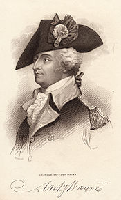
was organized. It was named for the American general "Mad Anthony" Wayne
Anthony Wayne
Anthony Wayne was a United States Army general and statesman. Wayne adopted a military career at the outset of the American Revolutionary War, where his military exploits and fiery personality quickly earned him a promotion to the rank of brigadier general and the sobriquet of Mad Anthony.-Early...
. It originally encompassed the entire area of the Lower Peninsula of Michigan
Lower Peninsula of Michigan
The Lower Peninsula of Michigan is the southern of the two major landmasses of the U.S. state of Michigan. It is surrounded by water on all sides except its southern border, which it shares with Ohio and Indiana. Geographically, the Lower Peninsula has a recognizable shape that many people...
, as well as small sections that are now part of northern Ohio
Ohio
Ohio is a Midwestern state in the United States. The 34th largest state by area in the U.S.,it is the 7th‑most populous with over 11.5 million residents, containing several major American cities and seven metropolitan areas with populations of 500,000 or more.The state's capital is Columbus...
, Indiana
Indiana
Indiana is a US state, admitted to the United States as the 19th on December 11, 1816. It is located in the Midwestern United States and Great Lakes Region. With 6,483,802 residents, the state is ranked 15th in population and 16th in population density. Indiana is ranked 38th in land area and is...
and Illinois
Illinois
Illinois is the fifth-most populous state of the United States of America, and is often noted for being a microcosm of the entire country. With Chicago in the northeast, small industrial cities and great agricultural productivity in central and northern Illinois, and natural resources like coal,...
. By proclamation of the Territorial Secretary and Acting Governor, Winthrop Sargent, on August 15, 1796, the boundaries of Wayne County were declared to begin at the mouth of the Cuyahoga River
Cuyahoga River
The Cuyahoga River is located in Northeast Ohio in the United States. Outside of Ohio, the river is most famous for being "the river that caught fire", helping to spur the environmental movement in the late 1960s...
then west to Fort Wayne
Fort Wayne, Indiana
Fort Wayne is a city in the US state of Indiana and the county seat of Allen County. The population was 253,691 at the 2010 Census making it the 74th largest city in the United States and the second largest in Indiana...
, then to the southernmost point of Lake Michigan
Lake Michigan
Lake Michigan is one of the five Great Lakes of North America and the only one located entirely within the United States. It is the second largest of the Great Lakes by volume and the third largest by surface area, after Lake Superior and Lake Huron...
and along the western shore north to the territorial boundary in Lake Superior
Lake Superior
Lake Superior is the largest of the five traditionally-demarcated Great Lakes of North America. It is bounded to the north by the Canadian province of Ontario and the U.S. state of Minnesota, and to the south by the U.S. states of Wisconsin and Michigan. It is the largest freshwater lake in the...
and then along the territorial boundary through Lake Huron
Lake Huron
Lake Huron is one of the five Great Lakes of North America. Hydrologically, it comprises the larger portion of Lake Michigan-Huron. It is bounded on the east by the Canadian province of Ontario and on the west by the state of Michigan in the United States...
, Lake St. Clair, and Lake Erie
Lake Erie
Lake Erie is the fourth largest lake of the five Great Lakes in North America, and the tenth largest globally. It is the southernmost, shallowest, and smallest by volume of the Great Lakes and therefore also has the shortest average water residence time. It is bounded on the north by the...
back to the starting point.
On January 14, 1803, the Governor of Indiana Territory
Indiana Territory
The Territory of Indiana was an organized incorporated territory of the United States that existed from July 4, 1800, until November 7, 1816, when the southern portion of the territory was admitted to the Union as the state of Indiana....
, William Henry Harrison
William Henry Harrison
William Henry Harrison was the ninth President of the United States , an American military officer and politician, and the first president to die in office. He was 68 years, 23 days old when elected, the oldest president elected until Ronald Reagan in 1980, and last President to be born before the...
, issued a similar proclamation defining the boundaries as beginning at a point where an east and west line passing through the southernmost extreme of Lake Michigan would intersect a north and south line, passing through the westernmost extreme of the lake, then north to the territorial boundary, then along said boundary line to a point where an east and west line passing through the southerly extreme of Lake Michigan would intersect the same, then along this last mentioned line to the place of beginning. This boundary would include Chicago
Chicago
Chicago is the largest city in the US state of Illinois. With nearly 2.7 million residents, it is the most populous city in the Midwestern United States and the third most populous in the US, after New York City and Los Angeles...
, Illinois
Illinois
Illinois is the fifth-most populous state of the United States of America, and is often noted for being a microcosm of the entire country. With Chicago in the northeast, small industrial cities and great agricultural productivity in central and northern Illinois, and natural resources like coal,...
and a sizable strip of Wisconsin
Wisconsin
Wisconsin is a U.S. state located in the north-central United States and is part of the Midwest. It is bordered by Minnesota to the west, Iowa to the southwest, Illinois to the south, Lake Michigan to the east, Michigan to the northeast, and Lake Superior to the north. Wisconsin's capital is...
along Lake Michigan.
These boundaries would be adjusted as Indiana
Indiana
Indiana is a US state, admitted to the United States as the 19th on December 11, 1816. It is located in the Midwestern United States and Great Lakes Region. With 6,483,802 residents, the state is ranked 15th in population and 16th in population density. Indiana is ranked 38th in land area and is...
and Illinois
Illinois
Illinois is the fifth-most populous state of the United States of America, and is often noted for being a microcosm of the entire country. With Chicago in the northeast, small industrial cities and great agricultural productivity in central and northern Illinois, and natural resources like coal,...
became states and as other counties were formed within Michigan Territory
Michigan Territory
The Territory of Michigan was an organized incorporated territory of the United States that existed from June 30, 1805, until January 26, 1837, when the final extent of the territory was admitted to the Union as the State of Michigan...
.
Transportation
 |
I-75 Interstate 75 in Michigan Interstate 75 is a part of the Interstate Highway System and runs from Miami, Florida to Sault Ste. Marie in the Upper Peninsula of Michigan. I-75 enters the state from Ohio in the south, just to the north of Toledo. It runs generally north through Detroit, Pontiac and Bay City, crossing the... |
Interstate 75 travels through the Downriver Downriver Downriver is the unofficial name for a collection of 18 suburban cities and townships in Wayne County, Michigan south of Detroit along the western shore of the Detroit River.... communities, then through the southwest-side neighborhoods of Detroit and serves as the northern border of Downtown Detroit Downtown Detroit Downtown Detroit is the central business district and a residential area of Detroit, Michigan, United States. Downtown is bordered by the Lodge Freeway to the west, the Fisher Freeway to the north, Interstate 375 to the east, and the Detroit River to the south.Downtown contains much historic... as the Fisher Freeway. It then turns away from the Fisher onto the Chrysler Freeway at a complex interchange with I-375 and an unnumbered extension which connects with M-3, then follows M-1, which is less than a mile away through the remainder of Detroit, connecting eastern Wayne County to Toledo Toledo, Ohio Toledo is the fourth most populous city in the U.S. state of Ohio and is the county seat of Lucas County. Toledo is in northwest Ohio, on the western end of Lake Erie, and borders the State of Michigan... and Flint Flint, Michigan Flint is a city in the U.S. state of Michigan and is located along the Flint River, northwest of Detroit. The U.S. Census Bureau reports the 2010 population to be placed at 102,434, making Flint the seventh largest city in Michigan. It is the county seat of Genesee County which lies in the... to the south and north respectively. It runs non-stop to the Sault Ste. Marie International Bridge Sault Ste. Marie International Bridge The Sault Ste. Marie International Bridge, often known just as the International Bridge, spans the St. Marys River between the United States and Canada connecting the twin cities of Sault Ste. Marie, Michigan and Sault Ste. Marie, Ontario. It serves as the northern terminus of Interstate 75... to the north and to Florida Florida Florida is a state in the southeastern United States, located on the nation's Atlantic and Gulf coasts. It is bordered to the west by the Gulf of Mexico, to the north by Alabama and Georgia and to the east by the Atlantic Ocean. With a population of 18,801,310 as measured by the 2010 census, it... to the south. |
 |
I-94 Interstate 94 in Michigan Interstate 94 is a part of the Interstate Highway System that runs from Billings, Montana, to the Lower Peninsula of the US state of Michigan. In Michigan, it is a state trunkline highway that enters the state south of New Buffalo... |
Interstate 94 runs east-west through the central parts of Wayne County, connecting it to Port Huron Port Huron, Michigan Port Huron is a city in the U.S. state of Michigan and the county seat of St. Clair County. The population was 30,184 at the 2010 census. The city is adjacent to Port Huron Township but is administratively autonomous. It is joined by the Blue Water Bridge over the St. Clair River to Sarnia,... eastbound and Chicago Chicago Chicago is the largest city in the US state of Illinois. With nearly 2.7 million residents, it is the most populous city in the Midwestern United States and the third most populous in the US, after New York City and Los Angeles... westbound. To the west it provides an uninterrupted route as far as Montana Montana Montana is a state in the Western United States. The western third of Montana contains numerous mountain ranges. Smaller, "island ranges" are found in the central third of the state, for a total of 77 named ranges of the Rocky Mountains. This geographical fact is reflected in the state's name,... and connects to the northern side of the Detroit Metro Airport Detroit Metropolitan Wayne County Airport Detroit Metropolitan Wayne County Airport , usually called Detroit Metro Airport, Metro Airport locally, or simply DTW, is a major international airport covering in Romulus, Michigan, a suburb of Detroit. It is Michigan's busiest airport.... . In Detroit it is known as the Edsel Ford Freeway. |
 |
I-96 Interstate 96 Interstate 96 is an intrastate Interstate Highway that is entirely within the US state of Michigan. Its western terminus is at an interchange with US Highway 31 and Business US Highway 31 , on the western boundary of Norton Shores southeast of Muskegon. Its eastern terminus is at I-75 near the... |
has its eastern terminus in the county, in Detroit. It follows Grand River Avenue Grand River Avenue US Highway 16 , also called Grand River Avenue for much of its length, is one of the principal pre-Interstate roads in the state of Michigan. Before the creation of the United States Numbered Highway System in 1926, the highway had been designated M-16... until the city's northwest side, there it turns due west to I-275, where it turns north to concurrent with I-275. West of Detroit to I-275 it is known as the Jeffries Freeway; in Detroit it is the Rosa Parks Memorial Highway, but it is sometimes still known as the Jeffries. |
 |
I-275 Interstate 275 (Michigan) Interstate 275 in the US state of Michigan is an Interstate Highway that functions as a western bypass of the Detroit metropolitan area. The Michigan Department of Transportation maintains it as a component of the larger state trunkline highway system. The freeway runs through the western suburbs... |
Most of Interstate 275's mileage is in Wayne County, serving the southern side of the Detroit Metro Airport Detroit Metropolitan Wayne County Airport Detroit Metropolitan Wayne County Airport , usually called Detroit Metro Airport, Metro Airport locally, or simply DTW, is a major international airport covering in Romulus, Michigan, a suburb of Detroit. It is Michigan's busiest airport.... as well as the Pinnacle Race Course Pinnacle Race Course Pinnacle Race Course is a thoroughbred horse racing track located in Huron Township, Michigan, southwest of Detroit off of Interstate 275. The track is just south of the Detroit Metro Airport.-History and information:... . |
 |
I-375 Interstate 375 (Michigan) The unsigned Business Spur Interstate 375 , which is long, continues west on Jefferson Avenue from the southern end of I-375, ending at the entrance to the Detroit–Windsor Tunnel at Randolph Street . Jefferson Avenue past that intersection is M-10, quickly becoming the Lodge Freeway. BS I-375 runs... |
Interstate 375 is the nation's shortest Interstate Highway to be signed. However some highways are shorter but are not signed at all. It serves as the eastern boundary of Downtown Detroit Downtown Detroit Downtown Detroit is the central business district and a residential area of Detroit, Michigan, United States. Downtown is bordered by the Lodge Freeway to the west, the Fisher Freeway to the north, Interstate 375 to the east, and the Detroit River to the south.Downtown contains much historic... and is a southern extension of the Chrysler Freeway. |
 |
US-12 U.S. Route 12 in Michigan US Highway 12 is a US Highway that runs from Aberdeen, Washington to Detroit, Michigan. In the US state of Michigan it runs for . Previous to the creation of Interstate Highways in Michigan, US 12 ran along Michigan Avenue between Kalamazoo and Detroit, a highway corridor now served by I-94... |
U.S. Route 12 has its eastern terminus in Downtown Detroit Downtown Detroit Downtown Detroit is the central business district and a residential area of Detroit, Michigan, United States. Downtown is bordered by the Lodge Freeway to the west, the Fisher Freeway to the north, Interstate 375 to the east, and the Detroit River to the south.Downtown contains much historic... at Cass Avenue. From there it travels through the west side of Detroit and through Dearborn Dearborn, Michigan -Economy:Ford Motor Company has its world headquarters in Dearborn. In addition its Dearborn campus contains many research, testing, finance and some production facilities. Ford Land controls the numerous properties owned by Ford including sales and leasing to unrelated businesses such as the... and other points west and is a useful alternative to I-94. Locally it is known as Michigan Avenue. |
 |
US-24 | U.S. Route 24 traverses through Downriver Downriver Downriver is the unofficial name for a collection of 18 suburban cities and townships in Wayne County, Michigan south of Detroit along the western shore of the Detroit River.... and the far west sides of Dearborn Dearborn, Michigan -Economy:Ford Motor Company has its world headquarters in Dearborn. In addition its Dearborn campus contains many research, testing, finance and some production facilities. Ford Land controls the numerous properties owned by Ford including sales and leasing to unrelated businesses such as the... and Detroit and is a useful alternative to I-75. Locally it is known as Telegraph Road. |
 |
US 10 U.S. Route 10 in Michigan US Highway 10 is a part of the United States Numbered Highway System that runs from West Fargo, North Dakota, to the Lower Peninsula of the US state of Michigan. The highway enters the state on the SS Badger crossing Lake Michigan at Ludington and ends at Bay City.US 10 was created as part of... |
U.S. Route 10 entered the county by two ways. Initially it was via Woodward Avenue but when the Lodge Freeway was completed U.S. Route 10 was relocated onto it; the Woodward route became M-1. Later the existing highway was truncated in Bay City Bay City, Michigan Bay City is a city in the U.S. state of Michigan located near the base of the Saginaw Bay on Lake Huron. As of the 2010 census, the city's population was 34,932, and is the principal city of the Bay City Metropolitan Statistical Area, which is included in the Saginaw-Bay City-Saginaw Township North... and M-10 replaced it on the Lodge. |
 |
US 16 | U.S. Route 16 entered Wayne County on Grand River Avenue Grand River Avenue US Highway 16 , also called Grand River Avenue for much of its length, is one of the principal pre-Interstate roads in the state of Michigan. Before the creation of the United States Numbered Highway System in 1926, the highway had been designated M-16... and ended in Downtown Detroit Downtown Detroit Downtown Detroit is the central business district and a residential area of Detroit, Michigan, United States. Downtown is bordered by the Lodge Freeway to the west, the Fisher Freeway to the north, Interstate 375 to the east, and the Detroit River to the south.Downtown contains much historic... . |
 |
US 25 | Locally, U.S. Route 25 was the designated name for Dix-Toledo Highway in Downriver Downriver Downriver is the unofficial name for a collection of 18 suburban cities and townships in Wayne County, Michigan south of Detroit along the western shore of the Detroit River.... and Fort Street and Gratiot Avenue in Detroit. The construction of I-75 resulted in the truncation of U.S. Route 25 to Cincinnati. |
 |
US 112 | U.S. Route 112 followed Michigan Avenue out of Downtown Detroit Downtown Detroit Downtown Detroit is the central business district and a residential area of Detroit, Michigan, United States. Downtown is bordered by the Lodge Freeway to the west, the Fisher Freeway to the north, Interstate 375 to the east, and the Detroit River to the south.Downtown contains much historic... and out of Wayne County. Is now a routing of U.S. Route 12. |
 |
M-1 M-1 (Michigan highway) M-1, commonly known as Woodward Avenue, named for Augustus B. Woodward, is a north–south state trunkline in the US state of Michigan. Until a few years ago, the northern terminus of M-1 was at BL I-75 and BUS US 24 in Bloomfield Township between the city limits of Bloomfield Hills and... |
M-1 has its southern terminus in Downtown Detroit Downtown Detroit Downtown Detroit is the central business district and a residential area of Detroit, Michigan, United States. Downtown is bordered by the Lodge Freeway to the west, the Fisher Freeway to the north, Interstate 375 to the east, and the Detroit River to the south.Downtown contains much historic... at Adams Street. It travels through Midtown Detroit and New Center and through Highland Park Highland Park, Michigan - Geography :According to the United States Census Bureau, the city has a total area of , all land.- Demographics :As of the census of 2000, there were 16,746 people, 6,199 households, and 3,521 families residing in the city. The population density was 5,622.9 per square mile . There were 7,249... . It serves as an alternative to I-75 and M-10. Locally known as Woodward Avenue. M-1 was a result of US-10 being redesignated to the Lodge Freeway. |
 |
M-3 M-3 (Michigan highway) M-3 is a north–south state highway in the US state of Michigan in the Detroit metropolitan area. For most of its length, M-3 is known as Gratiot Avenue... |
M-3 has its southern terminus in Downtown Detroit Downtown Detroit Downtown Detroit is the central business district and a residential area of Detroit, Michigan, United States. Downtown is bordered by the Lodge Freeway to the west, the Fisher Freeway to the north, Interstate 375 to the east, and the Detroit River to the south.Downtown contains much historic... at Randolph and Jefferson Avenue Jefferson Avenue (Detroit) Jefferson Avenue is a scenic road along the eastern part of the Detroit metropolitan area in the U.S. state of Michigan. It travels alongside Lake Erie, the Detroit River, and Lake Saint Clair. This road also provides access to many recreational facilities in the area... . It proceeds northeasterly through Detroit's northeast side and beyond towards Mount Clemens Mount Clemens, Michigan Mount Clemens is a city in the U.S. state of Michigan. As of the 2000 census, the city population was 17,312. It is the county seat of Macomb County.-Early history:... and points further north. Locally known as Gratiot Avenue. M-3 was the result of the removal of US-25 from Michigan. |
 |
M-5 M-5 (Michigan highway) M-5 is a highway in the metro Detroit area of the US state of Michigan.-Route description:M-5's eastern terminus is at the junction of Grand River Avenue and Interstate 96 in western Detroit... |
M-5 begins at the northern intersection with I-96 on Detroit's northwest side and follows Grand River Avenue Grand River Avenue US Highway 16 , also called Grand River Avenue for much of its length, is one of the principal pre-Interstate roads in the state of Michigan. Before the creation of the United States Numbered Highway System in 1926, the highway had been designated M-16... out of the county. |
 |
M-8 M-8 (Michigan highway) M-8 is a state trunkline highway in the U.S. state of Michigan lying within the cities of Detroit and Highland Park. Much of it is the Davison Freeway, the nation's first urban depressed freeway, which became a connector between the Lodge and the Chrysler Freeways.Named for an English immigrant... |
M-8 runs from I-96 to Conant Street in Detroit, passing through Highland Park Highland Park, Michigan - Geography :According to the United States Census Bureau, the city has a total area of , all land.- Demographics :As of the census of 2000, there were 16,746 people, 6,199 households, and 3,521 families residing in the city. The population density was 5,622.9 per square mile . There were 7,249... . The freeway portion is known as the Davison Freeway. |
 |
M-10 M-10 (Michigan highway) M-10, is a state trunkline route in the US state of Michigan. The southernmost portion follows Jefferson Avenue in downtown Detroit, and the southern terminus is at the intersection of Jefferson and Randolph Street leading to the entrance to the Detroit–Windsor Tunnel... |
M-10 starts at the same intersection where M-3 starts in Downtown Detroit Downtown Detroit Downtown Detroit is the central business district and a residential area of Detroit, Michigan, United States. Downtown is bordered by the Lodge Freeway to the west, the Fisher Freeway to the north, Interstate 375 to the east, and the Detroit River to the south.Downtown contains much historic... and travels further into the city on the Lodge Freeway and connects it to Southfield Southfield, Michigan According to the United States Census Bureau, the city has a total area of , of which 0.04% is water. The main branch of the River Rouge runs through Southfield. The city is bounded to the south by Eight Mile Road, its western border is Inkster Road, and to the east it is bounded by Greenfield Road... . |
 |
M-14 M-14 (Michigan highway) M-14 is a east–west state trunkline highway in the southeastern portion of the US state of Michigan. Entirely freeway, it connects Ann Arbor with Detroit by way of connecting with I-96.-Route description:... |
M-14 starts at the interchange with I-96 and I-275 in Livonia Livonia, Michigan Livonia is a city in the northwest part of Wayne County in the U.S. state of Michigan. Livonia is a very large suburb with an array of traditional neighborhoods connected to the metropolitan area by freeways. The population was 96,942 at the 2010 census, making it Michigan's 9th largest... and travels out into rural areas, serving Plymouth Plymouth, Michigan Plymouth is a city in Wayne County of the U.S. state of Michigan. The population was 9,132 at the 2010 census. The City of Plymouth is an enclave completely surrounded by Plymouth Charter Township, Michigan.-Geography:... and Ann Arbor Ann Arbor, Michigan Ann Arbor is a city in the U.S. state of Michigan and the county seat of Washtenaw County. The 2010 census places the population at 113,934, making it the sixth largest city in Michigan. The Ann Arbor Metropolitan Statistical Area had a population of 344,791 as of 2010... . |
 |
M-39 M-39 (Michigan highway) M-39 is a state highway in the US state of Michigan that runs from Lincoln Park to Southfield. The southern terminus of M-39 is at the corner of Southfield Road and Lafayette Boulevard in Lincoln Park, one block southeast of the junction of I-75 and two blocks northwest of M-85... |
M-39 starts in Lincoln Park Lincoln Park, Michigan Lincoln Park is a city in Wayne County in the U.S. state of Michigan. It lies in an area of cities and communities known as Downriver. The population was 38,144 at the 2010 census . The settlement was organized as a village in 1921, and reorganized as a city in 1925. The area was originally home to... 's city center and runs along Southfield Road to Allen Park Allen Park, Michigan Allen Park is a city in Wayne County in the U.S. state of Michigan. As of the 2010 census, the population was 28,210. The suburb of Detroit was recognized in Money Magazine's list of America's Best Small Cities. Allen Park is part of the collection of communities known as DownriverFord Motor... and becomes the Southfield Freeway, traveling through the west side of Detroit. |
 |
M-53 M-53 (Michigan highway) M-53 is a gateway route to The Thumb region of the US state of Michigan, carrying vacationers to the many cottages and resorts located on Saginaw Bay and Lake Huron in the vicinity of Caseville and Port Austin. This highway is also used to transport agricultural and manufactured products from the... |
M-53 begins at M-3 in Detroit, running through the city and connecting it to the Thumb area of the state. Locally known as Van Dyke Avenue. |
 |
M-85 M-85 (Michigan highway) M-85, also known as Fort Street or Fort Road for its entire length, is a state highway route in the U.S. state of Michigan.In Detroit proper, M-85 consists of West Fort street and South Fort street... |
The entire length of M-85 is in Wayne County, starting at Griswold Street Griswold Street Griswold Street is a major north-south street in downtown Detroit, which passes through the city's Financial District lined with many of its most familiar and recognizable structures, such as the Guardian Building and One Woodward Avenue... in Downtown Detroit Downtown Detroit Downtown Detroit is the central business district and a residential area of Detroit, Michigan, United States. Downtown is bordered by the Lodge Freeway to the west, the Fisher Freeway to the north, Interstate 375 to the east, and the Detroit River to the south.Downtown contains much historic... and connecting the city's southwest side to Downriver Downriver Downriver is the unofficial name for a collection of 18 suburban cities and townships in Wayne County, Michigan south of Detroit along the western shore of the Detroit River.... , ending near Flat Rock Flat Rock, Michigan - Racial makeup :As of the census of 2000, there were 8,488 people, 3,181 households, and 2,306 families residing in the city. The population density was 1,266.9 per square mile . There were 3,291 housing units at an average density of 491.2 per square mile... at I-75, for whom which M-85 serves as an alternative. Locally known as West Fort and South Fort, divided at the River Rouge River Rouge (Michigan) The River Rouge, also known as the Rouge River, is a river in the Metro Detroit area of southeastern Michigan. It flows into the Detroit River at Zug Island, which is the boundary between the cities of River Rouge and Detroit.... . |
 |
M-97 M-97 (Michigan highway) M-97 is a state trunkline highway in the U.S. state of Michigan. It runs from Detroit to north of Mt. Clemens following Groesbeck Highway. The highway starts south of 7 Mile Road and runs northeasterly through Macomb County suburbs to Hall Road, which takes the place of 20 Mile Road in the Mile... |
M-97 only runs a short distance through Detroit's northeast side, starting at M-3. In the city it follows Gunston Street and Hoover Street. |
 |
M-102 M-102 (Michigan highway) M-102 is a state trunkline in the US state of Michigan, running along the northern boundary of Detroit. It is known as 8 Mile Road for most of its length. As part of the land surveying of the state, the road follows the Michigan Baseline, and it is called Base Line Road in places. M-102 is the... |
M-102 follows the county line between M-5 and I-94. Locally known as West 8 Mile and East 8 Mile, divided at John R. Street. |
 |
M-153 M-153 (Michigan highway) M-153 is a state trunkline highway in the U.S. state of Michigan. It is also known as Ford Road for nearly its entire length, except for its westernmost portion where it splits from Ford Road and junctions with the M-14 freeway... |
M-153 starts at Wyoming Street on the Detroit-Dearborn limit and continues through the western suburbs as Ford Road. |
 |
M-16 | M-16 became part of U.S. Route 16, which is also removed from Michigan. |
 |
M-17 M-17 (Michigan highway) M-17 is a long state trunkline highway in the U.S. state of Michigan, connecting the cities of Ypsilanti and Ann Arbor in Washtenaw County. It was once part of a highway that spanned the southern Lower Peninsula of Michigan before the creation of the U.S. Highway System in 1926... |
M-17 once followed Ecorse Road into Lincoln Park Lincoln Park, Michigan Lincoln Park is a city in Wayne County in the U.S. state of Michigan. It lies in an area of cities and communities known as Downriver. The population was 38,144 at the 2010 census . The settlement was organized as a village in 1921, and reorganized as a city in 1925. The area was originally home to... , then ran concurrently with U.S. Route 25 to Downtown Detroit Downtown Detroit Downtown Detroit is the central business district and a residential area of Detroit, Michigan, United States. Downtown is bordered by the Lodge Freeway to the west, the Fisher Freeway to the north, Interstate 375 to the east, and the Detroit River to the south.Downtown contains much historic... . |
 |
M-56 | During the 1950s, M-56 connected U.S. Route 25 in Flat Rock Flat Rock, Michigan - Racial makeup :As of the census of 2000, there were 8,488 people, 3,181 households, and 2,306 families residing in the city. The population density was 1,266.9 per square mile . There were 3,291 housing units at an average density of 491.2 per square mile... to U.S. Route 112 in Canton along Huron River Drive and Belleville Road. |
 |
M-112 M-112 (Michigan highway) M-112 was the state trunkline highway designation given to segments of what is now Interstate 94 in the Metro Detroit area of the US state of Michigan.-Route description:... |
During World War II World War II World War II, or the Second World War , was a global conflict lasting from 1939 to 1945, involving most of the world's nations—including all of the great powers—eventually forming two opposing military alliances: the Allies and the Axis... and the years following, M-112 entered Wayne County on an expressway, providing access to the Willow Run Airport Willow Run Airport Willow Run Airport is an airport located in Van Buren Charter Township and in Ypsilanti Township, near Ypsilanti, Michigan, that serves freight, corporate, and general aviation clients... in Van Buren Township Van Buren Township, Michigan Van Buren Charter Township is a charter township of Wayne County in the U.S. state of Michigan. The population was 28,821 at the 2010 census. It is home to Willow Run Airport, Metro Detroit's second busiest airport.-Geography:... and turned onto present-day Interstate 94 in Romulus Township Romulus, Michigan Romulus is a suburban city of Metro Detroit, located in Wayne County in the U.S. state of Michigan. The population was 23,989 at the 2010 census, an increase from 22,979 in 2000. Romulus is home to Detroit Metropolitan Wayne County Airport and a General Motors plant that opened in 1976... . In Taylor Township Taylor, Michigan Taylor is a city in Wayne County in the U.S. state of Michigan. The population was 63,131 at the 2010 census. Taylor was originally known as Taylor Township and residents of the township voted to incorporate as the City of Taylor in May 1968... it had interchanges with both M-17 and U.S. Route 24, then ended at U.S. Route 112 in Dearborn Dearborn, Michigan -Economy:Ford Motor Company has its world headquarters in Dearborn. In addition its Dearborn campus contains many research, testing, finance and some production facilities. Ford Land controls the numerous properties owned by Ford including sales and leasing to unrelated businesses such as the... . |
 |
Dixie Highway Dixie Highway The Dixie Highway was a United States automobile highway, first planned in 1914 to connect the US Midwest with the Southern United States. It was part of the National Auto Trail system, and grew out of an earlier Miami to Montreal highway. The final result is better understood as a small network of... |
Dixie Highway ran through Wayne County as early as 1915. Back then it was one of the only routes that connected the county to the Southern United States Southern United States The Southern United States—commonly referred to as the American South, Dixie, or simply the South—constitutes a large distinctive area in the southeastern and south-central United States... . Today there are no traces of the old highway in the county. |
 |
Detroit Metropolitan Wayne County Airport Detroit Metropolitan Wayne County Airport Detroit Metropolitan Wayne County Airport , usually called Detroit Metro Airport, Metro Airport locally, or simply DTW, is a major international airport covering in Romulus, Michigan, a suburb of Detroit. It is Michigan's busiest airport.... |
Detroit Metro Airport is located in the Downriver Downriver Downriver is the unofficial name for a collection of 18 suburban cities and townships in Wayne County, Michigan south of Detroit along the western shore of the Detroit River.... community of Romulus Romulus, Michigan Romulus is a suburban city of Metro Detroit, located in Wayne County in the U.S. state of Michigan. The population was 23,989 at the 2010 census, an increase from 22,979 in 2000. Romulus is home to Detroit Metropolitan Wayne County Airport and a General Motors plant that opened in 1976... . It serves as a hub for Delta Air Lines Delta Air Lines Delta Air Lines, Inc. is a major airline based in the United States and headquartered in Atlanta, Georgia. The airline operates an extensive domestic and international network serving all continents except Antarctica. Delta and its subsidiaries operate over 4,000 flights every day... and Spirit Airlines Spirit Airlines Spirit Airlines is a United States ultra low-cost carrier operating scheduled flights throughout the Americas. The airline is headquartered in Miramar, Florida, in the Miami metropolitan area. Spirit currently maintains a base in Fort Lauderdale, Florida... and is one of the two airports operated by the Wayne County Airport Authority Wayne County Airport Authority Wayne County Airport Authority is a governmental entity that operates airports in Metro Detroit in Michigan. The agency has its headquarters in the L.C. Smith Terminal at Detroit Metropolitan Wayne County Airport in Romulus... . |
| |
Willow Run Airport Willow Run Airport Willow Run Airport is an airport located in Van Buren Charter Township and in Ypsilanti Township, near Ypsilanti, Michigan, that serves freight, corporate, and general aviation clients... |
Willow Run Airport is located in Van Buren Township Van Buren Township, Michigan Van Buren Charter Township is a charter township of Wayne County in the U.S. state of Michigan. The population was 28,821 at the 2010 census. It is home to Willow Run Airport, Metro Detroit's second busiest airport.-Geography:... and has four runways (a fifth was recently converted into a taxiway). No scheduled flights operate out of Willow Run and is one of the two airports operated by the Wayne County Airport Authority Wayne County Airport Authority Wayne County Airport Authority is a governmental entity that operates airports in Metro Detroit in Michigan. The agency has its headquarters in the L.C. Smith Terminal at Detroit Metropolitan Wayne County Airport in Romulus... . |
| |
Grosse Ile Municipal Airport Grosse Ile Municipal Airport Grosse Ile Municipal Airport is a public airport located two miles south of the central business district of Grosse Ile, in Wayne County, Michigan, United States. It is owned by the Township of Grosse Ile.Although most U.S... |
It is located about two miles (3 km) south of Grosse Ile Township Grosse Ile Township, Michigan Grosse Ile Township is a general law township of Wayne County in the U.S. state of Michigan. The township is situated on several islands in the Detroit River, but the largest island is also referred to as simply Grosse Ile. The name comes from French Grosse Île, meaning "Big Island"... 's downtown area. It has two paved runways. No scheduled flights operate out of this airport as well. |
| |
Coleman A. Young International Airport Coleman A. Young International Airport Coleman A. Young International Airport , also known as Coleman A. Young Municipal Airport, is a public use airport located five nautical miles northeast of the central business district of Detroit, in Wayne County, Michigan, United States... |
Also known as the Detroit City Airport (not to be confused with the larger and nearby Detroit Metro Airport). It is located just a short drive from Downtown Detroit Downtown Detroit Downtown Detroit is the central business district and a residential area of Detroit, Michigan, United States. Downtown is bordered by the Lodge Freeway to the west, the Fisher Freeway to the north, Interstate 375 to the east, and the Detroit River to the south.Downtown contains much historic... along M-3. It also has two runways and no scheduled flights, although it has been attempted in the past. |
Demographics
As of the censusCensus
A census is the procedure of systematically acquiring and recording information about the members of a given population. It is a regularly occurring and official count of a particular population. The term is used mostly in connection with national population and housing censuses; other common...
of 2000, there were 2,061,162 people, 768,440 households, and 511,781 families residing in the county. The population density
Population density
Population density is a measurement of population per unit area or unit volume. It is frequently applied to living organisms, and particularly to humans...
was 3,356 people per square mile (1,296/km²). There were 826,145 housing units at an average density of 1,345 per square mile (519/km²). The racial makeup of the county was 51.70% White
White American
White Americans are people of the United States who are considered or consider themselves White. The United States Census Bureau defines White people as those "having origins in any of the original peoples of Europe, the Middle East, or North Africa...
, 42.16% Black
African American
African Americans are citizens or residents of the United States who have at least partial ancestry from any of the native populations of Sub-Saharan Africa and are the direct descendants of enslaved Africans within the boundaries of the present United States...
or African American
African American
African Americans are citizens or residents of the United States who have at least partial ancestry from any of the native populations of Sub-Saharan Africa and are the direct descendants of enslaved Africans within the boundaries of the present United States...
, 0.37% Native American
Indigenous peoples of the Americas
The indigenous peoples of the Americas are the pre-Columbian inhabitants of North and South America, their descendants and other ethnic groups who are identified with those peoples. Indigenous peoples are known in Canada as Aboriginal peoples, and in the United States as Native Americans...
, 1.70% Asian
Asian American
Asian Americans are Americans of Asian descent. The U.S. Census Bureau definition of Asians as "Asian” refers to a person having origins in any of the original peoples of the Far East, Southeast Asia, or the Indian subcontinent, including, for example, Cambodia, China, India, Indonesia, Japan,...
, 0.02% Pacific Islander
Race (United States Census)
Race and ethnicity in the United States Census, as defined by the Federal Office of Management and Budget and the United States Census Bureau, are self-identification data items in which residents choose the race or races with which they most closely identify, and indicate whether or not they are...
, 1.55% from other races
Race (United States Census)
Race and ethnicity in the United States Census, as defined by the Federal Office of Management and Budget and the United States Census Bureau, are self-identification data items in which residents choose the race or races with which they most closely identify, and indicate whether or not they are...
, and 2.49% from two or more races. 3.75% of the population were Hispanic
Race (United States Census)
Race and ethnicity in the United States Census, as defined by the Federal Office of Management and Budget and the United States Census Bureau, are self-identification data items in which residents choose the race or races with which they most closely identify, and indicate whether or not they are...
or Latino
Race (United States Census)
Race and ethnicity in the United States Census, as defined by the Federal Office of Management and Budget and the United States Census Bureau, are self-identification data items in which residents choose the race or races with which they most closely identify, and indicate whether or not they are...
of any race.
8.5% were of German
Germans
The Germans are a Germanic ethnic group native to Central Europe. The English term Germans has referred to the German-speaking population of the Holy Roman Empire since the Late Middle Ages....
, 8.0% Polish
Poles
thumb|right|180px|The state flag of [[Poland]] as used by Polish government and diplomatic authoritiesThe Polish people, or Poles , are a nation indigenous to Poland. They are united by the Polish language, which belongs to the historical Lechitic subgroup of West Slavic languages of Central Europe...
and 5.7% Irish
Irish people
The Irish people are an ethnic group who originate in Ireland, an island in northwestern Europe. Ireland has been populated for around 9,000 years , with the Irish people's earliest ancestors recorded having legends of being descended from groups such as the Nemedians, Fomorians, Fir Bolg, Tuatha...
ancestry according to Census 2000. 89.3% spoke only English
English language
English is a West Germanic language that arose in the Anglo-Saxon kingdoms of England and spread into what was to become south-east Scotland under the influence of the Anglian medieval kingdom of Northumbria...
at home; 3.2% spoke Spanish
Spanish language
Spanish , also known as Castilian , is a Romance language in the Ibero-Romance group that evolved from several languages and dialects in central-northern Iberia around the 9th century and gradually spread with the expansion of the Kingdom of Castile into central and southern Iberia during the...
and 2.4% Arabic
Arabic language
Arabic is a name applied to the descendants of the Classical Arabic language of the 6th century AD, used most prominently in the Quran, the Islamic Holy Book...
.
Three native American groupings had over 1000 people in Wayne County in 2000, including 1,015 Iroquois
Iroquois
The Iroquois , also known as the Haudenosaunee or the "People of the Longhouse", are an association of several tribes of indigenous people of North America...
, including at least in theory members of all six tribes, and Chippewa or Ojibwa
Ojibwa
The Ojibwe or Chippewa are among the largest groups of Native Americans–First Nations north of Mexico. They are divided between Canada and the United States. In Canada, they are the third-largest population among First Nations, surpassed only by Cree and Inuit...
numbering 2,041. The Cherokee
Cherokee
The Cherokee are a Native American people historically settled in the Southeastern United States . Linguistically, they are part of the Iroquoian language family...
were the most numerous group of Native Americans here in Wayne County, as in most of the United States, with 4,127.
There were eight groups of Asians who were identified as having over 1000 in Wayne County. Asian Indians
Indian American
Indian Americans are Americans whose ancestral roots lie in India. The U.S. Census Bureau popularized the term Asian Indian to avoid confusion with Indigenous peoples of the Americas who are commonly referred to as American Indians.-The term: Indian:...
numbered 15,856. Chinese
Chinese American
Chinese Americans represent Americans of Chinese descent. Chinese Americans constitute one group of overseas Chinese and also a subgroup of East Asian Americans, which is further a subgroup of Asian Americans...
came in second at 5879. After that comes the Filipinos
Filipino American
Filipino Americans are Americans of Filipino ancestry. Filipino Americans, often shortened to "Fil-Ams", or "Pinoy",Filipinos in what is now the United States were first documented in the 16th century, with small settlements beginning in the 18th century...
, numbering 5480. There were 2478 Koreans
Korean American
Korean Americans are Americans of Korean descent, mostly from South Korea, with a small minority from North Korea...
. Bangladeshis
Bangladeshi American
Bangladeshi Americans are Americans of Bangladeshi descent. The overwhelming majority of Bangladeshi Americans are Bengalis. Most of them have immigrated from Sylhet region with a long trading history. Bangladeshi immigrants arrived in the United States especially since the early 1990s to become...
numbered 2238. Next came Japanese
Japanese American
are American people of Japanese heritage. Japanese Americans have historically been among the three largest Asian American communities, but in recent decades have become the sixth largest group at roughly 1,204,205, including those of mixed-race or mixed-ethnicity...
numbering 2025. Hmongs
Hmong American
A Hmong American is a resident of the United States who is of ethnic Hmong descent. Hmong Americans are one group of Asian Americans. Many Lao Hmong war refugees resettled in the U.S. following the communist takeover of Laos in 1975...
numbered 1927. Pakistanis
Pakistani American
A Pakistani American is any citizen or resident of the United States who has Pakistani heritage.- History in the United States :Muslim immigrants from areas that are now part of Pakistan have been migrating to America and first entered the United States as early as the eighteenth century, working...
numbered 1887 and Vietnamese
Vietnamese American
A Vietnamese American is an American of Vietnamese descent. They make up about half of all overseas Vietnamese and are the fourth-largest Asian American group....
1684.
There were 768,440 households out of which 32.80% had children under the age of 18 living with them, 40.70% were married couples
Marriage
Marriage is a social union or legal contract between people that creates kinship. It is an institution in which interpersonal relationships, usually intimate and sexual, are acknowledged in a variety of ways, depending on the culture or subculture in which it is found...
living together, 20.60% had a female householder with no husband present, and 33.40% were non-families. 28.30% of all households were made up of individuals and 10.00% had someone living alone who was 65 years of age or older. The average household size was 2.64 and the average family size was 3.26.
In the county the population was spread out with 28.00% under the age of 18, 8.70% from 18 to 24, 30.30% from 25 to 44, 20.90% from 45 to 64, and 12.10% who were 65 years of age or older. The median age was 34 years. For every 100 females there were 92.20 males. For every 100 females age 18 and over, there were 88.10 males.
The median income for a household in the county was $40,776, and the median income for a family was $48,805. Males had a median income of $42,392 versus $29,027 for females. The per capita income
Per capita income
Per capita income or income per person is a measure of mean income within an economic aggregate, such as a country or city. It is calculated by taking a measure of all sources of income in the aggregate and dividing it by the total population...
for the county was $20,058. About 12.70% of families and 16.40% of the population were below the poverty line, including 23.00% of those under age 18 and 11.30% of those age 65 or over.
Government
Municipal charter
A city charter or town charter is a legal document establishing a municipality such as a city or town. The concept developed in Europe during the middle ages....
setting up its structures within limits set in state law and constitution. Most Michigan county governments are structured according to state law, without a locally adopted charter.
The county government operates the jail, maintains rural roads, keeps files of deeds and mortgages, maintains vital records for all areas except Detroit, administers public health regulations, and participates with the state in the provision of welfare and other social services. Most other local government functions – police and fire, building and zoning, tax assessment, street maintenance, etc. – are the responsibility of individual cities and townships.
Wayne County Elected officials
- County ExecutiveCounty executiveA county executive is the head of the executive branch of government in a county. This position is common in the United States.The executive may be an elected or an appointed position...
: Robert A. FicanoRobert A. FicanoRobert Anthony Ficano, American politician, is County Executive of Wayne County, Michigan.He received his BA in 1974 from Michigan State University, and his JD in 1977 from University of Detroit. He worked as an attorney, and was assistant city attorney for the city of Westland, Michigan...
(DemocratDemocratic Party (United States)The Democratic Party is one of two major contemporary political parties in the United States, along with the Republican Party. The party's socially liberal and progressive platform is largely considered center-left in the U.S. political spectrum. The party has the lengthiest record of continuous...
) - Prosecuting AttorneyProsecutorThe prosecutor is the chief legal representative of the prosecution in countries with either the common law adversarial system, or the civil law inquisitorial system...
: Kym L. Worthy (Democrat) - SheriffSheriffA sheriff is in principle a legal official with responsibility for a county. In practice, the specific combination of legal, political, and ceremonial duties of a sheriff varies greatly from country to country....
: Benny N. Napoleon (Democrat) - County Clerk: Cathy M. Garrett (Democrat)
- County TreasurerTreasurerA treasurer is the person responsible for running the treasury of an organization. The adjective for a treasurer is normally "tresorial". The adjective "treasurial" normally means pertaining to a treasury, rather than the treasurer.-Government:...
: Raymond J. Wojtowicz (Democrat) - Register of Deeds: Bernard J. Youngblood (Democrat)
- County Board of CommissionersCounty commissionA county commission is a group of elected officials charged with administering the county government in local government in some states of the United States. County commissions are usually made up of three or more individuals...
: Edward A. Boike, Jr., Chair (Democrat) 15 members, elected from districts (14 Democrats, 1 Republican) - Circuit CourtCircuit courtCircuit court is the name of court systems in several common law jurisdictions.-History:King Henry II instituted the custom of having judges ride around the countryside each year to hear appeals, rather than forcing everyone to bring their appeals to London...
(3rd Circuit encompasses Wayne County): 61 judges (non-partisan) - Probate Court: 8 judges (non-partisan)
(information as of December 2009)
Politics
| Year | Democrat Democratic Party (United States) The Democratic Party is one of two major contemporary political parties in the United States, along with the Republican Party. The party's socially liberal and progressive platform is largely considered center-left in the U.S. political spectrum. The party has the lengthiest record of continuous... |
Republican Republican Party (United States) The Republican Party is one of the two major contemporary political parties in the United States, along with the Democratic Party. Founded by anti-slavery expansion activists in 1854, it is often called the GOP . The party's platform generally reflects American conservatism in the U.S... |
|---|---|---|
| 2008 | 74.02% 660,085 | 24.62% 219,582 |
| 2004 | 69.39% 600,047 | 29.81% 257,750 |
| 2000 | 69.01% 530,414 | 29.02% 223,021 |
| 1996 | 68.95% 504,466 | 24.04% 175,886 |
| 1992 | 60.39% 508,464 | 26.96% 227,002 |
| 1988 | 60.18% 450,222 | 39.03% 291,996 |
| 1984 | 57.19% 496,632 | 42.31% 367,391 |
| 1980 | 58.60% 522,024 | 35.42% 315,532 |
| 1976 | 60.11% 548,767 | 38.18% 348,588 |
| 1972 | 53.26% 514,913 | 45.08% 435,877 |
| 1968 | 63.25% 654,157 | 26.16% 270,566 |
| 1964 | 75.97% 831,674 | 23.83% 260,901 |
| 1960 | 65.99% 773,327 | 33.66% 394,485 |
Cities, villages, and townships

Cities
>Allen Park, Michigan
Allen Park is a city in Wayne County in the U.S. state of Michigan. As of the 2010 census, the population was 28,210. The suburb of Detroit was recognized in Money Magazine's list of America's Best Small Cities. Allen Park is part of the collection of communities known as DownriverFord Motor...
Belleville, Michigan
Belleville is a city in Wayne County in the U.S. state of Michigan. The population was 3,991 at the 2010 census. It is the sister city of Machynlleth, Wales. Belleville is southeast of Ann Arbor and southwest of Detroit.-Geography:...
Dearborn Heights, Michigan
Dearborn Heights is a city in Wayne County, in the Detroit metropolitan area, in the U.S. state of Michigan. The population was 57,774 at the 2010 census.-History:...
Dearborn, Michigan
-Economy:Ford Motor Company has its world headquarters in Dearborn. In addition its Dearborn campus contains many research, testing, finance and some production facilities. Ford Land controls the numerous properties owned by Ford including sales and leasing to unrelated businesses such as the...
Ecorse, Michigan
Ecorse is a city in Wayne County in the U.S. state of Michigan, named for the Ecorse River. The population was 9,512 at the 2010 census.-History:...
Flat Rock, Michigan
- Racial makeup :As of the census of 2000, there were 8,488 people, 3,181 households, and 2,306 families residing in the city. The population density was 1,266.9 per square mile . There were 3,291 housing units at an average density of 491.2 per square mile...
(partially in
Monroe County
Monroe County, Michigan
Monroe County is a county in the U.S. state of Michigan. According to the U.S. Census Bureau, the 2010 population is 152,021. The largest city and county seat is Monroe. The U.S. Census Bureau defines all of Monroe County as conterminous with the Monroe Metropolitan Area...
)
Garden City, Michigan
Garden City is a city in Wayne County of the U.S. state of Michigan. As of the 2010 census, the city population was 27,692. The city is part of the Metro Detroit region.- History :...
Gibraltar, Michigan
Gibraltar is a city in Wayne County in the U.S. state of Michigan. The population was 4,656 at the 2010 census. It is located on the Detroit River directly south of, and adjacent to, Trenton.-Geography:...
>
Grosse Pointe, Michigan
Grosse Pointe is a suburban city bordering Detroit in Wayne County in the U.S. state of Michigan. The city covers just over one square mile, and had a population of 5,421 at the 2010 census. It is bordered on the west by Grosse Pointe Park, on the north by Detroit, on the east by Grosse Pointe...
Grosse Pointe Farms, Michigan
Grosse Pointe Farms is a suburban city bordering Detroit located in Wayne County in the U.S. state of Michigan. It ranks as the 76th highest-income city in America. The population was 9,479 at the 2010 census. It is bordered by Grosse Pointe on the west, Detroit on the north, Grosse Pointe Woods...
Grosse Pointe Park, Michigan
Grosse Pointe Park is a city in Wayne County in the U.S. state of Michigan. The population was 11,555 at the 2010 census. Bordering on Detroit with frontage on southern Lake Saint Clair, it is the westernmost of the noted Grosse Pointe suburbs, with the oldest overall housing stock of the five cities...
Grosse Pointe Shores, Michigan
Grosse Pointe Shores is a city in the U.S. state of Michigan. With only land area, the city is the smallest of the five Grosse Pointe communities. The city, which is entirely residential, is the location of the Grosse Pointe Yacht Club on Lake Saint Clair. The city's population was 3,008 at the...
(partially in
Macomb County
Macomb County, Michigan
-Demographics:As of the census of 2000, there were 788,149 people, 309,203 households, and 210,876 families residing in the county. The population density was 1,640 people per square mile . There were 320,276 housing units at an average density of 667 per square mile...
)
Grosse Pointe Woods, Michigan
Grosse Pointe Woods is a suburban city in Wayne County in the U.S. state of Michigan, comprising a large portion of the Grosse Pointe communities. The population was 16,135 at the 2010 census...
Hamtramck, Michigan
Hamtramck is a city in Wayne County of the U.S. state of Michigan. As of the 2010 census, the city population was 22,423. Hamtramck is surrounded by the city of Detroit except for a small portion of the western border that touches the similarly surrounded city of Highland Park...
Harper Woods, Michigan
Harper Woods is a city located on the eastside of suburban Detroit, Michigan, United States. The city is located in Wayne County. As of the 2010 census, the city population was 14,236.- History :...
Highland Park, Michigan
- Geography :According to the United States Census Bureau, the city has a total area of , all land.- Demographics :As of the census of 2000, there were 16,746 people, 6,199 households, and 3,521 families residing in the city. The population density was 5,622.9 per square mile . There were 7,249...
Inkster, Michigan
Inkster is a city in Wayne County of the U.S. state of Michigan. At the 2010 census, the city population was 25,369. It is one of several suburbs in Metro Detroit whose population is majority or plurality African American.- History :...
Lincoln Park, Michigan
Lincoln Park is a city in Wayne County in the U.S. state of Michigan. It lies in an area of cities and communities known as Downriver. The population was 38,144 at the 2010 census . The settlement was organized as a village in 1921, and reorganized as a city in 1925. The area was originally home to...
Livonia, Michigan
Livonia is a city in the northwest part of Wayne County in the U.S. state of Michigan. Livonia is a very large suburb with an array of traditional neighborhoods connected to the metropolitan area by freeways. The population was 96,942 at the 2010 census, making it Michigan's 9th largest...
Melvindale, Michigan
Melvindale is a city in Wayne County of the U.S. state of Michigan and a downriver suburb of Detroit. As of the 2010 census, the city population was 10,715. Melvindale's slogan is "The Little City with a Big Heart."-History:...
Northville, Michigan
Northville is a city located in and divided by Oakland and Wayne counties in the U.S. state of Michigan and a suburb in Metro Detroit. The population was 5,970 at the 2010 census. The Oakland County portion is surrounded by the city of Novi. The Wayne County portion is surrounded by Northville...
(partially in
Oakland County
Oakland County, Michigan
-Demographics:As of the 2010 Census, there were 1,202,362 people, 471,115 households, and 315,175 families residing in the county. The population density as of the 2000 census was 1,369 people per square mile . There were 492,006 housing units at an average density of 564 per square mile...
)
Plymouth, Michigan
Plymouth is a city in Wayne County of the U.S. state of Michigan. The population was 9,132 at the 2010 census. The City of Plymouth is an enclave completely surrounded by Plymouth Charter Township, Michigan.-Geography:...
River Rouge, Michigan
As of the census of 2000, there were 9,917 people, 3,640 households, and 2,504 families residing in the city. The population density was 3,713.9 per square mile . There were 4,080 housing units at an average density of 1,528.0 per square mile...
Riverview, Michigan
Riverview is a city in Wayne County in the U.S. state of Michigan. The population was 12,486 at the time of the 2010 census.The city is a suburb in the Metro Detroit area, located along the shore of the Detroit River. Riverview incorporated as a village in 1922 and as a city in 1959...
Rockwood, Michigan
Rockwood is a city in Wayne County in the U.S. state of Michigan. The population was 3,289 at the 2010 census.-Geography:According to the United States Census Bureau, the city has a total area of , all land.- National Register of Historic Places :...
Romulus, Michigan
Romulus is a suburban city of Metro Detroit, located in Wayne County in the U.S. state of Michigan. The population was 23,989 at the 2010 census, an increase from 22,979 in 2000. Romulus is home to Detroit Metropolitan Wayne County Airport and a General Motors plant that opened in 1976...
Southgate, Michigan
Southgate is a city in Wayne County in the U.S. state of Michigan. The population was 30,047 at the 2010 census.Southgate was the last city to incorporate from the former Ecorse Township, gaining city status in October 1958...
Taylor, Michigan
Taylor is a city in Wayne County in the U.S. state of Michigan. The population was 63,131 at the 2010 census. Taylor was originally known as Taylor Township and residents of the township voted to incorporate as the City of Taylor in May 1968...
Trenton, Michigan
Trenton is a small city in Wayne County in the southeast portion of the U.S. state of Michigan. As of the 2010 census, the city population was 18,853...
Wayne, Michigan
Wayne is a city in Wayne County in the U.S. state of Michigan, southwest of Detroit. As of the 2010 census, the city population was 17,593...
Westland, Michigan
Westland is a city in Wayne County in the U.S. state of Michigan. It is located about west of downtown Detroit. As of the 2010 census, the city had a total population of 84,094.-Politics:...
Woodhaven, Michigan
Woodhaven is a city in Wayne County in the U.S. state of Michigan. As of the 2010 census, the city population was 12,875. It is part of a collection of 18 suburban communities known as Downriver.-History:...
Wyandotte, Michigan
Wyandotte is a city in Wayne County in the U.S. state of Michigan. The population was 25,883 at the 2010 census, a decrease of 7.6% from 2000. Wyandotte is located in southeastern Michigan, approximately south of Detroit on the Detroit River, and is part of the collection of communities known as...
Townships
>- Brownstown Charter Township
- Canton Charter TownshipCanton Township, MichiganThe Charter Township of Canton, usually referred to as Canton, is an affluent charter township of Wayne County in the U.S. state of Michigan. The commuter town is located west of Detroit and east of Ann Arbor. As of the 2010 census, the township had a population of 90,173, making it Michigan's...
- Grosse Ile TownshipGrosse Ile Township, MichiganGrosse Ile Township is a general law township of Wayne County in the U.S. state of Michigan. The township is situated on several islands in the Detroit River, but the largest island is also referred to as simply Grosse Ile. The name comes from French Grosse Île, meaning "Big Island"...
- Huron Charter TownshipHuron Charter Township, MichiganHuron Charter Township is a charter township of Wayne County in the U.S. state of Michigan. The population was 15,879 at the 2010 census.-Geography:...
Northville Township, Michigan
Northville Township, or The Charter Township of Northville, is a charter township of Wayne County in the U.S. state of Michigan and a suburb in Metro Detroit. The population was 28,497 at the 2010 census....
Plymouth Township, Michigan
The Charter Township of Plymouth is a charter township of Wayne County in the U.S. state of Michigan. The population was 27,524 at the 2010 census...
Redford Township, Michigan
The U.S. Census Bureau also defined Redford Township as a census-designated place in the 2000 Census so that the community would appear on the list of places as well on the list of county subdivisions...
Sumpter Township, Michigan
Sumpter Township is a general law township of Wayne County in the U.S. state of Michigan. As of the 2010 census, the township population was 9,549.-Geography:...
Van Buren Township, Michigan
Van Buren Charter Township is a charter township of Wayne County in the U.S. state of Michigan. The population was 28,821 at the 2010 census. It is home to Willow Run Airport, Metro Detroit's second busiest airport.-Geography:...
See also
- National Register of Historic Places listings in Wayne County, Michigan
- Saginaw TrailSaginaw trailSaginaw Trail is the collective name for a set of connected roads in Southeastern Michigan that runs from Detroit to Saginaw through Pontiac and Flint. It was originally a tribal foot trail. On December 7, 1818 the Michigan Territorial government authorized the building of a road from Detroit to...
Further reading
- Farmer, Silas. (1884) (Jul 1969) The history of Detroit and Michigan, or, The metropolis illustrated: a chronological cyclopaedia of the past and present: including a full record of territorial days in Michigan, and the annuals of Wayne County, in various formats at Open LibraryOpen LibraryOpen Library is an online project intended to create “one web page for every book ever published”. Open Library is a project of the non-profit Internet Archive and has been funded in part by a grant from the California State Library and the Kahle/Austin Foundation.-Books for the blind and...
.