
.gif)
Route 27 (New Jersey)
Encyclopedia
Route 27 is a state highway
in New Jersey
, United States
. It runs 38.53 mi (62.01 km) from U.S. Route 206
in Princeton Borough
, Mercer County
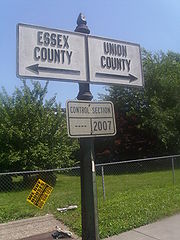
northeast to an interchange with Route 21 (McCarter Highway) and Broad Street in Newark
, Essex County
. The route passes through many communities along the way, including New Brunswick
, Metuchen
, Rahway
, and Elizabeth
. Route 27 is a two- to four-lane undivided highway for most of its length, passing through a variety of urban and suburban environments. It intersects many roads along the way, including Route 18 in New Brunswick, Interstate 287
in Edison
, the Garden State Parkway
in Woodbridge Township
, Route 35 in Rahway, Route 28 in Elizabeth, and U.S. Route 22
in Newark. Route 27 crosses the Raritan River
on the Albany Street Bridge
, which connects Highland Park
on the east with New Brunswick
on the west.
Route 27 was part of the alignment through New Jersey of the Lincoln Highway
, the United States' first transcontinental highway that was established in 1913. Route 27 is still referred to as the Lincoln Highway in many municipalities, such as Edison Township
. The Lincoln Highway became part of pre-1927 Route 1 between New Brunswick
and Elizabeth
in 1916 and pre-1927 Route 13 between Trenton
and New Brunswick in 1917. In 1927, the Lincoln Highway was renumbered as Route 27 between Trenton and Newark. U.S. Route 1 was designated on this portion of the road until it was relocated by the 1940s. U.S. Route 206 followed the route from Trenton to Princeton until 1953, when the southern terminus of Route 27 was cut back to Princeton to avoid the concurrency with U.S. Route 206.
 Route 27 begins at a traffic light with U.S. Route 206
and County Route 533
in downtown Princeton Borough
, Mercer County
. The route heads northeast along Nassau Street
, the main street of Princeton that runs along the northern edge of Princeton University
and is lined with numerous shops and restaurants. This portion of Route 27 sees between 10,000 and 20,000 cars a day. Just past the beginning of Route 27, County Route 583
heads to the southwest on Mercer Street. Route 27 moves through downtown Princeton, passing by the main gates to Princeton University near Nassau Hall
, and intersecting County Route 571
(Washington Road, also signed as County Route 526
). After leaving the downtown area, Route 27 continues through residential areas, crossing into Princeton Township
where the route becomes Princeton-Kingston Road. Route 27 runs parallel to Carnegie Lake
in Princeton Township, then crosses over the Millstone River
just north of the historic Kingston Bridge
.
, Somerset County
to the west and South Brunswick Township
, Middlesex County
to the east, passing through the historic community of Kingston
. It continues northeast through a mix of woodland and residences, intersecting Promenade Boulevard, which heads east and becomes County Route 522
after crossing U.S. Route 1
. Route 27 briefly runs entirely into Somerset County before resuming along the Middlesex/Somerset County border. The route continues north to an intersection with County Route 518
(Gateway Boulevard), where it resumes its northeast direction and heads into Kendall Park
as a variable two- to four-lane road, entering denser suburban development. Route 27 then passes through Franklin Park
, intersecting County Route 610 (Henderson Road). Past that intersection, Route 27 forms the border of Franklin Township to the west and North Brunswick Township
to the east, passing through suburban development with some areas of farmland, seeing about 38,487 cars a day. The road forms the border of Franklin Township and New Brunswick
upon intersecting County Route 680 (How Lane) becoming four-lane Somerset Street. Route 27 follows Somerset Street northeast through residential and commercial areas, passing by the community of Somerset
on the west side of the road.
. Past this intersection, the route becomes a two-lane road that heads into downtown New Brunswick, south of the main campus of Rutgers University
. Here, the route has a daily traffic count of approximately 11,559 vehicles. It crosses under the Northeast Corridor
rail line adjacent to the New Brunswick train station
. The route turns into a four-lane divided highway
and intersects County Route 514
and County Route 527
(Easton Avenue). At this point, County Route 644 ends, with Route 27 forming a concurrency
with both county routes 514 and 527, heading east along Albany Street. About 200 yards (182.9 m) later, the road crosses George Street, which heads to the north as County Route 672 and to the south as Route 171. County Route 527 splits from Albany Street by heading south on Route 171 while Route 27 and County Route 514 continue east, interchanging with Route 18 (Memorial Parkway) a quarter of a mile later. At the Route 18 interchange, Route 27 becomes state-maintained again, crossing the Raritan River
on the Albany Street Bridge
into Highland Park
.
Upon entering Highland Park, Route 27 becomes two-lane Raritan Avenue, intersecting County Route 622
(River Road) and continuing through the downtown area of Highland Park. County Route 514 splits from Route 27 by heading east on Woodbridge Avenue 0.75 mi (1.2 km) later. Route 27 resumes heading northeast past this intersection as a four-lane road that passes by homes, entering Edison Township
, where the name changes to Lincoln Highway
. The route continues northeast, intersecting County Route 676
(Suttons Lane/Duclos Lane) and County Route 529
(Plainfield Avenue), then travels through a mix of residences and businesses, briefly becoming a divided highway before intersecting Interstate 287
at a partial interchange with access to southbound Interstate 287 and from northbound Interstate 287. At this interchange, Route 27 sees approximately 14,386 cars a day. Beyond this interchange, Route 27 crosses into Metuchen
and becomes two-lane Essex Avenue, which turns to the east and heads through residential areas. The route turns north onto Lake Street and intersects County Route 501
(Amboy Avenue), forming a concurrency with that route. It passes under the Northeast Corridor and comes to Middlesex Avenue, where County Route 501 turns to the left and Route 27 turns to the right to resume its northeast direction.
Route 27 intersects County Route 531
(Main Street) after 0.2 mi (0.321868 km) and continues northeast on Middlesex Avenue, passing through a residential environment where the route carries about 22,414 vehicles daily. The route crosses back into Edison Township and becomes the Lincoln Highway again, passing over the Rahway River
. It heads through business areas and passes near the Thomas Alva Edison Memorial Tower and Museum
, which is located on the site of Thomas Edison
's Menlo Park laboratory. The route closely parallels the Northeast Corridor rail line and crosses into Woodbridge Township
, widening to four lanes at this point. Route 27 passes by the Metropark train station
and interchanges with the Garden State Parkway
near Iselin
, where approximately 19,780 vehicles travel on Route 27 on a daily basis. Past the Garden State Parkway, Route 27 narrows back to two lanes and continues northeast alongside the Northeast Corridor, passing through a mix of residential and commercial development as a three-lane road with two northbound lanes and one southbound lane.
 Route 27 crosses into Rahway
, Union County
and intersects the northern terminus of Route 35. Route 27 continues north using four-lane St. Georges Avenue. The route passes through Rahway, passing by residences and businesses. In Rahway, the route sees about 25,022 cars a day. It continues northeast and crosses into Linden
, where the route heads through a more commercial setting with businesses lining both sides of the road. At the intersection with County Route 617 (Wood Avenue), Route 27 forms the border of Roselle
to the west and Linden to the east, with about 23,081 vehicles using the road on a daily basis. It passes by Warinaco Park and forms the border between Elizabeth
to the west and Linden to the east before entirely entering Elizabeth at the Richford Terrace intersection.
In Elizabeth, Route 27 narrows to two lanes and becomes Rahway Avenue, crossing Route 439 and continuing to the northeast through residential and commercial areas. Route 27 splits into a one-way pair
with northbound Route 27 following Rahway Avenue east and turning north onto Cherry Street and southbound Route 27 following Westfield Avenue west and turning south onto Chilton Avenue. The southbound direction of Route 27 intersects the eastern terminus of Route 28, where that route continues west on Westfield Avenue. Past the one-way pair, Route 27 resumes east on four-lane Westfield Avenue, turning north onto Broad Street. The route heads into a more urbanized setting and continues northeast onto Newark Avenue, intersecting the northern terminus of Route 439. Through Elizabeth, about 10,000 to 20,000 vehicles travel on Route 27 every day.
, Essex County
at the Virginia Street intersection, where it becomes Frelinghuysen Avenue, a road that heads north through the Dayton
neighborhood of Newark, passing through urban areas and by Weequahic Park
. Route 27 interchanges with U.S. Route 22
and immediately passes under Interstate 78
. Route 27 continues north to an intersection with Poinier Street, where the route heads east along that road to its northern terminus at an interchange with Route 21 and Broad Street.
Assunpink Trail
that during the colonial era was known as the Old Dutch Trail, and later became the Kings Highway
. Route 27 follows portions of several 19th-century turnpikes
, including the Essex and Middlesex Turnpike, which was chartered on March 3, 1806 to run from New Brunswick to Newark along what is today Route 27, the Northeast Corridor rail line, and Broad Street in Newark, the Georgetown and Franklin Turnpike, chartered on February 15, 1816 to run from Lambertville
to New Brunswick along the present-day alignments of County Route 518 and Route 27, the Newark and Elizabeth Plank Road, chartered on March 14, 1856, and the Princeton and Kingston Branch Turnpike, chartered on December 3, 1807 to run from Trenton
to Kingston along current County Route 583 and Route 27. The route became a portion of the Lincoln Highway, the United States' first transcontinental highway that was established in 1913 to run from New York City
to San Francisco. It is still known by that name in a few places along the route, particularly in Edison Township. In 1916, the Lincoln Highway was legislated as part of pre-1927 Route 1 between New Brunswick and Elizabeth and as pre-1927 Route 13 between Trenton and New Brunswick in 1917. In the 1927 New Jersey state highway renumbering
, Route 27 was designated to run from Trenton to the intersection of Frelinghuysen Avenue and Astor Street in Newark, replacing the portions of Routes 1 and 13 that ran along the Lincoln Highway. With the creation of the U.S. Highway System
, U.S. Route 1 was designated along the length of Route 27 from 1927 until sometime before the 1940s, when the U.S. Route 1 designation was moved to Route 26
, Route S26, and Route 25 between Trenton and Newark. U.S. Route 206 was designated along the portion of route between Trenton and Princeton
by the 1940s. In the 1953 New Jersey state highway renumbering
, the southern terminus of Route 27 was cut back to Princeton to avoid the U.S. Route 206 concurrency.
State highway
State highway, state road or state route can refer to one of three related concepts, two of them related to a state or provincial government in a country that is divided into states or provinces :#A...
in New Jersey
New Jersey
New Jersey is a state in the Northeastern and Middle Atlantic regions of the United States. , its population was 8,791,894. It is bordered on the north and east by the state of New York, on the southeast and south by the Atlantic Ocean, on the west by Pennsylvania and on the southwest by Delaware...
, United States
United States
The United States of America is a federal constitutional republic comprising fifty states and a federal district...
. It runs 38.53 mi (62.01 km) from U.S. Route 206
U.S. Route 206
U.S. Route 206 is a long north–south United States highway in New Jersey and Pennsylvania, United States. Only about a half a mile of its length is in Pennsylvania; the Milford-Montague Toll Bridge carries it over the Delaware River into New Jersey, where it is the remainder of the route...
in Princeton Borough
Borough of Princeton, New Jersey
The Borough of Princeton is a borough and is one of the two municipalities making up Princeton, New Jersey. It lies in Mercer County, New Jersey, and is completely surrounded by Princeton Township, from which it was formed in 1894...
, Mercer County
Mercer County, New Jersey
As of the census of 2000, there were 350,761 people, 125,807 households, and 86,303 families residing in the county. The population density was 1,552 people per square mile . There were 133,280 housing units at an average density of 590 per square mile...
northeast to an interchange with Route 21 (McCarter Highway) and Broad Street in Newark
Newark, New Jersey
Newark is the largest city in the American state of New Jersey, and the seat of Essex County. As of the 2010 United States Census, Newark had a population of 277,140, maintaining its status as the largest municipality in New Jersey. It is the 68th largest city in the U.S...
, Essex County
Essex County, New Jersey
Essex County is a county located in the northeastern part of the U.S. state of New Jersey. As of the United States 2010 Census, the population was 783,969, ranking it third in the state after Bergen County and Middlesex County; Essex County's population has declined from 786,147 as of the bureau's...
. The route passes through many communities along the way, including New Brunswick
New Brunswick, New Jersey
New Brunswick is a city in Middlesex County, New Jersey, USA. It is the county seat and the home of Rutgers University. The city is located on the Northeast Corridor rail line, southwest of Manhattan, on the southern bank of the Raritan River. At the 2010 United States Census, the population of...
, Metuchen
Metuchen, New Jersey
Metuchen is a Borough in Middlesex County, New Jersey, United States, which is 8 miles northeast of New Brunswick, 18 miles southwest of Newark, 24 miles southwest of Jersey City, and 29 miles southwest of Manhattan, all part of the New York metropolitan area...
, Rahway
Rahway, New Jersey
Rahway is a city in southern Union County, New Jersey, United States. It is part of the New York metropolitan area, being 15 miles southwest of Manhattan and five miles west of Staten Island...
, and Elizabeth
Elizabeth, New Jersey
Elizabeth is a city in Union County, New Jersey, United States. As of the 2010 United States Census, the city had a total population of 124,969, retaining its ranking as New Jersey's fourth largest city with an increase of 4,401 residents from its 2000 Census population of 120,568...
. Route 27 is a two- to four-lane undivided highway for most of its length, passing through a variety of urban and suburban environments. It intersects many roads along the way, including Route 18 in New Brunswick, Interstate 287
Interstate 287
Interstate 287 is an auxiliary Interstate Highway in the U.S. states of New Jersey and New York. It is a partial beltway around New York City, serving the northern half of New Jersey and the counties of Rockland and Westchester in New York...
in Edison
Edison, New Jersey
Edison Township is a township in Middlesex County, New Jersey. What is now Edison Township was originally incorporated as Raritan Township by an Act of the New Jersey Legislature on March 17, 1870, from portions of both Piscataway Township and Woodbridge Township...
, the Garden State Parkway
Garden State Parkway
The Garden State Parkway is a 172.4-mile limited-access toll parkway that stretches the length of New Jersey from the New York line at Montvale, New Jersey, to Cape May at New Jersey's southernmost tip. Its name refers to New Jersey's nickname, the "Garden State." Most New Jersey residents refer...
in Woodbridge Township
Woodbridge Township, New Jersey
-Communities:Many distinct communities exist within Woodbridge Township. Several of these communities have their own ZIP codes, and many are listed by the United States Census Bureau as census-designated places, but they are all unincorporated areas and neighborhoods within the Township that,...
, Route 35 in Rahway, Route 28 in Elizabeth, and U.S. Route 22
U.S. Route 22 in New Jersey
U.S. Route 22 is a U.S. highway stretching from Cincinnati, Ohio in the west to Newark, New Jersey in the east. In New Jersey, the route runs for from the Easton-Phillipsburg Toll Bridge over the Delaware River in Phillipsburg, Warren County to Interstate 78 , US 1/9, and Route 21 at the Newark...
in Newark. Route 27 crosses the Raritan River
Raritan River
The Raritan River is a major river of central New Jersey in the United States. Its watershed drains much of the mountainous area of the central part of the state, emptying into the Raritan Bay on the Atlantic Ocean.-Description:...
on the Albany Street Bridge
Albany Street Bridge
The Albany Street Bridge is a bridge on Route 27 in the U.S. state of New Jersey spanning the Raritan River. The bridge connects Highland Park on the east with New Brunswick on the west....
, which connects Highland Park
Highland Park, New Jersey
Highland Park is a borough in Middlesex County, New Jersey, United States. As of the 2010 United States Census, the borough population was 13,982....
on the east with New Brunswick
New Brunswick, New Jersey
New Brunswick is a city in Middlesex County, New Jersey, USA. It is the county seat and the home of Rutgers University. The city is located on the Northeast Corridor rail line, southwest of Manhattan, on the southern bank of the Raritan River. At the 2010 United States Census, the population of...
on the west.
Route 27 was part of the alignment through New Jersey of the Lincoln Highway
Lincoln Highway
The Lincoln Highway was the first road across the United States of America.Conceived and promoted by entrepreneur Carl G. Fisher, the Lincoln Highway spanned coast-to-coast from Times Square in New York City to Lincoln Park in San Francisco, originally through 13 states: New York, New Jersey,...
, the United States' first transcontinental highway that was established in 1913. Route 27 is still referred to as the Lincoln Highway in many municipalities, such as Edison Township
Edison, New Jersey
Edison Township is a township in Middlesex County, New Jersey. What is now Edison Township was originally incorporated as Raritan Township by an Act of the New Jersey Legislature on March 17, 1870, from portions of both Piscataway Township and Woodbridge Township...
. The Lincoln Highway became part of pre-1927 Route 1 between New Brunswick
New Brunswick, New Jersey
New Brunswick is a city in Middlesex County, New Jersey, USA. It is the county seat and the home of Rutgers University. The city is located on the Northeast Corridor rail line, southwest of Manhattan, on the southern bank of the Raritan River. At the 2010 United States Census, the population of...
and Elizabeth
Elizabeth, New Jersey
Elizabeth is a city in Union County, New Jersey, United States. As of the 2010 United States Census, the city had a total population of 124,969, retaining its ranking as New Jersey's fourth largest city with an increase of 4,401 residents from its 2000 Census population of 120,568...
in 1916 and pre-1927 Route 13 between Trenton
Trenton, New Jersey
Trenton is the capital of the U.S. state of New Jersey and the county seat of Mercer County. As of the 2010 United States Census, Trenton had a population of 84,913...
and New Brunswick in 1917. In 1927, the Lincoln Highway was renumbered as Route 27 between Trenton and Newark. U.S. Route 1 was designated on this portion of the road until it was relocated by the 1940s. U.S. Route 206 followed the route from Trenton to Princeton until 1953, when the southern terminus of Route 27 was cut back to Princeton to avoid the concurrency with U.S. Route 206.
Mercer County
U.S. Route 206
U.S. Route 206 is a long north–south United States highway in New Jersey and Pennsylvania, United States. Only about a half a mile of its length is in Pennsylvania; the Milford-Montague Toll Bridge carries it over the Delaware River into New Jersey, where it is the remainder of the route...
and County Route 533
County Route 533 (New Jersey)
County Route 533 is a county highway in the U.S. state of New Jersey. The highway extends from the White Horse Circle, in Hamilton Township to County Route 527 in Bound Brook. Route 533 shares a major concurrency with U.S...
in downtown Princeton Borough
Borough of Princeton, New Jersey
The Borough of Princeton is a borough and is one of the two municipalities making up Princeton, New Jersey. It lies in Mercer County, New Jersey, and is completely surrounded by Princeton Township, from which it was formed in 1894...
, Mercer County
Mercer County, New Jersey
As of the census of 2000, there were 350,761 people, 125,807 households, and 86,303 families residing in the county. The population density was 1,552 people per square mile . There were 133,280 housing units at an average density of 590 per square mile...
. The route heads northeast along Nassau Street
Nassau Street (Princeton)
Nassau Street is the main downtown thoroughfare of Princeton, New Jersey. As such, of all the streets in Princeton, Nassau Street is the one most often full of automobile and pedestrian traffic. It is the southernmost portion of Route 27 and ends at U.S. Route 206. The main gates of Princeton...
, the main street of Princeton that runs along the northern edge of Princeton University
Princeton University
Princeton University is a private research university located in Princeton, New Jersey, United States. The school is one of the eight universities of the Ivy League, and is one of the nine Colonial Colleges founded before the American Revolution....
and is lined with numerous shops and restaurants. This portion of Route 27 sees between 10,000 and 20,000 cars a day. Just past the beginning of Route 27, County Route 583
County Route 583 (New Jersey)
County Route 583, abbreviated CR 583, is a county highway in the U.S. state of New Jersey. Its northern end is at an intersection with Route 27 in Princeton; its southern end is in a concurrency with U.S. Route 1 Business and U.S...
heads to the southwest on Mercer Street. Route 27 moves through downtown Princeton, passing by the main gates to Princeton University near Nassau Hall
Nassau Hall
Nassau Hall is the oldest building at Princeton University in the borough of Princeton, New Jersey . At the time it was built in 1754, Nassau Hall was the largest building in colonial New Jersey. Designed originally by Robert Smith, the building was subsequently remodeled by notable American...
, and intersecting County Route 571
County Route 571 (New Jersey)
County Route 571, abbreviated CR 571, is a county highway in the U.S. state of New Jersey. The highway extends from Route 37 in Toms River Township to Route 27 in the Borough of Princeton.-Ocean County:...
(Washington Road, also signed as County Route 526
County Route 526 (New Jersey)
County Route 526 is a county highway in the U.S. state of New Jersey. The highway extends from Hightstown Road in West Windsor Township to Lanes Mill Road in Lakewood Township....
). After leaving the downtown area, Route 27 continues through residential areas, crossing into Princeton Township
Princeton Township, New Jersey
Also Princeton Borough is an independent municipality completely surrounded by the township.Princeton North is a census-designated place and unincorporated area located within Princeton Township....
where the route becomes Princeton-Kingston Road. Route 27 runs parallel to Carnegie Lake
Lake Carnegie (New Jersey)
Lake Carnegie is a reservoir that is formed from a dam on the Millstone River, in the far northeastern corner of Princeton Township, New Jersey. The Delaware and Raritan Canal and its associated tow path are situated along the eastern shore of the lake...
in Princeton Township, then crosses over the Millstone River
Millstone River
The Millstone River is a tributary of the Raritan River in central New Jersey in the United States.The Millstone River begins in western Monmouth County and flows northward through southern Somerset County into the Raritan River at Manville. Almost three quarters of its length is paralleled by...
just north of the historic Kingston Bridge
Kingston Bridge (Kingston, New Jersey)
The Kingston Bridge in Kingston, New Jersey, USA is the oldest bridge in Somerset County. It carries New Jersey Route 27 over the Millstone River. It is part of the Kingston Mill Historic District, listed on the National Register of Historic Places since 1986....
.
Middlesex/Somerset County border
Upon crossing the Millstone River, Route 27 runs along the border of Franklin TownshipFranklin Township, Somerset County, New Jersey
-Communities of Franklin Township:The following are census-designated places, unincorporated enclaves, and historical communities located within Franklin Township...
, Somerset County
Somerset County, New Jersey
Somerset County is a county located in the U.S. state of New Jersey. In 2010, the population was 323,444. It is part of the New York Metropolitan Area. Its county seat is Somerville....
to the west and South Brunswick Township
South Brunswick Township, New Jersey
South Brunswick Township is a Township in Middlesex County, New Jersey, United States. As of the 2010 United States Census, the township population was 43,417....
, Middlesex County
Middlesex County, New Jersey
-Demographics:As of the census of 2000, there were 750,162 people, 265,815 households, and 190,855 families residing in the county. The population density was 2,422 people per square mile . There were 273,637 housing units at an average density of 884 per square mile...
to the east, passing through the historic community of Kingston
Kingston, New Jersey
Kingston is a census-designated place and unincorporated area in the U.S. state of New Jersey, which has been officially designated as a Village Center by the New Jersey State Planning Commission. The CDP portion, is the area that lies in Middlesex County...
. It continues northeast through a mix of woodland and residences, intersecting Promenade Boulevard, which heads east and becomes County Route 522
County Route 522 (New Jersey)
County Route 522 is a county highway in the U.S. state of New Jersey. The highway extends from U.S. 1 in South Brunswick Township to Main Street in Freehold Borough.-Middlesex County:...
after crossing U.S. Route 1
U.S. Route 1 in New Jersey
U.S. Route 1 is a United States highway which parallels the East Coast of the United States, running from Key West, Florida in the south to Fort Kent, Maine at the Canadian border in the north. Of the entire length of the route, of it runs through New Jersey...
. Route 27 briefly runs entirely into Somerset County before resuming along the Middlesex/Somerset County border. The route continues north to an intersection with County Route 518
County Route 518 (New Jersey)
County Route 518 is a county highway in the U.S. state of New Jersey. The highway extends from Route 165 in Lambertville to Lincoln Highway in Franklin Township...
(Gateway Boulevard), where it resumes its northeast direction and heads into Kendall Park
Kendall Park, New Jersey
Kendall Park is a census-designated place and unincorporated area located within South Brunswick Township, in Middlesex County, New Jersey. As of the United States 2000 Census, the CDP population was 9,006....
as a variable two- to four-lane road, entering denser suburban development. Route 27 then passes through Franklin Park
Franklin Park, New Jersey
Franklin Park is an unincorporated area within portions of North Brunswick Township and South Brunswick Township in Middlesex County and Franklin Township in Somerset County, in New Jersey, United States...
, intersecting County Route 610 (Henderson Road). Past that intersection, Route 27 forms the border of Franklin Township to the west and North Brunswick Township
North Brunswick Township, New Jersey
-Demographics:At the 2010 census, there were 40,742 people, 13,635 households and 9,367 families residing in the township. The population density was 3,018.3 per square mile . There were 13,932 housing units at an average density of 1,158.8 per square mile...
to the east, passing through suburban development with some areas of farmland, seeing about 38,487 cars a day. The road forms the border of Franklin Township and New Brunswick
New Brunswick, New Jersey
New Brunswick is a city in Middlesex County, New Jersey, USA. It is the county seat and the home of Rutgers University. The city is located on the Northeast Corridor rail line, southwest of Manhattan, on the southern bank of the Raritan River. At the 2010 United States Census, the population of...
upon intersecting County Route 680 (How Lane) becoming four-lane Somerset Street. Route 27 follows Somerset Street northeast through residential and commercial areas, passing by the community of Somerset
Somerset, New Jersey
Somerset is a census-designated place and unincorporated area located at the easternmost section within Franklin Township, in Somerset County, New Jersey. At the 2000 United States Census, the CDP population was 23,040...
on the west side of the road.
Middlesex County
The route splits from Somerset Street and heads entirely into New Brunswick, Middlesex County along French Street. At the Sandford Street intersection, Route 27 becomes a county-maintained road that is also signed as County Route 644. It then intersects County Route 693 (Jersey Avenue), which heads to the southwest to become Route 91New Jersey Route 91
Route 91 is a long spur state highway in Middlesex County, New Jersey. The route runs as a spur of U.S. Route 1 along Jersey Avenue in North Brunswick Township to Van Dyke Avenue in the city of New Brunswick. At Van Dyke Avenue, Route 91 ends as a state route, and Jersey Avenue continues as...
. Past this intersection, the route becomes a two-lane road that heads into downtown New Brunswick, south of the main campus of Rutgers University
Rutgers University
Rutgers, The State University of New Jersey , is the largest institution for higher education in New Jersey, United States. It was originally chartered as Queen's College in 1766. It is the eighth-oldest college in the United States and one of the nine Colonial colleges founded before the American...
. Here, the route has a daily traffic count of approximately 11,559 vehicles. It crosses under the Northeast Corridor
Northeast Corridor
The Northeast Corridor is a fully electrified railway line owned primarily by Amtrak serving the Northeast megalopolis of the United States from Boston in the north, via New York to Washington, D.C. in the south, with branches serving other cities...
rail line adjacent to the New Brunswick train station
New Brunswick (NJT station)
New Brunswick Station is a railroad station on the New Jersey Transit Northeast Corridor Line and the Amtrak Northeast Corridor in New Brunswick, New Jersey. New Brunswick has had a railroad station since the mid-19th century; the Pennsylvania Railroad built the current station in 1903 when the...
. The route turns into a four-lane divided highway
Divided Highway
Divided Highway is a compilation album by American rock band The Doobie Brothers, released in 2003. . All tracks are taken from the albums Cycles and Brotherhood .-Track listing:...
and intersects County Route 514
County Route 514 (New Jersey)
County Route 514 is a county highway in the U.S. state of New Jersey. The highway extends from US 202 in East Amwell Township to Bayway Avenue in Elizabeth...
and County Route 527
County Route 527 (New Jersey)
County Route 527 is a county highway in the U.S. state of New Jersey. The highway extends from Main Street in Toms River Township to Pompton Avenue in Cedar Grove. It is the second longest county highway in New Jersey after Route 519. It was first given the number 527 in 1954...
(Easton Avenue). At this point, County Route 644 ends, with Route 27 forming a concurrency
Concurrency (road)
A concurrency, overlap, or coincidence in a road network is an instance of one physical road bearing two or more different highway, motorway, or other route numbers...
with both county routes 514 and 527, heading east along Albany Street. About 200 yards (182.9 m) later, the road crosses George Street, which heads to the north as County Route 672 and to the south as Route 171. County Route 527 splits from Albany Street by heading south on Route 171 while Route 27 and County Route 514 continue east, interchanging with Route 18 (Memorial Parkway) a quarter of a mile later. At the Route 18 interchange, Route 27 becomes state-maintained again, crossing the Raritan River
Raritan River
The Raritan River is a major river of central New Jersey in the United States. Its watershed drains much of the mountainous area of the central part of the state, emptying into the Raritan Bay on the Atlantic Ocean.-Description:...
on the Albany Street Bridge
Albany Street Bridge
The Albany Street Bridge is a bridge on Route 27 in the U.S. state of New Jersey spanning the Raritan River. The bridge connects Highland Park on the east with New Brunswick on the west....
into Highland Park
Highland Park, New Jersey
Highland Park is a borough in Middlesex County, New Jersey, United States. As of the 2010 United States Census, the borough population was 13,982....
.
Upon entering Highland Park, Route 27 becomes two-lane Raritan Avenue, intersecting County Route 622
County Route 622 (Middlesex County, New Jersey)
Middlesex County Route 622 is a county highway in Middlesex County, New Jersey. It traverses the municipalities of Highland Park, Piscataway and Middlesex in its 7.44 mile length. The road began as Middlesex County Route 2R8 circa 1947. The road was changed into County Route 514 Spur, a spur...
(River Road) and continuing through the downtown area of Highland Park. County Route 514 splits from Route 27 by heading east on Woodbridge Avenue 0.75 mi (1.2 km) later. Route 27 resumes heading northeast past this intersection as a four-lane road that passes by homes, entering Edison Township
Edison, New Jersey
Edison Township is a township in Middlesex County, New Jersey. What is now Edison Township was originally incorporated as Raritan Township by an Act of the New Jersey Legislature on March 17, 1870, from portions of both Piscataway Township and Woodbridge Township...
, where the name changes to Lincoln Highway
Lincoln Highway
The Lincoln Highway was the first road across the United States of America.Conceived and promoted by entrepreneur Carl G. Fisher, the Lincoln Highway spanned coast-to-coast from Times Square in New York City to Lincoln Park in San Francisco, originally through 13 states: New York, New Jersey,...
. The route continues northeast, intersecting County Route 676
County Route 676 (Middlesex County, New Jersey)
County Route 676, abbreviated CR 676, is a county highway designation in Middlesex County, New Jersey, that uses the streets of Duclos Lane, North Riverview Avenue, Suttons Lane, and Woodbridge Avenue in Highland Park and Edison Township. It is long from Edmund Street to Truman Drive...
(Suttons Lane/Duclos Lane) and County Route 529
County Route 529 (New Jersey)
County Route 529 is a county highway in the U.S. state of New Jersey. The highway extends from Woodbridge Avenue in Edison to Mountain Boulevard in Watchung.-Route description:...
(Plainfield Avenue), then travels through a mix of residences and businesses, briefly becoming a divided highway before intersecting Interstate 287
Interstate 287
Interstate 287 is an auxiliary Interstate Highway in the U.S. states of New Jersey and New York. It is a partial beltway around New York City, serving the northern half of New Jersey and the counties of Rockland and Westchester in New York...
at a partial interchange with access to southbound Interstate 287 and from northbound Interstate 287. At this interchange, Route 27 sees approximately 14,386 cars a day. Beyond this interchange, Route 27 crosses into Metuchen
Metuchen, New Jersey
Metuchen is a Borough in Middlesex County, New Jersey, United States, which is 8 miles northeast of New Brunswick, 18 miles southwest of Newark, 24 miles southwest of Jersey City, and 29 miles southwest of Manhattan, all part of the New York metropolitan area...
and becomes two-lane Essex Avenue, which turns to the east and heads through residential areas. The route turns north onto Lake Street and intersects County Route 501
County Route 501 (New Jersey)
County Route 501 is a county highway in New Jersey in two sections spanning Middlesex, Hudson and Bergen Counties. The southern section runs from South Plainfield to Perth Amboy, the northern section runs from Bayonne to Rockleigh, and the two sections are connected by New York State Route 440...
(Amboy Avenue), forming a concurrency with that route. It passes under the Northeast Corridor and comes to Middlesex Avenue, where County Route 501 turns to the left and Route 27 turns to the right to resume its northeast direction.
Route 27 intersects County Route 531
County Route 531 (New Jersey)
County Route 531 is a county highway in the U.S. state of New Jersey. The highway extends 13.61 miles from Woodbridge Avenue in Edison, Middlesex County, through Somerset County to Passaic Valley Road in Long Hill Township, Morris County.-Route description:Route 531 begins at CR 514 in Edison...
(Main Street) after 0.2 mi (0.321868 km) and continues northeast on Middlesex Avenue, passing through a residential environment where the route carries about 22,414 vehicles daily. The route crosses back into Edison Township and becomes the Lincoln Highway again, passing over the Rahway River
Rahway River
The Rahway River is a river, approximately 24 mi long, in northeastern New Jersey in the United States. The river drains part of the suburban and urbanized area of New Jersey west of New York City. Part of the extended area of New York Harbor, the river empties into the Arthur Kill. In its...
. It heads through business areas and passes near the Thomas Alva Edison Memorial Tower and Museum
Thomas Alva Edison Memorial Tower and Museum
The Thomas Edison Center at Menlo Park, also known as the Menlo Park Museum / Edison Memorial Tower, is a memorial to inventor and businessman Thomas Alva Edison, located in the Menlo Park area of Edison, New Jersey...
, which is located on the site of Thomas Edison
Thomas Edison
Thomas Alva Edison was an American inventor and businessman. He developed many devices that greatly influenced life around the world, including the phonograph, the motion picture camera, and a long-lasting, practical electric light bulb. In addition, he created the world’s first industrial...
's Menlo Park laboratory. The route closely parallels the Northeast Corridor rail line and crosses into Woodbridge Township
Woodbridge Township, New Jersey
-Communities:Many distinct communities exist within Woodbridge Township. Several of these communities have their own ZIP codes, and many are listed by the United States Census Bureau as census-designated places, but they are all unincorporated areas and neighborhoods within the Township that,...
, widening to four lanes at this point. Route 27 passes by the Metropark train station
Metropark (NJT station)
Metropark Station is the name of a train station in Edison Township, Middlesex County, New Jersey, which is served by Amtrak and New Jersey Transit trains on the Northeast Corridor Line...
and interchanges with the Garden State Parkway
Garden State Parkway
The Garden State Parkway is a 172.4-mile limited-access toll parkway that stretches the length of New Jersey from the New York line at Montvale, New Jersey, to Cape May at New Jersey's southernmost tip. Its name refers to New Jersey's nickname, the "Garden State." Most New Jersey residents refer...
near Iselin
Iselin, New Jersey
Iselin is a census-designated place and unincorporated area within Woodbridge Township, in Middlesex County, New Jersey, United States. As of the United States 2000 Census, the CDP population was 16,698.-Geography:...
, where approximately 19,780 vehicles travel on Route 27 on a daily basis. Past the Garden State Parkway, Route 27 narrows back to two lanes and continues northeast alongside the Northeast Corridor, passing through a mix of residential and commercial development as a three-lane road with two northbound lanes and one southbound lane.
Union County
Rahway, New Jersey
Rahway is a city in southern Union County, New Jersey, United States. It is part of the New York metropolitan area, being 15 miles southwest of Manhattan and five miles west of Staten Island...
, Union County
Union County, New Jersey
Union County is a county located in the U.S. state of New Jersey. As of the 2010 Census, the population was 536,499. It is part of the New York Metropolitan Area. Its county seat is Elizabeth. Union County ranks 93rd among the highest-income counties in the United States. It also ranks 74th in...
and intersects the northern terminus of Route 35. Route 27 continues north using four-lane St. Georges Avenue. The route passes through Rahway, passing by residences and businesses. In Rahway, the route sees about 25,022 cars a day. It continues northeast and crosses into Linden
Linden, New Jersey
- Local government :, the Mayor of Linden is . The former longtime Mayor of Linden is 82-year-old John T. Gregorio, who served as mayor of Linden for 30, nonconsecutive years and was repeatedly tagged with scandal during his mayoral career, including one felony conviction, later pardoned, which...
, where the route heads through a more commercial setting with businesses lining both sides of the road. At the intersection with County Route 617 (Wood Avenue), Route 27 forms the border of Roselle
Roselle, New Jersey
Roselle is a Borough located in Union County in the state of New Jersey, United States. As of the 2010 United States Census, the borough population was 21,085....
to the west and Linden to the east, with about 23,081 vehicles using the road on a daily basis. It passes by Warinaco Park and forms the border between Elizabeth
Elizabeth, New Jersey
Elizabeth is a city in Union County, New Jersey, United States. As of the 2010 United States Census, the city had a total population of 124,969, retaining its ranking as New Jersey's fourth largest city with an increase of 4,401 residents from its 2000 Census population of 120,568...
to the west and Linden to the east before entirely entering Elizabeth at the Richford Terrace intersection.
In Elizabeth, Route 27 narrows to two lanes and becomes Rahway Avenue, crossing Route 439 and continuing to the northeast through residential and commercial areas. Route 27 splits into a one-way pair
One-way pair
A one-way pair, one-way couple, or just couplet is a pair of parallel, usually one-way streets that carry opposite directions of a signed route or major traffic flow, or sometimes opposite directions of a bus or streetcar route....
with northbound Route 27 following Rahway Avenue east and turning north onto Cherry Street and southbound Route 27 following Westfield Avenue west and turning south onto Chilton Avenue. The southbound direction of Route 27 intersects the eastern terminus of Route 28, where that route continues west on Westfield Avenue. Past the one-way pair, Route 27 resumes east on four-lane Westfield Avenue, turning north onto Broad Street. The route heads into a more urbanized setting and continues northeast onto Newark Avenue, intersecting the northern terminus of Route 439. Through Elizabeth, about 10,000 to 20,000 vehicles travel on Route 27 every day.
Essex County
Route 27 crosses into NewarkNewark, New Jersey
Newark is the largest city in the American state of New Jersey, and the seat of Essex County. As of the 2010 United States Census, Newark had a population of 277,140, maintaining its status as the largest municipality in New Jersey. It is the 68th largest city in the U.S...
, Essex County
Essex County, New Jersey
Essex County is a county located in the northeastern part of the U.S. state of New Jersey. As of the United States 2010 Census, the population was 783,969, ranking it third in the state after Bergen County and Middlesex County; Essex County's population has declined from 786,147 as of the bureau's...
at the Virginia Street intersection, where it becomes Frelinghuysen Avenue, a road that heads north through the Dayton
Dayton, Newark, New Jersey
Dayton is a neighborhood in Newark, New Jersey in the city's east ward, named after Jonathan Dayton. The area is bounded on the north by Peddie Street , on the east by Newark Liberty International Airport, on the south by Elizabeth and on the west by Elizabeth Avenue. The main road through the...
neighborhood of Newark, passing through urban areas and by Weequahic Park
Weequahic Park
Weequahic Park is a park located in the south ward of Newark, New Jersey. Designed by the Olmsted Brothers firm, Weequahic Park has the largest lake in Essex County. The park opened on what had been the Waverly Fairgrounds. The word "Weequahic" in the name of the park is from the Lenni-Lenape...
. Route 27 interchanges with U.S. Route 22
U.S. Route 22 in New Jersey
U.S. Route 22 is a U.S. highway stretching from Cincinnati, Ohio in the west to Newark, New Jersey in the east. In New Jersey, the route runs for from the Easton-Phillipsburg Toll Bridge over the Delaware River in Phillipsburg, Warren County to Interstate 78 , US 1/9, and Route 21 at the Newark...
and immediately passes under Interstate 78
Interstate 78 in New Jersey
Interstate 78 is an east–west route stretching from Union Township, Lebanon County, Pennsylvania to New York City. In New Jersey, I-78 is called the Phillipsburg–Newark Expressway and the Newark Bay Extension of the New Jersey Turnpike...
. Route 27 continues north to an intersection with Poinier Street, where the route heads east along that road to its northern terminus at an interchange with Route 21 and Broad Street.
History
The southern part of Route 27 follows the LenapeLenape
The Lenape are an Algonquian group of Native Americans of the Northeastern Woodlands. They are also called Delaware Indians. As a result of the American Revolutionary War and later Indian removals from the eastern United States, today the main groups live in Canada, where they are enrolled in the...
Assunpink Trail
Assunpink Trail
The Assunpink Trail was a Native American trail in what later became Middlesex, Somerset, and Mercer counties in the central and western part of New Jersey...
that during the colonial era was known as the Old Dutch Trail, and later became the Kings Highway
King's Highway (Charleston to Boston)
The King's Highway is a route over in length in the eastern United States. It joins Charleston, South Carolina, to Boston, Massachusetts. It was named after Charles II of England, who in 1650 directed his colonial governors to build it. It did not become a continuous wagon road until 1735...
. Route 27 follows portions of several 19th-century turnpikes
Toll road
A toll road is a privately or publicly built road for which a driver pays a toll for use. Structures for which tolls are charged include toll bridges and toll tunnels. Non-toll roads are financed using other sources of revenue, most typically fuel tax or general tax funds...
, including the Essex and Middlesex Turnpike, which was chartered on March 3, 1806 to run from New Brunswick to Newark along what is today Route 27, the Northeast Corridor rail line, and Broad Street in Newark, the Georgetown and Franklin Turnpike, chartered on February 15, 1816 to run from Lambertville
Lambertville, New Jersey
Lambertville is a city in Hunterdon County, New Jersey, United States. As of the 2010 United States Census, the city population was 3,906.Lambertville was originally incorporated as a town by an Act of the New Jersey Legislature on March 1, 1849, from portions of West Amwell Township...
to New Brunswick along the present-day alignments of County Route 518 and Route 27, the Newark and Elizabeth Plank Road, chartered on March 14, 1856, and the Princeton and Kingston Branch Turnpike, chartered on December 3, 1807 to run from Trenton
Trenton, New Jersey
Trenton is the capital of the U.S. state of New Jersey and the county seat of Mercer County. As of the 2010 United States Census, Trenton had a population of 84,913...
to Kingston along current County Route 583 and Route 27. The route became a portion of the Lincoln Highway, the United States' first transcontinental highway that was established in 1913 to run from New York City
New York City
New York is the most populous city in the United States and the center of the New York Metropolitan Area, one of the most populous metropolitan areas in the world. New York exerts a significant impact upon global commerce, finance, media, art, fashion, research, technology, education, and...
to San Francisco. It is still known by that name in a few places along the route, particularly in Edison Township. In 1916, the Lincoln Highway was legislated as part of pre-1927 Route 1 between New Brunswick and Elizabeth and as pre-1927 Route 13 between Trenton and New Brunswick in 1917. In the 1927 New Jersey state highway renumbering
1927 New Jersey state highway renumbering
In 1927, New Jersey's state highways were renumbered. The old system, which had been defined in sequence by the legislature, was growing badly, as several routes shared the same number, and many unnumbered state highways had been defined...
, Route 27 was designated to run from Trenton to the intersection of Frelinghuysen Avenue and Astor Street in Newark, replacing the portions of Routes 1 and 13 that ran along the Lincoln Highway. With the creation of the U.S. Highway System
United States Numbered Highways
The system of United States Numbered Highways is an integrated system of roads and highways in the United States numbered within a nationwide grid...
, U.S. Route 1 was designated along the length of Route 27 from 1927 until sometime before the 1940s, when the U.S. Route 1 designation was moved to Route 26
New Jersey Route 26
Route 26 is a state highway in New Jersey, United States, running along Livingston Avenue from U.S. Route 1 in North Brunswick Township northeast to Nassau Street at the to the border of New Brunswick. Prior to the 1953 renumbering, the route continued southwest along US 1 to Trenton...
, Route S26, and Route 25 between Trenton and Newark. U.S. Route 206 was designated along the portion of route between Trenton and Princeton
Princeton, New Jersey
Princeton is a community located in Mercer County, New Jersey, United States. It is best known as the location of Princeton University, which has been sited in the community since 1756...
by the 1940s. In the 1953 New Jersey state highway renumbering
1953 New Jersey state highway renumbering
On January 1, 1953, the New Jersey Department of Transportation renumbered many of the State Routes. A few rules were followed in deciding what to renumber:...
, the southern terminus of Route 27 was cut back to Princeton to avoid the U.S. Route 206 concurrency.