
.gif)
County Route 514 (New Jersey)
Encyclopedia
County Route 514 is a county highway
in the U.S. state
of New Jersey
. The highway extends 42.86 miles (69 km) from US 202
in East Amwell Township
to Bayway Avenue (Route 439) in Elizabeth
. West of East Amwell, County Route 514 continues as Route 179.
 CR 514 begins at an intersection with US 202
/Route 31 in East Amwell Township
, Hunterdon County
, heading northeast on two-lane undivided Old York Road
. West of US 202/Route 31, Old York Road becomes Route 179. A short distance after beginning, the road becomes the border between Raritan Township
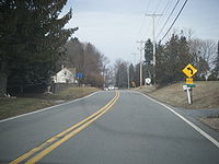
to the northwest and East Anwell Township to the southeast, pasing through a mix of farmland and homes. The route reaches the residential community of Reaville, where CR 514 splits from Old York Road and heads northeast onto Reaville-Clover Hill Road, with CR 613 continuing along Old York Road. The road comes to a junction with CR 609 before running east through more areas of agriculture and housing developments.
in Somerset County
and becomes Amwell Road, passing farms before continuing into more wooded areas with some agriculture and residences. The road enters woodland as it reaches an intersection with the southern terminus of CR 567
. The route passes through more areas of farms and woods before heading into wooded areas of residential development and coming to the CR 677 junction. At this point, CR 514 becomes Amwell Road Bypass and runs through woodland, before passing more residential subdivisions and widening to four lanes as it comes to CR 625. The route continues east as Amwell Road again to the US 206
junction, at which point it narrows back to two lanes. The road passes housing developments to the north and fields to the south prior to passing over CSX's Trenton Subdivision
. The route continues through farms, woods, and homes before reaching the CR 650 junction, at which point CR 514 turns northeast and enters Millstone
. The road bypasses the community to the north by passing through woodland and fields, turning east and intersecting CR 533 Bypass and CR 533
.
The route crosses the Millstone River
into Franklin Township
and passes over the Delaware and Raritan Canal
in forested areas. From this point, CR 514 continues through more farmland and woodland, intersecting CR 621 before turning north and coming to the CR 619 junction. At this point, the route turns east again and enters residential surroundings, intersecting CR 615, where it turns east-southeast and widens to four lanes. The road becomes Hamilton Street and heads into the community of Somerset
. Here, the route begins to curve to the east-northeast as it comes to the CR 617 intersection, narrowing back to two lanes. Following this junction, the road passes through a mix of homes and businesses.
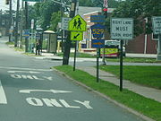 Upon crossing Mile Run Stream, CR 514 enters New Brunswick
in Middlesex County
and passes through more residential and commercial development as it comes to an intersection with CR 527
. At this point, the route turns southeast to form a concurrency
with CR 527 on Easton Avenue, heading into the commercial downtown of New Brunswick and passing under Amtrak
's Northeast Corridor
near the New Brunswick Station
before intersecting Route 27. Here, CR 514 and CR 527 form a concurrency with Route 27, heading east along four-lane divided
Albany Street. About 200 yards (182.9 m) later, the road crosses George Street, which heads to the north as CR 672 and to the south as Route 171. CR 527 splits from Albany Street by heading south on Route 171 while Route 27 and CR 514 continue east, interchanging with Route 18 a quarter of a mile later. After the Route 18 interchange, the road crosses the Raritan River
on the Albany Street Bridge
into Highland Park
. Upon entering Highland Park, Route 27/CR 514 becomes two-lane Raritan Avenue, intersecting CR 622
and continuing through the downtown area of Highland Park. CR 514 splits from Route 27 by heading east on Woodbridge Avenue, passing businesses. Upon entering Edison
, CR 676
briefly joins the route before it widens into a four-lane divided highway and interchanges with US 1
. Following this, the road becomes two lanes and undivided again as it comes to the CR 529
junction and passes through residential areas.
CR 514 widens into a four-lane divided highway and passes over the New Jersey Turnpike
(I-95
) before coming to an intersection with CR 667. Past this intersection, the route turns northeast and passes Middlesex County College
before running between residential areas to the northwest and commercial areas to the southeast. The road crosses a Conrail Shared Assets Operations
railroad line and intersects CR 531
, making a turn to the east. CR 514 turns northeast past more commercial development and intersects Raritan Center Parkway before coming to an interchange complex that has access to the New Jersey Turnpike and Route 440, I-287
. Following this interchange, the route becomes undivided again and passes more businesses, crossing CR 501
. The road narrows to two lanes at this point and continues into residential areas as it enters Woodbridge Township
, where the name of the road becomes Main Street. CR 514 passes over both the New Jersey Turnpike and the Garden State Parkway
simultaneously before heading into business areas as a four-lane road and reaching an interchange with US 9. Here, the road becomes two lanes again and passes homes before heading into the commercial dowtown of Woodbridge at the Route 35 intersection. CR 514 passes under New Jersey Transit
's North Jersey Coast Line
near the Woodbridge Station
prior to intersecting CR 652 and turning north onto Rahway Avenue. The road heads northeast through a mix of residences and businesses, with CR 604 joining the road for a short distance. The route crosses a Conrail Shared Assets Operations line prior to intersecting CR 650. Farther north, CR 514 crosses another railroad branch and heads through industrial areas to the east of East Jersey State Prison.
in Union County
and becomes Lawrence Avenue, intersecting CR 621 and passes a few homes before crossing the Rahway River
and intersects the southbound direction of US 1/9
, with northbound US 1/9 passing over CR 514. From this point, the road continues past more residences, intersecting CR 608. At the CR 613 junction, the route turns northwest onto East Grand Avenue and passes under the Northeast Corridor. CR 514 turns northeast onto Elizabeth Avenue, with CR 613 resuming along West Grand Avenue, and heads through residential and commercial areas a short distance to the northwest of the Northeast Corridor as it crosses CR 652. The route enters Linden
and heads past industry as it crosses an abandoned railroad branch. The road intersects CR 615 and passes businesses as it comes to CR 617. CR 514 passes more homes and commercial establishments, intersecting CR 619 and crossing under an abandoned railroad line. The road runs through more urban areas of businesses and industry as it reaches the CR 616 junction. CR 514 continues into Elizabeth
and passes homes on Fay Avenue as it reaches it eastern terminus at the Route 439 intersection.
Two former spur routes of County Route 514 existed. The first County Route 514 Spur in Hunterdon County ran along what is now Hunterdon County Routes 613 and 650. The second County Route 514 Spur ran along what is now Middlesex County Route 622
.
County highway
A county highway is a road in the United States and in the Canadian province of Ontario that is designated and/or maintained by the county highway department...
in the U.S. state
U.S. state
A U.S. state is any one of the 50 federated states of the United States of America that share sovereignty with the federal government. Because of this shared sovereignty, an American is a citizen both of the federal entity and of his or her state of domicile. Four states use the official title of...
of New Jersey
New Jersey
New Jersey is a state in the Northeastern and Middle Atlantic regions of the United States. , its population was 8,791,894. It is bordered on the north and east by the state of New York, on the southeast and south by the Atlantic Ocean, on the west by Pennsylvania and on the southwest by Delaware...
. The highway extends 42.86 miles (69 km) from US 202
U.S. Route 202
U.S. Route 202 is a highway stretching from Delaware to Maine, also passing through the states of Pennsylvania, New Jersey, New York, Connecticut, Massachusetts, and New Hampshire....
in East Amwell Township
East Amwell Township, New Jersey
-History:During the American Revolutionary War, a small but important skirmish occurred in East Amwell when local militia under Capt. John Schenck ambushed a party of British dragoons near Larison's Corner...
to Bayway Avenue (Route 439) in Elizabeth
Elizabeth, New Jersey
Elizabeth is a city in Union County, New Jersey, United States. As of the 2010 United States Census, the city had a total population of 124,969, retaining its ranking as New Jersey's fourth largest city with an increase of 4,401 residents from its 2000 Census population of 120,568...
. West of East Amwell, County Route 514 continues as Route 179.
Hunterdon County
U.S. Route 202 in New Jersey
U.S. Route 202 is a U.S. Highway running from New Castle, Delaware northeast to Bangor, Maine. In the U.S. state of New Jersey, the route runs from the New Hope-Lambertville Toll Bridge over the Delaware River at the Pennsylvania border in Delaware Township, Hunterdon County near Lambertville...
/Route 31 in East Amwell Township
East Amwell Township, New Jersey
-History:During the American Revolutionary War, a small but important skirmish occurred in East Amwell when local militia under Capt. John Schenck ambushed a party of British dragoons near Larison's Corner...
, Hunterdon County
Hunterdon County, New Jersey
Hunterdon County is a county located in the western section of the U.S. state of New Jersey. As of the 2010 United States Census, the population was 128,349. It is part of the New York Metropolitan Area. Its county seat is Flemington....
, heading northeast on two-lane undivided Old York Road
Old York Road
Old York Road or King's Highway is a roadway that was built in the 18th century to connect Philadelphia, Pennsylvania with New York City, New York. Through New Jersey it was built along the Raritan "Naraticong Trail"...
. West of US 202/Route 31, Old York Road becomes Route 179. A short distance after beginning, the road becomes the border between Raritan Township
Raritan Township, New Jersey
Raritan Township is a Township in Hunterdon County, New Jersey, United States. As of the United States 2010 Census, the township population was 22,185...
to the northwest and East Anwell Township to the southeast, pasing through a mix of farmland and homes. The route reaches the residential community of Reaville, where CR 514 splits from Old York Road and heads northeast onto Reaville-Clover Hill Road, with CR 613 continuing along Old York Road. The road comes to a junction with CR 609 before running east through more areas of agriculture and housing developments.
Somerset County
CR 514 continues east into Hillsborough TownshipHillsborough Township, New Jersey
Hillsborough Township is a Township in Somerset County, New Jersey, United States. As of the 2010 United States Census, the township population was 38,303....
in Somerset County
Somerset County, New Jersey
Somerset County is a county located in the U.S. state of New Jersey. In 2010, the population was 323,444. It is part of the New York Metropolitan Area. Its county seat is Somerville....
and becomes Amwell Road, passing farms before continuing into more wooded areas with some agriculture and residences. The road enters woodland as it reaches an intersection with the southern terminus of CR 567
County Route 567 (New Jersey)
County Route 567, abbreviated CR 567, is a county highway in the U.S. state of New Jersey. The highway extends from Amwell Road in Hillsborough Township to Union Avenue in Raritan Borough.-Route description:...
. The route passes through more areas of farms and woods before heading into wooded areas of residential development and coming to the CR 677 junction. At this point, CR 514 becomes Amwell Road Bypass and runs through woodland, before passing more residential subdivisions and widening to four lanes as it comes to CR 625. The route continues east as Amwell Road again to the US 206
U.S. Route 206
U.S. Route 206 is a long north–south United States highway in New Jersey and Pennsylvania, United States. Only about a half a mile of its length is in Pennsylvania; the Milford-Montague Toll Bridge carries it over the Delaware River into New Jersey, where it is the remainder of the route...
junction, at which point it narrows back to two lanes. The road passes housing developments to the north and fields to the south prior to passing over CSX's Trenton Subdivision
Trenton Subdivision
The Trenton Subdivision is a railroad line owned by CSX Transportation in the U.S. states of Pennsylvania and New Jersey. The line runs from Park Junction in Philadelphia, Pennsylvania northeast to Manville, New Jersey along a former Reading Company line....
. The route continues through farms, woods, and homes before reaching the CR 650 junction, at which point CR 514 turns northeast and enters Millstone
Millstone, New Jersey
Millstone is a Borough in Somerset County, New Jersey, United States. As of the United States 2010 Census, the borough population was 418.Millstone was incorporated as a borough by an Act of the New Jersey Legislature on May 14, 1894, from portions of Hillsborough Township, based on the results of...
. The road bypasses the community to the north by passing through woodland and fields, turning east and intersecting CR 533 Bypass and CR 533
County Route 533 (New Jersey)
County Route 533 is a county highway in the U.S. state of New Jersey. The highway extends from the White Horse Circle, in Hamilton Township to County Route 527 in Bound Brook. Route 533 shares a major concurrency with U.S...
.
The route crosses the Millstone River
Millstone River
The Millstone River is a tributary of the Raritan River in central New Jersey in the United States.The Millstone River begins in western Monmouth County and flows northward through southern Somerset County into the Raritan River at Manville. Almost three quarters of its length is paralleled by...
into Franklin Township
Franklin Township, Somerset County, New Jersey
-Communities of Franklin Township:The following are census-designated places, unincorporated enclaves, and historical communities located within Franklin Township...
and passes over the Delaware and Raritan Canal
Delaware and Raritan Canal
The Delaware and Raritan Canal is a canal in central New Jersey, United States, built in the 1830s that served to connect the Delaware River to the Raritan River. It was intended as an efficient and reliable means of transportation of freight between Philadelphia, Pennsylvania and New York City,...
in forested areas. From this point, CR 514 continues through more farmland and woodland, intersecting CR 621 before turning north and coming to the CR 619 junction. At this point, the route turns east again and enters residential surroundings, intersecting CR 615, where it turns east-southeast and widens to four lanes. The road becomes Hamilton Street and heads into the community of Somerset
Somerset, New Jersey
Somerset is a census-designated place and unincorporated area located at the easternmost section within Franklin Township, in Somerset County, New Jersey. At the 2000 United States Census, the CDP population was 23,040...
. Here, the route begins to curve to the east-northeast as it comes to the CR 617 intersection, narrowing back to two lanes. Following this junction, the road passes through a mix of homes and businesses.
Middlesex County
New Brunswick, New Jersey
New Brunswick is a city in Middlesex County, New Jersey, USA. It is the county seat and the home of Rutgers University. The city is located on the Northeast Corridor rail line, southwest of Manhattan, on the southern bank of the Raritan River. At the 2010 United States Census, the population of...
in Middlesex County
Middlesex County, New Jersey
-Demographics:As of the census of 2000, there were 750,162 people, 265,815 households, and 190,855 families residing in the county. The population density was 2,422 people per square mile . There were 273,637 housing units at an average density of 884 per square mile...
and passes through more residential and commercial development as it comes to an intersection with CR 527
County Route 527 (New Jersey)
County Route 527 is a county highway in the U.S. state of New Jersey. The highway extends from Main Street in Toms River Township to Pompton Avenue in Cedar Grove. It is the second longest county highway in New Jersey after Route 519. It was first given the number 527 in 1954...
. At this point, the route turns southeast to form a concurrency
Concurrency (road)
A concurrency, overlap, or coincidence in a road network is an instance of one physical road bearing two or more different highway, motorway, or other route numbers...
with CR 527 on Easton Avenue, heading into the commercial downtown of New Brunswick and passing under Amtrak
Amtrak
The National Railroad Passenger Corporation, doing business as Amtrak , is a government-owned corporation that was organized on May 1, 1971, to provide intercity passenger train service in the United States. "Amtrak" is a portmanteau of the words "America" and "track". It is headquartered at Union...
's Northeast Corridor
Northeast Corridor
The Northeast Corridor is a fully electrified railway line owned primarily by Amtrak serving the Northeast megalopolis of the United States from Boston in the north, via New York to Washington, D.C. in the south, with branches serving other cities...
near the New Brunswick Station
New Brunswick (NJT station)
New Brunswick Station is a railroad station on the New Jersey Transit Northeast Corridor Line and the Amtrak Northeast Corridor in New Brunswick, New Jersey. New Brunswick has had a railroad station since the mid-19th century; the Pennsylvania Railroad built the current station in 1903 when the...
before intersecting Route 27. Here, CR 514 and CR 527 form a concurrency with Route 27, heading east along four-lane divided
Divided Highway
Divided Highway is a compilation album by American rock band The Doobie Brothers, released in 2003. . All tracks are taken from the albums Cycles and Brotherhood .-Track listing:...
Albany Street. About 200 yards (182.9 m) later, the road crosses George Street, which heads to the north as CR 672 and to the south as Route 171. CR 527 splits from Albany Street by heading south on Route 171 while Route 27 and CR 514 continue east, interchanging with Route 18 a quarter of a mile later. After the Route 18 interchange, the road crosses the Raritan River
Raritan River
The Raritan River is a major river of central New Jersey in the United States. Its watershed drains much of the mountainous area of the central part of the state, emptying into the Raritan Bay on the Atlantic Ocean.-Description:...
on the Albany Street Bridge
Albany Street Bridge
The Albany Street Bridge is a bridge on Route 27 in the U.S. state of New Jersey spanning the Raritan River. The bridge connects Highland Park on the east with New Brunswick on the west....
into Highland Park
Highland Park, New Jersey
Highland Park is a borough in Middlesex County, New Jersey, United States. As of the 2010 United States Census, the borough population was 13,982....
. Upon entering Highland Park, Route 27/CR 514 becomes two-lane Raritan Avenue, intersecting CR 622
County Route 622 (Middlesex County, New Jersey)
Middlesex County Route 622 is a county highway in Middlesex County, New Jersey. It traverses the municipalities of Highland Park, Piscataway and Middlesex in its 7.44 mile length. The road began as Middlesex County Route 2R8 circa 1947. The road was changed into County Route 514 Spur, a spur...
and continuing through the downtown area of Highland Park. CR 514 splits from Route 27 by heading east on Woodbridge Avenue, passing businesses. Upon entering Edison
Edison, New Jersey
Edison Township is a township in Middlesex County, New Jersey. What is now Edison Township was originally incorporated as Raritan Township by an Act of the New Jersey Legislature on March 17, 1870, from portions of both Piscataway Township and Woodbridge Township...
, CR 676
County Route 676 (Middlesex County, New Jersey)
County Route 676, abbreviated CR 676, is a county highway designation in Middlesex County, New Jersey, that uses the streets of Duclos Lane, North Riverview Avenue, Suttons Lane, and Woodbridge Avenue in Highland Park and Edison Township. It is long from Edmund Street to Truman Drive...
briefly joins the route before it widens into a four-lane divided highway and interchanges with US 1
U.S. Route 1 in New Jersey
U.S. Route 1 is a United States highway which parallels the East Coast of the United States, running from Key West, Florida in the south to Fort Kent, Maine at the Canadian border in the north. Of the entire length of the route, of it runs through New Jersey...
. Following this, the road becomes two lanes and undivided again as it comes to the CR 529
County Route 529 (New Jersey)
County Route 529 is a county highway in the U.S. state of New Jersey. The highway extends from Woodbridge Avenue in Edison to Mountain Boulevard in Watchung.-Route description:...
junction and passes through residential areas.
CR 514 widens into a four-lane divided highway and passes over the New Jersey Turnpike
New Jersey Turnpike
The New Jersey Turnpike is a toll road in New Jersey, maintained by the New Jersey Turnpike Authority. According to the International Bridge, Tunnel and Turnpike Association, the Turnpike is the nation's sixth-busiest toll road and is among one of the most heavily traveled highways in the United...
(I-95
Interstate 95 in New Jersey
Interstate 95 is a major Interstate Highway that traverses the full extent of the East Coast of the United States, from Florida to Maine...
) before coming to an intersection with CR 667. Past this intersection, the route turns northeast and passes Middlesex County College
Middlesex County College
Middlesex County College is a community college with its main campus located in Edison, New Jersey, United States. The two-year college serves the needs of Middlesex County, as well as surrounding communities. There are two urban campuses located in New Brunswick and Perth Amboy.The college was...
before running between residential areas to the northwest and commercial areas to the southeast. The road crosses a Conrail Shared Assets Operations
Conrail Shared Assets Operations
Conrail Shared Assets Operations is an American railroad company. It operates three networks—the North Jersey, South Jersey/Philadelphia, and Detroit Shared Assets Areas, where it serves as a local carrier and switching company for CSX Transportation and the Norfolk Southern Railway...
railroad line and intersects CR 531
County Route 531 (New Jersey)
County Route 531 is a county highway in the U.S. state of New Jersey. The highway extends 13.61 miles from Woodbridge Avenue in Edison, Middlesex County, through Somerset County to Passaic Valley Road in Long Hill Township, Morris County.-Route description:Route 531 begins at CR 514 in Edison...
, making a turn to the east. CR 514 turns northeast past more commercial development and intersects Raritan Center Parkway before coming to an interchange complex that has access to the New Jersey Turnpike and Route 440, I-287
Interstate 287
Interstate 287 is an auxiliary Interstate Highway in the U.S. states of New Jersey and New York. It is a partial beltway around New York City, serving the northern half of New Jersey and the counties of Rockland and Westchester in New York...
. Following this interchange, the route becomes undivided again and passes more businesses, crossing CR 501
County Route 501 (New Jersey)
County Route 501 is a county highway in New Jersey in two sections spanning Middlesex, Hudson and Bergen Counties. The southern section runs from South Plainfield to Perth Amboy, the northern section runs from Bayonne to Rockleigh, and the two sections are connected by New York State Route 440...
. The road narrows to two lanes at this point and continues into residential areas as it enters Woodbridge Township
Woodbridge Township, New Jersey
-Communities:Many distinct communities exist within Woodbridge Township. Several of these communities have their own ZIP codes, and many are listed by the United States Census Bureau as census-designated places, but they are all unincorporated areas and neighborhoods within the Township that,...
, where the name of the road becomes Main Street. CR 514 passes over both the New Jersey Turnpike and the Garden State Parkway
Garden State Parkway
The Garden State Parkway is a 172.4-mile limited-access toll parkway that stretches the length of New Jersey from the New York line at Montvale, New Jersey, to Cape May at New Jersey's southernmost tip. Its name refers to New Jersey's nickname, the "Garden State." Most New Jersey residents refer...
simultaneously before heading into business areas as a four-lane road and reaching an interchange with US 9. Here, the road becomes two lanes again and passes homes before heading into the commercial dowtown of Woodbridge at the Route 35 intersection. CR 514 passes under New Jersey Transit
New Jersey Transit
The New Jersey Transit Corporation is a statewide public transportation system serving the United States state of New Jersey, and New York, Orange, and Rockland counties in New York State...
's North Jersey Coast Line
North Jersey Coast Line
The North Jersey Coast Line is a New Jersey Transit commuter rail service operating between New York Penn Station or Hoboken Terminal and Bay Head, New Jersey...
near the Woodbridge Station
Woodbridge (NJT station)
Woodbridge Station is a train station in Woodbridge Township, New Jersey, United States. It is one of three NJT stations in Woodbridge Township, the others being Avenel and Metropark in the Iselin section of the township. The station was built in 1939 as a Depression-era public works project...
prior to intersecting CR 652 and turning north onto Rahway Avenue. The road heads northeast through a mix of residences and businesses, with CR 604 joining the road for a short distance. The route crosses a Conrail Shared Assets Operations line prior to intersecting CR 650. Farther north, CR 514 crosses another railroad branch and heads through industrial areas to the east of East Jersey State Prison.
Union County
CR 514 continues into RahwayRahway, New Jersey
Rahway is a city in southern Union County, New Jersey, United States. It is part of the New York metropolitan area, being 15 miles southwest of Manhattan and five miles west of Staten Island...
in Union County
Union County, New Jersey
Union County is a county located in the U.S. state of New Jersey. As of the 2010 Census, the population was 536,499. It is part of the New York Metropolitan Area. Its county seat is Elizabeth. Union County ranks 93rd among the highest-income counties in the United States. It also ranks 74th in...
and becomes Lawrence Avenue, intersecting CR 621 and passes a few homes before crossing the Rahway River
Rahway River
The Rahway River is a river, approximately 24 mi long, in northeastern New Jersey in the United States. The river drains part of the suburban and urbanized area of New Jersey west of New York City. Part of the extended area of New York Harbor, the river empties into the Arthur Kill. In its...
and intersects the southbound direction of US 1/9
U.S. Route 1/9
U.S. Route 9 is a U.S. highway in the northeast United States, running from Laurel, Delaware north to the Canadian border near Champlain, New York...
, with northbound US 1/9 passing over CR 514. From this point, the road continues past more residences, intersecting CR 608. At the CR 613 junction, the route turns northwest onto East Grand Avenue and passes under the Northeast Corridor. CR 514 turns northeast onto Elizabeth Avenue, with CR 613 resuming along West Grand Avenue, and heads through residential and commercial areas a short distance to the northwest of the Northeast Corridor as it crosses CR 652. The route enters Linden
Linden, New Jersey
- Local government :, the Mayor of Linden is . The former longtime Mayor of Linden is 82-year-old John T. Gregorio, who served as mayor of Linden for 30, nonconsecutive years and was repeatedly tagged with scandal during his mayoral career, including one felony conviction, later pardoned, which...
and heads past industry as it crosses an abandoned railroad branch. The road intersects CR 615 and passes businesses as it comes to CR 617. CR 514 passes more homes and commercial establishments, intersecting CR 619 and crossing under an abandoned railroad line. The road runs through more urban areas of businesses and industry as it reaches the CR 616 junction. CR 514 continues into Elizabeth
Elizabeth, New Jersey
Elizabeth is a city in Union County, New Jersey, United States. As of the 2010 United States Census, the city had a total population of 124,969, retaining its ranking as New Jersey's fourth largest city with an increase of 4,401 residents from its 2000 Census population of 120,568...
and passes homes on Fay Avenue as it reaches it eastern terminus at the Route 439 intersection.
History
Prior to the 600-series county route designations, CR 514 in Middlesex County was designated as County Route 1R2.Two former spur routes of County Route 514 existed. The first County Route 514 Spur in Hunterdon County ran along what is now Hunterdon County Routes 613 and 650. The second County Route 514 Spur ran along what is now Middlesex County Route 622
County Route 622 (Middlesex County, New Jersey)
Middlesex County Route 622 is a county highway in Middlesex County, New Jersey. It traverses the municipalities of Highland Park, Piscataway and Middlesex in its 7.44 mile length. The road began as Middlesex County Route 2R8 circa 1947. The road was changed into County Route 514 Spur, a spur...
.