
Pennine Bridleway
Encyclopedia
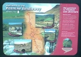
The Pennine Bridleway is a new National Trail under designation in Northern England
.
It runs roughly parallel with the Pennine Way
but provides access for horseback riders and cyclists as well as walkers
. The trail is around 130 miles (209 km) long; 73 miles (117 km) through Derbyshire
to the South Pennines
, the 47 miles (76 km) Mary Towneley Loop
and the 10 miles (16 km) Settle
Loop. In its southern part, it follows the High Peak Trail along the trackbed of the former Cromford and High Peak Railway
. The highest points along the trail are South Head Hill in Derbyshire (between Rushup Edge
and Hayfield
) and Top of Leach, the highest point on the Mary Towneley Loop.
 In 1986 Mary Towneley rode on horseback 250 miles (402 km) from Corbridge
, Northumberland
to Ashbourne
, Derbyshire to launch the idea of a Pennine Bridleway. This was followed by a feasibility study and route investigation from 1987 to 1990. Finally in 1995 approval was granted for the Pennine Bridleway National Trail from Carsington Water, Derbyshire to Kirkby Stephen
, Cumbria
.
In 1999 Sport England
awarded and donated £1,841,876 towards the route from Derbyshire to North Yorkshire
and 3 feeder routes from Keighley
, Bolton
and Penistone
. The Pennine Bridleway project team was appointed by the Countryside Agency and work began shortly.
In 2000 there was a proposal for an extension to the Pennine Bridleway from Kirkby Stephen
, Cumbria to Byrness
, Northumberland. This extension was approved in 2002.
Mary Towneley died in February 2001, and is commemorated by the Mary Towneley Loop, which opened in 2002. The southern section of the Trail from Derbyshire followed, and in 2005 the Settle
Loop opened, though it is currently not joined to the Pennine Bridleway.
The Pennine Bridleway is not to be confused with the Pennine Cycleway
(part of the National Cycle Network
) or the Pennine Way (a separate National Trail).
, Derbyshire, the Pennine Bridleway mainly follows historic routes and trails along the flanks of the Pennines. It initially follows the High Peak Trail along a disused railway passing through the limestone
of the White Peak
. (An alternative starting point is the site of the former Hartington railway station
, utilizing a short section of the Tissington Trail
before joining the High Peak Trail at Parsley Hay.) Beyond the limestone plateau is the millstone grit
of the Dark or High Peak area, and the trail follows the line of a packhorse road from Tideswell
, via Peak Forest
to Hayfield
, where it briefly follows the line of another converted railway, the Sett Valley Trail
.
Leaving Derbyshire for Greater Manchester
, the trail follows the edge of a heather moor and picks up an ancient highway along the Tame valley
. From here the trail descends to follow a dismantled railway where the route heads towards Hollingworth Lake
. It later joins the Mary Towneley Loop, which climbs to the highest point of the Trail: Top of Leach at 474 metres (1,555 ft). The trail passes through the town of Waterfoot in the Rossendale Valley
and follows new tracks via Lumb before entering the Cliviger Gorge
and then climbing up to the Long Causeway. The trail joins the Gorple Road, a more remote stretch of the trail that leads to Blackshaw Head. The trail drops down into the Calder
valley and the town of Hebden Bridge
, where the route picks up London Road and heads towards Bottomley.
Northern England
Northern England, also known as the North of England, the North or the North Country, is a cultural region of England. It is not an official government region, but rather an informal amalgamation of counties. The southern extent of the region is roughly the River Trent, while the North is bordered...
.
It runs roughly parallel with the Pennine Way
Pennine Way
The Pennine Way is a National Trail in England. The trail runs from Edale, in the northern Derbyshire Peak District, north through the Yorkshire Dales and the Northumberland National Park and ends at Kirk Yetholm, just inside the Scottish border. The path runs along the Pennine hills, sometimes...
but provides access for horseback riders and cyclists as well as walkers
Pedestrian
A pedestrian is a person traveling on foot, whether walking or running. In some communities, those traveling using roller skates or skateboards are also considered to be pedestrians. In modern times, the term mostly refers to someone walking on a road or footpath, but this was not the case...
. The trail is around 130 miles (209 km) long; 73 miles (117 km) through Derbyshire
Derbyshire
Derbyshire is a county in the East Midlands of England. A substantial portion of the Peak District National Park lies within Derbyshire. The northern part of Derbyshire overlaps with the Pennines, a famous chain of hills and mountains. The county contains within its boundary of approx...
to the South Pennines
Pennines
The Pennines are a low-rising mountain range, separating the North West of England from Yorkshire and the North East.Often described as the "backbone of England", they form a more-or-less continuous range stretching from the Peak District in Derbyshire, around the northern and eastern edges of...
, the 47 miles (76 km) Mary Towneley Loop
Mary Towneley Loop
The Mary Towneley Loop is a circular route that forms part of the Pennine Bridleway National Trail, along the borders of Lancashire and Yorkshire....
and the 10 miles (16 km) Settle
Settle
Settle is a small market town and civil parish within the Craven district of North Yorkshire, England. It is served by the Settle railway station, which is located near the town centre, and Giggleswick railway station which is a mile away. It is from Leeds Bradford Airport...
Loop. In its southern part, it follows the High Peak Trail along the trackbed of the former Cromford and High Peak Railway
Cromford and High Peak Railway
The Cromford and High Peak Railway in Derbyshire, England, was completed in 1831, to carry minerals and goods between the Cromford Canal wharf at High Peak Junction and the Peak Forest Canal at Whaley Bridge -Origins:...
. The highest points along the trail are South Head Hill in Derbyshire (between Rushup Edge
Rushup Edge
Rushup Edge is a ridge in the Derbyshire Peak District of England. The ridge's highest point is Lord's Seat at , while Mam Tor lies at its eastern end, beyond which the Great Ridge runs.-References:...
and Hayfield
Hayfield
Hayfield is a village and civil parish in the Borough of High Peak, in the county of Derbyshire, England. The village lies approximately east of New Mills, south of Glossop and north of Buxton by road....
) and Top of Leach, the highest point on the Mary Towneley Loop.
History
Corbridge
Corbridge is a village in Northumberland, England, situated west of Newcastle and east of Hexham. Villages in the vicinity include Halton, Acomb, Aydon and Sandhoe.-Roman fort and town:...
, Northumberland
Northumberland
Northumberland is the northernmost ceremonial county and a unitary district in North East England. For Eurostat purposes Northumberland is a NUTS 3 region and is one of three boroughs or unitary districts that comprise the "Northumberland and Tyne and Wear" NUTS 2 region...
to Ashbourne
Ashbourne, Derbyshire
Ashbourne is a small market town in the Derbyshire Dales, England. It has a population of 10,302.The town advertises itself as 'The Gateway to Dovedale'.- Local customs :...
, Derbyshire to launch the idea of a Pennine Bridleway. This was followed by a feasibility study and route investigation from 1987 to 1990. Finally in 1995 approval was granted for the Pennine Bridleway National Trail from Carsington Water, Derbyshire to Kirkby Stephen
Kirkby Stephen
Kirkby Stephen is a civil parish and small market town in Cumbria, in North West England which historically, is part of Westmorland. The town is located on the A685, surrounded by sparsely populated hill country, and about from the two nearest larger towns, Kendal and Penrith...
, Cumbria
Cumbria
Cumbria , is a non-metropolitan county in North West England. The county and Cumbria County Council, its local authority, came into existence in 1974 after the passage of the Local Government Act 1972. Cumbria's largest settlement and county town is Carlisle. It consists of six districts, and in...
.
In 1999 Sport England
Sport England
Sport England is the brand name for the English Sports Council and is a non-departmental public body under the Department for Culture, Media and Sport...
awarded and donated £1,841,876 towards the route from Derbyshire to North Yorkshire
North Yorkshire
North Yorkshire is a non-metropolitan or shire county located in the Yorkshire and the Humber region of England, and a ceremonial county primarily in that region but partly in North East England. Created in 1974 by the Local Government Act 1972 it covers an area of , making it the largest...
and 3 feeder routes from Keighley
Keighley
Keighley is a town and civil parish within the metropolitan borough of the City of Bradford in West Yorkshire, England. It is situated northwest of Bradford and is at the confluence of the River Aire and the River Worth...
, Bolton
Bolton
Bolton is a town in Greater Manchester, in the North West of England. Close to the West Pennine Moors, it is north west of the city of Manchester. Bolton is surrounded by several smaller towns and villages which together form the Metropolitan Borough of Bolton, of which Bolton is the...
and Penistone
Penistone
Penistone is a small town market town and civil parish in the Metropolitan Borough of Barnsley, in South Yorkshire, England, with a population of 10,101 at the 2001 census. It lies west of the town of Barnsley and north east of Glossop, in the foothills of the Pennines...
. The Pennine Bridleway project team was appointed by the Countryside Agency and work began shortly.
In 2000 there was a proposal for an extension to the Pennine Bridleway from Kirkby Stephen
Kirkby Stephen
Kirkby Stephen is a civil parish and small market town in Cumbria, in North West England which historically, is part of Westmorland. The town is located on the A685, surrounded by sparsely populated hill country, and about from the two nearest larger towns, Kendal and Penrith...
, Cumbria to Byrness
Byrness
Located in Northumberland, Byrness the last village in England before the A68 climbs the Cheviot Hills to cross Carter Bar into Scotland. It is situated approximately to the north-west of Newcastle on the A68. Byrness's village church features a stained-glass window commemorating the workers who...
, Northumberland. This extension was approved in 2002.
Mary Towneley died in February 2001, and is commemorated by the Mary Towneley Loop, which opened in 2002. The southern section of the Trail from Derbyshire followed, and in 2005 the Settle
Settle
Settle is a small market town and civil parish within the Craven district of North Yorkshire, England. It is served by the Settle railway station, which is located near the town centre, and Giggleswick railway station which is a mile away. It is from Leeds Bradford Airport...
Loop opened, though it is currently not joined to the Pennine Bridleway.
The Pennine Bridleway is not to be confused with the Pennine Cycleway
Pennine Cycleway
The Pennine Cycleway is a Sustrans-sponsored route from the English city of Derby to Berwick-upon-Tweed on the Scottish border. It goes through the Peak District and Yorkshire Dales by way of Buxton, Hebden Bridge, Sedbergh, Appleby, Bellingham and Branton....
(part of the National Cycle Network
National Cycle Network
The National Cycle Network is a network of cycle routes in the United Kingdom.The National Cycle Network was created by the charity Sustrans , and aided by a £42.5 million National Lottery grant. In 2005 it was used for over 230 million trips.Many routes hope to minimise contact with motor...
) or the Pennine Way (a separate National Trail).
Route
Starting in Middleton-by-WirksworthMiddleton-by-Wirksworth
Middleton-by-Wirksworth is an upland village lying approximately one mile NNW of Wirksworth, Derbyshire, formerly known for its lead mines and high quality limestone quarries, including the remarkable underground quarry site at Middleton Mine...
, Derbyshire, the Pennine Bridleway mainly follows historic routes and trails along the flanks of the Pennines. It initially follows the High Peak Trail along a disused railway passing through the limestone
Limestone
Limestone is a sedimentary rock composed largely of the minerals calcite and aragonite, which are different crystal forms of calcium carbonate . Many limestones are composed from skeletal fragments of marine organisms such as coral or foraminifera....
of the White Peak
White Peak
The White Peak is the lower, southern part of the Peak District in England. In contrast to the Dark Peak, the underlying limestone is not capped by impervious millstone grit, so caves and dry river valleys are common features of the area...
. (An alternative starting point is the site of the former Hartington railway station
Hartington railway station
Hartington railway station opened in 1899 about two miles away from the village it served - Hartington in Derbyshire, south east of Buxton....
, utilizing a short section of the Tissington Trail
Tissington Trail
right|thumb|200px|The Trail at the site of the former Tissington station, now a picnic site.The Tissington Trail is a bridleway and walk/cycle path in Derbyshire, England...
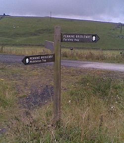
before joining the High Peak Trail at Parsley Hay.) Beyond the limestone plateau is the millstone grit
Millstone Grit
Millstone Grit is the name given to any of a number of coarse-grained sandstones of Carboniferous age which occur in the Northern England. The name derives from its use in earlier times as a source of millstones for use principally in watermills...
of the Dark or High Peak area, and the trail follows the line of a packhorse road from Tideswell
Tideswell
Tideswell is a village and civil parish in the Peak District of Derbyshire, in England. It lies east of Buxton on the B6049, in a wide dry valley on a limestone plateau, at an altitude of above sea level, and is within the District of Derbyshire Dales...
, via Peak Forest
Peak Forest
Peak Forest is a small village on the main road the from Chapel-en-le-Frith to Chesterfield in England.The village grew from the earlier settlement of Dam at the conjunction of Perrydale and Damdale. There is an inn, a village shop and a Primary School...
to Hayfield
Hayfield
Hayfield is a village and civil parish in the Borough of High Peak, in the county of Derbyshire, England. The village lies approximately east of New Mills, south of Glossop and north of Buxton by road....
, where it briefly follows the line of another converted railway, the Sett Valley Trail
Sett Valley Trail
The Sett Valley Trail is a cycle- and bridleway in Derbyshire, England, linking the village of Hayfield and the town of New Mills . It runs along the lower valley of the River Sett and follows the trackbed of a former branch railway line from to , which opened in 1868 and closed in 1970...
.
Leaving Derbyshire for Greater Manchester
Greater Manchester
Greater Manchester is a metropolitan county in North West England, with a population of 2.6 million. It encompasses one of the largest metropolitan areas in the United Kingdom and comprises ten metropolitan boroughs: Bolton, Bury, Oldham, Rochdale, Stockport, Tameside, Trafford, Wigan, and the...
, the trail follows the edge of a heather moor and picks up an ancient highway along the Tame valley
River Tame, Greater Manchester
The River Tame flows through Greater Manchester, England.-Source:The Tame rises on Denshaw Moor in Greater Manchester, close to the border with West Yorkshire but within the historic West Riding of Yorkshire.-Course:...
. From here the trail descends to follow a dismantled railway where the route heads towards Hollingworth Lake
Hollingworth Lake
Hollingworth Lake is a reservoir in the Hollingworth area of Littleborough — part of the Metropolitan Borough of Rochdale, in Greater Manchester, England. Also known as the Weaver's Seaport, Hollingworth Lake was originally built as the main water source for the Rochdale Canal, but forms part of...
. It later joins the Mary Towneley Loop, which climbs to the highest point of the Trail: Top of Leach at 474 metres (1,555 ft). The trail passes through the town of Waterfoot in the Rossendale Valley
Rossendale Valley
The Rossendale Valley is part of the Forest of Rossendale, an upland area of North West England, in Lancashire. The area is within the Borough of Rossendale...
and follows new tracks via Lumb before entering the Cliviger Gorge
Cliviger
Cliviger is a civil parish within the Borough of Burnley, in Lancashire, England. It is situated to the southeast of Burnley, and northwest of Todmorden and has a population of 2,350...
and then climbing up to the Long Causeway. The trail joins the Gorple Road, a more remote stretch of the trail that leads to Blackshaw Head. The trail drops down into the Calder
River Calder, West Yorkshire
The River Calder is a river in West Yorkshire, in Northern England.The Calder rises on the green eastern slopes of the Pennines flows through alternating green countryside, former woollen-mill villages, and large and small towns before joining the River Aire near Castleford.The river's valley is...
valley and the town of Hebden Bridge
Hebden Bridge
Hebden Bridge is a market town within the Metropolitan Borough of Calderdale, in West Yorkshire, England. It forms part of the Upper Calder Valley and lies 8 miles west of Halifax and 14 miles north east of Rochdale, at the confluence of the River Calder and the River Hebden .A 2004 profile of...
, where the route picks up London Road and heads towards Bottomley.
See also
- Rail trailRail trailA rail trail is the conversion of a disused railway easement into a multi-use path, typically for walking, cycling and sometimes horse riding. The characteristics of former tracks—flat, long, frequently running through historical areas—are appealing for various development. The term sometimes also...
- Pennine CyclewayPennine CyclewayThe Pennine Cycleway is a Sustrans-sponsored route from the English city of Derby to Berwick-upon-Tweed on the Scottish border. It goes through the Peak District and Yorkshire Dales by way of Buxton, Hebden Bridge, Sedbergh, Appleby, Bellingham and Branton....
- Sabrina WaySabrina WayThe Sabrina Way is a waymarked long distance footpath and bridleway in England.-The route:The route is primarily designed and intended for horses and horseback riders and links bridleways between the Pennines and the Cotswolds and The Ridgeway....
: a new bridleway that links southwards through StaffordshireStaffordshireStaffordshire is a landlocked county in the West Midlands region of England. For Eurostat purposes, the county is a NUTS 3 region and is one of four counties or unitary districts that comprise the "Shropshire and Staffordshire" NUTS 2 region. Part of the National Forest lies within its borders...
, ShropshireShropshireShropshire is a county in the West Midlands region of England. For Eurostat purposes, the county is a NUTS 3 region and is one of four counties or unitary districts that comprise the "Shropshire and Staffordshire" NUTS 2 region. It borders Wales to the west...
, WorcestershireWorcestershireWorcestershire is a non-metropolitan county, established in antiquity, located in the West Midlands region of England. For Eurostat purposes it is a NUTS 3 region and is one of three counties that comprise the "Herefordshire, Worcestershire and Warwickshire" NUTS 2 region...
and GloucestershireGloucestershireGloucestershire is a county in South West England. The county comprises part of the Cotswold Hills, part of the flat fertile valley of the River Severn, and the entire Forest of Dean....
into OxfordshireOxfordshireOxfordshire is a county in the South East region of England, bordering on Warwickshire and Northamptonshire , Buckinghamshire , Berkshire , Wiltshire and Gloucestershire ....