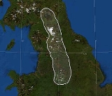
The
Pennines (ˈpɛnaɪnz) are a low-rising
mountain rangeA mountain range is a single, large mass consisting of a succession of mountains or narrowly spaced mountain ridges, with or without peaks, closely related in position, direction, formation, and age; a component part of a mountain system or of a mountain chain...
, separating the
North West of EnglandNorth West England, informally known as The North West, is one of the nine official regions of England.North West England had a 2006 estimated population of 6,853,201 the third most populated region after London and the South East...
from
YorkshireYorkshire is a historic county of northern England and the largest in the United Kingdom. Because of its great size in comparison to other English counties, functions have been increasingly undertaken over time by its subdivisions, which have also been subject to periodic reform...
and the
North EastNorth East England is one of the nine official regions of England. It covers Northumberland, County Durham, Tyne and Wear, and Teesside . The only cities in the region are Durham, Newcastle upon Tyne and Sunderland...
.
Often described as the "
backboneIn human anatomy, the vertebral column is a column usually consisting of 24 articulating vertebrae, and 9 fused vertebrae in the sacrum and the coccyx. It is situated in the dorsal aspect of the torso, separated by intervertebral discs...
of England", they form a more-or-less continuous range stretching from the
Peak DistrictThe Peak District is an upland area in central and northern England, lying mainly in northern Derbyshire, but also covering parts of Cheshire, Greater Manchester, Staffordshire, and South and West Yorkshire....
in
DerbyshireDerbyshire is a county in the East Midlands of England. A substantial portion of the Peak District National Park lies within Derbyshire. The northern part of Derbyshire overlaps with the Pennines, a famous chain of hills and mountains. The county contains within its boundary of approx...
, around the northern and eastern edges of
Greater ManchesterGreater Manchester is a metropolitan county in North West England, with a population of 2.6 million. It encompasses one of the largest metropolitan areas in the United Kingdom and comprises ten metropolitan boroughs: Bolton, Bury, Oldham, Rochdale, Stockport, Tameside, Trafford, Wigan, and the...
, through the
Yorkshire DalesThe Yorkshire Dales is the name given to an upland area in Northern England.The area lies within the historic county boundaries of Yorkshire, though it spans the ceremonial counties of North Yorkshire, West Yorkshire and Cumbria...
past the
CumbriaCumbria , is a non-metropolitan county in North West England. The county and Cumbria County Council, its local authority, came into existence in 1974 after the passage of the Local Government Act 1972. Cumbria's largest settlement and county town is Carlisle. It consists of six districts, and in...
n Fells to the
Cheviot HillsThe Cheviot Hills is a range of rolling hills straddling the England–Scotland border between Northumberland and the Scottish Borders.There is a broad split between the northern and the southern Cheviots...
on the
Anglo-Scottish borderThe Anglo-Scottish border is the official border and mark of entry between Scotland and England. It runs for 154 km between the River Tweed on the east coast and the Solway Firth in the west. It is Scotland's only land border...
. North of the
Aire GapAire Gap is a mountain pass through the backbone of England formed by geologic faults and carved out by glaciers. The term is used in various senses: a vast geological division, a travel route, or a location that is an entry into the Aire river valley....
, the Pennines give out a western
spurA spur is a subsidiary summit of a hill or mountain. By definition, spurs have low topographic prominence, as they are lower than their parent summit and are closely connected to them on the same ridgeline...
into Lancashire, the Bowland Fells, and south of the gap is a similar spur, comprising the Rossendale Fells and
West Pennine MoorsThe West Pennine Moors cover an area of approximately of moorland and reservoirs in Lancashire and Greater Manchester, England.The West Pennine Moors are separated from the main Pennine range by the Irwell Valley. The moorland includes Withnell, Anglezarke and Rivington Moors in the extreme west,...
.
Although the above is a common definition, the
Cheviot HillsThe Cheviot Hills is a range of rolling hills straddling the England–Scotland border between Northumberland and the Scottish Borders.There is a broad split between the northern and the southern Cheviots...
are not, strictly speaking, part of the Pennines, being separated by the Tyne Gap and the
Whin SillThe Whin Sill or Great Whin Sill is a tabular layer of the igneous rock dolerite in County Durham and Northumberland in the northeast of England. It lies partly in the North Pennines Area of Outstanding Natural Beauty and partly in Northumberland National Park and stretches from Teesdale northwards...
, along which run the
A69The A69 is a major road in northern England, running east-west across the Pennines, through the counties of Tyne and Wear, Northumberland and Cumbria. Originally the road started in Blaydon, but since the creation of the A1 Western Bypass around Newcastle upon Tyne, it now starts at Denton Burn a...
and
Hadrian's WallHadrian's Wall was a defensive fortification in Roman Britain. Begun in AD 122, during the rule of emperor Hadrian, it was the first of two fortifications built across Great Britain, the second being the Antonine Wall, lesser known of the two because its physical remains are less evident today.The...
, but because the
Pennine WayThe Pennine Way is a National Trail in England. The trail runs from Edale, in the northern Derbyshire Peak District, north through the Yorkshire Dales and the Northumberland National Park and ends at Kirk Yetholm, just inside the Scottish border. The path runs along the Pennine hills, sometimes...
crosses them they are often treated as such. Conversely, although the southern end of the Pennines is commonly said to be somewhere in the High Peak district of Derbyshire, often
EdaleEdale is a small Derbyshire village and Civil parish in the Peak District, in the Midlands of England. The Parish of Edale,area ,is in the Borough of High Peak....
(the start of the Pennine Way), they extend south into
StaffordshireStaffordshire is a landlocked county in the West Midlands region of England. For Eurostat purposes, the county is a NUTS 3 region and is one of four counties or unitary districts that comprise the "Shropshire and Staffordshire" NUTS 2 region. Part of the National Forest lies within its borders...
and the southern parts of
CheshireCheshire is a ceremonial county in North West England. Cheshire's county town is the city of Chester, although its largest town is Warrington. Other major towns include Widnes, Congleton, Crewe, Ellesmere Port, Runcorn, Macclesfield, Winsford, Northwich, and Wilmslow...
and Derbyshire. The true southern end of the Pennines is in the
Stoke-on-TrentStoke-on-Trent , also called The Potteries is a city in Staffordshire, England, which forms a linear conurbation almost 12 miles long, with an area of . Together with the Borough of Newcastle-under-Lyme Stoke forms The Potteries Urban Area...
area, about 40 miles (64 km) south of Edale.
The Pennines are an important water catchment area with numerous
reservoirA reservoir , artificial lake or dam is used to store water.Reservoirs may be created in river valleys by the construction of a dam or may be built by excavation in the ground or by conventional construction techniques such as brickwork or cast concrete.The term reservoir may also be used to...
s in the head streams of the major river valleys. The region is widely considered to be one of the most scenic areas of the
United KingdomThe United Kingdom of Great Britain and Northern IrelandIn the United Kingdom and Dependencies, other languages have been officially recognised as legitimate autochthonous languages under the European Charter for Regional or Minority Languages...
. The North Pennines and
NidderdaleNidderdale is one of the Yorkshire Dales in North Yorkshire, England. It is the upper valley of the River Nidd, which flows south through the dale, forming several reservoirs including the Gouthwaite Reservoir, before turning east and eventually joining the River Ouse.The only town in the dale is...
have been declared Areas of Outstanding Natural Beauty (AONB), as have
BowlandThe Forest of Bowland, also known as the Bowland Fells, is an area of barren gritstone fells, deep valleys and peat moorland, mostly in north-east Lancashire, England. A small part lies in North Yorkshire, and much of the area was historically part of the West Riding of Yorkshire...
and
Pendle HillPendle Hill is located in the north-east of Lancashire, England, near the towns of Burnley, Nelson, Colne, Clitheroe and Padiham, an area known as Pendleside. Its summit is above mean sea level. It gives its name to the Borough of Pendle. It is an isolated hill, separated from the Pennines to the...
. Portions of the Pennines are incorporated into the Peak District National Park, the Yorkshire Dales National Park and the
Northumberland National ParkNorthumberland National Park is the northernmost national park in England. It covers an area of more than 1030 km² between the Scottish Border in the north to just south of Hadrian's Wall. It is one of the least populated and least visited of the National Parks...
. Britain's first long distance footpath, the
Pennine WayThe Pennine Way is a National Trail in England. The trail runs from Edale, in the northern Derbyshire Peak District, north through the Yorkshire Dales and the Northumberland National Park and ends at Kirk Yetholm, just inside the Scottish border. The path runs along the Pennine hills, sometimes...
, runs along most of the Pennine chain and is 429 kilometres (268 mi) long.
Etymology
The first use of the name "Pennines" to describe the mountain range is in the spurious
De Situ BritanniaeDe Situ Britanniae is a fictional description of the peoples and places of ancient Britain. Purported to contain the account of a Roman general preserved in the manuscript of a fourteenth century English monk, it was considered the premier source of information on Roman Britain for more than a...
, first published in 1757:
- This province is divided into two equal parts by a chain of mountains called the Pennine Alps, which rising on the confines of the Iceni
The Iceni or Eceni were a British tribe who inhabited an area of East Anglia corresponding roughly to the modern-day county of Norfolk between the 1st century BC and the 1st century AD...
and Carnabii, near the River Trivona (River TrentThe River Trent is one of the major rivers of England. Its source is in Staffordshire on the southern edge of Biddulph Moor. It flows through the Midlands until it joins the River Ouse at Trent Falls to form the Humber Estuary, which empties into the North Sea below Hull and Immingham.The Trent...
), extend towards the north in a continued series of fifty miles.
This book purported to contain the account of a
RomanThe Roman Empire was the post-Republican period of the ancient Roman civilization, characterised by an autocratic form of government and large territorial holdings in Europe and around the Mediterranean....
general preserved in the manuscript of a 14th-century
EnglishThe English are a nation and ethnic group native to England, who speak English. The English identity is of early mediaeval origin, when they were known in Old English as the Anglecynn. England is now a country of the United Kingdom, and the majority of English people in England are British Citizens...
monk,
Richard of CirencesterRichard of Cirencester , historical writer, was a member of the Benedictine abbey at Westminster, and his name first appears on the chamberlain's list of the monks of that foundation drawn up in the year 1355....
, and was considered the premier source of information on
Roman BritainRoman Britain was the part of the island of Great Britain controlled by the Roman Empire from AD 43 until ca. AD 410.The Romans referred to the imperial province as Britannia, which eventually comprised all of the island of Great Britain south of the fluid frontier with Caledonia...
for more than a century after it was made available in 1749. It was in fact a forgery created by
Charles BertramCharles Bertram was the author of the forged manuscript De Situ Britanniae , a spurious history that was highly influential in the reconstruction of the history of Roman Britain for over a century. It had a similar impact on the explanation of Scottish history over the same period of time...
, an Englishman then living in
CopenhagenCopenhagen is the capital and largest city of Denmark, with an urban population of 1,199,224 and a metropolitan population of 1,930,260 . With the completion of the transnational Øresund Bridge in 2000, Copenhagen has become the centre of the increasingly integrating Øresund Region...
. In 1853, Arthur Hussey listed several names in
De Situ Britanniae that he could not trace to an earlier source, including the "Pennine Alps". However, by that time, particularly in the early 19th century, the name "Pennine Chain" or "Pennines" had become widely accepted.
In his 2004 book
Names and History: People, Places and Things, George Redmonds provided a modern assessment. He comments at length on the strange omission of the
etymologyEtymology is the study of the history of words, their origins, and how their form and meaning have changed over time.For languages with a long written history, etymologists make use of texts in these languages and texts about the languages to gather knowledge about how words were used during...
of the Pennines in the serious literature regarding that area of England, including publications on place-name origins of Derbyshire and
LancashireLancashire is a non-metropolitan county of historic origin in the North West of England. It takes its name from the city of Lancaster, and is sometimes known as the County of Lancaster. Although Lancaster is still considered to be the county town, Lancashire County Council is based in Preston...
by respected authors. He finally learns that the origin of the name is from
De Situ Britanniae and that "nor do we know any name for the whole range before the 18th century." There follows a discussion of the forgery and the fact that a number of its inventions had found their way into the
Ordnance SurveyOrdnance Survey , an executive agency and non-ministerial government department of the Government of the United Kingdom, is the national mapping agency for Great Britain, producing maps of Great Britain , and one of the world's largest producers of maps.The name reflects its creation together with...
maps; and that the true origin of the name was known by serious authors, most of whom simply chose not to speak of it. He also notes that the mountains had been called by various names in the past, and that there were allusional references to the mountains as "our Apennines" as early as the 1630s (and perhaps before that), so likely Bertram simply invented a name that was easy for people to accept as fact.
Redmonds also suggests that Bertram may have got the idea for the name from the Elizabethan commentator
William CamdenWilliam Camden was an English antiquarian, historian, topographer, and officer of arms. He wrote the first chorographical survey of the islands of Great Britain and Ireland and the first detailed historical account of the reign of Elizabeth I of England.- Early years :Camden was born in London...
, who wrote:
The north part...riseth up and swelleth somewhat mountainous, with moores and hills, which beginning here runs as an Apenine does in Italie, through the middest of England...even as far as Scotland, although oftentimes they change their name.
The name 'Pennines' may have become readily accepted if it was already closely related to an earlier name (or names) for the hills of a Cumbric origin, like the hill
Pen-y-ghentPen-y-ghent is a fell in the Yorkshire Dales. It is one of the Yorkshire Three Peaks, the other two being Ingleborough and Whernside. It lies some 3 km east of Horton in Ribblesdale...
in northern Yorkshire.
A very similar language to Cumbric was once spoken in
Northern ItalyNorthern Italy is a wide cultural, historical and geographical definition, without any administrative usage, used to indicate the northern part of the Italian state, also referred as Settentrione or Alta Italia...
.
The etymology for the Apennines of
ItalyItaly , officially the Italian Republic languages]] under the European Charter for Regional or Minority Languages. In each of these, Italy's official name is as follows:;;;;;;;;), is a unitary parliamentary republic in South-Central Europe. To the north it borders France, Switzerland, Austria and...
that is most frequently repeated (because of its semantic appropriateness) is that it derives from the Celtic
Penn, 'mountain, summit': which could have been assigned during the Celtic domination of north Italy in the 4th century BC or before.
The name originally applied to the north Apennines. However, historical linguists have never found a derivation with which they are universally comfortable. Wilhelm Deecke said: "...is doubtful but some derive it from the Ligurian-Celtish Pen or Ben, which means mountain peak."
Ranko MatasovićRanko Matasović is a Croatian linguist, Indo-Europeanist and Celticist.He was born and raised in Zagreb where he attended primary and secondary school. At the Faculty of philosophy at the University of Zagreb he graduated linguistics and philosophy, receiving M.A. in linguistics in 1992 and Ph.D...
reconstructs a Proto-Celtic root
*bando- 'peak, top', which he considers of non-
Indo-EuropeanThe Indo-European languages are a family of several hundred related languages and dialects, including most major current languages of Europe, the Iranian plateau, and South Asia and also historically predominant in Anatolia...
origin.
Toponymy
The names of towns and geographical features retain some evidence of the
CeltThe Celts were a diverse group of tribal societies in Iron Age and Roman-era Europe who spoke Celtic languages.The earliest archaeological culture commonly accepted as Celtic, or rather Proto-Celtic, was the central European Hallstatt culture , named for the rich grave finds in Hallstatt, Austria....
s who were here before, and after, the Romans: for example the town
PenrithPenrith was an urban district between 1894 and 1974, when it was merged into Eden District.The authority's area was coterminous with the civil parish of Penrith although when the council was abolished Penrith became an unparished area....
, the fell Pen-y-ghent, the
River EdenThe River Eden is a river that flows through Cumbria, England on its way to the Solway Firth.-Course of river:The Eden rises in Black Fell Moss, Mallerstang, on the high ground between High Seat, Yorkshire Dales and Hugh Seat. Here it forms the boundary between the counties of Cumbria and North...
, or the name
CumbriaCumbria , is a non-metropolitan county in North West England. The county and Cumbria County Council, its local authority, came into existence in 1974 after the passage of the Local Government Act 1972. Cumbria's largest settlement and county town is Carlisle. It consists of six districts, and in...
.
More commonly the local names result from the later
Anglo-SaxonAnglo-Saxon is a term used by historians to designate the Germanic tribes who invaded and settled the south and east of Great Britain beginning in the early 5th century AD, and the period from their creation of the English nation to the Norman conquest. The Anglo-Saxon Era denotes the period of...
and
NorseNorsemen is used to refer to the group of people as a whole who spoke what is now called the Old Norse language belonging to the North Germanic branch of Indo-European languages, especially Norwegian, Icelandic, Faroese, Swedish and Danish in their earlier forms.The meaning of Norseman was "people...
settlements. And in both Yorkshire and Cumbria many Norse words not commonly used in standard English are part of everyday speech: for example, gill (narrow steep valley),
beckBeck Hansen is an American musician, singer-songwriter and multi-instrumentalist, known by the stage name Beck...
(brook or stream),
fell“Fell” is a word used to refer to mountains, or certain types of mountainous landscape, in Scandinavia, the Isle of Man, and parts of northern England.- Etymology :...
(hill) and
daleA dale is an open valley. The name is used when describing the physical geography of an area. It is used most frequently in the Lowlands of Scotland and in the North of England, where the term "fell" commonly refers to the mountains or hills that flank the dale.The word dale comes from the Old...
(valley).
Geology and landscape
The Pennines have been carved from a series of geological structures whose overall form is that of a broad
anticlineIn structural geology, an anticline is a fold that is convex up and has its oldest beds at its core. The term is not to be confused with antiform, which is a purely descriptive term for any fold that is convex up. Therefore if age relationships In structural geology, an anticline is a fold that is...
whose axis extends in a north–south direction. The North Pennines are coincident with the
Alston BlockThe Alston Block is a term used by geologists to describe the geological structure of the North Pennines of northern England and which forms a part of the Pennine Block & Basin Province which originated during the Carboniferous period. It is defined by the Stublick and Ninety Fathom Faults to the...
, whilst the Yorkshire Dales are coincident with the
Askrigg BlockThe Askrigg Block is the name applied by geologists to the crustal block forming a part of The Pennines of northern England and which is essentially coincident with the Yorkshire Dales. It is defined by the Dent Fault to the west and the Craven Fault System to the south whilst to the north it is...
. In the south the Peak District is essentially a flat-topped dome.
Each of these structures consists of
CarboniferousThe Carboniferous is a geologic period and system that extends from the end of the Devonian Period, about 359.2 ± 2.5 Mya , to the beginning of the Permian Period, about 299.0 ± 0.8 Mya . The name is derived from the Latin word for coal, carbo. Carboniferous means "coal-bearing"...
LimestoneLimestone is a sedimentary rock composed largely of the minerals calcite and aragonite, which are different crystal forms of calcium carbonate . Many limestones are composed from skeletal fragments of marine organisms such as coral or foraminifera....
overlain with
Millstone GritMillstone Grit is the name given to any of a number of coarse-grained sandstones of Carboniferous age which occur in the Northern England. The name derives from its use in earlier times as a source of millstones for use principally in watermills...
. The limestone is exposed at the surface to the north of the range, in the North Pennines AONB, and to the south in the Derbyshire Peak District. In the Yorkshire Dales this limestone exposure has led to the formation of large underground cave systems and watercourses, known as "gills" and "pots" in the
Yorkshire dialectThe Yorkshire dialect refers to the varieties of English used in the Northern England historic county of Yorkshire. Those varieties are often referred to as Broad Yorkshire or Tyke. The dialect has roots in older languages such as Old English and Old Norse; it should not be confused with modern slang...
. These caves, or "potholes", are more prevalent on the eastern side and are amongst the largest in England; notable examples are the chasms of
Gaping GillGaping Gill is a natural cave in North Yorkshire, England. It is one of the unmistakable landmarks on the southern slopes of Ingleborough – a deep pothole with the stream Fell Beck flowing into it...
, which is over 350 ft (107 m) deep, and
Rowten PotRowten Pot is one of several hill top entrances into the West Kingsdale System in North Yorkshire, England. It connects into the Kingsdale Master Cave through a sump which is possible, though not recommended, to free-dive....
, which is 365 ft (111 m) deep. Erosion of the limestone has also led to some unusual geological formations in the region, such as the
limestone pavementA limestone pavement is a natural karst landform consisting of a flat, incised surface of exposed limestone that resembles an artificial pavement. The term is mainly used in the UK where many of these landforms have developed distinctive surface patterning resembling block of paving...
s of the Yorkshire Pennines. Between the northern and southern areas of exposed limestone (between
SkiptonSkipton is a market town and civil parish within the Craven district of North Yorkshire, England. It is located along the course of both the Leeds and Liverpool Canal and the River Aire, on the south side of the Yorkshire Dales, northwest of Bradford and west of York...
and the Peak District) lies a narrow belt of exposed gritstone. Here, the shales and sandstones of the Millstone Grit form high hills occupied by a
moorlandMoorland or moor is a type of habitat, in the temperate grasslands, savannas, and shrublands biome, found in upland areas, characterised by low-growing vegetation on acidic soils and heavy fog...
of
brackenBracken are several species of large, coarse ferns of the genus Pteridium. Ferns are vascular plants that have alternating generations, large plants that produce spores and small plants that produce sex cells . Brackens are in the family Dennstaedtiaceae, which are noted for their large, highly...
,
peatPeat is an accumulation of partially decayed vegetation matter or histosol. Peat forms in wetland bogs, moors, muskegs, pocosins, mires, and peat swamp forests. Peat is harvested as an important source of fuel in certain parts of the world...
, heather and coarse grasses, with the higher ground being uncultivable and barely fit for pastures.
The landscape of the Pennines is characterised by upland areas of high
moorlandMoorland or moor is a type of habitat, in the temperate grasslands, savannas, and shrublands biome, found in upland areas, characterised by low-growing vegetation on acidic soils and heavy fog...
indented by more fertile river valleys.
Climate
The climate of the Pennines is generally temperate like the rest of England, but they receive more precipitation, stronger winds and colder weather than the surrounding areas. Some areas of the Pennines could perhaps be described as temperate verging on
subarcticThe Subarctic is a region in the Northern Hemisphere immediately south of the true Arctic and covering much of Alaska, Canada, the north of Scandinavia, Siberia, and northern Mongolia...
in climate and indeed a small area of the Pennines is classified as subarctic, in certain parts of
TeesdaleTeesdale is a dale, or valley, of the east side of the Pennines in England. Large parts of Teesdale fall within the North Pennines Area of Outstanding Natural Beauty - the second largest AONB in England and Wales. The River Tees rises below Cross Fell, the highest hill in the Pennines, and its...
.
Snow falls in greater quantities in the Pennines than in surrounding lowland areas due to the elevation and distance from the coast; unlike lowland areas of England, the Pennines can actually have quite severe winters.
Precipitation is heavy, with North West England being amongst the wettest regions of England and much of that rain falling in the Pennines. The Pennines form two main watersheds, one leading to the Irish Sea and the other to the North Sea.
The eastern side of the Pennines is drier than the western side and the Pennines "shield" North East England from much rainfall that would otherwise fall there.
The precipitation in the Pennines is important for the biodiversity of the area and the human populations. Many towns and cities are along rivers that flow from the Pennines and in North West England the lack of natural aquifers is compensated for with many Pennine-based reservoirs.
The wet climate has carved out gorges, caves and limestone landscapes in areas of the Pennines such as the Yorkshire Dales and Peak District and has had a mixed effect on the Pennines as a whole. In some areas the precipitation has contributed to poor soils, resulting in part in the
moorlandMoorland or moor is a type of habitat, in the temperate grasslands, savannas, and shrublands biome, found in upland areas, characterised by low-growing vegetation on acidic soils and heavy fog...
landscapes that characterize much of the range. In other areas where the soil has not been degraded, it has resulted in lush vegetation.
The Pennines come under climate zones 7 and 8, with 8 being common throughout most of the UK and 7 being the UK's coldest climatic zones. The Pennines,
Scottish HighlandsThe Highlands is an historic region of Scotland. The area is sometimes referred to as the "Scottish Highlands". It was culturally distinguishable from the Lowlands from the later Middle Ages into the modern period, when Lowland Scots replaced Scottish Gaelic throughout most of the Lowlands...
,
Southern UplandsThe Southern Uplands are the southernmost and least populous of mainland Scotland's three major geographic areas . The term is used both to describe the geographical region and to collectively denote the various ranges of hills within this region...
and
SnowdoniaSnowdonia is a region in north Wales and a national park of in area. It was the first to be designated of the three National Parks in Wales, in 1951.-Name and extent:...
are the only areas of the UK to be placed in the 7 climatic zone.
Flora
Flora in the Pennines is adapted to
moorlandMoorland or moor is a type of habitat, in the temperate grasslands, savannas, and shrublands biome, found in upland areas, characterised by low-growing vegetation on acidic soils and heavy fog...
and subarctic landscapes and climates. The flora found there can be found in other areas of moorland in
Northern EuropeNorthern Europe is the northern part or region of Europe. Northern Europe typically refers to the seven countries in the northern part of the European subcontinent which includes Denmark, Estonia, Latvia, Lithuania, Norway, Finland and Sweden...
and some species are also found in areas of
tundraIn physical geography, tundra is a biome where the tree growth is hindered by low temperatures and short growing seasons. The term tundra comes through Russian тундра from the Kildin Sami word tūndâr "uplands," "treeless mountain tract." There are three types of tundra: Arctic tundra, alpine...
.
In the Pennine millstone grit areas above an altitude of 275 m (902 ft) the topsoil is so acidic, pH 2 to 4, that it can grow only
brackenBracken are several species of large, coarse ferns of the genus Pteridium. Ferns are vascular plants that have alternating generations, large plants that produce spores and small plants that produce sex cells . Brackens are in the family Dennstaedtiaceae, which are noted for their large, highly...
,
heatherThe Ericaceae, commonly known as the heath or heather family, is a group of mostly calcifuge flowering plants. The family is large, with roughly 4000 species spread across 126 genera, making it the 14th most speciose family of flowering plants...
,
sphagnumSphagnum is a genus of between 151 and 350 species of mosses commonly called peat moss, due to its prevalence in peat bogs and mires. A distinction is made between sphagnum moss, the live moss growing on top of a peat bog on one hand, and sphagnum peat moss or sphagnum peat on the other, the...
, and coarse grasses such as cottongrass, purple moor grass and
heath rushJuncus is a genus in the plant family Juncaceae. It consists of some 200 to 300 or more species of grassy plants commonly called rushes...
.
As the
Ice ageAn ice age or, more precisely, glacial age, is a generic geological period of long-term reduction in the temperature of the Earth's surface and atmosphere, resulting in the presence or expansion of continental ice sheets, polar ice sheets and alpine glaciers...
glacial sheetsAn ice sheet is a mass of glacier ice that covers surrounding terrain and is greater than 50,000 km² , thus also known as continental glacier...
retreated c. 11,500 BC trees returned and archaeological
palynologyPalynology is the science that studies contemporary and fossil palynomorphs, including pollen, spores, orbicules, dinoflagellate cysts, acritarchs, chitinozoans and scolecodonts, together with particulate organic matter and kerogen found in sedimentary rocks and sediments...
can identify their species.
The first trees to settle were willow, birch and juniper, followed later by alder and pine. By 6500 BC temperatures were warmer and woodlands covered 90% of the dales with mostly pine, elm, lime and oak. On the limestone soils the oak was slower to colonize and pine and birch predominated.
Around 3000 BC a noticeable decline in tree pollen indicates that neolithic farmers were clearing woodland to increase grazing for domestic livestock, and studies at
Linton MiresLinton is a village and civil parish in the Craven district of North Yorkshire, England. It is to the immediate south, and across the River Wharfe, from Grassington, near Threshfield and eight miles north of the market town Skipton. The green of this small, picturesque village is set among a fine...
and
Eshton TarnEshton is a small village and civil parish in the Craven district of North Yorkshire, England. It is in the Yorkshire Dales and about 6 miles south of Grassington.-External links:*...
find an increase in grassland species.
On poorly drained impermeable areas of millstone grit, shale or clays the topsoil gets waterlogged in winter and spring. Here tree suppression combined with the heavier rainfall results in
blanket bogBlanket bog or blanket mire is an area of peatland, forming where there is a climate of high rainfall and a low level of evapotranspiration, allowing peat to develop not only in wet hollows but over large expanses of undulating ground. The blanketing of the ground with a variable depth of peat...
up to 2 m (7 ft) thick. The erosion of peat ca 2010 still exposes stumps of ancient trees.
Conifers have now been widely replanted as a cheap source of wood, especially around areas such as
Kielder ForestKielder Forest is a large forestry plantation in Northumberland, England, surrounding the reservoir Kielder Water. It is the largest man-made woodland in Europe...
.
Fauna
Fauna in the Pennines is similar to the rest of
EnglandThe fauna of England is similar to that of other areas of Northern Europe and the British Isles and lies within the Palearctic ecozone. England's fauna is mainly made up of small animals and is notable for having few large mammals, but in similarity with other island nations; many bird...
and Wales, but the area hosts some specialised species. Deer are found throughout the Pennines and many species of animals that are rare elsewhere in England can be found here.
Arctic HareThe arctic hare , or polar rabbit is a species of hare which is adapted largely to polar and mountainous habitats. The arctic hare survives with a thick coat of fur and usually digs holes under the ground or snow to keep warm and sleep...
s, which were common in Britain during the Ice Age and retreated to the cooler, more tundra-like uplands once the climate warmed up, were introduced to the
Dark PeakThe Dark Peak is the higher, wilder northern part of the Peak District in England.It gets its name because , the underlying limestone is covered by a cap of Millstone Grit which means that in winter the soil is almost always saturated with water...
area of the
Peak DistrictThe Peak District is an upland area in central and northern England, lying mainly in northern Derbyshire, but also covering parts of Cheshire, Greater Manchester, Staffordshire, and South and West Yorkshire....
in the 19th century. Large areas of heather moorland in the Pennines are managed for driven shooting of wild
Red GrouseThe Red Grouse is a medium sized bird of the grouse family which is found in heather moorland in Great Britain and Ireland. It is usually classified as a subspecies of the Willow Grouse but is sometimes considered to be a separate species Lagopus scoticus...
.
Drainage
The Pennines constitute the main
watershedA drainage divide, water divide, divide or watershed is the line separating neighbouring drainage basins...
in
Northern EnglandNorthern England, also known as the North of England, the North or the North Country, is a cultural region of England. It is not an official government region, but rather an informal amalgamation of counties. The southern extent of the region is roughly the River Trent, while the North is bordered...
, dividing the eastern and western parts of the country. The rivers
EdenThe River Eden is a river that flows through Cumbria, England on its way to the Solway Firth.-Course of river:The Eden rises in Black Fell Moss, Mallerstang, on the high ground between High Seat, Yorkshire Dales and Hugh Seat. Here it forms the boundary between the counties of Cumbria and North...
,
RibbleThe River Ribble is a river that runs through North Yorkshire and Lancashire, in northern England. The river's drainage basin also includes parts of Greater Manchester around Wigan.-Geography:...
,
IrwellThe River Irwell is a long river which flows through the Irwell Valley in the counties of Lancashire and Greater Manchester in North West England. The river's source is at Irwell Springs on Deerplay Moor, approximately north of Bacup, in the parish of Cliviger, Lancashire...
and
MerseyThe River Mersey is a river in North West England. It is around long, stretching from Stockport, Greater Manchester, and ending at Liverpool Bay, Merseyside. For centuries, it formed part of the ancient county divide between Lancashire and Cheshire....
all rise in the Pennines and flow westwards towards the
Irish SeaThe Irish Sea separates the islands of Ireland and Great Britain. It is connected to the Celtic Sea in the south by St George's Channel, and to the Atlantic Ocean in the north by the North Channel. Anglesey is the largest island within the Irish Sea, followed by the Isle of Man...
. On the other side of the watershed, the rivers Tyne,
TeesThe River Tees is in Northern England. It rises on the eastern slope of Cross Fell in the North Pennines, and flows eastwards for 85 miles to reach the North Sea between Hartlepool and Redcar.-Geography:...
,
WearThe River Wear is located in North East England, rising in the Pennines and flowing eastwards, mostly through County Durham, to the North Sea at Sunderland.-Geology and history:...
,
SwaleThe River Swale is a river in Yorkshire, England and a major tributary of the River Ure, which itself becomes the River Ouse, emptying into the North Sea via the Humber Estuary....
,
UreThe River Ure is a river in North Yorkshire, England, approximately long from its source to the point where it changes name to the River Ouse. It is the principal river of Wensleydale, which is the only one of the Dales now named after a village rather than its river...
,
NiddThe River Nidd is a tributary of the River Ouse in the English county of North Yorkshire. In its first few miles it is dammed three times to create Angram Reservoir, Scar House Reservoir and Gouthwaite Reservoir which attract around 150,000 visitors a year...
,
CalderThe River Calder is a river in West Yorkshire, in Northern England.The Calder rises on the green eastern slopes of the Pennines flows through alternating green countryside, former woollen-mill villages, and large and small towns before joining the River Aire near Castleford.The river's valley is...
,
WharfeThe River Wharfe is a river in Yorkshire, England. For much of its length it is the county boundary between West Yorkshire and North Yorkshire. The name Wharfe is Celtic and means "twisting, winding".The valley of the River Wharfe is known as Wharfedale...
,
AireThe River Aire is a major river in Yorkshire, England of length . Part of the river is canalised, and is known as the Aire and Calder Navigation....
, Don and
TrentThe River Trent is one of the major rivers of England. Its source is in Staffordshire on the southern edge of Biddulph Moor. It flows through the Midlands until it joins the River Ouse at Trent Falls to form the Humber Estuary, which empties into the North Sea below Hull and Immingham.The Trent...
also rise in the region but flow eastwards to the
North SeaIn the southwest, beyond the Straits of Dover, the North Sea becomes the English Channel connecting to the Atlantic Ocean. In the east, it connects to the Baltic Sea via the Skagerrak and Kattegat, narrow straits that separate Denmark from Norway and Sweden respectively...
.
Elevation
The mountains are not very high and are often referred to as fells. The highest is
Cross FellCross Fell is the highest point in the Pennine Hills of northern England and the highest point in England outside of the Lake District.The summit, at , is a stony plateau, part of a long ridge running North West to South East, which also incorporates Little Dun Fell at and Great Dun Fell at...
in eastern Cumbria, at 2930 feet (893 m), while other principal peaks include
Mickle FellMickle Fell is a mountain in the Pennines, the range of hills and moors running down the middle of Northern England. It is 788 m high and lies slightly off the main watershed of the Pennines, about ten miles south of Cross Fell....
2585 ft (788 m),
WhernsideWhernside is a mountain in the Yorkshire Dales and is one of the Yorkshire Three Peaks, the other two being Ingleborough and Pen-y-ghent. It is the highest point in the ceremonial county of North Yorkshire,Mickle Fell in southern Teesdale is the highest point within the boundaries of the historic...
2415 ft (736 m),
IngleboroughIngleborough is the second highest mountain in the Yorkshire Dales. It is one of the Yorkshire Three Peaks, the other two being Whernside and Pen-y-ghent. Ingleborough is frequently climbed as part of the Yorkshire Three Peaks Challenge, which is a 24-mile circular challenge walk starting and...
2372 ft (723 m),
High SeatHigh Seat is a fell in the dale of Mallerstang, Cumbria. With a summit at 709 metres, it is the fourth highest fell in the Yorkshire Dales, although outside the National Park, after Whernside, Ingleborough and Great Shunner Fell...
2328 ft (710 m) and
Wild Boar FellWild Boar Fell is a mountain in Mallerstang on the eastern edge of Cumbria, England. At , it is either the 4th highest fell in the Yorkshire Dales or the 5th, whether counting nearby High Seat or not...
2324 ft (708 m), both in
MallerstangMallerstang is a civil parish in the extreme east of Cumbria, and, geographically, a dale at the head of the upper Eden Valley. Originally part of Westmorland, it lies about south of the nearest town, Kirkby Stephen...
,
Pen-y-ghentPen-y-ghent is a fell in the Yorkshire Dales. It is one of the Yorkshire Three Peaks, the other two being Ingleborough and Whernside. It lies some 3 km east of Horton in Ribblesdale...
2274 ft (693 m), and
Kinder ScoutKinder Scout is a moorland plateau in the Dark Peak of the Derbyshire Peak District in England. Part of the moor, at 636 m above sea level, is the highest point in the Peak District, the highest point in Derbyshire, and the highest point in the East Midlands. It is accessible from the villages of...
2087 ft (636 m).
Character Areas of the Pennines
England has been divided into areas of similar landscape character. These were originally called Joint Character Areas (JCAs), but are now called National Character Areas (NCAs). The NCAs are a widely recognised national spatial framework, but the boundaries are not precise and many should be considered as broad zones of transition.
The Pennines have eleven National Character Areas. These are:
- Border Moors and Forests
- Tyne Gap and Hadrian's Wall
Hadrian's Wall was a defensive fortification in Roman Britain. Begun in AD 122, during the rule of emperor Hadrian, it was the first of two fortifications built across Great Britain, the second being the Antonine Wall, lesser known of the two because its physical remains are less evident today.The...
- North Pennines
The North Pennines is the northernmost section of the Pennine range of hills which runs north-south through northern England. It lies between Carlisle to the west and Darlington to the east...
- Howgill Fells
The Howgill Fells are hills in Northern England between the Lake District and the Yorkshire Dales, lying roughly in between the vertices of a triangle made by the towns of Sedbergh, Kirkby Stephen and Tebay....
- Yorkshire Dales
The Yorkshire Dales is the name given to an upland area in Northern England.The area lies within the historic county boundaries of Yorkshire, though it spans the ceremonial counties of North Yorkshire, West Yorkshire and Cumbria...
- Bowland Fells alongside the Bowland Fringe and Pendle Hill
Pendle Hill is located in the north-east of Lancashire, England, near the towns of Burnley, Nelson, Colne, Clitheroe and Padiham, an area known as Pendleside. Its summit is above mean sea level. It gives its name to the Borough of Pendle. It is an isolated hill, separated from the Pennines to the...
- Southern Pennines
South Pennines is a region of moorland and hill country in northern England lying towards the southern end of the Pennines. It is bounded to the west by the Forest of Rossendale and the Yorkshire Dales to the north...
, including the West Pennine MoorsThe West Pennine Moors cover an area of approximately of moorland and reservoirs in Lancashire and Greater Manchester, England.The West Pennine Moors are separated from the main Pennine range by the Irwell Valley. The moorland includes Withnell, Anglezarke and Rivington Moors in the extreme west,...
- Dark Peak
The Dark Peak is the higher, wilder northern part of the Peak District in England.It gets its name because , the underlying limestone is covered by a cap of Millstone Grit which means that in winter the soil is almost always saturated with water...
- White Peak
The White Peak is the lower, southern part of the Peak District in England. In contrast to the Dark Peak, the underlying limestone is not capped by impervious millstone grit, so caves and dry river valleys are common features of the area...
- South West Peak
The Peak District is an upland area in central and northern England, lying mainly in northern Derbyshire, but also covering parts of Cheshire, Greater Manchester, Staffordshire, and South and West Yorkshire....
The Bowland area of the Pennines is dominated by a central upland landform of deeply incised gritstone fells covered with vast tracts of heather-covered
peatPeat is an accumulation of partially decayed vegetation matter or histosol. Peat forms in wetland bogs, moors, muskegs, pocosins, mires, and peat swamp forests. Peat is harvested as an important source of fuel in certain parts of the world...
moorland and
blanket bogBlanket bog or blanket mire is an area of peatland, forming where there is a climate of high rainfall and a low level of evapotranspiration, allowing peat to develop not only in wet hollows but over large expanses of undulating ground. The blanketing of the ground with a variable depth of peat...
. The lower slopes of the fells are dotted with stone-built farms and small villages and are criss-crossed by drystone walls enclosing reclaimed moorland pasture. Steep-sided wooded valleys link the upland and lowland landscapes. To the northeast of the area are extensive coniferous plantations and the eastern limestone areas support high-quality species-rich meadows.
Dales
- Airedale
Airedale is a geographic area in Yorkshire, England, corresponding to the river valley of the River Aire . The valley stretches from the river's origin in Malham which is in the Yorkshire Dales, down past Keighley and Bingley, through Leeds and Castleford and on to join the Humber...
- Calderdale
The River Calder is a river in West Yorkshire, in Northern England.The Calder rises on the green eastern slopes of the Pennines flows through alternating green countryside, former woollen-mill villages, and large and small towns before joining the River Aire near Castleford.The river's valley is...
- Dovedale
The River Dove is the principal river of the southwestern Peak District, in the Midlands of England and is around in length. It rises on Axe Edge Moor near Buxton and flows generally south to its confluence with the River Trent at Newton Solney. From there, its waters reach the North Sea via the...
- Nidderdale
Nidderdale is one of the Yorkshire Dales in North Yorkshire, England. It is the upper valley of the River Nidd, which flows south through the dale, forming several reservoirs including the Gouthwaite Reservoir, before turning east and eventually joining the River Ouse.The only town in the dale is...
- Ribblesdale
The River Ribble is a river that runs through North Yorkshire and Lancashire, in northern England. The river's drainage basin also includes parts of Greater Manchester around Wigan.-Geography:...
- Swaledale
Swaledale is one of the northernmost dales in the Yorkshire Dales National Park in northern England. It is the dale of the River Swale on the east side of the Pennines in North Yorkshire.-Geographical overview:...
- Teesdale
Teesdale is a dale, or valley, of the east side of the Pennines in England. Large parts of Teesdale fall within the North Pennines Area of Outstanding Natural Beauty - the second largest AONB in England and Wales. The River Tees rises below Cross Fell, the highest hill in the Pennines, and its...
- Weardale
Weardale is a dale, or valley, of the east side of the Pennines in County Durham, in England. Large parts of Weardale fall within the North Pennines Area of Outstanding Natural Beauty - the second largest AONB in England and Wales. The upper valley is surrounded by high fells and heather grouse...
- Wensleydale
Wensleydale is the valley of the River Ure on the east side of the Pennines in North Yorkshire, England.Wensleydale lies in the Yorkshire Dales National Park – one of only a few valleys in the Dales not currently named after its principal river , but the older name, "Yoredale", can still be seen...
- Wharfedale
Wharfedale is one of the Yorkshire Dales in England. It is the valley of the River Wharfe. Towns and villages in Wharfedale include Buckden, Kettlewell, Conistone, Grassington, Hebden, Ilkley, Burley-in-Wharfedale, Otley, Pool-in-Wharfedale, Arthington, Collingham, and Wetherby...
Demography
The Pennine region is relatively sparsely populated by
EnglishEngland is a country that is part of the United Kingdom. It shares land borders with Scotland to the north and Wales to the west; the Irish Sea is to the north west, the Celtic Sea to the south west, with the North Sea to the east and the English Channel to the south separating it from continental...
standards. Large population centres in the Pennines include
LeedsLeeds is a city and metropolitan borough in West Yorkshire, England. In 2001 Leeds' main urban subdivision had a population of 443,247, while the entire city has a population of 798,800 , making it the 30th-most populous city in the European Union.Leeds is the cultural, financial and commercial...
and
BradfordBradford lies at the heart of the City of Bradford, a metropolitan borough of West Yorkshire, in Northern England. It is situated in the foothills of the Pennines, west of Leeds, and northwest of Wakefield. Bradford became a municipal borough in 1847, and received its charter as a city in 1897...
and a few towns bordering the Peak District, but the rest of the area is only thinly populated.
Economy
The main economic activities include sheep farming,
quarryA quarry is a type of open-pit mine from which rock or minerals are extracted. Quarries are generally used for extracting building materials, such as dimension stone, construction aggregate, riprap, sand, and gravel. They are often collocated with concrete and asphalt plants due to the requirement...
ing, finance and
tourismTourism is travel for recreational, leisure or business purposes. The World Tourism Organization defines tourists as people "traveling to and staying in places outside their usual environment for not more than one consecutive year for leisure, business and other purposes".Tourism has become a...
.
Main settlements
- Sheffield
Sheffield is a city and metropolitan borough of South Yorkshire, England. Its name derives from the River Sheaf, which runs through the city. Historically a part of the West Riding of Yorkshire, and with some of its southern suburbs annexed from Derbyshire, the city has grown from its largely...
- Buxton
Buxton is a spa town in Derbyshire, England. It has the highest elevation of any market town in England. Located close to the county boundary with Cheshire to the west and Staffordshire to the south, Buxton is described as "the gateway to the Peak District National Park"...
- Glossop
Glossop is a market town within the Borough of High Peak in Derbyshire, England. It lies on the Glossop Brook, a tributary of the River Etherow, about east of the city of Manchester, west of the city of Sheffield. Glossop is situated near Derbyshire's county borders with Cheshire, Greater...
- Hawes
Hawes is a small market town and civil parish in the Richmondshire district of North Yorkshire, England, being granted its market charter in 1699...
- Keld
Keld is a hamlet in the English county of North Yorkshire. It is situated on Swaledale, in the Yorkshire Dales. The name derives from the Viking word Kelda meaning a spring, and the village was once called Appletre Kelde - the spring near the apple trees.Keld is the crossing point of the Coast to...
- Leek
Leek is a market town in the county of Staffordshire, England, on the River Churnet. It is an ancient borough and was granted its royal charter in 1214.It is the administrative centre for the Staffordshire Moorlands District Council...
- Muker
Muker is a village and civil parish in the Richmondshire district of North Yorkshire, England. Situated in Swaledale, one of the Yorkshire Dales, its name...
- Reeth
Reeth is a village in the Yorkshire Dales within the Richmondshire district of North Yorkshire, England and principal settlement of Swaledale. It is situated at the meeting point of the two most northerly of the Yorkshire Dales: Swaledale and Arkengarthdale....
- Stanhope
Stanhope is a small market town in County Durham, in England. It is situated on the River Wear between Eastgate and Frosterley on the north side of Weardale. The A689 trans-Pennine road meets the B6278 road from Barnard Castle to Shotley Bridge here....
- Thwaite
Thwaite is a small village in the Yorkshire Dales, North Yorkshire, England. It was the home and birthplace of Richard and Cherry Kearton, who were pioneers in wildlife photography at the end of the 19th century...
- Leeds
Leeds is a city and metropolitan borough in West Yorkshire, England. In 2001 Leeds' main urban subdivision had a population of 443,247, while the entire city has a population of 798,800 , making it the 30th-most populous city in the European Union.Leeds is the cultural, financial and commercial...
- Alston
Alston is a small town in Cumbria, England on the River South Tyne. It is one of the highest elevation towns in the country, at about 1,000 feet above sea level.-Geography:...
- Bradford
Bradford lies at the heart of the City of Bradford, a metropolitan borough of West Yorkshire, in Northern England. It is situated in the foothills of the Pennines, west of Leeds, and northwest of Wakefield. Bradford became a municipal borough in 1847, and received its charter as a city in 1897...
- Halifax
Halifax is a minster town, within the Metropolitan Borough of Calderdale in West Yorkshire, England. It has an urban area population of 82,056 in the 2001 Census. It is well-known as a centre of England's woollen manufacture from the 15th century onward, originally dealing through the Halifax Piece...
- Huddersfield
Huddersfield is a large market town within the Metropolitan Borough of Kirklees, in West Yorkshire, England, situated halfway between Leeds and Manchester. It lies north of London, and south of Bradford, the nearest city....
Transport
The three main gaps in the Pennines have always afforded communications links between the areas to the east and west. These gaps are the Tyne Gap between Carlisle and
Newcastle upon TyneNewcastle upon Tyne is a city and metropolitan borough of Tyne and Wear, in North East England. Historically a part of Northumberland, it is situated on the north bank of the River Tyne...
along which the
A69 roadThe A69 is a major road in northern England, running east-west across the Pennines, through the counties of Tyne and Wear, Northumberland and Cumbria. Originally the road started in Blaydon, but since the creation of the A1 Western Bypass around Newcastle upon Tyne, it now starts at Denton Burn a...
and the Tyne Valley railway run, the Stainmore Gap between the
Eden ValleyThe River Eden is a river that flows through Cumbria, England on its way to the Solway Firth.-Course of river:The Eden rises in Black Fell Moss, Mallerstang, on the high ground between High Seat, Yorkshire Dales and Hugh Seat. Here it forms the boundary between the counties of Cumbria and North...
in Cumbria and
TeesdaleTeesdale is a dale, or valley, of the east side of the Pennines in England. Large parts of Teesdale fall within the North Pennines Area of Outstanding Natural Beauty - the second largest AONB in England and Wales. The River Tees rises below Cross Fell, the highest hill in the Pennines, and its...
in
County DurhamCounty Durham is a ceremonial county and unitary district in north east England. The county town is Durham. The largest settlement in the ceremonial county is the town of Darlington...
, and the
AireThe River Aire is a major river in Yorkshire, England of length . Part of the river is canalised, and is known as the Aire and Calder Navigation....
Gap linking
LancashireLancashire is a non-metropolitan county of historic origin in the North West of England. It takes its name from the city of Lancaster, and is sometimes known as the County of Lancaster. Although Lancaster is still considered to be the county town, Lancashire County Council is based in Preston...
and Yorkshire via the valleys of the rivers Aire and
RibbleThe River Ribble is a river that runs through North Yorkshire and Lancashire, in northern England. The river's drainage basin also includes parts of Greater Manchester around Wigan.-Geography:...
. The Pennines are also traversed by the
Leeds and Liverpool CanalThe Leeds and Liverpool Canal is a canal in Northern England, linking the cities of Leeds and Liverpool. Over a distance of , it crosses the Pennines, and includes 91 locks on the main line...
and the
M62 motorwayThe M62 motorway is a west–east trans-Pennine motorway in Northern England, connecting the cities of Liverpool and Hull via Manchester and Leeds. The road also forms part of the unsigned Euroroutes E20 and E22...
. In many places, the Pennines remain a formidable barrier to be crossed by tunnel or roads that may be blocked by snow for several days in winter.
Rail services are operated along the
Huddersfield lineThe Huddersfield Line is the name given to one of the busiest rail services on the West Yorkshire MetroTrain network in northern England. Local services are operated by Northern Rail with longer distance services operated by TransPennine Express...
between
HuddersfieldHuddersfield railway station serves the town of Huddersfield in West Yorkshire, England.The station is managed by First TransPennine Express who provide trains between the North East, North and East Yorkshire, and Leeds to the east and Manchester Piccadilly and North West.It is also served by local...
and Victoria and Piccadilly stations in
ManchesterManchester is a city and metropolitan borough in Greater Manchester, England. According to the Office for National Statistics, the 2010 mid-year population estimate for Manchester was 498,800. Manchester lies within one of the UK's largest metropolitan areas, the metropolitan county of Greater...
. The name of the train-operating company
First TransPennine ExpressFirst TransPennine Express is a British train operating company. It is a joint operation between First Group and Keolis . It operates regular passenger services in northern England, including services linking the west and east coasts across the Pennines...
comes from such journeys - its trains connect the North West with the North East.
There are three trans-Pennine canals built during the
Industrial RevolutionThe Industrial Revolution was a period from the 18th to the 19th century where major changes in agriculture, manufacturing, mining, transportation, and technology had a profound effect on the social, economic and cultural conditions of the times...
which, as the name suggests, cross the range in various locations:
- The Huddersfield Narrow Canal
The Huddersfield Narrow Canal is an inland waterway in northern England. It runs just under from Lock 1E at the rear of the University of Huddersfield campus, near Aspley Basin at Huddersfield to the junction with the Ashton Canal at Whitelands Basin in Ashton-under-Lyne...
connects the town of Huddersfield Huddersfield is a large market town within the Metropolitan Borough of Kirklees, in West Yorkshire, England, situated halfway between Leeds and Manchester. It lies north of London, and south of Bradford, the nearest city....
in the east with the city of ManchesterManchester is a city and metropolitan borough in Greater Manchester, England. According to the Office for National Statistics, the 2010 mid-year population estimate for Manchester was 498,800. Manchester lies within one of the UK's largest metropolitan areas, the metropolitan county of Greater...
in the west. When it reaches the Pennines at MarsdenMarsden is a large village within the Metropolitan Borough of Kirklees, in West Yorkshire, England, west of Huddersfield and located at the confluence of the River Colne and the Wessenden Brook...
, it runs underneath the hills through a long tunnelThe Standedge Tunnels are four parallel tunnels that run beneath the Pennines at the traditional Standedge crossing point between Marsden and Diggle, on the edges of the conurbations of West Yorkshire and Greater Manchester respectively, in northern England.There are three railway tunnels and a...
to DiggleDiggle is a village within the Saddleworth parish of the Metropolitan Borough of Oldham, in Greater Manchester, England. The village is situated on the moorlands of the Pennine hills....
on the other side. Once a month during the summer season, it is possible to pass through the tunnel on a public narrowboat.
- The Rochdale Canal
The Rochdale Canal is a navigable "broad" canal in northern England, part of the connected system of the canals of Great Britain. The "Rochdale" in its name refers to the town of Rochdale, Greater Manchester, through which the canal passes....
crosses the Pennines via RochdaleRochdale is a large market town in Greater Manchester, England. It lies amongst the foothills of the Pennines on the River Roch, north-northwest of Oldham, and north-northeast of the city of Manchester. Rochdale is surrounded by several smaller settlements which together form the Metropolitan...
, connecting the market town of Sowerby BridgeSowerby Bridge is a market town that lies within the Upper Calder Valley in the district of Calderdale in the county of West Yorkshire, in northern England.-Geography:Sowerby Bridge is situated on the edge of Halifax, about three miles from its centre...
with Manchester.
- The Leeds & Liverpool Canal, the longest and most northerly of the three, crosses the Pennines via Skipton
Skipton is a market town and civil parish within the Craven district of North Yorkshire, England. It is located along the course of both the Leeds and Liverpool Canal and the River Aire, on the south side of the Yorkshire Dales, northwest of Bradford and west of York...
connecting LeedsLeeds is a city and metropolitan borough in West Yorkshire, England. In 2001 Leeds' main urban subdivision had a population of 443,247, while the entire city has a population of 798,800 , making it the 30th-most populous city in the European Union.Leeds is the cultural, financial and commercial...
in the east with LiverpoolLiverpool is a city and metropolitan borough of Merseyside, England, along the eastern side of the Mersey Estuary. It was founded as a borough in 1207 and was granted city status in 1880...
in the west.
National Parks and AONBs
Considerable areas of the Pennine landscapes are protected as
UK national parksThe national parks of England and Wales are areas of relatively undeveloped and scenic landscape that are designated under the National Parks and Access to the Countryside Act 1949...
and Areas of Outstanding Natural Beauty (AONBs):
Northumberland National ParkNorthumberland National Park is the northernmost national park in England. It covers an area of more than 1030 km² between the Scottish Border in the north to just south of Hadrian's Wall. It is one of the least populated and least visited of the National Parks...
(9),
Yorkshire Dales National ParkThe Yorkshire Dales is the name given to an upland area in Northern England.The area lies within the historic county boundaries of Yorkshire, though it spans the ceremonial counties of North Yorkshire, West Yorkshire and Cumbria...
(7) and the Peak District National Park (1) and the North Pennines AONB. Areas of Outstanding Natural Beauty are afforded much the same protection as National Parks.
The
North PenninesThe North Pennines is the northernmost section of the Pennine range of hills which runs north-south through northern England. It lies between Carlisle to the west and Darlington to the east...
AONB just north of the Yorkshire Dales rivals the National Park in size and includes some of the Pennines' highest peaks and some of its most isolated and sparsely populated areas.
History
Early inhabitants
The area contains many examples of
Bronze AgeThe Bronze Age is a period characterized by the use of copper and its alloy bronze as the chief hard materials in the manufacture of some implements and weapons. Chronologically, it stands between the Stone Age and Iron Age...
settlements, and evidence of
NeolithicThe Neolithic Age, Era, or Period, or New Stone Age, was a period in the development of human technology, beginning about 9500 BC in some parts of the Middle East, and later in other parts of the world. It is traditionally considered as the last part of the Stone Age...
settlement (including many stone circles or henges, such as
Long Meg and Her DaughtersLong Meg and Her Daughters, also known as Maughanby Circle, is a Bronze Age stone circle near Penrith in Cumbria, North West England. One of around 1,300 stone circles in the British Isles and Brittany, it was constructed as a part of a megalithic tradition that lasted from 3,300 to 900 BCE, during...
).
Celtic and Roman times
The Pennines would have come under the tribal federation of the
BrigantesThe Brigantes were a Celtic tribe who in pre-Roman times controlled the largest section of what would become Northern England, and a significant part of the Midlands. Their kingdom is sometimes called Brigantia, and it was centred in what was later known as Yorkshire...
. This tribal federation was made up of mainly small tribes who inhabited the Pennines and cooperated on defence and external affairs. The Brigantes later evolved into an early form of kingdom.
During Roman times, the Brigantes came under Roman domination. The Romans exploited the Pennines for the natural resources and wild animals found there.
Early Middle Ages
The Pennines were a major obstacle for
Anglo-SaxonAnglo-Saxon may refer to:* Anglo-Saxons, a group that invaded Britain** Old English, their language** Anglo-Saxon England, their history, one of various ships* White Anglo-Saxon Protestant, an ethnicity* Anglo-Saxon economy, modern macroeconomic term...
expansion west, although it appears they travelled through the Pennine valleys. During the Dark Ages the Pennines came under a number of Celtic and Anglo-Saxon kingdoms. It is believed that the north of the area first came under the kingdom of
RhegedRheged is described in poetic sources as one of the kingdoms of the Hen Ogledd , the Brythonic-speaking region of what is now northern England and southern Scotland, during the Early Middle Ages...
. There were later three kingdoms that were solely based in the Pennines, however. These were: The Kingdom of the Pennines and later the Kingdom of the Pennines broke up and was succeeded by
Dunoting/Kingdom of the North PenninesDunod Fawr is a figure known from the Welsh Genealogies believed to have been a noble in the post-Roman Hen Ogledd. Dunod was a son of Pabo Post Prydain and is believed to have succeeded his father as ruler of a small polity somewhere in what is now the North of England, possibly in Lonsdale and/or...
and
The Peak/Kingdom of the South PenninesThe Peak District is an upland area in central and northern England, lying mainly in northern Derbyshire, but also covering parts of Cheshire, Greater Manchester, Staffordshire, and South and West Yorkshire....
.
During Norse times the Pennines were settled by
Viking DanesThe history of Denmark dates back about 12,000 years, to the end of the last ice age, with the earliest evidence of human inhabitation. The Danes were first documented in written sources around 500 AD, including in the writings of Jordanes and Procopius. With the Christianization of the Danes c...
in the east and
Norwegian VikingsThe history of human settlement in what is present day Norway goes back at least 11,000 years, to the late Paleolithic. Archaeological finds in the county of Møre og Romsdal have been dated to 9,200 BC and are probably the remains of settlers from Doggerland, an area now submerged in the North Sea,...
in the west. The Vikings heavily influenced place-names, culture and genetics. When England was unified the Pennines were incorporated into it.
The Pennines with their mixture of Celtic, Anglo-Saxon and Viking heritage resembled much of the rest of
Northern EnglandNorthern England, also known as the North of England, the North or the North Country, is a cultural region of England. It is not an official government region, but rather an informal amalgamation of counties. The southern extent of the region is roughly the River Trent, while the North is bordered...
and the culture developed along with the area's lowland neighbours in North West and North East England. The Pennines did not form a distinct political entity of their own, but instead were subdivided between neighbouring counties in North East and North West England, with a major part being in the ceremonial county of
YorkshireYorkshire is a historic county of northern England and the largest in the United Kingdom. Because of its great size in comparison to other English counties, functions have been increasingly undertaken over time by its subdivisions, which have also been subject to periodic reform...
.
Other history
The Pennines were the major route for the
JacobiteThe Jacobite Risings were a series of uprisings, rebellions, and wars in Great Britain and Ireland occurring between 1688 and 1746. The uprisings were aimed at returning James VII of Scotland and II of England, and later his descendants of the House of Stuart, to the throne after he was deposed by...
attacks on England. They also became highly exploited in the
Victorian eraThe Victorian era of British history was the period of Queen Victoria's reign from 20 June 1837 until her death on 22 January 1901. It was a long period of peace, prosperity, refined sensibilities and national self-confidence...
.
Language
The language used in pre-Roman and Roman times was
BritishThe British language was an ancient Celtic language spoken in Britain.British language may also refer to:* Any of the Languages of the United Kingdom.*The Welsh language or the Brythonic languages more generally* British English...
. During the
Early Middle AgesThe Early Middle Ages was the period of European history lasting from the 5th century to approximately 1000. The Early Middle Ages followed the decline of the Western Roman Empire and preceded the High Middle Ages...
, the
Cumbric languageCumbric was a variety of the Celtic British language spoken during the Early Middle Ages in the Hen Ogledd or "Old North", or what is now northern England and southern Lowland Scotland, the area anciently known as Cumbria. It was closely related to Old Welsh and the other Brythonic languages...
developed. However, little evidence of Cumbric remains, so it is difficult to ascertain whether or not it was a language in its own right or simply a dialect of
Old WelshOld Welsh is the label attached to the Welsh language from about 800 AD until the early 12th century when it developed into Middle Welsh. The preceding period, from the time Welsh became distinct from the British language around 550, has been called "Primitive Welsh".Many poems and some prose...
. It is also uncertain as to the extent of the region in which Cumbric was spoken.
During
Anglo-SaxonAnglo-Saxon is a term used by historians to designate the Germanic tribes who invaded and settled the south and east of Great Britain beginning in the early 5th century AD, and the period from their creation of the English nation to the Norman conquest. The Anglo-Saxon Era denotes the period of...
times (the area was settled by Anglian peoples of
MerciaMercia was one of the kingdoms of the Anglo-Saxon Heptarchy. It was centred on the valley of the River Trent and its tributaries in the region now known as the English Midlands...
and
NorthumbriaNorthumbria was a medieval kingdom of the Angles, in what is now Northern England and South-East Scotland, becoming subsequently an earldom in a united Anglo-Saxon kingdom of England. The name reflects the approximate southern limit to the kingdom's territory, the Humber Estuary.Northumbria was...
, rather than the Saxon people of
Southern EnglandSouthern England, the South and the South of England are imprecise terms used to refer to the southern counties of England bordering the English Midlands. It has a number of different interpretations of its geographic extents. The South is considered by many to be a cultural region with a distinct...
).
Celtic speechThe Celtic languages are descended from Proto-Celtic, or "Common Celtic"; a branch of the greater Indo-European language family...
remained in most areas of the Pennines longer than it did in the surrounding areas of England. Eventually, the Celtic tongue of the Pennines was replaced by early
EnglishEnglish is a West Germanic language that arose in the Anglo-Saxon kingdoms of England and spread into what was to become south-east Scotland under the influence of the Anglian medieval kingdom of Northumbria...
as Anglo-Saxons and Vikings settled the area and assimilated the Celts.
In
NorseOld Norse is a North Germanic language that was spoken by inhabitants of Scandinavia and inhabitants of their overseas settlements during the Viking Age, until about 1300....
times,
VikingThe term Viking is customarily used to refer to the Norse explorers, warriors, merchants, and pirates who raided, traded, explored and settled in wide areas of Europe, Asia and the North Atlantic islands from the late 8th to the mid-11th century.These Norsemen used their famed longships to...
settlers brought their languages of Old Norse,
Old DanishDanish is a North Germanic language spoken by around six million people, principally in the country of Denmark. It is also spoken by 50,000 Germans of Danish ethnicity in the northern parts of Schleswig-Holstein, Germany, where it holds the status of minority language...
(mainly in the Yorkshire Dales and parts of the Peak District) and
Old NorwegianOld Norwegian refers to a group of Old Norse dialects spoken and written in Norway in the Middle Ages. They bridged the dialect continuum from Old East Norse to Old West Norse.-Old Norwegian vs Common Norse:...
(mainly in the western Pennines). With the eventual consolidation of England by the Saxon
kingdom of WessexThe Kingdom of Wessex or Kingdom of the West Saxons was an Anglo-Saxon kingdom of the West Saxons, in South West England, from the 6th century, until the emergence of a united English state in the 10th century, under the Wessex dynasty. It was to be an earldom after Canute the Great's conquest...
, the pure Norse speech died out in England, though it survived in the Pennines longer than in most areas. However, the fusion of Norse and Old English was an important part of the formation of Middle (and hence, Modern) English, and many individual words of Norse descent remain in use in local dialects, such as that of Yorkshire, and in local place names.
Norman FrenchAnglo-Norman is the name traditionally given to the kind of Old Norman used in England and to some extent elsewhere in the British Isles during the Anglo-Norman period....
had little effect on the language of the Pennines though. All of the above languages have had an influence, either large or small, on the modern placenames of the Pennines. The modern language of the Pennines is English.
Folklore and customs
The folklore and customs are mostly based on Celtic,
Anglo-SaxonAnglo-Saxon may refer to:* Anglo-Saxons, a group that invaded Britain** Old English, their language** Anglo-Saxon England, their history, one of various ships* White Anglo-Saxon Protestant, an ethnicity* Anglo-Saxon economy, modern macroeconomic term...
and
VikingThe term Viking is customarily used to refer to the Norse explorers, warriors, merchants, and pirates who raided, traded, explored and settled in wide areas of Europe, Asia and the North Atlantic islands from the late 8th to the mid-11th century.These Norsemen used their famed longships to...
customs and folklore. Many customs and stories have their origin in Christianised pagan traditions.
In the Peak District a notable custom is
well dressingWell dressing is a summer custom practised in rural England in which wells, springs or other water sources are decorated with designs created from flower petals...
, which has its origin in pagan traditions that became Christianized.
See also
- Geography of England
England comprises most of the central and southern two-thirds of the island of Great Britain, in addition to a number of small islands of which the largest is the Isle of Wight. England is bordered to the north by Scotland and to the west by Wales...
- Geology of the United Kingdom
- Geology of Yorkshire
In Yorkshire there is a very close relationship between the major topographical areas and the geological period in which they were formed. The rocks of the Pennine chain of hills in the west are of Carboniferous origin whilst those of the central vale are Permo-Triassic...
- South Pennines
South Pennines is a region of moorland and hill country in northern England lying towards the southern end of the Pennines. It is bounded to the west by the Forest of Rossendale and the Yorkshire Dales to the north...
- White Peak
The White Peak is the lower, southern part of the Peak District in England. In contrast to the Dark Peak, the underlying limestone is not capped by impervious millstone grit, so caves and dry river valleys are common features of the area...
- Yorkshire Three Peaks
The mountains of Whernside , Ingleborough and Pen-y-ghent are collectively known as the Three Peaks. The peaks, which form part of the...
External links