
Pennine Way
Encyclopedia
The Pennine Way is a National Trail in England
. The trail runs 429 km (266.6 mi) from Edale
, in the northern Derbyshire
Peak District
, north through the Yorkshire Dales
and the Northumberland National Park
and ends at Kirk Yetholm
, just inside the Scottish border
. The path runs along the Pennine
hills, sometimes described as the "backbone of England
". Although not the United Kingdom
's longest trail, (this distinction belongs to the 1014 km (630.1 mi) long South West Coast Path
), it is according to the Ramblers' Association "one of Britain's best known and toughest".
, inspired by similar trails in the United States of America, particularly the Appalachian Trail
. Stephenson proposed the concept in an article for the Daily Herald in 1935, and later lobbied Parliament for the creation of an official trail. The walk was originally planned to end at Wooler
but eventually it was decided that Kirk Yetholm would be the finishing point. The final section of the path was declared open in a ceremony held on Malham
Moor on 24 April 1965.
reported that 12,000 long-distance walkers and 250,000 day-walkers were using all or part of the trail per year and that walkers contributed £2 million (1990) to the local economy along the route, directly maintaining 156 jobs. The popularity of the walk has resulted in substantial erosion to the terrain in places, and steps have been taken to recover its condition, including diverting sections of the route onto firmer ground, and laying flagstone
s or duckboards in softer areas. These actions have been generally effective in reducing the extent of broken ground, though the intrusion into the natural landscape has at times been controversial.
Accommodation is available at Youth Hostel
s, camp sites, B&Bs, and pubs. However, these are limited on upland stretches, so when planning the walk it is sometimes necessary to choose between a long day (between two places offering on-route accommodation) or two shorter days involving an evening descent off-route (to a nearby village or farm) with a morning re-ascent.
There are 535 access points where the Pennine Way intersects with other public rights of way. The route is also crossed by many roads and passes through many villages and towns with good public transport. This makes it easy to sample a short section of the trail, or to split the Pennine Way across several vacations or long weekends.
Most of the Pennine Way is routed via public footpaths, rather than bridleways, and so is not accessible to travellers on horseback or bicycle. However, a roughly parallel Pennine Bridleway
is also now under development (as of autumn 2005, two principal sections are open). This route, open to anyone not using motorised vehicles, starts slightly further south than the Pennine Way.
s, 249 timber stile
s, 183 stone stiles and 204 bridge
s. 319 km (198.2 mi) of the route is on public footpaths, 112 km (69.6 mi) on public bridleways and 32 km (19.9 mi) on other public highways. The walker is aided by the provision of 458 waymarks.
across the middle of the Kinder Scout
plateau. It was rerouted to reduce erosion, and now heads west to climb onto the plateau by steps known as Jacob's Ladder. It then turns north to follow the western edge of the plateau past Kinder Downfall, crosses the Snake Pass
road (A57
) and climbs Bleaklow
. From the summit the trail descends to Longdendale
. In the dale it crosses the dam of Torside Reservoir
to Crowden
, the first village since the start of the trail 16 mi (25.7 km) away.
From Crowden the Pennine Way climbs a side valley past Laddow Rocks to the summit of Black Hill
on the border of Yorkshire
. It descends across Wessenden Head Moor (the eastern part of Saddleworth Moor
) and the A635 road
to the Wessenden Valley
. It climbs out of the valley to leave the National Park just south of the village of Standedge
on the A62 road
.
edges. It crosses the A640 road
, then the A672, before crossing the M62 motorway
by a long footbridge near Windy Hill
. Past the motorway the trail follows Blackstone Edge
to the A58 road
, then passes a series of reservoirs. It crosses the Calderdale Way
high above the village of Mankinholes
, then climbs to the prominent monument on Stoodley Pike
. From the monument it descends steeply to the valley of the River Calder
, which it crosses about 1.6 km (1 mi) west of the town of Hebden Bridge
, the largest settlement near the route.
The trail climbs out of the Calder valley through the scattered hamlet of Colden
, crossing Colden Water by an ancient clapper bridge
. It then passes the Walshaw Dean Reservoirs
and climbs to the ruins of Top Withens
, said to have been the inspiration for Wuthering Heights
. The trail then descends to Ponden Hall
, and crosses more moorland to the villages of Cowling
and Lothersdale
.
From Lothersdale the trail crosses Pinhaw Beacon to Thornton-in-Craven. There then follows gentler country, including a short section of the towpath of the Leeds and Liverpool Canal
at East Marton
, to reach the village of Gargrave
in Airedale
, on the busy A65
.
and Hanlith
to the larger village of Malham
. It then climbs steps on the west side of Malham Cove
, and traverses limestone pavement
to the shores of Malham Tarn
. The trail then crosses a shoulder of Fountains Fell
, to ascend the nose of Pen-y-Ghent
in a very steep section. From the summit of Pen-y-Ghent the Pennine Way descends to the village of Horton in Ribblesdale
(on the Settle-Carlisle Railway
).
The Pennine Way then heads up Ribblesdale along the old Settle
- Langstrothdale
packhorse road. It passes the eastern end of Ling Gill
and climbs Cam Fell, where it follows the line of a Roman road
, shared with the Dales Way
. The trail then passes Dodd Fell Hill
and follows a ridge between Widdale and Sleddale, before descending into Wensleydale
at Gayle
and the adjoining town of Hawes
.
The path crosses the dale to Hardraw
, then begins the 5 mi (8 km) ascent of Great Shunner Fell
. From the summit of the fell the trail descends to upper Swaledale
and the village of Thwaite
. It then crosses the side of Kisdon
, with good views down Swaledale, passes Kisdon Force
, a waterfall on the River Swale
, and reaches the village of Keld
.
From Keld the path crosses the route of the Coast to Coast Walk
, then ascends a side valley known as Stones Dale to reach Tan Hill and its isolated inn at the northern boundary of the National Park.
, where the route divides. The main route heads directly north across the moors, crossing God's Bridge
and passing beneath the A66 road
in a tunnel. The alternative route enters the town of Bowes
and rejoins the main route at Baldersdale
. From Baldersdale the trail crosses Lunedale
and decends to the small town of Middleton-in-Teesdale
.
From Middleton the path ascends Teesdale
on the right bank of the River Tees
, below the village of Holwick
. It passes the waterfalls of Low Force
and High Force
, and reaches the scattered settlement of Forest-in-Teesdale
. Further up the Tees, the path climbs beside the waterfall of Cauldron Snout
below the dam of Cow Green Reservoir
. The trail then ascends the gently rising side valley of Maize Beck to reach High Cup Nick, one of the most photgraphed places on the Pennine Way. From High Cup the trail descends to the village of Dufton
.
From Dufton the Pennine Way climbs back up the fells, passing in turn the summits of Knock Fell, Great Dun Fell
, Little Dun Fell and finally Cross Fell
, at 893 metres (2,929.8 ft) the highest point on the entire path. A long descent follows to the valley of the South Tyne at Garrigill
. The trail then keeps close to the river to enter the town of Alston
.
The trail continues down the valley of the South Tyne to Slaggyford
and Knarsdale
. Above the village of Lambley
the trail leaves the valley to cross more moorland to the A69
near the village of Greenhead
.
on Hadrian's Wall
. For the next 11 mi (17.7 km) the route coincides with the Hadrian's Wall Path
, following the wall closely past Once Brewed
to Rapishaw Gap, a mile west of the Housesteads Roman Fort
.
From the wall the trail heads north through Wark Forest
. Past the forest it follows field paths to Shitlington Crags
and descends to the large village of Bellingham
. More remote country follows, across Padon Hill and the edge of Redesdale Forest. The trail eventually reaches Redesdale
at Blakehopeburnhaugh and Cottonshopeburnfoot
, two neighbouring hamlets which compete for the longest name in England. The route then follows the River Rede
upstream to the village of Byrness
.
The last stage of the Pennine Way, across the Cheviot Hills
from Byrness to Kirk Yetholm
, is 27 mi (43.5 km) long, with no habitation en route. It is usually tackled in one long day, although there are two refuge huts (or bothies). The trail climbs steeply from the village, then heads north to cross the Scottish border
near Ogre Hill. For the rest of the stage the path switches between England and Scotland, along a fence which marks the border itself. Back in England the trail passes the Roman fort at Chew Green
, and briefly follows the Roman road of Dere Street
. The path then follows the border ridge, passing the high point of Windy Gyle
. At the west top of Cairn Hill (743 metres (2,437.7 ft)), from where there is a side trip to the summit of The Cheviot
, the main path turns sharply northwest with the border fence, descending to a refuge hut before climbing The Schil at 601 metres (1,971.8 ft), above the College Valley
. The path then descends into Scotland and enters the village of Kirk Yetholm. The path ends at the Border Hotel.
himself, who wrote the first official guidebook. A popular guide was authored and illustrated by the writer Alfred Wainwright
, whose offer to buy a half-pint of beer for anyone who finished the Pennine Way is estimated to have cost him up to £15,000 by his death in 1991. The National Trails Guides series covers the Pennine Way in two volumes, each containing route description and 1:25000 maps of the entire walk.
Barry Pilton
's book gives a more lighthearted and personal account of completing the Pennine Way, with a foreword by Mike Harding
. Mark Wallington
's book is another humorous personal story of the walk, accompanied by his dog. Movement artists Tamara Ashley and Simone Kenyon performed the entire length of the trail in August 2006. Their book documents the performance and invites readers to create their own interpretations of the landscapes along the way.
England
England is a country that is part of the United Kingdom. It shares land borders with Scotland to the north and Wales to the west; the Irish Sea is to the north west, the Celtic Sea to the south west, with the North Sea to the east and the English Channel to the south separating it from continental...
. The trail runs 429 km (266.6 mi) from Edale
Edale
Edale is a small Derbyshire village and Civil parish in the Peak District, in the Midlands of England. The Parish of Edale,area ,is in the Borough of High Peak....
, in the northern Derbyshire
Derbyshire
Derbyshire is a county in the East Midlands of England. A substantial portion of the Peak District National Park lies within Derbyshire. The northern part of Derbyshire overlaps with the Pennines, a famous chain of hills and mountains. The county contains within its boundary of approx...
Peak District
Peak District
The Peak District is an upland area in central and northern England, lying mainly in northern Derbyshire, but also covering parts of Cheshire, Greater Manchester, Staffordshire, and South and West Yorkshire....
, north through the Yorkshire Dales
Yorkshire Dales
The Yorkshire Dales is the name given to an upland area in Northern England.The area lies within the historic county boundaries of Yorkshire, though it spans the ceremonial counties of North Yorkshire, West Yorkshire and Cumbria...
and the Northumberland National Park
Northumberland National Park
Northumberland National Park is the northernmost national park in England. It covers an area of more than 1030 km² between the Scottish Border in the north to just south of Hadrian's Wall. It is one of the least populated and least visited of the National Parks...
and ends at Kirk Yetholm
Kirk Yetholm
Kirk Yetholm is a village in the Scottish Borders region of Scotland, south east of Kelso and less than west of the border. The first mention is of its church in the 13th century. Its sister town is Town Yetholm which lies half a mile across the Bowmont Water...
, just inside the Scottish border
Anglo-Scottish border
The Anglo-Scottish border is the official border and mark of entry between Scotland and England. It runs for 154 km between the River Tweed on the east coast and the Solway Firth in the west. It is Scotland's only land border...
. The path runs along the Pennine
Pennines
The Pennines are a low-rising mountain range, separating the North West of England from Yorkshire and the North East.Often described as the "backbone of England", they form a more-or-less continuous range stretching from the Peak District in Derbyshire, around the northern and eastern edges of...
hills, sometimes described as the "backbone of England
England
England is a country that is part of the United Kingdom. It shares land borders with Scotland to the north and Wales to the west; the Irish Sea is to the north west, the Celtic Sea to the south west, with the North Sea to the east and the English Channel to the south separating it from continental...
". Although not the United Kingdom
United Kingdom
The United Kingdom of Great Britain and Northern IrelandIn the United Kingdom and Dependencies, other languages have been officially recognised as legitimate autochthonous languages under the European Charter for Regional or Minority Languages...
's longest trail, (this distinction belongs to the 1014 km (630.1 mi) long South West Coast Path
South West Coast Path
The South West Coast Path is Britain's longest waymarked long-distance footpath and a National Trail. It stretches for , running from Minehead in Somerset, along the coasts of Devon and Cornwall, to Poole Harbour in Dorset. Since it rises and falls with every river mouth, it is also one of the more...
), it is according to the Ramblers' Association "one of Britain's best known and toughest".
History
The path was the idea of the journalist and rambler Tom StephensonTom Stephenson
Tom Criddle Stephenson was a British journalist and a leading champion of walkers' rights in the countryside.In the First World War he was imprisoned as a conscientious objector....
, inspired by similar trails in the United States of America, particularly the Appalachian Trail
Appalachian Trail
The Appalachian National Scenic Trail, generally known as the Appalachian Trail or simply the AT, is a marked hiking trail in the eastern United States extending between Springer Mountain in Georgia and Mount Katahdin in Maine. It is approximately long...
. Stephenson proposed the concept in an article for the Daily Herald in 1935, and later lobbied Parliament for the creation of an official trail. The walk was originally planned to end at Wooler
Wooler
Wooler is a small town in Northumberland, England. It lies on the edge of the Northumberland National Park, by the Cheviot Hills and so is a popular base for walkers and is referred to as the "Gateway to the Cheviots"...
but eventually it was decided that Kirk Yetholm would be the finishing point. The final section of the path was declared open in a ceremony held on Malham
Malham
Malham is a village and civil parish in the Craven district of North Yorkshire, England. Situated in the Yorkshire Dales with a population of approximately 150. The surrounding countryside is well known for its limestone pavements and other examples of limestone scenery...
Moor on 24 April 1965.
Usage
The Pennine Way has long been popular with walkers, and in 1990 the Countryside CommissionCountryside Commission
The Countryside Commission was a statutory body in England and Wales, and later in England only...
reported that 12,000 long-distance walkers and 250,000 day-walkers were using all or part of the trail per year and that walkers contributed £2 million (1990) to the local economy along the route, directly maintaining 156 jobs. The popularity of the walk has resulted in substantial erosion to the terrain in places, and steps have been taken to recover its condition, including diverting sections of the route onto firmer ground, and laying flagstone
Flagstone
Flagstone, is a generic flat stone, usually used for paving slabs or walkways, patios, fences and roofing. It may be used for memorials, headstones, facades and other constructions. The name derives from Middle English flagge meaning turf, perhaps from Old Norse flaga meaning slab.Flagstone is a...
s or duckboards in softer areas. These actions have been generally effective in reducing the extent of broken ground, though the intrusion into the natural landscape has at times been controversial.
Accommodation is available at Youth Hostel
YHA
YHA may refer to:* YHA Australia, a youth hostel association in Australia* Youth Hostels Association , a youth hostel charity in the United Kingdom* Youth Hostel Association of New Zealand, a youth hostel association in New Zealand...
s, camp sites, B&Bs, and pubs. However, these are limited on upland stretches, so when planning the walk it is sometimes necessary to choose between a long day (between two places offering on-route accommodation) or two shorter days involving an evening descent off-route (to a nearby village or farm) with a morning re-ascent.
There are 535 access points where the Pennine Way intersects with other public rights of way. The route is also crossed by many roads and passes through many villages and towns with good public transport. This makes it easy to sample a short section of the trail, or to split the Pennine Way across several vacations or long weekends.
Most of the Pennine Way is routed via public footpaths, rather than bridleways, and so is not accessible to travellers on horseback or bicycle. However, a roughly parallel Pennine Bridleway
Pennine Bridleway
The Pennine Bridleway is a new National Trail under designation in Northern England.It runs roughly parallel with the Pennine Way but provides access for horseback riders and cyclists as well as walkers. The trail is around long; through Derbyshire to the South Pennines, the Mary Towneley Loop...
is also now under development (as of autumn 2005, two principal sections are open). This route, open to anyone not using motorised vehicles, starts slightly further south than the Pennine Way.
Route
A survey by the National Trails agency reported that a walker covering the entire length of the trail is obliged to navigate 287 gateGate
A gate is a point of entry to a space enclosed by walls, or a moderately sized opening in a fence. Gates may prevent or control entry or exit, or they may be merely decorative. Other terms for gate include yett and port...
s, 249 timber stile
Stile
A stile is a structure which provides people a passage through or over a fence or boundary via steps, ladders, or narrow gaps. Stiles are often built in rural areas or along footpaths to allow access to an adjacent field or area separated by a fence, wall or hedge...
s, 183 stone stiles and 204 bridge
Bridge
A bridge is a structure built to span physical obstacles such as a body of water, valley, or road, for the purpose of providing passage over the obstacle...
s. 319 km (198.2 mi) of the route is on public footpaths, 112 km (69.6 mi) on public bridleways and 32 km (19.9 mi) on other public highways. The walker is aided by the provision of 458 waymarks.
Peak District National Park
The Pennine Way originally climbed north from EdaleEdale
Edale is a small Derbyshire village and Civil parish in the Peak District, in the Midlands of England. The Parish of Edale,area ,is in the Borough of High Peak....
across the middle of the Kinder Scout
Kinder Scout
Kinder Scout is a moorland plateau in the Dark Peak of the Derbyshire Peak District in England. Part of the moor, at 636 m above sea level, is the highest point in the Peak District, the highest point in Derbyshire, and the highest point in the East Midlands. It is accessible from the villages of...
plateau. It was rerouted to reduce erosion, and now heads west to climb onto the plateau by steps known as Jacob's Ladder. It then turns north to follow the western edge of the plateau past Kinder Downfall, crosses the Snake Pass
Snake Pass
The Snake Pass is the name given to the remote, higher reaches of the A57 road where it crosses the Peak District between Manchester and Sheffield in the north of England...
road (A57
A57 road
The A57 is a major road in England. It runs east from Liverpool to Lincoln, via Warrington, Cadishead, Irlam, Patricroft, Eccles, Salford and Manchester, then through the Pennines over the Snake Pass , around the Ladybower Reservoir, through Sheffield and past Worksop...
) and climbs Bleaklow
Bleaklow
Bleaklow is a high, largely peat covered, gritstone moorland, just north of Kinder Scout, across the Snake Pass , in the Derbyshire High Peak near the town of Glossop...
. From the summit the trail descends to Longdendale
Longdendale
Longdendale is a valley in the north of England, north of Glossop and south east of Holmfirth. The name means "long wooded valley".- Geography :...
. In the dale it crosses the dam of Torside Reservoir
Torside Reservoir
Torside Reservoir is the largest man-made lake in Longdendale in north Derbyshire. It was constructed by John Frederick Bateman between April 1849 and July 1864 as part of the Longdendale chain to supply water from the River Etherow to the urban areas of Greater Manchester.The Manchester...
to Crowden
Crowden, Derbyshire
Crowden is a landmark hamlet in the High Peak district of Derbyshire, miles northeast of Glossop and miles southwest of Holme in West Yorkshire, as well as from the larger city of Manchester and from the town of Barnsley...
, the first village since the start of the trail 16 mi (25.7 km) away.
From Crowden the Pennine Way climbs a side valley past Laddow Rocks to the summit of Black Hill
Black Hill (Peak District)
Black Hill is a hill in the Peak District, England.It used to be the highest point in Cheshire, but now lies on the border between the boroughs of Kirklees in West Yorkshire and High Peak in Derbyshire, reaching above sea level....
on the border of Yorkshire
Yorkshire
Yorkshire is a historic county of northern England and the largest in the United Kingdom. Because of its great size in comparison to other English counties, functions have been increasingly undertaken over time by its subdivisions, which have also been subject to periodic reform...
. It descends across Wessenden Head Moor (the eastern part of Saddleworth Moor
Saddleworth Moor
Saddleworth Moor is an area of the South Pennines in northern England. It is a sparsely populated moorland and millstone grit divided between the metropolitan boroughs of Oldham and Kirklees, in Greater Manchester and West Yorkshire respectively....
) and the A635 road
A635 road
The A635 is a main road that runs between Manchester and Doncaster running east–west through Stalybridge, Saddleworth Moor, Holmfirth and Barnsley....
to the Wessenden Valley
Wessenden Valley
The Wessenden Valley is a moorland valley nestled amidst the Dark Peak, immediately south of the large village of Marsden in the English county of West Yorkshire...
. It climbs out of the valley to leave the National Park just south of the village of Standedge
Standedge
Standedge is a moorland escarpment in the Pennine Hills of northern England. Located between Marsden and Diggle, on the edges of the metropolitan counties of West Yorkshire and Greater Manchester respectively, Standedge has been a major moorland crossing point since Roman times and possibly...
on the A62 road
A62 road
The A62 is a major road in Northern England that runs between the two major cities of Manchester and Leeds.The road is approximately 40 miles long. It runs north east from Manchester through Failsworth and Oldham then Saddleworth before crossing the Pennines at Standedge into West Yorkshire...
.
South Pennines
From Standedge the Pennine Way follows the Yorkshire - Greater Manchester border north along a series of gritstoneGritstone
Gritstone or Grit is a hard, coarse-grained, siliceous sandstone. This term is especially applied to such sandstones that are quarried for building material. British gritstone was used for millstones to mill flour, to grind wood into pulp for paper and for grindstones to sharpen blades. "Grit" is...
edges. It crosses the A640 road
A640 road
The A640 is a road in England which runs between Rochdale in Greater Manchester and Huddersfield in West Yorkshire.The Rochdale terminus is the junction of Drake Street and Manchester Road...
, then the A672, before crossing the M62 motorway
M62 motorway
The M62 motorway is a west–east trans-Pennine motorway in Northern England, connecting the cities of Liverpool and Hull via Manchester and Leeds. The road also forms part of the unsigned Euroroutes E20 and E22...
by a long footbridge near Windy Hill
Windy Hill (Pennines)
Windy Hill is a hill in Greater Manchester, and a part of the South Pennines, in northern England. It is located between the A672 road and Junction 22 of the M62 Motorway, just within the Metropolitan Borough of Rochdale; West Yorkshire is immediately to the east. A radio transmitter is located at...
. Past the motorway the trail follows Blackstone Edge
Blackstone Edge
Blackstone Edge is a gritstone escarpment at 1,549 feet above sea level in an area of moorland on the Greater Manchester–West Yorkshire county boundary, England....
to the A58 road
A58 road
The A58 is a major road in northern England that runs between Prescot, Merseyside and Wetherby, West Yorkshire.It runs north east from Prescot on the outskirts of Liverpool via St Helens, Ashton-in-Makerfield, Hindley, Westhoughton, Bolton, Bury, Heywood, Rochdale and Littleborough then over the...
, then passes a series of reservoirs. It crosses the Calderdale Way
Calderdale Way
The Calderdale Way is a long-distance footpath of about fifty miles in West Yorkshire. It was devised in the 1970s to draw attention to some of the attractions in the district of Calderdale, which was being established at that time....
high above the village of Mankinholes
Mankinholes
Mankinholes is a hamlet in the Metropolitan Borough of Calderdale, in West Yorkshire, England. It is part of the Pennines, and its nearest town is Todmorden in Yorkshire. It has a YHA hostel, managed by the larger hostel at nearby Haworth. Mankinholes is the starting point for the popular trek up...
, then climbs to the prominent monument on Stoodley Pike
Stoodley Pike
Stoodley Pike is a hill in the south Pennines, noted for the 121 foot Stoodley Pike Monument at its summit, which dominates the moors above Todmorden in West Yorkshire...
. From the monument it descends steeply to the valley of the River Calder
River Calder, West Yorkshire
The River Calder is a river in West Yorkshire, in Northern England.The Calder rises on the green eastern slopes of the Pennines flows through alternating green countryside, former woollen-mill villages, and large and small towns before joining the River Aire near Castleford.The river's valley is...
, which it crosses about 1.6 km (1 mi) west of the town of Hebden Bridge
Hebden Bridge
Hebden Bridge is a market town within the Metropolitan Borough of Calderdale, in West Yorkshire, England. It forms part of the Upper Calder Valley and lies 8 miles west of Halifax and 14 miles north east of Rochdale, at the confluence of the River Calder and the River Hebden .A 2004 profile of...
, the largest settlement near the route.
The trail climbs out of the Calder valley through the scattered hamlet of Colden
Colden, West Yorkshire
Colden is a hamlet in the civil parish of Heptonstall in Calderdale, West Yorkshire, England. The hamlet consists of scattered houses and farms on high ground west of Heptonstall, above the valley of Colden Water....
, crossing Colden Water by an ancient clapper bridge
Clapper bridge
A clapper bridge is an ancient form of bridge found on the moors of Devon and in other upland areas of the United Kingdom including Snowdonia and Anglesey...
. It then passes the Walshaw Dean Reservoirs
Walshaw Dean Reservoirs
Walshaw Dean Reservoirs are situated between Hebden Bridge and Top Withins, a ruined farmhouse near Haworth, West Yorkshire, England, the reputed inspiration for "Wuthering Heights" in the novel of the same name by Emily Brontë...
and climbs to the ruins of Top Withens
Top Withens
Top Withens is a ruined farmhouse near Haworth, West Yorkshire, England which is said to have been the inspiration for the location of the Earnshaw family house Wuthering Heights in the novel of the same name by Emily Brontë....
, said to have been the inspiration for Wuthering Heights
Wuthering Heights
Wuthering Heights is a novel by Emily Brontë published in 1847. It was her only novel and written between December 1845 and July 1846. It remained unpublished until July 1847 and was not printed until December after the success of her sister Charlotte Brontë's novel Jane Eyre...
. The trail then descends to Ponden Hall
Ponden Hall
Ponden Hall is a farm house near Stanbury in West Yorkshire, England. It is famous for reputedly being the inspiration for Thrushcross Grange, the home of the Linton family, Edgar, Isabella, and Cathy in Emily Brontë's novel Wuthering Heights...
, and crosses more moorland to the villages of Cowling
Cowling, Craven
Cowling is a village and civil parish in the Craven district of North Yorkshire, England.It is a village consisting of 1,000 to 2,000 residents. The village is expanding due to new housing built around the outskirts of the village...
and Lothersdale
Lothersdale
Lothersdale is a small village and civil parish in the Craven district of North Yorkshire, England. Situated near Skipton and located within the triangle formed by Skipton, Cross Hills and Colne. It is a small community of about 200 houses but local amenities include a park, church, chapel, pub,...
.
From Lothersdale the trail crosses Pinhaw Beacon to Thornton-in-Craven. There then follows gentler country, including a short section of the towpath of the Leeds and Liverpool Canal
Leeds and Liverpool Canal
The Leeds and Liverpool Canal is a canal in Northern England, linking the cities of Leeds and Liverpool. Over a distance of , it crosses the Pennines, and includes 91 locks on the main line...
at East Marton
East Marton
East Marton is a village in the Craven district of North Yorkshire, England. It is situated approximately west of the market town of Skipton and is on the A59 road. The Leeds and Liverpool Canal passes through the village on the descent from Foulridge to Leeds.Together with West Marton it forms...
, to reach the village of Gargrave
Gargrave
Gargrave is a small village and civil parish in the Craven district located along the A65, northwest of Skipton in North Yorkshire, England.It is situated on the very edge of the Yorkshire Dales. The River Aire and the Leeds and Liverpool Canal pass through the village...
in Airedale
Airedale
Airedale is a geographic area in Yorkshire, England, corresponding to the river valley of the River Aire . The valley stretches from the river's origin in Malham which is in the Yorkshire Dales, down past Keighley and Bingley, through Leeds and Castleford and on to join the Humber...
, on the busy A65
A65 road
The A65 is a major road in England. It runs north west from Leeds in Yorkshire via Kirkstall, Horsforth, Yeadon, Guiseley, Ilkley and Skipton, passes west of Settle, then continues through Ingleton and Kirkby Lonsdale before terminating at Kendal in Cumbria....
.
Yorkshire Dales National Park
North of Gargrave the Pennine Way ascends Airedale and enters the Yorkshire Dales National Park. It follows field paths, through the small villages of AirtonAirton
Airton is a small village and civil parish in the Craven district of North Yorkshire, England, situated north-west of Skipton. The local travel links are located from the village to Hellifield railway station and to Leeds Bradford International Airport. Also, the local roads link the village to...
and Hanlith
Hanlith
Hanlith is a small village and civil parish in the Craven district of North Yorkshire, England. It is situated near Kirkby Malham and tourist attraction Malham Cove. It is about north west of Skipton, and consists of only 13 houses.-External links:**...
to the larger village of Malham
Malham
Malham is a village and civil parish in the Craven district of North Yorkshire, England. Situated in the Yorkshire Dales with a population of approximately 150. The surrounding countryside is well known for its limestone pavements and other examples of limestone scenery...
. It then climbs steps on the west side of Malham Cove
Malham Cove
Malham Cove is a natural limestone formation 1 km north of the village of Malham, North Yorkshire, England. A well-known beauty spot, it is a large, curved limestone cliff at the head of a valley, with a fine area of limestone pavement at the top....
, and traverses limestone pavement
Limestone pavement
A limestone pavement is a natural karst landform consisting of a flat, incised surface of exposed limestone that resembles an artificial pavement. The term is mainly used in the UK where many of these landforms have developed distinctive surface patterning resembling block of paving...
to the shores of Malham Tarn
Malham Tarn
-External links:****...
. The trail then crosses a shoulder of Fountains Fell
Fountains Fell
Fountains Fell is a mountain in the Yorkshire Dales, England. The main summit has a height of and a relative height or topographic prominence of and thus qualifies as a Marilyn. Its subsidiary south top reaches and qualifies as a Nuttall...
, to ascend the nose of Pen-y-Ghent
Pen-y-ghent
Pen-y-ghent is a fell in the Yorkshire Dales. It is one of the Yorkshire Three Peaks, the other two being Ingleborough and Whernside. It lies some 3 km east of Horton in Ribblesdale...
in a very steep section. From the summit of Pen-y-Ghent the Pennine Way descends to the village of Horton in Ribblesdale
Horton in Ribblesdale
Horton in Ribblesdale is a small village and civil parish in the Craven district of North Yorkshire, England. It is situated in Ribblesdale on the Settle–Carlisle Railway to the west of Pen-y-ghent....
(on the Settle-Carlisle Railway
Settle-Carlisle Railway
The Settle–Carlisle Line is a long main railway line in northern England. It is also known as the Settle and Carlisle. It is a part of the National Rail network and was constructed in the 1870s...
).
The Pennine Way then heads up Ribblesdale along the old Settle
Settle
Settle is a small market town and civil parish within the Craven district of North Yorkshire, England. It is served by the Settle railway station, which is located near the town centre, and Giggleswick railway station which is a mile away. It is from Leeds Bradford Airport...
- Langstrothdale
Langstrothdale
Langstrothdale is a valley in the Yorkshire Dales in North Yorkshire, England. The uppermost course of the River Wharfe runs through it, but Wharfedale does not begin until the Wharfe meets Cray Gill, downstream of Hubberholme....
packhorse road. It passes the eastern end of Ling Gill
Ling Gill
Ling Gill is a gill in the Yorkshire Dales in North Yorkshire, England. Cam Beck, a tributary of the River Ribble, flows through the gill....
and climbs Cam Fell, where it follows the line of a Roman road
Roman road
The Roman roads were a vital part of the development of the Roman state, from about 500 BC through the expansion during the Roman Republic and the Roman Empire. Roman roads enabled the Romans to move armies and trade goods and to communicate. The Roman road system spanned more than 400,000 km...
, shared with the Dales Way
Dales Way
The Dales Way is an 84-mile Long Distance Footpath in Northern England, from Ilkley, West Yorkshire to Bowness-on-Windermere, Cumbria....
. The trail then passes Dodd Fell Hill
Dodd Fell Hill
Dodd Fell Hill is a Marilyn in the Yorkshire Dales, in North Yorkshire, England....
and follows a ridge between Widdale and Sleddale, before descending into Wensleydale
Wensleydale
Wensleydale is the valley of the River Ure on the east side of the Pennines in North Yorkshire, England.Wensleydale lies in the Yorkshire Dales National Park – one of only a few valleys in the Dales not currently named after its principal river , but the older name, "Yoredale", can still be seen...
at Gayle
Gayle, North Yorkshire
Gayle is a hamlet sited a mile south of Hawes in Wensleydale, North Yorkshire, England.Gayle was originally a farming settlement but the population grew during the late 18th century to around 350 with employment in local quarries, coal-mining in Sleddale and in a water-driven cotton mill on Gayle...
and the adjoining town of Hawes
Hawes
Hawes is a small market town and civil parish in the Richmondshire district of North Yorkshire, England, being granted its market charter in 1699...
.
The path crosses the dale to Hardraw
Hardraw
Hardraw is a hamlet near Hawes within the Yorkshire Dales in North Yorkshire, England. It takes its name from the nearby Hardraw Force waterfall....
, then begins the 5 mi (8 km) ascent of Great Shunner Fell
Great Shunner Fell
Great Shunner Fell is the third highest mountain in the Yorkshire Dales, North Yorkshire, England, and the highest point in Wensleydale; at 716 metres above sea level.The Pennine Way passes over its summit, on the way from Hawes to Keld...
. From the summit of the fell the trail descends to upper Swaledale
Swaledale
Swaledale is one of the northernmost dales in the Yorkshire Dales National Park in northern England. It is the dale of the River Swale on the east side of the Pennines in North Yorkshire.-Geographical overview:...
and the village of Thwaite
Thwaite, North Yorkshire
Thwaite is a small village in the Yorkshire Dales, North Yorkshire, England. It was the home and birthplace of Richard and Cherry Kearton, who were pioneers in wildlife photography at the end of the 19th century...
. It then crosses the side of Kisdon
Kisdon
Kisdon, also called Kisdon Hill is a fell situated in upper Swaledale in the Yorkshire Dales National Park in North Yorkshire, England.- Geography and history :...
, with good views down Swaledale, passes Kisdon Force
Kisdon Force
Kisdon Force is a series of waterfalls on the River Swale in Swaledale, England. The falls are situated at grid reference within the Yorkshire Dales National Park in the county of North Yorkshire, 500 metres downstream from the small hamlet of Keld....
, a waterfall on the River Swale
River Swale
The River Swale is a river in Yorkshire, England and a major tributary of the River Ure, which itself becomes the River Ouse, emptying into the North Sea via the Humber Estuary....
, and reaches the village of Keld
Keld, North Yorkshire
Keld is a hamlet in the English county of North Yorkshire. It is situated on Swaledale, in the Yorkshire Dales. The name derives from the Viking word Kelda meaning a spring, and the village was once called Appletre Kelde - the spring near the apple trees.Keld is the crossing point of the Coast to...
.
From Keld the path crosses the route of the Coast to Coast Walk
Coast to Coast Walk
The Coast to Coast Walk is a 192-mile unofficial and mostly unsignposted long distance footpath in Northern England...
, then ascends a side valley known as Stones Dale to reach Tan Hill and its isolated inn at the northern boundary of the National Park.
North Pennines
At Tan Hill the Pennine Way enters the North Pennines AONB and follows moorland tracks to the isolated settlement of SleightholmeSleightholme
Sleightholme is a secluded hamlet on a dead end road in County Durham, England. It lies beside Sleightholme Beck, a tributary of the River Greta. The nearest town is Bowes, 4 miles away....
, where the route divides. The main route heads directly north across the moors, crossing God's Bridge
God's Bridge
God's Bridge is a Site of Special Scientific Interest in the Teesdale district of south-west County Durham, England. It is a natural limestone bridge over the River Greta, just over 3 km upstream from the village of Bowes....
and passing beneath the A66 road
A66 road
The A66 is a major road in northern England which in part follows the course of the Roman road from Scotch Corner to Penrith. It runs from east of Middlesbrough in the ceremonial county of North Yorkshire to Workington in Cumbria...
in a tunnel. The alternative route enters the town of Bowes
Bowes
Bowes is a village in County Durham, England. Located in the Pennine hills, it is situated close to Barnard Castle. It is built around the medieval Bowes Castle.-Civic history:...
and rejoins the main route at Baldersdale
Baldersdale
Baldersdale is a dale, or valley, on the east side of the Pennines in England, north of Barnard Castle. Its principal settlements are Hury and Briscoe. Baldersdale lies within the traditional boundaries of the North Riding of Yorkshire...
. From Baldersdale the trail crosses Lunedale
Lunedale
Lunedale is a dale, or valley, of the east side of the Pennines in England, east of Middleton-in-Teesdale. Its principal villages are Grassholme, Thringarth and West Pasture. Lunedale is part of County Durham....
and decends to the small town of Middleton-in-Teesdale
Middleton-in-Teesdale
Middleton-in-Teesdale is a small market town in County Durham, in England. It is situated on the north side of Teesdale between Eggleston and Newbiggin, a few miles to the north west of Barnard Castle...
.
From Middleton the path ascends Teesdale
Teesdale
Teesdale is a dale, or valley, of the east side of the Pennines in England. Large parts of Teesdale fall within the North Pennines Area of Outstanding Natural Beauty - the second largest AONB in England and Wales. The River Tees rises below Cross Fell, the highest hill in the Pennines, and its...
on the right bank of the River Tees
River Tees
The River Tees is in Northern England. It rises on the eastern slope of Cross Fell in the North Pennines, and flows eastwards for 85 miles to reach the North Sea between Hartlepool and Redcar.-Geography:...
, below the village of Holwick
Holwick
Holwick is a small village in Teesdale, County Durham, England. Located in the Pennine hills, it consists of a few houses spread along a road in the pattern of a linear settlement....
. It passes the waterfalls of Low Force
Low Force
Low Force is a 5.5m high set of falls in the Tees Valley, England. Further upstream is the High Force waterfall. Low Force is also the site of the Wynch Bridge, completed in 1830. It is suggested that only one person at a time should cross the bridge as it may be unstable.Low Force is within the...
and High Force
High Force
High Force is a waterfall on the River Tees, near Middleton-in-Teesdale, Teesdale, County Durham, England. The waterfall is within the North Pennines Area of Outstanding Natural Beauty and European Geopark....
, and reaches the scattered settlement of Forest-in-Teesdale
Forest-in-Teesdale
Forest-in-Teesdale is a village in County Durham, in England. It is situated in upper Teesdale, on the north side of the Tees between Newbiggin and Langdon Beck....
. Further up the Tees, the path climbs beside the waterfall of Cauldron Snout
Cauldron Snout
Cauldron Snout is a waterfall on the upper reaches of the River Tees in Northern England, immediately below the dam of the Cow Green Reservoir. It is well upstream of the High Force waterfall, and is on the boundary between County Durham and Cumbria, England...
below the dam of Cow Green Reservoir
Cow Green Reservoir
Cow Green Reservoir, is a water reservoir long built between 1967 and 1971 to supply the industries of Teesside in England..The reservoir acts as a river regulation reservoir releasing water into the River Tees during dry conditions so that it can be abstracted further downstream...
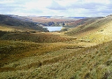
. The trail then ascends the gently rising side valley of Maize Beck to reach High Cup Nick, one of the most photgraphed places on the Pennine Way. From High Cup the trail descends to the village of Dufton
Dufton
Dufton is a village and civil parish in Cumbria, England. It lies in the Eden Valley and below Great Dun Fell. It is mostly around 180m above sea level. At the 2001 census the parish had a population of 169....
.
From Dufton the Pennine Way climbs back up the fells, passing in turn the summits of Knock Fell, Great Dun Fell
Great Dun Fell
Great Dun Fell is the second-highest hill in the Pennine range, United Kingdom, lying two miles south along the watershed from Cross Fell, its higher neighbour...
, Little Dun Fell and finally Cross Fell
Cross Fell
Cross Fell is the highest point in the Pennine Hills of northern England and the highest point in England outside of the Lake District.The summit, at , is a stony plateau, part of a long ridge running North West to South East, which also incorporates Little Dun Fell at and Great Dun Fell at...
, at 893 metres (2,929.8 ft) the highest point on the entire path. A long descent follows to the valley of the South Tyne at Garrigill
Garrigill
Garrigill, Cumbria is a small village in the North Pennine region of the UK situated on the banks and close to the source of the River South Tyne...
. The trail then keeps close to the river to enter the town of Alston
Alston, Cumbria
Alston is a small town in Cumbria, England on the River South Tyne. It is one of the highest elevation towns in the country, at about 1,000 feet above sea level.-Geography:...
.
The trail continues down the valley of the South Tyne to Slaggyford
Slaggyford
Slaggyford is a village in Northumberland, England on the A689 road about north of Alston, Cumbria.- Governance : is in the parliamentary constituency of Hexham.- Transport :Railways...
and Knarsdale
Knarsdale
Knarsdale, historically Knaresdale, is a village in Northumberland, England about north of Alston. The village takes its name from the Knarr Burn: Knarr means 'rugged rock'.- History :...
. Above the village of Lambley
Lambley, Northumberland
Lambley, formerly Harper Town,is a village in Northumberland, England about southwest of Haltwhistle. The place name Lambley refers to the "pasture of lambs"....
the trail leaves the valley to cross more moorland to the A69
A69 road
The A69 is a major road in northern England, running east-west across the Pennines, through the counties of Tyne and Wear, Northumberland and Cumbria. Originally the road started in Blaydon, but since the creation of the A1 Western Bypass around Newcastle upon Tyne, it now starts at Denton Burn a...
near the village of Greenhead
Greenhead, Northumberland
Greenhead is a village in Northumberland, England. The village is on the Military Road , about from Chollerford, from Haltwhistle and from Brampton, Cumbria along the A69 road. The A69 road bypasses the village, but until the 1980s all vehicular traffic passed through the village. The village...
.
Northumberland National Park and the Scottish border
Outside Greenhead the Pennine Way passes Thirlwall CastleThirlwall Castle
Thirlwall Castle is a 12th-century castle in Northumberland, England, on the bank of the River Tipalt close to the village of Greenhead and approximately west of Hexham. It was built in the 12th century, and later strengthened using stones from nearby Hadrian's Wall, but began to fall into...
on Hadrian's Wall
Hadrian's Wall
Hadrian's Wall was a defensive fortification in Roman Britain. Begun in AD 122, during the rule of emperor Hadrian, it was the first of two fortifications built across Great Britain, the second being the Antonine Wall, lesser known of the two because its physical remains are less evident today.The...
. For the next 11 mi (17.7 km) the route coincides with the Hadrian's Wall Path
Hadrian's Wall Path
The Hadrian’s Wall Path is a long distance footpath in the north of England, which became the 15th National Trail in 2003. It runs for , from Wallsend on the east coast of Great Britain to Bowness-on-Solway on the west coast. The path runs through urban areas, and over moors...
, following the wall closely past Once Brewed
Once Brewed
Once Brewed, also known as Twice Brewed or Once Brewed/Twice Brewed is a village in Northumberland, England. It lies on the Military Road B6318.-Name:...
to Rapishaw Gap, a mile west of the Housesteads Roman Fort
Housesteads Roman Fort
Vercovicium, now known as Housesteads Roman Fort, was an auxiliary fort on Hadrian's Wall, in the Roman province of Britannia. Its ruins are located at Housesteads in the civil parish of Bardon Mill in Northumberland, England, somewhat to the south of Broomlee Lough.-History:In the 2nd century AD,...
.
From the wall the trail heads north through Wark Forest
Wark Forest
Wark Forest is the name of the southern part of Kielder Forest in Northumberland England. Wark Forest is found within the south-west tip of Northumberland National Park....
. Past the forest it follows field paths to Shitlington Crags
Shitlington Crags
Shitlington Crags is a crag in Northumberland, England. It is located near Shitlington Hall, south of Bellingham. The crag is at an average altitude of 170 metres....
and descends to the large village of Bellingham
Bellingham, Northumberland
Bellingham is a village in Northumberland, to the north-west of Newcastle upon Tyne and is situated on the Hareshaw burn at its confluence with the River North Tyne. Hareshaw Linn is a waterfall on the Hareshaw Burn near Bellingham. It is pronounced Bell-ing-jumFamous as a stopping point on the...
. More remote country follows, across Padon Hill and the edge of Redesdale Forest. The trail eventually reaches Redesdale
Redesdale
Redesdale is a valley iin the western part of the county of Northumberland, in northeast England. This area contains the valley of the River Rede, a tributary of the North Tyne River. Redesdale includes the settlements of Elsdon, Otterburn, Rochester, Byrness and Carter Bar.Historically this...
at Blakehopeburnhaugh and Cottonshopeburnfoot
Cottonshopeburnfoot
Cottonshopeburnfoot is a hamlet in Redesdale in Northumberland, England. It lies on the A68 road, 2 miles south east of the village of Byrness...
, two neighbouring hamlets which compete for the longest name in England. The route then follows the River Rede
River Rede
The Rede is a river in Northumberland, England. The river rises on Carter Fell on the Anglo-Scottish border feeding Catcleugh Reservoir and joins the River North Tyne below the village of Redesmouth-See also:*Carter Bar*List of places in Northumberland...
upstream to the village of Byrness
Byrness
Located in Northumberland, Byrness the last village in England before the A68 climbs the Cheviot Hills to cross Carter Bar into Scotland. It is situated approximately to the north-west of Newcastle on the A68. Byrness's village church features a stained-glass window commemorating the workers who...
.
The last stage of the Pennine Way, across the Cheviot Hills
Cheviot Hills
The Cheviot Hills is a range of rolling hills straddling the England–Scotland border between Northumberland and the Scottish Borders.There is a broad split between the northern and the southern Cheviots...
from Byrness to Kirk Yetholm
Kirk Yetholm
Kirk Yetholm is a village in the Scottish Borders region of Scotland, south east of Kelso and less than west of the border. The first mention is of its church in the 13th century. Its sister town is Town Yetholm which lies half a mile across the Bowmont Water...
, is 27 mi (43.5 km) long, with no habitation en route. It is usually tackled in one long day, although there are two refuge huts (or bothies). The trail climbs steeply from the village, then heads north to cross the Scottish border
Anglo-Scottish border
The Anglo-Scottish border is the official border and mark of entry between Scotland and England. It runs for 154 km between the River Tweed on the east coast and the Solway Firth in the west. It is Scotland's only land border...
near Ogre Hill. For the rest of the stage the path switches between England and Scotland, along a fence which marks the border itself. Back in England the trail passes the Roman fort at Chew Green
Chew Green
Chew Green is the site of the ancient Roman encampment Ad Fines in Northumberland, England, north of Rochester and west of Alwinton. The encampment was adjacent to Dere Street, a Roman road that stretched south to York , and almost on the present-day border with Scotland.Archaeological excavation...
, and briefly follows the Roman road of Dere Street
Dere Street
Dere Street or Deere Street, was a Roman road between Eboracum and Veluniate, in what is now Scotland. It still exists in the form of the route of many major roads, including the A1 and A68 just north of Corbridge.Its name corresponds with the post Roman Anglo-Saxon kingdom of Deira, through...
. The path then follows the border ridge, passing the high point of Windy Gyle
Windy Gyle
Windy Gyle is a hill in the Cheviot Hills, right on the border between England and Scotland. It lies on the border ridge, and like the other hills in the area is rounded and grass-covered. Although maps show the border passing right through the summit, the summit cairn lies a few metres north of...
. At the west top of Cairn Hill (743 metres (2,437.7 ft)), from where there is a side trip to the summit of The Cheviot
The Cheviot
The Cheviot is the highest summit in the Cheviot Hills in the far north of England, only 2 km from the Scottish border. It is the last major peak on the Pennine Way, if travelling from south to north, before the descent into Kirk Yetholm....
, the main path turns sharply northwest with the border fence, descending to a refuge hut before climbing The Schil at 601 metres (1,971.8 ft), above the College Valley
College Valley
The College Valley is one of five cuttings into the Cheviot Hills. The valley is owned by College Valley Estates which in turn is funded by a trust created by Sir James Knott MP....
. The path then descends into Scotland and enters the village of Kirk Yetholm. The path ends at the Border Hotel.
Further reading
The Pennine Way has attracted a number of writers over the years, including StephensonTom Stephenson
Tom Criddle Stephenson was a British journalist and a leading champion of walkers' rights in the countryside.In the First World War he was imprisoned as a conscientious objector....
himself, who wrote the first official guidebook. A popular guide was authored and illustrated by the writer Alfred Wainwright
Alfred Wainwright
Alfred Wainwright MBE was a British fellwalker, guidebook author and illustrator. His seven-volume Pictorial Guide to the Lakeland Fells, published between 1955 and 1966 and consisting entirely of reproductions of his manuscript, has become the standard reference work to 214 of the fells of the...
, whose offer to buy a half-pint of beer for anyone who finished the Pennine Way is estimated to have cost him up to £15,000 by his death in 1991. The National Trails Guides series covers the Pennine Way in two volumes, each containing route description and 1:25000 maps of the entire walk.
Barry Pilton
Barry Pilton
Barry Pilton is a travel writer, radio and television comedy scriptwriter and novelist. He was educated in Dulwich College and King's College London. In 1967-8 he taught English in Paris and from 1969 worked as a journalist on the Sunday Post, becoming a freelance writer in 1976...
's book gives a more lighthearted and personal account of completing the Pennine Way, with a foreword by Mike Harding
Mike Harding
Mike Harding is an English singer, songwriter, comedian, author, poet and broadcaster. He is known as 'The Rochdale Cowboy' after one of his hit records...
. Mark Wallington
Mark Wallington (writer)
Mark Wallington is an author and broadcaster, perhaps most famous for his humorous "Boogie" travelogues, both memorably serialised on BBC Radio Four. After leaving school, Wallington worked as a jobbing gardener before embarking on a career as a journalist and scriptwriter, his first credit being...
's book is another humorous personal story of the walk, accompanied by his dog. Movement artists Tamara Ashley and Simone Kenyon performed the entire length of the trail in August 2006. Their book documents the performance and invites readers to create their own interpretations of the landscapes along the way.