
Nandurbar District
Encyclopedia
Nandurbar is an administrative district in the northwest corner (Khandesh
Region) of Maharashtra
state in India
. On 1 July 1998 Dhule
was bifurcated as two separate districts now known as Dhule and Nandurbar. The district headquarters are located at Nandurbar
city. The district occupies an area of 5035 km² and has a population of 1,311,709 of which 15.45% were urban (as of 2001).
Nandurbar district is bounded to the south and south-east by Dhule district, to the west and north is the state of Gujarat, to the north and north-east is the state of Madhya Pradesh
. The northern boundary of the district is defined by the great Narmada
river.
Current site for the construction and operation of the world's largest wind farm having an output of 1000MW is just 30 km away from Nandurbar city. This project is being undertaken by Suzlon Energy
. Suzlon also has local manufacturing units at this site for making WTG tower and blades.
Ranjana Sonawane of TembhlI village and rushil in Nandurbar district became first citizen of India to get twelve (12) digit Unique Identification on 29 September 2010. The unique identification or Aadhaar is ambitious project of the central government of India to provide unique identification to its billion plus citizens.
, Nandurbar and Navapur.
There is one Lok Sabha
constituency in the district which is Nandurbar (ST)
reserved for ST. There are four Maharashtra Assembly seats namely Akkalkuwa (ST), Shahada (ST), Nandurbar (ST), Nawapur (ST).
Sakri (ST) and Shirpur (ST) assembly seats from Dhule district
are also part of Nandurbar Lok Sabha seat. Nandurbar is primarily a tribal (Adiwasi) district.
. Nandurbar, Dhule and Jalgaon
districts formed what was known as the Khandesh
district. Dhule was known as the west Khandesh whereas Jalgaon was known as the east Khandesh. So, much of history applicabe to Khandesh and Dhule, is applicable to Nandurbar.
Nandurbar is also known as Nandanagri as the king Named Nandaraja was the ruler of this territory.
The ancient name of this region was Rasika. It is bounded on the east by Berar
(ancient Vidarbha
), on the north by the Nemad district (ancient Anupa
) and on the south by the Aurangabad (ancient Mulaka) and Bhir
(ancient Asmaka) districts. Later the country came to be called as Seunadesa after king, Seunchandra of the Early Yadava dynasty, who ruled over it. Subsequently its name was changed to Khandesh to suit the title Khan given to the Faruqi
kings by Ahmad I of Gujarat.
During Aryan's
penetration of the Deccan, Agastya
was the first Aryan who crossed Vindhya and resided on the bank of river Godavari. This territory became part of the Mauryan Empire during Chandragupta's
southern conquest of India. Pusyamitra, the founder of Sunga dynasty overthrew Maurya dynasty and thus ruled this region. Later on the Satavahana
s ruled over this region.
About 250, the Satavahans were supplanted by the Abhiras
in Western Maharashtra (Regan Isvarsena). The names of feudatories of Abhiras who ruled in Khandesh have come to light from copperplates discovered at Kalachala (Gujarat) and Cave X5II at Ajanta
. After the downfall of the Satavahans the Vakatakas rose to power in Vidarbha. The Vakatakas were overthrown by the Rashtrakuta
family. This region was then ruled by the Chalukyas of Badami and subsequently by the Yadavas.
In 1296, Ala-ud-din Khilji invaded Ramachandra Yadava who had to pay a heavy ransom for the defeat. Ramachandra's successor Singhana III challenged the supremacy of Khilji, who sent Malik Kafur
to recapture Devagiri in 1310. Singhana III was killed in the ensuing battle and Khilji's army occupied Devagiri. In 1318 the last Rajah of Devagiri Harpal was flayed alive thus comprehensively ending the Yadava rule of Devagiri. In 1345, Devagiri was passed into the hands of Hasan Gangu
, the founder of Bahamani dynasty.
However, Khandesh formed the southern boundary of the Tughluq empire
. In 1370, Firuz Shah Tughlaq assigned the district of Thalner
and Karavanda to Malik Raja Faruqi, the founder of Faruqi dynasty
. His family claimed descent from the Caliph Umar-al-Faruq
. He established himself at Thalner. The Governor of Gujarat honored Malik Raja with the title Sipahsalar of Khandesh. From the title Khan the region came to be known as Khandesh: the country of the Khan.
By 1382, he became a completely independent ruler of Khandesh. At the time of his accession, Khandesh was a backward region populated by a few thousand Bhils and Kolis. The sole prosperous area in Khandesh was Asirgarh
, populated by the rich cowherds, Ahirs
. One of the first acts of Malik Raja was taking steps to develop the agriculture in his kingdom.
During his rule he was able to increase his area of control to such an extent that even the Gond Raja of Mandla was forced to pay tribute to him. Soon after his accession as an independent ruler, he attacked Gujarat and annexed Sultanpur and Nandurbar. Almost immediately, the governor of Gujarat Zafar Khan (Muzaffar Shah) retaliated and laid siege to Thalner. Malik Raja had to return back all the territories annexed by him. He died on 19 April (April 28, according to Ferishta), 1399 and was buried in Thalner
Nasir Khan or Malik Nasir (also known as Garib Khan) was the elder son of Malik Raja, who succeeded him in 1399. He commenced his rule from Laling
, as Thalner was under the control of his younger brother Malik Iftikar Hasan. Soon after his accession in 1400, he captured the fort of Asirgarh and killed its Ahir ruler, Asa Ahir. It became his capital till he shifted to Burhanpur
, the new city founded by him. In 1417, with the help of Malwa sultan Hoshang Shah, he captured the fort of Thalner and imprisoned his brother Malik Iftikar (who was later granted asylum in Gujarat). Next, the combined forces of Khandesh and Malwa attacked Gujarat and occupied the Sultanpur fort. But soon, Gujarat sultan Ahmad Shah’s
general Malik Turk repulsed the attack and Thalner was besieged. After swearing fealty to the Gujarat sultan, the siege was ended and Ahmad Shah honoured Malik Nasir with the title of Khan
.
In 1429, Nasir Khan married off his daughter to the Bahamani prince Ala-ud-Din (Ala-ud-Din Ahmad Shah II), son of Ahmad Shah I. In the same year, Raja Kanha of Jhalawar
fled from Gujarat and took refuge in Asirgarh. Later on his advice, Raja Kanha went to Bidar
to ask help from the Bahamani sultan Ahmad Shah I. After initial advances in Nandurbar by the Raja along with the legions of Khandesh and Bahamani army, the Gujarat army defeated the combined forces.
In 1435, Nasir Khan supported by the Raja of Gondwana
and some discontented Bahamani officials attacked and captured Berar. The Bahmani governor fled to Narnala
. In retaliation, the Bahamani sultan Ala-ud-Din Ahmad Shah II’s army led by his general Malik-ut-Tujjar, first defeated him in Rohankhedaghat, then followed him to Burhanpur, ransacked the city and finally crushed his army in Laling. Nasir Khan died within a few days after this humiliating defeat on 18 September (September 19, according to Ferishta), 1437. He was also buried in Thalner.
Thus, from the period 1382 to 1601 Khandesh was successfully ruled by the Faruqi dynasty. The last ruler of the Faruqi dynasty was Bahadur Shah. On 10 December 1600 Bahadur Shah surrendered to Akbar but the fort was still held by his general Yakut Khan. Asirgarh fell to the Mughals only on 17 January 1601. Khandesh was annexed to the Mughal empire. Prince Daniyal was appointed viceroy of the Subah
. Bahadur Shah was taken prisoner and he died later in Agra
in 1624. Khandesh was fancifully named by Akbar as Dandes after his son Daniyal.
After the Mughal Empire's decline, the Marathas took control of Khandesh and subsequently on 3 June 1818 the Maratha Peshwa
surrendered Khandesh to the British rule.
Nandurbar had its own share in the Indian struggle for independence. It was here that during the Quit India Movement
of 1942 Shirish Kumar, a mere boy of 15 years, lost his life by a gun shot. A small memorial has been erected in memory of Shirish Kumar in the square where he shed his blood.
, a Kandeshi tongue with approximately 780 000 speakers, similar to Marathi
and Bhili
.; and Bareli Pauri, a Bhil
language with approximately 175 000 speakers, written in the Devanagari script.
Others are: Marathi
, Hindi
, Bhili, Gujar/Gujrathi and Kokani.
named Nandurbar one of the country's 250 most backward districts
(out of a total of 640
). It is one of the twelve districts in Maharashtra currently receiving funds from the Backward Regions Grant Fund Programme (BRGF).

of Nandurbar District is generally Hot and Dry. As the rest of India Nandurbar District has three distinct seasons; Summer, Monsoon
/Rainy and the Winter season.
Summer is from March to mid of June. Summers are usually hot and dry. During the month of May the summer is at its peak. Temperatures can be as high as 40° Celsius during the peak of Summer. The Monsoon sets in during the mid or end of June. During this season the weather is usually humid and hot. The northern and western regions receive more rainfall than the rest of the region. The average rainfall is 767 mm through the district. Winter is from the month of November to February. Winters are mildly cold but dry.
Nandurbar district has a population
of 1,646,177, roughly equal to the nation of Guinea-Bissau
or the US state of Idaho
. This gives it a ranking of 304th in India (out of a total of 640
).
The district has a population density of 276 PD/sqkm . Its population growth rate
over the decade 2001–2011 was 25.5 %. Nandurbar has a sex ratio
of 972 females
for every 1000 males, and a literacy rate
of 63.04 %.
Khandesh
Khandesh is a region of central India, which forms the northwestern portion of Maharashtra state.Khandesh was the terminal territorial part under the rule of Mughals. The Start of Deccan region demarcated by the boundary of Khandesh....
Region) of Maharashtra
Maharashtra
Maharashtra is a state located in India. It is the second most populous after Uttar Pradesh and third largest state by area in India...
state in India
India
India , officially the Republic of India , is a country in South Asia. It is the seventh-largest country by geographical area, the second-most populous country with over 1.2 billion people, and the most populous democracy in the world...
. On 1 July 1998 Dhule
Dhule district
Dhule district is a district of Maharashtra state in central India. The city of Dhule is the administrative headquarters of the district.The Dhule district previously comprised tracts of land predominantly inhabited by tribal population...
was bifurcated as two separate districts now known as Dhule and Nandurbar. The district headquarters are located at Nandurbar
Nandurbar
Nandurbar is a city and a municipal council in Nandurbar district in the Indian state of Maharashtra. It came into limelight during February 2006 Bird Flu crisis which struck many of its poultry farms. Thousand of chickens from the farms had to be killed and buried in nearby grounds to stop the...
city. The district occupies an area of 5035 km² and has a population of 1,311,709 of which 15.45% were urban (as of 2001).
Nandurbar district is bounded to the south and south-east by Dhule district, to the west and north is the state of Gujarat, to the north and north-east is the state of Madhya Pradesh
Madhya Pradesh
Madhya Pradesh , often called the Heart of India, is a state in central India. Its capital is Bhopal and Indore is the largest city....
. The northern boundary of the district is defined by the great Narmada
Narmada River
The Narmada , also called Rewa is a river in central India and the fifth largest river in the Indian subcontinent. It is the third largest river that completely flows within India after Ganges and Godavari...
river.
Current site for the construction and operation of the world's largest wind farm having an output of 1000MW is just 30 km away from Nandurbar city. This project is being undertaken by Suzlon Energy
Suzlon Energy
Suzlon Energy is a global wind power company based in India. In terms of market share, the company is the fifth largest wind turbine manufacturer in Asia...
. Suzlon also has local manufacturing units at this site for making WTG tower and blades.
Ranjana Sonawane of TembhlI village and rushil in Nandurbar district became first citizen of India to get twelve (12) digit Unique Identification on 29 September 2010. The unique identification or Aadhaar is ambitious project of the central government of India to provide unique identification to its billion plus citizens.
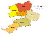
Divisions
The district comprises 6 talukas. These talukas are Akkalkuwa, Akrani Mahal (also called Dhadgaon), Taloda, ShahadaShahada, Maharashtra
Shahādā , one of the 7 Tehsils in the Nandurbar district, is a town situated in the northwest corner of Maharashtra state in India. Shahādā town was in Dhule District until 1 July 1998...
, Nandurbar and Navapur.
There is one Lok Sabha
Lok Sabha
The Lok Sabha or House of the People is the lower house of the Parliament of India. Members of the Lok Sabha are elected by direct election under universal adult suffrage. As of 2009, there have been fifteen Lok Sabhas elected by the people of India...
constituency in the district which is Nandurbar (ST)
Nandurbar (Lok Sabha constituency)
Nandurbar Lok Sabha constituency is one of the 48 Lok Sabha constituencies of Maharashtra state in western India. Presently, four of its Vidhan Sabha segments are located in Nandurbar district, while the other two segments are located in Dhule district.-Assembly segments:Before the delimitation,...
reserved for ST. There are four Maharashtra Assembly seats namely Akkalkuwa (ST), Shahada (ST), Nandurbar (ST), Nawapur (ST).
Sakri (ST) and Shirpur (ST) assembly seats from Dhule district
Dhule district
Dhule district is a district of Maharashtra state in central India. The city of Dhule is the administrative headquarters of the district.The Dhule district previously comprised tracts of land predominantly inhabited by tribal population...
are also part of Nandurbar Lok Sabha seat. Nandurbar is primarily a tribal (Adiwasi) district.
History
Before 1 July 1998 Nandurbar was part of the larger Dhule districtDhule district
Dhule district is a district of Maharashtra state in central India. The city of Dhule is the administrative headquarters of the district.The Dhule district previously comprised tracts of land predominantly inhabited by tribal population...
. Nandurbar, Dhule and Jalgaon
Jalgaon District
Jalgaon district is a district of Maharashtra. It was formerly known as East Khandesh district. It has an area of 11,765 km², and a population of 3,682,690 of which 71.4% were rural....
districts formed what was known as the Khandesh
Khandesh
Khandesh is a region of central India, which forms the northwestern portion of Maharashtra state.Khandesh was the terminal territorial part under the rule of Mughals. The Start of Deccan region demarcated by the boundary of Khandesh....
district. Dhule was known as the west Khandesh whereas Jalgaon was known as the east Khandesh. So, much of history applicabe to Khandesh and Dhule, is applicable to Nandurbar.
Nandurbar is also known as Nandanagri as the king Named Nandaraja was the ruler of this territory.
The ancient name of this region was Rasika. It is bounded on the east by Berar
Berar Sultanate
-Berar in Ancient History:Subah Berar and Gondwana the Vidarbha region known as Gulshan-e-Berar in medieval period since Khilji dynasty to mughal period according Aine-Akbari and Alimgeer Namah report the berar is hole Fourteen sarkar...
(ancient Vidarbha
Vidarbha
Vidarbha is the eastern region of Maharashtra state made up of Nagpur Division and Amravati Division. Its former name is Berar . It occupies 31.6% of total area and holds 21.3% of total population of Maharashtra...
), on the north by the Nemad district (ancient Anupa
Anupa
Anupa, is an ancient Indian region roughly corresponds to the areas around ancient Mahsihmati city in the present-day Khargone district of Madhya Pradesh. The Vayu Purana mentions a janapada of Anupa, located on the Vindhyaprishtha...
) and on the south by the Aurangabad (ancient Mulaka) and Bhir
Beed
Beed is a town and administrative headquarters of the district of the same name located in central Maharashtra state of India. According to 2001 census, it is the largest urban area in the district with a population of 138,091. Calculated population of 2010 is 161,604. It ranks 295th in population...
(ancient Asmaka) districts. Later the country came to be called as Seunadesa after king, Seunchandra of the Early Yadava dynasty, who ruled over it. Subsequently its name was changed to Khandesh to suit the title Khan given to the Faruqi
Faruqi dynasty
The Faruqi dynasty was the ruling dynasty of the Khandesh sultanate from its inception in 1382 till its annexation by the Mughal emperor Akbar in 1601. The founder of the dynasty, Malik Ahmad participated in a rebellion against the Bahmani ruler Muhmmad Shah I in his early years...
kings by Ahmad I of Gujarat.
During Aryan's
Aryan
Aryan is an English language loanword derived from Sanskrit ārya and denoting variously*In scholarly usage:**Indo-Iranian languages *in dated usage:**the Indo-European languages more generally and their speakers...
penetration of the Deccan, Agastya
Agastya
Agastya was a Tamil/Vedic Siddhar or sage. Agastya and his clan are also generally credited with uncovering many mantras of the Rig Veda, the earliest and most revered Hindu scripture, in the sense of first having the mantras revealed in his mind by the Supreme Brahman...
was the first Aryan who crossed Vindhya and resided on the bank of river Godavari. This territory became part of the Mauryan Empire during Chandragupta's
Chandragupta Maurya
Chandragupta Maurya , was the founder of the Maurya Empire. Chandragupta succeeded in conquering most of the Indian subcontinent. Chandragupta is considered the first unifier of India and its first genuine emperor...
southern conquest of India. Pusyamitra, the founder of Sunga dynasty overthrew Maurya dynasty and thus ruled this region. Later on the Satavahana
Satavahana
The Sātavāhana Empire or Andhra Empire, was a royal Indian dynasty based from Dharanikota and Amaravati in Andhra Pradesh as well as Junnar and Prathisthan in Maharashtra. The territory of the empire covered much of India from 230 BCE onward...
s ruled over this region.
About 250, the Satavahans were supplanted by the Abhiras
Ahirs
Ahir is an Indian caste. The term can be used synonymously with Yadav, as the latter term refers to Ahirs who have identified as Yadavs. The major divisions of Ahirs are: Yaduvanshi, Nandvanshi, and Gwalvanshi.-Etymology:...
in Western Maharashtra (Regan Isvarsena). The names of feudatories of Abhiras who ruled in Khandesh have come to light from copperplates discovered at Kalachala (Gujarat) and Cave X5II at Ajanta
Ajanta
The Ajanta Caves in Aurangabad district of Maharashtra, India are 29 rock-cut cave monuments which date from the 2nd century BCE. The caves include paintings and sculptures considered to be masterpieces of both Buddhist religious art as well as frescos which are reminiscent of the Sigiriya...
. After the downfall of the Satavahans the Vakatakas rose to power in Vidarbha. The Vakatakas were overthrown by the Rashtrakuta
Rashtrakuta
The Rashtrakuta Empire was a royal dynasty ruling large parts of the Indian Subcontinent between the sixth and the 10th centuries. During this period they ruled as several closely related, but individual clans. Rastrakutas in inscriptions represented as descendants of Satyaki, a Yadava well known...
family. This region was then ruled by the Chalukyas of Badami and subsequently by the Yadavas.
In 1296, Ala-ud-din Khilji invaded Ramachandra Yadava who had to pay a heavy ransom for the defeat. Ramachandra's successor Singhana III challenged the supremacy of Khilji, who sent Malik Kafur
Malik Kafur
Malik Kafur, General , or Chand Ram as his name was originally, was a slave who became a head general in the army of Alauddin Khilji, ruler of the Delhi sultanate from 1296 to 1316 AD. He was originally seized by Alauddin's army after the army conquered the city of Khambhat...
to recapture Devagiri in 1310. Singhana III was killed in the ensuing battle and Khilji's army occupied Devagiri. In 1318 the last Rajah of Devagiri Harpal was flayed alive thus comprehensively ending the Yadava rule of Devagiri. In 1345, Devagiri was passed into the hands of Hasan Gangu
Hasan Gangu
Abu'l Muzaffar Ala-ud-Din Bahman Shah , whose original name was Hasan Gangu or Hansan Kanku and also bore the title of Zafar Khan was the founder of the Bahmani sultanate.-Ancestry and early life:...
, the founder of Bahamani dynasty.
However, Khandesh formed the southern boundary of the Tughluq empire
Tughlaq dynasty
The Tughlaq dynasty of north India started in 1321 in Delhi when Ghazi Malik assumed the throne under the title of Ghiyath al-Din Tughluq. The Tughluqs were a Muslim family of Turkic origin...
. In 1370, Firuz Shah Tughlaq assigned the district of Thalner
Thalner
Thalner , the first capital of the Faruqi kings, stands on the Tapi river, in Shirpur tehsil about 46.67 km. north-east of Dhule in the Maharashtra state of India. It was fortified by a strong fort which played a very significant role in the history of Khandesh. Situated on the banks of the...
and Karavanda to Malik Raja Faruqi, the founder of Faruqi dynasty
Faruqi dynasty
The Faruqi dynasty was the ruling dynasty of the Khandesh sultanate from its inception in 1382 till its annexation by the Mughal emperor Akbar in 1601. The founder of the dynasty, Malik Ahmad participated in a rebellion against the Bahmani ruler Muhmmad Shah I in his early years...
. His family claimed descent from the Caliph Umar-al-Faruq
Umar
`Umar ibn al-Khattāb c. 2 November , was a leading companion and adviser to the Islamic prophet Muhammad who later became the second Muslim Caliph after Muhammad's death....
. He established himself at Thalner. The Governor of Gujarat honored Malik Raja with the title Sipahsalar of Khandesh. From the title Khan the region came to be known as Khandesh: the country of the Khan.
By 1382, he became a completely independent ruler of Khandesh. At the time of his accession, Khandesh was a backward region populated by a few thousand Bhils and Kolis. The sole prosperous area in Khandesh was Asirgarh
Asirgarh
Asirgarh Qila is an Indian fortress situated in the Satpura Range, about 20 km north of the town of Burhanpur, in Burhanpur District of Madhya Pradesh state. The fortress commands a pass through the Satpuras connecting the valleys of the Narmada and Tapti rivers, one of the most important...
, populated by the rich cowherds, Ahirs
Ahirs
Ahir is an Indian caste. The term can be used synonymously with Yadav, as the latter term refers to Ahirs who have identified as Yadavs. The major divisions of Ahirs are: Yaduvanshi, Nandvanshi, and Gwalvanshi.-Etymology:...
. One of the first acts of Malik Raja was taking steps to develop the agriculture in his kingdom.
During his rule he was able to increase his area of control to such an extent that even the Gond Raja of Mandla was forced to pay tribute to him. Soon after his accession as an independent ruler, he attacked Gujarat and annexed Sultanpur and Nandurbar. Almost immediately, the governor of Gujarat Zafar Khan (Muzaffar Shah) retaliated and laid siege to Thalner. Malik Raja had to return back all the territories annexed by him. He died on 19 April (April 28, according to Ferishta), 1399 and was buried in Thalner
Nasir Khan or Malik Nasir (also known as Garib Khan) was the elder son of Malik Raja, who succeeded him in 1399. He commenced his rule from Laling
Laling fort
Laling Qila is a small fort situated in the present day Dhule district of Maharashtra state in India. The fort is situated on top of Laling hill about south of Dhule city...
, as Thalner was under the control of his younger brother Malik Iftikar Hasan. Soon after his accession in 1400, he captured the fort of Asirgarh and killed its Ahir ruler, Asa Ahir. It became his capital till he shifted to Burhanpur
Burhanpur
Burhanpur is an important city in Madhya Pradesh state, India. It is the administrative seat of Burhanpur District. It is situated on the north bank of the Tapti River, southwest of Bhopal and northeast of Mumbai...
, the new city founded by him. In 1417, with the help of Malwa sultan Hoshang Shah, he captured the fort of Thalner and imprisoned his brother Malik Iftikar (who was later granted asylum in Gujarat). Next, the combined forces of Khandesh and Malwa attacked Gujarat and occupied the Sultanpur fort. But soon, Gujarat sultan Ahmad Shah’s
Ahmed Shah of Gujarat
Ahmed Shah of Gujarat was a sultan of Gujarat's ruling Muzaffarid dynasty from 1411 until his death in 1442. Today, he is famously known as Ahmed Shah Badshah of Ahmedabad....
general Malik Turk repulsed the attack and Thalner was besieged. After swearing fealty to the Gujarat sultan, the siege was ended and Ahmad Shah honoured Malik Nasir with the title of Khan
Khan (title)
Khan is an originally Altaic and subsequently Central Asian title for a sovereign or military ruler, widely used by medieval nomadic Turko-Mongol tribes living to the north of China. 'Khan' is also seen as a title in the Xianbei confederation for their chief between 283 and 289...
.
In 1429, Nasir Khan married off his daughter to the Bahamani prince Ala-ud-Din (Ala-ud-Din Ahmad Shah II), son of Ahmad Shah I. In the same year, Raja Kanha of Jhalawar
Jhalawar
Jhalawar is a city in southeastern Rajasthan. It was the capital of the former princely state of Jhalawar, and is the administrative headquarters of Jhalawar District. Jhalawar was once known as Brijnagar .-Jhalawar town:...
fled from Gujarat and took refuge in Asirgarh. Later on his advice, Raja Kanha went to Bidar
Bidar
Bidar is a city in the Indian state of Karnataka. Located on the Deccan Plateau in the north-eastern part of Karnataka. It is the headquarters of the Bidar District....
to ask help from the Bahamani sultan Ahmad Shah I. After initial advances in Nandurbar by the Raja along with the legions of Khandesh and Bahamani army, the Gujarat army defeated the combined forces.
In 1435, Nasir Khan supported by the Raja of Gondwana
Gondwana (India)
Gondwana is a region of India. Named after the Gondi people who live there , the name of the ancient continent of Gondwanaland was derived from Gondwana, because some of the earliest rock formations of this continent were first investigated in part of the region, in modern Orissa.As Gonds are...
and some discontented Bahamani officials attacked and captured Berar. The Bahmani governor fled to Narnala
Narnala
Narnala also known as "Shahanur Fort" is an Indian hill fortress in Maharashtra, India. Narnala was one of the thirteen sarkar of Berar Subah...
. In retaliation, the Bahamani sultan Ala-ud-Din Ahmad Shah II’s army led by his general Malik-ut-Tujjar, first defeated him in Rohankhedaghat, then followed him to Burhanpur, ransacked the city and finally crushed his army in Laling. Nasir Khan died within a few days after this humiliating defeat on 18 September (September 19, according to Ferishta), 1437. He was also buried in Thalner.
Thus, from the period 1382 to 1601 Khandesh was successfully ruled by the Faruqi dynasty. The last ruler of the Faruqi dynasty was Bahadur Shah. On 10 December 1600 Bahadur Shah surrendered to Akbar but the fort was still held by his general Yakut Khan. Asirgarh fell to the Mughals only on 17 January 1601. Khandesh was annexed to the Mughal empire. Prince Daniyal was appointed viceroy of the Subah
Subah
A Subah was a province of the Mughal Empire in South Asia. The governor of a subah was known as a subahdar, which later became subedar to refer to an officer in the Indian Army...
. Bahadur Shah was taken prisoner and he died later in Agra
Agra
Agra a.k.a. Akbarabad is a city on the banks of the river Yamuna in the northern state of Uttar Pradesh, India, west of state capital, Lucknow and south from national capital New Delhi. With a population of 1,686,976 , it is one of the most populous cities in Uttar Pradesh and the 19th most...
in 1624. Khandesh was fancifully named by Akbar as Dandes after his son Daniyal.
After the Mughal Empire's decline, the Marathas took control of Khandesh and subsequently on 3 June 1818 the Maratha Peshwa
Peshwa
A Peshwa is the titular equivalent of a modern Prime Minister. Emporer Shivaji created the Peshwa designation in order to more effectively delegate administrative duties during the growth of the Maratha Empire. Prior to 1749, Peshwas held office for 8-9 years and controlled the Maratha army...
surrendered Khandesh to the British rule.
Nandurbar had its own share in the Indian struggle for independence. It was here that during the Quit India Movement
Quit India Movement
The Quit India Movement , or the August Movement was a civil disobedience movement launched in India in August 1942 in response to Mohandas Gandhi's call for immediate independence. Gandhi hoped to bring the British government to the negotiating table...
of 1942 Shirish Kumar, a mere boy of 15 years, lost his life by a gun shot. A small memorial has been erected in memory of Shirish Kumar in the square where he shed his blood.
Demographics
India census, Nandurbar District had a population of 1,309,135, being 50.62% male and 49.38% female. Nandurbar District has an average literacy rate of 46.63%: male literacy is 55.11%, and female literacy is 37.93%.Languages
Languages spoken include AhiraniAhirani language
The Khandeshi languages form a small subgroup within the Indo-Aryan languages, wedged between the territory of Bhili and that of Marathi.It consists of Khandeshi proper , Dhanki and Ahirani which comes from Ahir caste...
, a Kandeshi tongue with approximately 780 000 speakers, similar to Marathi
Marathi language
Marathi is an Indo-Aryan language spoken by the Marathi people of western and central India. It is the official language of the state of Maharashtra. There are over 68 million fluent speakers worldwide. Marathi has the fourth largest number of native speakers in India and is the fifteenth most...
and Bhili
Bhili language
Bhili is a Western Indo-Aryan language spoken in west-central India, in the region east of Ahmedabad. Other names for the language include Bhagoria and Bhilboli; varieties are Wagdi and Garasia. Bhili is a member of the Bhil language family, which is related to Gujarati and the Rajasthani language...
.; and Bareli Pauri, a Bhil
Bhil languages
The Bhil languages are a group of Western Indo-Aryan languages spoken by some 6 million Bhils in western, central, and by small numbers, even in far eastern, India...
language with approximately 175 000 speakers, written in the Devanagari script.
Others are: Marathi
Marathi language
Marathi is an Indo-Aryan language spoken by the Marathi people of western and central India. It is the official language of the state of Maharashtra. There are over 68 million fluent speakers worldwide. Marathi has the fourth largest number of native speakers in India and is the fifteenth most...
, Hindi
Hindi
Standard Hindi, or more precisely Modern Standard Hindi, also known as Manak Hindi , High Hindi, Nagari Hindi, and Literary Hindi, is a standardized and sanskritized register of the Hindustani language derived from the Khariboli dialect of Delhi...
, Bhili, Gujar/Gujrathi and Kokani.
Transport and Communication
- Total railway Lines length :90 km
- No of villages connected by road
- 12 Months :671
- Temporary :262
- Total length of the roads :4338 km
- Total length of National Highway :44 km
- Total length of State Highway :611 km
- Total length of Major District Roads :948 km
- Total length of Other District Roads :672 km
- Total length of Village Roads :2063 km
Education
- Nandurbar District has 1354 primary schools with 4497 teachers teaching 1,59,502 students that comes to 36 students per teacher.
- Around 257 Secondary schools with 2765 teachers teaching 1,31,554 students and no of students per teacher come to 48.
- Total Colleges for Higher studies including Medical and Engineering is 30 and more than 8580 students enrolls each year.
- Nandurbar District also has 6 Government ITI (Industrial Training Institutes) and 2 private ITI having 1444 students in total.
- 3 VJNT Pri.school [Mhasawad,Akrale & Nandrakhe] 2 High school,1 Jr.College
- 1 SC Residencial School Shahada
Economy
In 2006 the Ministry of Panchayati RajMinistry of Panchayati Raj
The Ministry of Panchayati Raj is a branch of the Government of India looking after the ongoing process of decentralization and local governance in the States....
named Nandurbar one of the country's 250 most backward districts
Poverty in India
Poverty is widespread in India, with the nation estimated to have a third of the world's poor. According to a 2005 World Bank estimate, 41.6% of the total Indian population falls below the international poverty line of 1.25 a day...
(out of a total of 640
Districts of India
A district is an administrative division of an Indian state or territory. Districts are further subdivided, in some cases into Sub-Divisions, and otherwise directly into tehsils or talukas.District officials include:...
). It is one of the twelve districts in Maharashtra currently receiving funds from the Backward Regions Grant Fund Programme (BRGF).
Industries
- Total Registered Factories :346
- Total Registered & running Factories :346
- Cooperative Sugar Factories :3
- Total Spinning Mills :2
- Total Cooperative Societies 1400
- Primary Agricultural Credit Societies Total :159
- Members :47448
- Cooperative Milk Societies :392
Agriculture
- Main Crops JawarSorghumSorghum is a genus of numerous species of grasses, one of which is raised for grain and many of which are used as fodder plants either cultivated or as part of pasture. The plants are cultivated in warmer climates worldwide. Species are native to tropical and subtropical regions of all continents...
, Wheat, Rice, ToorPigeon peaThe pigeon pea , also known as tropical green pea, toor dāl or arhar dāl , ತೊಗರಿ ಬೇಳೆ kadios , or Congo pea or gungo pea , pois Congo , gandul , gunga pea, or no-eye pea, [Cajanus...
, GroundnutsPeanutThe peanut, or groundnut , is a species in the legume or "bean" family , so it is not a nut. The peanut was probably first cultivated in the valleys of Peru. It is an annual herbaceous plant growing tall...
, ChillyChillyChilly may refer to:*Cold, i.e. low temperature-Entertainment:*Chilly , a disco band from the 1970s*Chilly Willy, a cartoon penguin-Food:*Chiefly india: chili pepper, the spicy fruit of plants in the genus Capsicum... - Annual Crops SugarcaneSugarcaneSugarcane refers to any of six to 37 species of tall perennial grasses of the genus Saccharum . Native to the warm temperate to tropical regions of South Asia, they have stout, jointed, fibrous stalks that are rich in sugar, and measure two to six metres tall...
, Cotton - Area Under Cultivation :2,53,413 Ha
- Crop Pattern Kharif (approx. 800 villages), RabiRabiRabi may refer to:* Rabi crop, spring harvest in India and Pakistan* Rabi cycle, in physics is the cyclic behaviour of a two-state quantum system in the presence of an oscillatory driving field...
(approx. 130 villages) - Fruits :MangoMangoThe mango is a fleshy stone fruit belonging to the genus Mangifera, consisting of numerous tropical fruiting trees in the flowering plant family Anacardiaceae. The mango is native to India from where it spread all over the world. It is also the most cultivated fruit of the tropical world. While...
, Sitaphal, Banana
Climate
The ClimateClimate
Climate encompasses the statistics of temperature, humidity, atmospheric pressure, wind, rainfall, atmospheric particle count and other meteorological elemental measurements in a given region over long periods...
of Nandurbar District is generally Hot and Dry. As the rest of India Nandurbar District has three distinct seasons; Summer, Monsoon
Monsoon
Monsoon is traditionally defined as a seasonal reversing wind accompanied by corresponding changes in precipitation, but is now used to describe seasonal changes in atmospheric circulation and precipitation associated with the asymmetric heating of land and sea...
/Rainy and the Winter season.
Summer is from March to mid of June. Summers are usually hot and dry. During the month of May the summer is at its peak. Temperatures can be as high as 40° Celsius during the peak of Summer. The Monsoon sets in during the mid or end of June. During this season the weather is usually humid and hot. The northern and western regions receive more rainfall than the rest of the region. The average rainfall is 767 mm through the district. Winter is from the month of November to February. Winters are mildly cold but dry.
| Seasons | Start | End |
|---|---|---|
| Summer | March | Mid June |
| Monsoon | mid June | October |
| Winter | November | February |
Religion
- PrakashaPrakashaPrakasha, popularly known as Dakshin Kashi, is a village situated on the bank of Tapi River in taluka Shahada in Nandurbar district, Maharashtra, India.-Demographics:...
, one of the famous religious places, also known as Dakshin Kashi, is in Shahada TehsilTehsilA Tehsil or Tahsil/Tahasil , also known as Taluk and Mandal, is an administrative division of some country/countries of South Asia....
. The temple of Prakasha is very old. - One of the famous temples of God Shree Ganesha (Heramb) is at Jaynagar, 24 km away from Shahada. Hundreds of thousands of people visit this temple on the occasion of Mangli Chathurthi.
- Shri DattaDattatreyaDattatreya or Datta is a Hindu deity encompassing the trinity of Brahma, Vishnu and Shiva, collectively known as Trimurti. The name Dattatreya can be divided into two words - "Datta" and "Atreya" referring to the sage Atri, his physical father.Various Hindu sects worship him differently...
temple is at SarangkhedaSarangkhedaSarangkheda is a village in Shahada taluka in Nandurbar district of Maharashtra state in India. Sarangkheda village is situated around 15 km South of Shahada on the bank of Tapti River.- Overview :...
. Every year a big fair is organised on the eve of Datta Jayanti which has main attraction of sale of horses. - Hingani is a small village between Shahada and ShirpurShirpurShirpur is a city and taluka in Dhule district of Nashik Division, Maharashtra. It is located on National Highway 3, which runs from Agra in Uttar Pradesh to Mumbai, Maharashtra. The Arunawati river flows through the city. Shirpur is just 50 kilometers away from the city of Dhule...
. People there conduct the "Mahavakya" & "MahakavyaMahakavyaMahākāvya , also known as sargabandha, is a genre of Indian epic poetry in classical Sanskrit literature. The genre is characterised by ornate and elaborate descriptions of scenery, love, battles and so on — in short, everything that tests a poet's skill at description...
" of the MahanubhavMahanubhavaMahanubhav- Hindu sects in maharashtra mainly in amaravati district started by Chakradhar Swami in 1267. Chakradhar Swami propagated a religious movement as well as social movement, in which all were accepted irrespective of their castes and the traditional ritualistic religion was...
panthPanthPanthan is the term used for several religious traditions in India.A panth is founded by a guru or an acharya, and is often led by scholars or senior practitioners of the tradition.Some of the major panthas in India are:...
. - Ashwashthama and Shanimandal religious places are also in this district.
- Dandapaneshwar Ganesh Mandir
- Astamba rishi yatra in Akrani Tahasil religious places is also in this district.
Demographics
According to the 2011 census2011 census of India
The 15th Indian National census was conducted in two phases, houselisting and population enumeration. Houselisting phase began on April 1, 2010 and involved collection of information about all buildings...
Nandurbar district has a population
Demographics of India
The demographics of India are inclusive of the second most populous country in the world, with over 1.21 billion people , more than a sixth of the world's population. Already containing 17.5% of the world's population, India is projected to be the world's most populous country by 2025, surpassing...
of 1,646,177, roughly equal to the nation of Guinea-Bissau
Guinea-Bissau
The Republic of Guinea-Bissau is a country in West Africa. It is bordered by Senegal to the north, and Guinea to the south and east, with the Atlantic Ocean to its west....
or the US state of Idaho
Idaho
Idaho is a state in the Rocky Mountain area of the United States. The state's largest city and capital is Boise. Residents are called "Idahoans". Idaho was admitted to the Union on July 3, 1890, as the 43rd state....
. This gives it a ranking of 304th in India (out of a total of 640
Districts of India
A district is an administrative division of an Indian state or territory. Districts are further subdivided, in some cases into Sub-Divisions, and otherwise directly into tehsils or talukas.District officials include:...
).
The district has a population density of 276 PD/sqkm . Its population growth rate
Family planning in India
Family planning in India is based on efforts largely sponsored by the Indian government. In the 1965-2009 period, contraceptive usage has more than tripled and the fertility rate has more than halved , but the national fertility rate is still high enough to cause long-term population growth...
over the decade 2001–2011 was 25.5 %. Nandurbar has a sex ratio
Sex ratio
Sex ratio is the ratio of males to females in a population. The primary sex ratio is the ratio at the time of conception, secondary sex ratio is the ratio at time of birth, and tertiary sex ratio is the ratio of mature organisms....
of 972 females
Women in India
The status of women in India has been subject to many great changes over the past few millennia. From equal status with men in ancient times through the low points of the medieval period, to the promotion of equal rights by many reformers, the history of women in India has been eventful...
for every 1000 males, and a literacy rate
Literacy in India
Literacy in India is key for socio-economic progress, and the Indian literacy rate grew to 74.04% in 2011 from 12% at the end of British rule in 1947. Although this was a greater than sixfold improvement, the level is well below the world average literacy rate of 84%, and India currently has the...
of 63.04 %.
Tourist places in Nandurbar District
- ToranmalToranmalToranmal is an Hill Station in the municipal council of the Nandurbar district in the Indian state of Maharashtra. One can reach through Shahada. It is a hill station located in the Satpura Range. Its Gorakhnath Temple is the site of a Yatra attended by thousands of devotees on Mahashivratri...
is the second coolest hill stationHill stationA hill station is a town located at a higher elevation than the nearby plain or valley. The term was used mostly in colonial Asia , but also in Africa , for towns founded by European colonial rulers as refuges from the summer heat, up where temperatures are cooler...
in Maharashtra state and is near Shahada (approx. 40 km). It is the second highest place in MaharashtraMaharashtraMaharashtra is a state located in India. It is the second most populous after Uttar Pradesh and third largest state by area in India...
. It has a natural lake called Yashwant Lake which is natural and full of flowering lotusLotus (plant)Lotus identifies various plant taxa:* Nelumbo, a genus of aquatic plants with showy flowers** Nelumbo nucifera, the Sacred or Indian lotus** Nelumbo lutea, the American or Yellow lotus...
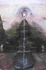
. It is a good place for sight-seeing and picnic. - UnapdevUnapdevUnapdev is in Shahada, Maharashtra tahsil located near the village Dara. It has a permanent natural hot water source.-Approach :...
(25 km from Shāhāda) is a pleasant picnic point in Shahada tehsilTehsilA Tehsil or Tahsil/Tahasil , also known as Taluk and Mandal, is an administrative division of some country/countries of South Asia....
. It has a permanent natural hot water sourceHot springA hot spring is a spring that is produced by the emergence of geothermally heated groundwater from the Earth's crust. There are geothermal hot springs in many locations all over the crust of the earth.-Definitions:...
, and it flows throughout the year from a structure in the shape of a cow's mouth. - Asthamba one of the religious place of Nandurbar district is in Akrani Tahsil. One of the popular fair of tribals from south Gujrat and north-west Maharashtra is the Asthamba fair. This fair is held during Diwali festival seasion for 10 to 15 days.Asthamba is a mythological character from Hindu epic called Mahabharat. Tribals say he is also known as Ashvasthama,a male character and son of Dronacharya.