

N1 (South Africa)
Encyclopedia
The N1 is a South Africa
n National Route, running from Cape Town
to Beit Bridge on the border
with Zimbabwe
. It is also the main road link between Johannesburg
and Cape Town, and forms the first section of the famed Cape to Cairo Road
.
Prior to 1970, the N1 used to run from Beit Bridge to Colesburg, and then follow the alignment of the present N9 to George. Ironically, the section from Cape Town to Colesburg used to be the N9.
at the northern end of Buitengracht Street outside the entrance to the Victoria & Alfred Waterfront
. The first section of the N1 is shared with
the beginning of the N2
; it is a four-lane elevated freeway that runs along a strip of land between the city centre and the Port of Cape Town
. On the eastern edge of the city centre the two roads split, and the N1 turns east as Table Bay Boulevard, passing the Ysterplaat Air Force Base
and Century City before the N7
intersects it on its own way out of the city towards Namibia
. Major improvements have been made to the Koeberg Interchange of the N1 with the M5, one of the main aterial routes linking Milnerton with the Southern Suburbs.
The N1 then heads through the suburbs of Goodwood
and Bellville
, where the R300
terminates at it, before heading towards Paarl. At Paarl, the freeway ends, and the N1 is tolled as it passes through the Huguenot Tunnel
running underneath the Du Toitskloof Mountains
; the tunnel was opened in the late 1980s to replace the old Du Toitskloof Pass
running over the mountain. After emerging from the tunnel, the N1 winds through the Molenaar River Valley (which is a short dual carriageway section) before emerging from the valley and heading towards Worcester
. From Worcester, the route heads through the Hex River Valley and then enters the Karoo
by ascending the Hex River Pass
.
Currently only the section of the N1 passing through the Huguenot Tunnel is tolled, although there are plans to toll the N1 from the junction with the R300, roughly to De Doorns. This would allow for upgrading of the N1, most especially the opening and construction of the Northern Bore of the Huguenot Tunnel so that two lanes of traffic could pass in each direction through the tunnel, and the building of grade separated junctions along the N1 through Worcester. Although the town is bypassed, there are a number of traffic lights on the N1 through Worcester.
From the top of the pass, the N1 passes Touws River
and Matjiesfontein
before passing through Laingsburg
, then heads towards Beaufort West
. The 200 km section between Laingsburg and Beaufort West is notorious for claiming many lives in fatigue-related accidents; also, the N1 begins to turn towards the north-east along this stretch of road. Just before Beaufort West, the N12
from George
meets the N1; the N12 shares the N1 route through Beaufort West and for the next 80 km before leaving it at Three Sisters. The N12 later meets the N1 again in Johannesburg
, making the N12 an alternative route to the N1, passing through Kimberly instead of Bloemfontein. Although parts of the N12 between Warrenton and Klerksdorp are in poor condition (although in process of being upgraded), the N1 from Bloemfontein onwards is tolled while the N12 is toll-free. Whereas the N12 also passes through most of the towns en route to Johannesburg, the N1 bypasses every town between Beaufort West and Johannesburg.
The N1 briefly crosses into the Northern Cape
at Three Sisters for a few kilometres before crossing back into the Western Cape
, and remains in the Western Cape until just after its intersection with the R63, where it finally leaves the Western Cape behind.
; after it passes into this province, it passes through the town of Richmond
before intersecting with the N10
at Hanover. The N1 then continues towards Colesberg
, where the N9
terminates where it meets the N1. After Colesberg, the N1 crosses the Orange River
and enters the Free State
.
crossing, the N1 makes a direct line for Bloemfontein
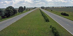
, heading in a more northerly direction. The N1 from Colesburg to Bloemfontein is highly significant because it was the first single carriageway freeway built in South Africa. The bridges with the interchanges at Edenburg and Trompsburg show the ambitious plans for this road as a dual carriage freeway.
Just before reaching Bloemfontein, the N6 from East London terminates where it meets the N1. This intersection marks the beginning of the Bloemfontein Western Bypass, which is the first freeway section on the route since Paarl. The N8 WEST from Kimberley
intersects with the N1 bypass, joining it for 3km, before heading EAST through the central parts of Bloemfontein and then to Maseru
in Lesotho
,
The N1 is signed as a Toll Road from the N6 interchange until its end at Beit Bridge. The N1 becomes a single carriageway freeway a few kilometres north of Bloemfontein after passing the R30 to Brandfort, however construction work is in progress to extend the freeway for another 20km by building a second carriageway. Once the freeway ends, the road will be a single carriageway but with two lanes in each direction until 5km before the toll plaza at Verkeerdevlei
, halfway between Bloemfontein and Winburg. Initial plans were for the N1 from Winburg to Bloemfontein to be a dual carriageway freeway. At Winburg, the N5 splits from the N1, which bypasses the north of Lesotho
before its own termination at the N3
in Harrismith
.
Many motorists from Cape Town heading for Durban travel the N1 to Winburg, and then then N5 to Harrismith as an alternative to reach Durban. This is due to the much better quality of this route compared with the N2, especially between Port Shepstone and Grahamstown.
The N1 continues north and passes through Ventersburg
before reaching Kroonstad
. Here the R34 joins the N1 from Welkom. There is a short dual carriageway freeway bypass of Kroonstad, before the N1 heads towards the Vaal River
and Gauteng
. Just before passing into Gauteng
at the Vaal River
, the N1 becomes a dual-carriageway freeway and features another toll plaza.
,_pretoria.jpg) After crossing the Vaal River
After crossing the Vaal River
, the N1 continues towards Johannesburg
, bypassing Vanderbijlpark and featuring another toll plaza at Grasmere. At the southern outskirts of Johannesburg, the N12
once again meets the N1, and shares its route for a few kilometers before splitting off to become the Southern Bypass
portion of the Johannesburg Ring Road
. From just north of the Vaal River the N1 changes from being a tar road to a concrete road, until just after the N12. The N1 then becomes the Western Bypass
portion of the same ring road, and cuts a swath through Johannesburg's western suburbs before meeting the N3
(the Eastern Bypass
portion of the Johannesburg Ring Road, later going to Durban
) and Johannesburg's own M1
freeway at the Buccleuch Interchange.
The N1 then heads towards Pretoria
along the Ben Schoeman Highway; this section carries 300,000 vehicles per day and is purported to be the busiest stretch of road in South Africa
. At Centurion
, the N1 meets the N14
and leaves the Ben Schoeman Highway (which then becomes part of the N14) to become the Pretoria Eastern Bypass
, intersecting with the R21
during this time. The N4
then joins the N1 from Witbank
and follows the N1 a short distance before splitting to the west towards Rustenburg
. From the interchange with the N4, the N1 is tolled for the remainder of its length, with various toll plazas located along it. The N1 then heads to the north and passes into Limpopo
province.
(previously Warmbaths) and Modimolle
(previously Nylstroom). At the Modimolle exit, the freeway ends; the section of freeway between the Vaal River
and Modimolle is the longest freeway in South Africa by route number at approximately 265 km (although there are two changes in the alignment of freeway in Gauteng
, at Buccleuch and Brakfontein Interchanges. South Africa's longest continuous freeway is the N3
between Durban
and Ladysmith
, which is approximately 20 km shorter. The N1 then heads past Mokopane
(previously Potgietersrus), where the N11
intersects it (leaving the N18
as the only national road
that does not intersect with the N1), before heading to Polokwane
(previously Pietersburg). The Eastern Bypass around Polokwane has recently been opened, although it is not grade separated.
After Polokwane
, the N1 heads north, crossing the Tropic of Capricorn
before passing Louis Trichardt. The N1 then winds through the Soutpansberg Mountains
(containing two short tunnels) before heading to Musina
. Plans are underway for a bypass around Musina. The route then makes a 16 km line for the Beit Bridge border crossing with Zimbabwe
on the Limpopo River
.
After crossing into Zimbabwe
, the route is no longer known as the N1. It passes through the border town of Beit Bridge on the Zimbabwean side before splitting into two routes: the A6
to Bulawayo
and the A4
to Harare
.
 In numerous places in South Africa, specifically near major cities, the N1 route was built to freeway standards. The original routes usually carry the designation of R101 and are often alternative routes to the newer, sometimes tolled, highways. An example is the R101 over Du Toitskloof Pass
where the new N1 highway bypasses the pass altogether by use of the Huguenot Tunnel
.
There are exceptions to the usual R101 alternative route designation:
South Africa
The Republic of South Africa is a country in southern Africa. Located at the southern tip of Africa, it is divided into nine provinces, with of coastline on the Atlantic and Indian oceans...
n National Route, running from Cape Town
Cape Town
Cape Town is the second-most populous city in South Africa, and the provincial capital and primate city of the Western Cape. As the seat of the National Parliament, it is also the legislative capital of the country. It forms part of the City of Cape Town metropolitan municipality...
to Beit Bridge on the border
Border
Borders define geographic boundaries of political entities or legal jurisdictions, such as governments, sovereign states, federated states and other subnational entities. Some borders—such as a state's internal administrative borders, or inter-state borders within the Schengen Area—are open and...
with Zimbabwe
Zimbabwe
Zimbabwe is a landlocked country located in the southern part of the African continent, between the Zambezi and Limpopo rivers. It is bordered by South Africa to the south, Botswana to the southwest, Zambia and a tip of Namibia to the northwest and Mozambique to the east. Zimbabwe has three...
. It is also the main road link between Johannesburg
Johannesburg
Johannesburg also known as Jozi, Jo'burg or Egoli, is the largest city in South Africa, by population. Johannesburg is the provincial capital of Gauteng, the wealthiest province in South Africa, having the largest economy of any metropolitan region in Sub-Saharan Africa...
and Cape Town, and forms the first section of the famed Cape to Cairo Road
Cape to Cairo Road
The Cape to Cairo Road or 'Pan-African Highway', sometimes called the Great North Road in sub-Saharan Africa, was an imperial dream envisioned by the British Empire that would see a road stretch the length of Africa, from Cape Town to Cairo, similar to the Pan-American Highway...
.
Prior to 1970, the N1 used to run from Beit Bridge to Colesburg, and then follow the alignment of the present N9 to George. Ironically, the section from Cape Town to Colesburg used to be the N9.
Western Cape
The N1 begins in central Cape TownCape Town
Cape Town is the second-most populous city in South Africa, and the provincial capital and primate city of the Western Cape. As the seat of the National Parliament, it is also the legislative capital of the country. It forms part of the City of Cape Town metropolitan municipality...
at the northern end of Buitengracht Street outside the entrance to the Victoria & Alfred Waterfront
Victoria & Alfred Waterfront
The Victoria & Alfred Waterfront in the historic heart of Cape Town's working harbour is South Africa's most-visited destination, having the highest rate of foreign tourists of any attraction in the country...
. The first section of the N1 is shared with
Concurrency (road)
A concurrency, overlap, or coincidence in a road network is an instance of one physical road bearing two or more different highway, motorway, or other route numbers...
the beginning of the N2
N2 (South Africa)
The N2 is a National Route in South Africa; it is the main highway along the Indian Ocean coast of the country. The N2 starts in Cape Town in the Western Cape and runs through the cities of Port Elizabeth and East London in the Eastern Cape and Durban in KwaZulu-Natal to end at Ermelo in...
; it is a four-lane elevated freeway that runs along a strip of land between the city centre and the Port of Cape Town
Port of Cape Town
The Port of Cape Town is the port of the city of Cape Town, South Africa. It is situated in Table Bay.Because of its position along one of the world's busiest trade routes it is one of the busiest ports in South Africa, handling the largest amount of fresh fruit and second only to Durban as a...
. On the eastern edge of the city centre the two roads split, and the N1 turns east as Table Bay Boulevard, passing the Ysterplaat Air Force Base
AFB Ysterplaat
Air Force Base Ysterplaat is an airbase of the South African Air Force. It is located in Cape Town, on the southwestern coast of South Africa.The name Ysterplaat is Afrikaans; it means Iron Plate in English....
and Century City before the N7
N7 (South Africa)
The N7 is a National Route in South Africa, connecting Cape Town, South Africa to Vioolsdrif, a border post to Namibia. After crossing the border, it changes designation to B1 and runs north through Windhoek and the north of Namibia....
intersects it on its own way out of the city towards Namibia
Namibia
Namibia, officially the Republic of Namibia , is a country in southern Africa whose western border is the Atlantic Ocean. It shares land borders with Angola and Zambia to the north, Botswana to the east and South Africa to the south and east. It gained independence from South Africa on 21 March...
. Major improvements have been made to the Koeberg Interchange of the N1 with the M5, one of the main aterial routes linking Milnerton with the Southern Suburbs.
The N1 then heads through the suburbs of Goodwood
Goodwood, Cape Town
Goodwood is a suburb situated between the northern and southern suburbs of Cape Town, South Africa. It is 10 kilometres from the city centre and accessible from the N1, N7 and N2 highways....
and Bellville
Bellville, Cape Town
Bellville is a former city in the Western Cape province of South Africa; it is now part of the greater Cape Town metropolitan area. It falls within the area of the City of Cape Town municipality....
, where the R300
R300 (Western Cape)
The R300 or Kuils River Freeway is a Regional Route in Cape Town, South Africa that connects Mitchells Plain with the N2, Kuils River, and the N1 at Bellville...
terminates at it, before heading towards Paarl. At Paarl, the freeway ends, and the N1 is tolled as it passes through the Huguenot Tunnel
Huguenot Tunnel
The Huguenot Tunnel is a toll tunnel near Cape Town, South Africa. It extends the N1 national road through the Du Toitskloof mountains that separate Paarl from Worcester, providing a route that is safer, faster and shorter than the old Du Toitskloof Pass travelling over the mountain.Geological...
running underneath the Du Toitskloof Mountains
Du Toits Peak
Du Toits Peak is the highest seaward facing peak in the Cape Fold Belt ranges, i.e. the highest peak in the Western Cape within direct sight of the ocean. Located between Paarl and Worcester in the south-west of South Africa, 70 km to the north-east of the provincial capital of Cape Town...
; the tunnel was opened in the late 1980s to replace the old Du Toitskloof Pass
Du Toitskloof Pass
Du Toitskloof Pass is situated in the Western Cape province of South Africa, on the Regional road R101 between Paarl and Worcester. The pass was named after Francois Du Toit, a 17th century Huguenot pioneer who settled in the foothills...
running over the mountain. After emerging from the tunnel, the N1 winds through the Molenaar River Valley (which is a short dual carriageway section) before emerging from the valley and heading towards Worcester
Worcester, Western Cape
Worcester is a town in the Western Cape, South Africa. It is located 120 km north-east of Cape Town on the N1 highway north to Johannesburg....
. From Worcester, the route heads through the Hex River Valley and then enters the Karoo
Karoo
The Karoo is a semi-desert region of South Africa. It has two main sub-regions - the Great Karoo in the north and the Little Karoo in the south. The 'High' Karoo is one of the distinct physiographic provinces of the larger South African Platform division.-Great Karoo:The Great Karoo has an area of...
by ascending the Hex River Pass
Hex River Pass
Hex River Pass, Is situated in the Western Cape, province of South Africa, on the National road N1 road between De Doorns and Touws River.-Be Aware:* Driving Skill level: Novice* Road Condition: Tarred surface, sweeping turns...
.
Currently only the section of the N1 passing through the Huguenot Tunnel is tolled, although there are plans to toll the N1 from the junction with the R300, roughly to De Doorns. This would allow for upgrading of the N1, most especially the opening and construction of the Northern Bore of the Huguenot Tunnel so that two lanes of traffic could pass in each direction through the tunnel, and the building of grade separated junctions along the N1 through Worcester. Although the town is bypassed, there are a number of traffic lights on the N1 through Worcester.
From the top of the pass, the N1 passes Touws River
Touws River (town)
Touws River is a small railway town of 6,800 people in the Western Cape province of South Africa. It is located on the river of the same name, about north-east of Cape Town.-History:...
and Matjiesfontein
Matjiesfontein
Matjiesfontein is a settlement in Central Karoo District Municipality in the Western Cape province of South Africa....
before passing through Laingsburg
Laingsburg, Western Cape
- History :Laingsburg was first established in the 1870s by Stephanus Greeff. He bought the farm Vischkuil-aan-de-Buffelsrivier . The town only started developing when the railway line to it was completed...
, then heads towards Beaufort West
Beaufort West
Beaufort West is a town in the Western Cape province in South Africa. It is the largest town in the arid Great Karoo region, and forms part of the Beaufort West Local Municipality, with 37 000 inhabitants in 2001....
. The 200 km section between Laingsburg and Beaufort West is notorious for claiming many lives in fatigue-related accidents; also, the N1 begins to turn towards the north-east along this stretch of road. Just before Beaufort West, the N12
N12 (South Africa)
The N12 is a National Route in South Africa. It is maintained by the South African National Roads Agency.- Route :The road starts in George in the Western Cape and ends in Witbank in Mpumalanga. The road runs roughly from south to north, however, once it passes Kimberley in the Northern Cape, it...
from George
George, Western Cape
George is a city with 203,253 inhabitants in South Africa's Western Cape province. The city is a popular holiday and conference centre and the administrative and commercial hub of the Garden Route.- Location :...
meets the N1; the N12 shares the N1 route through Beaufort West and for the next 80 km before leaving it at Three Sisters. The N12 later meets the N1 again in Johannesburg
Johannesburg
Johannesburg also known as Jozi, Jo'burg or Egoli, is the largest city in South Africa, by population. Johannesburg is the provincial capital of Gauteng, the wealthiest province in South Africa, having the largest economy of any metropolitan region in Sub-Saharan Africa...
, making the N12 an alternative route to the N1, passing through Kimberly instead of Bloemfontein. Although parts of the N12 between Warrenton and Klerksdorp are in poor condition (although in process of being upgraded), the N1 from Bloemfontein onwards is tolled while the N12 is toll-free. Whereas the N12 also passes through most of the towns en route to Johannesburg, the N1 bypasses every town between Beaufort West and Johannesburg.
The N1 briefly crosses into the Northern Cape
Northern Cape
The Northern Cape is the largest and most sparsely populated province of South Africa. It was created in 1994 when the Cape Province was split up. Its capital is Kimberley. It includes the Kalahari Gemsbok National Park, part of an international park shared with Botswana...
at Three Sisters for a few kilometres before crossing back into the Western Cape
Western Cape
The Western Cape is a province in the south west of South Africa. The capital is Cape Town. Prior to 1994, the region that now forms the Western Cape was part of the much larger Cape Province...
, and remains in the Western Cape until just after its intersection with the R63, where it finally leaves the Western Cape behind.
Northern Cape
The N1 has a short section in the Northern CapeNorthern Cape
The Northern Cape is the largest and most sparsely populated province of South Africa. It was created in 1994 when the Cape Province was split up. Its capital is Kimberley. It includes the Kalahari Gemsbok National Park, part of an international park shared with Botswana...
; after it passes into this province, it passes through the town of Richmond
Richmond, Northern Cape
Richmond is a town in the central Karoo region of the Northern Cape Province, South Africa. It is situated on the main N1 route.-Origin, architecture and history:The town was established in 1843 in one of the coldest parts of South Africa's inland plateau...
before intersecting with the N10
N10 (South Africa)
The N10 is a National Route in South Africa. It connects Port Elizabeth on the Eastern Cape coast with the Namibian border at Nakop, via De Aar and Upington.-Route:...
at Hanover. The N1 then continues towards Colesberg
Colesberg
Colesberg is a town with 17,354 inhabitants in the Northern Cape province of South Africa, located on the main road from Cape Town to Johannesburg....
, where the N9
N9 (South Africa)
The N9 is one of the National Roads of South Africa, connecting George in the Western Cape to the N1 at Colesberg in the Northern Cape.-Route:...
terminates where it meets the N1. After Colesberg, the N1 crosses the Orange River
Orange River
The Orange River , Gariep River, Groote River or Senqu River is the longest river in South Africa. It rises in the Drakensberg mountains in Lesotho, flowing westwards through South Africa to the Atlantic Ocean...
and enters the Free State
Free State
The Free State is a province of South Africa. Its capital is Bloemfontein, which is also South Africa's judicial capital. Its historical origins lie in the Orange Free State Boer republic and later Orange Free State Province. The current borders of the province date from 1994 when the Bantustans...
.
Free State
After the Orange RiverOrange River
The Orange River , Gariep River, Groote River or Senqu River is the longest river in South Africa. It rises in the Drakensberg mountains in Lesotho, flowing westwards through South Africa to the Atlantic Ocean...
crossing, the N1 makes a direct line for Bloemfontein
Bloemfontein
Bloemfontein is the capital city of the Free State Province of South Africa; and, as the judicial capital of the nation, one of South Africa's three national capitals – the other two being Cape Town, the legislative capital, and Pretoria, the administrative capital.Bloemfontein is popularly and...
, heading in a more northerly direction. The N1 from Colesburg to Bloemfontein is highly significant because it was the first single carriageway freeway built in South Africa. The bridges with the interchanges at Edenburg and Trompsburg show the ambitious plans for this road as a dual carriage freeway.
Just before reaching Bloemfontein, the N6 from East London terminates where it meets the N1. This intersection marks the beginning of the Bloemfontein Western Bypass, which is the first freeway section on the route since Paarl. The N8 WEST from Kimberley
Kimberley, Northern Cape
Kimberley is a city in South Africa, and the capital of the Northern Cape. It is located near the confluence of the Vaal and Orange Rivers. The town has considerable historical significance due its diamond mining past and siege during the Second Boer War...
intersects with the N1 bypass, joining it for 3km, before heading EAST through the central parts of Bloemfontein and then to Maseru
Maseru
Maseru is the capital of Lesotho. It is also the capital of the Maseru District. Located on the Caledon River, bordering South Africa, Maseru is Lesotho's only sizable city, with a population of approximately 227,880 . The city was established as a police camp and assigned as the capital after the...
in Lesotho
Lesotho
Lesotho , officially the Kingdom of Lesotho, is a landlocked country and enclave, surrounded by the Republic of South Africa. It is just over in size with a population of approximately 2,067,000. Its capital and largest city is Maseru. Lesotho is a member of the Commonwealth of Nations. The name...
,
The N1 is signed as a Toll Road from the N6 interchange until its end at Beit Bridge. The N1 becomes a single carriageway freeway a few kilometres north of Bloemfontein after passing the R30 to Brandfort, however construction work is in progress to extend the freeway for another 20km by building a second carriageway. Once the freeway ends, the road will be a single carriageway but with two lanes in each direction until 5km before the toll plaza at Verkeerdevlei
Verkeerdevlei
Verkeerdevlei is a small town in the Free State province of South Africa. It was named after a stream which runs in the opposite direction compared to other streams in the area, hence the name in Afrikaans for "Wrong Marsh". The town is roughly 100 km from Bloemfontein and is in the...
, halfway between Bloemfontein and Winburg. Initial plans were for the N1 from Winburg to Bloemfontein to be a dual carriageway freeway. At Winburg, the N5 splits from the N1, which bypasses the north of Lesotho
Lesotho
Lesotho , officially the Kingdom of Lesotho, is a landlocked country and enclave, surrounded by the Republic of South Africa. It is just over in size with a population of approximately 2,067,000. Its capital and largest city is Maseru. Lesotho is a member of the Commonwealth of Nations. The name...
before its own termination at the N3
N3 (South Africa)
The N3 is a National Route in South Africa, connecting Johannesburg and Durban, respectively South Africa's largest and third-largest cities. Johannesburg is the financial and commercial heartland of South Africa, while Durban is South Africa's key port and one of the busiest ports in the Southern...
in Harrismith
Harrismith
Harrismith, named after Sir Harry Smith, is a large town in the Free State province of South Africa, situated on the N3 highway approximately midway between Johannesburg, about 300 km north-east, and Durban. The town is at the junction with the N5 highway, which continues west towards the...
.
Many motorists from Cape Town heading for Durban travel the N1 to Winburg, and then then N5 to Harrismith as an alternative to reach Durban. This is due to the much better quality of this route compared with the N2, especially between Port Shepstone and Grahamstown.
The N1 continues north and passes through Ventersburg
Ventersburg
Ventersburg is a small town in the Lejweleputswa District Municipality of the Free State province in South Africa. It was established on the farm Kromfontein which was owned by PA Venter who died in 1857. His son allowed a Reform Church to be established on the farm in 1864 and by 1871, the first...
before reaching Kroonstad
Kroonstad
Kroonstad is the third-largest town in the Free State province of South Africa, and lies two hours drive from Gauteng. In the 1991 census it had a population of 110,963...
. Here the R34 joins the N1 from Welkom. There is a short dual carriageway freeway bypass of Kroonstad, before the N1 heads towards the Vaal River
Vaal River
The Vaal River is the largest tributary of the Orange River in South Africa. The river has its source in the Drakensberg mountains in Mpumalanga, east of Johannesburg and about 30 km north of Ermelo and only about 240 km from the Indian Ocean. It then flows westwards to its conjunction...
and Gauteng
Gauteng
Gauteng is one of the nine provinces of South Africa. It was formed from part of the old Transvaal Province after South Africa's first all-race elections on 27 April 1994...
. Just before passing into Gauteng
Gauteng
Gauteng is one of the nine provinces of South Africa. It was formed from part of the old Transvaal Province after South Africa's first all-race elections on 27 April 1994...
at the Vaal River
Vaal River
The Vaal River is the largest tributary of the Orange River in South Africa. The river has its source in the Drakensberg mountains in Mpumalanga, east of Johannesburg and about 30 km north of Ermelo and only about 240 km from the Indian Ocean. It then flows westwards to its conjunction...
, the N1 becomes a dual-carriageway freeway and features another toll plaza.
Gauteng
Vaal River
The Vaal River is the largest tributary of the Orange River in South Africa. The river has its source in the Drakensberg mountains in Mpumalanga, east of Johannesburg and about 30 km north of Ermelo and only about 240 km from the Indian Ocean. It then flows westwards to its conjunction...
, the N1 continues towards Johannesburg
Johannesburg
Johannesburg also known as Jozi, Jo'burg or Egoli, is the largest city in South Africa, by population. Johannesburg is the provincial capital of Gauteng, the wealthiest province in South Africa, having the largest economy of any metropolitan region in Sub-Saharan Africa...
, bypassing Vanderbijlpark and featuring another toll plaza at Grasmere. At the southern outskirts of Johannesburg, the N12
N12 (South Africa)
The N12 is a National Route in South Africa. It is maintained by the South African National Roads Agency.- Route :The road starts in George in the Western Cape and ends in Witbank in Mpumalanga. The road runs roughly from south to north, however, once it passes Kimberley in the Northern Cape, it...
once again meets the N1, and shares its route for a few kilometers before splitting off to become the Southern Bypass
N12 Southern Bypass (South Africa)
The N12 Southern Bypass is a section of the Johannesburg Ring Road located in the city of Johannesburg, South Africa. The freeway was the last section of the Ring Road to be built, with the final section opening in 1986. It was initially called the N13. From the west, the Southern Bypass begins at...
portion of the Johannesburg Ring Road
Johannesburg Ring Road
The Johannesburg Ring Road is Africa's most famous beltway. It is made up of a subset of the freeways that circle the city of Johannesburg, South Africa and services the Greater Johannesburg Metropolitan Area. Construction on the Ring Road began in the late 1960s...
. From just north of the Vaal River the N1 changes from being a tar road to a concrete road, until just after the N12. The N1 then becomes the Western Bypass
N1 Western Bypass (South Africa)
The Western Bypass is a section of the N1 and the Johannesburg Ring Road located in the city of Johannesburg, South Africa. The freeway was inially opened in 1975 as a route to avoid the city centre of Johannesburg and access for the western areas of the Witwatersrand. From the south, the Western...
portion of the same ring road, and cuts a swath through Johannesburg's western suburbs before meeting the N3
N3 (South Africa)
The N3 is a National Route in South Africa, connecting Johannesburg and Durban, respectively South Africa's largest and third-largest cities. Johannesburg is the financial and commercial heartland of South Africa, while Durban is South Africa's key port and one of the busiest ports in the Southern...
(the Eastern Bypass
N3 Eastern Bypass (South Africa)
The N3 Eastern Bypass is a section of the Johannesburg Ring Road that forms a beltway around the city of Johannesburg, South Africa, as part of the N3. The first section of the freeway opened in 1971, from Buccleuch to Geldenhuys Interchange...
portion of the Johannesburg Ring Road, later going to Durban
Durban
Durban is the largest city in the South African province of KwaZulu-Natal and the third largest city in South Africa. It forms part of the eThekwini metropolitan municipality. Durban is famous for being the busiest port in South Africa. It is also seen as one of the major centres of tourism...
) and Johannesburg's own M1
M1 (Johannesburg)
The M1 De Villiers Graaff motorway is a major freeway in Johannesburg, South Africa. The highway connects the southern areas with the city centre and extends further north through Sandton...
freeway at the Buccleuch Interchange.
The N1 then heads towards Pretoria
Pretoria
Pretoria is a city located in the northern part of Gauteng Province, South Africa. It is one of the country's three capital cities, serving as the executive and de facto national capital; the others are Cape Town, the legislative capital, and Bloemfontein, the judicial capital.Pretoria is...
along the Ben Schoeman Highway; this section carries 300,000 vehicles per day and is purported to be the busiest stretch of road in South Africa
South Africa
The Republic of South Africa is a country in southern Africa. Located at the southern tip of Africa, it is divided into nine provinces, with of coastline on the Atlantic and Indian oceans...
. At Centurion
Centurion, Gauteng
Centurion is an area with 279,430 inhabitants in Gauteng Province of South Africa, located between Pretoria and Midrand . Formerly an independent municipality, with its own town council, it is now part of the City of Tshwane Metropolitan Municipality...
, the N1 meets the N14
N14 (South Africa)
The N14 is a South African National Route, running from Springbok in the Northern Cape to Pretoria. It passes through Upington, Kuruman, Vryburg, Krugersdorp and Centurion....
and leaves the Ben Schoeman Highway (which then becomes part of the N14) to become the Pretoria Eastern Bypass
Pretoria Bypass
The Pretoria Bypass a collection of two bypasses that together form a partial ring road around the city of Pretoria, South Africa. At the moment, the two bypasses do not form a complete ring road....
, intersecting with the R21
R21 (Gauteng)
The R21 is a major north-south Regional Route in eastern Gauteng Province, South Africa. Built in the early 1970's, it remains the only other freeway that links Pretoria with Johannesburg, via the R24...
during this time. The N4
N4 (South Africa)
The N4 is a National Route which forms the South African section of the Walvis Bay to Maputo highway, which links the east and west coasts of Southern Africa...
then joins the N1 from Witbank
Witbank
Witbank , also known as eMalahleni is a city situated on the Highveld of Mpumalanga, South Africa, within the eMalahleni Local Municipality. The name Witbank is Afrikaans for White Ridge and is named after a white sandstone outcrop where wagon transport drivers rested...
and follows the N1 a short distance before splitting to the west towards Rustenburg
Rustenburg, North West
Rustenburg |Dutch]]: Town of Rest) is a city and a local municipality of 395,539 inhabitants situated at the foot of the Magaliesberg mountain range in North West Province of South Africa...
. From the interchange with the N4, the N1 is tolled for the remainder of its length, with various toll plazas located along it. The N1 then heads to the north and passes into Limpopo
Limpopo
Limpopo is the northernmost province of South Africa. The capital is Polokwane, formerly named Pietersburg. The province was formed from the northern region of Transvaal Province in 1994, and initially named Northern Transvaal...
province.
Limpopo
The N1 then passes near Bela BelaBela Bela
' is a town in the Limpopo Province of South Africa. Deriving its name from the geothermic hot springs around which the town was built, it is widely known by the name Warmbaths, officially changed to the current name in 2002. Likewise, the Afrikaans name for the town was Warmbad before the name...
(previously Warmbaths) and Modimolle
Modimolle
Modimolle is a town located near the southern edge of the Waterberg Massif in Limpopo province, South Africa. It is a medium sized town that focuses primarily on agriculture and farming as well as wildlife and tourism...
(previously Nylstroom). At the Modimolle exit, the freeway ends; the section of freeway between the Vaal River
Vaal River
The Vaal River is the largest tributary of the Orange River in South Africa. The river has its source in the Drakensberg mountains in Mpumalanga, east of Johannesburg and about 30 km north of Ermelo and only about 240 km from the Indian Ocean. It then flows westwards to its conjunction...
and Modimolle is the longest freeway in South Africa by route number at approximately 265 km (although there are two changes in the alignment of freeway in Gauteng
Gauteng
Gauteng is one of the nine provinces of South Africa. It was formed from part of the old Transvaal Province after South Africa's first all-race elections on 27 April 1994...
, at Buccleuch and Brakfontein Interchanges. South Africa's longest continuous freeway is the N3
N3 (South Africa)
The N3 is a National Route in South Africa, connecting Johannesburg and Durban, respectively South Africa's largest and third-largest cities. Johannesburg is the financial and commercial heartland of South Africa, while Durban is South Africa's key port and one of the busiest ports in the Southern...
between Durban
Durban
Durban is the largest city in the South African province of KwaZulu-Natal and the third largest city in South Africa. It forms part of the eThekwini metropolitan municipality. Durban is famous for being the busiest port in South Africa. It is also seen as one of the major centres of tourism...
and Ladysmith
Ladysmith, KwaZulu-Natal
Ladysmith is a city in the Uthukela District of KwaZulu-Natal, South Africa. It is north-west of Durban and south of Johannesburg. Important industries in the area include food processing, textile and tyre production...
, which is approximately 20 km shorter. The N1 then heads past Mokopane
Mokopane
Mokopane , is a town in the Limpopo province of South Africa. The town was established by the Voortrekkers and named Potgietersrus after the slain Voortrekker leader Piet Potgieter...
(previously Potgietersrus), where the N11
N11 (South Africa)
The N11 is a National Route in South Africa, connecting the Botswana border at Grobler's Bridge with the N3 near Ladysmith in KwaZulu-Natal.-Route:...
intersects it (leaving the N18
N18 (South Africa)
The N18 is a South African National Route, running from Warrenton in the Northern Cape to the border with Botswana at Ramatlabama. It passes through Vryburg and Mafikeng.-External links:*...
as the only national road
National Roads in South Africa
In South Africa, national routes constitute a numbered network of roads starting with an "N" prefix . They usually connect major centres. Although the terms National Road and National Route are often used interchangably in everyday conversation, the two are not synonymous, and some Regional Routes ...
that does not intersect with the N1), before heading to Polokwane
Polokwane
Polokwane, meaning "Place of Safety",is a city in the Polokwane Local Municipality and the capital of the Limpopo province, South Africa. It is also often referred to by its former name, Pietersburg. Polokwane is a major urban centre, the biggest and most important north of Gauteng. The population...
(previously Pietersburg). The Eastern Bypass around Polokwane has recently been opened, although it is not grade separated.
After Polokwane
Polokwane
Polokwane, meaning "Place of Safety",is a city in the Polokwane Local Municipality and the capital of the Limpopo province, South Africa. It is also often referred to by its former name, Pietersburg. Polokwane is a major urban centre, the biggest and most important north of Gauteng. The population...
, the N1 heads north, crossing the Tropic of Capricorn
Tropic of Capricorn
The Tropic of Capricorn, or Southern tropic, marks the most southerly latitude on the Earth at which the Sun can be directly overhead. This event occurs at the December solstice, when the southern hemisphere is tilted towards the Sun to its maximum extent.Tropic of Capricorn is one of the five...
before passing Louis Trichardt. The N1 then winds through the Soutpansberg Mountains
Soutpansberg
The Soutpansberg meaning "Salt Pan Mountain" in Afrikaans, is a range of mountains in the far north of South Africa. It is named for the salt pan located at its western end. The mountain reaches the opposite extremity at in the Matikwa Nature Reserve, some due east...
(containing two short tunnels) before heading to Musina
Musina
Musina or Messina is the northernmost town in the Limpopo province of South Africa near the Limpopo River border to Zimbabwe. It has a population of between 20,000 and 40,000. Iron ore, coal, magnetite, graphite, asbestos, diamonds, semi-precious stones and copper are mined in the...
. Plans are underway for a bypass around Musina. The route then makes a 16 km line for the Beit Bridge border crossing with Zimbabwe
Zimbabwe
Zimbabwe is a landlocked country located in the southern part of the African continent, between the Zambezi and Limpopo rivers. It is bordered by South Africa to the south, Botswana to the southwest, Zambia and a tip of Namibia to the northwest and Mozambique to the east. Zimbabwe has three...
on the Limpopo River
Limpopo River
The Limpopo River rises in central southern Africa, and flows generally eastwards to the Indian Ocean. It is around long, with a drainage basin in size. Its mean annual discharge is 170 m³/s at its mouth...
.
After crossing into Zimbabwe
Zimbabwe
Zimbabwe is a landlocked country located in the southern part of the African continent, between the Zambezi and Limpopo rivers. It is bordered by South Africa to the south, Botswana to the southwest, Zambia and a tip of Namibia to the northwest and Mozambique to the east. Zimbabwe has three...
, the route is no longer known as the N1. It passes through the border town of Beit Bridge on the Zimbabwean side before splitting into two routes: the A6
A6 road (Zimbabwe)
The A6 is a highway in Zimbabwe running from Beitbridge to Gwanda and Bulawayo.- See also :* Trans-African Highway network...
to Bulawayo
Bulawayo
Bulawayo is the second largest city in Zimbabwe after the capital Harare, with an estimated population in 2010 of 2,000,000. It is located in Matabeleland, 439 km southwest of Harare, and is now treated as a separate provincial area from Matabeleland...
and the A4
A4 road (Zimbabwe)
The A4 is a highway between Beitbridge and Masvingo in Zimbabwe.The road passes through Rutenga in Mwenezi District.- See also :* Trans-African Highway network...
to Harare
Harare
Harare before 1982 known as Salisbury) is the largest city and capital of Zimbabwe. It has an estimated population of 1,600,000, with 2,800,000 in its metropolitan area . Administratively, Harare is an independent city equivalent to a province. It is Zimbabwe's largest city and its...
.
| What | Where | Coordinates |
|---|---|---|
| Southwest end | in Cape Town Cape Town Cape Town is the second-most populous city in South Africa, and the provincial capital and primate city of the Western Cape. As the seat of the National Parliament, it is also the legislative capital of the country. It forms part of the City of Cape Town metropolitan municipality... |
33°54′52"S 18°25′26"E |
| junction | in Cape Town | 33°55′12"S 18°26′07"E |
| junction | in Cape Town | 33°53′07"S 18°31′53"E |
| junction | near Beaufort West Beaufort West Beaufort West is a town in the Western Cape province in South Africa. It is the largest town in the arid Great Karoo region, and forms part of the Beaufort West Local Municipality, with 37 000 inhabitants in 2001.... |
32°22′36"S 22°31′37"E |
| junction | at Three Sisters | 31°53′04"S 23°04′58"E |
| junction | at Hanover Hanover, Northern Cape Hanover, a small town in the Northern Cape Province of South Africa, is named after Hanover in Germany. The town was established in 1854.Much of the farming in the area is with Merino sheep.- Tourist attractions :... |
31°04′32"S 24°25′56"E |
| junction | at Colesberg Colesberg Colesberg is a town with 17,354 inhabitants in the Northern Cape province of South Africa, located on the main road from Cape Town to Johannesburg.... |
30°44′00"S 25°05′07"E |
| junction | near Bloemfontein Bloemfontein Bloemfontein is the capital city of the Free State Province of South Africa; and, as the judicial capital of the nation, one of South Africa's three national capitals – the other two being Cape Town, the legislative capital, and Pretoria, the administrative capital.Bloemfontein is popularly and... |
29°12′04"S 26°11′28"E |
| junction | near Bloemfontein | 29°07′37"S 26°09′49"E |
| junction | at Winburg Winburg Winburg is a small mixed farming town in the Free State province of South Africa.It is the oldest proclaimed town in the Orange Free State, South Africa and thus along with Griquatown, one of the oldest settlements in South Africa located north of the Orange River.Winburg is situated midway... |
28°29′57"S 26°59′50"E |
| junction | near Soweto Soweto Soweto is a lower-class-populated urban area of the city of Johannesburg in Gauteng, South Africa, bordering the city's mining belt in the south. Its name is an English syllabic abbreviation for South Western Townships... |
26°15′37"S 27°57′51"E |
| junction | near Sandton | 26°02′48"S 28°05′46"E |
| junction | in Centurion Centurion, Gauteng Centurion is an area with 279,430 inhabitants in Gauteng Province of South Africa, located between Pretoria and Midrand . Formerly an independent municipality, with its own town council, it is now part of the City of Tshwane Metropolitan Municipality... |
25°52′41"S 28°10′08"E |
| junction | near Pretoria Pretoria Pretoria is a city located in the northern part of Gauteng Province, South Africa. It is one of the country's three capital cities, serving as the executive and de facto national capital; the others are Cape Town, the legislative capital, and Bloemfontein, the judicial capital.Pretoria is... |
25°44′25"S 28°15′53"E |
| junction | near Mokopane Mokopane Mokopane , is a town in the Limpopo province of South Africa. The town was established by the Voortrekkers and named Potgietersrus after the slain Voortrekker leader Piet Potgieter... |
24°17′13"S 28°58′53"E |
| Northeast end | at Beit Bridge | 22°13′28"S 29°59′12"E |
Old Route
Du Toitskloof Pass
Du Toitskloof Pass is situated in the Western Cape province of South Africa, on the Regional road R101 between Paarl and Worcester. The pass was named after Francois Du Toit, a 17th century Huguenot pioneer who settled in the foothills...
where the new N1 highway bypasses the pass altogether by use of the Huguenot Tunnel
Huguenot Tunnel
The Huguenot Tunnel is a toll tunnel near Cape Town, South Africa. It extends the N1 national road through the Du Toitskloof mountains that separate Paarl from Worcester, providing a route that is safer, faster and shorter than the old Du Toitskloof Pass travelling over the mountain.Geological...
.
There are exceptions to the usual R101 alternative route designation:
- The old N1 route from Colesburg to Bloemfontein is designated R717 until Redderburg when it is designated N6N6 road (South Africa)The N6 is a National Routein South Africa. It is maintained by the South African National Roads Agency.- Route :The road starts in East London in the Eastern Cape and ends in Bloemfontein in the Free State. The road runs roughly from north to south, providing a link between the coastal N2 with the N1...
- The old N1 route through BloemfonteinBloemfonteinBloemfontein is the capital city of the Free State Province of South Africa; and, as the judicial capital of the nation, one of South Africa's three national capitals – the other two being Cape Town, the legislative capital, and Pretoria, the administrative capital.Bloemfontein is popularly and...
is designated as the M30. - Between KroonstadKroonstadKroonstad is the third-largest town in the Free State province of South Africa, and lies two hours drive from Gauteng. In the 1991 census it had a population of 110,963...
and ParysParysParys is a town situated on the banks of the Vaal River in the Free State province of South Africa. Population 43,791.In the eariy 1870's, towns in the northern Free State were situated very far apart and members of different churches had to travel great distances to participate in religious...
, the old route is designated firstly as the R721 from Kroonstad to Vredefort and then as the R59R59 (Free State)The R59 is a Regional Route in South Africa that connects Hertzogville with Alberton via Parys and Vereeniging.-External links:*...
through Parys to the interchange with the N1 at the Vaal Toll Plaza, approximately 10 km south of the Vaal RiverVaal RiverThe Vaal River is the largest tributary of the Orange River in South Africa. The river has its source in the Drakensberg mountains in Mpumalanga, east of Johannesburg and about 30 km north of Ermelo and only about 240 km from the Indian Ocean. It then flows westwards to its conjunction...
. - Between the Vaal RiverVaal RiverThe Vaal River is the largest tributary of the Orange River in South Africa. The river has its source in the Drakensberg mountains in Mpumalanga, east of Johannesburg and about 30 km north of Ermelo and only about 240 km from the Indian Ocean. It then flows westwards to its conjunction...
and JohannesburgJohannesburgJohannesburg also known as Jozi, Jo'burg or Egoli, is the largest city in South Africa, by population. Johannesburg is the provincial capital of Gauteng, the wealthiest province in South Africa, having the largest economy of any metropolitan region in Sub-Saharan Africa...
, several alternative routes exist, the official alternative route being via the Golden Highway (R553). The old N1 route however followed the designation of the R42R42 (Gauteng)The R42 is a Regional Route in South Africa that connects Vanderbijlpark with Bronkhorstspruit via Vereeniging, Heidelberg and Delmas.-External links:*...
to Vereeniging, and then the R82R82 (Gauteng)The R82 is a Regional Route in South Africa that connects Johannesburg with Kroonstad via Vereeniging and Sasolburg.-External links:*...
leading to Johannesburg's M1M1 (Johannesburg)The M1 De Villiers Graaff motorway is a major freeway in Johannesburg, South Africa. The highway connects the southern areas with the city centre and extends further north through Sandton...
freeway. The M1 provides the alternative route through Johannesburg; near the Buccleuch Interchange (the point where the N1, M1 and N3N3 (South Africa)The N3 is a National Route in South Africa, connecting Johannesburg and Durban, respectively South Africa's largest and third-largest cities. Johannesburg is the financial and commercial heartland of South Africa, while Durban is South Africa's key port and one of the busiest ports in the Southern...
converge), the R101 then resumes, providing the alternative route through to PolokwanePolokwanePolokwane, meaning "Place of Safety",is a city in the Polokwane Local Municipality and the capital of the Limpopo province, South Africa. It is also often referred to by its former name, Pietersburg. Polokwane is a major urban centre, the biggest and most important north of Gauteng. The population...
.
Tolls
The list below only includes mainline toll plazas; ramp toll plazas have not been included.| Name | Location | Toll fees (as of 1 March 2010) | |||
|---|---|---|---|---|---|
| Light vehicle | Heavy vehicle (2 axles) | Heavy vehicle (3/4 axles) | Heavy vehicle (5+ axles) | ||
| Huguenot Toll Plaza | Paarl 33°44′34"S 19°01′11"E |
R25.00 | R66.00 | R104.00 | R168.00 |
| Verkeerdevlei Toll Plaza | near Verkeerdevlei Verkeerdevlei Verkeerdevlei is a small town in the Free State province of South Africa. It was named after a stream which runs in the opposite direction compared to other streams in the area, hence the name in Afrikaans for "Wrong Marsh". The town is roughly 100 km from Bloemfontein and is in the... 28°47′56"S 26°41′26"E |
R36.00 | R71.00 | R107.00 | R150.00 |
| Vaal Toll Plaza | near Parys Parys Parys is a town situated on the banks of the Vaal River in the Free State province of South Africa. Population 43,791.In the eariy 1870's, towns in the northern Free State were situated very far apart and members of different churches had to travel great distances to participate in religious... 26°51′23"S 27°38′07"E |
R41.00 | R78.00 | R94.00 | R125.00 |
| Grasmere Toll Plaza | Lenasia Lenasia, Gauteng Lenasia is a large formerly exclusively Indian township south of Soweto in Gauteng Province, South Africa. It is part of the City of Johannesburg Metropolitan Municipality... 26°24′41"S 27°53′03"E |
R13.00 | R35.00 | R41.00 | R54.00 |
| Pumulani Toll Plaza | N4 N4 (South Africa) The N4 is a National Route which forms the South African section of the Walvis Bay to Maputo highway, which links the east and west coasts of Southern Africa... exit to Rustenburg Rustenburg, North West Rustenburg |Dutch]]: Town of Rest) is a city and a local municipality of 395,539 inhabitants situated at the foot of the Magaliesberg mountain range in North West Province of South Africa... 25°38′22"S 28°16′32"E |
R7.50 | R19.00 | R22.00 | R26.00 |
| Carousel Toll Plaza | between Pretoria Pretoria Pretoria is a city located in the northern part of Gauteng Province, South Africa. It is one of the country's three capital cities, serving as the executive and de facto national capital; the others are Cape Town, the legislative capital, and Bloemfontein, the judicial capital.Pretoria is... and Bela Bela Bela Bela ' is a town in the Limpopo Province of South Africa. Deriving its name from the geothermic hot springs around which the town was built, it is widely known by the name Warmbaths, officially changed to the current name in 2002. Likewise, the Afrikaans name for the town was Warmbad before the name... 25°19′22"S 28°17′52"E |
R35.00 | R93.00 | R103.00 | R119.00 |
| Kranskop Toll Plaza | between Bela Bela Bela Bela ' is a town in the Limpopo Province of South Africa. Deriving its name from the geothermic hot springs around which the town was built, it is widely known by the name Warmbaths, officially changed to the current name in 2002. Likewise, the Afrikaans name for the town was Warmbad before the name... and Modimolle Modimolle Modimolle is a town located near the southern edge of the Waterberg Massif in Limpopo province, South Africa. It is a medium sized town that focuses primarily on agriculture and farming as well as wildlife and tourism... 24°46′54"S 28°28′17"E |
R28.00 | R71.00 | R91.00 | R117.00 |
| Nyl Toll Plaza | between Modimolle Modimolle Modimolle is a town located near the southern edge of the Waterberg Massif in Limpopo province, South Africa. It is a medium sized town that focuses primarily on agriculture and farming as well as wildlife and tourism... and Polokwane Polokwane Polokwane, meaning "Place of Safety",is a city in the Polokwane Local Municipality and the capital of the Limpopo province, South Africa. It is also often referred to by its former name, Pietersburg. Polokwane is a major urban centre, the biggest and most important north of Gauteng. The population... 24°17′23"S 28°58′44"E |
R36.00 | R67.00 | R82.00 | R109.00 |
| Capricorn Toll Plaza 23°22'0.56"S | between Polokwane Polokwane Polokwane, meaning "Place of Safety",is a city in the Polokwane Local Municipality and the capital of the Limpopo province, South Africa. It is also often referred to by its former name, Pietersburg. Polokwane is a major urban centre, the biggest and most important north of Gauteng. The population... and Louis Trichardt 23°22′01"S 29°46′30"E |
R29.00 | R77.00 | R93.00 | R116.00 |
| Baobab Toll Plaza | between Louis Trichardt and Musina Musina Musina or Messina is the northernmost town in the Limpopo province of South Africa near the Limpopo River border to Zimbabwe. It has a population of between 20,000 and 40,000. Iron ore, coal, magnetite, graphite, asbestos, diamonds, semi-precious stones and copper are mined in the... 22°38′49"S 29°55′07"E |
R28.00 | R74.00 | R105.00 | R126.00 |