

Lighthouses and lightvessels in Australia
Encyclopedia
This is a list of lighthouses and lightvessels in Australia.
Australia has a coastline of 25760 kilometres (16,006.6 mi), with over 350 lighthouses and navigational aids around the Australian coastline, and a single inland lighthouse, the Point Malcolm lighthouse.
The first lighthouse was Macquarie Lighthouse
, which was lit in 1793 as a tripod mounted wood and coal fired beacon. The last manned lighthouse was Maatsuyker Island Lighthouse, off the south coast of Tasmania, which was automated in 1996.
List of Lights publication 111. They are listed by the United Kingdom Hydrographic Office
on volume K of the Admiralty List of Lights & Fog Signals. The ARLHS World List of Lights lists them with the prefix "AUS".
On The Lighthouse Directory, the lighthouses of Australia are listed according to their location:
Another listing is held by Lighthouses of Australia Inc., which lists lighthouses by state
Another list exists at Australian Lighthouses, a website which includes a both an A-Z list and a list by state.
A list also exists at SeaSide Lights, which lists lighthouses by state:
In order to be listed below, an active lighthouse has to appear at least in one of The Lighthouse Directory, Lighthouses of Australia Inc. or SeaSide Lights. Other lists mentioned above include many lights which are hard to describe as "lighthouses". Historical lighthouses were sometimes included when they are mentioned in other reliable sources.
(AMSA), though the AMSA usually only manages the lighting equipment, with local authorities managing the lighthouses and parklands. In New South Wales the lighthouses and parklands are mostly managed by the Department of Environment, Climate Change and Water or the New South Wales Department of Lands. In the Northern Territory some of the lighthouses are managed by the Darwin
Port Corporation. In South Australia some of the stations are managed by the Department for Environment and Heritage. On Tasmania, many lighthouses are managed by the Tasmania Parks and Wildlife Service
. In Victoria, harbor aids are maintained by the Port of Melbourne Corporation
in the Melbourne
area and by the Victorian Regional Channels Authority elsewhere, while parklands are mostly managed by Parks Victoria
. In Western Australia some of the stations are managed by the Department of Environment and Conservation.
, East Vernon Light
, Emery Point Light
, Cape Hotham Light
and Cape Fourcroy
.
Of these five, three can be considered "siblings", Cape Hotham Light
, Emery Point Light
and Cape Fourcroy Light
. They are almost identical white square skeletal towers, and they also share a similar light characteristic, three flashes every 15 second (Fl.(3) 15s).
Australia has a coastline of 25760 kilometres (16,006.6 mi), with over 350 lighthouses and navigational aids around the Australian coastline, and a single inland lighthouse, the Point Malcolm lighthouse.
The first lighthouse was Macquarie Lighthouse
Macquarie Lighthouse
The Macquarie Lighthouse, also known as South Head Upper Light, was the first, and is the longest serving, lighthouse site in Australia. It is located on Dunbar Head, Vaucluse near the entrance to Sydney Harbour. There has been a navigational aid in this vicinity since 1791 and a lighthouse near...
, which was lit in 1793 as a tripod mounted wood and coal fired beacon. The last manned lighthouse was Maatsuyker Island Lighthouse, off the south coast of Tasmania, which was automated in 1996.
Listing
The lighthouses and lightvessels of Australia are listed in the National Geospatial-Intelligence AgencyNational Geospatial-Intelligence Agency
The National Geospatial-Intelligence Agency is an agency of the federal government of the United States with the primary mission of collecting, analyzing and distributing geospatial intelligence in support of national security. NGA was formerly known as the National Imagery and Mapping Agency ...
List of Lights publication 111. They are listed by the United Kingdom Hydrographic Office
United Kingdom Hydrographic Office
The United Kingdom Hydrographic Office is an organisation within the UK government responsible for providing navigational and other hydrographic information for national, civil and defence requirements...
on volume K of the Admiralty List of Lights & Fog Signals. The ARLHS World List of Lights lists them with the prefix "AUS".
On The Lighthouse Directory, the lighthouses of Australia are listed according to their location:
- Coral Sea Islands Territory
- New South WalesNew South WalesNew South Wales is a state of :Australia, located in the east of the country. It is bordered by Queensland, Victoria and South Australia to the north, south and west respectively. To the east, the state is bordered by the Tasman Sea, which forms part of the Pacific Ocean. New South Wales...
, including Cape St George Lighthouse which is in Jervis Bay TerritoryJervis Bay TerritoryThe Jervis Bay Territory is a territory of the Commonwealth of Australia. It was surrendered by the state of New South Wales to the Commonwealth Government in 1915 so that the Federal capital at Canberra would have "access to the sea"....
. - Northern TerritoryNorthern TerritoryThe Northern Territory is a federal territory of Australia, occupying much of the centre of the mainland continent, as well as the central northern regions...
- QueenslandQueenslandQueensland is a state of Australia, occupying the north-eastern section of the mainland continent. It is bordered by the Northern Territory, South Australia and New South Wales to the west, south-west and south respectively. To the east, Queensland is bordered by the Coral Sea and Pacific Ocean...
's East Coast, from Townsville southwards - Far North QueenslandFar North QueenslandFar North Queensland, or FNQ, is the northernmost part of the Australian state of Queensland. The region, which contains a large section of the Tropical North Queensland area, stretches from the city of Cairns north to the Torres Strait...
- South AustraliaSouth AustraliaSouth Australia is a state of Australia in the southern central part of the country. It covers some of the most arid parts of the continent; with a total land area of , it is the fourth largest of Australia's six states and two territories.South Australia shares borders with all of the mainland...
- TasmaniaTasmaniaTasmania is an Australian island and state. It is south of the continent, separated by Bass Strait. The state includes the island of Tasmania—the 26th largest island in the world—and the surrounding islands. The state has a population of 507,626 , of whom almost half reside in the greater Hobart...
- VictoriaVictoria (Australia)Victoria is the second most populous state in Australia. Geographically the smallest mainland state, Victoria is bordered by New South Wales, South Australia, and Tasmania on Boundary Islet to the north, west and south respectively....
- Western AustraliaWestern AustraliaWestern Australia is a state of Australia, occupying the entire western third of the Australian continent. It is bounded by the Indian Ocean to the north and west, the Great Australian Bight and Indian Ocean to the south, the Northern Territory to the north-east and South Australia to the south-east...
Another listing is held by Lighthouses of Australia Inc., which lists lighthouses by state
States and territories of Australia
The Commonwealth of Australia is a union of six states and various territories. The Australian mainland is made up of five states and three territories, with the sixth state of Tasmania being made up of islands. In addition there are six island territories, known as external territories, and a...
- Western AustraliaWestern AustraliaWestern Australia is a state of Australia, occupying the entire western third of the Australian continent. It is bounded by the Indian Ocean to the north and west, the Great Australian Bight and Indian Ocean to the south, the Northern Territory to the north-east and South Australia to the south-east...
- Northern TerritoryNorthern TerritoryThe Northern Territory is a federal territory of Australia, occupying much of the centre of the mainland continent, as well as the central northern regions...
- South AustraliaSouth AustraliaSouth Australia is a state of Australia in the southern central part of the country. It covers some of the most arid parts of the continent; with a total land area of , it is the fourth largest of Australia's six states and two territories.South Australia shares borders with all of the mainland...
- QueenslandQueenslandQueensland is a state of Australia, occupying the north-eastern section of the mainland continent. It is bordered by the Northern Territory, South Australia and New South Wales to the west, south-west and south respectively. To the east, Queensland is bordered by the Coral Sea and Pacific Ocean...
- New South WalesNew South WalesNew South Wales is a state of :Australia, located in the east of the country. It is bordered by Queensland, Victoria and South Australia to the north, south and west respectively. To the east, the state is bordered by the Tasman Sea, which forms part of the Pacific Ocean. New South Wales...
- VictoriaVictoria (Australia)Victoria is the second most populous state in Australia. Geographically the smallest mainland state, Victoria is bordered by New South Wales, South Australia, and Tasmania on Boundary Islet to the north, west and south respectively....
- TasmaniaTasmaniaTasmania is an Australian island and state. It is south of the continent, separated by Bass Strait. The state includes the island of Tasmania—the 26th largest island in the world—and the surrounding islands. The state has a population of 507,626 , of whom almost half reside in the greater Hobart...
Another list exists at Australian Lighthouses, a website which includes a both an A-Z list and a list by state.
A list also exists at SeaSide Lights, which lists lighthouses by state:
- Western AustraliaWestern AustraliaWestern Australia is a state of Australia, occupying the entire western third of the Australian continent. It is bounded by the Indian Ocean to the north and west, the Great Australian Bight and Indian Ocean to the south, the Northern Territory to the north-east and South Australia to the south-east...
- Northern TerritoryNorthern TerritoryThe Northern Territory is a federal territory of Australia, occupying much of the centre of the mainland continent, as well as the central northern regions...
- South AustraliaSouth AustraliaSouth Australia is a state of Australia in the southern central part of the country. It covers some of the most arid parts of the continent; with a total land area of , it is the fourth largest of Australia's six states and two territories.South Australia shares borders with all of the mainland...
- QueenslandQueenslandQueensland is a state of Australia, occupying the north-eastern section of the mainland continent. It is bordered by the Northern Territory, South Australia and New South Wales to the west, south-west and south respectively. To the east, Queensland is bordered by the Coral Sea and Pacific Ocean...
- New South WalesNew South WalesNew South Wales is a state of :Australia, located in the east of the country. It is bordered by Queensland, Victoria and South Australia to the north, south and west respectively. To the east, the state is bordered by the Tasman Sea, which forms part of the Pacific Ocean. New South Wales...
- VictoriaVictoria (Australia)Victoria is the second most populous state in Australia. Geographically the smallest mainland state, Victoria is bordered by New South Wales, South Australia, and Tasmania on Boundary Islet to the north, west and south respectively....
- TasmaniaTasmaniaTasmania is an Australian island and state. It is south of the continent, separated by Bass Strait. The state includes the island of Tasmania—the 26th largest island in the world—and the surrounding islands. The state has a population of 507,626 , of whom almost half reside in the greater Hobart...
In order to be listed below, an active lighthouse has to appear at least in one of The Lighthouse Directory, Lighthouses of Australia Inc. or SeaSide Lights. Other lists mentioned above include many lights which are hard to describe as "lighthouses". Historical lighthouses were sometimes included when they are mentioned in other reliable sources.
Management
Most of the lighthouses and lightvessels in Australia are managed by the Australian Maritime Safety AuthorityAustralian Maritime Safety Authority
Australian Maritime Safety Authority is responsible, on behalf of the Commonwealth Government of Australia, for the regulation and safety oversight of Australia's shipping fleet and management of Australia's international maritime obligations...
(AMSA), though the AMSA usually only manages the lighting equipment, with local authorities managing the lighthouses and parklands. In New South Wales the lighthouses and parklands are mostly managed by the Department of Environment, Climate Change and Water or the New South Wales Department of Lands. In the Northern Territory some of the lighthouses are managed by the Darwin
Darwin, Northern Territory
Darwin is the capital city of the Northern Territory, Australia. Situated on the Timor Sea, Darwin has a population of 127,500, making it by far the largest and most populated city in the sparsely populated Northern Territory, but the least populous of all Australia's capital cities...
Port Corporation. In South Australia some of the stations are managed by the Department for Environment and Heritage. On Tasmania, many lighthouses are managed by the Tasmania Parks and Wildlife Service
Tasmania Parks and Wildlife Service
Tasmania Parks and Wildlife Service is the Tasmanian Government body responsible for the care and administration of Tasmania's National Parks and wildlife.-History:...
. In Victoria, harbor aids are maintained by the Port of Melbourne Corporation
Port of Melbourne Corporation
The Port of Melbourne Corporation is a statutory body established by the Victorian Government. The Corporation commenced operations on 1 July 2003, when it took over the management of the Port of Melbourne from Melbourne Port Corporation...
in the Melbourne
Melbourne
Melbourne is the capital and most populous city in the state of Victoria, and the second most populous city in Australia. The Melbourne City Centre is the hub of the greater metropolitan area and the Census statistical division—of which "Melbourne" is the common name. As of June 2009, the greater...
area and by the Victorian Regional Channels Authority elsewhere, while parklands are mostly managed by Parks Victoria
Parks Victoria
-Department:Parks Victoria was established in December 1996 as a statutory authority, reporting to the Minister for Environment and Climate Change. The Parks Victoria Act 1998 makes Parks Victoria responsible for managing national parks, reserves and other land under the control of the state,...
. In Western Australia some of the stations are managed by the Department of Environment and Conservation.
Jervis Bay Territory
| Location | |Image | Jervis Bay Village Jervis Bay Village, Jervis Bay Territory Jervis Bay Village is a town in the Jervis Bay Territory. HMAS Creswell navy base is located in the town. Apart from the navy base there is an Aboriginal Community in the town... | Cape St George Lighthouse | 35.15184°S 150.76154°E | 1860 | 1889 | Destroyed |
|---|
New South Wales
There are several lighthouse siblings in the vicinity - lighthouses where were designed by the same architect around the same time, which are very similar by design. These include:- Wollongong Breakwater Lighthouse and Warden Head LightWarden Head LightWarden Head Light, also known as Ulladulla Lighthouse, is an active lighthouse on Warden Head, a headland south of Ulladulla, New South Wales, Australia, guarding the entrance to the Port of Ulladulla. It is one of only two wrought iron lighthouses in New South Wales, the other being its sibling,...
, built 1872-1873, initiated by Edward O. Moriarty - Crowdy Head LightCrowdy Head LightCrowdy Head Light is an active lighthouse located at Crowdy Head, a headland between Forster and Port Macquarie, New South Wales, Australia. It is registered with the Register of the National Estate.-History:...
, Fingal Head LightFingal Head LightFingal Head Light is an active lighthouse located at Fingal Head, New South Wales, Australia, a headland about south of Point Danger, which marks the Queensland border.-History:...
, Clarence River LightClarence River LightClarence River Light, also known as Yamba Light or Clarence Head Light, is an active lighthouse located on Pilot Hill, a hill in Wooli Park, Yamba, New South Wales, Australia, south of the entrance of Clarence River. The current lighthouse was built in 1955, replacing a previous lighthouse built in...
(the original, now demolished), Tacking Point LighthouseTacking Point LighthouseTacking Point Lighthouse is Australia's third oldest lighthouse. It was built on a rocky headland about 8 kilometres south of Port Macquarie in 1879 by Shepard and Mortley, to a design by the New South Wales government's architect of the time, James Barnet...
and Richmond River LightRichmond River LightRichmond River Light, also known as Ballina Head Light and Ballina Light, is an active lighthouse located at Ballina Head, a headland in Ballina, New South Wales, Australia. The headland is at the northern side of the entrance to the Richmond River...
, designed by James BarnetJames BarnetJames Johnstone Barnet was the Colonial Architect for New South Wales from 1862 - 1890.-Life and career:Barnet was born at Almericlose, Arbroath, Scotland. The son of a builder, he was educated at the local high school...
in 1878 - Point Perpendicular LightPoint Perpendicular LightPoint Perpendicular Light is a lighthouse located on Point Perpendicular, a point at the southern tip of the Beecroft Peninsula, in New South Wales, Australia. It marks and the northern entrance to Jervis Bay. The historic lighthouse was active from 1889 to 1993 and is still present, though its...
(1899), Cape Byron LightCape Byron LightCape Byron Light is an active lighthouse located at Cape Byron, New South Wales, Australia. The cape is the easternmost point of the mainland of Australia, located about northeast of the town of Byron Bay...
(1901) and Norah Head LightNorah Head LightNorah Head Light is an active lighthouse located at Norah Head, a headland on the Central Coast, New South Wales, Australia, close to Toukley. It is the last lighthouse of the James Barnet style to be built, and the last staffed lighthouse constructed in New South Wales.Officially displayed for the...
(1903), designed by Charles Assinder Harding - Bradleys Head LightBradleys Head LightBradleys Head Light is an active lighthouse located at Bradleys Head, a headland protruding from the north shore of Sydney Harbour, within the metropolitan area of Sydney, New South Wales, Australia...
(1905) and Robertson Point LightRobertson Point LightRobertson Point Light, also known as Cremorne Point Light, is an active lighthouse in Cremorne Point, a suburb on the lower North Shore of Sydney, New South Wales, Australia...
(1910) - The "Disney Castles", Grotto Point Light, Parriwi Head LightParriwi Head LightParriwi Head Light, also known as Rosherville Light and Port Jackson Entrance Range Rear Light, is an active lighthouse located just off Parriwi Road, near Rosherville Reserve on the south side of Middle Harbour in Mosman, New South Wales, Australia. It serves as the rear range light, Grotto Point...
, Vaucluse Bay Range Front LightVaucluse Bay Range Front LightVaucluse Bay Range Front Light is an active lighthouse located on the east side of the entrance to Vaucluse Bay in Vaucluse, New South Wales, Australia. It serves as the front range light, Vaucluse Bay Range Rear Light serving as the rear light, into Vaucluse Bay...
and Vaucluse Bay Range Rear LightVaucluse Bay Range Rear LightVaucluse Bay Range Front Light is an active lighthouse located on the east side of the entrance to Vaucluse Bay in Vaucluse, New South Wales, Australia. It serves as the front range light, Vaucluse Bay Range Front Light serving as the front light, into Vaucluse Bay...
, built 1910-1911 by Maurice Festu - The "Wedding Cakes", Eastern Channel Pile LightEastern Channel Pile LightEastern Channel Pile Light, also known as the East Wedding Cake due to its shape, is an active pile lighthouse located at the Sydney Harbour, New South Wales, Australia, off Laings Point in the Vaucluse suburb of Sydney. It marks the eastern end of the Sow and Pigs Shoal.-History:Eastern Channel...
and Western Channel Pile LightWestern Channel Pile LightWestern Channel Pile Light, also known as the West Wedding Cake due to its shape, is an active pile lighthouse located at the Sydney Harbour, New South Wales, Australia, off Georges Head at Mosman. It marks the western end of the Sow and Pigs Shoal...
built in 1924
| Location | |Image | Balgowlah Heights Balgowlah Heights, New South Wales Balgowlah Heights is a suburb of northern Sydney, in the state of New South Wales, Australia. Balgowlah Heights is located 11 kilometres north-east of the Sydney central business district in the local government area of Manly Council, in the Northern Beaches region... | Grotto Point Light | 33.8177°S 151.2615°E | 1911 | active | |
|---|---|---|---|---|---|---|---|
| Ballina Ballina, New South Wales Ballina is a town on the Northern Rivers of New South Wales, Australia, and the seat of the Ballina Shire Local Government Area. It had a population of 16,477 in the 2006 Census.-Location:... |
Richmond River Light Richmond River Light Richmond River Light, also known as Ballina Head Light and Ballina Light, is an active lighthouse located at Ballina Head, a headland in Ballina, New South Wales, Australia. The headland is at the northern side of the entrance to the Richmond River... |
28.8670°S 153.5918°E | 1866 | 1920 | active | ||
| Bradleys Head | Bradleys Head Light Bradleys Head Light Bradleys Head Light is an active lighthouse located at Bradleys Head, a headland protruding from the north shore of Sydney Harbour, within the metropolitan area of Sydney, New South Wales, Australia... |
33.8536°S 151.2467°E | 1905 | active | |||
| Burrewarra Point Burrewarra Point Burrewarra Point is to the north of Broulee and 25 kilometers to the south of Batemans Bay on the south coast of New South Wales, Australia.An active lighthouse, Burrewarra Point Light, is located at Burrewarra Point. It was built in 1974.... |
Burrewarra Point Light Burrewarra Point Light Burrewarra Point Light is an active lighthouse located at Burrewarra Point, New South Wales, Australia, which is north of Broulee and to the south of Batemans Bay.... |
 |
35.8339°S 150.2336°E | 1974 | 1974 | active | Solar powered |
| Cape Byron Cape Byron Cape Byron is the easternmost point of the mainland of Australia. It is located about northeast of the town of Byron Bay and projects into the Pacific Ocean... |
Cape Byron Light Cape Byron Light Cape Byron Light is an active lighthouse located at Cape Byron, New South Wales, Australia. The cape is the easternmost point of the mainland of Australia, located about northeast of the town of Byron Bay... |
28.63854°S 153.6364°E | 1901 | active | |||
| Cremorne Point | Robertson Point Light Robertson Point Light Robertson Point Light, also known as Cremorne Point Light, is an active lighthouse in Cremorne Point, a suburb on the lower North Shore of Sydney, New South Wales, Australia... |
33.8487°S 151.2330°E | 1910 | active | |||
| Crowdy Head Crowdy Head Crowdy Head is a headland on the coast of New South Wales, Australia, between Forster and Port Macquarie, overlooking the mouth of the Manning River. It is the site of Crowdy Head Light, a tall lighthouse built in 1878.-References:... |
Crowdy Head Light Crowdy Head Light Crowdy Head Light is an active lighthouse located at Crowdy Head, a headland between Forster and Port Macquarie, New South Wales, Australia. It is registered with the Register of the National Estate.-History:... |
31.84344°S 152.7536°E | 1878 | 1928 | active | ||
| Culburra Beach Culburra Beach, New South Wales Culburra Beach, commonly referred to as Culburra, is in the Shoalhaven region of New South Wales, Australia. It is 18 km east-southeast of Nowra on the South Coast... |
Crookhaven Heads Light Crookhaven Heads Light Crookhaven Heads Light is an active lighthouse located at Crookhaven Heads, a headland on the south side of the entrance to the Shoalhaven River, north of Culburra Beach, New South Wales, Australia. Together with a movable light flashing yellow every 2s it serves as a range light into the channel... |
34.89914°S 150.77024°E | 1882 | active | Solar Powered | ||
| Fingal Head Fingal Head, New South Wales Fingal Head was first sighted by James Cook about 17:15 EST 15–16 May 1770 . The area and small town is often just called Fingal. It is located on the Far North Coast of New South Wales in Tweed Shire, about 5 km south of the New South Wales and Queensland border, and south of the Gold Coast... |
Fingal Head Light Fingal Head Light Fingal Head Light is an active lighthouse located at Fingal Head, New South Wales, Australia, a headland about south of Point Danger, which marks the Queensland border.-History:... |
28.200°S 153.5708°E | 1872 | 1920 | active | ||
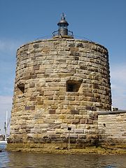
| Fort Denison | Fort Denison Light Fort Denison Light Fort Denison Light, also known as Pinchgut Light, is an active lighthouse located on top of a Martello Tower at Fort Denison, a former penal site and defensive facility occupying a small island in Sydney Harbour, New South Wales, Australia. The island is located downstream from the Harbour Bridge... |
 |
33.8546°S 151.2260°E | 1913 | active | ||
| Green Cape Green Cape Green Cape is a headland or cape on the far south coast of New South Wales. It is located at 37° 15' S 150° 03' E, within Ben Boyd National Park, south of Eden, New South Wales... |
Green Cape Lighthouse Green Cape Lighthouse The Green Cape Lighthouse is a lighthouse located at the tip of Green Cape, a headland forming the northern boundary of Disaster Bay, in southern New South Wales, Australia. It is the southernmost lighthouse in New South Wales and Australia's first lighthouse built in concrete. At it is also the... |
37.2614°S 150.0493°E | 1883 | 1983 | 1997 | replaced with solar powered light tower | |
| Kiama Kiama, New South Wales -Transport:The town is served by Kiama Station on the South Coast Line. It is served by road in the form of the Princes Highway and the Kiama Bypass.-Attractions:... |
Kiama Light Kiama Light Kiama Light, also known as Kiama Harbour Light, is an active lighthouse in Kiama, New South Wales, Australia. The lighthouse is located close to the Kiama Blowhole on Blowhole Point, south of Kiama Harbour.-History:... |
34.6718°S 150.8626°E | 1887 | 1920 | active | ||
| Kurnell Kurnell, New South Wales Kurnell is a suburb in southern Sydney, in the state of New South Wales, Australia. Kurnell is located south of the Sydney central business district, in the local government area of the Sutherland Shire.... |
Cape Bailey Light Cape Bailey Light Cape Bailey Light is an active lighthouse located at Cape Bailey, a headland at the south side of the entrance to Botany Bay, New South Wales, Australia. The light serves in help north-bound shipping hug the coast to avoid the strong southerly currents further out to sea.-History:The light was... |
34.0352°S 151.2222°E | 1950 | active | |||
| Montague Island | Montague Island Light Montague Island Light Montague Island Light is an active lighthouse on Montague Island, an island offshore from Narooma on the south coast of New South Wales, Australia. The lighthouse is located at the highest point of the island.-History:... |
36.2520°S 150.2264°E | 1881 | 1986 | active | Solar powered | |
| Nelson Bay Nelson Bay, New South Wales Nelson Bay is a suburb of the Port Stephens Local Government Area in the Hunter Region of New South Wales, Australia. It is located on a bay of the same name on the southern shore of Port Stephens about by road north-east of Newcastle, its nearest rail link. At the 2006 census, Nelson Bay had a... |
Nelson Head Light Nelson Head Light Nelson Head Light, also known as Nelson Head Inner Light, is an inactive unusual lighthouse located on Nelson Head, a headland northeast of the town of Nelson Bay, New South Wales, Australia, near Halifax Park, on the southern shore of Port Stephens. The light served guiding ships into the port.... |
32.7104°S 152.1614°E | 1872 | 1984 | 2003 | ||
| Newcastle Newcastle, New South Wales The Newcastle metropolitan area is the second most populated area in the Australian state of New South Wales and includes most of the Newcastle and Lake Macquarie Local Government Areas... |
Nobbys Head Light Nobbys Head Light Nobbys Head Light is an active lighthouse on Nobbys Head, a headland on the south side of the entrance to Newcastle Harbour, New South Wales, Australia. It is included in Newcastle's Coat of Arms.... |
32.9185°S 151.7984°E | 1854 | 1935 | active | ||
| Norah Head | Norah Head Light Norah Head Light Norah Head Light is an active lighthouse located at Norah Head, a headland on the Central Coast, New South Wales, Australia, close to Toukley. It is the last lighthouse of the James Barnet style to be built, and the last staffed lighthouse constructed in New South Wales.Officially displayed for the... |
33.2816°S 151.5764°E | 1903 | 1995 | active | ||
| Palm Beach Palm Beach, New South Wales Palm Beach is a northern beachside suburb of Sydney, in the state of New South Wales, Australia. Palm Beach is located 41 kilometres north of the Sydney central business district, in the local government area of Pittwater Council, in the Northern Beaches region. Palm Beach sits on a peninsula at... |
Barrenjoey Lighthouse Barrenjoey, New South Wales Barrenjoey is a locality in the suburb of Palm Beach, at the farthest northern tip of Pittwater. The headland is mostly made up of Hawkesbury sandstone which overlays Narrabeen shale. Around 10,000 years ago the headland was cutoff from the mainland due to the rising sea level; subsequent buildup... |
 |
33.5801°S 151.3298°E | 1855 | 1932 | active | |
| Mosman Mosman, New South Wales Mosman is a suburb on the Lower North Shore of Sydney, in the state of New South Wales, Australia. Mosman is located 8 kilometres north-east of the Sydney central business district and is the administrative centre for the local government area of the Municipality of Mosman.-Localities:In February... |
Parriwi Head Light Parriwi Head Light Parriwi Head Light, also known as Rosherville Light and Port Jackson Entrance Range Rear Light, is an active lighthouse located just off Parriwi Road, near Rosherville Reserve on the south side of Middle Harbour in Mosman, New South Wales, Australia. It serves as the rear range light, Grotto Point... |
33.8121°S 151.2463°E | 1911 | active | |||
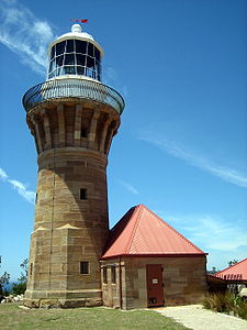
| Point Perpendicular Point Perpendicular Point Perpendicular is a point at the southern tip of the Beecroft Peninsula and at the northern entry to Jervis Bay, in New South Wales, Australia... |
Point Perpendicular Light Point Perpendicular Light Point Perpendicular Light is a lighthouse located on Point Perpendicular, a point at the southern tip of the Beecroft Peninsula, in New South Wales, Australia. It marks and the northern entrance to Jervis Bay. The historic lighthouse was active from 1889 to 1993 and is still present, though its... |
35.0939°S 150.8044°E | 1899 | 1993 | replaced with solar powered light tower | ||
| Point Stephens | Point Stephens Light Point Stephens Light Point Stephens Light is an active lighthouse located on Point Stephens, a point on an unnamed headland at the east of Fingal Bay, south of the entrance of Port Stephens, New South Wales, Australia. It serves in assisting vessels entering Port Stephens. It is considered an endangered lighthouse due... |
32.7470°S 152.2014°E | 1862 | 1989 | active | Solar powered | |
| Shark Island | Shark Island Light Shark Island Light Shark Island Light is an active pile lighthouse located just north of Shark Island, an island in in Sydney Harbour, New South Wales, Australia. Its light is only visible on in the fairway of the harbour, between Shark Point and Point Piper.-Site operation:... |
33.8565°S 151.2572°E | 1913 | active | |||
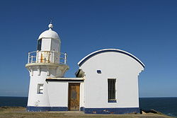
| Smoky Cape Smoky Cape Smoky Cape is a headland in Australia on the New South Wales Mid-North Coast. It lies just east of the town of South West Rocks, and within the Hat Head National Park.- Cape :... |
Smoky Cape Lighthouse Smoky Cape Lighthouse Smoky Cape Lighthouse is an active lighthouse located on Smoky Cape, a headland east of the town of South West Rocks, New South Wales, Australia, and within the Hat Head National Park... |
30.9230°S 153.0877°E | 1891 | 1988 | active | ||
| Solitary Islands North solitary island North Solitary Island is one of the largest islands found off the New South Wales coast and inside the continental shelf. It is located 40 km north-east of Coffs Harbour and about 13 km east-south-east of Wooli. The island is divided into two sections by a channel... |
North Solitary Island Light North Solitary Island Light North Solitary Island Light is an active lighthouse on North Solitary Island, a large island off the coast of New South Wales, Australia. The light is located on the summit of the island which is on the northern section of the island.... |
29.9246°S 153.3897°E | 1975 | active | Fibreglass structure; Solar powered | ||
| Solitary Islands | South Solitary Island Light South Solitary Island Light South Solitary Island Light is an active lighthouse on South Solitary Island, an island about northeast of Coffs Harbour, New South Wales, Australia. The lighthouse is located at the summit of the island. It is considered the most isolated lighthouse on the New South Wales coast... |
30.2067°S 153.2674°E | 1880 | 1975 | active | Solar powered | |
| Seal Rocks Seal Rocks, New South Wales Seal Rocks is a small coastal settlement in the Great Lakes Council Local Government Area, in the Mid North Coast/Hunter regions of New South Wales, Australia, north-north-east of Sydney... |
Sugarloaf Point Light Sugarloaf Point Light Sugarloaf Point Light, also known as Seal Rocks Lighthouse, is an active lighthouse located on Sugarloaf Point, a point about southeast of Seal Rocks, New South Wales, Australia. It guards Seal Rocks, a treacherous rock formation to the south. It is the first lighthouse designed by James Barnet... |
32.4409°S 152.5392°E | 1875 | 1987 | active | External stairs | |
| Sydney Harbour | Eastern Channel Pile Light Eastern Channel Pile Light Eastern Channel Pile Light, also known as the East Wedding Cake due to its shape, is an active pile lighthouse located at the Sydney Harbour, New South Wales, Australia, off Laings Point in the Vaucluse suburb of Sydney. It marks the eastern end of the Sow and Pigs Shoal.-History:Eastern Channel... |
33.8418°S 151.2718°E | 1924 | active | |||
| Sydney Harbour | Western Channel Pile Light Western Channel Pile Light Western Channel Pile Light, also known as the West Wedding Cake due to its shape, is an active pile lighthouse located at the Sydney Harbour, New South Wales, Australia, off Georges Head at Mosman. It marks the western end of the Sow and Pigs Shoal... |
33.8379°S 151.2629°E | 1924 | active | |||
| Port Macquarie Port Macquarie, New South Wales Port Macquarie is a city on the Mid North Coast of New South Wales, Australia, located about north of Sydney, and south of Brisbane. The city is located on the coast, at the mouth of the Hastings River, and has an estimated population of 44,313.... |
Tacking Point Lighthouse Tacking Point Lighthouse Tacking Point Lighthouse is Australia's third oldest lighthouse. It was built on a rocky headland about 8 kilometres south of Port Macquarie in 1879 by Shepard and Mortley, to a design by the New South Wales government's architect of the time, James Barnet... |
 |
31.4754°S 152.9372°E | 1879 | 1919 | active | |
| Ulladulla Ulladulla, New South Wales Ulladulla is a coastal town in New South Wales, Australia in the City of Shoalhaven local government area. It is on the Princes Highway, about half way between the larger towns of Batemans Bay to the south and Nowra to the north and approximately 179 km south of Sydney... |
Warden Head Light Warden Head Light Warden Head Light, also known as Ulladulla Lighthouse, is an active lighthouse on Warden Head, a headland south of Ulladulla, New South Wales, Australia, guarding the entrance to the Port of Ulladulla. It is one of only two wrought iron lighthouses in New South Wales, the other being its sibling,... |
35.3655°S 150.4909°E | 1873 | 1920 | active | Battery powered, relocated | |
| Vaucluse Vaucluse, New South Wales Vaucluse is an eastern suburb of Sydney, in the state of New South Wales, Australia. Vaucluse is located north-east of the Sydney central business district, in the local government areas of Waverley Council and the Municipality of Woollahra.... |
Macquarie Lighthouse Macquarie Lighthouse The Macquarie Lighthouse, also known as South Head Upper Light, was the first, and is the longest serving, lighthouse site in Australia. It is located on Dunbar Head, Vaucluse near the entrance to Sydney Harbour. There has been a navigational aid in this vicinity since 1791 and a lighthouse near... |
33.8539°S 151.2851°E | 1793 | 1976 | active | Australia's first lighthouse | |
| Vaucluse Vaucluse, New South Wales Vaucluse is an eastern suburb of Sydney, in the state of New South Wales, Australia. Vaucluse is located north-east of the Sydney central business district, in the local government areas of Waverley Council and the Municipality of Woollahra.... |
Vaucluse Bay Range Front Light Vaucluse Bay Range Front Light Vaucluse Bay Range Front Light is an active lighthouse located on the east side of the entrance to Vaucluse Bay in Vaucluse, New South Wales, Australia. It serves as the front range light, Vaucluse Bay Range Rear Light serving as the rear light, into Vaucluse Bay... |
33.8495°S 151.2739°E | 1884 | active | |||
| Vaucluse Vaucluse, New South Wales Vaucluse is an eastern suburb of Sydney, in the state of New South Wales, Australia. Vaucluse is located north-east of the Sydney central business district, in the local government areas of Waverley Council and the Municipality of Woollahra.... |
Vaucluse Bay Range Rear Light Vaucluse Bay Range Rear Light Vaucluse Bay Range Front Light is an active lighthouse located on the east side of the entrance to Vaucluse Bay in Vaucluse, New South Wales, Australia. It serves as the front range light, Vaucluse Bay Range Front Light serving as the front light, into Vaucluse Bay... |
33.8582°S 151.2729°E | 1884 | active | |||
| Watsons Bay Watsons Bay, New South Wales Watsons Bay is a harbourside, eastern suburb of Sydney, in the state of New South Wales, Australia. Watsons Bay is located 11 km north-east of the Sydney central business district, in the local government area of the Municipality of Woollahra.... |
Hornby Lighthouse Hornby Lighthouse Hornby Lighthouse, also known as South Head Lower Light, is an active lighthouse located on the tip of South Head, New South Wales, Australia, a headland to the north of the suburb Watsons Bay. It marks the southern entrance to Port Jackson and Sydney Harbour, as well as lighting the South Reef, a... |
33.8335°S 151.2809°E | 1858 | 1933 | active | ||
| Wollongong | Wollongong Breakwater Lighthouse | 34.4196°S 150.9067°E | c.1870 | 1974 | |||
| Wollongong | Wollongong Head Lighthouse Wollongong Head Lighthouse Wollongong Head Lighthouse, also known as Flagstaff Lighthouse or Flagstaff Point Light, is an active lighthouse located in Wollongong, a coastal city south of Sydney, New South Wales. It overlooks the Tasman Sea from the top of Flagstaff Point, directly east of the city centre... |
34.4219°S 150.9097°E | 1936 | 1936 | active | ||
| Yamba Yamba, New South Wales Yamba is a town in northern New South Wales, Australia at the mouth of the Clarence River. The first European to visit the area was Matthew Flinders, who stopped by in Yamba Bay for six days in July 1799.... |
Clarence River Light Clarence River Light Clarence River Light, also known as Yamba Light or Clarence Head Light, is an active lighthouse located on Pilot Hill, a hill in Wooli Park, Yamba, New South Wales, Australia, south of the entrance of Clarence River. The current lighthouse was built in 1955, replacing a previous lighthouse built in... |
 |
29.4324°S 153.3639°E | 1866 | 1920 | active | Battery powered |
Northern Territory
Most of the lighthouses in the Northern Territory were constructed by the Commonwealth Lighthouse Service during the "Golden Age of Australian Lighthouses", between 1913 and 1920. These include Cape Don LightCape Don Light
Cape Don Light is an active lighthouse located on Cape Don, at the tip of the Cobourg Peninsula, Northern Territory, Australia, in Garig Gunak Barlu National Park, marking the entrance to the Dundas Strait. It is Australia's northernmost traditional lighthouse. The station served on the important...
, East Vernon Light
East Vernon Light
East Vernon Light is an active lighthouse located on the water's edge at the south side of East Vernon Island, an island off the shore of the Northern Territory, Australia...
, Emery Point Light
Emery Point Light
Emery Point Light is an active lighthouse located at Larrakeyah Barracks, the main base for the Australian Defence Force in Northern Territory, Australia, at the entrance to Port Darwin. It was the second lighthouse to be built in Port Darwin...
, Cape Hotham Light
Cape Hotham Light
Cape Hotham Light is an active lighthouse located on Cape Hotham, which is on a the shore of the Timor Sea on a long unnamed peninsula about northeast of Darwin, Northern Territory, Australia...
and Cape Fourcroy
Cape Fourcroy
Cape Fourcroy is located at the western tip of Bathurst Island. Cyclone Tracy passed through here. It is the location of Cape Fourcroy Light, an active lighthouse....
.
Of these five, three can be considered "siblings", Cape Hotham Light
Cape Hotham Light
Cape Hotham Light is an active lighthouse located on Cape Hotham, which is on a the shore of the Timor Sea on a long unnamed peninsula about northeast of Darwin, Northern Territory, Australia...
, Emery Point Light
Emery Point Light
Emery Point Light is an active lighthouse located at Larrakeyah Barracks, the main base for the Australian Defence Force in Northern Territory, Australia, at the entrance to Port Darwin. It was the second lighthouse to be built in Port Darwin...
and Cape Fourcroy Light
Cape Fourcroy Light
Cape Fourcroy Light is an active lighthouse located on Cape Fourcroy, on the southwestern tip of Bathurst Island, Northern Territory, Australia. The lighthouse marks the beginning of the route from the Timor Sea to Darwin....
. They are almost identical white square skeletal towers, and they also share a similar light characteristic, three flashes every 15 second (Fl.(3) 15s).
| Location | |Image | Cobourg Peninsula Cobourg Peninsula The Cobourg Peninsula is located 350 kilometres east of Darwin in the Northern Territory, Australia. It is deeply indented with coves and bays, covers a land area of about 2,100 km², and is virtually uninhabited with a population ranging from about 20 to 30 in five family outstations, but... | Cape Don Light Cape Don Light Cape Don Light is an active lighthouse located on Cape Don, at the tip of the Cobourg Peninsula, Northern Territory, Australia, in Garig Gunak Barlu National Park, marking the entrance to the Dundas Strait. It is Australia's northernmost traditional lighthouse. The station served on the important... |
11.30786°S 131.76515°E | 1917 | 1983 | active | solar powered |
|---|---|---|---|---|---|---|---|
| Cape Fourcroy Cape Fourcroy Cape Fourcroy is located at the western tip of Bathurst Island. Cyclone Tracy passed through here. It is the location of Cape Fourcroy Light, an active lighthouse.... |
Cape Fourcroy Light Cape Fourcroy Light Cape Fourcroy Light is an active lighthouse located on Cape Fourcroy, on the southwestern tip of Bathurst Island, Northern Territory, Australia. The lighthouse marks the beginning of the route from the Timor Sea to Darwin.... |
11.79747°S 130.02434°E | active | ||||
| Clarence Strait | Cape Hotham Light Cape Hotham Light Cape Hotham Light is an active lighthouse located on Cape Hotham, which is on a the shore of the Timor Sea on a long unnamed peninsula about northeast of Darwin, Northern Territory, Australia... |
12.04644°S 131.28946°E | 1928 | active | |||
| East Vernon Island | East Vernon Light East Vernon Light East Vernon Light is an active lighthouse located on the water's edge at the south side of East Vernon Island, an island off the shore of the Northern Territory, Australia... |
12.07722°S 131.09531°E | 1928 | active | |||
| Larrakeyah Barracks Larrakeyah Barracks Larrakeyah Barracks incorporating HMAS Coonawarra is the main base for the Australian Defence Force in the Northern Territory of Australia, and occupies the headland west of the suburb of Larrakeyah in the capital, Darwin... |
Emery Point Light Emery Point Light Emery Point Light is an active lighthouse located at Larrakeyah Barracks, the main base for the Australian Defence Force in Northern Territory, Australia, at the entrance to Port Darwin. It was the second lighthouse to be built in Port Darwin... |
12.45382°S 130.81555°E | 1900 | active | |||
| Cox Peninsula Cox Peninsula The Wagait Shire, before 1 July 2008 Cox Peninsula Community Government Council, is a Local Government Area in the Northern Territory. The council was established 28 April 1995. It is located west of Darwin, Northern Territory, as a 15 minute ferry ride, or a 138km Drive on fully sealed roads.The... |
Point Charles Light Point Charles Light Point Charles Light, also known as Charles Point Light, is an active lighthouse located on a headland at the northern end of the Cox Peninsula, northwest of Port Darwin, Northern Territory, Australia... |
12.38929°S 130.63068°E | 1893 | 1933 | active | survived cyclone Tracy Cyclone Tracy Cyclone Tracy was a tropical cyclone that devastated the city of Darwin, Northern Territory, Australia, from Christmas Eve to Christmas Day, 1974... ; solar powered |
Queensland
Most lighthouses in Queensland were constructed in well established groups:- Two lighthouses constructed using bolted prefabricatedPrefabricationPrefabrication is the practice of assembling components of a structure in a factory or other manufacturing site, and transporting complete assemblies or sub-assemblies to the construction site where the structure is to be located...
segments of cast ironCast ironCast iron is derived from pig iron, and while it usually refers to gray iron, it also identifies a large group of ferrous alloys which solidify with a eutectic. The color of a fractured surface can be used to identify an alloy. White cast iron is named after its white surface when fractured, due...
: Sandy Cape LightSandy Cape LightSandy Cape Light is an active lighthouse located on Sandy Cape, the most northern point on Fraser Island, Queensland, Australia. It stands about southwest of the northeastern tip of the island. It is the tallest lighthouse in Queensland. Built in 1870, it is the second major lighthouse to be built...
and Bustard Head LightBustard Head LightBustard Head Light is an active lighthouse located on the southeast tip of Bustard Head, a headland, about northwest of 1770, Queensland, Australia, within the Eurimbula National Park. Built in 1868, it is the second oldest lightstation in Queensland, following Cape Moreton Light, and the first to...
. - Eight lighthouses made of hardwood frame clad with corrugated iron: Little Sea Hill Light, Grassy Hill LightGrassy Hill LightGrassy Hill Light, also known as Cooktown Light, is an active lighthouse located on Grassy Hill above Cooktown, Queensland, Australia, on the south side of the entrance to Endeavour River.-History:...
, Goods Island LightGoods Island LightGoods Island Light is an active lighthouse located on the highest point of Goods Island , an island in the Torres Strait, belonging to Queensland, Australia. It serves as the rear light of the Goods Island Range, pointing out the entrance to Normanby Sound.-History:The first navigation aid on Goods...
, Bay Rock LightBay Rock LightBay Rock Light is an inactive lighthouse which used to be located on Bay Rock, a rocky islet northwest of Magnetic Island, about north of Townsville, Queensland, Australia. First lit in 1886, it was automated in 1920 and deactivated in the 1980s. It was relocated in 1992 to the Townsville Maritime...
, Old Caloundra LightOld Caloundra LightOld Caloundra Light, also known as Old Caloundra Head Light or Cape Caloundra Light, is an inactive lighthouse located in Caloundra on the Sunshine Coast in South East Queensland, Australia. It is the oldest surviving building in Caloundra. The lighthouse was active between 1896 and 1968. The tower...
, North Point Hummock Light (demolished), Gatcombe Head Light (demolished) and Bulwer Island LightBulwer Island LightBulwer Island Light, also known as Bulwer Island Range Rear Light, is an inactive lighthouse that used to be located on Bulwer Island, in the city of Brisbane, Queensland, Australia. In 1983 it was moved to the Queensland Maritime Museum in Brisbane....
. - Seven concrete towers erected between 1964 and 1979: Cape Capricorn LightCape Capricorn LightCape Capricorn Light is an active lighthouse located on Cape Capricorn, a coastal headland on the northeast point of Curtis Island, in Central Queensland, Australia...
, New Caloundra LightNew Caloundra LightNew Caloundra Light, also known as New Caloundra Head Light, is an inactive lighthouse located in Caloundra on the Sunshine Coast in South East Queensland, Australia. It stands on Canberra Terrace near downtown Caloundra. The lighthouse was active from 1968 to 1992...
, Point Danger LightPoint Danger LightPoint Danger Light, also known as the Captain Cook Memorial Light, is an active lighthouse located on Point Danger, a headland between Coolangatta, Queensland and Tweed Heads, New South Wales, marking the border between New South Wales and Queensland, Australia...
, New Burnett Heads LightNew Burnett Heads LightThe New Burnett Heads Light, also known as South Head Light, is an active lighthouse standing on the south side of the Burnett River entrance, in Burnett Heads, Queensland, Australia...
, Fitzroy Island LightFitzroy Island LightFitzroy Island Light is an inactive lighthouse on Fitzroy Island, a continental island southeast of Cairns, Queensland, Australia. It was only active between 1973 and 1992, though a light station at the area is active since 1926 and to these days...
, Point Cartwright LightPoint Cartwright LightPoint Cartwright Light is an active lighthouse located on Point Cartwright, a point near the mouth of the Mooloolah River, in Mooloolaba, Queensland, Australia...
and Archer Point LightArcher Point LightArcher Point Light is an active lighthouse located on Archer Point, a conical, , grassy headland, about southeast of Cooktown, Queensland, Australia. Originally an 1883 timber frame lighthouse, covered with galvanised iron, it was replaced in 1975 with a modern square concrete equipment room,...
.
| Location | |Image | Cooktown Cooktown, Queensland Cooktown is a small town located at the mouth of the Endeavour River, on Cape York Peninsula in Far North Queensland where James Cook beached his ship, the Endeavour, for repairs in 1770. At the 2006 census, Cooktown had a population of 1,336... | Archer Point Light Archer Point Light Archer Point Light is an active lighthouse located on Archer Point, a conical, , grassy headland, about southeast of Cooktown, Queensland, Australia. Originally an 1883 timber frame lighthouse, covered with galvanised iron, it was replaced in 1975 with a modern square concrete equipment room,... |
15.5936°S 145.3285°E | 1883 | 1979 | active |
|---|---|---|---|---|---|---|---|
| Townsville | Bay Rock Light Bay Rock Light Bay Rock Light is an inactive lighthouse which used to be located on Bay Rock, a rocky islet northwest of Magnetic Island, about north of Townsville, Queensland, Australia. First lit in 1886, it was automated in 1920 and deactivated in the 1980s. It was relocated in 1992 to the Townsville Maritime... |
19.1168°S 146.7529°E | 1886 | 1930 | c.1992 | ||
| Booby Island Booby Island, Torres Strait Booby Island is an island West of Muttee Heads at the tip of Cape York Peninsula within the Endeavour Strait, Queensland, Australia. This island in the Torres Strait, south of Thursday Island and Prince of Wales Island.-Shipwrecks:... |
Booby Island Light Booby Island Light Booby Island Light is an active lighthouse located on Booby Island, an island near the tip of Cape York Peninsula, west of Prince of Wales Island, within the Endeavour Strait, Queensland, Australia. It marks the western entrance to the navigation channel through the Torres Strait... |
10.6042°S 141.9100°E | 1890 | 1991 | active | generator powered | |
| Bulwer Island | Bulwer Island Light Bulwer Island Light Bulwer Island Light, also known as Bulwer Island Range Rear Light, is an inactive lighthouse that used to be located on Bulwer Island, in the city of Brisbane, Queensland, Australia. In 1983 it was moved to the Queensland Maritime Museum in Brisbane.... |
 |
27.4815°S 153.0266°E | 1912 | 1983 | not original site | |
| Burnett Heads Burnett Heads, Queensland Burnett Heads is a town at the mouth of the Burnett River in Queensland, Australia, located 16 km north of the regional city of Bundaberg. At the 2006 census, Burnett Heads had a population of 2,419.... |
New Burnett Heads Light New Burnett Heads Light The New Burnett Heads Light, also known as South Head Light, is an active lighthouse standing on the south side of the Burnett River entrance, in Burnett Heads, Queensland, Australia... |
24.7582°S 152.4126°E | 1971 | 1971 | active | ||
| Burnett Heads Burnett Heads, Queensland Burnett Heads is a town at the mouth of the Burnett River in Queensland, Australia, located 16 km north of the regional city of Bundaberg. At the 2006 census, Burnett Heads had a population of 2,419.... |
Old Burnett Heads Light Old Burnett Heads Light The Old Burnett Heads Light is an inactive lighthouse which used to be located on the south side of the Burnett River entrance, in Burnett Heads, Queensland, Australia. It was relocated to the Burnett Heads Lighthouse Holiday Park... |
24.7637°S 152.4091°E | 1873 | 1932 | 1971 | ||
| Bustard Head | Bustard Head Light Bustard Head Light Bustard Head Light is an active lighthouse located on the southeast tip of Bustard Head, a headland, about northwest of 1770, Queensland, Australia, within the Eurimbula National Park. Built in 1868, it is the second oldest lightstation in Queensland, following Cape Moreton Light, and the first to... |
24.0223°S 151.7644°E | 1869 | 1985 | active | ||
| Caloundra | New Caloundra Light New Caloundra Light New Caloundra Light, also known as New Caloundra Head Light, is an inactive lighthouse located in Caloundra on the Sunshine Coast in South East Queensland, Australia. It stands on Canberra Terrace near downtown Caloundra. The lighthouse was active from 1968 to 1992... |
26.8015°S 153.1374°E | 1968 | 1969 | 1997 | ||
| Caloundra | Old Caloundra Light Old Caloundra Light Old Caloundra Light, also known as Old Caloundra Head Light or Cape Caloundra Light, is an inactive lighthouse located in Caloundra on the Sunshine Coast in South East Queensland, Australia. It is the oldest surviving building in Caloundra. The lighthouse was active between 1896 and 1968. The tower... |
26.8016°S 153.1374°E | 1896 | 1942 | 1968 | ||
| Cape Bowling Green | Cape Bowling Green Light Cape Bowling Green Light Cape Bowling Green Light is an active lighthouse located on Cape Bowling Green, a lengthy headland ending with a long low sandspit, about from Ayr, Queensland, Australia. The lighthouse is at the end of the headland, near the base of the sandspit. The first lighthouse at the location, established... |
19.3262°S 147.4256°E | 1874 | 1920 | active | original moved | |
| Cape Capricorn Cape Capricorn Cape Capricorn is a coastal headland in central Queensland, Australia, at It was named by Captain Cook when he passed on 25 May 1770, since he found it to located on the Tropic of Capricorn. The modern surveyed location of its endpoint is just slightly north of the tropic.-Lighthouse:A lighthouse... |
Cape Capricorn Light Cape Capricorn Light Cape Capricorn Light is an active lighthouse located on Cape Capricorn, a coastal headland on the northeast point of Curtis Island, in Central Queensland, Australia... |
23.4863°S 151.2361°E | 1875 | active | |||
| Cape Cleveland | Cape Cleveland Light Cape Cleveland Light Cape Cleveland Light is an active lighthouse located on the northern tip of Cape Cleveland, a promontory projecting into the Coral Sea west of Cleveland Bay and about east of Townsville, Queensland, Australia... |
19.1829°S 147.0154°E | 1879 | active | |||
| Cape Moreton Cape Moreton Cape Moreton is a rocky headland located at the north eastern tip of Moreton Island in South East Queensland, Australia. The surrounding area is part of the Moreton Island National Park. 5 km north-west of Cape Moreton is Flinders Reef.... |
Cape Moreton Light Cape Moreton Light Cape Moreton Light, also listed as North Point Range Rear Light, is an active lighthouse located on Cape Moreton, a rocky headland located at the north eastern tip of Moreton Island, a large sand island on the eastern side of Moreton Bay, on the coast of South East Queensland, Australia... |
27.0319°S 153.4659°E | 1857 | active | |||
| Cleveland Cleveland, Queensland Cleveland is a suburb located approximately east-south-east of Brisbane, the capital of the Australian state of Queensland, and is the council seat for the Redland City local government area... |
New Cleveland Point Light | 27.51018°S 153.28909°E | 1976 | active | |||
| Cleveland Cleveland, Queensland Cleveland is a suburb located approximately east-south-east of Brisbane, the capital of the Australian state of Queensland, and is the council seat for the Redland City local government area... |
Old Cleveland Point Light | 27.5102°S 153.2890°E | 1847 | 1976 | experimented with laser lighthouse in 1969 | ||
| Cooktown Cooktown, Queensland Cooktown is a small town located at the mouth of the Endeavour River, on Cape York Peninsula in Far North Queensland where James Cook beached his ship, the Endeavour, for repairs in 1770. At the 2006 census, Cooktown had a population of 1,336... |
Grassy Hill Light Grassy Hill Light Grassy Hill Light, also known as Cooktown Light, is an active lighthouse located on Grassy Hill above Cooktown, Queensland, Australia, on the south side of the entrance to Endeavour River.-History:... |
15.4606°S 145.2553°E | 1886 | 1927 | active | ||
| Comboyuro Point | Comboyuro Point Light | 27.06164°N 153.36263°W | 1874 | 1954 | 1960 | Collapsed | |
| Cowan Cowan Point | Cowan Cowan Point Light | 27.13655°N 153.36282°W | 1873 | 1950 | Demolished | ||
| Creal Reef | Creal Reef Light Creal Reef Light Creal Reef Light is an active lighthouse located at Creal Reef, a planar reef about east of Mackay, Queensland, Australia. It guides ships outgoing from Mackay into Hydrographers Passage, a deep water channel east of Mackay... |
20.533973°S 150.38051°E | 1985 | active | |||
| Curtis Island | Sea Hill Light Sea Hill Light Sea Hill Light, also known as Sea Hill Point Light Little Sea Hill Light, was a lighthouse on the northwest point of Curtis Island, Queensland, Australia. Its purpose was to mark the east side of the entrance to Keppel Bay, on passage to Fitzroy River and Port Alma... |
23.490931°S 150.980414°E | 1876 | 2006 | First lighthouse now at Gladstone Maritime Museum | ||
| Dent Island Dent Island (Whitsunday Islands) Dent Island is an island just off the coast of Queensland, Australia. Dent Island is located at . Dent Island is part of the Whitsunday Group and lies immediately west of Hamilton Island. The Whitsunday Group is one of the Island Groups that together comprise the Whitsunday Islands... |
Dent Island Light Dent Island Light Dent Island Light is an active lighthouse located on Dent Island, a small island off the coast of Queensland, Australia. Dent Island is part of the Whitsunday Group of the Whitsunday Islands... |
20.3692°S 148.9289°E | 1879 | 1987 | active | ||
| Double Island Point Double Island Point Double Island Point is a coastal headland in Queensland, Australia. It's the next headland north of Noosa and is within the Cooloola section of the Great Sandy National Park, at the southern end of Wide Bay.... |
Double Island Point Light Double Island Point Light Double Island Point Light is an active lighthouse located at the summit of Double Island Point, a coastal headland within the Cooloola section of the Great Sandy National Park. It is located at the southern end of Wide Bay, north of Noosa Heads, Queensland, Australia.Though the location was... |
25.9362°S 153.1907°E | 1884 | 1992 | active | ||
| Eborac Island | Eborac Island Light Eborac Island Light Eborac Island Light is an active lighthouse on Eborac Island, a small rocky island in the Adolphus Channel just off Cape York, the northern tip of Cape York Peninsula, Far North Queensland, Australia. It guides ships into the coastal channel inside the Great Barrier Reef... |
10.682116°S 142.533649°E | active | ||||
| Fitzroy Island | Fitzroy Island Light Fitzroy Island Light Fitzroy Island Light is an inactive lighthouse on Fitzroy Island, a continental island southeast of Cairns, Queensland, Australia. It was only active between 1973 and 1992, though a light station at the area is active since 1926 and to these days... |
16.9261°S 146.0020°E | 1943 | 1992 | |||
| Flat Top Island | Flat Top Island Light Flat Top Island Light Flat Top Island Light is an inactive lighthouse located on Flat Top Island, a small island off the entrance to Mackay harbor at the mouth of Pioneer River, about east of Mackay, Queensland, Australia. It used to mark the river entrance for shipping and the direction of the port, as well as... |
21.1615°S 149.2464°E | 1879 | 1920 | 2007 | ||
| Sandy Cape Sandy Cape Sandy Cape is the most northern point on Fraser Island off the coast of Queensland, Australia. The place was named by James Cook during his 1770 voyage up the eastern coast of Australia aboard the Endeavour... |
Sandy Cape Light Sandy Cape Light Sandy Cape Light is an active lighthouse located on Sandy Cape, the most northern point on Fraser Island, Queensland, Australia. It stands about southwest of the northeastern tip of the island. It is the tallest lighthouse in Queensland. Built in 1870, it is the second major lighthouse to be built... |
24.7299°S 153.2086°E | 1870 | 1991 | active | ||
| Goods Island | Goods Island Light Goods Island Light Goods Island Light is an active lighthouse located on the highest point of Goods Island , an island in the Torres Strait, belonging to Queensland, Australia. It serves as the rear light of the Goods Island Range, pointing out the entrance to Normanby Sound.-History:The first navigation aid on Goods... |
10.5654°S 142.1494°E | 1886 | active | |||
| Lady Elliot Island Lady Elliot Island Lady Elliot Island is the southern-most coral cay of the Great Barrier Reef, Australia. The island lies north-east of Bundaberg and covers an area of approximately . The island is home to a small eco resort and an airstrip, which is serviced daily by flights from Bundaberg, Hervey Bay,... |
Lady Elliot Island Light Lady Elliot Island Light Lady Elliot Island Light is an active lighthouse located on Lady Elliot Island, the southern-most coral cay of the Great Barrier Reef, north-east of Bundaberg, Queensland, Australia. The lighthouse is located on the western side of the island... |
 |
24.1146°S 152.7116°E | 1873 | active | ||
| Gulf of Carpenteria | CLS-4 Carpentaria | 27.481317°S 153.026867°E | 1918 | 1985 | Lightship; Not in service | ||
| Low Island Low Island, Queensland Low Island North Queensland is about 25 km North East of Port Douglas in Trinity Bay, North Queensland.Low Island is part of the Low Isles... |
Low Isles Light Low Isles Light Low Isles Light, also known as Low Islets Light or Low Island Light, is an active lighthouse located on Low Island, a coral cay which together with Woody Island forms the Low Isles group, about northeast of Port Douglas, Queensland, Australia... |
16.3840°S 145.5598°E | 1878 | 1993 | active | ||
| Moreton Bay Moreton Bay Moreton Bay is a bay on the eastern coast of Australia 45 km from Brisbane, Queensland. It is one of Queensland's most important coastal resources... |
Moreton Bay Pile Light Moreton Bay Pile Light Moreton Bay Pile Light was a pile lighthouse positioned at the mouth of Brisbane River, in Moreton Bay, Queensland, Australia, marking the entrance to the port of Brisbane. The light's early history was closely related to the dredging of the Brisbane River. It was established in 1884 as a result of... |
27.3109°S 153.2104°E | 1884 | 1952 | 1966-1967 | Structure destroyed in 1949 | |
| North Reef | North Reef Light North Reef Light North Reef Light is an active lighthouse located on North Reef, a planar reef, about northeast of Gladstone, Queensland, Australia. The lighthouse was constructed on a migratory patch of sand inside a fringing coral reef, which over the years disappeared and reappeared, as sand was washed away... |
23.1855°S 151.9037°E | 1878 | 1978 | active | ||
| Pine Islet | Pine Islet Light Pine Islet Light Pine Islet Light, also known as Percy Isles Light, is an active lighthouse located at Pine Islet, a small islet belonging to the Percy Isles group of the Northumberland Islands, about southeast of Mackay, Queensland, Australia... |
21.6575°S 150.2166°E | 1885 | 1985 | relocated; last working kerosene lighthouse in the world | ||
| Mooloolaba Mooloolaba, Queensland Mooloolaba is a suburb and tourist resort township on the Sunshine Coast in Queensland, Australia. It is located north of the state capital, Brisbane, and is part of the Maroochydore urban centre.- Etymology :... |
Point Cartwright Light Point Cartwright Light Point Cartwright Light is an active lighthouse located on Point Cartwright, a point near the mouth of the Mooloolah River, in Mooloolaba, Queensland, Australia... |
26.6797°S 153.1384°E | 1978 | 1978 | active | ||
| Point Lookout Point Lookout, Queensland Point Lookout is a headland and small coastal village located on the eastern coast of North Stradbroke Island. To the north lies Cape Moreton and to the south the next major headland is Point Danger on the New South Wales/Queensland border. The other towns on the island are Dunwich and Amity Point.... |
Point Lookout Light | 27.4316°S 153.5404°E | 1932 | active | |||
| Point Danger | Point Danger Light Point Danger Light Point Danger Light, also known as the Captain Cook Memorial Light, is an active lighthouse located on Point Danger, a headland between Coolangatta, Queensland and Tweed Heads, New South Wales, marking the border between New South Wales and Queensland, Australia... |
28.1650°S 153.5507°E | 1971 | 1971 | active | experimented with laser lighthouse in 1971 | |
| Townsville | Wharton Reef Light Wharton Reef Light Wharton Reef Light is an inactive lighthouse which used to be located on Wharton Reef in Princess Charlotte Bay off the Cape York Peninsula, Queensland, Australia. When it was deactivated in 1990 it was donated to the Townsville Maritime Museum and it is now on display near the museum... |
19.2599°S 146.8217°E | 1915 | 1915 | 1990 | not original site | |
| Wyborn Reef | Wyborn Reef Light Wyborn Reef Light Wyborn Reef Light is an active lighthouse located at Wyborn Reef, formerly known as Y Reef, about southeast of Albany Island, east of the tip of Cape York Peninsula, Queensland, Australia. It marks the entrance to the Albany Passage. The lighthouse was constructed in 1938 and upgraded in 1991 and... |
10.819185°S 142.77493°E | 1938 | active | |||
South Australia
| Location | |Image | 1879 | 1991 | active | Diesel Powered | ||
|---|---|---|---|---|---|---|---|
| Beachport Beachport, South Australia Beachport is a small coastal town 379 kilometres south-east of Adelaide, South Australia, located in the Wattle Range Council. Known for its 772 metre long jetty , Beachport is located on the northern end of Rivoli Bay... |
Cape Martin Lighthouse | 37.4895°S 140.0125°E | 1960 | active | |||
| Cape Banks | Cape Banks Lighthouse | 37.8980°S 140.3763°E | 1883 | 1928 | active | ||
| Cape Borda Cape Borda Cape Borda is a headland with a lighthouse on the west coast of Kangaroo Island, South Australia and is situated 70 kilometres west from the town of Kingscote.- Cape Borda Lightstation :... |
Cape Borda Lighthouse |  |
35.7528°S 136.5937°E | 1858 | 1989 | active | |
| Cape Donnington | Cape Donnington Lighthouse | 34.7265°S 135.9939°E | 1878 | active | |||
| Cape du Couedic Cape du Couedic Cape du Couedic is the south-western point of Kangaroo Island, off the coast of South Australia. Cape du Couedic was named in 1803 by French explorer Nicolas Baudin in honour of his friend and famous French sea captain Charles Louis, Chevalier du Couedic de Kergoualer .thumb|300px|left|Cape du... |
Cape du Couedic Lighthouse | 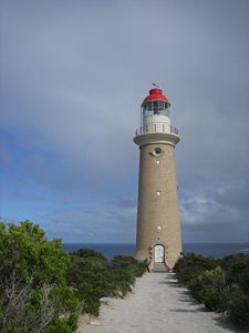 |
36.0579°S 136.7049°E | 1909 | 1957 | active | |
| Cape Jaffa | Cape Jaffa Lighthouse Cape Jaffa Lighthouse Cape Jaffa Lighthouse is located in Kingston SE, South AustraliaCape Jaffa Lighthouse is the property of the National Trust of South Australia.... |
 |
36.8359°S 139.8462°E | 1872 | 1973 | Screw pile; Not original site | |
| Cape Jervis | Cape Jervis Lighthouse | 35.6037°S 138.0945°E | 1871 | 1972 | active | ||
| Cape Spencer Cape Spencer (South Australia) Cape Spencer is a headland in Innes National Park, South Australia. It was named by Matthew Flinders after the 2nd Earl Spencer. The current concrete lighthouse was built in the 1970s to replace a small automatic beacon erected in 1950. The Cape has views to Kangaroo Island on a clear day and is... |
Cape Spencer Lighthouse | 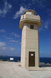 |
35.2988°S 136.8827°E | 1950 | 1975 | active | |
| Cape St Albans | Cape St Albans Lighthouse | 35.8036°S 138.1248°E | 1908 | 1908 | active | ||
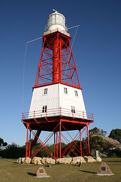
| Cape Willoughby | Cape Willoughby Lighthouse | 35.8428°S 138.1327°E | 1852 | 1974 | 2003 | South Australia's first lighthouse | |
| Corny Point | Corny Point Lighthouse | 34.8965°S 137.0104°E | 1882 | 1920 | active | ||
| Marino Marino, South Australia Marino is a suburb in the south of Adelaide, South Australia. It sits on coastal hills overlooking Gulf St Vincent, within the City of Marion Local Government Area. It neighbours Seacliff, Hallett Cove and Kingston Park.... |
Marino Rocks Navigational Aid | 35.0536°S 138.5117°E | 1962 | 1962 | active | ||
| Penguin Island | Penguin Island Lighthouse | 37.4979°S 140.0136°E | 1878 | 1918 | 1960 | Abandoned | |
| Point Lowly | Point Lowly Lighthouse | 32.9996°S 137.7853°E | 1883 | 1973 | 1993 | ||
| Point Malcolm | Point Malcolm Lighthouse | 35.5089°S 139.1909°E | 1878 | 1931 | Australia's only inland lighthouse; reactivated | ||
| Port Adelaide Port Adelaide Port Adelaide is a suburb of Adelaide lying about 14 kilometres northwest of the City of Adelaide. It lies within the City of Port Adelaide Enfield and is the main port for the city of Adelaide... |
Port Adelaide Lighthouse | 34.8424°S 138.5042°E | 1869 | 1901 | Not original site; lit on Saturdays | ||
| Port Macdonnell Port MacDonnell, South Australia Port MacDonnell is a small port about southeast of Adelaide and south of Mount Gambier, in the Limestone Coast region of south-eastern South Australia. Port MacDonnell is the southernmost town in South Australia. At the 2006 census, the town had a population of 623... |
Cape Northumberland Lighthouse | 38.0563°S 140.6674°E | 1882 | 1990 | active | ||
| Port Macdonnell Port MacDonnell, South Australia Port MacDonnell is a small port about southeast of Adelaide and south of Mount Gambier, in the Limestone Coast region of south-eastern South Australia. Port MacDonnell is the southernmost town in South Australia. At the 2006 census, the town had a population of 623... |
Old Macdonnell Lighthouse | 38.0563°S 140.6674°E | 1859 | 1881 | destroyed | ||
| Robe Robe, South Australia Robe is a town and fishing port on the South East Limestone Coast of South Australia. The town's distinctive combination of historical buildings, ocean, fishing fleets, lakes and dense bush is widely appreciated. Robe lies on the southern shore of Guichen Bay, just off the Princes Highway. At the... |
Robe Lighthouse | 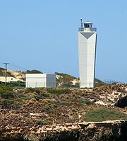 |
37.1643°S 137.0104°E | 1972 | 1972 | active | |
| South Neptune Island Neptune Island The South Neptune Islands sit on the Southern aspect of the Australasian Continental shelf, at a distance of 70 kilometres South by South~East of Port Lincoln, in South Australia. The depth of water on the Eastern side of the islands is 40 metres. Water depth increases to 95 metres on the southern... |
South Neptune Island Lighthouse | 35.3375°S 136.1177°E | 1901 | c.1990 | active | New tower | |
| Tipara Reef | Tipara Reef Screw Pile | 33.9297°S 137.6263°E | 1877 | 1995 | Not original site | ||
| Troubridge Hill | Troubridge Hill Lighthouse | 35.1663°S 137.6408°E | 1980 | 1980 | active | ||
| Troubridge Island Troubridge Island Troubridge Island is a small sandy island lying about 7 km east of Sultana Point on the Yorke Peninsula at the south-western end of Gulf St Vincent, South Australia. It is important as a seabird colony site.-Description:... |
Troubridge Island Lighthouse | 35.1170°S 137.8276°E | 1856 | 1981 | 2001 | Under threat from erosion Erosion Erosion is when materials are removed from the surface and changed into something else. It only works by hydraulic actions and transport of solids in the natural environment, and leads to the deposition of these materials elsewhere... |
|
| West Cape | West Cape Lighthouse | 35.2442°S 136.8241°E | 1980 | 1980 | active | Build of stainless steel Stainless steel In metallurgy, stainless steel, also known as inox steel or inox from French "inoxydable", is defined as a steel alloy with a minimum of 10.5 or 11% chromium content by mass.... |
|
| Wonga Shoal | Wonga Shoal Lighthouse | 34.8233°S 138.4376°E | 1901 | 1912 | Destroyed |
Tasmania
| Location | |Image | 1982 | 1982 | active | |||
|---|---|---|---|---|---|---|---|
| Cape Bruny | Cape Bruny Lighthouse Cape Bruny Lighthouse Cape Bruny Lighthouse at the southern tip of Bruny Island, Tasmania, is the second oldest extant lighthouse tower in Australia, as well as having the longest history of being continuously manned. Construction began in April 1836, it was first lit in March 1838, and was eventually decommissioned... |
43.4910°S 147.1424°E | 1838 | 1996 | |||
| Cape Forrestier | Cape Forrestier Lighthouse | 42.1167°S 148.3589°E | 1971 | Dismantled | |||
| Cape Sorell | Cape Sorell Lighthouse | 42.1978°S 145.1693°E | 1899 | active | |||
| Cape Tourville Cape Tourville The Cape Tourville Lighthouse is an unmanned, automatic light, lighthouse built in 1971. The lighthouse replaced the Cape Forestier Lighthouse which had been situated on another jutting off the Freycinet Peninsula known as Lemon Rock.... |
Cape Tourville Lighthouse | 42.1226°S 148.3427°E | 1971 | 1971 | active | ||
| Cape Wickham Cape Wickham Cape Wickham is the most northerly point of King Island, Tasmania. From here, it is to Cape Otway on the Australian mainland. In the 19th century, ships coming from Europe would sometimes attempt to sail between Cape Wickham and Cape Otway to cut down on the required travelling time to Sydney,... |
Cape Wickham Lighthouse Cape Wickham Lighthouse The Cape Wickham Lighthouse is a lighthouse situated at Cape Wickham on King Island, Tasmania. At 48 metres tall, it is Australia's tallest lighthouse... |
39.5885°S 143.9429°E | 1861 | 1918 | active | ||
| Currie Harbour | Currie Lighthouse | 39.9293°S 143.8422°E | 1880 | active | deativated 1989 - 1995 | ||
| Deal Island Deal Island (Tasmania) Deal Island is a granite island, with an area of 1576.75 ha, in south-eastern Australia. It is the largest of Tasmania’s Kent Group, lying in northern Bass Strait between the Furneaux Group and Wilsons Promontory in Victoria. It is now part of the Kent Group National Park, Tasmania’s northernmost... |
Deal Island Lighhouse | 39.4943°S 147.3225°E | 1848 | 1921 | 1992 | Australia's highest lighthouse | |
| Eddystone Point | 40.9931°S 148.3478°E | 1889 | active | ||||
| Goose Island Goose Island (Tasmania) Goose Island is an elongated granite island, with an area of 109 ha, in south-eastern Australia. It is part of Tasmania’s Badger Island Group, lying in eastern Bass Strait west of Flinders and Cape Barren Islands in the Furneaux Group. It has a lighthouse at the narrow southern end, and is a... |
Goose Island Lighthouse | 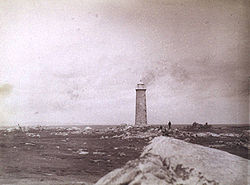 |
40.3116°S 147.8013°E | 1846 | 1931 | active | |
| Hells Gate Hell's Gates (Tasmania) Hells Gates is the name of the mouth of Macquarie Harbour on the West Coast of Tasmania. It is a notoriously shallow and dangerous channel entrance to the harbour. The actual channel is between Cape Sorell, Tasmania on the west and Entrance Island on the east... |
Bonnet Island Lighthouse | 42.2232°S 145.2219°E | 1892 | 1910 | active | ||
| Hells Gate Hell's Gates (Tasmania) Hells Gates is the name of the mouth of Macquarie Harbour on the West Coast of Tasmania. It is a notoriously shallow and dangerous channel entrance to the harbour. The actual channel is between Cape Sorell, Tasmania on the west and Entrance Island on the east... |
Entrance Island Lighthouse | 42.2108°S 145.2154°E | 1892 | 1910 | active | ||
| Highland Bluff (new) | 40.7386°S 145.2901°E | active | |||||
| Highland Bluff (old) | 40.7663°S 145.2985°E | 1924 | |||||
| Iron Pot Iron Pot Iron Pot is a small flat sandstone island with an area of 1.27 ha in south-eastern Australia. It is part of the Betsey Island Group, lying close to the south-eastern coast of Tasmania around the entrance to the Derwent River... |
Iron Pot Lighthouse | 43.0587°S 147.4172°E | 1832 | active | Tasmania's first lighthouse | ||
| Low Head | Low Head Lighthouse Low Head Lighthouse Low Head Lighthouse is located in Low Head, Tasmania, about north of George Town on the east side of the mouth of the Tamar River. It was the third lighthouse to be constructed in Australia, and it is also Australia's oldest continuously used pilot station... |
41.0553°S 146.7889°E | 1833 | 1995 | active | Tasmania's second lighthouse | |
| Low Head | Middle Channel Lighthouse | 41.0797°S 146.8074°E | 1882 | 1955 | active | ||
| Low Head | She Oak Point Lighthouse | 41.0777°S 146.8040°E | 1882 | 1955 | active | ||
| Maatsuyker Island Maatsuyker Island Maatsuyker Island is a lying close to the southern end of the south-western coast of Tasmania, Australia. It is part of the Maatsuyker Island Group which is included in the Southwest National Park, and the Tasmanian Wilderness World Heritage Site. It is the site of the Maatsuyker Island Lighthouse... |
Maatsuyker Island Lighthouse | 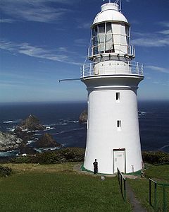 |
43.6570°S 146.2714°E | 1891 | 1996 | Last manned lighthouse; Australia's most southern; | |
| Mersey Bluff | 41.1587°S 146.3554°E | 1889 | 1920 | active | |||
| Point Home Lookout | Point Home Lookout Lighthouse | 42.5512°S 147.9537°E | 1971 | 1971 | active | ||
| Rocky Cape | 40.8545°S 145.5083°E | 1968 | 1968 | active | |||
| Round Hill Point | 41.0650°S 145.9618°E | 1923 | 1980 | active | |||
| Sandy Cape Sandy Cape Sandy Cape is the most northern point on Fraser Island off the coast of Queensland, Australia. The place was named by James Cook during his 1770 voyage up the eastern coast of Australia aboard the Endeavour... |
41.4217°S 144.7484°E | 1953 | active | ||||
| Swan Island Swan Island (Tasmania) Swan Island is a granite island, with an area of 239 ha , in south-eastern Australia. It is part of the Waterhouse Island Group, lying close to the north-eastern coast of Tasmania. Part of the island is privately owned and it contains an automated lighthouse, several houses and an airstrip. It... |
40.7277°S 148.1256°E | 1845 | 1985 | active | |||
| Table Cape | Table Cape Lighthouse | 40.9465°S 145.7290°E | 1888 | 1920 | active | ||
| Tasman Island Tasman Island Tasman Island is an oval island, with an area of 1.2 km2, in south-eastern Australia. It is part of the Tasman Island Group, lying close to the south-eastern coast of Tasmania around the Tasman Peninsula, and is in the Tasman National Park. It is a plateau surrounded by steep dolerite cliffs,... |
Tasman Island Lighthouse Tasman Island Lighthouse The Tasman Island Lighthouse is on Tasman Island off the coast of south-eastern Tasmania, Australia. It was one of the most isolated lighthouses in Australia. It was built in 1906, automated in 1976 and demanned in 1977. The island is now part of the Tasman National Park... |
43.2395°S 148.0051°E | 1906 | 1976 | active | ||
| West Point | 40.9428°S 144.6139°E | 1916 | 1982 | Destroyed |
Victoria
| Location | |Image | Aireys Inlet Aireys Inlet, Victoria Aireys Inlet is a small coastal inlet and town located on the Great Ocean Road, southwest of Melbourne, Victoria, Australia. Aireys Inlet is located between Anglesea and Lorne, and joined with Fairhaven to the west. At the 2006 census, Aireys Inlet had a population of 1,148.Many surfers holiday in... | Split Point Lighthouse Split Point Lighthouse Split Point Lighthouse is a lighthouse located in Aireys Inlet, a small town on the Great Ocean Road, Victoria, Australia.-History:Originally called Eagles Nest Point, the lighthouse was originally built in 1891. It was converted to automatic operation in 1919.The original British-made first order... |
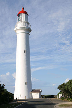 |
38.4680°S 144.1044°E | 1891 | 1919 | active |
|---|---|---|---|---|---|---|---|
| Cape Liptrap Cape Liptrap Cape Liptrap coastal park is located in south Gippsland, Victoria and is a peninsula that is the extension of the Hoddle Range that runs out to sea.... |
Cape Liptrap Lighthouse Cape Liptrap Lighthouse Cape Liptrap Lighthouse stands upon the rocky cliff top of Cape Liptrap peninsula, on a solitary part of the South Gippsland coastline. The lighthouse warns ships of the rocks in treacherous Bass Strait.-History:... |
38.9021°S 145.9167°E | 1913 | 1913 | active | ||
| Cape Nelson Cape Nelson State Park Cape Nelson State Park, near Portland on Victoria's southwest coast is a state park. Attractions include a clifftop walk and a visit to the Cape Nelson lighthouse. The lighthouse was completed in 1884 and today offers accommodation in the Light Station Keepers Cottages. Fauna include the Heath... |
Cape Nelson Lighthouse | 38.4310°S 141.5423°E | 1884 | 1995 | active | ||
| Cape Otway Cape Otway Cape Otway is a cape in south Victoria, Australia on the Great Ocean Road; much of the area is enclosed in the Otway National Park.-History:... |
Cape Otway Lighthouse | 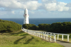 |
38.8568°S 143.5118°E | 1848 | 1994 | Replaced with a solar powered light tower | |
| Cape Schanck | Cape Schanck Lighthouse Cape Schanck Lighthouse The Cape Schanck lighthouse was built in 1859 as the second coastal lighthouse in Victoria. It is located on the southernmost tip of the Mornington Peninsula in Victoria, Australia. The tower was built from limestone, it is 21 metres tall... |
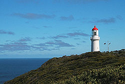 |
38.4927°S 144.8862°E | 1859 | active | ||
| Citadel Island Citadel Island Citadel Island is a small, rugged, granite island in the Glennie group of islands off the west coast of Wilsons Promontory, Victoria, Australia. It is the site of the first automatic acetylene powered lighthouse installed by Australia’s Commonwealth Lighthouse Service. There is no public access... |
Citadel Island Lighthouse | 39.1143°S 146.2367°E | 1913 | 1982 | Solar powered | ||
| Cliffy Island | Cliffy Island Lighthouse Cliffy Island Lighthouse The Cliffy Island Lighthouse is located atop Cliffy Island, a steep-sided island which is the summit of a granite submarine mountain in the Bass Strait. Cliffy Island is located about 32 kilometres diectly south of Port Albert, and roughly 38 kilometres to the northeast of Wilsons Promontory... |
38.9506°S 146.7056°E | 1884 | 1971 | active | Solar powered | |
| Gabo Island Gabo Island Gabo Island is a 154 ha island located off the coast of eastern Victoria, Australia, between Mallacoota and Cape Howe on the border with New South Wales. It is separated from the mainland by a 500 m wide channel; access is available by arranged flights and boats... |
Gabo Island Lighthouse | 37.5687°S 149.9169°E | 1853 | 1993 | active | Solar powered | |
| Gellibrand Shoal | Gellibrand Pile Light | 37.8785°S 144.9147°E | 1906 | 1976 | Destroyed | ||
| Griffiths Island | Griffiths Island Lighthouse | 38.3909°S 142.2552°E | 1853 | active | Wind powered | ||
| Lady Bay Lower | Lady Bay Lower Lighthouse | 38.3907°S 142.4854°E | 1854 | active | |||
| Lady Bay Upper | Lady Bay Upper Lighthouse | 38.3903°S 142.4854°E | 1859 | active | Not original site | ||
| McCrae McCrae, Victoria McCrae is a suburb in Melbourne, Victoria, Australia. Its Local Government Area is the Shire of Mornington Peninsula. McCrae is known for the McCrae Lighthouse... |
Eastern Lighthouse | 38.3483°S 144.9279°E | 1854 | 1994 | |||
| Point Hicks Point Hicks Point Hicks, formerly called Cape Everard, is a coastal headland on the eastern coast of Victoria, Australia, located within the Croajingolong National Park.- Name :... |
Point Hicks Lighthouse | 37.8018°S 149.2753°E | 1890 | active | |||
| Point Lonsdale Point Lonsdale, Victoria Point Lonsdale is a coastal township on the Bellarine Peninsula, near Queenscliff, Victoria, Australia, and included in the Borough of Queenscliffe. Point Lonsdale is also one of the headlands which, with Point Nepean, frame The Rip, the entrance to Port Phillip. The headland is dominated by the... |
Point Lonsdale Lighthouse Point Lonsdale Lighthouse Point Lonsdale Lighthouse, also known as the Point Lonsdale Signal Station, is close to the township of Point Lonsdale in the Borough of Queenscliffe, Victoria, Australia... |
38.2919°S 144.6139°E | 1863 | active | |||
| Portland Portland, Victoria The city of Portland is the oldest European settlement in what is now the state of Victoria, Australia. It is the main urban centre of the Shire of Glenelg. It is located on Portland Bay.-History:... |
Whaler's Bluff Lighthouse | 38.3373°S 141.6091°E | 1889 | active | |||
| Portland Portland, Victoria The city of Portland is the oldest European settlement in what is now the state of Victoria, Australia. It is the main urban centre of the Shire of Glenelg. It is located on Portland Bay.-History:... |
Portland Bay Lighthouse | 38.3542°S 141.6198°E | 1859 | 1889 | |||
| Port Melbourne Port Melbourne, Victoria Port Melbourne is a suburb of Melbourne, Victoria, Australia, 5 km southwest of Melbourne's central business district. Its Local Government areas are the cities of Port Phillip and Melbourne. At the 2006 Census, Port Melbourne had a population of 13,293.... |
Port Melbourne Front Light | 37.8417°S 144.9293°E | 1924 | ||||
| Port Melbourne Port Melbourne, Victoria Port Melbourne is a suburb of Melbourne, Victoria, Australia, 5 km southwest of Melbourne's central business district. Its Local Government areas are the cities of Port Phillip and Melbourne. At the 2006 Census, Port Melbourne had a population of 13,293.... |
Port Melbourne Rear Light | 37.8371°S 144.9294°E | 1924 | active | |||
| Port Phillip Port Phillip Port Phillip Port Phillip Port Phillip (also commonly referred to as Port Phillip Bay or (locally) just The Bay, is a large bay in southern Victoria, Australia; it is the location of Melbourne. Geographically, the bay covers and the shore stretches roughly . Although it is extremely shallow for... |
South Channel Pile Light | 38.3386°S 144.8186°E | 1874 | 1985 | relocated and reactivated | ||
| Port Phillip Port Phillip Port Phillip Port Phillip Port Phillip (also commonly referred to as Port Phillip Bay or (locally) just The Bay, is a large bay in southern Victoria, Australia; it is the location of Melbourne. Geographically, the bay covers and the shore stretches roughly . Although it is extremely shallow for... |
West Channel Pile Light West Channel Pile Light The West Channel Pile Light is a two-storey octagonal lighthouse in Port Phillip, Victoria, Australia. It was built in 1881, replacing a lightship installed in 1854, to mark the north-east end of the West Sand. The site is listed in the Victorian Heritage Register.... |
38.1927°S 144.7563°E | 1881 | active | |||
| Queenscliff Queenscliff, Victoria Queenscliff is a small town on the Bellarine Peninsula in southern Victoria, Australia, south of Swan Bay at the entrance to Port Phillip. It is the administrative centre for the Borough of Queenscliffe... |
Queenscliff High Light | 38.2715°S 144.6618°E | 1843 | active | Built of bluestone Bluestone Bluestone is a cultural or commercial name for a number of dimension or building stone varieties, including:*a feldspathic sandstone in the U.S. and Canada;*limestone in the Shenandoah Valley in the U.S... |
||
| Queenscliff Queenscliff, Victoria Queenscliff is a small town on the Bellarine Peninsula in southern Victoria, Australia, south of Swan Bay at the entrance to Port Phillip. It is the administrative centre for the Borough of Queenscliffe... |
Queenscliff Low Light Queenscliff Low Light The Queenscliff Low Light, also known as the Queenscliff White Lighthouse, is a lighthouse in the township of Queenscliff in the Borough of Queenscliffe, Victoria, Australia, at the eastern end of the Bellarine Peninsula... |
38.2737°S 144.6593°E | 1854 | active | Not original site | ||
| Williamstown Williamstown, Victoria Williamstown is a suburb in Melbourne, Victoria, Australia, 8 km south-west from Melbourne's central business district. Its Local Government Area is the City of Hobsons Bay. At the 2006 Census, Williamstown had a population of 12,733.... |
Williamstown Lighthouse Williamstown Lighthouse The Williamstown Lighthouse is situated at Gellibrand Point, in the Melbourne suburb of Williamstown. It was erected in 1852, and replaced earlier navigational aids established from the time of the first settlement in 1835. Built of local basalt, the unusual square plan form is the second oldest in... |
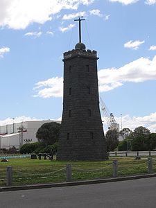 |
37.8668°S 144.9126°E | 1840 | 1934 | 1987 | Light deactivated; time ball active |
| Wilsons Promontory Wilsons Promontory Wilsons Promontory is a peninsula that forms the southernmost part of the Australian mainland and is located at . South Point at is the southernmost tip of Wilsons Promontory and hence of mainland Australia... |
Wilsons Promontory Lighthouse Wilsons Promontory Lighthouse Wilsons Promontory Lighthouse is situated on South East Point, Wilsons Promontory, Victoria, Australia. From its pont on the peninsula, it commands almost 360° views of Bass Strait. The Wilson's Promontory lighthouse is the southernmost lighthouse on mainland Australia. The walk from the nearest... |
39.1299°S 146.4242°E | 1859 | 1975 | active | Furthest south on mainland |
Western Australia
| Location | |Image | Adele Island Adele Island Adele Island is an island located in the Indian Ocean approximately North of Bardi off the Kimberley coast in Western Australia.-Description:The island is fish-hook shaped and has a length of and a width of and a total area of... | 15.5101°S 123.1574°E | 1951 | active | ||
|---|---|---|---|---|---|---|---|
| Arthur Head | Arthur Head Lighthouse | 32.0566°S 115.7400°E | 1851 | 1902 | Demolished | ||
| Bessieres Island Lighthouse | 21.6362°S 115.1118°E | 1913 | active | ||||
| Breaksea Island Breaksea Island (Western Australia) Breaksea Island is an island in King George Sound in the Great Southern of Western Australia and is South East of Albany. The island is a nature reserve and managed by Department of Environment and Conservation , it’s reserve number is 27614. The island is also registered as a national estate.... |
Breaksea Island Lighthouse | 35.0642°S 118.0573°E | 1858 | active | |||
| Bunbury Bunbury, Western Australia The port city of Bunbury is the third largest city in Western Australia after the State Capital Perth and Mandurah. It is situated south of Perth's central business district... |
Casuarina Point Lighthouse | 33.3191°S 115.6330°E | 1870 | active | |||
| Caffarelli Island | Caffarelli Island Lighthouse | 16.0461°S 123.2858°E | 1967 | active | |||
| Cape Bossut | Cape Bossut Lighthouse | 18.7137°S 121.6227°E | 1913 | c.1980 | demolished | ||
| Cape Leeuwin Cape Leeuwin Cape Leeuwin is the most south-westerly mainland point of the Australian Continent, in the state of Western Australia.A few small islands and rocks, the St Alouarn Islands, extend further to the south. The nearest settlement, north of the cape, is Augusta. South-east of Cape Leeuwin, the coast... |
Cape Leeuwin Lighthouse Cape Leeuwin Lighthouse The Cape Leeuwin Lighthouse is a lighthouse located on the headland of Cape Leeuwin, the most south-westerly point on the mainland of the Australian Continent, in the state of Western Australia.... |
34.3750°S 115.1362°E | 1896 | 1992 | active | ||
| Cape Leveque Cape Leveque Cape Leveque is the northernmost tip of the Dampier Peninsula in the Kimberley region of Western Australia. Cape Leveque is 240 km north of Broome, and is remote with few facilities. Nevertheless, the Cape's sandy beaches are attracting an increasing number of visitors.A 13-metre-tall... |
Cape Leveque Lighthouse | 16.3949°S 122.9282°E | 1911 | active | |||
| Cape Naturaliste Cape Naturaliste Cape Naturaliste is a headland in the south western region of Western Australia at the western edge of the Geographe Bay. It is the northernmost point of the Leeuwin-Naturaliste Ridge which was named after the cape... |
Cape Naturaliste Lighthouse | 34.3750°S 115.1362°E | 1873 | 1978 | active | struck by ball lightening in 1907 | |
| Carnarvon Carnarvon, Western Australia Carnarvon is a coastal town situated approximately 900 kilometres north of Perth, Western Australia. It lies at the mouth of the Gascoyne River on the Indian Ocean. The popular Shark Bay world heritage area lies to the south of the town and the Ningaloo Reef lies to the north... |
Babbage Island Lighthouse | 24.8760°S 113.6309°E | 1965 | active | |||
| Cave Point Cave Point Cave Point is a headland lying southwest of Barff Point on the east side of Cumberland East Bay, South Georgia. The name appears to be first used on a 1929 British Admiralty chart.... |
Cave Point Lighthouse | 35.1202°S 117.8990°E | 1976 | 1994 | |||
| Dirk Hartog Island Dirk Hartog Island Dirk Hartog Island is an island off the Gascoyne coast of Western Australia, within the Shark Bay World Heritage Area. It is about 80 kilometres long and between 3 and 15 kilometres wide and is Western Australia's largest and most western island. It covers an area of 620 square kilometres and is... |
Cape Inscription Lighthouse | 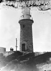 |
25.4818°S 112.9720°E | 1910 | 1917 | active | |
| East Island East Island (Lacepede Islands) East Island is an island within the Lacepede Islands group, which sits about 30 kilometres off the coast of the Dampier Peninsula in north-west Western Australia. It is located at . It is the site of the East Island Lighthouse... |
East Island Lighthouse East Island Lighthouse (Western Australia) East Island Lighthouse is a lighthouse located at 16º54'S 122º11'E, on East Island in the Lacepede Islands off the north west coast of Western Australia. First commissioned in 1984, it is a 23 metres high lattice metal tower, with the light's focal plane positioned at 33 metres above sea level. The... |
16.9024°S 122.1979°E | 1968 | active | |||
| Eclipse Island Eclipse Island (Western Australia) Eclipse Island is a barren island in Western Australia, near Albany, that has a lighthouse on it.The Eclipse Island Lighthouse was built in 1926 as a cylindrical tower made of concrete. Initially it was a manned station using kerosene as lantern fuel in combination with a first order Fresnel lens... |
Eclipse Island Lighthouse | 35.1821°S 117.8847°E | 1926 | 1976 | active | replaced with beacon | |
| Escape Island | Escape Island Lighthouse | 30.3334°S 114.9864°E | 1930 | active | |||
| Fremantle Fremantle, Western Australia Fremantle is a city in Western Australia, located at the mouth of the Swan River. Fremantle Harbour serves as the port of Perth, the state capital. Fremantle was the first area settled by the Swan River colonists in 1829... |
North Mole Lighthouse North Mole Lighthouse The North Mole Lighthouse began operation in 1906 at Fremantle, Western Australia. The occulting red light, emitted from a fixed lightsource at a focal plane height of 15 metres above sea level, is visible for 11 miles and indicates the western-most point of the harbour and its entrance... |
 |
32.0538°S 115.7245°E | 1906 | active | ||
| Fremantle Fremantle, Western Australia Fremantle is a city in Western Australia, located at the mouth of the Swan River. Fremantle Harbour serves as the port of Perth, the state capital. Fremantle was the first area settled by the Swan River colonists in 1829... |
South Mole Lighthouse | 32.0558°S 115.7325°E | 1903 | active | |||
| Gantheaume Point | Gantheaume Point Lighthouse | 17.9741°S 122.1775°E | 1905 | 1922 | active | ||
| Guilderton | Guilderton Lighthouse | 31.3394°S 115.4921°E | 1983 | 1983 | active | ||
| Hillarys Hillarys, Western Australia Hillarys is a northern coastal suburb of Perth, the capital city of Western Australia. Its Local Government Area is the City of Joondalup. It is part of the Whitfords precinct, and is located 21 km north-northwest of Perth's central business district via Mitchell Freeway and Hepburn... |
31.8235°S 115.7336°E | 1986 | active | ||||
| Jarman Island | Jarman Island Lighthouse | 20.6585°S 117.2174°E | 1888 | 1917 | 1985 | ||
| Legendre Island | Legendre Island Lighthouse | 20.3584°S 116.8427°E | 1927 | 1989 | active | ||
| Geraldton | Moore Point Lighthouse | 28.7827°S 114.5793°E | 1878 | 1985 | active | ||
| Mosman Park Mosman Park, Western Australia The Town of Mosman Park is a Local Government Area of Western Australia. It covers an area of approximately 4.3 km² in western metropolitan Perth, the capital of Western Australia and lies about 14 km southwest of the Perth CBD and 5 km from Fremantle.-History:The Buckland Hill Road... |
Buckland Hill Lighthouse | 32.01708°S 115.76097°E | c.1970 | active | |||
| North West Cape North West Cape North West Cape is a large peninsula of land in the north west coast of Western Australia. Cape Range runs down the spine of the peninsula and Ningaloo Reef runs along the western edge... |
North West Cape Light |  |
21.8156°S 114.1534°E | 1967 | active | on radio tower | |
| Pelsart Island | Pelsart Island Lighthouse | 28.9854°S 113.9623°E | 1974 | active | |||
| Point Cloates Point Cloates Point Cloates, Western Australia, is situated off North West Cape of Western Australia..Cloates island remained on marine charts and world maps until late in the 18th Century. The Guthrie world map published in 1785 maps out the voyages of Captain James Cook and shows "Cloats" Island in 97 degrees... |
Point Cloates Lighthouse | 22.7090°S 113.6808°E | 1910 | 1933 | 1936 | Ruins, heritage listed | |
| Point King | Point King Lighthouse | 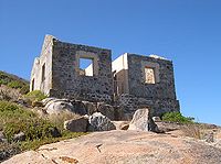 |
35.0354°S 117.9189°E | 1858 | 1911 | Ruins, heritage listed | |
| Quobba Point | Quobba Point Light | 24.4797°S 113.4181°E | 1950 | active | |||
| Rottnest Island Rottnest Island Rottnest Island is located off the coast of Western Australia, near Fremantle. It is called Wadjemup by the Noongar people, meaning "place across the water". The island is long, and at its widest point with a total land area of . It is classified as an A Class Reserve and is managed by the... |
Bathurst Lighthouse Bathurst Lighthouse Bathurst Lighthouse is one of two lighthouses on Rottnest Island, the other being Wadjemup Lighthouse. It is located on Bathurst Point, in the north east of the island, and was activated in 1900... |
31.9893°S 115.5406°E | 1900 | 1986 | active | ||
| Rottnest Island Rottnest Island Rottnest Island is located off the coast of Western Australia, near Fremantle. It is called Wadjemup by the Noongar people, meaning "place across the water". The island is long, and at its widest point with a total land area of . It is classified as an A Class Reserve and is managed by the... |
Wadjemup Lighthouse Wadjemup Lighthouse Completed in 1849, the original Wadjemup Lighthouse was Western Australia's first stone lighthouse and was built to provide a safer sailing passage for ships to Fremantle Port and the Swan River Colony.... |
32.0072°S 115.5041°E | 1851 | 1986 | active | Australia's first rotating beam lighthouse | |
| Woodman Point | Woodman Light Woodman Light Woodman Light, also known as Woodman Point Lighthouse, Gage Roads Lighthouse and Coogee Lighthouse, is a lighthouse in Western Australia. Located on Woodman Point in the City of Cockburn, it has been in continuous operation since 1902. It is high, and constructed of locally quarried limestone... |
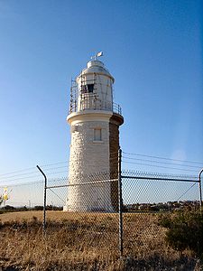 |
32.1309°S 115.7697°E | 1902 | 1955 | active |
External links
- Lighthouses Australia Inc. a non-profit organisation which aims to create a higher profile for Australian lighthouses.
- West Australian Lighthouse website