
Mosman Park, Western Australia
Encyclopedia
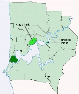
The Town of Mosman Park is a Local Government Area
of Western Australia
. It covers an area of approximately 4.3 km² in western metropolitan Perth
, the capital of Western Australia and lies about 14 km southwest of the Perth CBD
and 5 km from Fremantle
.
It was renamed Mosman Park in 1937, and on 1 July 1961, became a Shire following the enactment of the Local Government Act 1960. It became a town seven months later, and in 1997 the two wards were abolished.
is the only suburb within this municipality.
Local Government Areas of Western Australia
The Australian state of Western Australia is divided into 141 local government areas...
of Western Australia
Western Australia
Western Australia is a state of Australia, occupying the entire western third of the Australian continent. It is bounded by the Indian Ocean to the north and west, the Great Australian Bight and Indian Ocean to the south, the Northern Territory to the north-east and South Australia to the south-east...
. It covers an area of approximately 4.3 km² in western metropolitan Perth
Perth, Western Australia
Perth is the capital and largest city of the Australian state of Western Australia and the fourth most populous city in Australia. The Perth metropolitan area has an estimated population of almost 1,700,000....
, the capital of Western Australia and lies about 14 km southwest of the Perth CBD
Central business district
A central business district is the commercial and often geographic heart of a city. In North America this part of a city is commonly referred to as "downtown" or "city center"...
and 5 km from Fremantle
Fremantle, Western Australia
Fremantle is a city in Western Australia, located at the mouth of the Swan River. Fremantle Harbour serves as the port of Perth, the state capital. Fremantle was the first area settled by the Swan River colonists in 1829...
.
History
The Buckland Hill Road District was created on 6 October 1899. From July 1909 until October 1930, it was known as the Cottesloe Beach Road District.It was renamed Mosman Park in 1937, and on 1 July 1961, became a Shire following the enactment of the Local Government Act 1960. It became a town seven months later, and in 1997 the two wards were abolished.
Suburbs
Mosman ParkMosman Park, Western Australia
The Town of Mosman Park is a Local Government Area of Western Australia. It covers an area of approximately 4.3 km² in western metropolitan Perth, the capital of Western Australia and lies about 14 km southwest of the Perth CBD and 5 km from Fremantle.-History:The Buckland Hill Road...
is the only suburb within this municipality.
Population
| Year | Population |
|---|---|
| 1911 | 1,704 |
| 1921 | 3,221 |
| 1933 | 3,628 |
| 1947 | 5,442 |
| 1954 | 6,199 |
| 1961 | 5,862 |
| 1966 | 5,793 |
| 1971 | 7,199 |
| 1976 | 6,760 |
| 1981 | 7,018 |
| 1986 | 6,688 |
| 1991 | 7,254 |
| 1996 | 7,337 |
| 2001 | 7,732 |
| 2006 | 8,251 |