
Cooks Mills, Niagara Region, Ontario
Encyclopedia
Cooks Mills is a small community in the easternmost part of the city of Welland
in Ontario
, Canada
. It has been established, and is still centred, on a Welland River
tributary called Lyons Creek. It's almost entirely a bedroom community, as there are few companies located in the area.
and built a grist mill
on Lyon's Creek. (Today, one of the roads in Cooks Mills is called Yokom Road after them). Just before the War of 1812
, an Englishman
called Calvin Cook purchased the mill and added a tannery
, a sawmill
and a distillery
. The place known as Cook's Mills became a prominent community of the Crowland Township; some early maps call the location Crowland Village.
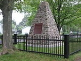
Towards the end of the War of 1812, a fire fight occurred at Cooks Mills, involving an American contingent sent to destroy flour and grain that might benefit the British. Early on the morning of October 19, 1814, the American picket at Misener's Hollow, just east of the mills, was attacked by soldiers of the Glengarry Light Infantry. The British force was supported by a 12-pound field cannon and Congreve rockets. The Americans succeeded in driving off the British, and then proceeded to throw the grain and flour into the mill pond.
Originally, Lyon's Creek headwaters were in the Wainfleet
Marsh. However, they were cut off by the construction of the Feeder Canal for the Welland Canal
. The creek was carried under the canal through a stone culvert
. Due to the construction, the water level in the marsh slowly receded. All the while, the culvert was being clogged up by debris. Eventually, the flow in Lyons Creek decreased to the extent when it was no longer able to turn the water wheels at Cook's Mills. The industries were closed and abandoned. Thus, the Canal, which contributed greatly to development of Welland, became an indirect cause of an economic recession for Cook's Mills. Later on, Welland beat out neighbouring communities in the running for the county seat. Cook's Mills found itself becoming a farming area as opposed to Welland's developing industry.
Over time, the apostrophes indicating the possessive in both Lyon's Creek and Cook's Mills were dropped following a trend in the region exemplified by St. Catharines
and St. Johns.
On January 1, 1961, the Crowland Township, including Cooks Mills, was incorporated into the City of Welland.
By the time of construction of the Welland By-Pass in 1967-1973, the original headwaters in the Wainfleet Marsh have all but disappeared, and most of what flow there was in the creek was coming from an earlier tributary called Indian Creek by some maps. This made Lyons Creek somewhat U-shaped, as Indian Creek flowed west before joining the original Lyons Creek. During the By-Pass construction, the creek was cut into three parts, and now what was once Indian Creek flows into the canal (photo). A couple kilometres north, Lyons Creek is fed directly from the canal (photo). The middle part of the creek dried up and much of its bed was torn up during the construction of approaches to the Townline Tunnel.
In a recent development, a study on the pollutants in the Niagara River
done in 2000 found the organic pollutants polychlorinated biphenyl
s (PCBs) to be present in the Lyons Creek. The Ontario Ministry of the Environment is presently investigating the source of PCBs and possible remedial actions to deal with contaminated sediment.
channel separates Cooks Mills from the main urbanized area of City of Welland. The most direct ways of crossing the channel are the Main Street and Townline
Tunnels.
Built-up areas in Cooks Mills are located close to the roads; the rest of the area consists mainly of wooded lots and fields. The Niagara Road 27, commonly known as Schisler Road, linking Welland and Niagara Falls
, runs to the north of the centre of the community, and Highway 140
runs to the west, while Montrose Road runs to the east, and Netherby Road runs to the south.
The main area of Welland
is located to the west. To the east is Niagara Falls
, to the north is Thorold
, and to the south is Port Colborne
.
Welland, Ontario
Welland is a city in the Regional Municipality of Niagara in Southern Ontario, Canada.The city has been traditionally known as the place where rails and water meet, referring to the railways from Buffalo to Toronto and Southwestern Ontario, and the waterways of Welland Canal and Welland River,...
in Ontario
Ontario
Ontario is a province of Canada, located in east-central Canada. It is Canada's most populous province and second largest in total area. It is home to the nation's most populous city, Toronto, and the nation's capital, Ottawa....
, Canada
Canada
Canada is a North American country consisting of ten provinces and three territories. Located in the northern part of the continent, it extends from the Atlantic Ocean in the east to the Pacific Ocean in the west, and northward into the Arctic Ocean...
. It has been established, and is still centred, on a Welland River
Welland River
The Welland River is a river in the Niagara Region of southern Ontario which flows from its headwaters south of Hamilton, Ontario to empty into the Niagara River near the city of Niagara Falls, Ontario. It drains an area of 880 km²....
tributary called Lyons Creek. It's almost entirely a bedroom community, as there are few companies located in the area.
History
The community actually predates the establishment of what is now downtown Welland. In 1799, when present-day Welland was but a couple of farms, the Yokom family came from PennsylvaniaPennsylvania
The Commonwealth of Pennsylvania is a U.S. state that is located in the Northeastern and Mid-Atlantic regions of the United States. The state borders Delaware and Maryland to the south, West Virginia to the southwest, Ohio to the west, New York and Ontario, Canada, to the north, and New Jersey to...
and built a grist mill
Gristmill
The terms gristmill or grist mill can refer either to a building in which grain is ground into flour, or to the grinding mechanism itself.- Early history :...
on Lyon's Creek. (Today, one of the roads in Cooks Mills is called Yokom Road after them). Just before the War of 1812
War of 1812
The War of 1812 was a military conflict fought between the forces of the United States of America and those of the British Empire. The Americans declared war in 1812 for several reasons, including trade restrictions because of Britain's ongoing war with France, impressment of American merchant...
, an Englishman
English people
The English are a nation and ethnic group native to England, who speak English. The English identity is of early mediaeval origin, when they were known in Old English as the Anglecynn. England is now a country of the United Kingdom, and the majority of English people in England are British Citizens...
called Calvin Cook purchased the mill and added a tannery
Tanning
Tanning is the making of leather from the skins of animals which does not easily decompose. Traditionally, tanning used tannin, an acidic chemical compound from which the tanning process draws its name . Coloring may occur during tanning...
, a sawmill
Sawmill
A sawmill is a facility where logs are cut into boards.-Sawmill process:A sawmill's basic operation is much like those of hundreds of years ago; a log enters on one end and dimensional lumber exits on the other end....
and a distillery
Distillation
Distillation is a method of separating mixtures based on differences in volatilities of components in a boiling liquid mixture. Distillation is a unit operation, or a physical separation process, and not a chemical reaction....
. The place known as Cook's Mills became a prominent community of the Crowland Township; some early maps call the location Crowland Village.
Towards the end of the War of 1812, a fire fight occurred at Cooks Mills, involving an American contingent sent to destroy flour and grain that might benefit the British. Early on the morning of October 19, 1814, the American picket at Misener's Hollow, just east of the mills, was attacked by soldiers of the Glengarry Light Infantry. The British force was supported by a 12-pound field cannon and Congreve rockets. The Americans succeeded in driving off the British, and then proceeded to throw the grain and flour into the mill pond.
Originally, Lyon's Creek headwaters were in the Wainfleet
Wainfleet, Ontario
Wainfleet is a rural township in southern Niagara Region, Ontario, Canada.There is a small and growing tourist industry, near and on Lake Erie at the southern area of Wainfleet called Long Beach...
Marsh. However, they were cut off by the construction of the Feeder Canal for the Welland Canal
Welland Canal
The Welland Canal is a ship canal in Canada that extends from Port Weller, Ontario, on Lake Ontario, to Port Colborne, Ontario, on Lake Erie. As a part of the St...
. The creek was carried under the canal through a stone culvert
Culvert
A culvert is a device used to channel water. It may be used to allow water to pass underneath a road, railway, or embankment. Culverts can be made of many different materials; steel, polyvinyl chloride and concrete are the most common...
. Due to the construction, the water level in the marsh slowly receded. All the while, the culvert was being clogged up by debris. Eventually, the flow in Lyons Creek decreased to the extent when it was no longer able to turn the water wheels at Cook's Mills. The industries were closed and abandoned. Thus, the Canal, which contributed greatly to development of Welland, became an indirect cause of an economic recession for Cook's Mills. Later on, Welland beat out neighbouring communities in the running for the county seat. Cook's Mills found itself becoming a farming area as opposed to Welland's developing industry.
Over time, the apostrophes indicating the possessive in both Lyon's Creek and Cook's Mills were dropped following a trend in the region exemplified by St. Catharines
St. Catharines, Ontario
St. Catharines is the largest city in Canada's Niagara Region and the sixth largest urban area in Ontario, Canada, with 97.11 square kilometres of land...
and St. Johns.
On January 1, 1961, the Crowland Township, including Cooks Mills, was incorporated into the City of Welland.
By the time of construction of the Welland By-Pass in 1967-1973, the original headwaters in the Wainfleet Marsh have all but disappeared, and most of what flow there was in the creek was coming from an earlier tributary called Indian Creek by some maps. This made Lyons Creek somewhat U-shaped, as Indian Creek flowed west before joining the original Lyons Creek. During the By-Pass construction, the creek was cut into three parts, and now what was once Indian Creek flows into the canal (photo). A couple kilometres north, Lyons Creek is fed directly from the canal (photo). The middle part of the creek dried up and much of its bed was torn up during the construction of approaches to the Townline Tunnel.
In a recent development, a study on the pollutants in the Niagara River
Niagara River
The Niagara River flows north from Lake Erie to Lake Ontario. It forms part of the border between the Province of Ontario in Canada and New York State in the United States. There are differing theories as to the origin of the name of the river...
done in 2000 found the organic pollutants polychlorinated biphenyl
Polychlorinated biphenyl
Polychlorinated biphenyls are a class of organic compounds with 2 to 10 chlorine atoms attached to biphenyl, which is a molecule composed of two benzene rings. The chemical formula for PCBs is C12H10-xClx...
s (PCBs) to be present in the Lyons Creek. The Ontario Ministry of the Environment is presently investigating the source of PCBs and possible remedial actions to deal with contaminated sediment.
Geography
As noted previously, the Welland By-PassWelland By-Pass
The Welland By-pass, completed in 1973, was a massive construction project on the Welland Canal in Ontario, Canada.A new channel long was constructed, providing a shorter, more direct alignment between Port Robinson and Port Colborne and by-passing downtown Welland...
channel separates Cooks Mills from the main urbanized area of City of Welland. The most direct ways of crossing the channel are the Main Street and Townline
Townline Tunnel
The Townline Tunnel, located in Welland, Ontario, Canada, is an underwater tunnel, carrying Highway 58A as well as the Canadian Pacific Railway under the Welland Canal. The "A" suffix is a misnomer since it is more of a connector than an alternative route. Highway 58A is a two-lane freeway in its...
Tunnels.
Built-up areas in Cooks Mills are located close to the roads; the rest of the area consists mainly of wooded lots and fields. The Niagara Road 27, commonly known as Schisler Road, linking Welland and Niagara Falls
Niagara Falls, Ontario
Niagara Falls is a Canadian city on the Niagara River in the Golden Horseshoe region of Southern Ontario. The municipality was incorporated on June 12, 1903...
, runs to the north of the centre of the community, and Highway 140
Highway 140 (Ontario)
King's Highway 140, commonly referred to as Highway 140, is a provincially maintained highway in the Canadian province of Ontario. The highway connects Port Colborne near Lake Erie with Highway 406 in Welland, via the Main Street Tunnel...
runs to the west, while Montrose Road runs to the east, and Netherby Road runs to the south.
The main area of Welland
Welland, Ontario
Welland is a city in the Regional Municipality of Niagara in Southern Ontario, Canada.The city has been traditionally known as the place where rails and water meet, referring to the railways from Buffalo to Toronto and Southwestern Ontario, and the waterways of Welland Canal and Welland River,...
is located to the west. To the east is Niagara Falls
Niagara Falls, Ontario
Niagara Falls is a Canadian city on the Niagara River in the Golden Horseshoe region of Southern Ontario. The municipality was incorporated on June 12, 1903...
, to the north is Thorold
Thorold, Ontario
Thorold is a city in Ontario, Canada, located on the Niagara Escarpment. It is also the seat of the Regional Municipality of Niagara....
, and to the south is Port Colborne
Port Colborne, Ontario
Port Colborne is a city on Lake Erie, at the southern end of the Welland Canal, in the Niagara Region of southern Ontario, Canada...
.
External links
- Cooks Mills in Google Satellite Maps. Lyons Creek is visible flowing from west to east just south of Lyons Creek Road
- Niagara Rails' Railway Maps has maps outlining the By-Pass project, including the Cooks Mills section
- The Ontario Ministry of the Environment study of Niagara River (PDFPortable Document FormatPortable Document Format is an open standard for document exchange. This file format, created by Adobe Systems in 1993, is used for representing documents in a manner independent of application software, hardware, and operating systems....
format)
External links
- Cooks Mills at Geographical Names of Canada