

National Scenic Byway
Encyclopedia

United States Department of Transportation
The United States Department of Transportation is a federal Cabinet department of the United States government concerned with transportation. It was established by an act of Congress on October 15, 1966, and began operation on April 1, 1967...
for its archeological, cultural, historic, natural, recreational, and/or scenic qualities. The program was established by Congress in 1991 to preserve and protect the nation's scenic but often less-traveled roads and promote tourism and economic development. The program is administered by the Federal Highway Administration
Federal Highway Administration
The Federal Highway Administration is a division of the United States Department of Transportation that specializes in highway transportation. The agency's major activities are grouped into two "programs," the Federal-aid Highway Program and the Federal Lands Highway Program...
.
The most scenic of the roads in the program are designated All-American Roads. The designation means they have features that do not exist elsewhere in the United States and are scenic enough to be tourist destinations unto themselves. As of November 2010, there are 120 National Scenic Byways and 31 All-American Roads, located in 46 states (all except Hawaii, Nebraska, Rhode Island, and Texas).
Requirements
National Scenic Byways must go through a nomination procedure, and must already be designated as a state scenic byway in order to be nominated (However, roads that meet all criteria and requirements for National designation but not State or designation criteria may be considered for national designation on a case-by-case basis).To be considered for designation as a National Scenic Byway "a road or highway must significantly meet at least one of the six scenic byways intrinsic qualities". To be designated as an All-American Road, a road must meet at least two of the six qualities. The qualities are:
- Scenic Quality is the heightened visual experience derived from the view of natural and manmade elements of the visual environment of the scenic byway corridor. The characteristics of the landscape are strikingly distinct and offer a pleasing and most memorable visual experience.
- Natural Quality applies to those features in the visual environment that are in a relatively undisturbed state. These features predate the arrival of human populations and may include geological formations, fossils, landform, water bodies, vegetation, and wildlife. There may be evidence of human activity, but the natural features reveal minimal disturbances.
- Historic Quality encompasses legacies of the past that are distinctly associated with physical elements of the landscape, whether natural or manmade, that are of such historic significance that they educate the viewer and stir an appreciation for the past. The historic elements reflect the actions of people and may include buildings, settlement patterns, and other examples of human activity.
- Cultural Quality is evidence and expressions of the customs or traditions of a distinct group of people. Cultural features include, but are not limited to, crafts, music, dance, rituals, festivals, speech, food, special events, or vernacular architecture.
- Archeological Quality involves those characteristics of the scenic byways corridor that are physical evidence of historic or prehistoric human life or activity. The scenic byway corridor's archeological interest, as identified through ruins, artifacts, structural remains, and other physical evidence have scientific significance that educate the viewer and stir an appreciation for the past.
- Recreational Quality involves outdoor recreational activities directly association with and dependent upon the natural and cultural elements of the corridor's landscape. The recreational activities provide opportunities for active and passive recreational experiences. They include, but are not limited to, downhill skiing, rafting, boating, fishing, and hiking. Driving the road itself may qualify as a pleasurable recreational experience. The recreational activities may be seasonal, but the quality and importance of the recreational activities as seasonal operations must be well recognized.
A "corridor management plan" must also be developed, with community involvement, and the plan "should provide for the conservation and enhancement of the byway's intrinsic qualities as well as the promotion of tourism and economic development". The plan includes, but is not limited to:
- A map identifying the corridor boundaries and the location of intrinsic qualities and different land uses within the corridor.
- A strategy for maintaining and enhancing those intrinsic qualities.
- A strategy describing how existing development might be enhanced and new development might be accommodated while still preserving the intrinsic qualities of the corridor.
- A general review of the road's or highway's safety and accident record to identify any correctable faults in highway design, maintenance, or operation.
- A signage plan that demonstrates how the State will insure and make the number and placement of signs more supportive of the visitor experience.
- A narrative describing how the National Scenic Byway will be positioned for marketing.
Corridor management plans for All-American Roads must also include:
- A narrative on how the All-American Road would be promoted, interpreted, and marketed in order to attract travelers, especially those from other countries.
- A plan to encourage the accommodation of increased tourism, if this is projected. Some demonstration that the roadway, lodging and dining facilities, roadside rest areas, and other tourist necessities will be adequate for the number of visitors induced by the byway's designation as an All-American Road.
- A plan for addressing multi-lingual information needs.
The final step is when the highway (or highways) is approved for designation by the Secretary of Transportation.
List of byways
| Type | Name | Image | States | Description | Designated |
|---|---|---|---|---|---|
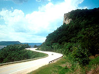
| NSB | A1A Scenic and Historic Coastal Byway | 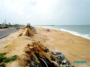 |
Florida | Follows Atlantic coast Atlantic Coast The Atlantic Coast is any coast fronting the Atlantic Ocean. The term differentiates the coasts of countries or continents with coastlines on more than one body of water, such as North America, South America, Africa and Europe.-See also:*Indian Ocean... barrier island Barrier island Barrier islands, a coastal landform and a type of barrier system, are relatively narrow strips of sand that parallel the mainland coast. They usually occur in chains, consisting of anything from a few islands to more than a dozen... s |
2002-06-13 |
| AAR | Acadia Byway | Maine | Scenic drive past mountains on the Maine shore Acadia National Park Acadia National Park is a National Park located in the U.S. state of Maine. It reserves much of Mount Desert Island, and associated smaller islands, off the Atlantic coast... |
2000-06-15 (AAR) | |
| NSB | Alabama’s Coastal Connection | Alabama | Scenic drive along the Gulf coast | 2009-10-16 | |
| AAR | Alaska's Marine Highway | 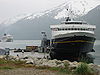 |
Alaska | Ferry system connecting Alaskan coastal communities | 2002-06-13 (NSB) 2005-09-22 (AAR) |
| NSB | Amish Country | Ohio | Historic drive through eastern Ohio's Amish Amish The Amish , sometimes referred to as Amish Mennonites, are a group of Christian church fellowships that form a subgroup of the Mennonite churches... communities |
2002-06-13 | |
| NSB | Arroyo Seco Parkway Scenic Byway | 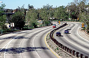 |
California | The first freeway in the Western U.S., connecting Los Angeles and Pasadena through the Arroyo Seco Arroyo Seco (Los Angeles County) The Arroyo Seco, meaning "dry stream" in Spanish, is a seasonal river, canyon, watershed, and cultural area in Los Angeles County, California, United States. The Arroyo Seco has been called the most celebrated canyon in Southern California.-River course:... |
2002-06-13 |
| NSB | Ashley River Road | South Carolina | Traverses a historic district along the Ashley River Ashley River (South Carolina) The Ashley River is a blackwater / tidal river in South Carolina, rising from the Wassamassaw and Great Cypress Swamps in western Berkeley County. It consolidates its main channel about five miles west of Summerville, widening into a tidal estuary just south of Fort Dorchester... |
2000-06-15 | |
| AAR | Beartooth Scenic Byway | 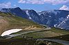 |
Montana, Wyoming | Scenic northeastern entrance to Yellowstone National Park Yellowstone National Park Yellowstone National Park, established by the U.S. Congress and signed into law by President Ulysses S. Grant on March 1, 1872, is a national park located primarily in the U.S. state of Wyoming, although it also extends into Montana and Idaho... |
2000-06-15 (AAR) 2002-06-13 (extended in Montana) |
| NSB | Billy the Kid Trail | New Mexico | Scenic drive through rugged mountains | 1998-06-09 | |
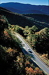
| AAR | Blue Ridge Parkway Blue Ridge Parkway The Blue Ridge Parkway is a National Parkway and All-American Road in the United States, noted for its scenic beauty. It runs for 469 miles , mostly along the famous Blue Ridge, a major mountain chain that is part of the Appalachian Mountains... |
 |
North Carolina, Virginia | Scenic drive through the Blue Ridge Mountains Blue Ridge Mountains The Blue Ridge Mountains are a physiographic province of the larger Appalachian Mountains range. This province consists of northern and southern physiographic regions, which divide near the Roanoke River gap. The mountain range is located in the eastern United States, starting at its southern-most... |
1996-09-19 (AAR, North Carolina) 2005-09-22 (AAR, Virginia) |
| NSB | Brandywine Valley Scenic Byway Brandywine Valley Scenic Byway The Brandywine Valley Scenic Byway is a National Scenic Byway in New Castle County, Delaware in the Brandywine valley. The route of the byway is along Delaware Route 52 from Wilmington north to the Pennsylvania border, and Delaware Route 100 from its intersection with Route 52, north to the... |
Delaware | Historic rolling hills of northern Delaware | 2005-09-22 | |
| NSB | CanalWay Ohio Scenic Byway | Ohio | Historic drive along the Ohio and Erie Canal Ohio and Erie Canal The Ohio Canal or Ohio and Erie Canal was a canal constructed in the 1820s and early 1830s. It connected Akron, Summit County, with the Cuyahoga River near its mouth on Lake Erie in Cleveland, Cuyahoga County, and a few years later, with the Ohio River near Portsmouth, Scioto County, and then... |
2000-06-15 | |
| NSB | Cascade Lakes Scenic Byway Cascade Lakes Scenic Byway The Cascades Lakes Scenic Byway is a National Scenic Byway in central Oregon in the United States. It runs for in the rugged country of Deschutes and Klamath counties on the east side of the Cascade Range. It offers particularly good views of Mount Bachelor and provides access to many... |
Oregon | Connects lakes and forests of central Oregon | 1998-06-09 | |
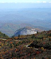
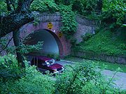
| NSB | Catoctin Mountain Scenic Byway | 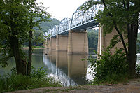 |
Maryland | Scenic and historic drive through the Catoctin Mountains | 2005-09-22 |
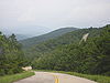
| NSB | Cherohala Skyway Cherohala Skyway The Cherohala Skyway is a National Scenic Byway that connects Tellico Plains, Tennessee, to Robbinsville, North Carolina in the southeastern United States. Its name is a portmanteau of Cherokee and Nantahala, the two national forests through which it passes... |
 |
North Carolina, Tennessee | Ridgetop drive in the Appalachians | 1996-09-19 (Tennessee) 1998-06-09 (North Carolina) |
| NSB | Cherokee Foothills Scenic Highway | South Carolina | Scenic drive along the Blue Ridge Escarpment Blue Ridge Mountains The Blue Ridge Mountains are a physiographic province of the larger Appalachian Mountains range. This province consists of northern and southern physiographic regions, which divide near the Roanoke River gap. The mountain range is located in the eastern United States, starting at its southern-most... |
1998-06-09 | |
| NSB | Chesapeake Country Scenic Byway Chesapeake Country Scenic Byway The Chesapeake Country Scenic Byway is a national scenic byway on Maryland's Eastern Shore region. The byway runs from Stevensville, near the Chesapeake Bay Bridge to the Chesapeake and Delaware Canal in Chesapeake City and has a spur to Eastern Neck Island in the Chester River... |
Maryland | Traverses the Eastern Shore of the Chesapeake Bay Chesapeake Bay The Chesapeake Bay is the largest estuary in the United States. It lies off the Atlantic Ocean, surrounded by Maryland and Virginia. The Chesapeake Bay's drainage basin covers in the District of Columbia and parts of six states: New York, Pennsylvania, Delaware, Maryland, Virginia, and West... |
2002-06-13 | |
| AAR | Chinook Scenic Byway | 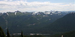 |
Washington | Scenic drive with views of Mount Rainier Mount Rainier Mount Rainier is a massive stratovolcano located southeast of Seattle in the state of Washington, United States. It is the most topographically prominent mountain in the contiguous United States and the Cascade Volcanic Arc, with a summit elevation of . Mt. Rainier is considered one of the most... |
1998-06-09 (AAR) |
| NSB | Coal Heritage Trail | West Virginia | Historic drive through coal-producing areas of southwestern West Virginia | 1998-06-09 | |
| AAR | Colonial Parkway Colonial Parkway Colonial Parkway is a scenic 23-mile parkway linking the three popular attractions of Virginia's Historic Triangle of colonial-era communities, Jamestown, Williamsburg, and Yorktown... |
 |
Virginia | Landscaped parkway through historic areas | 2005-09-22 (AAR) |
| NSB | Colorado River Headwaters Byway | Colorado | Descent along the Colorado River Colorado River The Colorado River , is a river in the Southwestern United States and northwestern Mexico, approximately long, draining a part of the arid regions on the western slope of the Rocky Mountains. The watershed of the Colorado River covers in parts of seven U.S. states and two Mexican states... through canyons |
2005-09-22 | |
| NSB | Connecticut River Byway | Massachusetts, New Hampshire, Vermont | Scenic drive on both sides of New England New England New England is a region in the northeastern corner of the United States consisting of the six states of Maine, New Hampshire, Vermont, Massachusetts, Rhode Island, and Connecticut... 's longest river Connecticut River The Connecticut River is the largest and longest river in New England, and also an American Heritage River. It flows roughly south, starting from the Fourth Connecticut Lake in New Hampshire. After flowing through the remaining Connecticut Lakes and Lake Francis, it defines the border between the... |
2005-09-22 | |
| NSB | Connecticut State Route 169 | 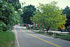 |
Connecticut | One of the last unspoiled areas in New England New England New England is a region in the northeastern corner of the United States consisting of the six states of Maine, New Hampshire, Vermont, Massachusetts, Rhode Island, and Connecticut... |
1996-09-19 |
| NSB | Copper Country Trail | Michigan | Traverses an area developed for copper mining | 2005-09-22 | |
| NSB | Coronado Trail Scenic Byway | Arizona | Scenic drive through high deserts and forests | 2005-09-22 | |
| NSB | Coulee Corridor Scenic Byway | Washington | Passes through coulee Coulee Coulee is applied rather loosely to different landforms, all of which refer to a kind of valley or drainage zone.The word coulee comes from the Canadian French coulée, from French word couler meaning "to flow".... s formed by receding glaciers |
2005-09-22 | |
| NSB | Country Music Highway | Kentucky | Historic drive through eastern Kentucky | 2002-06-13 | |
| AAR | Creole Nature Trail Creole Nature Trail The Creole Nature Trail, part of Louisiana's Outback, is an All-American Road comprising more than of highway including portions of Louisiana state highways 14, 82, 27, 384, and 385 in southwest Louisiana. The Creole Nature Trail was one of the first National Scenic Byways designated by the U.S.... |
Louisiana | Marsh Marsh In geography, a marsh, or morass, is a type of wetland that is subject to frequent or continuous flood. Typically the water is shallow and features grasses, rushes, reeds, typhas, sedges, other herbaceous plants, and moss.... es and prairie Prairie Prairies are considered part of the temperate grasslands, savannas, and shrublands biome by ecologists, based on similar temperate climates, moderate rainfall, and grasses, herbs, and shrubs, rather than trees, as the dominant vegetation type... s of southern Louisiana |
1996-09-19 (NSB) 2002-06-13 (AAR) |
|
| NSB | Crowley's Ridge Parkway Crowley's Ridge Parkway Crowley's Ridge Parkway is a road that runs in Arkansas and Missouri along Crowley's Ridge and Ozark-St. Francis National Forest. The route was designated a state scenic byway in Arkansas in 1997 and a National Scenic Byway in 1998... |
Arkansas, Missouri | Scenic drive along Crowley's Ridge Crowley's Ridge Crowley's Ridge is an unusual geological formation that rises 250 to above the alluvial plain of the Mississippi embayment in a line from southeastern Missouri to the Mississippi River near Helena, Arkansas. It is the most prominent feature in the Mississippi Alluvial Plain between Cape... , with a diversity of plant species |
1998-06-09 (Arkansas) 2000-06-15 (Missouri) |
|
| NSB | Death Valley Scenic Byway | 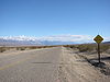 |
California | Scenic drive through the lowest place in North America, surrounded by mountains | 1998-06-09 2002-06-13 (extended) |
| NSB | Delaware River Scenic Byway | New Jersey | Scenic and historic drive along the Delaware River in central New Jersey | 2009-10-16 | |
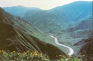
| NSB | Dinosaur Diamond Prehistoric Highway | 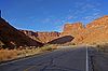 |
Colorado, Utah | Passes many dinosaur Dinosaur Dinosaurs are a diverse group of animals of the clade and superorder Dinosauria. They were the dominant terrestrial vertebrates for over 160 million years, from the late Triassic period until the end of the Cretaceous , when the Cretaceous–Paleogene extinction event led to the extinction of... fossil Fossil Fossils are the preserved remains or traces of animals , plants, and other organisms from the remote past... sites |
2002-06-13 |
| NSB | East Tennessee Crossing | Tennessee | 2009-10-16 | ||
| NSB | Ebbetts Pass Scenic Byway | 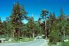 |
California | Crossing of the Sierra Nevada Sierra Nevada (US) The Sierra Nevada is a mountain range in the U.S. states of California and Nevada, between the California Central Valley and the Basin and Range Province. The Sierra runs north-to-south, and is approximately across east-to-west... past giant sequoia groves |
2005-09-22 |
| NSB | Edge of the Wilderness | Minnesota | Scenic drive through forests and hills of northern Minnesota | 1996-09-19 | |
| NSB | El Camino Real | New Mexico | Historic north–south route through central New Mexico | 1998-06-09 2005-09-22 (extended) |
|
| NSB | The Energy Loop: Huntington/Eccles Canyons Scenic Byway The Energy Loop: Huntington/Eccles Canyons Scenic Byway The Energy Loop: Huntington/Eccles Canyons Scenic Byway is a National Scenic Byway in the state of Utah. It spans approximately as it travels from Fairview through the Manti-La Sal National Forest southeast to Huntington via Huntington Canyon, and northeast to near Colton via Eccles Canyon.-Route... |
Utah | Historic drive past coal mining operations | 2000-06-15 | |
| NSB | Flaming Gorge-Uintas Scenic Byway Flaming Gorge-Uintas Scenic Byway The Flaming Gorge - Uintas Scenic Byway is a National Scenic Byway in the state of Utah. It spans approximately as it travels from Vernal, Utah northward through the Ashley National Forest and the Uintah Mountains to the area around Flaming Gorge National Recreation Area in the northeastern corner... |
Utah | Scenic drive through the Uinta Mountains Uinta Mountains The Uinta Mountains are a high chain of mountains in northeastern Utah and extreme northwestern Colorado in the United States. A subrange of the Rocky Mountains, they are unusual for being the highest range in the contiguous United States running east to west, and lie approximately east of Salt... |
1998-06-09 | |
| NSB | Flint Hills Scenic Byway |  |
Kansas | Scenic drive through Great Plains Great Plains The Great Plains are a broad expanse of flat land, much of it covered in prairie, steppe and grassland, which lies west of the Mississippi River and east of the Rocky Mountains in the United States and Canada. This area covers parts of the U.S... grassland Grassland Grasslands are areas where the vegetation is dominated by grasses and other herbaceous plants . However, sedge and rush families can also be found. Grasslands occur naturally on all continents except Antarctica... s |
2005-09-22 |
| NSB | Forest Heritage National Scenic Byway | North Carolina | 2009-10-16 | ||
| NSB | Frontier Pathways Scenic and Historic Byway | Colorado | Follows the paths of early explorers through the Sangre de Cristo Mountains Sangre de Cristo Mountains The Sangre de Cristo Mountains are the southernmost subrange of the Rocky Mountains. They are located in southern Colorado and northern New Mexico in the United States... |
1998-06-09 | |
| AAR | George Washington Memorial Parkway George Washington Memorial Parkway The George Washington Memorial Parkway, known to local motorists simply as the "G.W. Parkway", is a parkway maintained by the U.S. National Park Service. It is located mostly in Northern Virginia, although a short section northwest of the Arlington Memorial Bridge passes over Columbia Island,... |
 |
Virginia | Landscaped parkway along the Potomac River Potomac River The Potomac River flows into the Chesapeake Bay, located along the mid-Atlantic coast of the United States. The river is approximately long, with a drainage area of about 14,700 square miles... |
2005-09-22 (AAR) |
| NSB | Geronimo Trail Scenic Byway | New Mexico | Scenic drive past mountains and lakes of southwestern New Mexico | 2005-09-22 | |
| NSB | Glenn Highway Glenn Highway -References:* Pasch, A. D., K. C. May. 2001. Taphonomy and paleoenvironment of hadrosaur from the Matanuska Formation in South-Central Alaska. In: Mesozioc Vertebrate Life. Ed.s Tanke, D. H., Carpenter, K., Skrepnick, M. W. Indiana University Press. Pages 219-236.-External links:**... |
Alaska | Terrain shaped by receding glaciers | 2002-06-13 | |
| NSB | Gold Belt Tour Scenic and Historic Byway |  |
Colorado | Follows stage and rail routes to historic gold mining locations | 2000-06-15 |
| NSB | Grand Mesa Scenic and Historic Byway Grand Mesa Scenic and Historic Byway Grand Mesa Scenic and Historic Byway, also known at the Grand Mesa National Scenic and Historic Byway, runs North from Cedaredge along Highway 65, to the top of the Grand Mesa at more than 10,000 feet . It also includes Land's End Road to the Land's End Observatory from Highway 65... |
Colorado | Climbs to Grand Mesa Grand Mesa The Grand Mesa is a large mesa in western Colorado in the United States. It has an area of about and stretches for about east of Grand Junction between the Colorado River and the Gunnison River, its tributary to the south. The north side of the mesa is drained largely by Plateau Creek, a... |
1996-09-19 | |
| NSB | Grand Rounds Scenic Byway Grand Rounds Scenic Byway The Grand Rounds Scenic Byway is a linked series of park areas in Minneapolis, Minnesota that takes a roughly circular path through the city. The corridors include roads for automobile traffic plus paths for pedestrians and bicycles, and extend slightly into neighboring cities... |
 |
Minnesota | Continuous parkway surrounding Minneapolis | 1998-06-09 |
| NSB | Great River Road Great River Road The Great River Road is a collection of state, provincial, federal, and local roads which follow the course of the Mississippi River through ten states of the United States... |
 |
Arkansas, Illinois, Iowa, Minnesota, Mississippi, Tennessee, Wisconsin | Scenic drive along the Mississippi River Mississippi River The Mississippi River is the largest river system in North America. Flowing entirely in the United States, this river rises in western Minnesota and meanders slowly southwards for to the Mississippi River Delta at the Gulf of Mexico. With its many tributaries, the Mississippi's watershed drains... from its headwaters to southern Mississippi |
2000-06-15 (Illinois, Iowa, Minnesota, Wisconsin) 2002-06-13 (Arkansas) 2005-09-22 (Mississippi) 2009-10-16 (Tennessee) |
| AAR | Hells Canyon Scenic Byway Hells Canyon Scenic Byway Hells Canyon Scenic Byway is a designated All-American Road in the U.S. state of Oregon. It is located at the northeast corner of Oregon and comprises Oregon Route 82, Forest Roads 39 and 3365, and most of Oregon Route 86... |
 |
Oregon | Provides views of Hells Canyon Hells Canyon Hells Canyon is a wide canyon located along the border of eastern Oregon and western Idaho in the United States. It is North America's deepest river gorge at and part of the Hells Canyon National Recreation Area.... on the Snake River Snake River The Snake is a major river of the greater Pacific Northwest in the United States. At long, it is the largest tributary of the Columbia River, the largest North American river that empties into the Pacific Ocean... |
2000-06-15 (AAR) |
| NSB | Highland Scenic Highway | West Virginia | Scenic drive through mountains and valleys | 1996-09-19 | |
| NSB | Historic Bluff Country Scenic Byway | Minnesota | Historic and scenic drive through southearnern Minnesota | 2002-06-13 | |
| AAR | Historic Columbia River Highway |  |
Oregon | America's first scenic highway, through the Columbia River Gorge Columbia River Gorge The Columbia River Gorge is a canyon of the Columbia River in the Pacific Northwest of the United States. Up to deep, the canyon stretches for over as the river winds westward through the Cascade Range forming the boundary between the State of Washington to the north and Oregon to the south... |
1998-06-09 (AAR) |
| AAR | Historic National Road |  |
Illinois, Indiana, Maryland, Ohio, Pennsylvania, West Virginia | Historic gateway to the Midwestern U.S. | 1998-06-09 (NSB, Indiana) 2000-06-15 (NSB, Illinois) 2002-06-13 (AAR, all states) |
| NSB | Historic Route 66 | 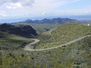 |
Arizona, Illinois, New Mexico | Historic "Mother Road" linking Chicago to Los Angeles | 2000-06-15 (New Mexico) 2005-09-22 (Arizona, Illinois) |
| NSB | Illinois River Road: Route of the Voyageurs Illinois River Road: Route of the Voyageurs The Illinois River Road: Route of the Voyageurs is a National Scenic Byway in central Illinois, United States.The byway traverses portions of the following routes:* Interstate 180* U.S. Route 150* U.S. Route 24* U.S. Route 34* U.S... |
Illinois | Scenic drive through the Illinois River Valley | 2005-09-22 | |
| NSB | Indian River Lagoon Scenic Highway Indian River Lagoon Scenic Highway The Indian River Lagoon Scenic Highway is a long scenic byway located in Florida. Basically, the Highway is actually a collection of several roads, mostly running north and south along either side of the Indian River Lagoon, connected by other roads running over the Lagoon... |
Florida | Diverse estuary Estuary An estuary is a partly enclosed coastal body of water with one or more rivers or streams flowing into it, and with a free connection to the open sea.... near Kennedy Space Center Kennedy Space Center The John F. Kennedy Space Center is the NASA installation that has been the launch site for every United States human space flight since 1968. Although such flights are currently on hiatus, KSC continues to manage and operate unmanned rocket launch facilities for America's civilian space program... |
2002-06-13 | |
| AAR | International Selkirk Loop International Selkirk Loop The International Selkirk Loop is a scenic highway in the U.S. states of Idaho and Washington, as well as the Canadian province of British Columbia. The loop encircles the Selkirk Mountain Range, and offers several side trips aside from the main route. Included on the loop is the Kootenay Lake... |
Idaho, Washington | Loop around the Selkirk Mountains Selkirk Mountains The Selkirk Mountains are a mountain range spanning the northern portion of the Idaho Panhandle, eastern Washington, and southeastern British Columbia. They begin at Mica Peak near Coeur d'Alene, Idaho and extend approximately 320 km north from the border. The range is bounded on its west,... |
2005-09-22 (AAR) | |
| NSB | Jemez Mountain Trail | New Mexico | Scenic drive past geological formations and Indian ruins | 1998-06-09 | |
| NSB | Kaibab Plateau - North Rim Parkway | Arizona | Scenic drive through dense forests to the North Rim of the Grand Canyon | 1998-06-09 | |
| NSB | Kancamagus Scenic Byway | New Hampshire | Passes through the White Mountains White Mountains (New Hampshire) The White Mountains are a mountain range covering about a quarter of the state of New Hampshire and a small portion of western Maine in the United States. Part of the Appalachian Mountains, they are considered the most rugged mountains in New England... |
1996-09-19 | |
| NSB | Lake Erie Coastal Ohio Trail | Ohio | Follows the south shore of Lake Erie Lake Erie Lake Erie is the fourth largest lake of the five Great Lakes in North America, and the tenth largest globally. It is the southernmost, shallowest, and smallest by volume of the Great Lakes and therefore also has the shortest average water residence time. It is bounded on the north by the... |
2005-09-22 | |
| NSB | Lake Tahoe - Eastshore Drive |  |
Nevada | Follows the east shore of Lake Tahoe Lake Tahoe Lake Tahoe is a large freshwater lake in the Sierra Nevada of the United States. At a surface elevation of , it is located along the border between California and Nevada, west of Carson City. Lake Tahoe is the largest alpine lake in North America. Its depth is , making it the USA's second-deepest... |
1996-09-19 |
| AAR | Lakes to Locks Passage, The Great Northeast Journey | New York | Passes by the connected waterways of the eastern tier of New York | 2002-06-13 (AAR) | |
| AAR | Las Vegas Strip Las Vegas Strip The Las Vegas Strip is an approximately stretch of Las Vegas Boulevard in Clark County, Nevada; adjacent to, but outside the city limits of Las Vegas proper. The Strip lies within the unincorporated townships of Paradise and Winchester... |
 |
Nevada | Urban boulevard past casino Casino In modern English, a casino is a facility which houses and accommodates certain types of gambling activities. Casinos are most commonly built near or combined with hotels, restaurants, retail shopping, cruise ships or other tourist attractions... s and other Las Vegas entertainment |
2000-06-15 (AAR) |
| NSB | Lincoln Highway | Illinois | A portion of America's first transcontinental highway | 2000-06-15 | |
| NSB | Little Dixie Highway of the Great River Road | Missouri | Part of the Great River Road Great River Road The Great River Road is a collection of state, provincial, federal, and local roads which follow the course of the Mississippi River through ten states of the United States... in northeastern Missouri |
2002-06-13 | |
| NSB | Loess Hills Scenic Byway | Iowa | Silt deposits in the Missouri River Valley Missouri River Valley The Missouri River Valley outlines the journey of the Missouri River from its headwaters where the Madison, Jefferson and Gallatin Rivers flow together in Montana to its confluence with the Mississippi River in the State of Missouri. At long the valley drains one-sixth of the United States, and is... |
2000-06-15 | |
| NSB | Logan Canyon Scenic Byway | 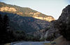 |
Utah | Passes through scenic Logan Canyon Logan Canyon Logan Canyon is a canyon that cuts its way through the Bear River Mountains, a branch of the Wasatch Range, in northeastern Utah. The canyon is popular for both summer and winter activities, especially rock-climbing, hiking, camping, fishing, snowmobiling, and skiing, at the Beaver Mountain ski... |
2002-06-13 |
| NSB | McKenzie Pass-Santiam Pass Scenic Byway | Oregon | Loop across two Cascade passes | 1998-06-09 | |
| NSB | Meeting of the Great Rivers Scenic Route Meeting of the Great Rivers Scenic Route The Meeting of the Great Rivers Scenic Route extends for in southwestern Illinois, traveling through the floodplain of the Mississippi, Missouri and Illinois rivers. The route has been officially designated as a National Scenic Byway by the Federal Highway Administration... |
Illinois | Floodplain Floodplain A floodplain, or flood plain, is a flat or nearly flat land adjacent a stream or river that stretches from the banks of its channel to the base of the enclosing valley walls and experiences flooding during periods of high discharge... where the Illinois Illinois River The Illinois River is a principal tributary of the Mississippi River, approximately long, in the State of Illinois. The river drains a large section of central Illinois, with a drainage basin of . This river was important among Native Americans and early French traders as the principal water route... , Mississippi Mississippi River The Mississippi River is the largest river system in North America. Flowing entirely in the United States, this river rises in western Minnesota and meanders slowly southwards for to the Mississippi River Delta at the Gulf of Mexico. With its many tributaries, the Mississippi's watershed drains... , and Missouri River Missouri River The Missouri River flows through the central United States, and is a tributary of the Mississippi River. It is the longest river in North America and drains the third largest area, though only the thirteenth largest by discharge. The Missouri's watershed encompasses most of the American Great... s meet |
1998-06-09 2000-06-15 (extended) |
|
| NSB | Merritt Parkway Merritt Parkway The Merritt Parkway is a historic limited-access parkway in Fairfield County, Connecticut. The parkway is known for its scenic layout, its uniquely styled signage, and the architecturally elaborate overpasses along the route. It is designated as a National Scenic Byway and is also listed in the... |
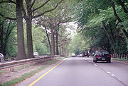 |
Connecticut | Historic parkway with individually-designed bridges | 1996-09-19 |
| NSB | Midland Trail | 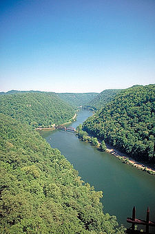 |
West Virginia | Scenic drive through the New River Gorge | 2000-06-15 |
| NSB | Millstone Valley Scenic Byway | New Jersey | Scenic and historic drive along the Millstone River in central New Jersey | 2009-10-16 | |
| NSB | Minnesota River Valley Scenic Byway | Minnesota | Historic drive through the Minnesota River Valley | 2002-06-13 | |
| NSB | Mohawk Towpath Byway Mohawk Towpath Byway The Mohawk Towpath Scenic Byway is a National Scenic Byway in the Capital District region of New York, United States. It extends from Schenectady to Waterford by way of a series of local, county, and state highways along the Mohawk River and the Erie Canal... |
New York | Follows the historic Erie Canal Erie Canal The Erie Canal is a waterway in New York that runs about from Albany, New York, on the Hudson River to Buffalo, New York, at Lake Erie, completing a navigable water route from the Atlantic Ocean to the Great Lakes. The canal contains 36 locks and encompasses a total elevation differential of... |
2005-09-22 | |
| NSB | Mountains to Sound Greenway - I-90 | 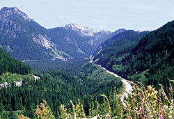 |
Washington | Scenic drive across the Cascades | 1998-06-09 |
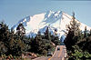
| NSB | Mt. Hood Scenic Byway | 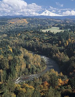 |
Oregon | Provides views of Mount Hood Mount Hood Mount Hood, called Wy'east by the Multnomah tribe, is a stratovolcano in the Cascade Volcanic Arc of northern Oregon. It was formed by a subduction zone and rests in the Pacific Northwest region of the United States... |
2005-09-22 |
| AAR | Natchez Trace Parkway Natchez Trace Parkway The Natchez Trace Parkway is a National Park Service unit in the southeastern United States that commemorates the historic Old Natchez Trace and preserves sections of the original trail.... |
Alabama, Mississippi, Tennessee | Early trail connecting the Mississippi Territory Mississippi Territory The Territory of Mississippi was an organized incorporated territory of the United States that existed from April 7, 1798, until December 10, 1817, when the final extent of the territory was admitted to the Union as the state of Mississippi.... with Nashville |
1996-09-19 (AAR) | |
| NSB | Native American Scenic Byway | North Dakota, South Dakota | Traverses four Lakota Sioux reservations | 1998-06-09 (South Dakota) 2005-09-22 (extended in both states) |
|
| NSB | Nebo Loop Scenic Byway | Utah | Passes near Mount Nebo Mount Nebo (Utah) Mount Nebo is the southernmost and highest mountain in the Wasatch Range of Utah, in the United States. Named after the biblical Mount Nebo overlooking Israel, which is said to be the place of Moses' death, it is the centerpiece of the Mount Nebo Wilderness, inside the Uinta National Forest.Mount... in the Wasatch Range Wasatch Range The Wasatch Range is a mountain range that stretches approximately from the Utah-Idaho border, south through central Utah in the western United States. It is generally considered the western edge of the greater Rocky Mountains, and the eastern edge of the Great Basin region... |
1998-06-09 | |
| AAR | North Shore Scenic Drive | Minnesota | Follows the north shore of Lake Superior Lake Superior Lake Superior is the largest of the five traditionally-demarcated Great Lakes of North America. It is bounded to the north by the Canadian province of Ontario and the U.S. state of Minnesota, and to the south by the U.S. states of Wisconsin and Michigan. It is the largest freshwater lake in the... |
2000-06-15 (AAR) 2002-06-13 (extended) |
|
| AAR | Northwest Passage Scenic Byway | Idaho | Follows Lewis and Clark's search for the Northwest Passage Northwest Passage The Northwest Passage is a sea route through the Arctic Ocean, along the northern coast of North America via waterways amidst the Canadian Arctic Archipelago, connecting the Atlantic and Pacific Oceans... |
2002-06-13 2005-09-22 (extended and became an AAR) |
|
| NSB | Ohio River Scenic Route | Illinois, Indiana, Ohio | Follows the north bank of the Ohio River Ohio River The Ohio River is the largest tributary, by volume, of the Mississippi River. At the confluence, the Ohio is even bigger than the Mississippi and, thus, is hydrologically the main stream of the whole river system, including the Allegheny River further upstream... |
1996-09-19 (Indiana) 1998-06-09 (Illinois, Ohio) |
|
| NSB | Old Canada Road Scenic Byway | Maine | Historic route between Maine and Quebec Quebec Quebec or is a province in east-central Canada. It is the only Canadian province with a predominantly French-speaking population and the only one whose sole official language is French at the provincial level.... |
2000-06-15 | |
| NSB | Outback Scenic Byway Outback Scenic Byway The Outback Scenic Byway is a designated National Scenic Byway on Oregon state highways that features the scenic rugged landscape of Central Oregon.-Route description:... |
Oregon | Scenic drive through rugged country of southern Oregon | 1998-06-09 | |
| NSB | Outer Banks Scenic Byway | North Carolina | 2009-10-16 | ||
| AAR | Pacific Coast Scenic Byway | 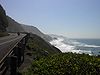 |
Oregon | Scenic drive along the Pacific coast Pacific Coast A country's Pacific coast is the part of its coast bordering the Pacific Ocean.-The Americas:Countries on the western side of the Americas have a Pacific coast as their western border.* Geography of Canada* Geography of Chile* Geography of Colombia... |
1998-06-09 (NSB) 2002-06-13 (AAR) |
| NSB | Paul Bunyan Scenic Byway | Minnesota | Passes through the forests of central Minnesota | 2005-09-22 | |
| NSB | Payette River Scenic Byway | Idaho | Traverses foothills and valleys | 2002-06-13 | |
| NSB | Pend Oreille Scenic Byway | Idaho | Scenic drive along Lake Pend Oreille Lake Pend Oreille Lake Pend Oreille is a lake in the northern Idaho Panhandle, with a surface area of . It is 65 miles long, and 1,150 feet deep in some regions, making it the fifth deepest in the United States. It is fed by the Clark Fork River and the Pack River, and drains via the Pend Oreille River... |
2002-06-13 | |
| NSB | Peter Norbeck Scenic Byway Peter Norbeck Scenic Byway The Peter Norbeck Scenic Byway is a National Scenic Byway in the Black Hills National Forest in South Dakota, USA. It is a loop which is composed of portions of U.S. Route 16A, South Dakota Highway 244, South Dakota Highway 87, and South Dakota Highway 89. Parts of the byway enter Black Hills... |
South Dakota | Scenic drive through mountains of southwestern South Dakota | 1996-09-19 | |
| NSB | Pioneer Historic Byway | Idaho | Includes Mormon settlements and Oregon Trail Oregon Trail The Oregon Trail is a historic east-west wagon route that connected the Missouri River to valleys in Oregon and locations in between.After 1840 steam-powered riverboats and steamboats traversing up and down the Ohio, Mississippi and Missouri rivers sped settlement and development in the flat... ruts |
2005-09-22 | |
| NSB | Pyramid Lake Scenic Byway | Nevada | One of the largest desert lakes in the world | 1996-09-19 | |
| NSB | Rangeley Lakes Scenic Byway | Maine | Scenic drive past mountains and lakes | 2000-06-15 | |
| NSB | Red River Gorge Scenic Byway | Kentucky | Scenic drive through the Red River Gorge Red River Gorge The Red River Gorge is a canyon system on the Red River in east-central Kentucky. Geologically, it is part of the Pottsville Escarpment.Much of the Gorge is located inside the Daniel Boone National Forest and has been subsequently reserved as the Red River Gorge Geological Area, an area of around... |
2002-06-13 | |
| AAR | Red Rock Scenic Road | Arizona | Scenic drive through the high desert | 2005-09-22 (AAR) | |
| NSB | River Road Scenic Byway River Road Scenic Byway The River Road is a National Scenic Byway in the US state of Michigan. This byway follows M-65 and River Road; it extends eastward into the Huron National Forest and ends in the historic community of Oscoda near Lake Huron. The road parallels the historic Riviere aux Sable... |
Michigan | Scenic drive through the Au Sable River Valley | 2005-09-22 | |
| NSB | Rogue-Umpqua Scenic Byway Rogue-Umpqua Scenic Byway The Rogue-Umpqua Scenic Byway is a National Scenic Byway in the U.S. state of Oregon. It provides a tour of the environs of the North Umpqua River, the High Cascades, and the Upper Rogue River.- Route description :... |
Oregon | Follows two scenic rivers through southwestern Oregon | 2002-06-13 | |
| AAR | Route One, Big Sur Coast Highway | 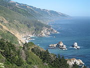 |
California | Scenic Drive along the Pacific coast Pacific Coast A country's Pacific coast is the part of its coast bordering the Pacific Ocean.-The Americas:Countries on the western side of the Americas have a Pacific coast as their western border.* Geography of Canada* Geography of Chile* Geography of Colombia... |
1996-09-19 (AAR) |
| AAR | Route One, San Luis Obispo North Coast Byway | California | Scenic Drive along the Pacific coast Pacific Coast A country's Pacific coast is the part of its coast bordering the Pacific Ocean.-The Americas:Countries on the western side of the Americas have a Pacific coast as their western border.* Geography of Canada* Geography of Chile* Geography of Colombia... |
2002-06-13 (AAR) | |
| NSB | Russell-Brasstown Scenic Byway Russell-Brasstown Scenic Byway The Russell–Brasstown Scenic Byway is a National Scenic Byway in the U.S. state of Georgia that includes State Route 180 , SR 348 The Russell–Brasstown Scenic Byway is a National Scenic Byway in the U.S. state of Georgia that includes State Route 180 (SR 180), SR 348 The... |
Georgia | Winds through the southern Appalachians | 2000-06-15 | |
| AAR | San Juan Skyway |  |
Colorado | Loop through the San Juan Mountains San Juan Mountains The San Juan Mountains are a high and rugged mountain range in the Rocky Mountains in southwestern Colorado. The area is highly mineralized and figured in the gold and silver mining industry of early Colorado. Major towns, all old mining camps, include Creede, Lake City, Silverton, Ouray, and... |
1996-09-19 (AAR) |
| NSB | Santa Fe Trail Scenic and Historic Byway | Colorado, New Mexico | Follows a historic trade route through scenic mountains and plains | 1998-06-09 | |
| NSB | Savannah River Scenic Byway | South Carolina | Scenic drive along the Savannah River Savannah River The Savannah River is a major river in the southeastern United States, forming most of the border between the states of South Carolina and Georgia. Two tributaries of the Savannah, the Tugaloo River and the Chattooga River, form the northernmost part of the border... |
1998-06-09 | |
| NSB | Schoodic Scenic Byway | Maine | Unspoiled coastline through the "quiet side" of Acadia National Park Acadia National Park Acadia National Park is a National Park located in the U.S. state of Maine. It reserves much of Mount Desert Island, and associated smaller islands, off the Atlantic coast... |
2000-06-15 | |
| NSB | Seaway Trail Seaway Trail The Great Lakes Seaway Trail, formerly named and commonly known as the Seaway Trail, is a National Scenic Byway in the northeastern United States, mostly contained in New York but with a small segment in Pennsylvania... |
New York, Pennsylvania | Scenic drive along the shores of the Great Lakes Great Lakes The Great Lakes are a collection of freshwater lakes located in northeastern North America, on the Canada – United States border. Consisting of Lakes Superior, Michigan, Huron, Erie, and Ontario, they form the largest group of freshwater lakes on Earth by total surface, coming in second by volume... and St. Lawrence River |
1996-09-19 (New York) 2005-09-22 (Pennsylvania) |
|
| AAR | Selma to Montgomery March Byway | Alabama | Route of the 1965 Selma to Montgomery March led by Martin Luther King, Jr. Martin Luther King, Jr. Martin Luther King, Jr. was an American clergyman, activist, and prominent leader in the African-American Civil Rights Movement. He is best known for being an iconic figure in the advancement of civil rights in the United States and around the world, using nonviolent methods following the... |
1996-09-19 (AAR) | |
| AAR | Seward Highway Seward Highway The Seward Highway is a highway in the U.S. state of Alaska that extends 127 miles from Seward to Anchorage. It was completed in 1951 and runs through the scenic Kenai Peninsula and Turnagain Arm, for which it was designated an All-American Road by the U.S... |
 |
Alaska | Scenic drive through mountains and fjord Fjord Geologically, a fjord is a long, narrow inlet with steep sides or cliffs, created in a valley carved by glacial activity.-Formation:A fjord is formed when a glacier cuts a U-shaped valley by abrasion of the surrounding bedrock. Glacial melting is accompanied by rebound of Earth's crust as the ice... s |
1998-06-09 (NSB) 2000-06-15 (AAR) |
| NSB | Sky Island Scenic Byway |  |
Arizona | Climb from the desert to forests with great biological diversity | 2005-09-22 |
| NSB | Skyline Drive Skyline Drive Skyline Drive is a 105-mile road that runs the entire length of the National Park Service's Shenandoah National Park in the Blue Ridge Mountains of Virginia, generally along the ridge of the mountains. The scenic drive is particularly popular in the fall when the leaves are changing colors... |
 |
Virginia | Scenic drive through Shenandoah National Park Shenandoah National Park Shenandoah National Park encompasses part of the Blue Ridge Mountains in the U.S. state of Virginia. This national park is long and narrow, with the broad Shenandoah River and valley on the west side, and the rolling hills of the Virginia Piedmont on the east... |
2005-09-22 |
| NSB | Sheyenne River Valley Scenic Byway | North Dakota | Historic drive through a scenic valley | 2002-06-13 | |
| NSB | Staunton-Parkersburg Turnpike | West Virginia | Historic drive through West Virginia forests | 2005-09-22 | |
| NSB | Stevens Pass Greenway | Washington | Scenic drive across the Cascades | 2005-09-22 | |
| NSB | Strait of Juan de Fuca Highway - SR 112 | 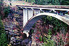 |
Washington | Follows the shoreline of northwestern Washington | 2000-06-15 |
| NSB | Talimena Scenic Drive Talimena Scenic Drive The Talimena Scenic Drive is a National Scenic Byway in southeastern Oklahoma and extreme western Arkansas spanning a stretch of Oklahoma State Highway 1 and Arkansas Highway 88 from Talihina, Oklahoma, to Mena, Arkansas.... |
 |
Arkansas, Oklahoma | Crest drive along some of the highest ridges between the Appalachians and Rockies Rocky Mountains The Rocky Mountains are a major mountain range in western North America. The Rocky Mountains stretch more than from the northernmost part of British Columbia, in western Canada, to New Mexico, in the southwestern United States... |
2005-09-22 |
| NSB | Talladega Scenic Drive | Alabama | Scenic drive through the southernmost extension of the Appalachian Mountains Appalachian Mountains The Appalachian Mountains #Whether the stressed vowel is or ,#Whether the "ch" is pronounced as a fricative or an affricate , and#Whether the final vowel is the monophthong or the diphthong .), often called the Appalachians, are a system of mountains in eastern North America. The Appalachians... |
1998-06-09 | |
| NSB | Tamiami Trail Scenic Highway | 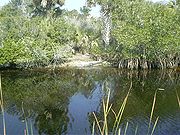 |
Florida | Traverses the Florida Everglades | 2000-06-15 |
| NSB | Tioga Road/Big Oak Flat Road | 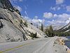 |
California | High mountain pass through Yosemite National Park Yosemite National Park Yosemite National Park is a United States National Park spanning eastern portions of Tuolumne, Mariposa and Madera counties in east central California, United States. The park covers an area of and reaches across the western slopes of the Sierra Nevada mountain chain... |
1996-09-19 |
| NSB | Top of the Rockies Top of the Rockies Top of the Rockies is the name of a National Scenic Byway in Colorado, in the Western United States. Most of the byway is above and thus the name of the byway is Top of the Rockies... |
Colorado | Scenic drive through the Rockies Rocky Mountains The Rocky Mountains are a major mountain range in western North America. The Rocky Mountains stretch more than from the northernmost part of British Columbia, in western Canada, to New Mexico, in the southwestern United States... near Leadville |
1998-06-09 | |
| NSB | Trail of the Ancients Trail of the Ancients The Trail of the Ancients is an National Scenic Byway located in the states of Colorado and Utah. The route highlights the archaeological and cultural history of southwestern Native American peoples, and traverses the widely diverse geological landscape of the Four Corners region... |
Colorado, Utah | Scenic drive through the Native American Native Americans in the United States Native Americans in the United States are the indigenous peoples in North America within the boundaries of the present-day continental United States, parts of Alaska, and the island state of Hawaii. They are composed of numerous, distinct tribes, states, and ethnic groups, many of which survive as... history of the Four Corners region |
2005-09-22 | |
| NSB | Trail of the Mountain Spirits Scenic Byway | New Mexico | Scenic drive through the mountains of southwestern New Mexico | 2005-09-22 | |
| AAR | Trail Ridge Road/Beaver Meadow Road | 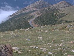 |
Colorado | America's highest continuously paved road | 1996-09-19 (AAR) |
| NSB | Turquoise Trail | New Mexico | Back road between Albuquerque and Santa Fe | 2000-06-15 | |
| NSB | Utah's Patchwork Parkway | Utah | Scenic drive through Cedar Breaks National Monument Cedar Breaks National Monument Cedar Breaks National Monument is a U.S. National Monument located in the U.S. state of Utah near Cedar City. Cedar Breaks is a natural amphitheater canyon, stretching across , with a depth of over . The elevation of the rim of the canyon is over above sea level.The eroded rock of the canyon is... |
2009-10-16 | |
| AAR | Utah's Scenic Byway 12 - A Journey Through Time | 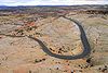 |
Utah | Scenic drive through canyons, plateaus, and valleys | 2002-06-13 (AAR) |
| AAR | Volcanic Legacy Scenic Byway Volcanic Legacy Scenic Byway The Volcanic Legacy Scenic Byway is an All-American Road in the U.S. states of California and Oregon. It is roughly 500 miles long and travels through the Cascade Range past numerous volcanoes. It is composed of two separate National Scenic Byways, the Volcanic Legacy Scenic Byway - Oregon and... |
 |
California, Oregon | Scenic drive through the Cascade Volcanic Arc | 1998-06-09 (AAR, Oregon) 2002-06-13 (AAR, California) |
| NSB | Washington Heritage Trail Washington Heritage Trail The Washington Heritage Trail is a National Scenic Byway through the easternmost counties of West Virginia's Eastern Panhandle. The trail forms a loop through the three counties and traces the footsteps of George Washington and the marks his family left in the Eastern Panhandle... |
West Virginia | Scenic and historic drive through West Virginia's Eastern Panhandle | 2000-06-15 | |
| NSB | West Cascades Scenic Byway West Cascades Scenic Byway The West Cascades Scenic Byway is a National Scenic Byway in the U.S. state of Oregon. The route is designed to provide a tour on the west side of the Cascade Range along the east side of the Willamette Valley.-Route description:... |
Oregon | Follows the west side of the Cascades | 2000-06-15 | |
| NSB | Western Heritage Historic Byway | Idaho | Scenic drive to the Snake River Canyon Snake River Canyon (Idaho) Snake River Canyon is a large canyon formed by the Snake River in the Magic Valley region of southern Idaho. It is well known as the site of an unsuccessful 1974 attempt by Evel Knievel to jump it in the Skycycle X-2.... |
2005-09-22 | |
| NSB | Wetlands and Wildlife Scenic Byway | Kansas | Scenic drive through wetland Wetland A wetland is an area of land whose soil is saturated with water either permanently or seasonally. Wetlands are categorised by their characteristic vegetation, which is adapted to these unique soil conditions.... s of central Kansas |
2005-09-22 | |
| NSB | White Mountain Trail White Mountain Trail The White Mountain Trail is a National Scenic Byway in New Hampshire. It runs through the heart of the White Mountains crossing three major mountain passes. The Trail designates sections of US 3 and US 302, between Lincoln and Conway, connecting at both ends with the Kancamagus Highway... |
New Hampshire | Passes through the White Mountains White Mountains (New Hampshire) The White Mountains are a mountain range covering about a quarter of the state of New Hampshire and a small portion of western Maine in the United States. Part of the Appalachian Mountains, they are considered the most rugged mountains in New England... and past Mount Washington Mount Washington (New Hampshire) Mount Washington is the highest peak in the Northeastern United States at , famous for dangerously erratic weather. For 76 years, a weather observatory on the summit held the record for the highest wind gust directly measured at the Earth's surface, , on the afternoon of April 12, 1934... |
1998-06-09 | |
| NSB | Wilderness Road Heritage Highway | Kentucky | Follows Daniel Boone Daniel Boone Daniel Boone was an American pioneer, explorer, and frontiersman whose frontier exploits mad']'e him one of the first folk heroes of the United States. Boone is most famous for his exploration and settlement of what is now the Commonwealth of Kentucky, which was then beyond the western borders of... 's historic entrance to the valleys of Kentucky |
2002-06-13 | |
| NSB | Woodward Avenue |  |
Michigan | Connects automobile-related historic sites of the "Motor City" | 2002-06-13 |
| NSB | Journey Through Hallowed Ground Byway | Maryland, Pennsylvania, Virginia | Corridor from Gettysburg, PA, to Monticello, VA; "Where America Happened" | Unknown |
Further reading
- Denver Post, State tops in scenic roads, September 20, 1996, p. B1
- Federal Highway AdministrationFederal Highway AdministrationThe Federal Highway Administration is a division of the United States Department of Transportation that specializes in highway transportation. The agency's major activities are grouped into two "programs," the Federal-aid Highway Program and the Federal Lands Highway Program...
, Transportation Secretary Slater Announces All-American Roads, Scenic Byways in 19 States, June 9, 1998 - Federal Highway AdministrationFederal Highway AdministrationThe Federal Highway Administration is a division of the United States Department of Transportation that specializes in highway transportation. The agency's major activities are grouped into two "programs," the Federal-aid Highway Program and the Federal Lands Highway Program...
, U.S. Transportation Deputy Secretary Downey Announces New All-American Roads, National Scenic Byways in 20 States, June 15, 2000 - Federal Highway AdministrationFederal Highway AdministrationThe Federal Highway Administration is a division of the United States Department of Transportation that specializes in highway transportation. The agency's major activities are grouped into two "programs," the Federal-aid Highway Program and the Federal Lands Highway Program...
, U.S. Transportation Secretary Mineta Names 36 New National Scenic Byways, All-American Roads, June 13, 2002 - National Scenic Byways Program, Share the Celebration! - 45 New Designations Announced, September 22, 2005