
2007 Pacific hurricane season
Encyclopedia
The 2007 Pacific hurricane season was an event in the annual cycle of tropical cyclone
formation. It officially started on May 15, 2007 in the eastern Pacific, designated as the area east of 140°W
, and on June 1, 2007 in the central Pacific, which is between the International Date Line
and 140°W
, and lasted until November 30, 2007. These dates conventionally delimit the period of each year when most tropical cyclones form in the Pacific basin.
The season began slowly; through the end of July, the seasonal ACE
was the third lowest since the geostationary satellite era began in 1966
. The inactivity continued through the next month, which was the third quietest August in terms of ACE since reliable records began in the basin in 1971
. Tropical Storm Barbara
in June caused $55 million (2007 USD) in crop damage in southeastern Mexico from heavy precipitation. In August, Hurricane Flossie
formed in the Eastern Pacific and crossed into the Central Pacific, threatening Hawaii
but causing little damage. In early September, Hurricane Henriette dropped heavy rainfall in southwest Mexico, which caused nine fatalities and $25 million (2007 USD) in damage.
On May 22, 2007, NOAA released their forecast for the 2007 Eastern Pacific and Central Pacific hurricane seasons. They predicted a below-normal level of activity in the Eastern Pacific, with 12 to 16 named storms, of which 6 to 9 were expected to become hurricanes, and 2 to 4 expected to become major hurricanes.
The Central Pacific basin was also expected to be below average, with only two to three tropical cyclones expected to form or cross into the area.
developed about 550 miles (885.1 km) south-southeast of Manzanillo
, Mexico
on May 24. Upper-level winds favored development, and the system slowly became better organized. By early on May 26, the system had developed a well-defined circulation, though associated convection
had become limited. Later that day convection increased significantly over the center, and early on May 27 Tropical Depression One-E formed 345 mi (555.2 km) south of the tip of Baja California
. Located to the east of a ridge
and to the west of a trough
, the depression tracked slowly westward through an area of weak steering flow.
Due to unfavorable thermodynamics
of the environment, the depression failed to immediately strengthen; the convection weakened, leaving the center located well to the northeast of the poorly organized convective areas. Inflow from the south was cut off by another area of disturbed weather to its southeast, and by late on May 27 one forecaster indicated there was inadequate convection to qualify the system as a tropical depression, although advisories continued since it was expected to strengthen again. Convection again re-developed early on May 28, and by later in the day remained vigorous but limited to the southwestern quadrant of the circulation. It consolidated further and strengthened into a tropical storm early on May 29. By later in the day, the convection again diminished, and the center of Alvin became difficult to locate on satellite imagery. Alvin was thus downgraded to a tropical depression after becoming less organised on May 30. On May 31, Alvin lost all deep convection. Tropical Depression Alvin degenerated into a remnant low on June 1.
extended southwestward from the Gulf of Tehuantepec
. On May 28, a small low pressure area
developed within the system, and it gradually became better organized as it drifted northward. Banding features developed in the eastern semicircle as the circulation became better defined, and late on May 29 the National Hurricane Center
classified the system as Tropical Depression Two-E while it was located about 235 miles (378.2 km) southeast of Acapulco
, Mexico
. Upon becoming a tropical cyclone, the depression was stationary in an area with warm sea surface temperatures, very light wind shear
, and favorable upper-level conditions.
It became more organised on satellite imagery on May 30, and was upgraded to a tropical storm, marking only the third time that there had been two named storms in May, after 1956 and 1984. It tracked slowly southeastward for the first few days, before losing much of its organisation overnight on May 31, leading to a forecast that Barbara could dissipate later that day. It managed to re-consolidate, however, and regained tropical storm intensity on June 1, when tropical storm watches were put into place. Barbara made landfall near the Mexico
-Guatemala
border on June 2. Heavy rainfall from the storm caused about $55 million (2007 USD) in crop damage in southeastern Mexico.
, but the system changed little in organization. The disturbance finally consolidated and became a tropical depression, the third of the season, on June 11, about 465 miles (748.3 km) south-southwest of Manzanillo, Mexico. However, the depression soon entered an environment of stable air and cooler sea surface temperatures and gradually weakened over the next two days. The National Hurricane Center issued its last advisory early on June 13 after the system lost most of its convection.
, Mexico
; conditions favored slow development, and it slowly became better organized as it tracked steadily westward. A well-defined low pressure area
developed within the system, and at 2100 UTC on July 9 the National Hurricane Center
classified it as Tropical Depression Four-E after deep convection was maintained near its low-level circulation. Upon becoming a tropical cyclone, the depression was poorly organized, and by early on July 10 the convection greatly diminished near the ill-defined center of circulation. Later that day, deep convection redeveloped despite detrimental atmospheric and oceanic conditions, though convection again deteriorated later while the winds decreased. After continued weakening the National Hurricane Center issued the final advisory on the system early on July 11.
. The National Hurricane Center
noted that there was potential for further development, but conditions were not favorable for development in the short-term, and the disturbance remained poorly consolidated. However, deep convection became more concentrated on July 12, and on July 14 Dvorak technique
classifications on the disturbance reached high-end tropical depression to low-end tropical storm strength. Based on this, the National Hurricane Center
upgraded it to Tropical Depression Five-E at 1500 UTC. The depression moved west-northwestward and quickly encountered cool sea surface temperatures, increasing wind shear
, and outflow from Tropical Storm Cosme. The NHC issued its last advisory late on July 15 after the circulation had become ill-defined and the depression had lost most of its deep convection.
estimated that the system had tropical storm force winds.
On July 16 it strengthened to become the first hurricane of the season, but shortly after that cooler waters and shearing winds initiated a rapid weakening. However, convection made a comeback and Cosme held on to minimal tropical storm strength for over a day, before finally weakening to a depression as it crossed into the Central Pacific. Cosme continued on a west-northwesterly track, moving closer to the Big Island
of Hawaii
. It passed about 185 miles (297.7 km) south of the Big Island on July 21 local time, bringing gusts of 35 to 40 mph (55 to 65 km/h) and heavy rain.
The final advisory was issued on the evening of July 22 local time as the depression started to dissipate.
on the morning of July 20. The National Hurricane Center
noted the possibility of some slow development of the system over the following 48 hours. 24 hours later, the circulation of the disturbance started to become more consolidated and better defined, leading the NHC to declare the possibility of the formation of a tropical depression. Late on July 21, the National Hurricane Center
initiated advisories on Tropical Depression Seven-E.
Convection began to flare on the morning of July 23 despite moderate wind shear
, and the depression was upgraded to Tropical Storm Dalila, the fourth tropical storm of the season. Under constant vertical shear, Dalila remained a weak tropical storm during the following days. Dalila started to strengthen during the afternoon of July 24 and reached its peak strength as a moderate tropical storm. Over the next three days, Dalila entered water with sea surface temperature
s too cool to support tropical cyclone activity and it ultimately weakened into a tropical depression. The final advisory was issued during the morning hours of July 27 as Dalila started degenerating into a remnant low.
. A broad low pressure area
formed on July 29, and initially moderate wind shear
prevented significant development. On the morning of July 31, a burst of convection developed in association with a low pressure area. The convection persisted and the first advisory on Tropical Depression Eight-E was issued later that afternoon. Early on August 1, the depression was upgraded to Tropical Storm Erick based on Dvorak estimates
of tropical storm status. Continued high amounts of wind shear
prevented further strengthening, and the system dissipated on August 2.
on August 2. Shower and thunderstorm activity increased in association with a small low pressure area
on August 5, and after continued organization, the National Hurricane Center remarked the system could develop into a tropical depression by early the next day. Subsequent to another reduction in convection, thunderstorm activity again increased. Despite marginal upper-level conditions, the system acquired a sufficient amount of organized deep convection for it to be classified Tropical Depression Nine-E late on August 8 while located about 1260 miles (2,027.8 km) west-southwest of the southern tip of Baja California
.
Upon first being classified, the depression maintained two ragged hooking bands; situated to the south of a mid-level ridge
, it tracked steadily westward. Later that day the depression was upgraded to Tropical Storm Flossie. The storm began to develop an eye late on August 9 with good cirrus outflow in all quadrants. On August 10 the eye became much better defined as the storm strengthened and was upgraded to a hurricane. Hurricane Flossie underwent rapid intensification
overnight and became a major hurricane on the morning of August 11 shortly before crossing into the Central Pacific.
In the Central Pacific, the storm continued to track westwards, moving closer to the Hawaiian islands
. On the afternoon of August 11 Flossie's wind speeds reached an initial peak of 140 mph (220 km/h), but heading into August 12 increasing vertical shear began restricting outflow and the storm weakened slightly. By that night outflow had been restored and the storm did not lose intensity as predicted, and the CPHC issued a hurricane watch the next morning for the Big Island
.
However, as the storm moved closer to the Big Island on August 13, the shear began to take a toll on the storm, and it weakened to a low-end Category 3 hurricane by late in the day local time, with further weakening expected before it approached the Big Island. Late on August 14 it was downgraded to a tropical storm as it veered to the south of the Big Island, and on August 16 it degenerated to a tropical depression.
Gil soon weakened as it encountered shearing winds and stable air layering, and it dissipated on September 2 as it moved over cooler waters.
One fatality was reported on August 29, when a 14-year-old boy was swept away by a flood-swollen river in Culiacán
, Sinaloa
, as parts of the town were flooded by up to 4.9 ft (1.5 m).
, Mexico
was designated Tropical Depression Eleven-E on August 30.
The next day it strengthened to become Tropical Storm Henriette, as it moved parallel to the Mexican
coast bringing heavy rains. It continued to strengthen as it moved away from Jalisco
towards Baja California
, and reached hurricane strength on September 4.
Hurricane Henriette made landfall on the tip of the Baja California peninsula
near San José del Cabo
on September 4. It was over land for only about six hours before emeging into the Sea of Cortez, still at hurricane strength. The next day it made final landfall near Guaymas
in the state of Sonora
.
Rock and mudfalls caused by the heavy rainfall in the Acapulco
area caused seven deaths. In Baja California Sur, the threat of the hurricane prompted the evacuations of about 300 people. Two fishermen were reported killed off the Sonora coast. Damage in Mexico totaled about $275 million (2007 MXN
, $25 million 2007 USD
).
. Later the same day it was upgraded to Tropical Storm Ivo, and it reached hurricane strength the next day. It weakened as it curved towards the southern Baja California Peninsula
, causing a tropical storm watch that was issued for part of the southern tip on September 22 to be canceled on September 23 as it was downgraded to a tropical depression.
on September 29. It strengthened to Tropical Storm Juliette later the same day. It peaked at 60 mph (85 km/h) on September 30 before weakening due to increased shear. Juliette dissipated early on October 2, never threatening land.
on October 15. It briefly strengthened to Tropical Storm Kiko the next day while its center remained almost stationary, but soon weakened again under the influence of shearing winds. On October 17 it was once more upgraded to a tropical storm and began to move east or northeast towards mainland Mexico
, causing storm warnings to be issued. On October 19 it turned to the northwest parallel to the Mexican coast and commenced strengthening, peaking just below hurricane strength on October 21. Thereafter it weakened as it moved westward, dissipating on October 23.
As Kiko traveled parallel to the coast, heavy rain affected the region for two days. In Kiko's rough seas off the coast of Mexico, a ship capsized with twenty-five passengers and crew.
, except for Alvin, which replaced Adolph, which was retired due to political sensitivities. The name Alvin was used for a storm for the first time this year.
For the central Pacific Ocean, four consecutive lists are used, with the names used sequentially until exhausted, rather than until the end of the year, due to the low number of storms each year.
No central pacific names were used; the next one used would have been Kika.
No names were retired for the 2007 Pacific hurricane season. The same list of names will be reused in the 2013 Pacific hurricane season.
Tropical cyclone
A tropical cyclone is a storm system characterized by a large low-pressure center and numerous thunderstorms that produce strong winds and heavy rain. Tropical cyclones strengthen when water evaporated from the ocean is released as the saturated air rises, resulting in condensation of water vapor...
formation. It officially started on May 15, 2007 in the eastern Pacific, designated as the area east of 140°W
140th meridian west
The meridian 140° west of Greenwich is a line of longitude that extends from the North Pole across the Arctic Ocean, North America, the Pacific Ocean, the Southern Ocean, and Antarctica to the South Pole....
, and on June 1, 2007 in the central Pacific, which is between the International Date Line
International Date Line
The International Date Line is a generally north-south imaginary line on the surface of the Earth, passing through the middle of the Pacific Ocean, that designates the place where each calendar day begins...
and 140°W
140th meridian west
The meridian 140° west of Greenwich is a line of longitude that extends from the North Pole across the Arctic Ocean, North America, the Pacific Ocean, the Southern Ocean, and Antarctica to the South Pole....
, and lasted until November 30, 2007. These dates conventionally delimit the period of each year when most tropical cyclones form in the Pacific basin.
The season began slowly; through the end of July, the seasonal ACE
Accumulated cyclone energy
Accumulated cyclone energy is a measure used by the National Oceanic and Atmospheric Administration to express the activity of individual tropical cyclones and entire tropical cyclone seasons, particularly the North Atlantic hurricane season. It uses an approximation of the energy used by a...
was the third lowest since the geostationary satellite era began in 1966
1950-1969 Pacific hurricane seasons
The 1950–1963 Pacific hurricane seasons all began on May 15, 1950-65 in the northeast Pacific Ocean and on June 1, 1950-65 in the central Pacific. They ended on November 30, 1950-65...
. The inactivity continued through the next month, which was the third quietest August in terms of ACE since reliable records began in the basin in 1971
1971 Pacific hurricane season
The 1971 Pacific hurricane season began on May 15, 1971 in the east Pacific, and on June 1, 1971 in the central Pacific. It ended on November 30, 1971. These dates conventionally delimit the period of time when tropical cyclones form in the east Pacific Ocean....
. Tropical Storm Barbara
Tropical Storm Barbara (2007)
Tropical Storm Barbara was the first tropical cyclone to make landfall during the 2007 Pacific hurricane season. The second storm of the season, Barbara developed from a small low pressure area on May 29 about 235 miles southeast of Acapulco, Mexico. The system drifted southward before...
in June caused $55 million (2007 USD) in crop damage in southeastern Mexico from heavy precipitation. In August, Hurricane Flossie
Hurricane Flossie (2007)
Hurricane Flossie was a strong Category Four Hurricane which brushed the island of Hawaiʻi as it rapidly weakened to a tropical storm. Flossie was the ninth tropical cyclone and sixth named storm of the 2007 Pacific hurricane season. Flossie developed from an ill defined wave which formed off the...
formed in the Eastern Pacific and crossed into the Central Pacific, threatening Hawaii
Hawaii
Hawaii is the newest of the 50 U.S. states , and is the only U.S. state made up entirely of islands. It is the northernmost island group in Polynesia, occupying most of an archipelago in the central Pacific Ocean, southwest of the continental United States, southeast of Japan, and northeast of...
but causing little damage. In early September, Hurricane Henriette dropped heavy rainfall in southwest Mexico, which caused nine fatalities and $25 million (2007 USD) in damage.
Seasonal forecasts
| Source | Date | Named storms |
Hurricanes | Major hurricanes |
| NOAA National Oceanic and Atmospheric Administration The National Oceanic and Atmospheric Administration , pronounced , like "noah", is a scientific agency within the United States Department of Commerce focused on the conditions of the oceans and the atmosphere... |
Average | 15.3 | 8.8 | 4.2 |
| NOAA | 22 May 2007 | 12 – 16 | 6 – 9 | 2 – 4 |
| Actual activity | 11 | 4 | 1 |
On May 22, 2007, NOAA released their forecast for the 2007 Eastern Pacific and Central Pacific hurricane seasons. They predicted a below-normal level of activity in the Eastern Pacific, with 12 to 16 named storms, of which 6 to 9 were expected to become hurricanes, and 2 to 4 expected to become major hurricanes.
The Central Pacific basin was also expected to be below average, with only two to three tropical cyclones expected to form or cross into the area.
Tropical Storm Alvin
A nearly stationary low pressure areaLow pressure area
A low-pressure area, or "low", is a region where the atmospheric pressure at sea level is below that of surrounding locations. Low-pressure systems form under areas of wind divergence which occur in upper levels of the troposphere. The formation process of a low-pressure area is known as...
developed about 550 miles (885.1 km) south-southeast of Manzanillo
Manzanillo, Colima
The name Manzanillo refers to the city as well as its surrounding municipality in the Mexican state of Colima. The city, located on the Pacific Ocean, contains Mexico's busiest port. Manzanillo was the third port created by the Spanish in the Pacific during the New Spain period...
, Mexico
Mexico
The United Mexican States , commonly known as Mexico , is a federal constitutional republic in North America. It is bordered on the north by the United States; on the south and west by the Pacific Ocean; on the southeast by Guatemala, Belize, and the Caribbean Sea; and on the east by the Gulf of...
on May 24. Upper-level winds favored development, and the system slowly became better organized. By early on May 26, the system had developed a well-defined circulation, though associated convection
Convection
Convection is the movement of molecules within fluids and rheids. It cannot take place in solids, since neither bulk current flows nor significant diffusion can take place in solids....
had become limited. Later that day convection increased significantly over the center, and early on May 27 Tropical Depression One-E formed 345 mi (555.2 km) south of the tip of Baja California
Baja California
Baja California officially Estado Libre y Soberano de Baja California is one of the 31 states which, with the Federal District, comprise the 32 Federal Entities of Mexico. It is both the northernmost and westernmost state of Mexico. Before becoming a state in 1953, the area was known as the North...
. Located to the east of a ridge
Ridge (meteorology)
A ridge is an elongated region of relatively high atmospheric pressure, the opposite of a trough....
and to the west of a trough
Trough (meteorology)
A trough is an elongated region of relatively low atmospheric pressure, often associated with fronts.Unlike fronts, there is not a universal symbol for a trough on a weather chart. The weather charts in some countries or regions mark troughs by a line. In the United States, a trough may be marked...
, the depression tracked slowly westward through an area of weak steering flow.
Due to unfavorable thermodynamics
Thermodynamics
Thermodynamics is a physical science that studies the effects on material bodies, and on radiation in regions of space, of transfer of heat and of work done on or by the bodies or radiation...
of the environment, the depression failed to immediately strengthen; the convection weakened, leaving the center located well to the northeast of the poorly organized convective areas. Inflow from the south was cut off by another area of disturbed weather to its southeast, and by late on May 27 one forecaster indicated there was inadequate convection to qualify the system as a tropical depression, although advisories continued since it was expected to strengthen again. Convection again re-developed early on May 28, and by later in the day remained vigorous but limited to the southwestern quadrant of the circulation. It consolidated further and strengthened into a tropical storm early on May 29. By later in the day, the convection again diminished, and the center of Alvin became difficult to locate on satellite imagery. Alvin was thus downgraded to a tropical depression after becoming less organised on May 30. On May 31, Alvin lost all deep convection. Tropical Depression Alvin degenerated into a remnant low on June 1.
Tropical Storm Barbara
On May 27, an area of disorganized convectionConvection
Convection is the movement of molecules within fluids and rheids. It cannot take place in solids, since neither bulk current flows nor significant diffusion can take place in solids....
extended southwestward from the Gulf of Tehuantepec
Gulf of Tehuantepec
Gulf of Tehuantepec is a large body of water on the Pacific coast of the Isthmus of Tehuantepec, southeastern Mexico, at . Most of the hurricanes that form in the Eastern Pacific organize in or near this body of water...
. On May 28, a small low pressure area
Low pressure area
A low-pressure area, or "low", is a region where the atmospheric pressure at sea level is below that of surrounding locations. Low-pressure systems form under areas of wind divergence which occur in upper levels of the troposphere. The formation process of a low-pressure area is known as...
developed within the system, and it gradually became better organized as it drifted northward. Banding features developed in the eastern semicircle as the circulation became better defined, and late on May 29 the National Hurricane Center
National Hurricane Center
The National Hurricane Center , located at Florida International University in Miami, Florida, is the division of the National Weather Service responsible for tracking and predicting weather systems within the tropics between the Prime Meridian and the 140th meridian west poleward to the 30th...
classified the system as Tropical Depression Two-E while it was located about 235 miles (378.2 km) southeast of Acapulco
Acapulco
Acapulco is a city, municipality and major sea port in the state of Guerrero on the Pacific coast of Mexico, southwest from Mexico City. Acapulco is located on a deep, semi-circular bay and has been a port since the early colonial period of Mexico’s history...
, Mexico
Mexico
The United Mexican States , commonly known as Mexico , is a federal constitutional republic in North America. It is bordered on the north by the United States; on the south and west by the Pacific Ocean; on the southeast by Guatemala, Belize, and the Caribbean Sea; and on the east by the Gulf of...
. Upon becoming a tropical cyclone, the depression was stationary in an area with warm sea surface temperatures, very light wind shear
Wind shear
Wind shear, sometimes referred to as windshear or wind gradient, is a difference in wind speed and direction over a relatively short distance in the atmosphere...
, and favorable upper-level conditions.
It became more organised on satellite imagery on May 30, and was upgraded to a tropical storm, marking only the third time that there had been two named storms in May, after 1956 and 1984. It tracked slowly southeastward for the first few days, before losing much of its organisation overnight on May 31, leading to a forecast that Barbara could dissipate later that day. It managed to re-consolidate, however, and regained tropical storm intensity on June 1, when tropical storm watches were put into place. Barbara made landfall near the Mexico
Mexico
The United Mexican States , commonly known as Mexico , is a federal constitutional republic in North America. It is bordered on the north by the United States; on the south and west by the Pacific Ocean; on the southeast by Guatemala, Belize, and the Caribbean Sea; and on the east by the Gulf of...
-Guatemala
Guatemala
Guatemala is a country in Central America bordered by Mexico to the north and west, the Pacific Ocean to the southwest, Belize to the northeast, the Caribbean to the east, and Honduras and El Salvador to the southeast...
border on June 2. Heavy rainfall from the storm caused about $55 million (2007 USD) in crop damage in southeastern Mexico.
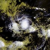
Tropical Depression Three-E
On the evening of June 9, the National Hurricane Center first mentioned the existence of a large, disorganized area of low pressure, which was located a few hundred miles southwest of Acapulco, with limited shower activity. The associated thunderstorms gained organization overnight, and on June 10 the National Hurricane Center first mentioned the possibility of some slow development of the system. Environmental conditions were favorable for tropical cyclone formationTropical cyclogenesis
Tropical cyclogenesis is the term that describes the development and strengthening of a tropical cyclone in the atmosphere. The mechanisms through which tropical cyclogenesis occurs are distinctly different from those through which mid-latitude cyclogenesis occurs...
, but the system changed little in organization. The disturbance finally consolidated and became a tropical depression, the third of the season, on June 11, about 465 miles (748.3 km) south-southwest of Manzanillo, Mexico. However, the depression soon entered an environment of stable air and cooler sea surface temperatures and gradually weakened over the next two days. The National Hurricane Center issued its last advisory early on June 13 after the system lost most of its convection.
Tropical Depression Four-E
On July 9, an area of convection developed about 725 miles (1,166.8 km) south of ManzanilloManzanillo, Colima
The name Manzanillo refers to the city as well as its surrounding municipality in the Mexican state of Colima. The city, located on the Pacific Ocean, contains Mexico's busiest port. Manzanillo was the third port created by the Spanish in the Pacific during the New Spain period...
, Mexico
Mexico
The United Mexican States , commonly known as Mexico , is a federal constitutional republic in North America. It is bordered on the north by the United States; on the south and west by the Pacific Ocean; on the southeast by Guatemala, Belize, and the Caribbean Sea; and on the east by the Gulf of...
; conditions favored slow development, and it slowly became better organized as it tracked steadily westward. A well-defined low pressure area
Low pressure area
A low-pressure area, or "low", is a region where the atmospheric pressure at sea level is below that of surrounding locations. Low-pressure systems form under areas of wind divergence which occur in upper levels of the troposphere. The formation process of a low-pressure area is known as...
developed within the system, and at 2100 UTC on July 9 the National Hurricane Center
National Hurricane Center
The National Hurricane Center , located at Florida International University in Miami, Florida, is the division of the National Weather Service responsible for tracking and predicting weather systems within the tropics between the Prime Meridian and the 140th meridian west poleward to the 30th...
classified it as Tropical Depression Four-E after deep convection was maintained near its low-level circulation. Upon becoming a tropical cyclone, the depression was poorly organized, and by early on July 10 the convection greatly diminished near the ill-defined center of circulation. Later that day, deep convection redeveloped despite detrimental atmospheric and oceanic conditions, though convection again deteriorated later while the winds decreased. After continued weakening the National Hurricane Center issued the final advisory on the system early on July 11.
Tropical Depression Five-E
Early on July 11, just as Tropical Depression Four-E had degenerated into a remnant low, an area of disturbed weather formed around 350 miles (563.3 km) south of AcapulcoAcapulco
Acapulco is a city, municipality and major sea port in the state of Guerrero on the Pacific coast of Mexico, southwest from Mexico City. Acapulco is located on a deep, semi-circular bay and has been a port since the early colonial period of Mexico’s history...
. The National Hurricane Center
National Hurricane Center
The National Hurricane Center , located at Florida International University in Miami, Florida, is the division of the National Weather Service responsible for tracking and predicting weather systems within the tropics between the Prime Meridian and the 140th meridian west poleward to the 30th...
noted that there was potential for further development, but conditions were not favorable for development in the short-term, and the disturbance remained poorly consolidated. However, deep convection became more concentrated on July 12, and on July 14 Dvorak technique
Dvorak technique
The Dvorak technique is a widely used system to subjectively estimate tropical cyclone intensity based solely on visible and infrared satellite images. Several agencies issue Dvorak intensity numbers for cyclones of sufficient intensity...
classifications on the disturbance reached high-end tropical depression to low-end tropical storm strength. Based on this, the National Hurricane Center
National Hurricane Center
The National Hurricane Center , located at Florida International University in Miami, Florida, is the division of the National Weather Service responsible for tracking and predicting weather systems within the tropics between the Prime Meridian and the 140th meridian west poleward to the 30th...
upgraded it to Tropical Depression Five-E at 1500 UTC. The depression moved west-northwestward and quickly encountered cool sea surface temperatures, increasing wind shear
Wind shear
Wind shear, sometimes referred to as windshear or wind gradient, is a difference in wind speed and direction over a relatively short distance in the atmosphere...
, and outflow from Tropical Storm Cosme. The NHC issued its last advisory late on July 15 after the circulation had become ill-defined and the depression had lost most of its deep convection.
Hurricane Cosme
Two hours after Tropical Depression Five-E was classified, a disturbed area of weather about halfway between Mexico and the Hawaiian islands acquired a surface circulation and sufficient deep convection for the National Hurricane Center to designate it as a tropical depression. Gradually, the depression became more organized and its circulation became better defined. The National Hurricane Center upgraded the system to Tropical Storm Cosme on July 15 after analysis with the Dvorak techniqueDvorak technique
The Dvorak technique is a widely used system to subjectively estimate tropical cyclone intensity based solely on visible and infrared satellite images. Several agencies issue Dvorak intensity numbers for cyclones of sufficient intensity...
estimated that the system had tropical storm force winds.
On July 16 it strengthened to become the first hurricane of the season, but shortly after that cooler waters and shearing winds initiated a rapid weakening. However, convection made a comeback and Cosme held on to minimal tropical storm strength for over a day, before finally weakening to a depression as it crossed into the Central Pacific. Cosme continued on a west-northwesterly track, moving closer to the Big Island
Hawaii (island)
The Island of Hawaii, also called the Big Island or Hawaii Island , is a volcanic island in the North Pacific Ocean...
of Hawaii
Hawaii
Hawaii is the newest of the 50 U.S. states , and is the only U.S. state made up entirely of islands. It is the northernmost island group in Polynesia, occupying most of an archipelago in the central Pacific Ocean, southwest of the continental United States, southeast of Japan, and northeast of...
. It passed about 185 miles (297.7 km) south of the Big Island on July 21 local time, bringing gusts of 35 to 40 mph (55 to 65 km/h) and heavy rain.
The final advisory was issued on the evening of July 22 local time as the depression started to dissipate.
Tropical Storm Dalila
An area of disturbed weather was first noticed a few hundred miles south-southwest of the Gulf of TehuantepecGulf of Tehuantepec
Gulf of Tehuantepec is a large body of water on the Pacific coast of the Isthmus of Tehuantepec, southeastern Mexico, at . Most of the hurricanes that form in the Eastern Pacific organize in or near this body of water...
on the morning of July 20. The National Hurricane Center
National Hurricane Center
The National Hurricane Center , located at Florida International University in Miami, Florida, is the division of the National Weather Service responsible for tracking and predicting weather systems within the tropics between the Prime Meridian and the 140th meridian west poleward to the 30th...
noted the possibility of some slow development of the system over the following 48 hours. 24 hours later, the circulation of the disturbance started to become more consolidated and better defined, leading the NHC to declare the possibility of the formation of a tropical depression. Late on July 21, the National Hurricane Center
National Hurricane Center
The National Hurricane Center , located at Florida International University in Miami, Florida, is the division of the National Weather Service responsible for tracking and predicting weather systems within the tropics between the Prime Meridian and the 140th meridian west poleward to the 30th...
initiated advisories on Tropical Depression Seven-E.
Convection began to flare on the morning of July 23 despite moderate wind shear
Wind shear
Wind shear, sometimes referred to as windshear or wind gradient, is a difference in wind speed and direction over a relatively short distance in the atmosphere...
, and the depression was upgraded to Tropical Storm Dalila, the fourth tropical storm of the season. Under constant vertical shear, Dalila remained a weak tropical storm during the following days. Dalila started to strengthen during the afternoon of July 24 and reached its peak strength as a moderate tropical storm. Over the next three days, Dalila entered water with sea surface temperature
Sea surface temperature
Sea surface temperature is the water temperature close to the oceans surface. The exact meaning of surface varies according to the measurement method used, but it is between and below the sea surface. Air masses in the Earth's atmosphere are highly modified by sea surface temperatures within a...
s too cool to support tropical cyclone activity and it ultimately weakened into a tropical depression. The final advisory was issued during the morning hours of July 27 as Dalila started degenerating into a remnant low.
Tropical Storm Erick
On July 28, a westward moving area of disturbed weather developed about 950 miles (1,528.9 km) south of the southern tip of Baja CaliforniaBaja California
Baja California officially Estado Libre y Soberano de Baja California is one of the 31 states which, with the Federal District, comprise the 32 Federal Entities of Mexico. It is both the northernmost and westernmost state of Mexico. Before becoming a state in 1953, the area was known as the North...
. A broad low pressure area
Low pressure area
A low-pressure area, or "low", is a region where the atmospheric pressure at sea level is below that of surrounding locations. Low-pressure systems form under areas of wind divergence which occur in upper levels of the troposphere. The formation process of a low-pressure area is known as...
formed on July 29, and initially moderate wind shear
Wind shear
Wind shear, sometimes referred to as windshear or wind gradient, is a difference in wind speed and direction over a relatively short distance in the atmosphere...
prevented significant development. On the morning of July 31, a burst of convection developed in association with a low pressure area. The convection persisted and the first advisory on Tropical Depression Eight-E was issued later that afternoon. Early on August 1, the depression was upgraded to Tropical Storm Erick based on Dvorak estimates
Dvorak technique
The Dvorak technique is a widely used system to subjectively estimate tropical cyclone intensity based solely on visible and infrared satellite images. Several agencies issue Dvorak intensity numbers for cyclones of sufficient intensity...
of tropical storm status. Continued high amounts of wind shear
Wind shear
Wind shear, sometimes referred to as windshear or wind gradient, is a difference in wind speed and direction over a relatively short distance in the atmosphere...
prevented further strengthening, and the system dissipated on August 2.
Hurricane Flossie
An area of disturbed weather formed about 600 miles (965.6 km) south-southeast of AcapulcoAcapulco
Acapulco is a city, municipality and major sea port in the state of Guerrero on the Pacific coast of Mexico, southwest from Mexico City. Acapulco is located on a deep, semi-circular bay and has been a port since the early colonial period of Mexico’s history...
on August 2. Shower and thunderstorm activity increased in association with a small low pressure area
Low pressure area
A low-pressure area, or "low", is a region where the atmospheric pressure at sea level is below that of surrounding locations. Low-pressure systems form under areas of wind divergence which occur in upper levels of the troposphere. The formation process of a low-pressure area is known as...
on August 5, and after continued organization, the National Hurricane Center remarked the system could develop into a tropical depression by early the next day. Subsequent to another reduction in convection, thunderstorm activity again increased. Despite marginal upper-level conditions, the system acquired a sufficient amount of organized deep convection for it to be classified Tropical Depression Nine-E late on August 8 while located about 1260 miles (2,027.8 km) west-southwest of the southern tip of Baja California
Baja California
Baja California officially Estado Libre y Soberano de Baja California is one of the 31 states which, with the Federal District, comprise the 32 Federal Entities of Mexico. It is both the northernmost and westernmost state of Mexico. Before becoming a state in 1953, the area was known as the North...
.
Upon first being classified, the depression maintained two ragged hooking bands; situated to the south of a mid-level ridge
Ridge (meteorology)
A ridge is an elongated region of relatively high atmospheric pressure, the opposite of a trough....
, it tracked steadily westward. Later that day the depression was upgraded to Tropical Storm Flossie. The storm began to develop an eye late on August 9 with good cirrus outflow in all quadrants. On August 10 the eye became much better defined as the storm strengthened and was upgraded to a hurricane. Hurricane Flossie underwent rapid intensification
Rapid deepening
Rapid deepening, also known as rapid intensification, is a meteorological condition that occurs when the minimum sea-level atmospheric pressure of a tropical cyclone decreases drastically in a short period of time. The National Weather Service describes rapid deepening as a decrease of...
overnight and became a major hurricane on the morning of August 11 shortly before crossing into the Central Pacific.
In the Central Pacific, the storm continued to track westwards, moving closer to the Hawaiian islands
Hawaii
Hawaii is the newest of the 50 U.S. states , and is the only U.S. state made up entirely of islands. It is the northernmost island group in Polynesia, occupying most of an archipelago in the central Pacific Ocean, southwest of the continental United States, southeast of Japan, and northeast of...
. On the afternoon of August 11 Flossie's wind speeds reached an initial peak of 140 mph (220 km/h), but heading into August 12 increasing vertical shear began restricting outflow and the storm weakened slightly. By that night outflow had been restored and the storm did not lose intensity as predicted, and the CPHC issued a hurricane watch the next morning for the Big Island
Hawaii (island)
The Island of Hawaii, also called the Big Island or Hawaii Island , is a volcanic island in the North Pacific Ocean...
.
However, as the storm moved closer to the Big Island on August 13, the shear began to take a toll on the storm, and it weakened to a low-end Category 3 hurricane by late in the day local time, with further weakening expected before it approached the Big Island. Late on August 14 it was downgraded to a tropical storm as it veered to the south of the Big Island, and on August 16 it degenerated to a tropical depression.
Tropical Storm Gil
Early on August 29, an area of disturbed weather west of Manzanillo, Colima, Mexico, was designated Tropical Depression Ten-E. That afternoon, it was upgraded to Tropical Storm Gil, the seventh tropical storm of the season.Gil soon weakened as it encountered shearing winds and stable air layering, and it dissipated on September 2 as it moved over cooler waters.
One fatality was reported on August 29, when a 14-year-old boy was swept away by a flood-swollen river in Culiacán
Culiacán
Culiacán is a city in northwestern Mexico, the largest city in the state of Sinaloa as well as its capital and capital of the municipality of Culiacán. With 675,773 inhabitants in the city , and 858,638 in the municipality, it is the largest city in the state of Sinaloa...
, Sinaloa
Sinaloa
Sinaloa officially Estado Libre y Soberano de Sinaloa is one of the 31 states which, with the Federal District, comprise the 32 Federal Entities of Mexico. It is divided in 18 municipalities and its capital city is Culiacán Rosales....
, as parts of the town were flooded by up to 4.9 ft (1.5 m).
Hurricane Henriette
An area of disturbed weather 400 kilometres (248.5 mi) southeast of AcapulcoAcapulco
Acapulco is a city, municipality and major sea port in the state of Guerrero on the Pacific coast of Mexico, southwest from Mexico City. Acapulco is located on a deep, semi-circular bay and has been a port since the early colonial period of Mexico’s history...
, Mexico
Mexico
The United Mexican States , commonly known as Mexico , is a federal constitutional republic in North America. It is bordered on the north by the United States; on the south and west by the Pacific Ocean; on the southeast by Guatemala, Belize, and the Caribbean Sea; and on the east by the Gulf of...
was designated Tropical Depression Eleven-E on August 30.
The next day it strengthened to become Tropical Storm Henriette, as it moved parallel to the Mexican
Mexico
The United Mexican States , commonly known as Mexico , is a federal constitutional republic in North America. It is bordered on the north by the United States; on the south and west by the Pacific Ocean; on the southeast by Guatemala, Belize, and the Caribbean Sea; and on the east by the Gulf of...
coast bringing heavy rains. It continued to strengthen as it moved away from Jalisco
Jalisco
Jalisco officially Estado Libre y Soberano de Jalisco is one of the 31 states which, with the Federal District, comprise the 32 Federal Entities of Mexico. It is located in Western Mexico and divided in 125 municipalities and its capital city is Guadalajara.It is one of the more important states...
towards Baja California
Baja California
Baja California officially Estado Libre y Soberano de Baja California is one of the 31 states which, with the Federal District, comprise the 32 Federal Entities of Mexico. It is both the northernmost and westernmost state of Mexico. Before becoming a state in 1953, the area was known as the North...
, and reached hurricane strength on September 4.
Hurricane Henriette made landfall on the tip of the Baja California peninsula
Baja California Peninsula
The Baja California peninsula , is a peninsula in northwestern Mexico. Its land mass separates the Pacific Ocean from the Gulf of California. The Peninsula extends from Mexicali, Baja California in the north to Cabo San Lucas, Baja California Sur in the south.The total area of the Baja California...
near San José del Cabo
San José del Cabo
The city of San José del Cabo is located in Baja California Sur Mexico and is the seat of the municipality of Los Cabos at the south end of the Baja California peninsula. In the 2010 census it had a population of 69,788. Together with neighboring Cabo San Lucas it forms a major tourist destination...
on September 4. It was over land for only about six hours before emeging into the Sea of Cortez, still at hurricane strength. The next day it made final landfall near Guaymas
Guaymas
Guaymas is a city and municipality located in the southwest part of the state of Sonora in northwestern Mexico. The city is located 117 km south of the state capital of Hermosillo, and 242 miles from the U.S. border, and is the principal port for the state. The municipality is located in the...
in the state of Sonora
Sonora
Sonora officially Estado Libre y Soberano de Sonora is one of the 31 states which, with the Federal District, comprise the 32 Federal Entities of Mexico. It is divided into 72 municipalities; the capital city is Hermosillo....
.
Rock and mudfalls caused by the heavy rainfall in the Acapulco
Acapulco
Acapulco is a city, municipality and major sea port in the state of Guerrero on the Pacific coast of Mexico, southwest from Mexico City. Acapulco is located on a deep, semi-circular bay and has been a port since the early colonial period of Mexico’s history...
area caused seven deaths. In Baja California Sur, the threat of the hurricane prompted the evacuations of about 300 people. Two fishermen were reported killed off the Sonora coast. Damage in Mexico totaled about $275 million (2007 MXN
Mexican peso
The peso is the currency of Mexico. Modern peso and dollar currencies have a common origin in the 15th–19th century Spanish dollar, most continuing to use its sign, "$". The Mexican peso is the 12th most traded currency in the world, the third most traded in the Americas, and by far the most...
, $25 million 2007 USD
United States dollar
The United States dollar , also referred to as the American dollar, is the official currency of the United States of America. It is divided into 100 smaller units called cents or pennies....
).
Hurricane Ivo
On September 18, Tropical Depression Twelve-E formed about 670 miles south-southeast of the southern tip of Baja CaliforniaBaja California
Baja California officially Estado Libre y Soberano de Baja California is one of the 31 states which, with the Federal District, comprise the 32 Federal Entities of Mexico. It is both the northernmost and westernmost state of Mexico. Before becoming a state in 1953, the area was known as the North...
. Later the same day it was upgraded to Tropical Storm Ivo, and it reached hurricane strength the next day. It weakened as it curved towards the southern Baja California Peninsula
Baja California Peninsula
The Baja California peninsula , is a peninsula in northwestern Mexico. Its land mass separates the Pacific Ocean from the Gulf of California. The Peninsula extends from Mexicali, Baja California in the north to Cabo San Lucas, Baja California Sur in the south.The total area of the Baja California...
, causing a tropical storm watch that was issued for part of the southern tip on September 22 to be canceled on September 23 as it was downgraded to a tropical depression.
Tropical Depression Thirteen-E
On September 19, an area of disturbed weather southwest of the southern tip of Baja California acquired enough organization to be classified as a tropical depression. Faced with low surface temperatures and stable air it could not strengthen further, and it dissipated the next day.Tropical Storm Juliette
Tropical Depression Fourteen-E formed from a low-pressure west-southwest of ManzanilloManzanillo, Colima
The name Manzanillo refers to the city as well as its surrounding municipality in the Mexican state of Colima. The city, located on the Pacific Ocean, contains Mexico's busiest port. Manzanillo was the third port created by the Spanish in the Pacific during the New Spain period...
on September 29. It strengthened to Tropical Storm Juliette later the same day. It peaked at 60 mph (85 km/h) on September 30 before weakening due to increased shear. Juliette dissipated early on October 2, never threatening land.
Tropical Storm Kiko
Tropical Depression Fifteen-E formed from a low-pressure area about 400 miles southwest of ManzanilloManzanillo, Colima
The name Manzanillo refers to the city as well as its surrounding municipality in the Mexican state of Colima. The city, located on the Pacific Ocean, contains Mexico's busiest port. Manzanillo was the third port created by the Spanish in the Pacific during the New Spain period...
on October 15. It briefly strengthened to Tropical Storm Kiko the next day while its center remained almost stationary, but soon weakened again under the influence of shearing winds. On October 17 it was once more upgraded to a tropical storm and began to move east or northeast towards mainland Mexico
Mexico
The United Mexican States , commonly known as Mexico , is a federal constitutional republic in North America. It is bordered on the north by the United States; on the south and west by the Pacific Ocean; on the southeast by Guatemala, Belize, and the Caribbean Sea; and on the east by the Gulf of...
, causing storm warnings to be issued. On October 19 it turned to the northwest parallel to the Mexican coast and commenced strengthening, peaking just below hurricane strength on October 21. Thereafter it weakened as it moved westward, dissipating on October 23.
As Kiko traveled parallel to the coast, heavy rain affected the region for two days. In Kiko's rough seas off the coast of Mexico, a ship capsized with twenty-five passengers and crew.
Storm names
The following names were used for named storms that formed in the northeast Pacific in 2007. This is the same list that was used in the 2001 season2001 Pacific hurricane season
The 2001 Pacific hurricane season was an event in tropical cyclone meteorology. The most notable storm that year was Hurricane Juliette, which caused devastating floods in Baja California, leading to 12 fatalities and $400 million worth of damage...
, except for Alvin, which replaced Adolph, which was retired due to political sensitivities. The name Alvin was used for a storm for the first time this year.
|
Hurricane Ivo (2007) Hurricane Ivo was a minimal hurricane that threatened the coast of Mexico during mid-September 2007. The 12th tropical cyclone, ninth named storm and fourth hurricane of the 2007 Pacific hurricane season, Ivo originated from a tropical wave that left the coast of Africa on September 1 and traversed... Tropical Storm Kiko (2007) Tropical Storm Kiko was a strong tropical storm that capsized a boat off the western coast of Mexico, killing at least 15 people. The 15th and final tropical cyclone of the 2007 Pacific hurricane season, Kiko developed out of a tropical wave that formed off the coast of Africa on September 26... |
For the central Pacific Ocean, four consecutive lists are used, with the names used sequentially until exhausted, rather than until the end of the year, due to the low number of storms each year.
No central pacific names were used; the next one used would have been Kika.
No names were retired for the 2007 Pacific hurricane season. The same list of names will be reused in the 2013 Pacific hurricane season.
Season impact
This is a table of the storms in 2007 and their landfall(s), if any. Deaths in parentheses are indirect; an example of such would be a traffic accident, but still storm-related. Damage and death totals include times when the storm was an extratropical storm or precursor wave.See also
- List of Pacific hurricanes
- List of Pacific hurricane seasons
- 2007 Atlantic hurricane season2007 Atlantic hurricane seasonThe 2007 Atlantic hurricane season was an active Atlantic hurricane season that produced 17 tropical cyclones, 15 tropical storms, six hurricanes, and two major hurricanes. It officially started on June 1 and ended on November 30, dates which conventionally delimit the...
- 2007 Pacific typhoon season2007 Pacific typhoon seasonThe 2007 Pacific typhoon season was a below average season which featured 24 named storms and 14 typhoons, compared to the average of 27 and 17 respectively. had no official bounds; it ran year-round in 2007, but most tropical cyclones tend to form in the northwestern Pacific Ocean between May and...
- 2007 North Indian Ocean cyclone season
- South-West Indian Ocean cyclone seasons: 2006–07, 2007–08
- Australian region cyclone seasons: 2006–07, 2007–08
- South Pacific cyclone seasons: 2006–07, 2007–082007–08 South Pacific cyclone seasonThe 2007–08 South Pacific cyclone season was one of the least active tropical cyclone seasons on record, with only four tropical cyclones occurring within the South Pacific Ocean to the east of 160°E. The season officially ran from November 1, 2007 until April 30, 2008, although the first cyclone,...
External links
-
- National Hurricane Center's Eastern Pacific Tropical Weather Outlook - updated four times daily
- National Hurricane Center
- National Hurricane Center's 2007 Advisory Archive
- Central Pacific Hurricane Center
- NRL hurricane page - Naval Research Laboratory page with extensive archives on individual storms