
1850-1859 Atlantic hurricane seasons
Encyclopedia
1830s
1840s
1850s 1860s
1870s
1830-1839 Atlantic hurricane seasons
1810s 1820s 1830s 1840s 1850s-1830 Atlantic hurricane season:I. A hurricane moved from Trinidad to western Cuba between August 3 and August 9.-Atlantic Coast Hurricane:...
1840s
1840-1849 Atlantic hurricane seasons
1820s 1830s 1840s 1850s 1860s-1840 Atlantic hurricane season:I. On June 19, a tropical storm hit near Lake Charles, Louisiana.II. A hurricane hit near the mouth of the Rio Grande, destroying villages and causing flooding....
1850s 1860s
1860-1869 Atlantic hurricane seasons
1840s 1850s 1860s 1870s 1880-84-Tropical Storm Four:While there were 6 storms this season, only one affected any landmass as a tropical system; a tropical storm hitting the Lesser Antilles.-Hurricane Three:...
1870s
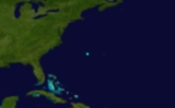
1850 Atlantic hurricane season
The first of three hurricanes to affect the upper Eastern SeaboardEast Coast of the United States
The East Coast of the United States, also known as the Eastern Seaboard, refers to the easternmost coastal states in the United States, which touch the Atlantic Ocean and stretch up to Canada. The term includes the U.S...
moved into North Carolina
North Carolina
North Carolina is a state located in the southeastern United States. The state borders South Carolina and Georgia to the south, Tennessee to the west and Virginia to the north. North Carolina contains 100 counties. Its capital is Raleigh, and its largest city is Charlotte...
on July 18. As it moved north, Chesapeake Bay
Chesapeake Bay
The Chesapeake Bay is the largest estuary in the United States. It lies off the Atlantic Ocean, surrounded by Maryland and Virginia. The Chesapeake Bay's drainage basin covers in the District of Columbia and parts of six states: New York, Pennsylvania, Delaware, Maryland, Virginia, and West...
and Delaware Bay
Delaware Bay
Delaware Bay is a major estuary outlet of the Delaware River on the Northeast seaboard of the United States whose fresh water mixes for many miles with the waters of the Atlantic Ocean. It is in area. The bay is bordered by the State of New Jersey and the State of Delaware...
took a beating as high waves and tides flooded the coast. It moved almost due north into central New York
New York
New York is a state in the Northeastern region of the United States. It is the nation's third most populous state. New York is bordered by New Jersey and Pennsylvania to the south, and by Connecticut, Massachusetts and Vermont to the east...
state.
The second hurricane hit North Carolina on August 24, sinking one ship.
A powerful Gulf hurricane struck Apalachicola on the same day as the previous hurricane, causing a great storm surge over the northeast Gulf coast. As the system moved north, enormous amounts of rain fell from Georgia
Georgia (U.S. state)
Georgia is a state located in the southeastern United States. It was established in 1732, the last of the original Thirteen Colonies. The state is named after King George II of Great Britain. Georgia was the fourth state to ratify the United States Constitution, on January 2, 1788...
northward to Virginia
Virginia
The Commonwealth of Virginia , is a U.S. state on the Atlantic Coast of the Southern United States. Virginia is nicknamed the "Old Dominion" and sometimes the "Mother of Presidents" after the eight U.S. presidents born there...
. Major flooding occurred along numerous rivers. The Dan
Dan River
The Dan River flows in the U.S. states of North Carolina and Virginia. It originates in Patrick County, Virginia, and crosses the state border into Stokes County, North Carolina. It then flows into Rockingham County. From there it goes back into Virginia. It reenters North Carolina near the...
rose to a level twenty feet above normal. The cyclone continued northeast, causing damage in its wake through New England
New England
New England is a region in the northeastern corner of the United States consisting of the six states of Maine, New Hampshire, Vermont, Massachusetts, Rhode Island, and Connecticut...
.
1851 Atlantic hurricane season
The 1851 Atlantic hurricane season was the first Atlantic hurricane seasonAtlantic hurricane season
The Atlantic hurricane season is the period in a year when hurricanes usually form in the Atlantic Ocean. Tropical cyclones in the North Atlantic are called hurricanes, tropical storms, or tropical depressions. In addition, there have been several storms over the years that have not been fully...
in the official Atlantic
Atlantic Ocean
The Atlantic Ocean is the second-largest of the world's oceanic divisions. With a total area of about , it covers approximately 20% of the Earth's surface and about 26% of its water surface area...
tropical cyclone record. Six known tropical cyclones occurred during the season, the earliest of which formed on June 25 and the latest of which dissipated on October 19. These dates fall within the range of most Atlantic tropical cyclone activity. None of the cyclones existed simultaneously with another. Of the six storms, two only have a single point in their track known. In addition to the storms in the official hurricane database, unofficial hurricanes were reported each near Tampico and Jamaica.
Five of the six tropical cyclones affected land, including three making landfall
Landfall (meteorology)
Landfall is the event of a tropical cyclone or a waterspout coming onto land after being over water. When a waterspout makes landfall it is reclassified as a tornado, which can then cause damage inland...
as a hurricane. The first struck Texas
Texas
Texas is the second largest U.S. state by both area and population, and the largest state by area in the contiguous United States.The name, based on the Caddo word "Tejas" meaning "friends" or "allies", was applied by the Spanish to the Caddo themselves and to the region of their settlement in...
as a hurricane, which caused moderate to heavy damage, particularly to shipping in Matagorda Bay
Matagorda Bay
Matagorda Bay is a large estuary bay on the Texas coast, lying in Calhoun and Matagorda counties and located approximately northeast of Corpus Christi, southeast of San Antonio, southwest of Houston, and southeast of Austin. It is separated from the Gulf of Mexico by Matagorda Peninsula and...
. One death was indirectly related to the hurricane, as well as at least two injuries. The strongest and deadliest hurricane of the season tracked from east of the Lesser Antilles
Lesser Antilles
The Lesser Antilles are a long, partly volcanic island arc in the Western Hemisphere. Most of its islands form the eastern boundary of the Caribbean Sea with the Atlantic Ocean, with the remainder located in the southern Caribbean just north of South America...
, through the Greater Antilles
Greater Antilles
The Greater Antilles are one of three island groups in the Caribbean. Comprising Cuba, Jamaica, Hispaniola , and Puerto Rico, the Greater Antilles constitute almost 90% of the land mass of the entire West Indies.-Greater Antilles in context :The islands of the Caribbean Sea, collectively known as...
, and across the southeastern United States
United States
The United States of America is a federal constitutional republic comprising fifty states and a federal district...
before last being observed near Newfoundland. When it hit near Panama City, Florida
Panama City, Florida
-Personal income:The median income for a household in the city was $31,572, and the median income for a family was $40,890. Males had a median income of $30,401 versus $21,431 for females. The per capita income for the city was $17,830...
as the equivalence of a Category 3 hurricane on the Saffir-Simpson scale
Saffir-Simpson Hurricane Scale
The Saffir–Simpson Hurricane Scale , or the Saffir–Simpson Hurricane Wind Scale , classifies hurricanes — Western Hemisphere tropical cyclones that exceed the intensities of tropical depressions and tropical storms — into five categories distinguished by the intensities of their sustained winds...
, it caused at least 23 deaths, including five when a lighthouse was destroyed. Many houses were destroyed along its path, primarily along the Florida Panhandle
Florida Panhandle
The Florida Panhandle, an informal, unofficial term for the northwestern part of Florida, is a strip of land roughly 200 miles long and 50 to 100 miles wide , lying between Alabama on the north and the west, Georgia also on the north, and the Gulf of Mexico to the south. Its eastern boundary is...
. The other landfalling hurricane was one that struck near Tampico
Tampico
Tampico is a city and port in the state of Tamaulipas, in the country of Mexico. It is located in the southeastern part of the state, directly north across the border from Veracruz. Tampico is the third largest city in Tamaulipas, and counts with a population of 309,003. The Metropolitan area of...
, where it caused heavy damage. The last tropical storm of the season made landfall on Rhode Island
Rhode Island
The state of Rhode Island and Providence Plantations, more commonly referred to as Rhode Island , is a state in the New England region of the United States. It is the smallest U.S. state by area...
, though associated damage is unknown. A tropical storm affected the Lesser Antilles
Lesser Antilles
The Lesser Antilles are a long, partly volcanic island arc in the Western Hemisphere. Most of its islands form the eastern boundary of the Caribbean Sea with the Atlantic Ocean, with the remainder located in the southern Caribbean just north of South America...
in early July, and another tropical storm remained nearly stationary for three days to the southeast of North Carolina
North Carolina
North Carolina is a state located in the southeastern United States. The state borders South Carolina and Georgia to the south, Tennessee to the west and Virginia to the north. North Carolina contains 100 counties. Its capital is Raleigh, and its largest city is Charlotte...
.
1852 Atlantic hurricane season
The 1852 Atlantic hurricane season was one of only five Atlantic hurricane seasons in which every tropical cycloneTropical cyclone
A tropical cyclone is a storm system characterized by a large low-pressure center and numerous thunderstorms that produce strong winds and heavy rain. Tropical cyclones strengthen when water evaporated from the ocean is released as the saturated air rises, resulting in condensation of water vapor...
attained hurricane status. Five tropical cyclones were reported during the season, the earliest of which was first observed on August 19 and the latest of which dissipated on October 11. These dates fall within the range of most Atlantic tropical cyclone activity. None of the cyclones existed simultaneously with another. Though there were officially five tropical cyclones in the season, hurricane scholar Michael Chenoweth assessed two of the cyclones as being the same storm. There may have been other unconfirmed tropical cyclones during the season. Meteorologist Christopher Landsea
Christopher Landsea
Christopher W. Landsea is an American meteorologist, formerly a research meteorologist with Hurricane Research Division of Atlantic Oceanographic & Meteorological Laboratory at NOAA, and now the Science and Operations Officer at the National Hurricane Center...
estimates between zero and six storms were missed each year from the official database, due to small tropical cyclone size, sparse ship reports, and relatively unpopulated coastlines.
Every tropical cyclone in the season was of hurricane status, or with winds at or exceeding 74 mph (119 km/h). In only five other season did every cyclone attain hurricane status; those years were 1858
1850-1859 Atlantic hurricane seasons
1830s 1840s 1850s 1860s 1870s-1850 Atlantic hurricane season:The first of three hurricanes to affect the upper Eastern Seaboard moved into North Carolina on July 18. As it moved north, Chesapeake Bay and Delaware Bay took a beating as high waves and tides flooded the coast...
, 1866
1860-1869 Atlantic hurricane seasons
1840s 1850s 1860s 1870s 1880-84-Tropical Storm Four:While there were 6 storms this season, only one affected any landmass as a tropical system; a tropical storm hitting the Lesser Antilles.-Hurricane Three:...
, 1884
1884 Atlantic hurricane season
The 1884 Atlantic hurricane season ran through the summer and the first half of fall in 1884. These dates conventionally delimit the period of each year when most tropical cyclones form in the Atlantic basin. Due to inactivity of the season, there was no storms in June, July, early to mid-August...
, 1929
1929 Atlantic hurricane season
The 1929 Atlantic hurricane season ran through the summer and the first half of fall in 1929. It was a mostly quiet season in the Atlantic as only five tropical cyclones formed during the season, with the distance between the first and second storms being nearly three months...
, and 1930
1930 Atlantic hurricane season
The 1930 Atlantic hurricane season was one of the least active hurricane seasons on record, with only three documented tropical cyclones. In the North Atlantic Ocean, hurricanes generally form between the months of June and November, with most occurring in August and September. The first system of...
. All five cyclones affected land; the strongest was the first storm, which caused severe damage and loss of life when it made landfall
Landfall (meteorology)
Landfall is the event of a tropical cyclone or a waterspout coming onto land after being over water. When a waterspout makes landfall it is reclassified as a tornado, which can then cause damage inland...
near the border between Mississippi
Mississippi
Mississippi is a U.S. state located in the Southern United States. Jackson is the state capital and largest city. The name of the state derives from the Mississippi River, which flows along its western boundary, whose name comes from the Ojibwe word misi-ziibi...
and Alabama
Alabama
Alabama is a state located in the southeastern region of the United States. It is bordered by Tennessee to the north, Georgia to the east, Florida and the Gulf of Mexico to the south, and Mississippi to the west. Alabama ranks 30th in total land area and ranks second in the size of its inland...
. The second storm of the season struck Puerto Rico
Puerto Rico
Puerto Rico , officially the Commonwealth of Puerto Rico , is an unincorporated territory of the United States, located in the northeastern Caribbean, east of the Dominican Republic and west of both the United States Virgin Islands and the British Virgin Islands.Puerto Rico comprises an...
, where it caused over 100 deaths, primarily from flooding. In the middle of September, the third storm moved across Florida with strong wind gusts and light rainfall, and a week later the fourth storm passed over or north of the Lesser
Lesser Antilles
The Lesser Antilles are a long, partly volcanic island arc in the Western Hemisphere. Most of its islands form the eastern boundary of the Caribbean Sea with the Atlantic Ocean, with the remainder located in the southern Caribbean just north of South America...
and Greater Antilles
Greater Antilles
The Greater Antilles are one of three island groups in the Caribbean. Comprising Cuba, Jamaica, Hispaniola , and Puerto Rico, the Greater Antilles constitute almost 90% of the land mass of the entire West Indies.-Greater Antilles in context :The islands of the Caribbean Sea, collectively known as...
. The last storm hit the Florida Panhandle, though damage was less than expected.
Hurricane Three
A powerful, long-tracking Cape Verde-type hurricaneCape Verde-type hurricane
A Cape Verde-type hurricane is an Atlantic hurricane that develops near the Cape Verde islands, off the west coast of Africa. The average hurricane season has about two Cape Verde-type hurricanes, which are usually the largest and most intense storms of the season because they often have plenty of...
that reached Category 4
Saffir-Simpson Hurricane Scale
The Saffir–Simpson Hurricane Scale , or the Saffir–Simpson Hurricane Wind Scale , classifies hurricanes — Western Hemisphere tropical cyclones that exceed the intensities of tropical depressions and tropical storms — into five categories distinguished by the intensities of their sustained winds...
intensity moved through the open Atlantic during the 2nd week of September, causing 40 deaths due to ships sinking. The storm recurved, never threatening any major land masses while moving well north of the Caribbean islands
Caribbean
The Caribbean is a crescent-shaped group of islands more than 2,000 miles long separating the Gulf of Mexico and the Caribbean Sea, to the west and south, from the Atlantic Ocean, to the east and north...
and well east of the Bahamas
The Bahamas
The Bahamas , officially the Commonwealth of the Bahamas, is a nation consisting of 29 islands, 661 cays, and 2,387 islets . It is located in the Atlantic Ocean north of Cuba and Hispaniola , northwest of the Turks and Caicos Islands, and southeast of the United States...
. At its peak it was estimated at 150 mph, with a minimum central pressure of 924 mbar. This was the lowest pressure ever measured in an Atlantic hurricane for 82 years; until the Labor Day Hurricane of 1935
Labor Day Hurricane of 1935
The 1935 Labor Day Hurricane was the strongest tropical cyclone of the 1935 Atlantic hurricane season, and one of the most intense hurricanes to make landfall in the United States in recorded history...
. This is the longest time a storm ever held that record. (Based on the "Best Track" archives compiled by the National Hurricane Center
National Hurricane Center
The National Hurricane Center , located at Florida International University in Miami, Florida, is the division of the National Weather Service responsible for tracking and predicting weather systems within the tropics between the Prime Meridian and the 140th meridian west poleward to the 30th...
. The Great Havana Hurricane of 1846
Great Havana Hurricane of 1846
The Great Havana Hurricane of 1846 was a powerful late season hurricane that caused extensive damage and up to 255 deaths as it moved across Cuba, Florida, and the eastern United States before dissipating over the Canadian Maritimes.-Meteorological history:...
might have been stronger.)
Hurricane Six
Hurricane Six was a tropical storm that passed near Bermuda before looping and strengthening to a peak intensity of Category 1 hurricane status. It never threatened land.Hurricane Eight
A hurricane off the coast of Florida brushed past Georgia as a strong Category 2 storm before weakening and turning out to sea.1854 Atlantic hurricane season
A major hurricane was observed over the Bahamas on September 7. It moved northwestward, making landfall near Savannah, GeorgiaSavannah, Georgia
Savannah is the largest city and the county seat of Chatham County, in the U.S. state of Georgia. Established in 1733, the city of Savannah was the colonial capital of the Province of Georgia and later the first state capital of Georgia. Today Savannah is an industrial center and an important...
as a strong hurricane, estimated at Category 3 intensity. It continued through the Carolinas, moving off the coast of Virginia
Virginia
The Commonwealth of Virginia , is a U.S. state on the Atlantic Coast of the Southern United States. Virginia is nicknamed the "Old Dominion" and sometimes the "Mother of Presidents" after the eight U.S. presidents born there...
on the 10th. It restrengthened to a Category 2 hurricane
Saffir-Simpson Hurricane Scale
The Saffir–Simpson Hurricane Scale , or the Saffir–Simpson Hurricane Wind Scale , classifies hurricanes — Western Hemisphere tropical cyclones that exceed the intensities of tropical depressions and tropical storms — into five categories distinguished by the intensities of their sustained winds...
, but dissipated on the 12th. It caused 26 deaths.
Another hurricane was observed in September, moving through the Gulf of Mexico
Gulf of Mexico
The Gulf of Mexico is a partially landlocked ocean basin largely surrounded by the North American continent and the island of Cuba. It is bounded on the northeast, north and northwest by the Gulf Coast of the United States, on the southwest and south by Mexico, and on the southeast by Cuba. In...
as a Category 2 hurricane. It moved inland near Galveston, Texas
Galveston, Texas
Galveston is a coastal city located on Galveston Island in the U.S. state of Texas. , the city had a total population of 47,743 within an area of...
, causing 2 deaths from nearly 6 inches of rainfall, as well as $20,000 in damage.
Hurricane Five
A minimal hurricane was observed in the central Gulf of Mexico during the middle of September. It rapidly strengthened to a 130 mph (210 km/h) hurricane before striking southeast LouisianaLouisiana
Louisiana is a state located in the southern region of the United States of America. Its capital is Baton Rouge and largest city is New Orleans. Louisiana is the only state in the U.S. with political subdivisions termed parishes, which are local governments equivalent to counties...
on September 16. It dissipated over Mississippi
Mississippi
Mississippi is a U.S. state located in the Southern United States. Jackson is the state capital and largest city. The name of the state derives from the Mississippi River, which flows along its western boundary, whose name comes from the Ojibwe word misi-ziibi...
on the 17th. The foundation of the Biloxi Lighthouse was endangered due to erosion from this storm.
Hurricane One
A Category 4 hurricane hit the island resort town of Last Island, LouisianaLast Island, Louisiana
Last Island was a barrier island and a pleasure resort southwest of New Orleans on the south shore of Louisiana, USA. It was destroyed by the Last Island Hurricane of August 10, 1856...
, causing at least 200 deaths, and perhaps as many as 400.
Tropical Storm Three
A tropical storm existed on August 19, moving into North CarolinaNorth Carolina
North Carolina is a state located in the southeastern United States. The state borders South Carolina and Georgia to the south, Tennessee to the west and Virginia to the north. North Carolina contains 100 counties. Its capital is Raleigh, and its largest city is Charlotte...
that night. It went out to sea the next day, after causing heavy rain over the area. This is known as the Charter Oak
Charter Oak
The Charter Oak was an unusually large white oak tree growing, from around the 12th or 13th century until 1856, on what the English colonists named Wyllys Hyll, in Hartford, Connecticut, USA...
Storm, as this was the storm that felled Hartford, Connecticut
Hartford, Connecticut
Hartford is the capital of the U.S. state of Connecticut. The seat of Hartford County until Connecticut disbanded county government in 1960, it is the second most populous city on New England's largest river, the Connecticut River. As of the 2010 Census, Hartford's population was 124,775, making...
's famed Charter Oak.
Hurricane Five
A hurricane existed north of Hispanola on August 25. It moved westward, striking the north coast of CubaCuba
The Republic of Cuba is an island nation in the Caribbean. The nation of Cuba consists of the main island of Cuba, the Isla de la Juventud, and several archipelagos. Havana is the largest city in Cuba and the country's capital. Santiago de Cuba is the second largest city...
before heading northward to a Florida
Florida
Florida is a state in the southeastern United States, located on the nation's Atlantic and Gulf coasts. It is bordered to the west by the Gulf of Mexico, to the north by Alabama and Georgia and to the east by the Atlantic Ocean. With a population of 18,801,310 as measured by the 2010 census, it...
landfall. It crossed the southeast U.S. and went out to sea.
Hurricane Two
A tropical storm was first observed north-northeast of the Dominican RepublicDominican Republic
The Dominican Republic is a nation on the island of La Hispaniola, part of the Greater Antilles archipelago in the Caribbean region. The western third of the island is occupied by the nation of Haiti, making Hispaniola one of two Caribbean islands that are shared by two countries...
on September 9. It moved northwestward, strengthening to a hurricane on the 10th and a Category 2 on the 12th, passing just west of the Outer Banks
Outer Banks
The Outer Banks is a 200-mile long string of narrow barrier islands off the coast of North Carolina, beginning in the southeastern corner of Virginia Beach on the east coast of the United States....
on the 13th. It weakened and went out to sea on the 14th. It caused 424 deaths, all from the ship named the SS Central America
SS Central America
SS Central America, sometimes called the Ship of Gold, was a 280-foot sidewheel steamer that operated between Central America and the eastern coast of the United States during the 1850s. She was originally named the SS George Law, after Mr. George Law of New York...
which sank during the storm. Also on the ship was 30,000 pounds of gold, which contributed to the Panic of 1857
Panic of 1857
The Panic of 1857 was a financial panic in the United States caused by the declining international economy and over-expansion of the domestic economy. Indeed, because of the interconnectedness of the world economy by the time of the 1850s, the financial crisis which began in the autumn of 1857 was...
.
Hurricane Three
A tropical storm forming over the Gulf of MexicoGulf of Mexico
The Gulf of Mexico is a partially landlocked ocean basin largely surrounded by the North American continent and the island of Cuba. It is bounded on the northeast, north and northwest by the Gulf Coast of the United States, on the southwest and south by Mexico, and on the southeast by Cuba. In...
moved across Florida
Florida
Florida is a state in the southeastern United States, located on the nation's Atlantic and Gulf coasts. It is bordered to the west by the Gulf of Mexico, to the north by Alabama and Georgia and to the east by the Atlantic Ocean. With a population of 18,801,310 as measured by the 2010 census, it...
and strengthened to a Category 2 hurricane
Saffir-Simpson Hurricane Scale
The Saffir–Simpson Hurricane Scale , or the Saffir–Simpson Hurricane Wind Scale , classifies hurricanes — Western Hemisphere tropical cyclones that exceed the intensities of tropical depressions and tropical storms — into five categories distinguished by the intensities of their sustained winds...
. It rapidly moved northeastward, hitting New England
New England
New England is a region in the northeastern corner of the United States consisting of the six states of Maine, New Hampshire, Vermont, Massachusetts, Rhode Island, and Connecticut...
as a Category 1 hurricane
Saffir-Simpson Hurricane Scale
The Saffir–Simpson Hurricane Scale , or the Saffir–Simpson Hurricane Wind Scale , classifies hurricanes — Western Hemisphere tropical cyclones that exceed the intensities of tropical depressions and tropical storms — into five categories distinguished by the intensities of their sustained winds...
on September 16 and causing heavy rain.
Tropical Storm Seven
A tropical storm made landfall in south FloridaFlorida
Florida is a state in the southeastern United States, located on the nation's Atlantic and Gulf coasts. It is bordered to the west by the Gulf of Mexico, to the north by Alabama and Georgia and to the east by the Atlantic Ocean. With a population of 18,801,310 as measured by the 2010 census, it...
on October 17.
Hurricane Eight
A late-season hurricane made landfall in the southern part of the Tampa BayTampa Bay
Tampa Bay is a large natural harbor and estuary along the Gulf of Mexico on the west central coast of Florida, comprising Hillsborough Bay, Old Tampa Bay, Middle Tampa Bay, and Lower Tampa Bay."Tampa Bay" is not the name of any municipality...
area as a Category 1 hurricane.
See also
- List of tropical cyclones
- List of Atlantic hurricane seasons
External links
- http://www.wavy.com/Global/story.asp?S=90814
- http://www.nhc.noaa.gov/pastdeadlyapp1.shtml
- http://www.hpc.ncep.noaa.gov/research/roth/vaerly19hur.htm
- http://www.hpc.ncep.noaa.gov/research/txhur.pdf
- http://www.hpc.ncep.noaa.gov/research/lahur.pdf