

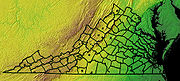
Virginia Seismic Zone
Encyclopedia
U.S. state
A U.S. state is any one of the 50 federated states of the United States of America that share sovereignty with the federal government. Because of this shared sovereignty, an American is a citizen both of the federal entity and of his or her state of domicile. Four states use the official title of...
of Virginia
Virginia
The Commonwealth of Virginia , is a U.S. state on the Atlantic Coast of the Southern United States. Virginia is nicknamed the "Old Dominion" and sometimes the "Mother of Presidents" after the eight U.S. presidents born there...
covers about 8,000 km2 (~3,000 mi2) in the Piedmont province. Earthquakes in the state are irregular and rarely top 4.5 on the Richter magnitude scale
Richter magnitude scale
The expression Richter magnitude scale refers to a number of ways to assign a single number to quantify the energy contained in an earthquake....
.
List of earthquakes
| Date | Magnitude | Location | Comments |
|---|---|---|---|
| February 21, 1774 | 4.5 | Near Petersburg Petersburg, Virginia Petersburg is an independent city in Virginia, United States located on the Appomattox River and south of the state capital city of Richmond. The city's population was 32,420 as of 2010, predominantly of African-American ethnicity... , Prince George County Prince George County, Virginia As of the census of 2000, there were 33,047 people, 10,159 households, and 8,096 families residing in the county. The population density was 124 people per square mile . There were 10,726 housing units at an average density of 40 per square mile... |
|
| August 27, 1833 | 4.5 | Central Virginia | |
| April 2, 1852 | 4.3 | Near Buckingham Buckingham, Virginia Buckingham is a census-designated place in and the county seat of Buckingham County, Virginia, United States... |
Central Virginia, about 55 km south of Charlottesville Charlottesville, Virginia Charlottesville is an independent city geographically surrounded by but separate from Albemarle County in the Commonwealth of Virginia, United States, and named after Charlotte of Mecklenburg-Strelitz, the queen consort of King George III of the United Kingdom.The official population estimate for... |
| April 29, 1852 | 4.9 | Near Wytheville Wytheville, Virginia Wytheville is a town in Wythe County, Virginia, United States. The population was 8,211 at the 2010 census. It is the county seat of Wythe County. The town is home to a Chautauqua Festival, held the third weekend in June every year since 1985... |
Wythe County Wythe County, Virginia As of the census of 2000, there were 27,599 people, 11,511 households, and 8,103 families residing in the county. The population density was 60 people per square mile . There were 12,744 housing units at an average density of 28 per square mile... |
| December 22–23, 1875 | 4.5 | Central Virginia | Near the James River James River (Virginia) The James River is a river in the U.S. state of Virginia. It is long, extending to if one includes the Jackson River, the longer of its two source tributaries. The James River drains a catchment comprising . The watershed includes about 4% open water and an area with a population of 2.5 million... waterfront in Goochland Goochland County, Virginia Goochland County is a county located in the Commonwealth of Virginia. As of 2010, the population was 21,717. Its county seat is Goochland. It is located in the Richmond-Petersburg region and is a portion of the Richmond Metropolitan Statistical Area .... and Powhatan Counties Powhatan County, Virginia As of the census of 2000, there were 22,377 people, 7,258 households, and 5,900 families residing in the county. The population density was 86 people per square mile . There were 7,509 housing units at an average density of 29 per square mile... , and in Louisa County Louisa County, Virginia Louisa County is a county located in the Commonwealth of Virginia. As of 2010, the population was 33,153. The county seat is Louisa.- History :... |
| May 3, 1897 | 4.3 | near Radford Radford, Virginia Radford is a city in Virginia, United States. The population was 16,408 in 2010. For statistical purposes, the Bureau of Economic Analysis combines the city of Radford with neighboring Montgomery County, including the towns of Blacksburg and Christiansburg, calling the combination the... |
Southwest Virginia |
| May 31, 1897 | 5.9 or 5.8 | Giles County Giles County, Virginia As of the census of 2000, there were 16,657 people, 6,994 households, and 4,888 families residing in the county. The population density was 47 people per square mile . There were 7,732 housing units at an average density of 22 per square mile... |
Largest earthquake in intensity; large areal extent with aftershocks continuing through June 6, 1897 |
| February 5, 1898 | unknown | Pulaski, Virginia Pulaski, Virginia Pulaski is a town in Pulaski County, Virginia, United States. The population was 9,086 at the 2010 census. It is the county seat of Pulaski County.Pulaski is part of the Blacksburg–Christiansburg–Radford Metropolitan Statistical Area.-History:... |
|
| February 11, 1907 | unknown | Near Arvonia Arvonia, Virginia Arvonia is an unincorporated community in Buckingham County, Virginia founded mainly by Welsh immigrants during the 19th century. The town derives its name from the popular port city of Caernarfon, Wales. Its major industry has been slate mining... |
Buckingham County |
| April 9–10, 1918 | unknown | Luray Luray, Virginia Luray is a town in Page County, Virginia, United States, in the Shenandoah Valley of the northern part of the state. It is also the county seat... |
Page County Page County, Virginia As of the census of 2000, there were 23,177 people, 9,305 households, and 6,634 families residing in the county. The population density was 74 people per square mile . There were 10,557 housing units at an average density of 34 per square mile... |
| September 5–6, 1919 | unknown | Near Front Royal Front Royal, Virginia Front Royal is a town in Warren County, Virginia, United States. The population was 13,589 at the 2000 census. It is the county seat of Warren County.-Geography:Front Royal is roughly west of Washington, D.C.... |
Warren County Warren County, Virginia As of the census of 2000, there were 31,584 people, 12,087 households, and 8,521 families residing in the county. The population density was 148 people per square mile . There were 13,299 housing units at an average density of 62 per square mile... |
| December 25–26, 1929 | unknown | Charlottesville Charlottesville, Virginia Charlottesville is an independent city geographically surrounded by but separate from Albemarle County in the Commonwealth of Virginia, United States, and named after Charlotte of Mecklenburg-Strelitz, the queen consort of King George III of the United Kingdom.The official population estimate for... |
Albemarle County Albemarle County, Virginia As of the census of 2000, there were 79,236 people, 31,876 households, and 21,070 families residing in the county. The population density was 110 people per square mile . There were 33,720 housing units at an average density of 47 per square mile... |
| April 23, 1959 | 3.8 | Giles County Giles County, Virginia As of the census of 2000, there were 16,657 people, 6,994 households, and 4,888 families residing in the county. The population density was 47 people per square mile . There were 7,732 housing units at an average density of 22 per square mile... |
strongest at Eggleston and Pembroke Pembroke, Virginia Pembroke is a town in Giles County, Virginia, United States. The population was 1,134 at the 2000 census. It is part of the Blacksburg–Christiansburg–Radford Metropolitan Statistical Area.-Geography:... |
| April 11, 1975 | unknown | Southwest Virginia, near Blacksburg Blacksburg, Virginia Blacksburg is an incorporated town located in Montgomery County, Virginia, United States, with a population of 42,620 at the 2010 census. Blacksburg, Christiansburg, and Radford are the three principal jurisdictions of the Blacksburg-Christiansburg-Radford Metropolitan Statistical Area which... |
Montgomery County Montgomery County, Virginia As of the census of 2000, there were 83,629 people, 30,997 households, and 17,203 families residing in the county. The population density was 215 people per square mile . There were 32,527 housing units at an average density of 84 per square mile... |
| December 9, 2003 15:59 EST | 4.5 | 37.599N -77.932W | in the foothills about 30 miles (48.3 km) west of Richmond Richmond, Virginia Richmond is the capital of the Commonwealth of Virginia, in the United States. It is an independent city and not part of any county. Richmond is the center of the Richmond Metropolitan Statistical Area and the Greater Richmond area... and was felt as far away as Norfolk Norfolk, Virginia Norfolk is an independent city in the Commonwealth of Virginia in the United States. With a population of 242,803 as of the 2010 Census, it is Virginia's second-largest city behind neighboring Virginia Beach.... |
| May 6, 2008 13:30 EDT | 1.9 | 38.80N -77.15W | epicenter was 1 mile SW Annandale Annandale, Virginia Annandale is a census-designated place in Fairfax County, Virginia, United States. The population was 41,008 at the 2010 census, down from 54,994 in 2000 due to the splitting off of the western part of it to form Wakefield and Woodburn CDP's.-Geography:... ; |
| May 16, 2009 04:08 EDT | 3.0 | 37.25N -80.00W | in Roanoke County Roanoke County, Virginia Roanoke County is a county located in the U.S. state of the Commonwealth of Virginia. It is part of the Roanoke Metropolitan Statistical Area and located within the Roanoke Region of Virginia. As of the 2000 census, the population was 85,778. As of 2010, the population was 92,376... , just outside the City of Roanoke Roanoke, Virginia Roanoke is an independent city in the Mid-Atlantic U.S. state of Virginia and is the tenth-largest city in the Commonwealth. It is located in the Roanoke Valley of the Roanoke Region of Virginia. The population within the city limits was 97,032 as of 2010... ; |
| July 6, 2009 23:59:52 EDT | 2.3 | 37.64N -77.64W | about 1 km SW of Short Pump Short Pump, Virginia Short Pump is a census-designated place in Henrico County, Virginia, United States. The population was 182 at the 2000 census.The village of Short Pump, located at the intersection of Three Chopt Road, Richmond Turnpike and Pouncey Tract Road, was named for the short handled pump beneath the... ; Magnitude 2.3 |
| July 16, 2010 05:18 EDT | 3.6 | 39.187N 77.286W | between Germantown and Gaithersburg, Maryland Gaithersburg, Maryland Gaithersburg is a city in Montgomery County, Maryland, United States. The city had a population of 59,933 at the 2010 census, making it the fourth largest incorporated city in the state, behind Baltimore, Frederick, and Rockville... ; |
| August 23, 2011 13:51 EDT 2011 Virginia earthquake The 2011 Virginia earthquake occurred on August 23, 2011, at 1:51 pm EDT in the Piedmont region of the U.S. state of Virginia. The epicenter, in Louisa County, was northwest of Richmond and south-southwest of the town of Mineral... http://earthquake.usgs.gov/earthquakes/recenteqsww/Quakes/se082311a.html |
5.8 | 37.936N 77.933W | Louisa County Louisa County, Virginia Louisa County is a county located in the Commonwealth of Virginia. As of 2010, the population was 33,153. The county seat is Louisa.- History :... , VA, 5 miles SSW of Mineral Mineral, Virginia Mineral is a town in Louisa County, Virginia, United States. The population was 424 at the 2000 census.-History:Mineral was originally known as Tolersville, but adopted its current name when it incorporated in 1902 due to the mining industry that supported the community... and 37 miles NW of Richmond Richmond, Virginia Richmond is the capital of the Commonwealth of Virginia, in the United States. It is an independent city and not part of any county. Richmond is the center of the Richmond Metropolitan Statistical Area and the Greater Richmond area... |
2003 earthquakes
On December 9, 2003 at 3:59 p.m. EST (20:59 UTC), a magnitude 4.5 event occurred near Farmville, about 30 miles (48.3 km) west of Richmond, VirginiaRichmond, Virginia
Richmond is the capital of the Commonwealth of Virginia, in the United States. It is an independent city and not part of any county. Richmond is the center of the Richmond Metropolitan Statistical Area and the Greater Richmond area...
, and was felt strongly across Virginia
Virginia
The Commonwealth of Virginia , is a U.S. state on the Atlantic Coast of the Southern United States. Virginia is nicknamed the "Old Dominion" and sometimes the "Mother of Presidents" after the eight U.S. presidents born there...
. Tremors were reported in North Carolina
North Carolina
North Carolina is a state located in the southeastern United States. The state borders South Carolina and Georgia to the south, Tennessee to the west and Virginia to the north. North Carolina contains 100 counties. Its capital is Raleigh, and its largest city is Charlotte...
, the District of Columbia, and suburban Maryland
Maryland
Maryland is a U.S. state located in the Mid Atlantic region of the United States, bordering Virginia, West Virginia, and the District of Columbia to its south and west; Pennsylvania to its north; and Delaware to its east...
, eastern West Virginia
West Virginia
West Virginia is a state in the Appalachian and Southeastern regions of the United States, bordered by Virginia to the southeast, Kentucky to the southwest, Ohio to the northwest, Pennsylvania to the northeast and Maryland to the east...
, southern Pennsylvania
Pennsylvania
The Commonwealth of Pennsylvania is a U.S. state that is located in the Northeastern and Mid-Atlantic regions of the United States. The state borders Delaware and Maryland to the south, West Virginia to the southwest, Ohio to the west, New York and Ontario, Canada, to the north, and New Jersey to...
, and portions of the Delmarva Peninsula
Delmarva Peninsula
The Delmarva Peninsula is a large peninsula on the East Coast of the United States, occupied by most of Delaware and portions of Maryland and Virginia...
. This event was located at 37.728° N, 78.087° W, at a depth of less than 5 km (3.1 mi) and may have occurred due to rupture along the Lakeside fault.
The December earthquake was preceded by a magnitude 3.8 event on May 5, 2003 whose epicenter was located approximately 40 miles NNE near Cartersville, VA.
2011 earthquake
The U.S. Geological Survey (USGS)United States Geological Survey
The United States Geological Survey is a scientific agency of the United States government. The scientists of the USGS study the landscape of the United States, its natural resources, and the natural hazards that threaten it. The organization has four major science disciplines, concerning biology,...
reported that a magnitude 5.8 Mw earthquake hit Virginia on Tuesday, August 23, 2011, at 17:51:04 UTC (1:51 pm Eastern Daylight Time). The quake occurred at an approximate depth of 3.7 miles and was centered in Louisa County
Louisa County, Virginia
Louisa County is a county located in the Commonwealth of Virginia. As of 2010, the population was 33,153. The county seat is Louisa.- History :...
(location at 37.936°N, 77.933°W), 5 miles SSW of Mineral
Mineral, Virginia
Mineral is a town in Louisa County, Virginia, United States. The population was 424 at the 2000 census.-History:Mineral was originally known as Tolersville, but adopted its current name when it incorporated in 1902 due to the mining industry that supported the community...
, Virginia
Virginia
The Commonwealth of Virginia , is a U.S. state on the Atlantic Coast of the Southern United States. Virginia is nicknamed the "Old Dominion" and sometimes the "Mother of Presidents" after the eight U.S. presidents born there...
and 37 miles NW of Richmond
Richmond, Virginia
Richmond is the capital of the Commonwealth of Virginia, in the United States. It is an independent city and not part of any county. Richmond is the center of the Richmond Metropolitan Statistical Area and the Greater Richmond area...
, Virginia's capital. Shaking was felt from from Atlanta, Georgia
Atlanta, Georgia
Atlanta is the capital and most populous city in the U.S. state of Georgia. According to the 2010 census, Atlanta's population is 420,003. Atlanta is the cultural and economic center of the Atlanta metropolitan area, which is home to 5,268,860 people and is the ninth largest metropolitan area in...
to Illinois
Illinois
Illinois is the fifth-most populous state of the United States of America, and is often noted for being a microcosm of the entire country. With Chicago in the northeast, small industrial cities and great agricultural productivity in central and northern Illinois, and natural resources like coal,...
to Detroit, Michigan
Detroit, Michigan
Detroit is the major city among the primary cultural, financial, and transportation centers in the Metro Detroit area, a region of 5.2 million people. As the seat of Wayne County, the city of Detroit is the largest city in the U.S. state of Michigan and serves as a major port on the Detroit River...
to Toronto, Ontario to New Brunswick
New Brunswick
New Brunswick is one of Canada's three Maritime provinces and is the only province in the federation that is constitutionally bilingual . The provincial capital is Fredericton and Saint John is the most populous city. Greater Moncton is the largest Census Metropolitan Area...
. Many Washington, DC buildings saw precautionary evacuations.
The earthquake caused an estimated $70 million in damage in Louisa County and forced Louisa County High School and Thomas Jefferson Elementary School to close for the year as well as rendered about a dozen homes unlivable. Other buildings were damaged as far away as Prince George's County, Maryland
Maryland
Maryland is a U.S. state located in the Mid Atlantic region of the United States, bordering Virginia, West Virginia, and the District of Columbia to its south and west; Pennsylvania to its north; and Delaware to its east...
. Three decorative pinnacles at Washington National Cathedral
Washington National Cathedral
The Washington National Cathedral, officially named the Cathedral Church of Saint Peter and Saint Paul, is a cathedral of the Episcopal Church located in Washington, D.C., the capital of the United States. Of neogothic design, it is the sixth-largest cathedral in the world, the second-largest in...
fell. The Washington Monument
Washington Monument
The Washington Monument is an obelisk near the west end of the National Mall in Washington, D.C., built to commemorate the first U.S. president, General George Washington...
was closed due to cracks in the top section.
A 4.2 aftershock occurred in central Virginia at approximately 8:05pm EDT, August 23, 2011.
Another 4.5 magnitude was detected just south of Mineral, Virginia on August 25, 2011 at 1:07:50 EDT.