

Utah Scenic Byways
Encyclopedia

Utah
Utah is a state in the Western United States. It was the 45th state to join the Union, on January 4, 1896. Approximately 80% of Utah's 2,763,885 people live along the Wasatch Front, centering on Salt Lake City. This leaves vast expanses of the state nearly uninhabited, making the population the...
has designated a system of Utah Scenic Byways in addition to the National Scenic Byway
National Scenic Byway
A National Scenic Byway is a road recognized by the United States Department of Transportation for its archeological, cultural, historic, natural, recreational, and/or scenic qualities. The program was established by Congress in 1991 to preserve and protect the nation's scenic but often...
s that are defined within the state. Some of the state designated routes overlap with the federal designations. The Utah Department of Transportation has signed both the state and federal designations with a Scenic Byway plaque directly below the route number. The byway system is defined at Utah Administrative Code section R926-13. The state has also designated some local, county and Forest Service roads as Scenic Backways.
National Scenic Byways in Utah
| Name | From | To | Highways Designated | Notes |
|---|---|---|---|---|
| Dinosaur Diamond Prehistoric Highway | Price Price, Utah Price is a city in Carbon County, Utah, United States. The city is home to the USU-College of Eastern Utah, as well as the large USU Eastern Prehistoric Museum affiliated with the college. Price is located within short distances from both Nine Mile Canyon and the Manti-La Sal National Forest... |
Delta, CO Delta, Colorado The City of Delta is the county seat and the most populous city of Delta County, Colorado, United States. The population was 8,915 at the 2010 census... |
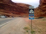
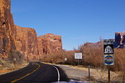
US-191, US-40, CO-64 Colorado State Highway 64 State Highway 64 is a 74-mile long two-lane state highway connecting the towns of Dinosaur and Meeker in the western part of the U.S. state of Colorado. It is located in both Moffat and Rio Blanco counties. The western end of State Highway 64 is part of the Dinosaur Diamond Scenic Byway, while the... , CO-139 Colorado State Highway 139 State Highway 139 is a long state highway in far western Colorado.-Route description:SH 139 begins in the south at exit 15 of Interstate 70 at Loma roughly fifteen miles west of Grand Junction. From there the road proceeds northward through very remote, very sparsely populated land to its... , I-70, US-50, SR-128 Utah State Route 128 State Route 128 is a state highway in the U.S. state of Utah. The entire length of the highway has been designated the Upper Colorado River Scenic Byway, as part of the Utah Scenic Byways program. This road also forms part of the Dinosaur Diamond Prehistoric Highway, a National Scenic Byway... |
Diamond-shaped loop in Utah and Colorado |
| The Energy Loop: Huntington/Eccles Canyons Scenic Byway The Energy Loop: Huntington/Eccles Canyons Scenic Byway The Energy Loop: Huntington/Eccles Canyons Scenic Byway is a National Scenic Byway in the state of Utah. It spans approximately as it travels from Fairview through the Manti-La Sal National Forest southeast to Huntington via Huntington Canyon, and northeast to near Colton via Eccles Canyon.-Route... |
Fairview Fairview, Utah Fairview is a city in Sanpete County, Utah, United States. The population was 1,160 at the 2000 census.-History:Located at the confluence of the San Pitch River and Cottonwood Creek, Fairview is the largest town in the northeast end of the Sanpete Valley... |
Huntington Huntington, Utah Huntington is a town in Emery County, Utah, United States. The population was 2,131 at the 2000 census. It is the largest town in Emery County.-History:... |
SR-31 Utah State Route 31 State Route 31 is a state highway in Sanpete and Emery Counties in the U.S. state of Utah. It runs for from US-89 at Fairview to SR-10 in Huntington... , SR-96 Utah State Route 96 State Route 96 is a state highway in the U.S. state of Utah, connecting SR-264 and the town of Scofield to US-6 in a span of . The route is known as the Eccles Canyon Scenic Byway, part of The Energy Loop, a National Scenic Byway.... |
Made up of Eccles Canyon Scenic Byway and Huntington Canyon Scenic Byway |
| Flaming Gorge-Uintas Scenic Byway Flaming Gorge-Uintas Scenic Byway The Flaming Gorge - Uintas Scenic Byway is a National Scenic Byway in the state of Utah. It spans approximately as it travels from Vernal, Utah northward through the Ashley National Forest and the Uintah Mountains to the area around Flaming Gorge National Recreation Area in the northeastern corner... |
Vernal Vernal, Utah Vernal, Uintah County's largest city, is located in eastern Utah near the Colorado State Line, and 175 miles east of Salt Lake City. It is bordered on the north by the Uinta Mountains, one of the few mountains ranges in the world which lie in an east-west rather than the usual north to south... |
Manila Manila, Utah Manila is a small town located in at the northern edge of Daggett County, Utah, just south of the Wyoming border. The town is at the junction of State Route 43 and State Route 44, and is the county seat of Daggett County... |
US-191, SR-44 Utah State Route 44 State Route 44 is a state highway in the U.S. state of Utah that runs from US-191 at Greendale Junction, southwest of Dutch John, to SR-43 in Manila... |
|
| Highway 12 - A Journey Through Time Scenic Byway | near Panguitch Panguitch, Utah Panguitch is a city in and the county seat of Garfield County, Utah, United States. The population was 1,623 at the 2000 census.-Geography:Panguitch is located at .... |
near Torrey Torrey, Utah Torrey is a town located on State Route 24 in Wayne County, Utah, eight miles from Capitol Reef National Park. As of the 2000 census, the town had a total population of 171.... |
SR-12 | Also designated an All american road |
| Logan Canyon Scenic Byway | Logan Logan, Utah -Layout of the City:Logan's city grid originates from its Main and Center Street block, with Main Street running north and south, and Center east and west. Each block north, east, south, or west of the origin accumulates in additions of 100 , though some streets have non-numeric names... |
Bear Lake Bear Lake (Idaho-Utah) Bear Lake is a natural freshwater lake on the Utah-Idaho border in the Western United States. It is the second largest natural freshwater lake in Utah and has been called the "Caribbean of the Rockies" for its unique turquoise-blue color, the result of suspended limestone deposits in the water... |
US-89 | |
| Nebo Loop Scenic Byway | near Nephi Nephi, Utah Nephi is a city in Juab County, Utah, United States. It is part of the Provo–Orem, Utah Metropolitan Statistical Area. The population was 4,733 at the 2000 census. It is the county seat of Juab County. It was settled by Mormon pioneers in 1851, and is the principal city in Juab Valley, an... |
near Payson Payson, Utah Payson is a city in Utah County, Utah, United States. It is part of the Provo–Orem, Utah Metropolitan Statistical Area. The population was 12,716 at the 2000 census. The current mayor is Rick Moore, who in the 2009 election was the first write-in candidate ever to defeat an incumbent mayor in... |
USFS road | |
| Trail of the Ancients Trail of the Ancients The Trail of the Ancients is an National Scenic Byway located in the states of Colorado and Utah. The route highlights the archaeological and cultural history of southwestern Native American peoples, and traverses the widely diverse geological landscape of the Four Corners region... |
Natural Bridges National Monument Natural Bridges National Monument Natural Bridges National Monument is a U.S. National Monument located about north west of the Four Corners boundary of southeast Utah, in the western United States, at the junction of White Canyon and Armstrong Canyon, part of the Colorado River drainage... |
Mesa Verde National Park Mesa Verde National Park Mesa Verde National Park is a U.S. National Park and UNESCO World Heritage Site located in Montezuma County, Colorado, United States. It was created in 1906 to protect some of the best-preserved cliff dwellings in the world... |
US-163, SR-261, SR-275, SR-95, US-191, SR-162 Utah State Route 162 State Route 162 is a state highway located in San Juan County, Utah. It begins at US-191 east of Bluff. It then follows the former alignment of SR-163 to Montezuma Creek. There, it intersects UT-262 at its southern terminus. Afterwards, it follows SR-262's former alignment past Aneth to the... , SR-262 Utah State Route 262 State Route 262 is a highway completely within San Juan County in southeastern Utah that connects US-191 north of Bluff to SR-162 in Montezuma Creek.-Route description:... , CO-41 Colorado State Highway 41 State Highway 41 is a highway on the Ute Mountain Ute Indian Reservation in southwest Colorado.-Route description:SH 41 runs , starting at a junction with US-160 near the Four Corners Monument. The highway goes northwest and ends at the Utah state line... , US-160, CO-145 Colorado State Highway 145 State Highway 145 is a long state highway in western Colorado.-Route description:The route begins in the south at its intersection with U.S. Highway 160 in the eastern portion of the city of Cortez... , CO-184 Colorado State Highway 184 State Highway 184 is a long state highway in the southwestern corner of Colorado.-Route description:SH 184 begins in the west at its junction with US 491 near Lewis and travels ESE to Mancos... , US-491, Montezuma County CC, San Juan County 414 |
Several Roads in the Four Corners region. Though the federal designation only lists routes in Utah and Colorado, the Four Corners Monument Four Corners Monument The Four Corners Monument marks the quadripoint in the Southwestern United States where the states of Arizona, Colorado, New Mexico and Utah meet. It is the only point in the United States shared by four states, leading to this area being called the Four Corners region... is included as an attraction which requires entering New Mexico New Mexico New Mexico is a state located in the southwest and western regions of the United States. New Mexico is also usually considered one of the Mountain States. With a population density of 16 per square mile, New Mexico is the sixth-most sparsely inhabited U.S... to access. |
State designated scenic byways
| Name | Highways | Notes |
|---|---|---|
| Bear Lake Scenic Byway | , Garden City (US-89) to Laketown | |
| Beaver Canyon Scenic Byway | , Beaver (SR-160) to Elk Meadows | |
| Bicentennial-Trail of the Ancients Scenic Byway | , Hanksville (SR-24) to Colorado Colorado Colorado is a U.S. state that encompasses much of the Rocky Mountains as well as the northeastern portion of the Colorado Plateau and the western edge of the Great Plains... ; branches to Natural Bridges National Monument Natural Bridges National Monument Natural Bridges National Monument is a U.S. National Monument located about north west of the Four Corners boundary of southeast Utah, in the western United States, at the junction of White Canyon and Armstrong Canyon, part of the Colorado River drainage... via SR-275 and Blanding via US-191 |
A portion is included in the Trail of the Ancients Trail of the Ancients The Trail of the Ancients is an National Scenic Byway located in the states of Colorado and Utah. The route highlights the archaeological and cultural history of southwestern Native American peoples, and traverses the widely diverse geological landscape of the Four Corners region... National Scenic Byway |
| Big Cottonwood Canyon Scenic Byway | , Cottonwood Heights Cottonwood Heights, Utah Cottonwood Heights is a city located in Salt Lake County, Utah, United States, along the east bench of the Salt Lake Valley. It lies south of the cities of Holladay and Murray, east of Midvale, and north of Sandy within the Salt Lake City, Utah Metropolitan Statistical Area. Following a successful... (SR-210) to Brighton |
|
| Brian Head-Panguitch Lake Scenic Byway | , Parowan (I-15) to Panguitch (US-89) | |
| Capitol Reef Country Scenic Byway | , Loa (SR-72) to Hanksville (SR-95) | |
| Cedar Breaks Scenic Byway | , SR-14 to SR-143 via Cedar Breaks National Monument Cedar Breaks National Monument Cedar Breaks National Monument is a U.S. National Monument located in the U.S. state of Utah near Cedar City. Cedar Breaks is a natural amphitheater canyon, stretching across , with a depth of over . The elevation of the rim of the canyon is over above sea level.The eroded rock of the canyon is... |
|
| Dead Horse Point Mesa Scenic Byway | , US-191 to Dead Horse Point State Park Dead Horse Point State Park Dead Horse Point State Park is a state park of Utah, USA, featuring a dramatic overlook of the Colorado River and Canyonlands National Park. The park is so named because of its use as a natural corral by cowboys in the 19th century... ; branch to Grandview Point via Island in the Sky Road |
|
| Fish Lake Scenic Byway | , SR-24 to SR-72 | |
| Great Salt Lake Legacy Parkway Scenic Byway | , Salt Lake City Salt Lake City, Utah Salt Lake City is the capital and the most populous city of the U.S. state of Utah. The name of the city is often shortened to Salt Lake or SLC. With a population of 186,440 as of the 2010 Census, the city lies in the Salt Lake City metropolitan area, which has a total population of 1,124,197... (I-215) to Farmington Farmington, Utah Farmington is a city in Davis County, Utah, United States. It is part of the Ogden–Clearfield, Utah Metropolitan Statistical Area. The population was 18,255 at the 2010 census. It is the county seat of Davis County... (I-15) |
Also designated as the Legacy Parkway Legacy Parkway Legacy Parkway is a four-lane freeway completely within Davis County in the northern part of the U.S. state of Utah, running from Interstate 215 in North Salt Lake to Interstate 15 and US-89 in Farmington. Construction began in 2006 and was completed in 2008, with the freeway opening in September... |
| Indian Canyon Scenic Byway | , Helper (US-6) to Duchesne (US-40) | Part of the Dinosaur Diamond Prehistoric Highway |
| Indian Creek Scenic Byway | , US-191 to Canyonlands National Park Canyonlands National Park Canyonlands National Park is a U.S. National Park located in southeastern Utah near the town of Moab and preserves a colorful landscape eroded into countless canyons, mesas and buttes by the Colorado River, the Green River, and their respective tributaries. The park is divided into four districts:... |
|
| Kolob Fingers Road Scenic Byway | Zion National Park Zion National Park Zion National Park is located in the Southwestern United States, near Springdale, Utah. A prominent feature of the park is Zion Canyon, which is 15 miles long and up to half a mile deep, cut through the reddish and tan-colored Navajo Sandstone by the North Fork of the Virgin River... road, I-15 to Kolob Canyon Overlook |
|
| Little Cottonwood Canyon Scenic Byway | , Granite Granite, Utah Granite is a census-designated place in Salt Lake County, Utah, United States, adjoining the City of Sandy on the east. As of the 2000 census, the CDP population was 2,018, a decrease from the 1990 population of 3,300 largely due to annexations by Sandy. Salt Lake County has designated a Granite... (SR-209) to Alta Alta, Utah Alta is a town in Salt Lake County, Utah, United States. It is part of the Salt Lake City, Utah Metropolitan Statistical Area. The population was 370 at the 2000 census, a slight decrease from the 1990 figure of 397.... |
|
| Markagunt High Plateau Scenic Byway | , Cedar City (SR-130) to Long Valley Junction (US-89) | |
| Mirror Lake Scenic Byway | , Kamas (SR-32) to Wyoming Wyoming Wyoming is a state in the mountain region of the Western United States. The western two thirds of the state is covered mostly with the mountain ranges and rangelands in the foothills of the Eastern Rocky Mountains, while the eastern third of the state is high elevation prairie known as the High... |
Cuts through the western Uinta Mountains Uinta Mountains The Uinta Mountains are a high chain of mountains in northeastern Utah and extreme northwestern Colorado in the United States. A subrange of the Rocky Mountains, they are unusual for being the highest range in the contiguous United States running east to west, and lie approximately east of Salt... and is the highest paved road in Utah with a summit Route summit A route summit is the highest point on a transportation route crossing higher ground. The term is often used in describing railway routes, less often in road transportation... at elevation 10715 ft (3,265.9 m). (3266 m) |
| Monument Valley to Bluff Scenic Byway | , Arizona Arizona Arizona ; is a state located in the southwestern region of the United States. It is also part of the western United States and the mountain west. The capital and largest city is Phoenix... to Bluff |
Part of the Trail of the Ancients Trail of the Ancients The Trail of the Ancients is an National Scenic Byway located in the states of Colorado and Utah. The route highlights the archaeological and cultural history of southwestern Native American peoples, and traverses the widely diverse geological landscape of the Four Corners region... |
| Mt. Carmel Scenic Byway | , Kanab to Bryce Canyon Junction (SR-12) | |
| Ogden River Scenic Byway | , Ogden at the mouth of Ogden Canyon Ogden Canyon thumb|350px|Ogden CanyonOgden Canyon is a canyon near Ogden, Utah, United States.-Geography:Ogden Canyon is an about long canyon with a series of smaller side canyons in the Wasatch Range. It was carved by the long Ogden River... to west of Woodruff; loops around Pineview Reservoir via SR-158 and former SR-166 |
|
| Potash-Lower Colorado River Scenic Byway | , potash mine to US-191 | |
| Provo Canyon Scenic Byway | , Provo (SR-52) to Heber City (US-40) | |
| Upper Colorado River Scenic Byway | , US-191 near Moab to I-70 near Cisco | Part of the Dinosaur Diamond Prehistoric Highway |
| Zion Park Scenic Byway | , I-15 to Mt. Carmel Junction (US-89) |
External links
- Utah-- National Scenic Byways Program by U.S. Department of Transportation
- Utah Scenic Byways by Utah Office of Tourism/Utah Travel Industry