

U.S. Route 5 in Connecticut
Encyclopedia
U.S. Route 5
(US 5), a north–south U.S. Highway that is generally paralleled by Interstate 91
, begins at the city of New Haven
in Connecticut
and heads north through western Massachusetts
and eastern Vermont
to the international border with Canada
. Within Connecticut, US 5 proceeds north from New Haven and passes through Meriden and Hartford towards Springfield, Massachusetts
.
US 5 begins at Exit 5 of I-91 northeast of downtown New Haven, heading north through the suburbs of New Haven. It crosses the Quinnipiac River
in North Haven
, shifting eastward to a different road. US 5 continues north through the town of Wallingford
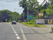
before entering the city of Meriden
. North of Meriden, it becomes a four-lane divided highway known as the Berlin Turnpike
, where a long overlap with Route 15
also begins. US 5 continues through the southern suburbs of Hartford
along the Berlin Turnpike, shifting just south of the city line to the Wilbur Cross Highway
, a limited access highway. The Wilbur Cross Highway bypasses downtown Hartford and crosses the Connecticut River
on the Charter Oak Bridge
into East Hartford
. From here, US 5 exits the Wilbur Cross Highway and runs along a four-lane, divided surface road to South Windsor
before returning to a two-lane road the rest of the way to the Massachusetts state line in Enfield
.
US 5 roughly follows the route used by the Upper Boston Post Road, an early colonial highway for transporting mail between New York City
and Boston
. The route was first improved in 1798 as the Hartford and New Haven Turnpike
, which ran in a nearly straight line between the court houses of New Haven and Hartford. In 1922, the Upper Boston Post Road corridor was designated as Route 2 of the New England road marking system, crossing to the east of the Connecticut River in Hartford before continuing north to the Massachusetts state line. In 1926, Route 2 was redesignated as U.S. Route 5. Several realignments have been made in the cities of New Haven and Hartford with the opening of several expressways in these areas. Because it is closely paralleled by Interstate 91 between New Haven and Hartford, US 5 serves mainly as a secondary route today.
. It has an interchange with Route 40
in this area. US 5 then turns right at the intersection with Bishop Street in North Haven and crosses the Quinnipiac River, the railroad tracks, and I-91 (at Exit 11) overlapped with Route 22
on a four-lane wide road.
The bridge ends at a four-way intersection where US 5 turns left on Washington Avenue, Route 22 continues straight on Clintonville Road, and Route 103 begins on the right along Washington Avenue. The four-lane Washington Avenue runs through the commercial areas of North Haven still paralleling the railroad tracks, crosses under I-91 (at Exit 12) and continues into Wallingford as South Colony Street. At the town line is the Wharton Brook State Park
just north of which is a short expressway connector (Wharton Brook Connector) to I-91 (at Exit 13). South Colony Street narrows to two lanes within the Wallingford town center.
After crossing Center Street (Route 150) near the Wallingford train station, the road becomes North Colony Street and heads out of the town center. The road crosses Route 68
at a grade-separated junction about two miles (three km) later, followed by a series of junctions about half a mile (0.8 km) apart each: an interchange with the Wilbur Cross Parkway
(at Exit 66), a split to the left where Route 71 begins and a merge from the left where Route 150 ends.
 At the merge with Route 150 just before the town line, US 5 then follows South Broad Street (the alignment of the old Hartford and New Haven Turnpike) into the city of Meriden. South Broad Street becomes Broad Street after the intersection with Hall Avenue as it passes by the eastern part of the city, avoiding the downtown area. Past Olive Street, the road becomes divided with a wide grassy median. At the north end of the divided section, it has an intersection with East Main Street, the main east–west business route through the city. About 0.7 miles (1.1 km) north of East Main Street, US 5 has an interchange with I-691 (at Exit 8). At the intersection with Brittania Street, the road becomes North Broad Street, which climbs up on a slope as it meets with the north end of the Wilbur Cross Parkway
. The northbound roadway overpasses the Parkway and then merges onto it from the right. This is the beginning of a 15 miles (24.1 km) overlap with Route 15
. Southbound at the beginning of the Parkway, US 5 is signed as an exit (with no number) from the main roadway. North Broad Street continues north from the merge as a divided 4-lane arterial road for another 1.1 miles (1.8 km) up to the Berlin town line, where the road becomes the Berlin Turnpike
.
 US 5 and Route 15 run for 10 miles (16.1 km) along the Berlin Turnpike within the towns of Berlin, Newington, and Wethersfield. The Berlin Turnpike is mostly a four-lane divided arterial road with some six-lane sections and is the alignment of the old Hartford and New Haven Turnpike. In Berlin, it has an interchange with the Route 9
expressway. In Wethersfield, Routes 5 and 15 leave the Berlin Turnpike to travel along the Wilbur Cross Highway
, an expressway bypass along the south of downtown Hartford. The Wilbur Cross Highway runs through Wethersfield and Hartford, then crosses the Connecticut River
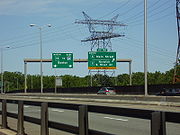
into East Hartford on the Charter Oak Bridge
. Just prior to the river crossing in Hartford, the Wilbur Cross Highway runs parallel to and interconnects with I-91 near the vicinity of Brainard Airport. Just after the crossing, US 5 exits from the Wilbur Cross Highway on Exit 90, ending the long overlap with Route 15. US 5 continues north to East Hartford center along Main Street.
From East Hartford northward to the Massachusetts state line, US 5 runs along the east bank of the Connecticut River. Main Street in East Hartford is mostly a 4-lane divided highway. It crosses under I-84 about 0.5 mile (0.80467 km) north of the split with Route 15 with access to the westbound direction only. Main Street continues through the town center, intersecting (and briefly overlapping) U.S. Route 44. North of the town center, US 5 leaves Main Street to go on Ellington Road (via a short segment of King Street) until the South Windsor town line, where the road becomes known as John Fitch Boulevard (still a four-lane divided arterial road). About half a mile (0.8 km) further north, US 5 has an interchange with I-291 (at Exit 4) that also includes access to Route 30
, the main road to the South Windsor town center. John Fitch Boulevard continues through the rest of South Windsor, passing through the village of East Windsor Hill near the East Windsor town line.
After crossing into the town of East Windsor, the roadway becomes two lanes wide with auxiliary left turn lanes and is known as South Main Street. It intersects with Route 191 (Phelps Street), which leads to the East Windsor town center. About half a mile (0.8 km) north of this junction, US 5 leaves Main Street to go on Prospect Hill Road, bypassing the Warehouse Point area. There is also a partial interchange with I-91 in this area (at Exit 44). Just south of the Enfield town line, US 5 intersects with Route 140, which crosses the Connecticut River into the town of Windsor Locks
and Bradley International Airport
.
In Enfield, the road becomes known as King Street, crossing over I-91 with a full interchange (Exit 46). As it approaches the town center, the road becomes known as Enfield Street. It has a grade-separated intersection with Route 190 in this area. Just before going across the state line, US 5 crosses over I-91 again (at Exit 49) and becomes Longmeadow Street as it enters the town of Longmeadow, Massachusetts
.
and Route 99) and via Meriden (now very roughly US 5). North of Hartford, the road remained on the west side of the Connecticut River
, following the general path of present Route 159
.
Along this route between New Haven and Hartford, the Hartford and New Haven Turnpike
was chartered in 1798 and opened in 1799, beginning at Grove Street in New Haven and leaving on Whitney Avenue, passing via Meriden and Berlin, and entering Hartford on Maple Avenue. This was one of the first turnpikes to be built on a straight line rather than along existing roads.
In the 1910s, Connecticut and Massachusetts adopted a system of marking major roads by colors. The route from New Haven to Springfield, crossing the Connecticut River at Hartford, was marked with blue bands, signifying a major north–south route. This route crossed the Quinnipiac River
in New Haven, heading north along an old road (now Route 103 and US 5) to Tracy, crossing the turnpike and running through downtown Meriden on Old Colony Road, Cook Avenue, and Colony Street. It then used the turnpike alignment from Lamentation State Park into Hartford. From East Hartford north to Springfield, another older road was used.
 When the New England road marking system was adopted in 1922, Route 2 was assigned to a route from New Haven north via Hartford and Springfield towards Sherbrooke, Quebec
. This route followed the older blue-banded route from New Haven north to Hartford. At Hartford, Route 2 crossed the Connecticut River on the Bulkeley Bridge
and ran north from East Hartford to Springfield on the east side of the river.
U.S. Route 5 was designated in 1926 along the Route 2 alignment. Between 1926 and 1932, U.S. Route 5 and Route 2 were co-signed throughout the length of the route. In the 1932 state highway renumbering
, the Route 2 designation was removed, leaving only the US 5 designation. Only a small number of changes have been made since then, the most prominent being in the cities of New Haven and Hartford.
US 5 initially used Temple Street, Whitney Avenue, Edwards Street and upper State Street in New Haven, beginning at U.S. Route 1 (Chapel Street). By the 1940s, it had been moved onto a bypass of the downtown area, consisting of Edwards Street, Hillside Place, Munson Street, Henry Street, Sherman Avenue, Winthrop Avenue, and Davenport Avenue, ending at US 1 west of downtown. At the time, it still crossed the river on Middletown Avenue; the route leaving to the north on State Street was signed as an alternate route. The main and alternate routes were swapped by the mid-1950s, and US 5 was sent down East Street to US 1. (The alternate is now Route 103.) The old bypass became extensions of Route 80
and Route 10, but is now unnumbered. The final changes truncated US 5 to I-91 when I-91 opened in 1966 in New Haven, and relocated US 5 to the new Route 22
Connector across I-91 in North Haven in 1973, leaving the old route on Broadway as unsigned State Road 729.
In Hartford, the original alignment of US 5 entered the city on Maple Avenue and made its way to the Bulkeley Bridge
via Main Street, Central Row, and Columbus Boulevard. The route was shifted slightly eastward to Wyllys Street and Columbus Boulevard by 1941. The opening of the Charter Oak Bridge
and Hartford Bypass on September 5, 1942 led to US 5 bypassing downtown Hartford on its current alignment; U.S. Route 5A, an alternate route on the west side of the Connecticut River to Springfield, was extended south along Main Street to the beginning of the bypass.
In the early 1940s, several sections of US 5 in the Hartford area were upgraded to four-lane boulevards. The Berlin Turnpike segment was reconstructed as a divided four-lane highway, with several segments also straightened out. In East Hartford and South Windsor, a new four-lane divided highway, John Fitch Boulevard, was also constructed. Both of these roadways opened in 1942. In 1948, Route 15
was designated on the Berlin Turnpike and Hartford Bypass segments of US 5 in order to connect the Merritt Parkway
and Wilbur Cross Parkway
to the Wilbur Cross Highway
, providing a continuous high-speed route between New York and Massachusetts.
has been given a commemorative designation by the Connecticut General Assembly over the years. The following segments of U.S. Route 5 have such designations:
U.S. Route 5
U.S. Route 5 is a north–south United States highway running through the New England states of Connecticut, Massachusetts, and Vermont. Significant cities along the route include New Haven, Connecticut; Hartford, Connecticut; and Springfield, Massachusetts. From Hartford northward to St...
(US 5), a north–south U.S. Highway that is generally paralleled by Interstate 91
Interstate 91
Interstate 91 is an Interstate Highway in the New England region of the United States. It provides the primary north–south thoroughfare in the western part of New England...
, begins at the city of New Haven
New Haven, Connecticut
New Haven is the second-largest city in Connecticut and the sixth-largest in New England. According to the 2010 Census, New Haven's population increased by 5.0% between 2000 and 2010, a rate higher than that of the State of Connecticut, and higher than that of the state's five largest cities, and...
in Connecticut
Connecticut
Connecticut is a state in the New England region of the northeastern United States. It is bordered by Rhode Island to the east, Massachusetts to the north, and the state of New York to the west and the south .Connecticut is named for the Connecticut River, the major U.S. river that approximately...
and heads north through western Massachusetts
Massachusetts
The Commonwealth of Massachusetts is a state in the New England region of the northeastern United States of America. It is bordered by Rhode Island and Connecticut to the south, New York to the west, and Vermont and New Hampshire to the north; at its east lies the Atlantic Ocean. As of the 2010...
and eastern Vermont
Vermont
Vermont is a state in the New England region of the northeastern United States of America. The state ranks 43rd in land area, , and 45th in total area. Its population according to the 2010 census, 630,337, is the second smallest in the country, larger only than Wyoming. It is the only New England...
to the international border with Canada
Canada
Canada is a North American country consisting of ten provinces and three territories. Located in the northern part of the continent, it extends from the Atlantic Ocean in the east to the Pacific Ocean in the west, and northward into the Arctic Ocean...
. Within Connecticut, US 5 proceeds north from New Haven and passes through Meriden and Hartford towards Springfield, Massachusetts
Springfield, Massachusetts
Springfield is the most populous city in Western New England, and the seat of Hampden County, Massachusetts, United States. Springfield sits on the eastern bank of the Connecticut River near its confluence with three rivers; the western Westfield River, the eastern Chicopee River, and the eastern...
.
US 5 begins at Exit 5 of I-91 northeast of downtown New Haven, heading north through the suburbs of New Haven. It crosses the Quinnipiac River
Quinnipiac River
The Quinnipiac River is a river in the New England region of the United States, located entirely in the state of Connecticut.It rises in west central Connecticut from Dead Wood Swamp west of the city of New Britain...
in North Haven
North Haven, Connecticut
North Haven is a town in New Haven County, Connecticut on the outskirts of New Haven, Connecticut.North Haven is less than ten miles from downtown New Haven and Yale University. It is near Sleeping Giant State Park and home the Quinnipiac University School of Health Sciences, the School of Nursing,...
, shifting eastward to a different road. US 5 continues north through the town of Wallingford
Wallingford, Connecticut
Wallingford is a town in New Haven County, Connecticut, United States. The population was 43,026 at the 2000 census.- History :Wallingford was established on October 10, 1667, when the Connecticut General Assembly authorized the "making of a village on the east river" to 38 planters and freemen...
before entering the city of Meriden
Meriden, Connecticut
Meriden is a city in New Haven County, Connecticut, United States. According to 2005 Census Bureau estimates, the population of the city is 59,653.-History:...
. North of Meriden, it becomes a four-lane divided highway known as the Berlin Turnpike
Berlin Turnpike
The Berlin Turnpike is a 4-lane/6-lane divided arterial road carrying U.S. Route 5 and Route 15 through the towns of Berlin, Newington, and Wethersfield, Connecticut, United States. The road begins at the Meriden-Berlin town line. The official length of the Berlin Turnpike is 11.02 miles but the...
, where a long overlap with Route 15
Route 15 (Connecticut)
Route 15 is a state highway in the U.S. state of Connecticut that runs from a connection with New York's Hutchinson River Parkway in Greenwich, Connecticut to its northern terminus intersecting with Interstate 84 in East Hartford, Connecticut...
also begins. US 5 continues through the southern suburbs of Hartford
Hartford, Connecticut
Hartford is the capital of the U.S. state of Connecticut. The seat of Hartford County until Connecticut disbanded county government in 1960, it is the second most populous city on New England's largest river, the Connecticut River. As of the 2010 Census, Hartford's population was 124,775, making...
along the Berlin Turnpike, shifting just south of the city line to the Wilbur Cross Highway
Wilbur Cross Highway
The Wilbur Cross Highway is the designation for the portion of old Route 15 from Wethersfield in Connecticut, through Hartford and Manchester, to the Massachusetts Turnpike in Sturbridge, Massachusetts. The highway was built in the 1940s before the Interstate Highway era...
, a limited access highway. The Wilbur Cross Highway bypasses downtown Hartford and crosses the Connecticut River
Connecticut River
The Connecticut River is the largest and longest river in New England, and also an American Heritage River. It flows roughly south, starting from the Fourth Connecticut Lake in New Hampshire. After flowing through the remaining Connecticut Lakes and Lake Francis, it defines the border between the...
on the Charter Oak Bridge
Charter Oak Bridge
The Charter Oak Bridge is one of the three highway bridges over the Connecticut River in Hartford, Connecticut. The twin steel stringer bridge carries the Route 15 and U.S. Route 5...
into East Hartford
East Hartford, Connecticut
East Hartford is a town in Hartford County, Connecticut, United States. The population was 51,252 at the 2010 census.-Geography:...
. From here, US 5 exits the Wilbur Cross Highway and runs along a four-lane, divided surface road to South Windsor
South Windsor, Connecticut
-History:In 1659, Thomas Burnham purchased the tract of land now covered by the towns of South Windsor and East Hartford from Tantinomo, chief sachem of the Podunk Indians. Burnham lived on the land and later willed it to his nine children...
before returning to a two-lane road the rest of the way to the Massachusetts state line in Enfield
Enfield, Connecticut
Enfield is a town located in Hartford County, Connecticut, United States. The population was 45,212 at the 2000 census. It sits on the border with Longmeadow, Massachusetts and East Longmeadow, Massachusetts to the north, Somers to the east, East Windsor and Ellington to the south, and the...
.
US 5 roughly follows the route used by the Upper Boston Post Road, an early colonial highway for transporting mail between New York City
New York City
New York is the most populous city in the United States and the center of the New York Metropolitan Area, one of the most populous metropolitan areas in the world. New York exerts a significant impact upon global commerce, finance, media, art, fashion, research, technology, education, and...
and Boston
Boston
Boston is the capital of and largest city in Massachusetts, and is one of the oldest cities in the United States. The largest city in New England, Boston is regarded as the unofficial "Capital of New England" for its economic and cultural impact on the entire New England region. The city proper had...
. The route was first improved in 1798 as the Hartford and New Haven Turnpike
Hartford and New Haven Turnpike
The Hartford and New Haven Turnpike was a toll road that was built in 1798-1799 to connect the cities of New Haven and Hartford in the U.S. state of Connecticut. The turnpike was built along the principle of a straight line and connected the court houses of New Haven and Hartford in as straight a...
, which ran in a nearly straight line between the court houses of New Haven and Hartford. In 1922, the Upper Boston Post Road corridor was designated as Route 2 of the New England road marking system, crossing to the east of the Connecticut River in Hartford before continuing north to the Massachusetts state line. In 1926, Route 2 was redesignated as U.S. Route 5. Several realignments have been made in the cities of New Haven and Hartford with the opening of several expressways in these areas. Because it is closely paralleled by Interstate 91 between New Haven and Hartford, US 5 serves mainly as a secondary route today.
New Haven area
US 5 begins on State Street at exit 5 of Interstate 91 in New Haven. State Street continues southwest into downtown as a local, unnumbered street. US 5 starts out as an undivided four-lane road becoming two lanes just before crossing into Hamden. State Street continues north through Hamden and the industrial section of North Haven, closely paralleling the Amtrak railroad tracks on the west side of the Quinnipiac RiverQuinnipiac River
The Quinnipiac River is a river in the New England region of the United States, located entirely in the state of Connecticut.It rises in west central Connecticut from Dead Wood Swamp west of the city of New Britain...
. It has an interchange with Route 40
Route 40 (Connecticut)
Route 40, also known as the Mount Carmel Connector, is a spur route from Interstate 91 in North Haven, Connecticut connecting I-91 and Bailey Road in North Haven to Route 10 in the Mount Carmel neighborhood of Hamden. Route 40 is a 4-lane freeway with one intermediate exit leading to/from U.S....
in this area. US 5 then turns right at the intersection with Bishop Street in North Haven and crosses the Quinnipiac River, the railroad tracks, and I-91 (at Exit 11) overlapped with Route 22
Route 22 (Connecticut)
Route 22 is a long secondary state route within the U.S. state of Connecticut. Route 22 is an L-shaped road that is signed east–west from Hamden to North Branford, and north–south from North Branford to Guilford...
on a four-lane wide road.
The bridge ends at a four-way intersection where US 5 turns left on Washington Avenue, Route 22 continues straight on Clintonville Road, and Route 103 begins on the right along Washington Avenue. The four-lane Washington Avenue runs through the commercial areas of North Haven still paralleling the railroad tracks, crosses under I-91 (at Exit 12) and continues into Wallingford as South Colony Street. At the town line is the Wharton Brook State Park
Wharton Brook State Park
Wharton Brook State Park is a park located off U.S. Route 5 in the area between the towns of North Haven and Wallingford in Connecticut. The park contains a medium sized lake fed by Wharton Brook. Fishing and swimming are permitted at the park, and there are several large picnic areas. The park...
just north of which is a short expressway connector (Wharton Brook Connector) to I-91 (at Exit 13). South Colony Street narrows to two lanes within the Wallingford town center.
After crossing Center Street (Route 150) near the Wallingford train station, the road becomes North Colony Street and heads out of the town center. The road crosses Route 68
Route 68 (Connecticut)
Route 68 is an east–west state highway in the U.S. state of Connecticut connecting the towns of Durham and Naugatuck.-Route description:...
at a grade-separated junction about two miles (three km) later, followed by a series of junctions about half a mile (0.8 km) apart each: an interchange with the Wilbur Cross Parkway
Wilbur Cross Parkway
The Wilbur Cross Parkway is a limited access road in Connecticut, comprising the portion of Route 15 between Milford and Meriden. It is named after Wilbur Lucius Cross, a former governor of the state...
(at Exit 66), a split to the left where Route 71 begins and a merge from the left where Route 150 ends.
Wilbur Cross Parkway
The Wilbur Cross Parkway is a limited access road in Connecticut, comprising the portion of Route 15 between Milford and Meriden. It is named after Wilbur Lucius Cross, a former governor of the state...
. The northbound roadway overpasses the Parkway and then merges onto it from the right. This is the beginning of a 15 miles (24.1 km) overlap with Route 15
Route 15 (Connecticut)
Route 15 is a state highway in the U.S. state of Connecticut that runs from a connection with New York's Hutchinson River Parkway in Greenwich, Connecticut to its northern terminus intersecting with Interstate 84 in East Hartford, Connecticut...
. Southbound at the beginning of the Parkway, US 5 is signed as an exit (with no number) from the main roadway. North Broad Street continues north from the merge as a divided 4-lane arterial road for another 1.1 miles (1.8 km) up to the Berlin town line, where the road becomes the Berlin Turnpike
Berlin Turnpike
The Berlin Turnpike is a 4-lane/6-lane divided arterial road carrying U.S. Route 5 and Route 15 through the towns of Berlin, Newington, and Wethersfield, Connecticut, United States. The road begins at the Meriden-Berlin town line. The official length of the Berlin Turnpike is 11.02 miles but the...
.
Hartford area
Route 9 (Connecticut)
Route 9 is a , 4-lane freeway beginning in Old Saybrook and ending at the Farmington-West Hartford town line.-Route description:Route 9 begins at an interchange with I-95/U.S. 1, on the west banks of the Connecticut River...
expressway. In Wethersfield, Routes 5 and 15 leave the Berlin Turnpike to travel along the Wilbur Cross Highway
Wilbur Cross Highway
The Wilbur Cross Highway is the designation for the portion of old Route 15 from Wethersfield in Connecticut, through Hartford and Manchester, to the Massachusetts Turnpike in Sturbridge, Massachusetts. The highway was built in the 1940s before the Interstate Highway era...
, an expressway bypass along the south of downtown Hartford. The Wilbur Cross Highway runs through Wethersfield and Hartford, then crosses the Connecticut River
Connecticut River
The Connecticut River is the largest and longest river in New England, and also an American Heritage River. It flows roughly south, starting from the Fourth Connecticut Lake in New Hampshire. After flowing through the remaining Connecticut Lakes and Lake Francis, it defines the border between the...
into East Hartford on the Charter Oak Bridge
Charter Oak Bridge
The Charter Oak Bridge is one of the three highway bridges over the Connecticut River in Hartford, Connecticut. The twin steel stringer bridge carries the Route 15 and U.S. Route 5...
. Just prior to the river crossing in Hartford, the Wilbur Cross Highway runs parallel to and interconnects with I-91 near the vicinity of Brainard Airport. Just after the crossing, US 5 exits from the Wilbur Cross Highway on Exit 90, ending the long overlap with Route 15. US 5 continues north to East Hartford center along Main Street.
From East Hartford northward to the Massachusetts state line, US 5 runs along the east bank of the Connecticut River. Main Street in East Hartford is mostly a 4-lane divided highway. It crosses under I-84 about 0.5 mile (0.80467 km) north of the split with Route 15 with access to the westbound direction only. Main Street continues through the town center, intersecting (and briefly overlapping) U.S. Route 44. North of the town center, US 5 leaves Main Street to go on Ellington Road (via a short segment of King Street) until the South Windsor town line, where the road becomes known as John Fitch Boulevard (still a four-lane divided arterial road). About half a mile (0.8 km) further north, US 5 has an interchange with I-291 (at Exit 4) that also includes access to Route 30
Route 30 (Connecticut)
Route 30 is a Connecticut state highway running from South Windsor to Stafford. Although officially designated north–south, the section from South Windsor to Vernon is a major east–west arterial road.- Route description:...
, the main road to the South Windsor town center. John Fitch Boulevard continues through the rest of South Windsor, passing through the village of East Windsor Hill near the East Windsor town line.
After crossing into the town of East Windsor, the roadway becomes two lanes wide with auxiliary left turn lanes and is known as South Main Street. It intersects with Route 191 (Phelps Street), which leads to the East Windsor town center. About half a mile (0.8 km) north of this junction, US 5 leaves Main Street to go on Prospect Hill Road, bypassing the Warehouse Point area. There is also a partial interchange with I-91 in this area (at Exit 44). Just south of the Enfield town line, US 5 intersects with Route 140, which crosses the Connecticut River into the town of Windsor Locks
Windsor Locks, Connecticut
Windsor Locks is a town located in Hartford County, Connecticut, United States. As of the 2000 census, its population was 12,043. It is the site of Bradley International Airport, which serves the Greater Hartford-Springfield region. It is also the site of the New England Air Museum...
and Bradley International Airport
Bradley International Airport
Bradley International Airport is a joint civil-military public airport located in Windsor Locks on the border with East Granby and Suffield, in Hartford County, Connecticut, United States. It is owned by the State of Connecticut....
.
In Enfield, the road becomes known as King Street, crossing over I-91 with a full interchange (Exit 46). As it approaches the town center, the road becomes known as Enfield Street. It has a grade-separated intersection with Route 190 in this area. Just before going across the state line, US 5 crosses over I-91 again (at Exit 49) and becomes Longmeadow Street as it enters the town of Longmeadow, Massachusetts
Longmeadow, Massachusetts
As of the census of 2000, there were 15,633 people, 5,734 households, and 4,432 families residing in the town. The population density was . There were 5,879 housing units at an average density of . The racial makeup of the town was 95.42% White, 0.69% African American, 0.05% Native American, 2.90%...
.
History
The Upper Boston Post Road was established in 1673 between New York and Boston via New Haven, Hartford, Springfield, and Worcester. From New Haven to Hartford, it ran at various times via Middletown (now roughly Route 17Route 17 (Connecticut)
Route 17 is a primary north–south state route beginning in New Haven, through Middletown, and ending in Glastonbury, with a length of .-Route description:...
and Route 99) and via Meriden (now very roughly US 5). North of Hartford, the road remained on the west side of the Connecticut River
Connecticut River
The Connecticut River is the largest and longest river in New England, and also an American Heritage River. It flows roughly south, starting from the Fourth Connecticut Lake in New Hampshire. After flowing through the remaining Connecticut Lakes and Lake Francis, it defines the border between the...
, following the general path of present Route 159
Route 159 (Connecticut)
Route 159 is a state highway connecting the Hartford and Springfield areas in the U.S. states of Connecticut and Massachusetts. It begins as the northern extension of Main Street in Hartford and proceeds northward along the west bank of the Connecticut River towards Agawam, Massachusetts...
.
Along this route between New Haven and Hartford, the Hartford and New Haven Turnpike
Hartford and New Haven Turnpike
The Hartford and New Haven Turnpike was a toll road that was built in 1798-1799 to connect the cities of New Haven and Hartford in the U.S. state of Connecticut. The turnpike was built along the principle of a straight line and connected the court houses of New Haven and Hartford in as straight a...
was chartered in 1798 and opened in 1799, beginning at Grove Street in New Haven and leaving on Whitney Avenue, passing via Meriden and Berlin, and entering Hartford on Maple Avenue. This was one of the first turnpikes to be built on a straight line rather than along existing roads.
In the 1910s, Connecticut and Massachusetts adopted a system of marking major roads by colors. The route from New Haven to Springfield, crossing the Connecticut River at Hartford, was marked with blue bands, signifying a major north–south route. This route crossed the Quinnipiac River
Quinnipiac River
The Quinnipiac River is a river in the New England region of the United States, located entirely in the state of Connecticut.It rises in west central Connecticut from Dead Wood Swamp west of the city of New Britain...
in New Haven, heading north along an old road (now Route 103 and US 5) to Tracy, crossing the turnpike and running through downtown Meriden on Old Colony Road, Cook Avenue, and Colony Street. It then used the turnpike alignment from Lamentation State Park into Hartford. From East Hartford north to Springfield, another older road was used.
Sherbrooke, Quebec
Sherbrooke is a Canadian city in southern Quebec. Sherbrooke is situated at the confluence of the Saint-François and Magog rivers in the heart of the Estrie administrative region. Sherbrooke is also the name of a territory equivalent to a regional county municipality and census division of...
. This route followed the older blue-banded route from New Haven north to Hartford. At Hartford, Route 2 crossed the Connecticut River on the Bulkeley Bridge
Bulkeley Bridge
The Bulkeley Bridge is a stone arch bridge composed of nine spans located in Hartford, Connecticut. The bridge carries Interstate 84, U.S. Route 6 and U.S. Route 44 across the Connecticut River, connecting Hartford to East Hartford...
and ran north from East Hartford to Springfield on the east side of the river.
U.S. Route 5 was designated in 1926 along the Route 2 alignment. Between 1926 and 1932, U.S. Route 5 and Route 2 were co-signed throughout the length of the route. In the 1932 state highway renumbering
1932 state highway renumbering (Connecticut)
In 1932, the Highway Department of the U.S. state of Connecticut , decided to completely renumber all its state highways. The only exceptions were the U.S. Highways and some of the New England Interstate Routes. Between 1922 and 1932, Connecticut used a state highway numbering system shared with...
, the Route 2 designation was removed, leaving only the US 5 designation. Only a small number of changes have been made since then, the most prominent being in the cities of New Haven and Hartford.
US 5 initially used Temple Street, Whitney Avenue, Edwards Street and upper State Street in New Haven, beginning at U.S. Route 1 (Chapel Street). By the 1940s, it had been moved onto a bypass of the downtown area, consisting of Edwards Street, Hillside Place, Munson Street, Henry Street, Sherman Avenue, Winthrop Avenue, and Davenport Avenue, ending at US 1 west of downtown. At the time, it still crossed the river on Middletown Avenue; the route leaving to the north on State Street was signed as an alternate route. The main and alternate routes were swapped by the mid-1950s, and US 5 was sent down East Street to US 1. (The alternate is now Route 103.) The old bypass became extensions of Route 80
Route 80 (Connecticut)
Route 80 is a long secondary east–west state route in Connecticut from New Haven to Deep River. It serves as a more inland alternate route to US 1 in eastern New Haven County and Middlesex County.-Route description:...
and Route 10, but is now unnumbered. The final changes truncated US 5 to I-91 when I-91 opened in 1966 in New Haven, and relocated US 5 to the new Route 22
Route 22 (Connecticut)
Route 22 is a long secondary state route within the U.S. state of Connecticut. Route 22 is an L-shaped road that is signed east–west from Hamden to North Branford, and north–south from North Branford to Guilford...
Connector across I-91 in North Haven in 1973, leaving the old route on Broadway as unsigned State Road 729.
In Hartford, the original alignment of US 5 entered the city on Maple Avenue and made its way to the Bulkeley Bridge
Bulkeley Bridge
The Bulkeley Bridge is a stone arch bridge composed of nine spans located in Hartford, Connecticut. The bridge carries Interstate 84, U.S. Route 6 and U.S. Route 44 across the Connecticut River, connecting Hartford to East Hartford...
via Main Street, Central Row, and Columbus Boulevard. The route was shifted slightly eastward to Wyllys Street and Columbus Boulevard by 1941. The opening of the Charter Oak Bridge
Charter Oak Bridge
The Charter Oak Bridge is one of the three highway bridges over the Connecticut River in Hartford, Connecticut. The twin steel stringer bridge carries the Route 15 and U.S. Route 5...
and Hartford Bypass on September 5, 1942 led to US 5 bypassing downtown Hartford on its current alignment; U.S. Route 5A, an alternate route on the west side of the Connecticut River to Springfield, was extended south along Main Street to the beginning of the bypass.
In the early 1940s, several sections of US 5 in the Hartford area were upgraded to four-lane boulevards. The Berlin Turnpike segment was reconstructed as a divided four-lane highway, with several segments also straightened out. In East Hartford and South Windsor, a new four-lane divided highway, John Fitch Boulevard, was also constructed. Both of these roadways opened in 1942. In 1948, Route 15
Route 15 (Connecticut)
Route 15 is a state highway in the U.S. state of Connecticut that runs from a connection with New York's Hutchinson River Parkway in Greenwich, Connecticut to its northern terminus intersecting with Interstate 84 in East Hartford, Connecticut...
was designated on the Berlin Turnpike and Hartford Bypass segments of US 5 in order to connect the Merritt Parkway
Merritt Parkway
The Merritt Parkway is a historic limited-access parkway in Fairfield County, Connecticut. The parkway is known for its scenic layout, its uniquely styled signage, and the architecturally elaborate overpasses along the route. It is designated as a National Scenic Byway and is also listed in the...
and Wilbur Cross Parkway
Wilbur Cross Parkway
The Wilbur Cross Parkway is a limited access road in Connecticut, comprising the portion of Route 15 between Milford and Meriden. It is named after Wilbur Lucius Cross, a former governor of the state...
to the Wilbur Cross Highway
Wilbur Cross Highway
The Wilbur Cross Highway is the designation for the portion of old Route 15 from Wethersfield in Connecticut, through Hartford and Manchester, to the Massachusetts Turnpike in Sturbridge, Massachusetts. The highway was built in the 1940s before the Interstate Highway era...
, providing a continuous high-speed route between New York and Massachusetts.
Special designations
Many sections of various state highways in Connecticut have commemorative designations for various veterans organizations or groups, as well as military servicemen and Connecticut State Troopers killed in the line of duty. In the case of U.S. Route 5, most of its non-expressway alignment except for the Berlin TurnpikeBerlin Turnpike
The Berlin Turnpike is a 4-lane/6-lane divided arterial road carrying U.S. Route 5 and Route 15 through the towns of Berlin, Newington, and Wethersfield, Connecticut, United States. The road begins at the Meriden-Berlin town line. The official length of the Berlin Turnpike is 11.02 miles but the...
has been given a commemorative designation by the Connecticut General Assembly over the years. The following segments of U.S. Route 5 have such designations:
- The portion from the Hamden-North Haven line to Devine Street (SR 720) in North Haven is also known as the "Korean WarKorean WarThe Korean War was a conventional war between South Korea, supported by the United Nations, and North Korea, supported by the People's Republic of China , with military material aid from the Soviet Union...
Veterans Chapter 204 Memorial Highway". - The portion from Devine Street (SR 720) to Bishop Street in North Haven is also known as the "VFWVeterans of Foreign WarsThe Veterans of Foreign Wars of the United States is a congressionally chartered war veterans organization in the United States. Headquartered in Kansas City, Missouri, VFW currently has 1.5 million members belonging to 7,644 posts, and is the largest American organization of combat...
Post 10128 Memorial Highway". - The Route 5/22 connector between State Street and Washington Avenue in North Haven is also known as the "Officer Timothy W. Laffin Memorial Highway". Timothy Laffin was a North Haven Police officer who lost his life in a motor vehicle accident while pursuing a wanted suspect.
- South Colony Street in Wallingford, running from the North Haven-Wallingford line to Route 150 in Wallingford center, is also known as the "American LegionAmerican LegionThe American Legion is a mutual-aid organization of veterans of the United States armed forces chartered by the United States Congress. It was founded to benefit those veterans who served during a wartime period as defined by Congress...
Shaw-Sinon Post 73 Memorial Highway". - South Broad Street from the northern Route 150 junction in Wallingford to the Meriden town line is also known as the "VFWVeterans of Foreign WarsThe Veterans of Foreign Wars of the United States is a congressionally chartered war veterans organization in the United States. Headquartered in Kansas City, Missouri, VFW currently has 1.5 million members belonging to 7,644 posts, and is the largest American organization of combat...
Connecticut Ladies Auxiliary Highway". - The portion from the I-84 junction in East Hartford to the East Windsor-Enfield line is also known as the "Purple HeartPurple HeartThe Purple Heart is a United States military decoration awarded in the name of the President to those who have been wounded or killed while serving on or after April 5, 1917 with the U.S. military. The National Purple Heart Hall of Honor is located in New Windsor, New York...
Highway".
Junction list
| Town | Mile | Exit Exit number An exit number is a number assigned to a road junction, usually an exit from a freeway. It is usually marked on the same sign as the destinations of the exit, as well as a sign in the gore.... |
Intersection | Notes |
|---|---|---|---|---|
| New Haven New Haven, Connecticut New Haven is the second-largest city in Connecticut and the sixth-largest in New England. According to the 2010 Census, New Haven's population increased by 5.0% between 2000 and 2010, a rate higher than that of the State of Connecticut, and higher than that of the state's five largest cities, and... |
0.0 | Exit 5 of I-91 | ||
| 0.4 | Ferry Street | Old US 5A, Route 17, and Route 80 | ||
| N. Haven North Haven, Connecticut North Haven is a town in New Haven County, Connecticut on the outskirts of New Haven, Connecticut.North Haven is less than ten miles from downtown New Haven and Yale University. It is near Sleeping Giant State Park and home the Quinnipiac University School of Health Sciences, the School of Nursing,... |
4.6 | Dixwell Avenue (SR 717) | ||
| 4.7 | Access via SR 717 and SR 720 | |||
| 4.8 | Devine Street (SR 720) | |||
| 5.7 | Broadway (SR 729) | Old US 5 and Route 22 | ||
| 5.8 | Route 22 overlap begins | |||
| 6.2 | Exit 11 of I-91 | |||
| 6.5 | Route 22 overlap ends | |||
| 7.2 | Exit 12 of I-91 | |||
| Wallingford Wallingford, Connecticut Wallingford is a town in New Haven County, Connecticut, United States. The population was 43,026 at the 2000 census.- History :Wallingford was established on October 10, 1667, when the Connecticut General Assembly authorized the "making of a village on the east river" to 38 planters and freemen... |
9.4 | Wharton Brook Connector (SR 702) | Connects to exit 13 of I-91 | |
| 11.4 | ||||
| 13.6 | ||||
| 14.0 | Exit 66 of Route 15 | |||
| 14.4 | Old US 5A | |||
| 14.9 | ||||
| Meriden Meriden, Connecticut Meriden is a city in New Haven County, Connecticut, United States. According to 2005 Census Bureau estimates, the population of the city is 59,653.-History:... |
17.1 | Main Street | Old US 6A | |
| 17.8 | Exit 8 of I-691 | |||
| 19.3 | Route 15 overlap begins | |||
| Berlin Berlin, Connecticut Berlin is a town in Hartford County, Connecticut, United States. The population was 19,866 at the 2010 census. It was incorporated in 1785. The geographic center of Connecticut is located in the town. Berlin is residential and industrial, and served by the Amtrak station of the same name... |
20.4 | Colony Road | Old US 5A | |
| 22.6 | Worthington Ridge Road | Old US 5A | ||
| 24.0 | Exit 21 of Route 9 | |||
| 24.0 | ||||
| 24.4 | Worthington Ridge Road (SR 572) | Old US 5A | ||
| 25.2 | ||||
| Newington Newington, Connecticut Newington is a town in Hartford County, Connecticut, United States. As of the 2000 census, it had a total population of 29,306. The Connecticut Department of Transportation has its headquarters in Newington.... |
26.7 | |||
| 27.3 | ||||
| 28.7 | Route 287 overlap begins | |||
| 28.8 | Route 287 overlap ends | |||
| Wethersfield Wethersfield, Connecticut Wethersfield is a town in Hartford County, Connecticut, United States. Many records from colonial times spell the name Weathersfield, while Native Americans called it Pyquag... |
29.4 | Russell Road (SSR 424) |
||
| 30.4 | A short piece of Berlin Turnpike southbound is SR 919 Old US 5A |
|||
| 32.2 | 85 | |||
| Hartford Hartford, Connecticut Hartford is the capital of the U.S. state of Connecticut. The seat of Hartford County until Connecticut disbanded county government in 1960, it is the second most populous city on New England's largest river, the Connecticut River. As of the 2010 Census, Hartford's population was 124,775, making... |
32.8 | 86 | Exit 28 of I-91 | |
| 33.0 | 87 |  Brainard Road, Airport Road (SR 530) – Brainard Airport Brainard Road, Airport Road (SR 530) – Brainard AirportHartford-Brainard Airport - See also :* Bradley International Airport * Connecticut World War II Army Airfields- External links :* at Connecticut DOT website... |
Old US 6 | |
| 33.8 | 89 | Exit 29 of I-91 Old US 5A and Route 9 |
||
| 34.3 | Charter Oak Bridge Charter Oak Bridge The Charter Oak Bridge is one of the three highway bridges over the Connecticut River in Hartford, Connecticut. The twin steel stringer bridge carries the Route 15 and U.S. Route 5... over the Connecticut River Connecticut River The Connecticut River is the largest and longest river in New England, and also an American Heritage River. It flows roughly south, starting from the Fourth Connecticut Lake in New Hampshire. After flowing through the remaining Connecticut Lakes and Lake Francis, it defines the border between the... |
|||
| East Hartford East Hartford, Connecticut East Hartford is a town in Hartford County, Connecticut, United States. The population was 51,252 at the 2010 census.-Geography:... |
34.6 | |||
| 34.9 | Main Street (SR 517) | Old Route 2 and Route 17 | ||
| 35.0 | Route 15 overlap ends | |||
| 35.1 | East River Drive Extension (SR 502) Silver Lane (SR 502) |
Old US 6 | ||
| 35.5 | ||||
| 35.8 | US 44 overlap begins | |||
| 36.2 | US 44 overlap ends | |||
| 37.2 | Main Street | Old US 5A | ||
| South Windsor South Windsor, Connecticut -History:In 1659, Thomas Burnham purchased the tract of land now covered by the towns of South Windsor and East Hartford from Tantinomo, chief sachem of the Podunk Indians. Burnham lived on the land and later willed it to his nine children... |
38.6 | |||
| 38.8 | Exit 4 of I-291 | |||
| 42.5 | ||||
| 42.6 | Main Street | Old US 5A | ||
| East Windsor East Windsor, Connecticut East Windsor is a town in Hartford County, Connecticut, United States. The population was 11,162 at the 2010 census.The town has five villages: Broad Brook, Melrose, Scantic, Warehouse Point and Windsorville.-Area:... |
45.0 | |||
| 46.5 | Main Street (SR 510) | |||
| 46.7 | Exit 44 of I-91 | |||
| 47.8 | ||||
| Enfield Enfield, Connecticut Enfield is a town located in Hartford County, Connecticut, United States. The population was 45,212 at the 2000 census. It sits on the border with Longmeadow, Massachusetts and East Longmeadow, Massachusetts to the north, Somers to the east, East Windsor and Ellington to the south, and the... |
48.6 | Depot Hill Road (SR 510) | Old Route 20 | |
| 49.3 | Exit 46 of I-91 | |||
| 52.0 | Frew Terrace (SR 515) | |||
| 52.0 | Access via SR 514 and SR 515 | |||
| 52.1 | Franklin Street (SR 514) | |||
| 52.6 | Old Route 190 | |||
| 54.3 | Exit 49 of I-91 | |||
| 54.6 | Massachusetts Massachusetts The Commonwealth of Massachusetts is a state in the New England region of the northeastern United States of America. It is bordered by Rhode Island and Connecticut to the south, New York to the west, and Vermont and New Hampshire to the north; at its east lies the Atlantic Ocean. As of the 2010... state line |
|||