

U.S. Route 33 in Virginia
Encyclopedia
U.S. Route 33 is a part of the U.S. Highway System that runs from Elkhart, Indiana
to Richmond, Virginia
. In Virginia
, the U.S. Highway runs 135.6 miles (218.2 km) from the West Virginia
state line near Rawley Springs
east to its eastern terminus at SR 33
in Richmond. US 33 is the primary east–west highway of Rockingham County
, which lies in the Shenandoah Valley
. The highway connects the county seat
of Harrisonburg
, the town of Elkton
, and an entrance to Shenandoah National Park
. East of the Blue Ridge Mountains
, US 33 connects the Piedmont
communities of Stanardsville
, Gordonsville
, and Louisa
. The U.S. Highway is a major suburban and urban route in the Richmond metropolitan area. Within Richmond, US 33 runs concurrently
with US 250
. SR 33 continues from US 33's eastern terminus as a state-numbered extension of the U.S. Highway that connects Richmond with Virginia's Middle Peninsula
.
state line, having climbed steeply from the community of Brandywine, West Virginia
, in the valley of the South Fork of the South Branch of the Potomac River
. US 33 then heads east as Rawley Pike, with a curvaceous descent to the narrow but flat valley of the Dry River
, which the highway follows east through the George Washington National Forest. East of Rawley Springs
, the highway veers away from the river, leaves the national forest, and passes through a low, wide gap in Great North Mountain
to enter the Shenandoah Valley.
 Once in the Shenandoah Valley
, US 33 passes through the hamlets of Hinton
and Dale Enterprise
, then passes to the north of Mole Hill
before entering the independent city
of Harrisonburg
.
US 33 continues into Harrisonburg as Market Street, a four-lane divided highway. The road becomes an undivided highway and then reduces to two lanes at its intersection with SR 42
(High Street) in downtown Harrisonburg, after which the highway intersects a branch of the Norfolk Southern Railway's Roanoke District
at grade. US 33 meets the southbound direction of US 11
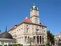
(Liberty Street), then splits to pass along a two-lane, one-way street surrounding Court Square, the site of the Rockingham County
courthouse. The eastern side of the square, Main Street, is followed by northbound US 11. Both directions of US 33 therefore have short but separate concurrencies with each direction of US 11 around the Courthouse, before US 33 exits the downtown Harrisonburg area as Market Street.
US 33 expands to four lanes at Mason Street, then curves south and becomes a divided highway at Vine Street. The highway passes over the Norfolk & Southern's Roanoke District
rail line, then intersects with I-81
. After I-81, US 33 expands to six lanes, passing through a commercial area that includes the Harrisonburg Crossingshopping center
and the Valley Mall
. Eastward, the route returns to a four-lane highway, and is named Spotswood Trail at the city limits of Harrisonburg. US 33 meets the northern end of SR 276
(Cross Keys Road) in Penn Laird as the highway makes a broad curve around the southern end of Massanutten Mountain
, within which is the Massanutten Resort
. The highway crosses the Norfolk & Southern rail line again and passes through McGaheysville
, at the base of Massanutten Mountain, continuing to Elkton
at the southern edge of the Page Valley
.
West of Elkton, US 33 Business (Old Spotswood Trail) splits to the north. US 33 then crosses the South Fork of the Shenandoah River, enters the town limits, and crosses over the Norfolk & Southern rail line for the last time. The highway leaves the town at US 340
(East Side Highway) and the east end of US 33 Business. The route then follows West Swift Run southeast to the hamlet of Swift Run, after which it reduces to two lanes and begins a curvaceous ascent of the Blue Ridge
, cresting the mountain at Swift Run Gap
at an elevation of 2365 feet (720.9 m), where the highway crosses the Appalachian Trail
and has an intersection with the access roads to the Blue Ridge Parkway
and to Skyline Drive
, the north–south highway through Shenandoah National Park
, then descending to the Virginia Piedmont
.
, US 33 enters Greene County
and has a more gentle descent of the eastern side of the mountain, where the highway follows Swift Run to the hamlet of Lydia
, then passes around the north side of Powell Mountain and meets the stream again west of Stanardsville
, where the road expands to a four-lane divided highway. US 33 Business (Spotswood Trail) splits to the north to pass through the center of Stanardsville, the county seat of Greene County, while US 33 follows the Stanardsville Bypass. US 33 Business provides access to SR 230
, which heads toward Madison
. US 33 continues southeast through Quinque
and intersects US 29
(Seminole Trail) in Ruckersville
.
East of US 29, US 33 reduces to two lanes and enters Orange County
. The highway has a short concurrency with SR 20
(Constitution Highway) through Barboursville
, where both highways pass under the Norfolk & Southern's Washington District
rail line. US 33 passes through a gap in the Southwest Mountains
before reaching Gordonsville
. At the town limit, the U.S. Highway has an intersection with SR 231
(Blue Ridge Turnpike). US 33 and SR 231 run together a short distance east to the Gordonsville Roundabout, where SR 231 heads southwest as Gordon Avenue toward Cismont
and US 33 becomes concurrent with US 15
(James Madison Highway) along Main Street. The two highways pass the Exchange Hotel
at their underpass of the Washington Subdivision
, the Charlottesville
–Orange
rail line owned by the Buckingham Branch Railroad
. At the southern edge of downtown Gordonsville, US 33 and US 15 leave Main Street and veer onto Martinsburg Avenue, which follows CSX's Piedmont Subdivision
to the southern limit of Gordonsville, where the highways enter Louisa County
.
US 15 continues south as the James Madison Highway toward Farmville
, while US 33 continues paralleling the railroad along Spotswood Trail. At Trevilians
, US 33 becomes concurrent with SR 22
(Louisa Road). US 33 and SR 22 head into the town of Louisa
as Main Street. On the east side of this county seat, the highways intersect SR 208
(Courthouse Road). SR 208 joins the two highways for a short distance until the state highways diverge from US 33, following the railroad east along Davis Highway toward Mineral
, near the epicenter
of the 2011 Virginia earthquake
, with US 33 continuing southeast along Jefferson Highway. The route passes south of Northeast Creek Reservoir before a short concurrency with US 522
in Cuckoo
, where US 522 heads north as Pendleton Road toward Mineral and south as Cross County Highway toward Goochland
. Continuing eastward, US 33 then approaches the Richmond
Metropolitan Area.
, where the highway is named Mountain Road. The route then passes through the village of Montpelier, after which it meets the western end of SR 54
(Patrick Henry Road). US 33 crosses the South Anna River
at Ground Squirrel Bridge northwest of Farrington, then expands to a four-lane divided highway just north of the Chickahominy River
, where the highway enters Henrico County
and becomes Staples Mill Road. It then intersects I-295
, then meets the northern end of SR 157
(Springfield Road) in the Richmond suburb of Glen Allen
.
In the community of Laurel
, US 33 expands to six lanes at its intersection with Parham Road north of the Richmond Staples Mill Road
Amtrak
station. In Dumbarton
, US 33 meets the western end of SR 356
(Hilliard Road) and has a partial cloverleaf interchange with I-64
with a flyover ramp from westbound I-64 to eastbound US 33.
US 33 enters Richmond
, an independent city
, just before the highway meets US 250
(Broad Street) near The Shops at Willow Lawn
. US 33 and US 250 continue together southeast along this six-lane boulevard toward downtown Richmond. The two highways parallel the city line to SR 197
(Malvern Avenue), then pass over I-195
with no access. US 33 and US 250 intersect SR 161
(Boulevard) northwest of the Science Museum of Virginia
, in the former Broad Street railroad station
. US 33 and US 250 split just east of the Siegel Center, home of the Virginia Commonwealth University
Rams basketball teams, with US 250 continuing on Broad Street, while US 33 turns north onto Hancock Street. The federally numbered highway reaches its eastern terminus at Leigh Street, where it becomes Virginia SR 33
. SR 33 then heads east as a state-numbered extension of US 33 through the eastern part of Richmond and West Point
to the Middle Peninsula
on Virginia's Coastal Plain
, reaching the Chesapeake Bay
at Stingray Point
just east of Deltaville
.
!County
!Location
!Mile
!Destinations
!Notes
|-
|Rockingham
|Shenandoah Mountain
|0.00
|
|Western terminus of US 33 in Virginia; West Virginia
state line
|-
|rowspan=4 colspan=2|City of Harrisonburg
|21.88
|
|
|-
|21.96
|
|
|-
|22.06
|
|Court Square
|-
|23.65
|
|I-81 Exit 247
|-
|rowspan=4|Rockingham
|Penn Laird
|27.06
|
|
|-
|rowspan=2|Elkton
|37.81
|
|
|-
|39.43
|
|Partial cloverleaf interchange
|-
|Swift Run Gap
|45.68
|Skyline Drive
– Shenandoah National Park
|Interchange
|-
|rowspan=3|Greene
|rowspan=2|Stanardsville
|53.06
|
|
|-
|55.15
|
|
|-
|Ruckersville
|59.89
|
|
|-
|rowspan=4|Orange
|rowspan=2|Barboursville
|66.64
|
|West end of concurrency with SR 20
|-
|66.86
|
|East end of concurrency with SR 20
|-
|rowspan=3|Gordonsville
|72.31
|
|West end of concurrency with SR 231
|-
|72.46
|
|Gordonsville Roundabout; east end of concurrency with SR 231; west end of concurrency with US 15
|-
|rowspan=6|Louisa
|74.03
|
|East end of concurrency with US 15
|-
|Trevilians
|82.31
|
|West end of concurrency with SR 22
|-
|rowspan=2|Louisa
|87.23
|
|West end of concurrency with SR 208
|-
|87.63
|
|East end of concurrencies with SR 22 and SR 208
|-
|rowspan=2|Cuckoo
|94.19
|
|West end of concurrency with US 522
|-
|94.85
|
|East end of concurrency with US 522
|-
|Hanover
|Montpelier
|112.74
|
|
|-
|rowspan=4|Henrico
|rowspan=2|Glen Allen
|124.54
|
|I-295 Exit 49
|-
|125.15
|
|
|-
|rowspan=2|Dumbarton
|129.85
|
|
|-
|130.86
|
|I-64 Exit 185
|-
|rowspan=5 colspan=2|City of Richmond
|132.21
|
|West end of concurrency with US 250
|-
|133.00
|
|
|-
|134.06
|
|
|-
|135.37
|
|East end of concurrency with US 250
|-
|135.60
|
|Eastern terminus of US 33; western terminus of eastbound SR 33
Elkhart, Indiana
Elkhart is a city in Elkhart County, Indiana, United States. The city is located east of South Bend, northwest of Fort Wayne, east of Chicago, and north of Indianapolis...
to Richmond, Virginia
Richmond, Virginia
Richmond is the capital of the Commonwealth of Virginia, in the United States. It is an independent city and not part of any county. Richmond is the center of the Richmond Metropolitan Statistical Area and the Greater Richmond area...
. In Virginia
Virginia
The Commonwealth of Virginia , is a U.S. state on the Atlantic Coast of the Southern United States. Virginia is nicknamed the "Old Dominion" and sometimes the "Mother of Presidents" after the eight U.S. presidents born there...
, the U.S. Highway runs 135.6 miles (218.2 km) from the West Virginia
West Virginia
West Virginia is a state in the Appalachian and Southeastern regions of the United States, bordered by Virginia to the southeast, Kentucky to the southwest, Ohio to the northwest, Pennsylvania to the northeast and Maryland to the east...
state line near Rawley Springs
Rawley Springs, Virginia
Rawley Springs is an unincorporated community located in Rockingham County, in the U.S. state of Virginia. It is located twelve miles northwest of Harrisonburg, north of Clover Hill, along Virginia State Route 33, in George Washington National Forest. It lies on the Dry River and is situated on the...
east to its eastern terminus at SR 33
Virginia State Route 33
Virginia State Route 33 is a primary state highway in the U.S. state of Virginia. The state highway runs from U.S. Route 33 and US 250 in Richmond, Virginia east to Chesapeake Boulevard in Stingray Point...
in Richmond. US 33 is the primary east–west highway of Rockingham County
Rockingham County, Virginia
As of the census of 2000, there were 67,725 people, 25,355 households, and 18,889 families residing in the county. The population density was 80 people per square mile . There were 27,328 housing units at an average density of 32 per square mile...
, which lies in the Shenandoah Valley
Shenandoah Valley
The Shenandoah Valley is both a geographic valley and cultural region of western Virginia and West Virginia in the United States. The valley is bounded to the east by the Blue Ridge Mountains, to the west by the eastern front of the Ridge-and-Valley Appalachians , to the north by the Potomac River...
. The highway connects the county seat
County seat
A county seat is an administrative center, or seat of government, for a county or civil parish. The term is primarily used in the United States....
of Harrisonburg
Harrisonburg, Virginia
Harrisonburg is an independent city in the Shenandoah Valley region of Virginia in the United States. Its population as of 2010 is 48,914, and at the 2000 census, 40,468. Harrisonburg is the county seat of Rockingham County and the core city of the Harrisonburg, Virginia Metropolitan Statistical...
, the town of Elkton
Elkton, Virginia
Elkton is an incorporated town in Rockingham County, Virginia, United States. It is included in the Harrisonburg, Virginia Metropolitan Statistical Area. The population was 2,042 at the 2000 census. Elkton was named for the Elk Run stream.It is located along the south fork of the Shenandoah River...
, and an entrance to Shenandoah National Park
Shenandoah National Park
Shenandoah National Park encompasses part of the Blue Ridge Mountains in the U.S. state of Virginia. This national park is long and narrow, with the broad Shenandoah River and valley on the west side, and the rolling hills of the Virginia Piedmont on the east...
. East of the Blue Ridge Mountains
Blue Ridge Mountains
The Blue Ridge Mountains are a physiographic province of the larger Appalachian Mountains range. This province consists of northern and southern physiographic regions, which divide near the Roanoke River gap. The mountain range is located in the eastern United States, starting at its southern-most...
, US 33 connects the Piedmont
Piedmont (United States)
The Piedmont is a plateau region located in the eastern United States between the Atlantic Coastal Plain and the main Appalachian Mountains, stretching from New Jersey in the north to central Alabama in the south. The Piedmont province is a physiographic province of the larger Appalachian division...
communities of Stanardsville
Stanardsville, Virginia
Stanardsville is a town in Greene County, Virginia, United States. The population was 476 at the 2000 census. It is the county seat of Greene County. The name is from Robert Stanard, a benefactor who donated land for public use...
, Gordonsville
Gordonsville, Virginia
Gordonsville is a town in Louisa and Orange counties in the U.S. state of Virginia. The population was 1,496 at the 2010 census.-History:Nathaniel Gordon purchased in 1787 and in 1794, or possibly earlier, applied for and was granted a license to operate a tavern...
, and Louisa
Louisa, Virginia
Louisa is a town in Louisa County, Virginia, United States. The population was 1,401 at the 2000 census. It is the county seat of Louisa County.-Geography:Louisa is located at ....
. The U.S. Highway is a major suburban and urban route in the Richmond metropolitan area. Within Richmond, US 33 runs concurrently
Concurrency (road)
A concurrency, overlap, or coincidence in a road network is an instance of one physical road bearing two or more different highway, motorway, or other route numbers...
with US 250
U.S. Route 250 in Virginia
U.S. Route 250 is a part of the U.S. Highway System that runs from Sandusky, Ohio to Richmond, Virginia. In Virginia, the U.S. Highway runs from the West Virginia state line near Hightown east to its eastern terminus at US 360 in Richmond...
. SR 33 continues from US 33's eastern terminus as a state-numbered extension of the U.S. Highway that connects Richmond with Virginia's Middle Peninsula
Middle Peninsula
The Middle Peninsula is the second of three large peninsulas on the western shore of Chesapeake Bay in Virginia, in the United States. It lies between the Northern Neck and the Virginia Peninsula. This peninsula is bounded by the Rappahannock River on the north and the York River on the south...
.
Allegheny Mountains
US 33 enters Virginia at about 3450 feet (1,051.6 m) elevation at Dry River Gap on top of Shenandoah Mountain at the West VirginiaWest Virginia
West Virginia is a state in the Appalachian and Southeastern regions of the United States, bordered by Virginia to the southeast, Kentucky to the southwest, Ohio to the northwest, Pennsylvania to the northeast and Maryland to the east...
state line, having climbed steeply from the community of Brandywine, West Virginia
Brandywine, West Virginia
Brandywine is an unincorporated census-designated place located on U.S. Highway 33 in Pendleton County, West Virginia, USA. The town lies along the South Fork South Branch Potomac River at its confluence with Hawes Run...
, in the valley of the South Fork of the South Branch of the Potomac River
Potomac River
The Potomac River flows into the Chesapeake Bay, located along the mid-Atlantic coast of the United States. The river is approximately long, with a drainage area of about 14,700 square miles...
. US 33 then heads east as Rawley Pike, with a curvaceous descent to the narrow but flat valley of the Dry River
Dry River (Virginia)
The Dry River is a tributary of the North River in the U.S. state of Virginia. It flows entirely within Rockingham County, rising within the George Washington National Forest east of the West Virginia border and flowing south to the North River at Bridgewater...
, which the highway follows east through the George Washington National Forest. East of Rawley Springs
Rawley Springs, Virginia
Rawley Springs is an unincorporated community located in Rockingham County, in the U.S. state of Virginia. It is located twelve miles northwest of Harrisonburg, north of Clover Hill, along Virginia State Route 33, in George Washington National Forest. It lies on the Dry River and is situated on the...
, the highway veers away from the river, leaves the national forest, and passes through a low, wide gap in Great North Mountain
Great North Mountain
Great North Mountain is a long mountain range within the Ridge-and-valley Appalachians in the U.S. states of Virginia and West Virginia. The range is located west of the Shenandoah Valley and Massanutten Mountain in Virginia, and east of the Allegheny Mountains and Cacapon River in West...
to enter the Shenandoah Valley.
Shenandoah Valley
Shenandoah Valley
The Shenandoah Valley is both a geographic valley and cultural region of western Virginia and West Virginia in the United States. The valley is bounded to the east by the Blue Ridge Mountains, to the west by the eastern front of the Ridge-and-Valley Appalachians , to the north by the Potomac River...
, US 33 passes through the hamlets of Hinton
Hinton, Virginia
Hinton is an unincorporated community located in Rockingham County, in the U.S. state of Virginia. It is located northwest of Harrisonburg along U.S. Route 33 and Route 752 near the edge of George Washington National Forest....
and Dale Enterprise
Dale Enterprise, Virginia
Dale Enterprise is an unincorporated community in Rockingham County, Virginia, United States.-Geography:Dale Enterprise is located at latitude 38.455 N and longitude 78.939 W in the Shenandoah Valley, approximately four miles west of the City of Harrisonburg along U. S. Highway 33 .,, The community...
, then passes to the north of Mole Hill
Mole Hill (Virginia)
Mole Hill, located west of Harrisonburg, VA, in Rockingham County, is a rounded hill composed of basalt, a volcanic rock, of Eocene age...
before entering the independent city
Independent city
An independent city is a city that does not form part of another general-purpose local government entity. These type of cities should not be confused with city-states , which are fully sovereign cities that are not part of any other sovereign state.-Historical precursors:In the Holy Roman Empire,...
of Harrisonburg
Harrisonburg, Virginia
Harrisonburg is an independent city in the Shenandoah Valley region of Virginia in the United States. Its population as of 2010 is 48,914, and at the 2000 census, 40,468. Harrisonburg is the county seat of Rockingham County and the core city of the Harrisonburg, Virginia Metropolitan Statistical...
.
US 33 continues into Harrisonburg as Market Street, a four-lane divided highway. The road becomes an undivided highway and then reduces to two lanes at its intersection with SR 42
Virginia State Route 42
State Route 42 is a primary state highway in the U.S. state of Virginia. Running parallel to and west of Interstate 81, SR 42 consists of three sections with gaps filled by secondary routes in between. Some of SR 42 lies along the old Fincastle and Cumberland Gap Turnpike...
(High Street) in downtown Harrisonburg, after which the highway intersects a branch of the Norfolk Southern Railway's Roanoke District
Norfolk Southern Railway
The Norfolk Southern Railway is a Class I railroad in the United States, owned by the Norfolk Southern Corporation. With headquarters in Norfolk, Virginia, the company operates 21,500 route miles in 22 eastern states, the District of Columbia and the province of Ontario, Canada...
at grade. US 33 meets the southbound direction of US 11
U.S. Route 11 in Virginia
U.S. Route 11 in Virginia runs north–south through the western part of the state, parallel to Interstate 81.-History:What is now US 11 was added to the state highway system in 1918 as portions of State Route 10 and State Route 3 . SR 3 became State Route 33 in 1923, and US 11 was applied to...
(Liberty Street), then splits to pass along a two-lane, one-way street surrounding Court Square, the site of the Rockingham County
Rockingham County, Virginia
As of the census of 2000, there were 67,725 people, 25,355 households, and 18,889 families residing in the county. The population density was 80 people per square mile . There were 27,328 housing units at an average density of 32 per square mile...
courthouse. The eastern side of the square, Main Street, is followed by northbound US 11. Both directions of US 33 therefore have short but separate concurrencies with each direction of US 11 around the Courthouse, before US 33 exits the downtown Harrisonburg area as Market Street.
US 33 expands to four lanes at Mason Street, then curves south and becomes a divided highway at Vine Street. The highway passes over the Norfolk & Southern's Roanoke District
Norfolk Southern Railway
The Norfolk Southern Railway is a Class I railroad in the United States, owned by the Norfolk Southern Corporation. With headquarters in Norfolk, Virginia, the company operates 21,500 route miles in 22 eastern states, the District of Columbia and the province of Ontario, Canada...
rail line, then intersects with I-81
Interstate 81 in Virginia
Interstate 81 is an long highway. In the U.S. state of Virginia, I-81 runs for , making it longer in Virginia than in any other state. It stretches from the Tennessee state line near Bristol to the West Virginia state line near Winchester. U.S...
. After I-81, US 33 expands to six lanes, passing through a commercial area that includes the Harrisonburg Crossingshopping center
Harrisonburg Crossing
Harrisonburg Crossing is an outdoor shopping center in Harrisonburg, Virginia, United States. It was built on the site of an old factory, Dunham-Bush. Containing stores such as Wal-Mart, Bed Bath & Beyond and Home Depot it has become a major point of commercial traffic, as well as a shortcut from...
and the Valley Mall
Valley Mall (Harrisonburg)
Valley Mall is a shopping mall in Harrisonburg, Virginia, owned by Simon Property Group and serving the Central Shenandoah Valley area of Virginia. It currently features more than 50 stores, with JCPenney, Belk, and Target serving as anchor stores....
. Eastward, the route returns to a four-lane highway, and is named Spotswood Trail at the city limits of Harrisonburg. US 33 meets the northern end of SR 276
Virginia State Route 276
State Route 276 is a primary state highway in the U.S. state of Virginia. It runs from State Route 256 at Weyers Cave in a general north-northeasterly direction to U.S. Route 33 near Keezletown.-External links:*...
(Cross Keys Road) in Penn Laird as the highway makes a broad curve around the southern end of Massanutten Mountain
Massanutten Mountain
Massanutten Mountain is a synclinal ridge in the Ridge-and-Valley Appalachians, located in the U.S. state of Virginia.-Geography:The mountain bisects the Shenandoah Valley just east of Strasburg in Shenandoah County in the north, to its highest peak east of Harrisonburg in Rockingham County in the...
, within which is the Massanutten Resort
Massanutten, Virginia
Massanutten is a census-designated place in Rockingham County, Virginia, United States, built around a ski resort. The population was 1,945 at the 2000 census. It is part of the Harrisonburg Metropolitan Statistical Area-Geography:...
. The highway crosses the Norfolk & Southern rail line again and passes through McGaheysville
McGaheysville, Virginia
McGaheysville is an unincorporated community located in Rockingham County, in the U.S. state of Virginia. It is located along U.S. Route 33 between Penn Laird and Elkton, and sits at the base of the Massanutten....
, at the base of Massanutten Mountain, continuing to Elkton
Elkton, Virginia
Elkton is an incorporated town in Rockingham County, Virginia, United States. It is included in the Harrisonburg, Virginia Metropolitan Statistical Area. The population was 2,042 at the 2000 census. Elkton was named for the Elk Run stream.It is located along the south fork of the Shenandoah River...
at the southern edge of the Page Valley
Page Valley
The Page Valley is a small valley geographically and culturally associated with the Shenandoah Valley. The valley is located between the Massanutten and Blue Ridge mountain ranges in western Virginia.-Geography:The valley is approximately long...
.
West of Elkton, US 33 Business (Old Spotswood Trail) splits to the north. US 33 then crosses the South Fork of the Shenandoah River, enters the town limits, and crosses over the Norfolk & Southern rail line for the last time. The highway leaves the town at US 340
U.S. Route 340 in Virginia
In the U.S. state of Virginia, U.S. Route 340 runs north–south, parallel and east of U.S. Route 11, from US 11 north of Greenville via Waynesboro, Grottoes, Elkton, Luray, Front Royal, and Berryville to the West Virginia state line...
(East Side Highway) and the east end of US 33 Business. The route then follows West Swift Run southeast to the hamlet of Swift Run, after which it reduces to two lanes and begins a curvaceous ascent of the Blue Ridge
Blue Ridge Mountains
The Blue Ridge Mountains are a physiographic province of the larger Appalachian Mountains range. This province consists of northern and southern physiographic regions, which divide near the Roanoke River gap. The mountain range is located in the eastern United States, starting at its southern-most...
, cresting the mountain at Swift Run Gap
Swift Run Gap
Swift Run Gap is a wind gap in the Blue Ridge Mountains located in the U.S. state of Virginia.-Geography:At an elevation of , it is the site of the mountain crossing of U.S...
at an elevation of 2365 feet (720.9 m), where the highway crosses the Appalachian Trail
Appalachian Trail
The Appalachian National Scenic Trail, generally known as the Appalachian Trail or simply the AT, is a marked hiking trail in the eastern United States extending between Springer Mountain in Georgia and Mount Katahdin in Maine. It is approximately long...
and has an intersection with the access roads to the Blue Ridge Parkway
Blue Ridge Parkway
The Blue Ridge Parkway is a National Parkway and All-American Road in the United States, noted for its scenic beauty. It runs for 469 miles , mostly along the famous Blue Ridge, a major mountain chain that is part of the Appalachian Mountains...
and to Skyline Drive
Skyline Drive
Skyline Drive is a 105-mile road that runs the entire length of the National Park Service's Shenandoah National Park in the Blue Ridge Mountains of Virginia, generally along the ridge of the mountains. The scenic drive is particularly popular in the fall when the leaves are changing colors...
, the north–south highway through Shenandoah National Park
Shenandoah National Park
Shenandoah National Park encompasses part of the Blue Ridge Mountains in the U.S. state of Virginia. This national park is long and narrow, with the broad Shenandoah River and valley on the west side, and the rolling hills of the Virginia Piedmont on the east...
, then descending to the Virginia Piedmont
Piedmont (United States)
The Piedmont is a plateau region located in the eastern United States between the Atlantic Coastal Plain and the main Appalachian Mountains, stretching from New Jersey in the north to central Alabama in the south. The Piedmont province is a physiographic province of the larger Appalachian division...
.
Piedmont
After cresting the Blue RidgeBlue Ridge Mountains
The Blue Ridge Mountains are a physiographic province of the larger Appalachian Mountains range. This province consists of northern and southern physiographic regions, which divide near the Roanoke River gap. The mountain range is located in the eastern United States, starting at its southern-most...
, US 33 enters Greene County
Greene County, Virginia
As of the census of 2000, there are 15,244 people, 5,574 households, and 4,291 families residing in the county. The population density is 97 people per square mile . There are 5,986 housing units at an average density of 38 per square mile...
and has a more gentle descent of the eastern side of the mountain, where the highway follows Swift Run to the hamlet of Lydia
Lydia, Virginia
Lydia is an unincorporated community in Greene County, Virginia, United States.-References:*...
, then passes around the north side of Powell Mountain and meets the stream again west of Stanardsville
Stanardsville, Virginia
Stanardsville is a town in Greene County, Virginia, United States. The population was 476 at the 2000 census. It is the county seat of Greene County. The name is from Robert Stanard, a benefactor who donated land for public use...
, where the road expands to a four-lane divided highway. US 33 Business (Spotswood Trail) splits to the north to pass through the center of Stanardsville, the county seat of Greene County, while US 33 follows the Stanardsville Bypass. US 33 Business provides access to SR 230
Virginia State Route 230
State Route 230 is a primary state highway in the U.S. state of Virginia. It runs from U.S. Route 33 Business in Stanardsville northeast and east via McMullen, Hood, Wolftown, Pratts, Aroda, Radiant, and Burnt Tree to U.S. Route 15 at Madison Mills....
, which heads toward Madison
Madison, Virginia
Madison is a town in Madison County, Virginia, United States. The population was 210 at the 2000 census. It is the county seat of Madison County.-Geography:Madison is located at ....
. US 33 continues southeast through Quinque
Quinque, Virginia
Quinque is an unincorporated community in Greene County, Virginia, United States.-References:*...
and intersects US 29
U.S. Route 29 in Virginia
U.S. Route 29 is a major north–south route in the Commonwealth of Virginia. It covers from the North Carolina border at the city of Danville to the Key Bridge in Washington, D.C....
(Seminole Trail) in Ruckersville
Ruckersville, Virginia
Ruckersville is a census-designated place in Greene County, Virginia, United States, located in a rural area on the outskirts of Charlottesville. The population as of the 2010 Census was 1,141. The community lies amidst hills, mountain views, trees, and farmland. It is located at the intersection...
.
East of US 29, US 33 reduces to two lanes and enters Orange County
Orange County, Virginia
As of the census of 2000, there were 25,881 people, 10,150 households, and 7,470 families residing in the county. The population density was 76 people per square mile . There were 11,354 housing units at an average density of 33 per square mile...
. The highway has a short concurrency with SR 20
Virginia State Route 20
Virginia State Route 20 is a primary state highway in the U.S. state of Virginia. The state highway runs from U.S. Route 15 in Dillwyn north to SR 3 in Wilderness. SR 20 is a C-shaped route that connects Charlottesville with Farmville in Southside Virginia...
(Constitution Highway) through Barboursville
Barboursville, Virginia
Barboursville is an unincorporated community in Albemarle and Orange counties in the U.S. state of Virginia. Barboursville is famous for being the birthplace of renowned American military commander and President Zachary Taylor...
, where both highways pass under the Norfolk & Southern's Washington District
Norfolk Southern Railway
The Norfolk Southern Railway is a Class I railroad in the United States, owned by the Norfolk Southern Corporation. With headquarters in Norfolk, Virginia, the company operates 21,500 route miles in 22 eastern states, the District of Columbia and the province of Ontario, Canada...
rail line. US 33 passes through a gap in the Southwest Mountains
Southwest Mountains
The Southwest Mountains of Virginia are a mountain range centered around Charlottesville, parallel to and geologically associated with the Blue Ridge Mountains, which lie about 30 miles to the west...
before reaching Gordonsville
Gordonsville, Virginia
Gordonsville is a town in Louisa and Orange counties in the U.S. state of Virginia. The population was 1,496 at the 2010 census.-History:Nathaniel Gordon purchased in 1787 and in 1794, or possibly earlier, applied for and was granted a license to operate a tavern...
. At the town limit, the U.S. Highway has an intersection with SR 231
Virginia State Route 231
State Route 231 is a primary state highway in the U.S. state of Virginia. It runs from State Route 22 near Cismont north via Gordonsville, Somerset, Rochelle, Pratts, Madison, Banco, and Etlan to U.S. Route 522 near Sperryville.-Major intersections:...
(Blue Ridge Turnpike). US 33 and SR 231 run together a short distance east to the Gordonsville Roundabout, where SR 231 heads southwest as Gordon Avenue toward Cismont
Cismont, Virginia
Cismont is an unincorporated community in Albemarle County, Virginia....
and US 33 becomes concurrent with US 15
U.S. Route 15 in Virginia
U.S. Route 15 is a part of the U.S. Highway System that runs from Walterboro, South Carolina to Painted Post, New York. In Virginia, the U.S. Highway runs from the North Carolina state line near Clarksville north to the Maryland state line at the Potomac River near Lucketts...
(James Madison Highway) along Main Street. The two highways pass the Exchange Hotel
Exchange Hotel (Gordonsville, Virginia)
The Exchange Hotel in Gordonsville, Virginia, was built in 1860 for Richard F. Omohundro next to an important railroad junction, when the Exchange Hotel offered a welcome stopping place for weary passengers on the Virginia Central Railroad.-Civil War:...
at their underpass of the Washington Subdivision
Washington Subdivision
The Washington Subdivision is a railroad line leased and operated by the Buckingham Branch Railroad in the U.S. state of Virginia.The line runs from Orange southwest to Charlottesville, and was a CSX Transportation line until 2004. At Charlottesville, the North Mountain Subdivision continues west;...
, the Charlottesville
Charlottesville, Virginia
Charlottesville is an independent city geographically surrounded by but separate from Albemarle County in the Commonwealth of Virginia, United States, and named after Charlotte of Mecklenburg-Strelitz, the queen consort of King George III of the United Kingdom.The official population estimate for...
–Orange
Orange, Virginia
Orange is a town in Orange County, Virginia, United States. The population was 4,721 at the 2010 census. It is the county seat of Orange County...
rail line owned by the Buckingham Branch Railroad
Buckingham Branch Railroad
Buckingham Branch Railroad is a Class III short-line railroad operating over 200 miles of historic and strategic trackage in Central Virginia...
. At the southern edge of downtown Gordonsville, US 33 and US 15 leave Main Street and veer onto Martinsburg Avenue, which follows CSX's Piedmont Subdivision
CSX Transportation
CSX Transportation operates a Class I railroad in the United States known as the CSX Railroad. It is the main subsidiary of the CSX Corporation. The company is headquartered in Jacksonville, Florida, and owns approximately 21,000 route miles...
to the southern limit of Gordonsville, where the highways enter Louisa County
Louisa County, Virginia
Louisa County is a county located in the Commonwealth of Virginia. As of 2010, the population was 33,153. The county seat is Louisa.- History :...
.
US 15 continues south as the James Madison Highway toward Farmville
Farmville, Virginia
Farmville is a town in Prince Edward and Cumberland counties in the U.S. state of Virginia. The population was 6,845 at the 2000 census. It is the county seat of Prince Edward County....
, while US 33 continues paralleling the railroad along Spotswood Trail. At Trevilians
Trevilians, Virginia
Trevilians is an unincorporated community in Louisa County, Virginia, United States. Trevilians is located at the junction of U.S. Route 33 and Virginia State Route 22 west-northwest of Louisa. Trevilians has a post office with ZIP code 23170....
, US 33 becomes concurrent with SR 22
Virginia State Route 22
Virginia State Route 22 is a primary state highway in the U.S. state of Virginia. The state highway runs from U.S. Route 250 in Shadwell east to US 522 and SR 208 in Mineral. SR 22 is one of two primary east–west highways in Louisa County, connecting the county seat of Louisa with...
(Louisa Road). US 33 and SR 22 head into the town of Louisa
Louisa, Virginia
Louisa is a town in Louisa County, Virginia, United States. The population was 1,401 at the 2000 census. It is the county seat of Louisa County.-Geography:Louisa is located at ....
as Main Street. On the east side of this county seat, the highways intersect SR 208
Virginia State Route 208
State Route 208 is a primary state highway in the U.S. state of Virginia. It runs from U.S. Route 250 in Louisa in a general northeasterly direction to U.S...
(Courthouse Road). SR 208 joins the two highways for a short distance until the state highways diverge from US 33, following the railroad east along Davis Highway toward Mineral
Mineral, Virginia
Mineral is a town in Louisa County, Virginia, United States. The population was 424 at the 2000 census.-History:Mineral was originally known as Tolersville, but adopted its current name when it incorporated in 1902 due to the mining industry that supported the community...
, near the epicenter
Epicenter
The epicenter or epicentre is the point on the Earth's surface that is directly above the hypocenter or focus, the point where an earthquake or underground explosion originates...
of the 2011 Virginia earthquake
2011 Virginia earthquake
The 2011 Virginia earthquake occurred on August 23, 2011, at 1:51 pm EDT in the Piedmont region of the U.S. state of Virginia. The epicenter, in Louisa County, was northwest of Richmond and south-southwest of the town of Mineral...
, with US 33 continuing southeast along Jefferson Highway. The route passes south of Northeast Creek Reservoir before a short concurrency with US 522
U.S. Route 522 in Virginia
U.S. Route 522 is a part of the U.S. Highway System that runs from Powhatan, Virginia to Selinsgrove, Pennsylvania. In Virginia, the U.S. highway runs from its southern terminus at US 60 in Powhatan north to the West Virginia state line near Cross Junction...
in Cuckoo
Cuckoo, Virginia
Cuckoo is a small unincorporated community in Louisa County, Virginia, United States. It is located in about 8 miles southeast of Louisa, roughly between Charlottesville and Richmond. The Cuckoo Tavern stood nearby, which in 1781 was the beginning of Jack Jouett's ride to warn the Colonists of the...
, where US 522 heads north as Pendleton Road toward Mineral and south as Cross County Highway toward Goochland
Goochland, Virginia
Goochland is a census-designated place in and the county seat of Goochland County, Virginia, United States. The population as of the 2010 Census was 861. The community is also known as Goochland Courthouse or by an alternative spelling, Goochland Court House...
. Continuing eastward, US 33 then approaches the Richmond
Richmond, Virginia
Richmond is the capital of the Commonwealth of Virginia, in the United States. It is an independent city and not part of any county. Richmond is the center of the Richmond Metropolitan Statistical Area and the Greater Richmond area...
Metropolitan Area.
Richmond metropolitan area
Continuing eastward across the Piedmont, US 33 heads southeast into Hanover CountyHanover County, Virginia
As of the census of 2000, there were 86,320 people, 31,121 households, and 24,461 families residing in the county. The population density was 183 people per square mile . There were 32,196 housing units at an average density of 68 per square mile...
, where the highway is named Mountain Road. The route then passes through the village of Montpelier, after which it meets the western end of SR 54
Virginia State Route 54
Virginia State Route 54 is a primary state highway in the U.S. state of Virginia. Known for most of its length as Patrick Henry Road, the state highway runs from U.S. Route 33 in Montpelier east to US 301 and SR 2 in Hanover Courthouse...
(Patrick Henry Road). US 33 crosses the South Anna River
South Anna River
The South Anna River is a principal tributary of the Pamunkey River, about long, in central Virginia in the United States. Via the Pamunkey and York rivers, it is part of the watershed of Chesapeake Bay....
at Ground Squirrel Bridge northwest of Farrington, then expands to a four-lane divided highway just north of the Chickahominy River
Chickahominy River
The Chickahominy is an river in the eastern portion of the U.S. state of Virginia. The river rises about northwest of Richmond and flows southeast and south to the James River...
, where the highway enters Henrico County
Henrico County, Virginia
Henrico is a county located in the Commonwealth of Virginia, a state of the United States. As of 2010, Henrico was home to 306,935 people. It is located in the Richmond-Petersburg region and is a portion of the Richmond Metropolitan Statistical Area...
and becomes Staples Mill Road. It then intersects I-295
Interstate 295 (Virginia)
Interstate 295 is an eastern and northern bypass of the cities of Richmond and Petersburg in the U.S. state of Virginia. The southern terminus is a junction with Interstate 95 southeast of Petersburg...
, then meets the northern end of SR 157
Virginia State Route 157
Virginia State Route 157 is a primary state highway in the U.S. state of Virginia. The state highway runs from SR 6 in Tuckahoe north to U.S. Route 33 in Glen Allen...
(Springfield Road) in the Richmond suburb of Glen Allen
Glen Allen, Virginia
Glen Allen is a census-designated place in Henrico County, Virginia, United States. The population was 12,562 at the 2000 census.-Geography:...
.
In the community of Laurel
Laurel, Virginia
Laurel is a census-designated place in Henrico County, Virginia, United States. The population was 14,875 at the 2000 census.-Geography:Laurel is located at ....
, US 33 expands to six lanes at its intersection with Parham Road north of the Richmond Staples Mill Road
Richmond Staples Mill Road (Amtrak station)
The Richmond Staples Mill Road Amtrak station lies about 5 miles north of downtown Richmond, Virginia, located in Henrico County. The station designed by David Volkert and Associates, and was built in 1975 as a replacement for Main Street Station, which had sustained damage from floods....
Amtrak
Amtrak
The National Railroad Passenger Corporation, doing business as Amtrak , is a government-owned corporation that was organized on May 1, 1971, to provide intercity passenger train service in the United States. "Amtrak" is a portmanteau of the words "America" and "track". It is headquartered at Union...
station. In Dumbarton
Dumbarton, Virginia
Dumbarton is a census-designated place in Henrico County, Virginia, United States. The population was 6,674 at the 2000 census.-Geography:Dumbarton is located at ....
, US 33 meets the western end of SR 356
Virginia State Route 356
State Route 356 is a primary state highway in Henrico County, Virginia, United States. It runs along Hilliard Road from U.S. Route 33 at Greendale east to State Route 161 near Lakeside.-External links:*...
(Hilliard Road) and has a partial cloverleaf interchange with I-64
Interstate 64 in Virginia
In the U.S. state of Virginia, Interstate 64 runs east–west through the middle of the state from West Virginia to the Hampton Roads region, a total of . It is notable for crossing the mouth of the harbor of Hampton Roads on the Hampton Roads Bridge-Tunnel, the first bridge-tunnel to...
with a flyover ramp from westbound I-64 to eastbound US 33.
US 33 enters Richmond
Richmond, Virginia
Richmond is the capital of the Commonwealth of Virginia, in the United States. It is an independent city and not part of any county. Richmond is the center of the Richmond Metropolitan Statistical Area and the Greater Richmond area...
, an independent city
Independent city
An independent city is a city that does not form part of another general-purpose local government entity. These type of cities should not be confused with city-states , which are fully sovereign cities that are not part of any other sovereign state.-Historical precursors:In the Holy Roman Empire,...
, just before the highway meets US 250
U.S. Route 250
U.S. Route 250 is a route of the United States Numbered Highway System, and is a spur of U.S. Route 50. It currently runs for from Sandusky, Ohio to Richmond, Virginia. It passes through the states of Virginia, West Virginia, and Ohio. It goes through the cities of Richmond, Virginia,...
(Broad Street) near The Shops at Willow Lawn
The Shops at Willow Lawn
The Shops at Willow Lawn is a shopping center located in Richmond, Virginia, USA. It is the first shopping center in the Richmond area. Currently, the center is mostly a strip mall, although a portion of it is enclosed. The center features over 60 stores and several restaurants...
. US 33 and US 250 continue together southeast along this six-lane boulevard toward downtown Richmond. The two highways parallel the city line to SR 197
Virginia State Route 197
State Route 197 is a primary state highway in and near Richmond, Virginia, United States. It forms a partial bypass of downtown Richmond, using Malvern Avenue, Westwood Avenue, Saunders Avenue, and Laburnum Avenue between State Route 147 and U.S. Route 1/U.S. Route 301 .-External links:*...
(Malvern Avenue), then pass over I-195
Interstate 195 (Virginia)
Interstate 195 is an Interstate Highway in the U.S. state of Virginia. Known as the Beltline Expressway, the highway runs from Virginia State Route 195 , a toll road that continues south into Downtown Richmond, north to I-64 and I-95 on the northern edge of Richmond. I-195 passes through the West...
with no access. US 33 and US 250 intersect SR 161
Virginia State Route 161
State Route 161 is a primary state highway in and near Richmond, Virginia, United States. It extends from an interchange with Interstate 95 in the independent city of Richmond north to an intersection with U.S...
(Boulevard) northwest of the Science Museum of Virginia
Science Museum of Virginia
The Science Museum of Virginia is a science museum located in Richmond, Virginia.-History:In 1906, the Virginia General Assembly approved funds for the construction of a simple "exhibits center" to display mineral and timber exhibits being assembled for the Jamestown Exposition of 1907. After the...
, in the former Broad Street railroad station
Broad Street Station (Richmond)
Broad Street Station was a union railroad station in Richmond, Virginia, USA, across Broad Street from the Fan district....
. US 33 and US 250 split just east of the Siegel Center, home of the Virginia Commonwealth University
Virginia Commonwealth University
Virginia Commonwealth University is a public university located in Richmond, Virginia. It comprises two campuses in the Downtown Richmond area, the product of a merger between the Richmond Professional Institute and the Medical College of Virginia in 1968...
Rams basketball teams, with US 250 continuing on Broad Street, while US 33 turns north onto Hancock Street. The federally numbered highway reaches its eastern terminus at Leigh Street, where it becomes Virginia SR 33
Virginia State Route 33
Virginia State Route 33 is a primary state highway in the U.S. state of Virginia. The state highway runs from U.S. Route 33 and US 250 in Richmond, Virginia east to Chesapeake Boulevard in Stingray Point...
. SR 33 then heads east as a state-numbered extension of US 33 through the eastern part of Richmond and West Point
West Point, Virginia
West Point is an incorporated town in King William County, Virginia, United States. The population was 2,867 at the 2000 census.-Geography:West Point is located at...
to the Middle Peninsula
Middle Peninsula
The Middle Peninsula is the second of three large peninsulas on the western shore of Chesapeake Bay in Virginia, in the United States. It lies between the Northern Neck and the Virginia Peninsula. This peninsula is bounded by the Rappahannock River on the north and the York River on the south...
on Virginia's Coastal Plain
Atlantic Coastal Plain
The Atlantic coastal plain has both low elevation and low relief, but it is also a relatively flat landform extending from the New York Bight southward to a Georgia/Florida section of the Eastern Continental Divide, which demarcates the plain from the ACF River Basin in the Gulf Coastal Plain to...
, reaching the Chesapeake Bay
Chesapeake Bay
The Chesapeake Bay is the largest estuary in the United States. It lies off the Atlantic Ocean, surrounded by Maryland and Virginia. The Chesapeake Bay's drainage basin covers in the District of Columbia and parts of six states: New York, Pennsylvania, Delaware, Maryland, Virginia, and West...
at Stingray Point
Stingray Point
Stingray Point is a small community on the Chesapeake Bay near the village of Deltaville in Middlesex County, Virginia. It is located at the eastern terminus of State Route 33. It is populated by fewer than 250 full time residents; however, during summer months that population surges as tourists...
just east of Deltaville
Deltaville, Virginia
Deltaville is a small unincorporated community on the eastern tip of Middlesex County in the eastern part of the U.S. state of Virginia. It is known for being a vacation spot for those looking for sailing, fishing, and other activities associated with the water...
.
Major intersections
{| class="wikitable"!County
!Location
!Mile
!Destinations
!Notes
|-
|Rockingham
Rockingham County, Virginia
As of the census of 2000, there were 67,725 people, 25,355 households, and 18,889 families residing in the county. The population density was 80 people per square mile . There were 27,328 housing units at an average density of 32 per square mile...
|Shenandoah Mountain
|0.00
|
|Western terminus of US 33 in Virginia; West Virginia
West Virginia
West Virginia is a state in the Appalachian and Southeastern regions of the United States, bordered by Virginia to the southeast, Kentucky to the southwest, Ohio to the northwest, Pennsylvania to the northeast and Maryland to the east...
state line
|-
|rowspan=4 colspan=2|City of Harrisonburg
Harrisonburg, Virginia
Harrisonburg is an independent city in the Shenandoah Valley region of Virginia in the United States. Its population as of 2010 is 48,914, and at the 2000 census, 40,468. Harrisonburg is the county seat of Rockingham County and the core city of the Harrisonburg, Virginia Metropolitan Statistical...
|21.88
|
|
|-
|21.96
|
|
|-
|22.06
|
|Court Square
|-
|23.65
|
|I-81 Exit 247
|-
|rowspan=4|Rockingham
Rockingham County, Virginia
As of the census of 2000, there were 67,725 people, 25,355 households, and 18,889 families residing in the county. The population density was 80 people per square mile . There were 27,328 housing units at an average density of 32 per square mile...
|Penn Laird
|27.06
|
|
|-
|rowspan=2|Elkton
Elkton, Virginia
Elkton is an incorporated town in Rockingham County, Virginia, United States. It is included in the Harrisonburg, Virginia Metropolitan Statistical Area. The population was 2,042 at the 2000 census. Elkton was named for the Elk Run stream.It is located along the south fork of the Shenandoah River...
|37.81
|
|
|-
|39.43
|
|Partial cloverleaf interchange
|-
|Swift Run Gap
Swift Run Gap
Swift Run Gap is a wind gap in the Blue Ridge Mountains located in the U.S. state of Virginia.-Geography:At an elevation of , it is the site of the mountain crossing of U.S...
|45.68
|Skyline Drive
Skyline Drive
Skyline Drive is a 105-mile road that runs the entire length of the National Park Service's Shenandoah National Park in the Blue Ridge Mountains of Virginia, generally along the ridge of the mountains. The scenic drive is particularly popular in the fall when the leaves are changing colors...
– Shenandoah National Park
Shenandoah National Park
Shenandoah National Park encompasses part of the Blue Ridge Mountains in the U.S. state of Virginia. This national park is long and narrow, with the broad Shenandoah River and valley on the west side, and the rolling hills of the Virginia Piedmont on the east...
|Interchange
|-
|rowspan=3|Greene
Greene County, Virginia
As of the census of 2000, there are 15,244 people, 5,574 households, and 4,291 families residing in the county. The population density is 97 people per square mile . There are 5,986 housing units at an average density of 38 per square mile...
|rowspan=2|Stanardsville
Stanardsville, Virginia
Stanardsville is a town in Greene County, Virginia, United States. The population was 476 at the 2000 census. It is the county seat of Greene County. The name is from Robert Stanard, a benefactor who donated land for public use...
|53.06
|
|
|-
|55.15
|
|
|-
|Ruckersville
Ruckersville, Virginia
Ruckersville is a census-designated place in Greene County, Virginia, United States, located in a rural area on the outskirts of Charlottesville. The population as of the 2010 Census was 1,141. The community lies amidst hills, mountain views, trees, and farmland. It is located at the intersection...
|59.89
|
|
|-
|rowspan=4|Orange
Orange County, Virginia
As of the census of 2000, there were 25,881 people, 10,150 households, and 7,470 families residing in the county. The population density was 76 people per square mile . There were 11,354 housing units at an average density of 33 per square mile...
|rowspan=2|Barboursville
Barboursville, Virginia
Barboursville is an unincorporated community in Albemarle and Orange counties in the U.S. state of Virginia. Barboursville is famous for being the birthplace of renowned American military commander and President Zachary Taylor...
|66.64
|
|West end of concurrency with SR 20
|-
|66.86
|
|East end of concurrency with SR 20
|-
|rowspan=3|Gordonsville
Gordonsville, Virginia
Gordonsville is a town in Louisa and Orange counties in the U.S. state of Virginia. The population was 1,496 at the 2010 census.-History:Nathaniel Gordon purchased in 1787 and in 1794, or possibly earlier, applied for and was granted a license to operate a tavern...
|72.31
|
|West end of concurrency with SR 231
|-
|72.46
|
|Gordonsville Roundabout; east end of concurrency with SR 231; west end of concurrency with US 15
|-
|rowspan=6|Louisa
Louisa County, Virginia
Louisa County is a county located in the Commonwealth of Virginia. As of 2010, the population was 33,153. The county seat is Louisa.- History :...
|74.03
|
|East end of concurrency with US 15
|-
|Trevilians
Trevilians, Virginia
Trevilians is an unincorporated community in Louisa County, Virginia, United States. Trevilians is located at the junction of U.S. Route 33 and Virginia State Route 22 west-northwest of Louisa. Trevilians has a post office with ZIP code 23170....
|82.31
|
|West end of concurrency with SR 22
|-
|rowspan=2|Louisa
Louisa, Virginia
Louisa is a town in Louisa County, Virginia, United States. The population was 1,401 at the 2000 census. It is the county seat of Louisa County.-Geography:Louisa is located at ....
|87.23
|
|West end of concurrency with SR 208
|-
|87.63
|
|East end of concurrencies with SR 22 and SR 208
|-
|rowspan=2|Cuckoo
Cuckoo, Virginia
Cuckoo is a small unincorporated community in Louisa County, Virginia, United States. It is located in about 8 miles southeast of Louisa, roughly between Charlottesville and Richmond. The Cuckoo Tavern stood nearby, which in 1781 was the beginning of Jack Jouett's ride to warn the Colonists of the...
|94.19
|
|West end of concurrency with US 522
|-
|94.85
|
|East end of concurrency with US 522
|-
|Hanover
Hanover County, Virginia
As of the census of 2000, there were 86,320 people, 31,121 households, and 24,461 families residing in the county. The population density was 183 people per square mile . There were 32,196 housing units at an average density of 68 per square mile...
|Montpelier
|112.74
|
|
|-
|rowspan=4|Henrico
Henrico County, Virginia
Henrico is a county located in the Commonwealth of Virginia, a state of the United States. As of 2010, Henrico was home to 306,935 people. It is located in the Richmond-Petersburg region and is a portion of the Richmond Metropolitan Statistical Area...
|rowspan=2|Glen Allen
Glen Allen, Virginia
Glen Allen is a census-designated place in Henrico County, Virginia, United States. The population was 12,562 at the 2000 census.-Geography:...
|124.54
|
|I-295 Exit 49
|-
|125.15
|
|
|-
|rowspan=2|Dumbarton
Dumbarton, Virginia
Dumbarton is a census-designated place in Henrico County, Virginia, United States. The population was 6,674 at the 2000 census.-Geography:Dumbarton is located at ....
|129.85
|
|
|-
|130.86
|
|I-64 Exit 185
|-
|rowspan=5 colspan=2|City of Richmond
Richmond, Virginia
Richmond is the capital of the Commonwealth of Virginia, in the United States. It is an independent city and not part of any county. Richmond is the center of the Richmond Metropolitan Statistical Area and the Greater Richmond area...
|132.21
|
|West end of concurrency with US 250
|-
|133.00
|
|
|-
|134.06
|
|
|-
|135.37
|
|East end of concurrency with US 250
|-
|135.60
|
|Eastern terminus of US 33; western terminus of eastbound SR 33