

U.S. Route 302
Encyclopedia
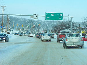
U.S. Route 302 is a spur of U.S. Route 2
. It currently runs 171 miles north (275 km) from Portland
, Maine
, at U.S. Route 1
, to Montpelier
, Vermont
, at US 2. It passes through the states of Maine
, New Hampshire
and Vermont
.
to Portland, Oregon
. The highway leaves Portland, Maine
, bridging the Presumpscot River
into Westbrook
at Riverton. The Roosevelt Trail then bridges the Pleasant River
at milepost 13.4 in Windham
, the Crooked River
in Casco
near a boyhood home of Nathaniel Hawthorne
, Long Lake
near milepost 31 in Naples
, Moose Pond near milepost 46 in Bridgton, and the Saco River
near milepost 56 in Fryeburg. The highway follows the Saco River from Fryeburg into the White Mountains
and enters New Hampshire
near milepost 58. It is a two-lane highway for almost all of its length, but there are multi-lane sections within the Portland area, as well as short four-lane sections in and around North Windham
(especially the commercial areas). Some of the hilly sections also feature a third passing lane.
following the Saco River through Crawford Notch
in the White Mountains
. The highway follows the Ammonoosuc River
out of the mountains and bridges the Connecticut River
into Wells River, Vermont
.
road from Portland through Windham to Bridgton. The portion from Windham to Bridgton was built about 1785. Stagecoach service began in 1803, and the route became a post road
for the United States Postal Service
in 1814. Transportation over this route was augmented by the Cumberland and Oxford Canal
from 1832 to 1932, and by the Bridgton and Saco River Railroad
from 1883 to 1941. The highway through Crawford Notch follows the Tenth New Hampshire Turnpike built in 1803 and parallels the Maine Central Railroad
Mountain Division built in 1877. The highway eliminated railway passenger travel over the route from Portland by 1958 and railroad freight service through Crawford Notch was discontinued in 1983.
 From 1922 until 1935, much of what is now US 302 was a part of the New England Interstate road system, designated as New England Interstate Route 18 (NE-18) from Portland, Maine, northwest to Littleton, New Hampshire
(roughly 112 miles). From Littleton west to Montpelier in Vermont, US 302 and NE-18 took different paths. NE-18 took a more northerly route, along present-day New Hampshire Route 18
and Vermont Route 18
to St. Johnsbury, Vermont
(closely paralleling I-93), then along present-day US 2 up to Montpelier.
Current US 302 runs along a more southerly route using other former sections of New England Interstate Routes. From Littleton, it went along former NE-10
to Woodsville, New Hampshire
, then along former NE-25
to Montpelier.
U.S. Route 2
U.S. Route 2 is an east–west U.S. Highway spanning across the northern continental United States. US 2 consists of two segments connected by various roadways in southern Canada...
. It currently runs 171 miles north (275 km) from Portland
Portland, Maine
Portland is the largest city in Maine and is the county seat of Cumberland County. The 2010 city population was 66,194, growing 3 percent since the census of 2000...
, Maine
Maine
Maine is a state in the New England region of the northeastern United States, bordered by the Atlantic Ocean to the east and south, New Hampshire to the west, and the Canadian provinces of Quebec to the northwest and New Brunswick to the northeast. Maine is both the northernmost and easternmost...
, at U.S. Route 1
U.S. Route 1
U.S. Route 1 is a major north–south U.S. Highway that serves the East Coast of the United States. It runs 2,377 miles from Fort Kent, Maine at the Canadian border south to Key West, Florida. U.S. 1 generally parallels Interstate 95, though it is significantly farther west between...
, to Montpelier
Montpelier, Vermont
Montpelier is a city in the U.S. state of Vermont that serves as the state capital and the shire town of Washington County. As the capital of Vermont, Montpelier is the site of the Vermont State House, seat of the legislative branch of Vermont government. The population was 7,855 at the 2010...
, Vermont
Vermont
Vermont is a state in the New England region of the northeastern United States of America. The state ranks 43rd in land area, , and 45th in total area. Its population according to the 2010 census, 630,337, is the second smallest in the country, larger only than Wyoming. It is the only New England...
, at US 2. It passes through the states of Maine
Maine
Maine is a state in the New England region of the northeastern United States, bordered by the Atlantic Ocean to the east and south, New Hampshire to the west, and the Canadian provinces of Quebec to the northwest and New Brunswick to the northeast. Maine is both the northernmost and easternmost...
, New Hampshire
New Hampshire
New Hampshire is a state in the New England region of the northeastern United States of America. The state was named after the southern English county of Hampshire. It is bordered by Massachusetts to the south, Vermont to the west, Maine and the Atlantic Ocean to the east, and the Canadian...
and Vermont
Vermont
Vermont is a state in the New England region of the northeastern United States of America. The state ranks 43rd in land area, , and 45th in total area. Its population according to the 2010 census, 630,337, is the second smallest in the country, larger only than Wyoming. It is the only New England...
.
Route description
Maine
US 302 is known as the Roosevelt Trail through southern Maine because it was the beginning of the Theodore Roosevelt International HighwayTheodore Roosevelt International Highway
The Theodore Roosevelt International Highway was a transcontinental North American highway through the United States and Canada that ran from Portland, Maine, to Portland, Oregon. Its length was about .-Route description:...
to Portland, Oregon
Portland, Oregon
Portland is a city located in the Pacific Northwest, near the confluence of the Willamette and Columbia rivers in the U.S. state of Oregon. As of the 2010 Census, it had a population of 583,776, making it the 29th most populous city in the United States...
. The highway leaves Portland, Maine
Portland, Maine
Portland is the largest city in Maine and is the county seat of Cumberland County. The 2010 city population was 66,194, growing 3 percent since the census of 2000...
, bridging the Presumpscot River
Presumpscot River
The Presumpscot River is a river located in Cumberland County, Maine. It is the main outlet of Sebago Lake.-Course:The river flows through the communities of Standish, Windham, Gorham, Westbrook, Portland, and Falmouth before emptying into Casco Bay at Falmouth...
into Westbrook
Westbrook, Maine
Westbrook is a city in Cumberland County, Maine, United States and a suburb of Portland. The population was 17,494 at the 2010 census. It is part of the Portland–South Portland–Biddeford, Maine metropolitan statistical area.-History:...
at Riverton. The Roosevelt Trail then bridges the Pleasant River
Pleasant River (Presumpscot River)
The Pleasant River is a tributary of the Presumpscot River in the U.S. state of Maine.The Pleasant River originates in the town of Gray and parallels U.S...
at milepost 13.4 in Windham
Windham, Maine
Windham is a town in Cumberland County, Maine, United States. The population was 17,001 at the 2010 census. It includes the villages of South Windham and North Windham...
, the Crooked River
Crooked River (Songo River)
The Crooked River is a tributary of the Songo River in the U.S. state of Maine. It is the longest of the tributaries of Sebago Lake, the outlet of which is the Presumpscot River, flowing to Casco Bay on the Atlantic Ocean....
in Casco
Casco, Maine
Farmers found the surface of the town uneven, its hard and rocky soil "tolerably productive." Outlets of ponds, however, provided Casco with good sites for water powered mills. The town had four sawmills, four gristmills, a shook mill, a barrel stave mill, four shingle factories, a carriage factory...
near a boyhood home of Nathaniel Hawthorne
Nathaniel Hawthorne
Nathaniel Hawthorne was an American novelist and short story writer.Nathaniel Hawthorne was born in 1804 in the city of Salem, Massachusetts to Nathaniel Hathorne and the former Elizabeth Clarke Manning. His ancestors include John Hathorne, a judge during the Salem Witch Trials...
, Long Lake
Long Lake (Maine)
Long Lake is an eleven mile lake between the towns of Naples, Maine, Bridgton, Maine and Harrison, Maine. It is connected to Brandy Pond through the Chute River. Long Lake was created by receding glaciers, and has many coves and rocks....
near milepost 31 in Naples
Naples, Maine
Naples is a town in Cumberland County, Maine, United States. It is part of the Portland–South Portland–Biddeford, Maine metropolitan statistical area. The population was 3,274 at the 2000 census, and it is home to part of Sebago Lake State Park. Naples is a resort area.-History:The area...
, Moose Pond near milepost 46 in Bridgton, and the Saco River
Saco River
The Saco River is a river in northeastern New Hampshire and southwestern Maine in the United States. It drains a rural area of of forests and farmlands west and southwest of Portland, emptying into the Atlantic Ocean at Saco Bay, from its source. It supplies drinking water to roughly 250,000...
near milepost 56 in Fryeburg. The highway follows the Saco River from Fryeburg into the White Mountains
White Mountains (New Hampshire)
The White Mountains are a mountain range covering about a quarter of the state of New Hampshire and a small portion of western Maine in the United States. Part of the Appalachian Mountains, they are considered the most rugged mountains in New England...
and enters New Hampshire
New Hampshire
New Hampshire is a state in the New England region of the northeastern United States of America. The state was named after the southern English county of Hampshire. It is bordered by Massachusetts to the south, Vermont to the west, Maine and the Atlantic Ocean to the east, and the Canadian...
near milepost 58. It is a two-lane highway for almost all of its length, but there are multi-lane sections within the Portland area, as well as short four-lane sections in and around North Windham
North Windham, Maine
North Windham is a census-designated place within the town of Windham in Cumberland County, Maine, United States. The population was 4,568 at the 2000 census...
(especially the commercial areas). Some of the hilly sections also feature a third passing lane.
New Hampshire
U.S. Route 302 enters New HampshireNew Hampshire
New Hampshire is a state in the New England region of the northeastern United States of America. The state was named after the southern English county of Hampshire. It is bordered by Massachusetts to the south, Vermont to the west, Maine and the Atlantic Ocean to the east, and the Canadian...
following the Saco River through Crawford Notch
Crawford Notch
Crawford Notch is the steep and narrow gorge of the Saco River in the White Mountains of New Hampshire, located almost entirely within the town of Hart's Location...
in the White Mountains
White Mountains (New Hampshire)
The White Mountains are a mountain range covering about a quarter of the state of New Hampshire and a small portion of western Maine in the United States. Part of the Appalachian Mountains, they are considered the most rugged mountains in New England...
. The highway follows the Ammonoosuc River
Ammonoosuc River
The Ammonoosuc River is a river, 55 mi long, in northwestern New Hampshire in the United States. It is a tributary of the Connecticut River, which flows to Long Island Sound. "Ammonoosuc" is Abnaki for "small, narrow fishing place"....
out of the mountains and bridges the Connecticut River
Connecticut River
The Connecticut River is the largest and longest river in New England, and also an American Heritage River. It flows roughly south, starting from the Fourth Connecticut Lake in New Hampshire. After flowing through the remaining Connecticut Lakes and Lake Francis, it defines the border between the...
into Wells River, Vermont
Wells River, Vermont
Wells River is a village in the town of Newbury in Orange County, Vermont, United States. The population was 325 at the 2000 census. The village center is located at the junction of U.S...
.
History
The southern end of US 302 follows city streets from Longfellow Square in the 17th century colonial seaport of Portland, Maine. The highway follows a 19th century stagecoachStagecoach
A stagecoach is a type of covered wagon for passengers and goods, strongly sprung and drawn by four horses, usually four-in-hand. Widely used before the introduction of railway transport, it made regular trips between stages or stations, which were places of rest provided for stagecoach travelers...
road from Portland through Windham to Bridgton. The portion from Windham to Bridgton was built about 1785. Stagecoach service began in 1803, and the route became a post road
Post road
For other uses, see Post Road .A post road is a road designated for the transportation of postal mail. In past centuries only major towns had a post house, and the roads used by post riders or mail coaches to carry mail among them were particularly important ones or, due to the special attention...
for the United States Postal Service
United States Postal Service
The United States Postal Service is an independent agency of the United States government responsible for providing postal service in the United States...
in 1814. Transportation over this route was augmented by the Cumberland and Oxford Canal
Cumberland and Oxford Canal
The Cumberland and Oxford Canal was opened in 1832 to connect the largest lakes of southern Maine with the seaport of Portland, Maine. The canal followed the Presumpscot River from Sebago Lake through the towns of Standish, Windham, Gorham, and Westbrook. The Canal diverged from the river at...
from 1832 to 1932, and by the Bridgton and Saco River Railroad
Bridgton and Saco River Railroad
The Bridgton and Saco River Railroad was a gauge railroad that operated in the vicinity of Bridgton and Harrison, Maine. It connected with the Portland and Ogdensburg Railroad from Portland, Maine, to St...
from 1883 to 1941. The highway through Crawford Notch follows the Tenth New Hampshire Turnpike built in 1803 and parallels the Maine Central Railroad
Maine Central Railroad
The Maine Central Railroad Company was a railroad in central and southern Maine. It was chartered in 1856 and began operations in 1862. It operated a mainline between South Portland, Maine, east to the Canada-U.S...
Mountain Division built in 1877. The highway eliminated railway passenger travel over the route from Portland by 1958 and railroad freight service through Crawford Notch was discontinued in 1983.
Littleton, New Hampshire
Littleton is a town in Grafton County, New Hampshire, United States. The population was 5,928 at the 2010 census. Situated at the edge of the White Mountains, Littleton is bounded on the northwest by the Connecticut River....
(roughly 112 miles). From Littleton west to Montpelier in Vermont, US 302 and NE-18 took different paths. NE-18 took a more northerly route, along present-day New Hampshire Route 18
New Hampshire Route 18
New Hampshire Route 18 is a long north–south state highway in New Hampshire. Its northern terminus is at the Vermont state line in the town of Littleton, where the road continues north as Vermont Route 18. The southern terminus of NH 18 is at an interchange with Interstate 93 and U.S...
and Vermont Route 18
Vermont Route 18
Vermont Route 18 is a state highway in Caledonia County, Vermont, United States. It runs southeast from the town of St. Johnsbury to the New Hampshire state line, continuing there as New Hampshire Route 18...
to St. Johnsbury, Vermont
St. Johnsbury, Vermont
St. Johnsbury is the shire town of Caledonia County, Vermont, United States. The population was 7,571 at the 2000 census. St. Johnsbury is located approximately northwest of the Connecticut River and south of the Canadian border.St...
(closely paralleling I-93), then along present-day US 2 up to Montpelier.
Current US 302 runs along a more southerly route using other former sections of New England Interstate Routes. From Littleton, it went along former NE-10
Route 10 (New England)
New England Route 10 was a multi-state north–south state highway in the New England region of the United States, running through Connecticut, Massachusetts, and New Hampshire. "Route 10" still exists as a continuous state highway in each of its original states, running from New Haven,...
to Woodsville, New Hampshire
Woodsville, New Hampshire
Woodsville is a census-designated place in the town of Haverhill in Grafton County, New Hampshire, U.S., along the Connecticut River at the mouth of the Ammonoosuc River. The population was 1,126 at the 2010 census...
, then along former NE-25
Route 25 (New England)
New England Interstate Route 25 was a New England Interstate Route from Montpelier, Vermont through Plymouth, New Hampshire to Portland, Maine. The alignment is mostly intact in New Hampshire and Maine as same numbered state highways. In Vermont, the original NE-25 ran along current U.S. Route 302...
to Montpelier.
Bannered routes
- U.S. Route 302 Business (Bartlett, New Hampshire), a loop connecting US 302 to Lower BartlettBartlett, New HampshireBartlett is a town in Carroll County, New Hampshire, United States. The population was 2,788 at the 2010 census. Bartlett includes the villages of Glen, Lower Bartlett and Intervale. It is set in the White Mountains, surrounded by the White Mountain National Forest...
. It is locally known as the IntervaleIntervale, New HampshireIntervale is an unincorporated village located on the boundary between the towns of Bartlett and Conway in the White Mountains of New Hampshire. The village is part of the Mount Washington Valley, a resort area that also includes the communities of North Conway and Jackson.Intervale is found along...
Resort Loop and is signed only as New Hampshire Route 16A.