
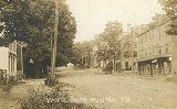
Windham, Maine
Encyclopedia
Windham is a town
in Cumberland County
, Maine
, United States. The population was 17,001 at the 2010 census. It includes the villages of South Windham
and North Windham
. It is part of the Portland
–South Portland
–Biddeford
, Maine Metropolitan Statistical Area
.
to Abraham Howard, Joseph Blaney and 58 others from Marblehead, Massachusetts
. In 1737, New Marblehead Plantation was settled by Captain Thomas Chute. By order of the Massachusetts General Court, a fort was built in spring of 1744 at the center of the settlement to offer protection during King George's War
. It was equipped with 2 swivel guns, and within its stockade
the town's inhabitants remained between 1745 and 1751. The last Indian
attack on the town occurred on May 14, 1756. New Marblehead Plantation was incorporated on June 12, 1762 as Windham, named for Wymondham
in Norfolk
, England.
Most of the early inhabitants were farmer
s, who found the soil loamy and easily worked. Early subdivision of land was in strips perpendicular to the Presumpscot River
and Pleasant River
. Each landowner cleared the river floodplain
for cropland and had river access for transportation to the coast until River Road and Old Gray Road (U.S. Route 202
) were built linking connected farm
buildings on high ground adjacent to the floodplain. Windham provided numerous sites for water power, and as early as 1738 a mill
was erected at Mallison Falls. Edmund Fowler and Lester Laflin began manufacturing gunpowder
at Gambo Falls (near Newhall) in 1817. A charcoal house, saltpeter
refinery, mills, and storehouses were separated along a mile of both banks of the Presumpscot River upstream of Gambo to minimize damage during infrequent explosions. Oriental Powder Company
became the largest gunpowder factory in Maine, and remained in operation until 1905 providing rock blasting
powder, gunpowder for belligerents in the Crimean War
, and 25 percent of the Union gunpowder supply for the American Civil War
.
The Cumberland and Oxford Canal
opened in 1832, carrying goods along the Presumpscot River between Sebago Lake
and Portland
. In 1859, when Windham's population was 2,380, it had 8 sawmill
s, a corn
and flour
mill, 2 shingle
mills, a fulling
mill, 2 carding
mills, a woolen
textile
factory, a barrel
factory, a chair stuff factory, a gunpowder
factory and 2 tanneries
. By 1886, the town also produced felt
, boot
s and shoes
, wood-paper board, carriage
s, harness
, coffin
s, clothing
and wooden ware. On April 4, 1919, the legislature passed an act creating at South Windham
the Reformatory for Men. It is now the Maine Correctional Center, a minimum to medium security facility for men and women. With its principal village at North Windham
, the town is today a recreational area and Portland suburb.
, the town has a total area of 50.3 square miles (130.3 km²), of which, 46.7 square miles (121 km²) of it is land and 3.6 square miles (9.3 km²) of it (7.16%) is water. Located beside Sebago Lake
, Windham is drained by the Pleasant River and the Presumpscot River
.
The town is crossed by U.S. routes 202 and 302, and state routes 4
, 35
and 115. It borders the towns of Standish
and Gorham
to the west, Westbrook
to the south, Falmouth
and Cumberland
to the east, Gray
to the northeast and Raymond
to the north. There are several roads that connect certain parts of the town,as well as to other towns, such as Pope Road (Connecting North Windham to Windham Center), River Road (main connector between Windham and Westbrook), Windham Center Road (mainly crosses the town in an east-west direction, as well as connecting Windham to Standish), and Falmouth Road (connects North Windham to Falmouth).
of 2000, there were 14,904 people, 5,522 households, and 4,020 families residing in the town. The population density
was 319.3 people per square mile (123.3/km²). There were 6,088 housing units at an average density of 130.4 per square mile (50.4/km²). The racial makeup of the town was 97.56% White, 0.49% African American, 0.42% Native American, 0.38% Asian, 0.01% Pacific Islander, 0.12% from other races
, and 1.03% from two or more races. Hispanic or Latino of any race were 0.44% of the population.
There were 5,522 households out of which 35.6% had children under the age of 18 living with them, 59.8% were married couples
living together, 9.5% had a female householder with no husband present, and 27.2% were non-families. 20.1% of all households were made up of individuals and 6.8% had someone living alone who was 65 years of age or older. The average household size was 2.58 and the average family size was 2.98.
In the town the population was spread out with 24.3% under the age of 18, 7.4% from 18 to 24, 34.3% from 25 to 44, 24.1% from 45 to 64, and 9.9% who were 65 years of age or older. The median age was 36 years. For every 100 females there were 103.0 males. For every 100 females age 18 and over, there were 103.0 males.
The median income for a household in the town was $46,526, and the median income for a family was $52,218. Males had a median income of $32,441 versus $26,157 for females. The per capita income
for the town was $19,890. About 3.5% of families and 5.0% of the population were below the poverty line, including 5.7% of those under age 18 and 7.5% of those age 65 or over.
It has been recently changed to RSU 14. A consolidated school district of Windham and Raymond.
New England town
The New England town is the basic unit of local government in each of the six New England states. Without a direct counterpart in most other U.S. states, New England towns are conceptually similar to civil townships in other states, but are incorporated, possessing powers like cities in other...
in Cumberland County
Cumberland County, Maine
Cumberland County is a county located in the U.S. state of Maine. As of 2010, the population was 281,674. Its county seat is Portland, and is the most populous of the sixteen Maine counties, as well as the most affluent. Cumberland County has the deepest and second largest body of water in the...
, Maine
Maine
Maine is a state in the New England region of the northeastern United States, bordered by the Atlantic Ocean to the east and south, New Hampshire to the west, and the Canadian provinces of Quebec to the northwest and New Brunswick to the northeast. Maine is both the northernmost and easternmost...
, United States. The population was 17,001 at the 2010 census. It includes the villages of South Windham
Little Falls-South Windham, Maine
Little Falls-South Windham was a census-designated place in Cumberland County, Maine, United States defined for the 2000 census. The population of the CDP was 1,792 at the time...
and North Windham
North Windham, Maine
North Windham is a census-designated place within the town of Windham in Cumberland County, Maine, United States. The population was 4,568 at the 2000 census...
. It is part of the Portland
Portland, Maine
Portland is the largest city in Maine and is the county seat of Cumberland County. The 2010 city population was 66,194, growing 3 percent since the census of 2000...
–South Portland
South Portland, Maine
South Portland is a city in Cumberland County, Maine, United States, and is the fourth-largest city in the state. Founded in 1895, as of the 2010 census, the city population was 25,002. Known for its working waterfront, South Portland is situated on Portland Harbor and overlooks the skyline of...
–Biddeford
Biddeford, Maine
Biddeford is a town in York County, Maine, United States. It is the largest town in the county, and is the sixth-largest in the state. It is the most southerly incorporated town in the state and the principal commercial center of York County. The population was 21,277 at the 2010 census...
, Maine Metropolitan Statistical Area
Portland-South Portland-Biddeford metropolitan area
The Portland–South Portland–Biddeford Metropolitan Statistical Area, also known as Greater Portland, as defined by the United States Census Bureau, is an area consisting of three counties in Maine, anchored by the city of Portland and the smaller cities of South Portland and Biddeford...
.
History
The township was granted in 1734 by the Massachusetts General CourtMassachusetts General Court
The Massachusetts General Court is the state legislature of the Commonwealth of Massachusetts. The name "General Court" is a hold-over from the Colonial Era, when this body also sat in judgment of judicial appeals cases...
to Abraham Howard, Joseph Blaney and 58 others from Marblehead, Massachusetts
Marblehead, Massachusetts
Marblehead is a town in Essex County, Massachusetts, United States. The population was 19,808 at the 2010 census. It is home to the Marblehead Neck Wildlife Sanctuary and Devereux Beach...
. In 1737, New Marblehead Plantation was settled by Captain Thomas Chute. By order of the Massachusetts General Court, a fort was built in spring of 1744 at the center of the settlement to offer protection during King George's War
King George's War
King George's War is the name given to the operations in North America that formed part of the War of the Austrian Succession . It was the third of the four French and Indian Wars. It took place primarily in the British provinces of New York, Massachusetts Bay, New Hampshire, and Nova Scotia...
. It was equipped with 2 swivel guns, and within its stockade
Stockade
A stockade is an enclosure of palisades and tall walls made of logs placed side by side vertically with the tops sharpened to provide security.-Stockade as a security fence:...
the town's inhabitants remained between 1745 and 1751. The last Indian
Indigenous peoples of the Americas
The indigenous peoples of the Americas are the pre-Columbian inhabitants of North and South America, their descendants and other ethnic groups who are identified with those peoples. Indigenous peoples are known in Canada as Aboriginal peoples, and in the United States as Native Americans...
attack on the town occurred on May 14, 1756. New Marblehead Plantation was incorporated on June 12, 1762 as Windham, named for Wymondham
Wymondham
Wymondham is a historic market town and civil parish in the English county of Norfolk. It lies 9.5 miles to the south west of the city of Norwich, on the A11 road to Thetford and London.- Before The Great Fire :...
in Norfolk
Norfolk
Norfolk is a low-lying county in the East of England. It has borders with Lincolnshire to the west, Cambridgeshire to the west and southwest and Suffolk to the south. Its northern and eastern boundaries are the North Sea coast and to the north-west the county is bordered by The Wash. The county...
, England.
Most of the early inhabitants were farmer
Farmer
A farmer is a person engaged in agriculture, who raises living organisms for food or raw materials, generally including livestock husbandry and growing crops, such as produce and grain...
s, who found the soil loamy and easily worked. Early subdivision of land was in strips perpendicular to the Presumpscot River
Presumpscot River
The Presumpscot River is a river located in Cumberland County, Maine. It is the main outlet of Sebago Lake.-Course:The river flows through the communities of Standish, Windham, Gorham, Westbrook, Portland, and Falmouth before emptying into Casco Bay at Falmouth...
and Pleasant River
Pleasant River (Presumpscot River)
The Pleasant River is a tributary of the Presumpscot River in the U.S. state of Maine.The Pleasant River originates in the town of Gray and parallels U.S...
. Each landowner cleared the river floodplain
Floodplain
A floodplain, or flood plain, is a flat or nearly flat land adjacent a stream or river that stretches from the banks of its channel to the base of the enclosing valley walls and experiences flooding during periods of high discharge...
for cropland and had river access for transportation to the coast until River Road and Old Gray Road (U.S. Route 202
U.S. Route 202
U.S. Route 202 is a highway stretching from Delaware to Maine, also passing through the states of Pennsylvania, New Jersey, New York, Connecticut, Massachusetts, and New Hampshire....
) were built linking connected farm
Connected farm
A connected farm is an architectural design common in the New England Region of the United States, and England and Wales in the United Kingdom. North American connected farms date back to the 17th century, their British counterparts have also existed for several centuries...
buildings on high ground adjacent to the floodplain. Windham provided numerous sites for water power, and as early as 1738 a mill
Watermill
A watermill is a structure that uses a water wheel or turbine to drive a mechanical process such as flour, lumber or textile production, or metal shaping .- History :...
was erected at Mallison Falls. Edmund Fowler and Lester Laflin began manufacturing gunpowder
Gunpowder
Gunpowder, also known since in the late 19th century as black powder, was the first chemical explosive and the only one known until the mid 1800s. It is a mixture of sulfur, charcoal, and potassium nitrate - with the sulfur and charcoal acting as fuels, while the saltpeter works as an oxidizer...
at Gambo Falls (near Newhall) in 1817. A charcoal house, saltpeter
Saltpeter
Saltpeter or saltpetre often refers to:*Potassium nitrate, or the mineral niter, the critical oxidizing component of gunpowder, and a food preservative.It may also refer to:...
refinery, mills, and storehouses were separated along a mile of both banks of the Presumpscot River upstream of Gambo to minimize damage during infrequent explosions. Oriental Powder Company
Oriental Powder Company
Oriental Powder Company was a gunpowder manufacturer with mills located on the Presumpscot River in Gorham and Windham, Maine. The company was one of the four largest suppliers to Union forces through the American Civil War.-History:...
became the largest gunpowder factory in Maine, and remained in operation until 1905 providing rock blasting
Rock blasting
Rock blasting is the controlled use of explosives to excavate, break down or remove rock. It is practised most often in mining, quarrying and civil engineering such as dam or road construction...
powder, gunpowder for belligerents in the Crimean War
Crimean War
The Crimean War was a conflict fought between the Russian Empire and an alliance of the French Empire, the British Empire, the Ottoman Empire, and the Kingdom of Sardinia. The war was part of a long-running contest between the major European powers for influence over territories of the declining...
, and 25 percent of the Union gunpowder supply for the American Civil War
American Civil War
The American Civil War was a civil war fought in the United States of America. In response to the election of Abraham Lincoln as President of the United States, 11 southern slave states declared their secession from the United States and formed the Confederate States of America ; the other 25...
.
The Cumberland and Oxford Canal
Cumberland and Oxford Canal
The Cumberland and Oxford Canal was opened in 1832 to connect the largest lakes of southern Maine with the seaport of Portland, Maine. The canal followed the Presumpscot River from Sebago Lake through the towns of Standish, Windham, Gorham, and Westbrook. The Canal diverged from the river at...
opened in 1832, carrying goods along the Presumpscot River between Sebago Lake
Sebago Lake
Sebago Lake is the deepest and second largest lake in the U.S. state of Maine. The lake is deep at its deepest point, with a mean depth of , covers about in surface area, has a length of and a shoreline length of . The surface is around above sea level, so the deep bottom is below the present...
and Portland
Portland, Maine
Portland is the largest city in Maine and is the county seat of Cumberland County. The 2010 city population was 66,194, growing 3 percent since the census of 2000...
. In 1859, when Windham's population was 2,380, it had 8 sawmill
Sawmill
A sawmill is a facility where logs are cut into boards.-Sawmill process:A sawmill's basic operation is much like those of hundreds of years ago; a log enters on one end and dimensional lumber exits on the other end....
s, a corn
Maize
Maize known in many English-speaking countries as corn or mielie/mealie, is a grain domesticated by indigenous peoples in Mesoamerica in prehistoric times. The leafy stalk produces ears which contain seeds called kernels. Though technically a grain, maize kernels are used in cooking as a vegetable...
and flour
Flour
Flour is a powder which is made by grinding cereal grains, other seeds or roots . It is the main ingredient of bread, which is a staple food for many cultures, making the availability of adequate supplies of flour a major economic and political issue at various times throughout history...
mill, 2 shingle
Roof shingle
Roof shingles are a roof covering consisting of individual overlapping elements. These elements are typically flat rectangular shapes laid in rows from the bottom edge of the roof up, with each successive higher row overlapping the joints in the row below...
mills, a fulling
Fulling
Fulling or tucking or walking is a step in woolen clothmaking which involves the cleansing of cloth to eliminate oils, dirt, and other impurities, and making it thicker. The worker who does the job is a fuller, tucker, or walker...
mill, 2 carding
Carding
Carding is a mechanical process that breaks up locks and unorganised clumps of fibre and then aligns the individual fibres so that they are more or less parallel with each other. The word is derived from the Latin carduus meaning teasel, as dried vegetable teasels were first used to comb the raw wool...
mills, a woolen
Woolen
Woolen or woollen is a type of yarn made from carded wool. Woolen yarn is soft, light, stretchy, and full of air. It is thus a good insulator, and makes a good knitting yarn...
textile
Textile
A textile or cloth is a flexible woven material consisting of a network of natural or artificial fibres often referred to as thread or yarn. Yarn is produced by spinning raw fibres of wool, flax, cotton, or other material to produce long strands...
factory, a barrel
Barrel
A barrel or cask is a hollow cylindrical container, traditionally made of vertical wooden staves and bound by wooden or metal hoops. Traditionally, the barrel was a standard size of measure referring to a set capacity or weight of a given commodity. A small barrel is called a keg.For example, a...
factory, a chair stuff factory, a gunpowder
Gunpowder
Gunpowder, also known since in the late 19th century as black powder, was the first chemical explosive and the only one known until the mid 1800s. It is a mixture of sulfur, charcoal, and potassium nitrate - with the sulfur and charcoal acting as fuels, while the saltpeter works as an oxidizer...
factory and 2 tanneries
Tanning
Tanning is the making of leather from the skins of animals which does not easily decompose. Traditionally, tanning used tannin, an acidic chemical compound from which the tanning process draws its name . Coloring may occur during tanning...
. By 1886, the town also produced felt
Felt
Felt is a non-woven cloth that is produced by matting, condensing and pressing woollen fibres. While some types of felt are very soft, some are tough enough to form construction materials. Felt can be of any colour, and made into any shape or size....
, boot
Boot
A boot is a type of footwear but they are not shoes. Most boots mainly cover the foot and the ankle and extend up the leg, sometimes as far as the knee or even the hip. Most boots have a heel that is clearly distinguishable from the rest of the sole, even if the two are made of one piece....
s and shoes
Shoemaking
Shoemaking is the process of making footwear. Originally, shoes were made one at a time by hand. Traditional handicraft shoemaking has now been largely superseded in volume of shoes produced by industrial mass production of footwear, but not necessarily in quality, attention to detail, or...
, wood-paper board, carriage
Carriage
A carriage is a wheeled vehicle for people, usually horse-drawn; litters and sedan chairs are excluded, since they are wheelless vehicles. The carriage is especially designed for private passenger use and for comfort or elegance, though some are also used to transport goods. It may be light,...
s, harness
Horse harness
A horse harness is a type of horse tack that allows a horse or other equine to pull various horse-drawn vehicles such as a carriage, wagon or sleigh. Harnesses may also be used to hitch animals to other loads such as a plow or canal boat....
, coffin
Coffin
A coffin is a funerary box used in the display and containment of dead people – either for burial or cremation.Contemporary North American English makes a distinction between "coffin", which is generally understood to denote a funerary box having six sides in plan view, and "casket", which...
s, clothing
Clothing
Clothing refers to any covering for the human body that is worn. The wearing of clothing is exclusively a human characteristic and is a feature of nearly all human societies...
and wooden ware. On April 4, 1919, the legislature passed an act creating at South Windham
Little Falls-South Windham, Maine
Little Falls-South Windham was a census-designated place in Cumberland County, Maine, United States defined for the 2000 census. The population of the CDP was 1,792 at the time...
the Reformatory for Men. It is now the Maine Correctional Center, a minimum to medium security facility for men and women. With its principal village at North Windham
North Windham, Maine
North Windham is a census-designated place within the town of Windham in Cumberland County, Maine, United States. The population was 4,568 at the 2000 census...
, the town is today a recreational area and Portland suburb.
Geography
According to the United States Census BureauUnited States Census Bureau
The United States Census Bureau is the government agency that is responsible for the United States Census. It also gathers other national demographic and economic data...
, the town has a total area of 50.3 square miles (130.3 km²), of which, 46.7 square miles (121 km²) of it is land and 3.6 square miles (9.3 km²) of it (7.16%) is water. Located beside Sebago Lake
Sebago Lake
Sebago Lake is the deepest and second largest lake in the U.S. state of Maine. The lake is deep at its deepest point, with a mean depth of , covers about in surface area, has a length of and a shoreline length of . The surface is around above sea level, so the deep bottom is below the present...
, Windham is drained by the Pleasant River and the Presumpscot River
Presumpscot River
The Presumpscot River is a river located in Cumberland County, Maine. It is the main outlet of Sebago Lake.-Course:The river flows through the communities of Standish, Windham, Gorham, Westbrook, Portland, and Falmouth before emptying into Casco Bay at Falmouth...
.
The town is crossed by U.S. routes 202 and 302, and state routes 4
Maine State Route 4
State Route 4 is part of Maine's system of numbered state highways, running from the New Hampshire border in South Berwick to Haines Landing on Mooselookmeguntic Lake in the town of Rangeley...
, 35
Maine State Route 35
Maine State Route 35 runs the course of western Maine, from Bethel to Kennebunk. It passes through Oxford, Cumberland and York Counties. It is known in its lower sections for both its unusually windy course as well as its notoriously poor paving, as a result of winter frost heaves. Its northern...
and 115. It borders the towns of Standish
Standish, Maine
Standish is a town in Cumberland County, Maine, United States. The population was 9,874 at the 2010 census. It includes the villages of Standish Corner, Sebago Lake Village and Steep Falls, and the localities known as Richville, Standish Neck and Two Trails...
and Gorham
Gorham, Maine
Gorham is a town in Cumberland County, Maine, United States. The population was 16,381 at the 2010 census. In addition to an urban village center known as Gorham Village or simply "the Village," the town also encompasses a number of smaller, unincorporated villages and hamlets with distinct...
to the west, Westbrook
Westbrook, Maine
Westbrook is a city in Cumberland County, Maine, United States and a suburb of Portland. The population was 17,494 at the 2010 census. It is part of the Portland–South Portland–Biddeford, Maine metropolitan statistical area.-History:...
to the south, Falmouth
Falmouth, Maine
Falmouth is a town in Cumberland County, Maine, United States. The population was 11,185 at the 2010 census. It is part of the Portland–South Portland–Biddeford, Maine metropolitan statistical area....
and Cumberland
Cumberland, Maine
Cumberland is a town in Cumberland County, Maine, United States. The population was 7,211 at the 2010 census. It is part of the Portland–South Portland–Biddeford, Maine Metropolitan Statistical Area.-History:...
to the east, Gray
Gray, Maine
Gray is a town in Cumberland County, Maine, United States. The population was 6,820 at the 2000 census. It is part of the Portland–South Portland–Biddeford, Maine metropolitan statistical area. Gray is home to regional headquarters for the Maine Department of Inland Fisheries and...
to the northeast and Raymond
Raymond, Maine
Raymond is a town in Cumberland County, Maine, United States. The population was 4,299 at the 2000 census. It is a summer recreation area and is part of the Portland–South Portland–Biddeford, Maine metropolitan statistical area...
to the north. There are several roads that connect certain parts of the town,as well as to other towns, such as Pope Road (Connecting North Windham to Windham Center), River Road (main connector between Windham and Westbrook), Windham Center Road (mainly crosses the town in an east-west direction, as well as connecting Windham to Standish), and Falmouth Road (connects North Windham to Falmouth).
Demographics
As of the censusCensus
A census is the procedure of systematically acquiring and recording information about the members of a given population. It is a regularly occurring and official count of a particular population. The term is used mostly in connection with national population and housing censuses; other common...
of 2000, there were 14,904 people, 5,522 households, and 4,020 families residing in the town. The population density
Population density
Population density is a measurement of population per unit area or unit volume. It is frequently applied to living organisms, and particularly to humans...
was 319.3 people per square mile (123.3/km²). There were 6,088 housing units at an average density of 130.4 per square mile (50.4/km²). The racial makeup of the town was 97.56% White, 0.49% African American, 0.42% Native American, 0.38% Asian, 0.01% Pacific Islander, 0.12% from other races
Race (United States Census)
Race and ethnicity in the United States Census, as defined by the Federal Office of Management and Budget and the United States Census Bureau, are self-identification data items in which residents choose the race or races with which they most closely identify, and indicate whether or not they are...
, and 1.03% from two or more races. Hispanic or Latino of any race were 0.44% of the population.
There were 5,522 households out of which 35.6% had children under the age of 18 living with them, 59.8% were married couples
Marriage
Marriage is a social union or legal contract between people that creates kinship. It is an institution in which interpersonal relationships, usually intimate and sexual, are acknowledged in a variety of ways, depending on the culture or subculture in which it is found...
living together, 9.5% had a female householder with no husband present, and 27.2% were non-families. 20.1% of all households were made up of individuals and 6.8% had someone living alone who was 65 years of age or older. The average household size was 2.58 and the average family size was 2.98.
In the town the population was spread out with 24.3% under the age of 18, 7.4% from 18 to 24, 34.3% from 25 to 44, 24.1% from 45 to 64, and 9.9% who were 65 years of age or older. The median age was 36 years. For every 100 females there were 103.0 males. For every 100 females age 18 and over, there were 103.0 males.
The median income for a household in the town was $46,526, and the median income for a family was $52,218. Males had a median income of $32,441 versus $26,157 for females. The per capita income
Per capita income
Per capita income or income per person is a measure of mean income within an economic aggregate, such as a country or city. It is calculated by taking a measure of all sources of income in the aggregate and dividing it by the total population...
for the town was $19,890. About 3.5% of families and 5.0% of the population were below the poverty line, including 5.7% of those under age 18 and 7.5% of those age 65 or over.
Notable people
- John AndersonJohn Anderson (Maine)John Anderson was a Maine politician. Anderson served as United States Representative from Maine from 1825-1833. He was born in Windham on July 30, 1792. He attended the common schools and graduated from Bowdoin College in 1813...
, congressman. - John Albion AndrewJohn Albion AndrewJohn Albion Andrew was a U.S. political figure. He served as the 25th Governor of Massachusetts between 1861 and 1866 during the American Civil War. He was a guiding force behind the creation of some of the first U.S. Army units of black men—including the famed 54th Massachusetts Infantry.-Early...
, 25th Governor of Massachusetts. - Jeff DonnellJeff DonnellJeff Donnell was an American film and television actress. Born Jean Marie Donnell, she grew up in South Windham, Maine...
, actress. - Willard MainsWillard MainsWillard Eben Mains was an American professional baseball pitcher. He joined the National League at the age of 19 with the Chicago White Stockings, started two games in , winning one and losing the other...
, MLBMajor League BaseballMajor League Baseball is the highest level of professional baseball in the United States and Canada, consisting of teams that play in the National League and the American League...
pitcher.
Education
Windham has its own school district called the Windham School Department, including Windham Primary School (K-3), Manchester School (4-5), Windham Middle School (6-8), and Windham High School (9-12).It has been recently changed to RSU 14. A consolidated school district of Windham and Raymond.
Site of interest
- Windham Historical Society
- The Windham Land Trust
- Goold HouseGoold HouseThe William Goold House is an historic house in Windham, Maine. It was listed on the National Register of Historic Places in August 1990. It is named for William Goold, a Maine State Senator, legislator and local historian....
- Maplewood FarmMaplewood FarmMaplewood Farm also known as the Anderson--Lord House is an historic property in South Windham, Maine. It was primarily expanded by John Anderson, noted agriculturist, civil engineer and politician. It was added to the National Register of Historic Places in 1991....
- Parson Smith House