

Transport in Zagreb
Encyclopedia
Transport in Zagreb
, the capital of Croatia
, relies on a combination of city-managed mass transit and individual transportation. Mass transit is composed of 19 inner-city tram
lines and 120 bus routes, both managed entirely by Zagrebački električni tramvaj. Croatian Railways
manages the parallel Zagreb Commuter Rail
system. The city is served by the Zagreb Airport
, which carries more than 2,000,000 passengers per year.
and Zagrebačka Avenue
. The 18 kilometres (11.2 mi) Slavonska Avenue
is the longest and one of the most congested roads in Zagreb, connecting the inner city to the A3
highway in the east.
Zagreb is a regional highway hub with eight highways and expressways radially leading into the city through the Zagreb bypass
. Major highways and expressways include A1
/A6
, leading to Gorski Kotar
, the Littoral
and Dalmatia
; A3 leading west to Rakitje
, Samobor
, Žumberak
and Slovenia
and east to Rugvica, Ivanić-Grad, Slavonia
and Serbia
; A2
leading northwest to Zaprešić
, Zabok
, Krapina
and Central Europe
; A4
leading northeast to Varaždin
, Čakovec
, Hungary
and on to Eastern Europe
; A11
leading southeast to Velika Gorica
, Sisak and Petrinja
(still in construction) and B28
leading east to Vrbovec
, Bjelovar
and Virovitica
.
Similar to other European cities, Zagreb does not feature a regular grid plan
. Donji Grad
, the Zagreb downtown
, mostly built in the 19th century, features a quasi-rectangular street plan, but the rest of the city depends on the form of wide straight avenues intersecting densely-built neighborhoods composed of mostly chaotical street systems.
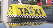 The first taxicab
ever in Zagreb started operating on June 11, 1901. It was driven by Tadija Bartolović, a skilled fiaker driver. After a successful test drive where Bartolović drove mayor Adolf Mošinsky
through Mesnička Street and Gornji Grad
, the first taxicab stand in the city was opened on the Ban Jelačić Square
. There are more than 1,150 taxicabs operating on Zagreb streets, available 24 hours a day. All vehicles are equipped with GPS device, ABS system and are air conditioned. A taxicab can be made available by dialing 1212 or 060800800.
.jpg)
Mass transit in Zagreb is managed by the company Zagrebački električni tramvaj (ZET), part of the Zagreb holding, a holding
managing utilities and other city services. ZET's trams used to span the entire city, but due to only two expansions (the Dubec
and Prečko routes) in the last 20 years, trams are today confined to the inner city. However, a bus network supplements the tram and services a large part of the Zagreb metropolitan area even outside the borders of the city proper
. Other transport amenities are also available, such as the Sljeme
gondola lift
(closed for re-construction since 2007) or the Zagreb Funicular
.
). The network covers much of the inner city, but some lines extend to the suburbs, such as line 15 (operating in Podsljeme
) or lines 7 and 11 (operating in Sesvete
). Although the trams are capable of achieving speeds in excess of 70 km/h (43.5 mph), the unique fact that the network operates mostly at the curb limits their speed to the speed of surrounding vehicles, causing the trams to travel at speeds of 25–50 km/h (15-31 mph) in the inner city, with considerable slowdowns during the rush hour
s.
The rolling stock is made up by various trams, including 87 ČKD
-Tatra T4
cars (designated as TMK 401 by ZET), 15 TMK 101 cars (obsolete, used only as substitutes), 18 TMK 201, 16 Düwag GT6 (TMK 901), 16 TMK 2100
cars and 140 new, 100% low-floor TMK 2200 cars. TMK 2200 is produced by the Crotram
consortium, composed of Končar elektroindustrija, TŽV Gredelj
and Đuro Đaković. Another 70 shorter versions will be delivered in the following period.
' long-distance trains. The trains normally operate on a 15-minute frequency, but reach only a portion of the city's suburbs.
. Still no concrete work has been done, due to lack of funding.
. The city has had a history of flooding, and since the last catastrophic flood in 1964, when inundation affected 60 km2 of inner city territory, the city authorities had built a system of levee
s to protect itself from Sava, together with a discharge canal Sava-Odra, completed in 1971. Since then the city's waterside has been strictly isolated, spanned only by three central bridges between the north of Zagreb and Novi Zagreb
in the south. Later two more bridges were built in the west and the east, also over the levees.
In recent times plans arose to build a dam
system and a new port in Rugvica
area.
Zagreb
Zagreb is the capital and the largest city of the Republic of Croatia. It is in the northwest of the country, along the Sava river, at the southern slopes of the Medvednica mountain. Zagreb lies at an elevation of approximately above sea level. According to the last official census, Zagreb's city...
, the capital of Croatia
Croatia
Croatia , officially the Republic of Croatia , is a unitary democratic parliamentary republic in Europe at the crossroads of the Mitteleuropa, the Balkans, and the Mediterranean. Its capital and largest city is Zagreb. The country is divided into 20 counties and the city of Zagreb. Croatia covers ...
, relies on a combination of city-managed mass transit and individual transportation. Mass transit is composed of 19 inner-city tram
Tram
A tram is a passenger rail vehicle which runs on tracks along public urban streets and also sometimes on separate rights of way. It may also run between cities and/or towns , and/or partially grade separated even in the cities...
lines and 120 bus routes, both managed entirely by Zagrebački električni tramvaj. Croatian Railways
Croatian Railways
Croatian Railways is the national railway company of Croatia. It was formed after the dissolution of Yugoslavia and Yugoslav Railways.Croatia is a member of the International Union of Railways . The UIC Country Code for Croatia is 78.-Railway network:...
manages the parallel Zagreb Commuter Rail
Zagreb Commuter Rail
Zagreb Commuter Rail is the suburban/commuter railway network that provides mass-transit service in the city of Zagreb, Croatia and its suburbs. This suburban rail system is operated by HŽ , and has been in development since 1992.With 21 trains the Suburban Railway mainly covers the eastern and...
system. The city is served by the Zagreb Airport
Zagreb Airport
Zagreb Airport , also known as Pleso Airport after the nearby suburb of Pleso, is the main international airport of Croatia and also a Croatian Air Force and Defense major fighter jet base. Located 10 km from the central railway station in Zagreb, it served 2,071,561 passengers in 2010 and is the...
, which carries more than 2,000,000 passengers per year.
Road transport
Zagreb drivers typically use a wide network of avenues and other arterial streets. Due to the shape of the city, most of the trips done in the city are on the east-west relation, causing high traffic on roads like Vukovar Avenue, Dubrovnik AvenueDubrovnik Avenue
Dubrovnik Avenue is an avenue located in the Novi Zagreb part of Zagreb, Croatia. It is mostly six or eight lanes wide. It runs between the roundabout beneath the southward extension of the Youth Bridge in the east and the Remetinec Roundabout in the west of Novi Zagreb. Its most important...
and Zagrebačka Avenue
Zagrebacka Avenue
Zagrebačka Avenue is an important east-west avenue in western Zagreb, Croatia. It is a dual carriageway with three lanes in each direction that starts as a continuation of the Slavonska Avenue under the intersection with the Savska Road, ending at the Savska Opatovina roundabout.It was previously...
. The 18 kilometres (11.2 mi) Slavonska Avenue
Slavonska Avenue
Slavonska Avenue is a controlled-access avenue in Zagreb, Croatia. It is the longest street in Zagreb, being long. It mostly has a speed limit, although the speed is limited to on a short section near the Ivanja Reka interchange with the Zagreb bypass and to on the section between the Ivanja...
is the longest and one of the most congested roads in Zagreb, connecting the inner city to the A3
A3 (Croatia)
The A3 motorway is a major motorway in Croatia spanning . The motorway connects Zagreb, the nation's capital, to the Slavonia region and a number of cities along the Sava River. It represents a major east–west transportation corridor in Croatia and a significant part of the Pan-European Corridor...
highway in the east.
Zagreb is a regional highway hub with eight highways and expressways radially leading into the city through the Zagreb bypass
Zagreb bypass
Zagreb bypass , is an U-shaped motorway partially encircling Zagreb, Croatia. The largest part by far, between Jankomir and Ivanja Reka interchanges, has been built between 1977 and 1979, while Ivanja Reka - Sveta Helena section has been built between 1996 and 1999. The bypass is long, tracing...
. Major highways and expressways include A1
A1 (Croatia)
The A1 motorway is the longest motorway in Croatia spanning . As it connects Zagreb, the nation's capital, to Split, the second largest city in the country and the largest city in Dalmatia, the motorway represents a major north–south transportation corridor in Croatia and a significant part of the...
/A6
A6 (Croatia)
The A6 motorway is a motorway in Croatia spanning . It connects the nation's capital, Zagreb, via the A1, to the seaport of Rijeka. The motorway forms a major north–south transportation corridor in Croatia and is a part of European route E65...
, leading to Gorski Kotar
Gorski kotar
Gorski kotar is the mountainous region in Croatia between Karlovac and Rijeka. Together with Lika and the Ogulin-Plaški valley it forms Mountainous Croatia. Because 63% of its surface is forested it is popularly called the green lungs of Croatia or Croatian Switzerland...
, the Littoral
Croatian Littoral
The Croatian Littoral is a geographical term that refers to the narrow coastal strip along the Adriatic Sea in Croatia extending from east the city Rijeka south to Karlobag...
and Dalmatia
Dalmatia
Dalmatia is a historical region on the eastern coast of the Adriatic Sea. It stretches from the island of Rab in the northwest to the Bay of Kotor in the southeast. The hinterland, the Dalmatian Zagora, ranges from fifty kilometers in width in the north to just a few kilometers in the south....
; A3 leading west to Rakitje
Rakitje
Rakitje is a village in central Croatia located west of Zagreb. County road Ž3064 connects it to the D1 highway....
, Samobor
Samobor
Samobor is a town in the Zagreb County, Croatia. It is part of the Zagreb metropolitan area.-Geography:Samobor is located west of Zagreb, between the eastern slopes of the Samoborsko gorje , in the Sava River valley.-Population:...
, Žumberak
Žumberak
Žumberak or Gorjanci is a range of mountains or hills between Croatia and Slovenia. The highest peak is Sveta Gera on the border between Croatia and Slovenia, being tall....
and Slovenia
Slovenia
Slovenia , officially the Republic of Slovenia , is a country in Central and Southeastern Europe touching the Alps and bordering the Mediterranean. Slovenia borders Italy to the west, Croatia to the south and east, Hungary to the northeast, and Austria to the north, and also has a small portion of...
and east to Rugvica, Ivanić-Grad, Slavonia
Slavonia
Slavonia is a geographical and historical region in eastern Croatia...
and Serbia
Serbia
Serbia , officially the Republic of Serbia , is a landlocked country located at the crossroads of Central and Southeast Europe, covering the southern part of the Carpathian basin and the central part of the Balkans...
; A2
A2 (Croatia)
The A2 motorway is a motorway in the Hrvatsko Zagorje region of northern Croatia, connecting Zagreb to the Macelj border crossing and Slovenia. The A2 motorway is part of the European route E59 and the Pan-European Corridor Xa...
leading northwest to Zaprešić
Zaprešic
Zaprešić is a city in Zagreb County in Croatia. Its population is 25.875 inhabitants for the city proper, and over 51,000 for its seven-municipality metropolitan area. Zaprešić is the third-largest, and most densely populated division of the county. It is located northwest of the Croatian capital...
, Zabok
Zabok
Zabok is a town and municipality situated in northwest Croatia in the Krapina-Zagorje County. It has a total population of 9,365 . Zabok is situated on the main crossroads in the heart of Hrvatsko zagorje region...
, Krapina
Krapina
Krapina is a town in northern Croatia and the administrative centre of Krapina-Zagorje County with a population of 4,482 and a total municipality population of 12,479...
and Central Europe
Central Europe
Central Europe or alternatively Middle Europe is a region of the European continent lying between the variously defined areas of Eastern and Western Europe...
; A4
A4 (Croatia)
The A4 motorway is a motorway in Croatia spanning . It connects the nation's capital, Zagreb, to the city of Varaždin and to Budapest, Hungary via the Goričan border crossing. The motorway represents a major north–south transportation corridor in Croatia and is a part of European routes E65...
leading northeast to Varaždin
Varaždin
Varaždin is a city in north Croatia, north of Zagreb on the highway A4. The total population is 47,055, with 38,746 on of the city settlement itself . The centre of Varaždin county is located near the Drava river, at...
, Čakovec
Cakovec
Čakovec is a city in northern Croatia, located around 90 kilometres north of Zagreb, the Croatian capital. Čakovec is both the county seat and largest city of Međimurje County, the northernmost, smallest and most densely populated Croatian county.-Population:...
, Hungary
Hungary
Hungary , officially the Republic of Hungary , is a landlocked country in Central Europe. It is situated in the Carpathian Basin and is bordered by Slovakia to the north, Ukraine and Romania to the east, Serbia and Croatia to the south, Slovenia to the southwest and Austria to the west. The...
and on to Eastern Europe
Eastern Europe
Eastern Europe is the eastern part of Europe. The term has widely disparate geopolitical, geographical, cultural and socioeconomic readings, which makes it highly context-dependent and even volatile, and there are "almost as many definitions of Eastern Europe as there are scholars of the region"...
; A11
A11 (Croatia)
The A11 motorway is an incomplete motorway in Croatia, long. It connects Velika Gorica, located south of Zagreb to Buševec exit. Only a fifth of the planned route is complete, and the motorway, when completed, shall span between Jakuševec interchange and Mošćenica near Sisak...
leading southeast to Velika Gorica
Velika Gorica
Velika Gorica is the largest and most populous city in Zagreb County, Croatia. The city itself has a population of 31,341, while the municipality has a population of 63,511 inhabitants .Velika Gorica is the centre of the historical Turopolje region....
, Sisak and Petrinja
Petrinja
Petrinja is a city in central Croatia near Sisak in the historic region of Banovina. The city belongs to Sisak-Moslavina County .- History :The name of Petrinja has its roots in Latin petrus, meaning "stone"...
(still in construction) and B28
B28 (Croatia)
D28 is a state road in the central Croatia connecting the D5 in Veliki Zdenci to the A4 motorway in Sveta Helena interchange near Vrbovec. The road is long....
leading east to Vrbovec
Vrbovec
Vrbovec is city in Zagreb county, Croatia, lying to the northeast of the capital Zagreb.-Geography:The town of Vrbovec lies to the north-east of Zagreb, either along the highway A4 , and then B28 expressway Vrbovec is city in Zagreb county, Croatia, lying to the northeast of the capital...
, Bjelovar
Bjelovar
Bjelovar is a city in central Croatia. It is the administrative centre of Bjelovar-Bilogora County. During the 2001 census, there were 41,869 inhabitants, 90.51% which are Croats....
and Virovitica
Virovitica
Virovitica is a Croatian town near the Croatian-Hungarian border. It is situated near the Drava river and belongs to the historic region of Slavonia. Virovitica has a population of 14,663, with 21,327 people in the municipality...
.
Similar to other European cities, Zagreb does not feature a regular grid plan
Grid plan
The grid plan, grid street plan or gridiron plan is a type of city plan in which streets run at right angles to each other, forming a grid...
. Donji Grad
Donji Grad
Donji grad is one of the 17 city districts of Zagreb, the capital of Croatia. It is located in the central part of the city and has 45,108 inhabitants . The official name of the district is rarely used, for it is dubbed centar by most of the Zagreb residents....
, the Zagreb downtown
Downtown
Downtown is a term primarily used in North America by English speakers to refer to a city's core or central business district ....
, mostly built in the 19th century, features a quasi-rectangular street plan, but the rest of the city depends on the form of wide straight avenues intersecting densely-built neighborhoods composed of mostly chaotical street systems.
Taxicabs
Taxicab
A taxicab, also taxi or cab, is a type of vehicle for hire with a driver, used by a single passenger or small group of passengers, often for a non-shared ride. A taxicab conveys passengers between locations of their choice...
ever in Zagreb started operating on June 11, 1901. It was driven by Tadija Bartolović, a skilled fiaker driver. After a successful test drive where Bartolović drove mayor Adolf Mošinsky
Adolf Mošinsky
Adolf pl. Mošinsky was a mayor of Zagreb from 1892 to 1904. Being the head of the city for three consecutive terms, he set a record in mayoring length that still remains unbroken. One of his most important achievements was building the Zagreb sewer system from scratch and turning Medveščak stream...
through Mesnička Street and Gornji Grad
Gradec, Zagreb
Gradec or Grič is a part of the Zagreb, Croatia, and together with Kaptol it is the mediaeval nucleus of the city. It's situated on the hill of Gornji Grad.- History :Gradec was given a royal charter by King Bela IV in 1242...
, the first taxicab stand in the city was opened on the Ban Jelačić Square
Ban Jelacic Square
Ban Jelačić Square is the central square of the city of Zagreb, Croatia, named after ban Josip Jelačić. The official name is Trg bana Jelačića...
. There are more than 1,150 taxicabs operating on Zagreb streets, available 24 hours a day. All vehicles are equipped with GPS device, ABS system and are air conditioned. A taxicab can be made available by dialing 1212 or 060800800.
Mass transit
Mass transit in Zagreb is managed by the company Zagrebački električni tramvaj (ZET), part of the Zagreb holding, a holding
Holding company
A holding company is a company or firm that owns other companies' outstanding stock. It usually refers to a company which does not produce goods or services itself; rather, its purpose is to own shares of other companies. Holding companies allow the reduction of risk for the owners and can allow...
managing utilities and other city services. ZET's trams used to span the entire city, but due to only two expansions (the Dubec
Dubeč
Dubeč is a municipal district and cadastral area in Prague. It is located in the eastern part of the city. As of 2008, there were 2,971 inhabitants living in Dubeč....
and Prečko routes) in the last 20 years, trams are today confined to the inner city. However, a bus network supplements the tram and services a large part of the Zagreb metropolitan area even outside the borders of the city proper
City proper
City proper is defined as a "locality with legally fixed boundaries and an administratively recognized urban status that is usually characterized by some form of local government", or the area within the corporate limits. This definition has been consistently used since the United Nations...
. Other transport amenities are also available, such as the Sljeme
Šljeme
Šljeme is a village in the municipality of Ilijaš, Bosnia and Herzegovina.-References:...
gondola lift
Gondola lift
A gondola lift is a type of aerial lift, normally called a cable car, which is supported and propelled by cables from above. It consists of a loop of steel cable that is strung between two stations, sometimes over intermediate supporting towers. The cable is driven by a bullwheel in a terminal,...
(closed for re-construction since 2007) or the Zagreb Funicular
Zagreb Funicular
The Zagreb Funicular is the funicular in Zagreb operated by ZET, situated in Tomić Street, connecting the Ilica Street with Strossmayerovo šetalište to the north ....
.
Tram
The first tram line was opened on September 5, 1891, setting off a vital part of the Zagreb mass transit system. Zagreb today features an extensive tram network with 15 day and 4 night lines running over 117 km (72.7 mi) of tracks through 255 stations and transporting almost 500,000 passengers per day (almost twice as much as the Los Angeles County Metro RailLos Angeles County Metro Rail
Metro Rail is the rapid transit rail system consisting of five separate lines serving 70 stations in the Los Angeles County, California area. The new Expo line is due to enter service in early 2012. It connects with the Metro liner bus rapid transit system and also with the Metrolink commuter...
). The network covers much of the inner city, but some lines extend to the suburbs, such as line 15 (operating in Podsljeme
Podsljeme
Podsljeme is in the foothills of Zagreb's mountain Medvednica and its name means "under Sljeme" . It has the status of četvrt and as such has an elected council. The historic Medvedgrad castle is located in the district of Črnomerec, west of Podsljeme.Podsljeme had 17,744 residents in 2001...
) or lines 7 and 11 (operating in Sesvete
Sesvete
Sesvete is one of the districts of Zagreb, Croatia. It is located in the eastern part of the city and has 59,212 inhabitants .-Administrative division:...
). Although the trams are capable of achieving speeds in excess of 70 km/h (43.5 mph), the unique fact that the network operates mostly at the curb limits their speed to the speed of surrounding vehicles, causing the trams to travel at speeds of 25–50 km/h (15-31 mph) in the inner city, with considerable slowdowns during the rush hour
Rush hour
A rush hour or peak hour is a part of the day during which traffic congestion on roads and crowding on public transport is at its highest. Normally, this happens twice a day—once in the morning and once in the evening, the times during when the most people commute...
s.
The rolling stock is made up by various trams, including 87 ČKD
CKD
A knock-down kit is a kit containing the parts needed to assemble a product...
-Tatra T4
Tatra T4
T4 is the name of a tram produced by ČKD Tatra. It is the narrower variant of the Tatra T3 model. A large number of cars was supplied to the DDR, the USSR, Romania and the former Yugoslavia using names T4D, T4SU, T4R and T4YU, respectively...
cars (designated as TMK 401 by ZET), 15 TMK 101 cars (obsolete, used only as substitutes), 18 TMK 201, 16 Düwag GT6 (TMK 901), 16 TMK 2100
TMK 2100
TMK 2100 is a tramcar vehicle produced by Croatian companies Končar and TŽV Gredelj, between 1994 and 2003. The prototype was made in 1994, and serial production began in 1997...
cars and 140 new, 100% low-floor TMK 2200 cars. TMK 2200 is produced by the Crotram
CROTRAM
Crotram is a Croatian consortium of two companies, which produces the first Croatian low-floor tram . It consists of Končar Elektroindustrija d.d. and TŽV Gredelj d.o.o., both from Zagreb...
consortium, composed of Končar elektroindustrija, TŽV Gredelj
TŽV Gredelj
TŽV Gredelj is a Croatian rolling stock factory. It was founded in 1894 as main workshop of the Hungarian state railways for repair and general overhaul of steam locomotives....
and Đuro Đaković. Another 70 shorter versions will be delivered in the following period.
Commuter rail
With 21 trains, the Zagreb suburban railway mainly covers the eastern and western parts of Zagreb. It mostly operates on the same standard-gauge lines used for Croatian RailwaysCroatian Railways
Croatian Railways is the national railway company of Croatia. It was formed after the dissolution of Yugoslavia and Yugoslav Railways.Croatia is a member of the International Union of Railways . The UIC Country Code for Croatia is 78.-Railway network:...
' long-distance trains. The trains normally operate on a 15-minute frequency, but reach only a portion of the city's suburbs.
Metro
A second urban rail, the Zagreb Metro, has been planned numerous times. It would complement the tram and commuter rail networks and would be light metro due to high cost and capacity surplus of full metroRapid transit
A rapid transit, underground, subway, elevated railway, metro or metropolitan railway system is an electric passenger railway in an urban area with a high capacity and frequency, and grade separation from other traffic. Rapid transit systems are typically located either in underground tunnels or on...
. Still no concrete work has been done, due to lack of funding.
Water transport
The river Sava flows through the city, but it is not navigable in Zagreb and the nearest port is located in SisakSisak
Sisak is a city in central Croatia. The city's population in 2011 was 33,049, with a total of 49,699 in the administrative region and it is also the administrative centre of the Sisak-Moslavina county...
. The city has had a history of flooding, and since the last catastrophic flood in 1964, when inundation affected 60 km2 of inner city territory, the city authorities had built a system of levee
Levee
A levee, levée, dike , embankment, floodbank or stopbank is an elongated naturally occurring ridge or artificially constructed fill or wall, which regulates water levels...
s to protect itself from Sava, together with a discharge canal Sava-Odra, completed in 1971. Since then the city's waterside has been strictly isolated, spanned only by three central bridges between the north of Zagreb and Novi Zagreb
Novi Zagreb
Novi Zagreb is the part of the city of Zagreb located south of the Sava river, on the way from the Pleso airport to the city center...
in the south. Later two more bridges were built in the west and the east, also over the levees.
In recent times plans arose to build a dam
Dam
A dam is a barrier that impounds water or underground streams. Dams generally serve the primary purpose of retaining water, while other structures such as floodgates or levees are used to manage or prevent water flow into specific land regions. Hydropower and pumped-storage hydroelectricity are...
system and a new port in Rugvica
Rugvica
Rugvica is a municipality in Croatia in the Zagreb county. According to the 2001 census, there are 7,608 inhabitants, absolute majority of which are Croats....
area.