

Timeline of the 2008 Pacific hurricane season
Encyclopedia
Below is the Timeline of the 2008 Pacific hurricane season, documenting all the storm formations, strengthening, weakening, landfalls
, extratropical transitions, as well as dissipation. The 2008 Pacific hurricane season
officially began on May 15, 2008, and will last until November 30. For convenience and clarity, in the timeline below, all landfalls are bolded. The timeline will also include information, when it becomes available, which was not operationally released, meaning that information from post-storm reviews by the National Hurricane Center
, such as information on a storm that was not operationally warned on, have been included.
The graphical bar below gives a brief overview of storm activity during the season, and for convenience, the storm's maximum intensity is included as a color bar.
May 28

May 29
May 30
 June 1
June 26
 June 27
June 28
June 30
July 2
July 3
July 4
July 5
July 6
July 7
July 11
July 14
July 15
July 16
July 17
July 18
July 19
July 21
July 22
July 25
July 26
July 27
August 8
August 9
August 10
August 11
August 12
August 13
August 16
August 23
August 24
August 26
September 3
September 6
September 11
October 3
October 4
October 6
October 7
October 8
October 9
October 11
October 12
October 22
October 24
November 4
Landfall (meteorology)
Landfall is the event of a tropical cyclone or a waterspout coming onto land after being over water. When a waterspout makes landfall it is reclassified as a tornado, which can then cause damage inland...
, extratropical transitions, as well as dissipation. The 2008 Pacific hurricane season
2008 Pacific hurricane season
The 2008 Pacific hurricane season was an event in the annual cycle of tropical cyclone formation. It officially started May 15, 2008 in the eastern Pacific, started on June 1, 2008 in the central Pacific, and lasted until November 30, 2008....
officially began on May 15, 2008, and will last until November 30. For convenience and clarity, in the timeline below, all landfalls are bolded. The timeline will also include information, when it becomes available, which was not operationally released, meaning that information from post-storm reviews by the National Hurricane Center
National Hurricane Center
The National Hurricane Center , located at Florida International University in Miami, Florida, is the division of the National Weather Service responsible for tracking and predicting weather systems within the tropics between the Prime Meridian and the 140th meridian west poleward to the 30th...
, such as information on a storm that was not operationally warned on, have been included.
The graphical bar below gives a brief overview of storm activity during the season, and for convenience, the storm's maximum intensity is included as a color bar.
May
May 15- The Eastern Pacific hurricane season officially begins.
May 28
- 5:00 p.m. PDTPacific Time ZoneThe Pacific Time Zone observes standard time by subtracting eight hours from Coordinated Universal Time . The clock time in this zone is based on the mean solar time of the 120th meridian west of the Greenwich Observatory. During daylight saving time, its time offset is UTC-7.In the United States...
(00:00 UTCCoordinated Universal TimeCoordinated Universal Time is the primary time standard by which the world regulates clocks and time. It is one of several closely related successors to Greenwich Mean Time. Computer servers, online services and other entities that rely on having a universally accepted time use UTC for that purpose...
May 29) – Tropical Depression One-E forms 100 mi (160 km west-notyhwest Cabo Blanco, Costa Rica. - 11:00 p.m. PDT (06:00 UTC May 29) – Tropical Depression One-E strengthens into Tropical Storm AlmaTropical Storm AlmaTropical Storm Alma of the 2008 Pacific hurricane season was the easternmost forming Pacific tropical cyclone on record and the first tropical storm on record to strike the Pacific coast of Nicaragua. In the spring of 2009, the WMO retired the name Alma and replaced it with Amanda for use in the...
.
May 29
- 12:45 p.m. PDT (19:45 UTC) – Tropical Storm Alma makes landfall near León, NicaraguaLeón, NicaraguaLeón is a department in northwestern Nicaragua . It is also the second largest city in Nicaragua, after Managua. It was founded by the Spaniards as Santiago de los Caballeros de León and rivals Granada, Nicaragua, in the number of historic Spanish colonial homes and churches...
with 65 mph (100 km/h) winds. - 11:00 p.m. PDT (00:00 UTC May 30) – Tropical Storm Alma is downgraded to a tropical depression.
May 30
- 11:00 a.m. PDT (18:00 UTC) – Tropical Depression Alma dissipates over the mountains of western HondurasHondurasHonduras is a republic in Central America. It was previously known as Spanish Honduras to differentiate it from British Honduras, which became the modern-day state of Belize...
.
June
- – The Central Pacific hurricane season officially begins.
June 26
- 11 p.m. PDT (0600 UTC June 27)– Tropical Depression Two-E forms 605 miles (973.7 km) south-southwest of Manzanillo, MexicoManzanillo, ColimaThe name Manzanillo refers to the city as well as its surrounding municipality in the Mexican state of Colima. The city, located on the Pacific Ocean, contains Mexico's busiest port. Manzanillo was the third port created by the Spanish in the Pacific during the New Spain period...
.
- 5 a.m. PDT (1200 UTC) – Tropical Depression Two-E strengthens into Tropical Storm Boris.
- 11 a.m. PDT (1800 UTC) – Tropical Depression Three-E forms 900 miles (1450 km) southwest of the southern tip of Baja California.
June 28
- 5 a.m. PDT (1200 UTC) – Tropical Depression Three-E strengthens into Tropical Storm Cristina.
June 30
- 8 a.m. PDT (1200 UTC) – Tropical Storm Cristina weakens into a tropical depression.
- 11 a.m. PDT (1800 UTC) – Tropical Depression Cristina degenerates into a remnant low.
- 5 p.m. PDT (0000 UTC July 1) – Tropical Storm Boris strengthens into a hurricane.
July
July 1- 11 a.m. PDT (1800 UTC) – Hurricane Boris weakens to a tropical storm.
- 11 a.m. PDT (1800 UTC) – Tropical Depression Four-E forms 280 miles (450.6 km) southwest of Manzanillo, Mexico.
- 5 p.m. PDT (0000 UTC July 2) - Tropical Storm Boris re-strengthens into a hurricane.
July 2
- 5 a.m. PDT (1200 UTC)– Tropical Depression Four-E strengthens into Tropical Storm DouglasTropical Storm Douglas (2008)Tropical Storm Douglas was the fourth named storm of the 2008 Pacific hurricane season. Douglas developed out of a tropical wave that formed off the African coast on June 19 and traversed the Atlantic Ocean. On June 27, the wave crossed Central America and entered the Pacific Ocean...
. - 11 a.m. PDT (1800 UTC) – Hurricane Boris weakens to a tropical storm again.
July 3
- 11 a.m. PDT (1800 UTC) – Tropical Storm Douglas weakens to a tropical depression.
- 5 p.m. PDT (0000 UTC July 4) – Tropical Storm Boris weakens to a tropical depression.
- 11 p.m. PDT (0600 UTC July 4) – Tropical Depression Douglas degenerates into an area of low pressure.
July 4
- 5 a.m. PDT (1200 UTC) – Tropical Depression Boris degenerates into an area of low pressureLow pressure areaA low-pressure area, or "low", is a region where the atmospheric pressure at sea level is below that of surrounding locations. Low-pressure systems form under areas of wind divergence which occur in upper levels of the troposphere. The formation process of a low-pressure area is known as...
.
July 5
- 11:00 a.m. PDT (1800 UTC) – Tropical Depression Five-E forms 175 miles (281.6 km) south-southeast of Acapulco, Mexico.
July 6
- 11:00 p.m. PDT (06:00 UTC July 7) – Tropical Depression Five-E makes landfall near Lázaro Cárdenas, MexicoLázaro Cárdenas, MichoacánLázaro Cárdenas is a port city that with its surrounding municipality is located in the southern part of the Mexican state of Michoacán. It was formerly known as Los Llanitos, but changed its name as a tribute to Lázaro Cárdenas del Río, a Michoacán-born politician who was president of Mexico from...
with 35 mph (56.3 km/h) winds.
July 7
- 5:00 a.m. PDT (12:00 UTC): Tropical Depression Five-E dissipates over southwestern Mexico.
July 11
- 11:00 a.m. PDT (18:00 UTC) – Tropical Depression Six-E forms 360 miles (579.4 km) south-southeast of Puerto Ángel, MexicoPuerto ÁngelPuerto Ángel is a small coastal town in the Mexican state of Oaxaca located in the municipality of San Pedro Pochutla. It, along with San Agustinillo and Playa Zipolite are known as the "Riviera Oaxaqueña. It is located 9 km south of city of Pochutla fifty km west of Huatulco and eighty km...
. - 11:00 a.m. PDT (06:00 UTC July 12) - Tropical Depression Six-E strengthens into Tropical Storm ElidaHurricane Elida (2008)Hurricane Elida was the sixth tropical cyclone, fifth named storm, and second hurricane of the 2008 Pacific hurricane season. Elida formed out of a weak tropical wave which formed off the western coast of Central America on July 8. The wave remained poorly organized over the next two days before...
.
July 14
- 5:00 a.m. PDT (12:00 UTC) – Tropical Storm Elida strengthens into a hurricane.
July 15
- 11 p.m. PDT (0600 UTC July 16) – Tropical Depression Seven-E forms 555 miles (893.2 km) southeast of Acapulco, Mexico.
July 16
- 5 a.m. PDT (1200 UTC) – Tropical Depression Seven-E strengthens into Tropical Storm Fausto.
- 11:00 a.m. PDT (18:00 UTC) – Hurricane Elida strengthens into a Category 2 hurricane.
July 17
- 5:00 a.m. PDT (12:00 UTC) - Hurricane Elida weakens to a Category 1 hurricane.
- 11:00 p.m. PDT (06:00 UTC July 18) - Hurricane Elida weakens to a tropical storm.
July 18
- 5 a.m. PDT (1200 UTC) – Tropical Storm Fausto strengthens into a hurricane.
- 11:00 p.m. PDT (06:00 UTC July 19) – Tropical Storm Elida weakens to a tropical depression.
July 19
- 5:00 a.m. PDT (12:00 UTC) - Tropical Depression Elida degenerates into an area of low pressure over open waters.
July 21
- 8 a.m. PDT (1500 UTC) – Tropical Depression Eight-E forms south-southeast of AcapulcoAcapulcoAcapulco is a city, municipality and major sea port in the state of Guerrero on the Pacific coast of Mexico, southwest from Mexico City. Acapulco is located on a deep, semi-circular bay and has been a port since the early colonial period of Mexico’s history...
. - 11 a.m. PDT (1800 UTC) - Hurricane Fausto weakens to a tropical storm.
- 2 p.m. PDT (2100 UTC) – Tropical Depression Eight-E strengthens into Tropical Storm Genevieve.
July 22
- 11 a.m. PDT (1800 UTC) – Tropical Storm Fausto weakens to a tropical depression.
- 5 p.m. PDT (0000 UTC July 23) – Tropical Depression Fausto degenerates into a remnant low pressure areaLow pressure areaA low-pressure area, or "low", is a region where the atmospheric pressure at sea level is below that of surrounding locations. Low-pressure systems form under areas of wind divergence which occur in upper levels of the troposphere. The formation process of a low-pressure area is known as...
.
July 25
- 8 a.m. PDT (1500 UTC) – Tropical Storm Genevieve strengthens into Hurricane Genevieve.
July 26
- 2 a.m. PDT (0900 UTC) – Hurricane Genevieve weakens to a tropical storm.
July 27
- 2 a.m. PDT (0900 UTC) – Tropical Storm Genevieve weakens to a tropical depression.
- 8 a.m. PDT (1500 UTC) – Tropical Depression Genevieve weakens to a remnant low.
August
August 6- 5 a.m. PDT (1200 UTC) - Tropical Depression Nine-E forms 775 miles (1,247.2 km) south-southwest of the southern tip of Baja CaliforniaBaja California SurBaja California Sur , is one of the 31 states which, with the Federal District, comprise the 32 Federal Entities of Mexico. Before becoming a state on October 8, 1974, the area was known as the South Territory of Baja California. It has an area of , or 3.57% of the land mass of Mexico and comprises...
. - 5 p.m. PDT (0000 UTC August 7) - Tropical Depression Nine-E strengthens into Tropical Storm HernanHurricane Hernan (2008)Hurricane Hernan was the ninth tropical depression, eighth named storm, fifth hurricane, and first major hurricane of the 2008 Pacific hurricane season. Hernan developed out of a tropical wave that formed off the east coast of Africa on July 24. Over the next week, the wave traversed the Atlantic...
. - 5 p.m. HSTHawaii-Aleutian time zoneThe Hawaii-Aleutian Time Zone observes Hawaii-Aleutian Standard Time , by subtracting ten hours from Coordinated Universal Time . The clock time in this zone is based on the mean solar time of the 150th meridian west of the Greenwich Observatory....
(0300 UTC August 7): Tropical Depression One-C forms southeast of HawaiiHawaii (island)The Island of Hawaii, also called the Big Island or Hawaii Island , is a volcanic island in the North Pacific Ocean...
. - 11 p.m. HST (0900 UTC August 7): Tropical Depression One-C strengthens into Tropical Storm Kika.
August 8
- 5 a.m. PDT (1200 UTC) - Tropical Storm Hernan strengthens into a hurricane.
- 11 p.m. PDT (0600 UTC August 9) - Hurricane Hernan strengthens into a Category 2 hurricane.
August 9
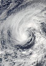
- 5 a.m. PDT (1200 UTC) - Hurricane Hernan strengthens into a major hurricane—a storm with winds of 111 mph (178.6 km/h) or higher.
- 11 p.m. PDT (0600 UTC) - Hurricane Hernan weakens to a Category 2 hurricane.
August 10
- 5 a.m. PDT (1200 UTC) - Hurricane Hernan weakens to a Category 1 hurricane.
August 11
- 5 a.m. HST (1500 UTC): Tropical Storm Kika weakens to a tropical depression.
- 5 p.m. PDT (0000 UTC August 12) - Hurricane Hernan weakens to a tropical storm.
- 11 p.m. HST (0900 UTC August 12): The final advisory issued on Tropical Depression Kika.
August 12
- 5 p.m. PDT (0000 UTC August 13) - Tropical Storm Hernan degenerates into an area of low pressure.
August 13
- 8 a.m. PDT (1500 UTC): Tropical Depression Ten-E forms south-southwest of ManzanilloManzanillo, ColimaThe name Manzanillo refers to the city as well as its surrounding municipality in the Mexican state of Colima. The city, located on the Pacific Ocean, contains Mexico's busiest port. Manzanillo was the third port created by the Spanish in the Pacific during the New Spain period...
. - 2 p.m. PDT (2100 UTC): Tropical Depression Ten-E strengthens into Tropical Storm Iselle.
August 16
- 8 p.m. PDT (0300 UTC August 17): Tropical Depression Iselle dissipates, and the final advisory is issued.
August 23
- 8 a.m. PDT (1500 UTC): Tropical Depression Eleven-E forms southwest of MexicoMexicoThe United Mexican States , commonly known as Mexico , is a federal constitutional republic in North America. It is bordered on the north by the United States; on the south and west by the Pacific Ocean; on the southeast by Guatemala, Belize, and the Caribbean Sea; and on the east by the Gulf of...
. - 2:05 a.m. PDT (2105 UTC): Tropical Depression Eleven-E is upgraded to Tropical Storm Julio.
August 24
- 12 p.m. PDT (1900 UTC): Tropical Storm Julio makes landfall near the tip of Baja CaliforniaBaja CaliforniaBaja California officially Estado Libre y Soberano de Baja California is one of the 31 states which, with the Federal District, comprise the 32 Federal Entities of Mexico. It is both the northernmost and westernmost state of Mexico. Before becoming a state in 1953, the area was known as the North...
with 50 mph (80.5 km/h) winds.
August 26
- 8 a.m. PDT (1500 UTC): Tropical Depression Julio weakens to a remnant low, and the final advisory is issued.
September
September 2- 9 a.m. PDT (1600 UTC): Tropical Storm Karina forms from a strong tropical wave south of the Baja California peninsulaBaja California PeninsulaThe Baja California peninsula , is a peninsula in northwestern Mexico. Its land mass separates the Pacific Ocean from the Gulf of California. The Peninsula extends from Mexicali, Baja California in the north to Cabo San Lucas, Baja California Sur in the south.The total area of the Baja California...
.
September 3
- 8 a.m. PDT (1500 UTC): The final advisory is issued on dissipating Tropical Depression Karina.
September 6
- 8 p.m. PDT (0300 UTC September 7): Tropical Storm Lowell forms southeast of ManzanilloManzanillo, ColimaThe name Manzanillo refers to the city as well as its surrounding municipality in the Mexican state of Colima. The city, located on the Pacific Ocean, contains Mexico's busiest port. Manzanillo was the third port created by the Spanish in the Pacific during the New Spain period...
, Mexico.
September 11
- 2 a.m. PDT (0900 UTC): Tropical Depression Lowell makes landfall in southern Baja CaliforniaBaja CaliforniaBaja California officially Estado Libre y Soberano de Baja California is one of the 31 states which, with the Federal District, comprise the 32 Federal Entities of Mexico. It is both the northernmost and westernmost state of Mexico. Before becoming a state in 1953, the area was known as the North...
with 30 mph (48.3 km/h) winds. - 8 p.m. PDT (0300 UTC September 12): Tropical Depression Lowell weakens to a remnant low, and the final advisory is issued.
October
October 1- 2 a.m. PDT (0900 UTC): Tropical Depression Fourteen-E forms southwest of Baja CaliforniaBaja CaliforniaBaja California officially Estado Libre y Soberano de Baja California is one of the 31 states which, with the Federal District, comprise the 32 Federal Entities of Mexico. It is both the northernmost and westernmost state of Mexico. Before becoming a state in 1953, the area was known as the North...
. - 8 a.m. PDT (1500 UTC): Tropical Depression Fourteen-E strengthens to Tropical Storm Marie.
October 3
- 2 p.m. PDT (2100 UTC): Tropical Storm Marie strengthens to Hurricane Marie.
- 8 p.m. PDT (0300 UTC, October 1940 The NHC downgrades Marie to a tropical storm.
- 8 p.m. PDT (0300 UTC, October 4): Tropical Depression Fifteen-E forms south of Acapulco, Mexico.
October 4
- 8 p.m. PDT (0300 UTC, October 5): Tropical Depression Fifteen-E strengthens to Tropical Storm Norbert.
October 6
- 8 a.m. PDT (1500 UTC): Tropical Storm Marie weakens into a tropical depression.
- 2 p.m. PDT (2100 UTC): Tropical Depression Marie weakens into a remnant low.
- 8 p.m. PDT (0300 UTC, October 7): Tropical Storm Norbert strengthens to Hurricane Norbert.
October 7
- 8 p.m. PDT (0300 UTC, October 8): Hurricane Norbert reaches Category 2 intensity.
October 8
- 2 a.m. PDT (0900 UTC): Hurricane Norbert reaches Category 3 intensity.
- 2 p.m. PDT (2100 UTC): Hurricane Norbert reaches Category 4 intensity.
- 2 p.m. PDT (2100 UTC): Tropical Depression Sixteen-E forms south of GuatemalaGuatemalaGuatemala is a country in Central America bordered by Mexico to the north and west, the Pacific Ocean to the southwest, Belize to the northeast, the Caribbean to the east, and Honduras and El Salvador to the southeast...
.
October 9
- 2 a.m. PDT (0900 UTC): Tropical Depression Sixteen-E strengthens to Tropical Storm Odile.
October 11
- 9:30 a.m. PDT (1630 UTC): Hurricane Norbert makes landfall near Puerto CharleyPuerto CharleyPuerto Chale is a town located on the Pacific coast side of La Paz Municipality in the Mexican state of Baja California Sur. Hurricane Norbert made landfall in Puerto Chale on October 11, 2008, with 105 mph winds, a Category 2 hurricane. It had a population of 373 inhabitants in the 2010...
with 105 mph winds - 9 p.m. PDT (0400 UTC, October 8): Hurricane Norbert makes final landfall in southern SonoraSonoraSonora officially Estado Libre y Soberano de Sonora is one of the 31 states which, with the Federal District, comprise the 32 Federal Entities of Mexico. It is divided into 72 municipalities; the capital city is Hermosillo....
state with 85 mph winds.
October 12
- 2 a.m. PDT (0900 UTC): Hurricane Norbert weakens into a tropical storm.
October 22
- 11 p.m. PDT (0600 UTC October 23) - Tropical Depression Seventeen-E forms 470 miles (756.4 km) south of Manzanillo, Mexico.
October 24
- 11 a.m. PDT (1800 UTC) - Tropical Depression Seventeen-E degenerates into an area of low pressure.
November
November 2- 5 a.m. PDT (1200 UTC) - Tropical Depression Eighteen-E forms 780 miles (1,255.3 km) south-southwest of Manzanillo, Mexico.
- 5 p.m. PDT (0000 UTC November 3) - Tropical Depression Eighteen-E strengthens into Tropical Storm Polo.
November 4
- 5 p.m. PDT (0000 UTC November 5) - Tropical Storm Polo weakens to a tropical depression.
- 11 p.m. PDT (0600 UTC November 5) - Tropical Depression Polo dissipated over open waters.
See also
- 2008 Pacific hurricane season2008 Pacific hurricane seasonThe 2008 Pacific hurricane season was an event in the annual cycle of tropical cyclone formation. It officially started May 15, 2008 in the eastern Pacific, started on June 1, 2008 in the central Pacific, and lasted until November 30, 2008....
- List of Pacific hurricane seasons
- Timeline of the 2008 Atlantic hurricane seasonTimeline of the 2008 Atlantic hurricane seasonThe 2008 Atlantic hurricane season was a well above-average year in which sixteen named storms formed, making it the fourth most active season ever recorded. An average season has eleven tropical storms, six hurricanes and two major hurricanes...
- Timeline of the 2008 Pacific typhoon seasonTimeline of the 2008 Pacific typhoon seasonThis timeline documents all the storm formations, strengthening, weakening, landfalls, extratropical transitions, as well as dissipation during the 2008 Pacific typhoon season. The 2008 Pacific typhoon season officially started on January 1, 2008 and ended on January 1, 2009. The first tropical...
- Timeline of the 2008 North Indian Ocean cyclone seasonTimeline of the 2008 North Indian Ocean cyclone seasonThe 2008 North Indian Ocean cyclone season officially ran throughout the year during 2008, with the first depression forming on April 27. The timeline includes information that was not operationally released, meaning that information from post-storm reviews by the Joint Typhoon Warning Center , and...
- South-West Indian Ocean cyclone seasons: 2007-08Timeline of the 2007-08 South-West Indian Ocean cyclone seasonBelow is a timeline of the 2007-08 South-West Indian Ocean cyclone season, documenting all the storm formations, strengthening, weakening, landfalls, extratropical transitions, as well as dissipation....
, 2008-09 - Australian region cyclone seasons: 2007-08Timeline of the 2007-08 Australian region cyclone seasonThe 2007–08 Australian region cyclone season was only the second season to have a tropical cyclone form in July. This timeline documents all the storm formations, strengthening, weakening, landfalls, extratropical transitions, as well as dissipation. The season officially began on 1 November 2007,...
, 2008-09 - South Pacific cyclone seasons:2007-08Timeline of the 2007–08 South Pacific cyclone seasonThe 2007–08 South Pacific cyclone season was a below-average season with only four tropical cyclones, forming within the South Pacific to the east of 160°E.An average season has nine tropical cyclones, about half of which become severe tropical cyclones...
, 2008-09Timeline of the 2008–09 South Pacific cyclone seasonThe 2008–09 South Pacific cyclone season was a below-average season with only six tropical cyclones occurring within the South Pacific between 160°E and 120°W...