
State highways in California
Encyclopedia
Each state highway
in the U.S. State
of California
is maintained by the California Department of Transportation
(Caltrans) and is assigned a Route (officially State Highway Route) number in the Streets and Highways Code (Sections 300-635). Most of these are numbered in a statewide system, and are known as State Route X (abbreviated SR-X). United States Numbered Highways
are labeled US X, and Interstate Highways are Interstate X, though Caltrans typically uses Route X for all classes.
Since July 1 of 1964, the majority of legislative route numbers, those defined in the Streets and Highways Code, match the sign route numbers. On the other hand, some short routes are instead signed as parts of other routes — for instance, Route 112 and Route 260 are signed as part of the longer State Route 61, and Route 51 is part of Interstate 80 Business
.
 Business route
s are not maintained by the state unless they are also assigned legislative route numbers. A few routes or sections of routes are considered unrelinquished - a new alignment has been built, or the legislative definition has changed to omit the section, but the state still maintains the roadway — and are officially Route XU. State Route 14U, an old alignment of State Route 14, is the only one signed as such. Some new alignments are considered supplemental and have a suffix of S; State Route 86S
, a replacement for State Route 86 between approximately three miles north of the Imperial
/Riverside
County line west of the Salton Sea
and Interstate 10 east of Indio
is the only one that includes the "S" suffix on its signing. Both types of suffixed routes are also considered spurs. Current or former unsigned suffixed routes include State Route 156U, signed as State Route 156 Business through Hollister
, and State Route 180S, the freeway replacement for State Route 180 in Fresno (now signed as SR 180).
The California Highway Patrol
(CHP) is tasked with patrolling
all state highways to enforce traffic laws
.
 The first legislative routes were defined by the State Highway Bond Act in 1909, passed by the California State Legislature
and signed by Governor James Gillett
. These, and later extensions to the system, were numbered sequentially. No signs were erected for these routes.
The United States Numbered Highways
were assigned by the American Association of State Highway Officials (AASHO) in November 1926, but posting did not begin in California until January 1928. These were assigned to some of the main legislative routes in California. Initially, signs were posted by the Automobile Club of Southern California
(ACSC) and California State Automobile Association
(CSAA), which had been active in signing national auto trail
s and local roads since the mid-1900s.
In 1934, after the major expansion of the state highway system in 1933 by the California Legislature, California sign route numbers were assigned by the California Division of Highways (predecessor to Caltrans). The California sign route numbers were assigned in a geographical system, completely independent of the legislative routes. Odd-numbered routes ran north–south and even-numbered routes ran east–west. The routes were split among southern California (ACSC) and central and northern California (CSAA) as follows:
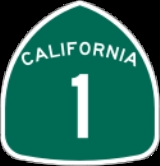
For instance, State Route 1 and State Route 4
were in central and northern California, and State Route 2
and State Route 3
(since moved) were in southern California. A rough grid was used inside the two regions, with the largest numbers — all less than 200 (except for State Route 740, which was related to State Route 74) - in eastern California (north–south) and near the border between the two regions (east–west).
The Interstate Highway System
numbers were assigned by AASHO in late 1959. In 1963 and 1964, a total renumbering of the legislative routes was made, aligning them with the sign routes. Some changes were also made to the sign routes, mostly related to decommissionings of U.S. Routes in favor of Interstates.
Since the 1990s, many non-freeway routes, especially in urban area
s, have been deleted and turned over to local control. Not all cities have been prepared to accept such routes from Caltrans simultaneously, so many have been decommissioned from the state system one fragment at a time. In the case of the San Francisco Bay Area, the Caltrans district responsible for that region is granted permission to retain in the State highway system routes that run on conventional (non freeway or expressway) roadways unless a freeway is built to bypass the surface street route.
") or the 405 , while the former use the number alone (e.g. "taking 80 to San Francisco
") or less frequently, with "I-" in the case of interstate freeways.
State highway
State highway, state road or state route can refer to one of three related concepts, two of them related to a state or provincial government in a country that is divided into states or provinces :#A...
in the U.S. State
U.S. state
A U.S. state is any one of the 50 federated states of the United States of America that share sovereignty with the federal government. Because of this shared sovereignty, an American is a citizen both of the federal entity and of his or her state of domicile. Four states use the official title of...
of California
California
California is a state located on the West Coast of the United States. It is by far the most populous U.S. state, and the third-largest by land area...
is maintained by the California Department of Transportation
California Department of Transportation
The California Department of Transportation is a government department in the U.S. state of California. Its mission is to improve mobility across the state. It manages the state highway system and is actively involved with public transportation systems throughout the state...
(Caltrans) and is assigned a Route (officially State Highway Route) number in the Streets and Highways Code (Sections 300-635). Most of these are numbered in a statewide system, and are known as State Route X (abbreviated SR-X). United States Numbered Highways
United States Numbered Highways
The system of United States Numbered Highways is an integrated system of roads and highways in the United States numbered within a nationwide grid...
are labeled US X, and Interstate Highways are Interstate X, though Caltrans typically uses Route X for all classes.
Since July 1 of 1964, the majority of legislative route numbers, those defined in the Streets and Highways Code, match the sign route numbers. On the other hand, some short routes are instead signed as parts of other routes — for instance, Route 112 and Route 260 are signed as part of the longer State Route 61, and Route 51 is part of Interstate 80 Business
Interstate 80 Business (Sacramento, California)
Interstate 80 Business, called the Capital City Freeway in its entirety, is a Business Loop of Interstate 80 through Sacramento. As it is state-maintained, unlike most business routes in California, it is assigned route numbers - part of U.S. Route 50 on its western half , and unsigned State Route...
.
Business route
A business route in the United States and Canada is a short special route connected to a parent numbered highway at its beginning, then routed through the central business district of a nearby city or town, and finally reconnecting with the same parent numbered highway again at its...
s are not maintained by the state unless they are also assigned legislative route numbers. A few routes or sections of routes are considered unrelinquished - a new alignment has been built, or the legislative definition has changed to omit the section, but the state still maintains the roadway — and are officially Route XU. State Route 14U, an old alignment of State Route 14, is the only one signed as such. Some new alignments are considered supplemental and have a suffix of S; State Route 86S
State Route 86S (California)
State Route 86S is an expressway in the U.S. state of California that runs through the Coachella Valley. In the future this will become State Route 86; however, this is currently a bypass of it. State Route 195 was supposed to be removed from the state highway system when this road was completed...
, a replacement for State Route 86 between approximately three miles north of the Imperial
Imperial County, California
Imperial County is a county located in the Imperial Valley, in the far southeast of the U.S. state of California, bordering both Arizona and Mexico. It is part of the El Centro Metropolitan Area, which encompasses all of Imperial County. The population as of 2000 was 142,361. The county seat is the...
/Riverside
Riverside County, California
Riverside County is a county in the U.S. state of California. One of 58 California counties, it covers in the southern part of the state, and stretches from Orange County to the Colorado River, which forms the state border with Arizona. The county derives its name from the city of Riverside,...
County line west of the Salton Sea
Salton Sea
The Salton Sea is a shallow, saline, endorheic rift lake located directly on the San Andreas Fault, predominantly in California's Imperial Valley. The lake occupies the lowest elevations of the Salton Sink in the Colorado Desert of Imperial and Riverside counties in Southern California. Like Death...
and Interstate 10 east of Indio
Indio, California
Indio is a city in Riverside County, California, United States, located in the Coachella Valley of Southern California's Colorado Desert region. It lies east of Palm Springs, east of Riverside, and east of Los Angeles. It is about north of Mexicali, Baja California on the U.S.-Mexican border...
is the only one that includes the "S" suffix on its signing. Both types of suffixed routes are also considered spurs. Current or former unsigned suffixed routes include State Route 156U, signed as State Route 156 Business through Hollister
Hollister, California
Hollister is a city in and the county seat of San Benito County, California, United States. The population was 34,928 at the 2010 census. Hollister is primarily an agricultural town.-History:...
, and State Route 180S, the freeway replacement for State Route 180 in Fresno (now signed as SR 180).
The California Highway Patrol
California Highway Patrol
The California Highway Patrol is a law enforcement agency of the U.S. state of California. The CHP has patrol jurisdiction over all California highways and also acts as the state police....
(CHP) is tasked with patrolling
Patrol
A patrol is commonly a group of personnel, such as police officers or soldiers, that are assigned to monitor a specific geographic area.- Military :...
all state highways to enforce traffic laws
Law
Law is a system of rules and guidelines which are enforced through social institutions to govern behavior, wherever possible. It shapes politics, economics and society in numerous ways and serves as a social mediator of relations between people. Contract law regulates everything from buying a bus...
.
History
California State Legislature
The California State Legislature is the state legislature of the U.S. state of California. It is a bicameral body consisting of the lower house, the California State Assembly, with 80 members, and the upper house, the California State Senate, with 40 members...
and signed by Governor James Gillett
James Gillett
James Norris Gillett was an American lawyer and politician. A Republican involved in federal and state politics, Gillett was elected both a member of the U.S...
. These, and later extensions to the system, were numbered sequentially. No signs were erected for these routes.
The United States Numbered Highways
United States Numbered Highways
The system of United States Numbered Highways is an integrated system of roads and highways in the United States numbered within a nationwide grid...
were assigned by the American Association of State Highway Officials (AASHO) in November 1926, but posting did not begin in California until January 1928. These were assigned to some of the main legislative routes in California. Initially, signs were posted by the Automobile Club of Southern California
Automobile Club of Southern California
The Automobile Club of Southern California is the Southern California affiliate of the American Automobile Association federation of motor clubs...
(ACSC) and California State Automobile Association
California State Automobile Association
AAA Northern California, Nevada and Utah , formerly known as the California State Automobile Association , is one of the largest motor clubs in the American Automobile Association National Federation...
(CSAA), which had been active in signing national auto trail
National auto trail
The system of auto trails was an informal network of marked routes that existed in the United States and Canada in the early part of the 20th century. Marked with colored bands on telephone poles, the trails were intended to help travellers in the early days of the automobile.Auto trails were...
s and local roads since the mid-1900s.
In 1934, after the major expansion of the state highway system in 1933 by the California Legislature, California sign route numbers were assigned by the California Division of Highways (predecessor to Caltrans). The California sign route numbers were assigned in a geographical system, completely independent of the legislative routes. Odd-numbered routes ran north–south and even-numbered routes ran east–west. The routes were split among southern California (ACSC) and central and northern California (CSAA) as follows:
- 0 or 1 moduloModular arithmeticIn mathematics, modular arithmetic is a system of arithmetic for integers, where numbers "wrap around" after they reach a certain value—the modulus....
4: central and northern California - 2 or 3 modulo 4: southern California
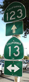
For instance, State Route 1 and State Route 4
State Route 4 (California)
State Route 4 is a state highway in the U.S. state of California, routed from Interstate 80 in the San Francisco Bay Area to State Route 89 in the Sierra Nevada. It passes through Ebbetts Pass and contains the Ebbetts Pass Scenic Byway, a National Scenic Byway.SR 4 roughly parallels the...
were in central and northern California, and State Route 2
State Route 2 (California)
State Route 2 is a state highway in the U.S. state of California. It runs from the junction of Lincoln Blvd and Interstate 10 in Santa Monica to SR 138 east of Wrightwood, running concurrent with U.S...
and State Route 3
State Route 3 (California)
State Route 3 is a state highway in the U.S. state of California. It runs from State Route 36 north along the shore of Trinity Lake, Fort Jones and Etna. The route approaches Yreka, intersecting with Interstate 5, and turns east to Montague...
(since moved) were in southern California. A rough grid was used inside the two regions, with the largest numbers — all less than 200 (except for State Route 740, which was related to State Route 74) - in eastern California (north–south) and near the border between the two regions (east–west).
The Interstate Highway System
Interstate Highway System
The Dwight D. Eisenhower National System of Interstate and Defense Highways, , is a network of limited-access roads including freeways, highways, and expressways forming part of the National Highway System of the United States of America...
numbers were assigned by AASHO in late 1959. In 1963 and 1964, a total renumbering of the legislative routes was made, aligning them with the sign routes. Some changes were also made to the sign routes, mostly related to decommissionings of U.S. Routes in favor of Interstates.
Since the 1990s, many non-freeway routes, especially in urban area
Urban area
An urban area is characterized by higher population density and vast human features in comparison to areas surrounding it. Urban areas may be cities, towns or conurbations, but the term is not commonly extended to rural settlements such as villages and hamlets.Urban areas are created and further...
s, have been deleted and turned over to local control. Not all cities have been prepared to accept such routes from Caltrans simultaneously, so many have been decommissioned from the state system one fragment at a time. In the case of the San Francisco Bay Area, the Caltrans district responsible for that region is granted permission to retain in the State highway system routes that run on conventional (non freeway or expressway) roadways unless a freeway is built to bypass the surface street route.
Nomenclature in California English
One cultural difference between Northern and Southern Californians is that the latter tend to put "the" before highway numbers (e.g. "taking the 5 to L.A.Los Angeles, California
Los Angeles , with a population at the 2010 United States Census of 3,792,621, is the most populous city in California, USA and the second most populous in the United States, after New York City. It has an area of , and is located in Southern California...
") or the 405 , while the former use the number alone (e.g. "taking 80 to San Francisco
San Francisco, California
San Francisco , officially the City and County of San Francisco, is the financial, cultural, and transportation center of the San Francisco Bay Area, a region of 7.15 million people which includes San Jose and Oakland...
") or less frequently, with "I-" in the case of interstate freeways.
Former U.S. Routes In California
- U.S. Route 40
- U.S. Route 40A
- U.S. Route 48
- U.S. Route 60
- U.S. Route 66
- U.S. Route 70
- U.S. Route 80
- U.S. Route 91
- U.S. Route 99
- U.S. Route 99E (central California)
- U.S. Route 99E (northern California)
- U.S. Route 99W (central California)
- U.S. Route 99W (northern California)
- U.S. Route 101A
- U.S. Route 101 Bypass, San Francisco Bay area
- U.S. Route 101 Bypass, Los Angeles & Orange Counties
- U.S. Route 101E
- U.S. Route 101W
- U.S. Route 299
- U.S. Route 399
- U.S. Route 466
See also
- Deleted California State Highways
- Unconstructed California State Highways
- Scenic California State HighwaysState Scenic Highway System (California)The State Scenic Highway System is a list of highways, mainly state highways, that have been designated by the California Department of Transportation as scenic highways. The California State Legislature, primarily through Section 263 of the Streets and Highways Code, makes highways eligible for...
- List of county routes in California
External links
- California Highways - Provides a complete history of California State Routes and every state route.
- The Big Highways Page (dead link, Geocities) - Information about every State Route in California, with points of interest.
- Road Signs of California
- AARoads California Highways Page
- 1964 Highway Renumbering
- Historic California U.S. Routes
- California by RV - Provides complete maps of California Main State Routes.