
.gif)
State Route 4 (California)
Encyclopedia
State Route 4 is a state highway
in the U.S. state
of California
, routed from Interstate 80 in the San Francisco Bay Area
to State Route 89 in the Sierra Nevada. It passes through Ebbetts Pass
and contains the Ebbetts Pass Scenic Byway, a National Scenic Byway
.
SR 4 roughly parallels the Sacramento-San Joaquin River Delta, a popular area for boating and fishing. There are a number of accesses to marinas and other attractions.
 State Route 4 is part of the California Freeway and Expressway System
and is eligible for the State Scenic Highway System
. However, it is only a scenic highway as designated by Caltrans from a point east of Arnold
to SR 89. SR 4 is also known as the John Muir Parkway from I-80 in Hercules to I-680 near Martinez, named for the environmentalist John Muir
. The stretch through Franklin Canyon was once known as "Blood Alley."
SR 4, an east–west highway, begins in Hercules
at San Pablo Avenue next to the Interstate 80 junction as part of John Muir Parkway. (The actual parkway extends a bit past the western terminus.) The road is an expressway
between from its starting point until it approaches Martinez
, at which point it becomes a full freeway (the California Delta Highway) passing Concord
, Pittsburg
, and Antioch
. The John Muir National Historic Site
, located directly north of Route 4 on Alhambra Avenue in Martinez
. Also on Alhambra Avenue at SR 4 is the Franklin Canyon Adobe. BART tracks run in the median of the freeway from the Port Chicago Highway interchange in Concord to the Bailey Road interchange in Bay Point, where the line currently ends at the Pittsburg/Bay Point Station
. Access to that station is provided by a pedestrian bridge crossing over the eastbound lanes of Highway 4. After Antioch, the freeway turns northward toward the Antioch Bridge
to become State Route 160, and Route 4 separates to become a suburban and rural road passing through the Bay Area
's outermost eastern suburbs (Oakley
and Brentwood
). Route 4 continues to Stockton
, where it briefly joins I-5 and then enters a separate freeway (known locally as the Crosstown Freeway) routing almost directly through downtown Stockton. The route then runs concurrent
with State Route 99 before running eastward into the Sierra through Angels Camp
, one of the richest quartz
mining sections of the Mother Lode and home of "The Celebrated Jumping Frog of Calaveras County
", and Calaveras Big Trees State Park
. The route runs through the 8050 ft (2,453.6 m). (2,454 m) Pacific Grade Summit
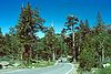
on its way up to the 8730 ft (2,660.9 m). (2,661 m) Ebbetts Pass
(being Northern California
's highest road) and ends at State Route 89 ten miles (16 km) west of Topaz Lake
, on the California–Nevada
border. The portion from Arnold to its terminus is designated the Ebbetts Pass Scenic Byway, which is eventually one lane.
Through the mountains, SR 4 is not suitable for large trucks, buses, or RVs, as it becomes very steep and narrow, with no center dividing line shortly after the Mount Reba Turnoff to Bear Valley Ski area, with tight switchbacks. The pass is not plowed for snow, and thus closes during the winter months often from November through as late as May. Thus, no passage between the Mount Reba Turnoff and Markleeville is possible. The western slope is plowed and rarely closes, even for a few hours, but often has chain restrictions during and immediately following storms, usually just east of Arnold. The eastern slope is not plowed.
As of March 2008, a freeway extension from the SR 160 junction, bypassing Oakley and Brentwood to the south and west, has been opened to vehicular traffic.
The portion of SR 4 from US Route 40 to State Route 24 was added to the highway system in 1933 as LRN 106. East of the concurrency with State Route 24 to State Route 49, SR 4 was designated as LRN 75 from 1931-1934. Finally, the segment from State Route 49 to State Route 89 was signed as LRN 24 from 1909 to 1934.
The freeway segment of SR 4 in Stockton is part of a proposed route to upgrade SR 99 into a future Interstate highway. Under one proposal, the new interstate would go along SR 99 from the split with I-5 at Wheeler Ridge north through Fresno to Stockton, where the proposed route would then turn west via the SR 4 freeway to a terminus at I-5.
{| class=wikitable
|-
!County
!Location
!Postmile
!Exit
!Destinations
!Notes
|-
|rowspan=38|Contra Costa
CC 0.00-48.39
|rowspan=3|Hercules
|0.00
|1A
|San Pablo Avenue
|At-grade intersection
; former US 40
|-
|0.00
|1B
|
|No exit number eastbound
|- style="background:#fdd;"
|0.78
|1C
|Willow Avenue
|Westbound exit and eastbound entrance
|-
|
| style="background:#fdd;"|R1.70
| style="background:#fdd;"|1
| style="background:#fdd;"|Sycamore Avenue
| style="background:#fdd;"|Eastbound exit and entrance
|-
| colspan="5" style="text-align:center;"|East end of freeway
|-
|
| style="background:#fdd;"|R1.70
| style="background:#fdd;"|
| style="background:#fdd;"|Carbon Way
| style="background:#fdd;"|Interchange; westbound exit and entrance; refinery traffic only
|-
|
|2.70
|3
|Franklin Canyon
|At-grade intersection eastbound; interchange westbound
|-
| colspan="5" style="text-align:center;"|West end of freeway
|-
|
|T4.89
|5
|.svg.png) Cummings Skyway to I-80 east – Crockett
Cummings Skyway to I-80 east – Crockett
, Port Costa
, Vallejo
|
|-
|
| style="background:#fdd;"|R5.17
| style="background:#fdd;"|6
| style="background:#fdd;"|McEwen Road – Port Costa
| style="background:#fdd;"|Westbound exit and eastbound entrance
|-
|rowspan=4|Martinez
|R8.55
|9
|Alhambra Avenue – Martinez
|
|-
|R9.19
|10
|Pine Street, Center Avenue
|
|-
|R10.33
|11
|Morello Avenue, Glacier Drive
|
|-
|12.41
|12A
|Pacheco Boulevard – Pacheco
|Former SR 21
|-
|
|12.67
|12
|
|Signed as exits 12B (south) and 12C (north)
|-
|
|R13.65
|13
|Solano Way
|
|-
|rowspan=2|Concord
|R14.67
|15A
|
|
|-
|R15.42
|15B
|Port Chicago Highway
|
|-
|
|R16.83
|17
|Willow Pass Road
|
|-
|
|R18.83
|19
|San Marco Boulevard, Willow Pass Road – Bay Point
|
|-
|
|R20.10
|20
|Bailey Road
|Signed as exits 20A (south) and 20B (north)
|-
|rowspan=2|Pittsburg
|23.05
|23
|Railroad Avenue, Harbor Street
|
|-
|24.32
|24
|Loveridge Road – Pittsburg
|
|-
|rowspan=8|Antioch
|26.01
|26
|Somersville Road, Auto Center Drive
|Signed as exits 26A (Somersville Road) and 26B (Auto Center Drive)
|- style="background:#fdd;"
|26.94
|27A
|Contra Loma Boulevard, L Street
|Eastbound exit and westbound entrance
|- style="background:#fdd;"
|27.29
|27B
|G Street – Central Antioch
|Eastbound exit and westbound entrance
|-
|R27.79
|28
|A Street, Lone Tree Way
|
|-
|R28.94
|29
|Hillcrest Avenue
|
|- style="background:#fdd;"
|31.13
|
|Bypass Road (SR 4 Byp. east) – Oakley
, Brentwood
|Eastbound exit and westbound entrance
|-
| colspan="4" style="text-align:center;"|East end of freeway
|-
|T31.52
|
|
|Interchange
|-
|Oakley
|R34.91
|
|Cypress Road – Bethel Island
|
|-
|rowspan=3|Brentwood
|37.07
|
|Lone Tree Way
|
|-
|
|
|Sand Creek Road
|
|-
|
|
|Balfour Road
|
|-
|
|
|
|Byron Highway – Knightsen
|
|-
|
|43.97
|
|Marsh Creek Road (to SR 4 Byp. west) – Antioch
, Clayton
, Concord
|
|-
|Byron
|R44.37
|
|
|
|-
|rowspan=16|San Joaquin
SJ 0.00-38.06
|
|5.96
|
|
|
|-
|rowspan=13|Stockton
| style="background:#dfd;"|15.91
25.36Indicates that the postmile represents the distance along I-5
rather than SR 4.
| style="background:#dfd;"|
| style="background:#dfd;"|
| style="background:#dfd;"|Interchange; west end of I-5 overlap; Charter Way was former SR 4 east
|-
| colspan="4" style="text-align:center;"|West end of freeway on I-5
|- style="background:#dfd;"
|26.19
R16.06
|65B
|
|East end of I-5 overlap
|-
|T15.32
|
|Fresno Avenue
|
|-
|R16.62
|66A
|El Dorado Street, Center Street – Downtown Stockton
|Serves Stockton Arena
and Ballpark; no exit number eastbound
|-
|R17.05
|66B
|Stanislaus Street – Downtown Stockton
|Signed as exit 66 eastbound
|-
|R17.71
|67
|Wilson Way
|Former US 50
/ US 99
|-
|R18.77
|68A
|Filbert Street
|Signed as exit 68 westbound
|- style="background:#dfd;"
|R19.44
18.68Indicates that the postmile represents the distance along SR 99
rather than SR 4.
|68B
|
|West end of SR 99 overlap
|- style="background:#fdd;"
|18.15
|253
|Main Street
|Westbound exit only
|- style="background:#fdd;"
|18.02
|253
|Charter Way (Dr. Martin Luther King Jr. Boulevard)
|No westbound exit; former SR 26
west
|-
| colspan="4" style="text-align:center;"|East end of freeway on SR 99
|- style="background:#dfd;"
|17.22
19.75
|
|, Los Angeles
, Stockton
|Interchange; east end of SR 99 overlap; Farmington Road was former SR 4 west
|-
|
|24.87
|
|
|
|-
|Farmington
|33.10
|
|
|
|-
|Stanislaus
STA 0.00-8.89
|
|4.54
|
|
|
|-
|rowspan=3|Calaveras
CAL R0.00-R65.87
|Copperopolis
|R8.14
|
|
|
|-
|Angels Camp
|R21.09
|
|
|
|-
|Vallecito
|26.22
|
| – Moaning Cavern
|
|-
|rowspan=2|Alpine
ALP R0.00-31.68
|
|3.89
|
|
|
|-
|Bullion
|31.68
|
|, Monitor Pass
|
A freeway extension bypassing Oakley and Brentwood has been built in three sections. Officially, it is designated as the California SR 4 Bypass, and has been named the John Marsh Heritage Highway. However, many of the signs and local maps designate this extension as simply "Bypass Road." By the end of 2009, all three sections were opened to traffic. Only the portion from California SR 160 to Lone Tree Way interchange is a multi-lane freeway. The portions from Lone Tree to Vasco Road
are single-lane each way and have signal-controlled grade crossings at Sand Creek Road, Balfour Road and Marsh Creek Road. In May 2010, this narrow stretch of the road handled 27,000 to 30,000 vehicles per day.
In June 2011, Caltrans awarded $25 million toward construction of a proposed interchange at Sand Creek Road.
The "bypass" does not reconnect to SR 4 east of Brentwood. Eastbound motorists wishing to reconnect to SR 4 are recommended to take Marsh Creek Road. The westbound bypass highway does not connect directly to SR 160. Instead, drivers wishing to go north must exit at Hillcrest, cross over the freeway, turn left and enter the eastbound lane of SR 4.
Big rigs are prohibited from using the bypass at present. This will change when Caltrans officially accepts responsibility for the road from the Highway 4 Bypass Authority in 2012. At that time, Caltrans will hand over authority for Main Street in Oakley and Brentwood Boulevard in Brentwood to the respective cities. The bypass will then be renamed State Route 4.
.
{| class=wikitable
|-
!Location
!Postmile
!Exit
!Destinations
!Notes
|-
|rowspan=2|Antioch
| style="background:#fdd;"|31.13
| style="background:#fdd;"|30
| style="background:#fdd;"|
| style="background:#fdd;"|Eastbound exit and westbound entrance; SR 4 currently exits; freeway continues as "Bypass Road"
|-
|
|31
|Laurel Road
|
|-
|rowspan=5|Brentwood
|-
|
|33
|Lone Tree Way
|
|-
| colspan="4" style="text-align:center;"|East end of freeway
|-
|
|
|Sand Creek Road
|Proposed interchange
|-
|
|
|Balfour Road
|Proposed interchange
|-
|
|
|
|Marsh Creek Road (to SR 4 east), Vasco Road
|
State highway
State highway, state road or state route can refer to one of three related concepts, two of them related to a state or provincial government in a country that is divided into states or provinces :#A...
in the U.S. state
U.S. state
A U.S. state is any one of the 50 federated states of the United States of America that share sovereignty with the federal government. Because of this shared sovereignty, an American is a citizen both of the federal entity and of his or her state of domicile. Four states use the official title of...
of California
California
California is a state located on the West Coast of the United States. It is by far the most populous U.S. state, and the third-largest by land area...
, routed from Interstate 80 in the San Francisco Bay Area
San Francisco Bay Area
The San Francisco Bay Area, commonly known as the Bay Area, is a populated region that surrounds the San Francisco and San Pablo estuaries in Northern California. The region encompasses metropolitan areas of San Francisco, Oakland, and San Jose, along with smaller urban and rural areas...
to State Route 89 in the Sierra Nevada. It passes through Ebbetts Pass
Ebbetts Pass
Ebbetts Pass, named after John Ebbetts, is a high mountain pass through the Sierra Nevada range in Alpine County, California. Ebbetts is the eastern of two passes in the area traversed by State Route 4. The western pass is the Pacific Grade Summit . The pass is registered as California Historical...
and contains the Ebbetts Pass Scenic Byway, a National Scenic Byway
National Scenic Byway
A National Scenic Byway is a road recognized by the United States Department of Transportation for its archeological, cultural, historic, natural, recreational, and/or scenic qualities. The program was established by Congress in 1991 to preserve and protect the nation's scenic but often...
.
SR 4 roughly parallels the Sacramento-San Joaquin River Delta, a popular area for boating and fishing. There are a number of accesses to marinas and other attractions.
Route description
California Freeway and Expressway System
The California Freeway and Expressway System is a system of existing or planned freeways and expressways in the U.S. state of California. It is defined by the Streets and Highways Code.-List of roads in the system:*State Route 1 *State Route 2...
and is eligible for the State Scenic Highway System
State Scenic Highway System (California)
The State Scenic Highway System is a list of highways, mainly state highways, that have been designated by the California Department of Transportation as scenic highways. The California State Legislature, primarily through Section 263 of the Streets and Highways Code, makes highways eligible for...
. However, it is only a scenic highway as designated by Caltrans from a point east of Arnold
Arnold, California
Arnold is a census-designated place in Calaveras County, California, United States. The population was 3,843 at the 2010 census, down from 4,218 at the 2000 census. Arnold is located on State Route 4.-History:...
to SR 89. SR 4 is also known as the John Muir Parkway from I-80 in Hercules to I-680 near Martinez, named for the environmentalist John Muir
John Muir
John Muir was a Scottish-born American naturalist, author, and early advocate of preservation of wilderness in the United States. His letters, essays, and books telling of his adventures in nature, especially in the Sierra Nevada mountains of California, have been read by millions...
. The stretch through Franklin Canyon was once known as "Blood Alley."
SR 4, an east–west highway, begins in Hercules
Hercules, California
Hercules is a city in western Contra Costa County, California. Situated along the coast of San Pablo Bay, it is located in the eastern region of the San Francisco Bay Area, about northeast of San Francisco. The city has a 2010 population of 24,060 according to the U.S...
at San Pablo Avenue next to the Interstate 80 junction as part of John Muir Parkway. (The actual parkway extends a bit past the western terminus.) The road is an expressway
Limited-access road
A limited-access road known by various terms worldwide, including limited-access highway, dual-carriageway and expressway, is a highway or arterial road for high-speed traffic which has many or most characteristics of a controlled-access highway , including limited or no access to adjacent...
between from its starting point until it approaches Martinez
Martinez, California
Martinez is a city and the county seat of Contra Costa County, California, United States. The population was 35,824 at the 2010 census. The downtown is notable for its large number of preserved old buildings...
, at which point it becomes a full freeway (the California Delta Highway) passing Concord
Concord, California
Concord is the largest city in Contra Costa County, California, USA. At the 2010 census, the city had a population of 122,067. Originally founded in 1869 as the community of Todos Santos by Salvio Pacheco, the name was changed to Concord within months...
, Pittsburg
Pittsburg, California
Pittsburg is a city located in eastern Contra Costa County, California, the outer portion of the East Bay region of the San Francisco Bay Area. The population was 63,264 at the 2010 census....
, and Antioch
Antioch, California
Antioch is a city in Contra Costa County, California. Located in the East Bay region of the San Francisco Bay Area along the San Joaquin-Sacramento River Delta, it is a suburb of San Francisco and Oakland. The city's population was 102,372 at the U.S...
. The John Muir National Historic Site
John Muir National Historic Site
The John Muir National Historic Site is located in the San Francisco Bay Area, in Martinez, Contra Costa County, California. It preserves the 14-room Italianate Victorian mansion where the naturalist and writer John Muir lived, as well as a nearby tract of native oak woodlands and grasslands...
, located directly north of Route 4 on Alhambra Avenue in Martinez
Martinez, California
Martinez is a city and the county seat of Contra Costa County, California, United States. The population was 35,824 at the 2010 census. The downtown is notable for its large number of preserved old buildings...
. Also on Alhambra Avenue at SR 4 is the Franklin Canyon Adobe. BART tracks run in the median of the freeway from the Port Chicago Highway interchange in Concord to the Bailey Road interchange in Bay Point, where the line currently ends at the Pittsburg/Bay Point Station
Pittsburg/Bay Point (BART station)
Pittsburg/Bay Point is a Bay Area Rapid Transit station in the town of Bay Point, California. As the terminal station of the Pittsburg/Bay Point - SFO Line, it serves all of northern and eastern Contra Costa County, including the cities of Pittsburg, Antioch, Oakley and Brentwood, as well as the...
. Access to that station is provided by a pedestrian bridge crossing over the eastbound lanes of Highway 4. After Antioch, the freeway turns northward toward the Antioch Bridge
Antioch Bridge
The Antioch Bridge crosses the San Joaquin River linking Antioch, California with Sacramento County, California. The bridge is signed as part of State Route 160. Unlike the other toll bridges in California, the Antioch bridge has only one lane going in each direction...
to become State Route 160, and Route 4 separates to become a suburban and rural road passing through the Bay Area
San Francisco Bay Area
The San Francisco Bay Area, commonly known as the Bay Area, is a populated region that surrounds the San Francisco and San Pablo estuaries in Northern California. The region encompasses metropolitan areas of San Francisco, Oakland, and San Jose, along with smaller urban and rural areas...
's outermost eastern suburbs (Oakley
Oakley, California
Oakley is a city in Contra Costa County, California, United States. The population was 35,432 at the 2010 U.S. Census. Oakley is part of the East Contra Costa Bicycle Plan, which has existing facilities in Oakley as well as plans for further expansion....
and Brentwood
Brentwood, California
Brentwood is a city in Contra Costa County, California, United States. It is located in the East Bay region of the San Francisco Bay Area. The population is 51,481 as of 2010....
). Route 4 continues to Stockton
Stockton, California
Stockton, California, the seat of San Joaquin County, is the fourth-largest city in the Central Valley of the U.S. state of California. With a population of 291,707 at the 2010 census, Stockton ranks as this state's 13th largest city...
, where it briefly joins I-5 and then enters a separate freeway (known locally as the Crosstown Freeway) routing almost directly through downtown Stockton. The route then runs concurrent
Concurrency (road)
A concurrency, overlap, or coincidence in a road network is an instance of one physical road bearing two or more different highway, motorway, or other route numbers...
with State Route 99 before running eastward into the Sierra through Angels Camp
Angels Camp, California
Angels Camp, also known as City of Angels and formerly Angel's Camp, Angels, Angels City, Carson's Creek, and Clearlake, is the only incorporated city in Calaveras County, California, United States. The population was 3,835 at the 2010 census, up from 3,004 at the 2000 census...
, one of the richest quartz
Quartz
Quartz is the second-most-abundant mineral in the Earth's continental crust, after feldspar. It is made up of a continuous framework of SiO4 silicon–oxygen tetrahedra, with each oxygen being shared between two tetrahedra, giving an overall formula SiO2. There are many different varieties of quartz,...
mining sections of the Mother Lode and home of "The Celebrated Jumping Frog of Calaveras County
The Celebrated Jumping Frog of Calaveras County
"The Celebrated Jumping Frog of Calaveras County" is an 1865 short story by Mark Twain, his first great success as a writer, bringing him national attention. The story has also been published as "Jim Smiley and His Jumping Frog" and "The Notorious Jumping Frog of Calaveras County"...
", and Calaveras Big Trees State Park
Calaveras Big Trees State Park
Calaveras Big Trees State Park is a state park of California, USA, preserving two groves of giant sequoia trees. It is located northeast of Arnold, California in the middle elevations of the Sierra Nevada...
. The route runs through the 8050 ft (2,453.6 m). (2,454 m) Pacific Grade Summit
Pacific Grade Summit
Pacific Grade Summit, at elevation 2,454 m / 8,050 ft., is a high mountain pass on the western approach to Ebbetts Pass to the east in the Sierra Nevada range in eastern California....
on its way up to the 8730 ft (2,660.9 m). (2,661 m) Ebbetts Pass
Ebbetts Pass
Ebbetts Pass, named after John Ebbetts, is a high mountain pass through the Sierra Nevada range in Alpine County, California. Ebbetts is the eastern of two passes in the area traversed by State Route 4. The western pass is the Pacific Grade Summit . The pass is registered as California Historical...
(being Northern California
Northern California
Northern California is the northern portion of the U.S. state of California. The San Francisco Bay Area , and Sacramento as well as its metropolitan area are the main population centers...
's highest road) and ends at State Route 89 ten miles (16 km) west of Topaz Lake
Topaz Lake
Topaz Lake is a reservoir located on the California-Nevada border, about south of Reno.The lake was formed by diverting waters from the West Walker River into a nearby basin that had previously contained a smaller, natural lake. The initial construction took place in 1922, resulting in a...
, on the California–Nevada
Nevada
Nevada is a state in the western, mountain west, and southwestern regions of the United States. With an area of and a population of about 2.7 million, it is the 7th-largest and 35th-most populous state. Over two-thirds of Nevada's people live in the Las Vegas metropolitan area, which contains its...
border. The portion from Arnold to its terminus is designated the Ebbetts Pass Scenic Byway, which is eventually one lane.
Through the mountains, SR 4 is not suitable for large trucks, buses, or RVs, as it becomes very steep and narrow, with no center dividing line shortly after the Mount Reba Turnoff to Bear Valley Ski area, with tight switchbacks. The pass is not plowed for snow, and thus closes during the winter months often from November through as late as May. Thus, no passage between the Mount Reba Turnoff and Markleeville is possible. The western slope is plowed and rarely closes, even for a few hours, but often has chain restrictions during and immediately following storms, usually just east of Arnold. The eastern slope is not plowed.
As of March 2008, a freeway extension from the SR 160 junction, bypassing Oakley and Brentwood to the south and west, has been opened to vehicular traffic.
History
Although segments of SR 4 were part of the state highway system since 1909, SR 4 was officially designated as such between US Route 40 (now Interstate 80) and State Route 99 in 1934. Prior to that date, the then existing segment was officially known as the "Borden Highway", and the bridge over the San Joaquin River is still referred to as the "Borden Highway Bridge" in tidal tables. Construction of SR 4 did not finish until 1935, however.The portion of SR 4 from US Route 40 to State Route 24 was added to the highway system in 1933 as LRN 106. East of the concurrency with State Route 24 to State Route 49, SR 4 was designated as LRN 75 from 1931-1934. Finally, the segment from State Route 49 to State Route 89 was signed as LRN 24 from 1909 to 1934.
The freeway segment of SR 4 in Stockton is part of a proposed route to upgrade SR 99 into a future Interstate highway. Under one proposal, the new interstate would go along SR 99 from the split with I-5 at Wheeler Ridge north through Fresno to Stockton, where the proposed route would then turn west via the SR 4 freeway to a terminus at I-5.
Major intersections
- Note: Except where prefixed with a letter, postmiles were measured in 1964, based on the alignment as it existed at that time, and do not necessarily reflect current mileage. The numbers reset at county lines; the start and end postmiles in each county are given in the county column.
{| class=wikitable
|-
!County
!Location
!Postmile
!Exit
!Destinations
!Notes
|-
|rowspan=38|Contra Costa
Contra Costa County, California
Contra Costa County is a primarily suburban county in the San Francisco Bay Area of the U.S. state of California. As of the 2010 census, it had a population of 1,049,025...
CC 0.00-48.39
|rowspan=3|Hercules
Hercules, California
Hercules is a city in western Contra Costa County, California. Situated along the coast of San Pablo Bay, it is located in the eastern region of the San Francisco Bay Area, about northeast of San Francisco. The city has a 2010 population of 24,060 according to the U.S...
|0.00
|1A
|San Pablo Avenue
|At-grade intersection
At-grade intersection
An at-grade intersection is a junction at which two or more transport axes cross at the same level .-Traffic management:With areas of high or fast traffic, an at-grade intersection normally requires a traffic control device such as a stop sign, traffic light or railway signal to manage conflicting...
; former US 40
|-
|0.00
|1B
|
|No exit number eastbound
|- style="background:#fdd;"
|0.78
|1C
|Willow Avenue
|Westbound exit and eastbound entrance
|-
|
| style="background:#fdd;"|R1.70
| style="background:#fdd;"|1
| style="background:#fdd;"|Sycamore Avenue
| style="background:#fdd;"|Eastbound exit and entrance
|-
| colspan="5" style="text-align:center;"|East end of freeway
|-
|
| style="background:#fdd;"|R1.70
| style="background:#fdd;"|
| style="background:#fdd;"|Carbon Way
| style="background:#fdd;"|Interchange; westbound exit and entrance; refinery traffic only
|-
|
|2.70
|3
|Franklin Canyon
|At-grade intersection eastbound; interchange westbound
|-
| colspan="5" style="text-align:center;"|West end of freeway
|-
|
|T4.89
|5
|
Crockett, California
Crockett is a census-designated place in Contra Costa County, California, United States. The population was 3,094 at the 2010 census...
, Port Costa
Port Costa, California
Port Costa is a census-designated place in Contra Costa County, California, United States. The population was 190 at the 2010 census.-Geography:...
, Vallejo
Vallejo, California
Vallejo is the largest city in Solano County, California, United States. The population was 115,942 at the 2010 census. It is located in the San Francisco Bay Area on the northeastern shore of San Pablo Bay...
|
|-
|
| style="background:#fdd;"|R5.17
| style="background:#fdd;"|6
| style="background:#fdd;"|McEwen Road – Port Costa
Port Costa, California
Port Costa is a census-designated place in Contra Costa County, California, United States. The population was 190 at the 2010 census.-Geography:...
| style="background:#fdd;"|Westbound exit and eastbound entrance
|-
|rowspan=4|Martinez
Martinez, California
Martinez is a city and the county seat of Contra Costa County, California, United States. The population was 35,824 at the 2010 census. The downtown is notable for its large number of preserved old buildings...
|R8.55
|9
|Alhambra Avenue – Martinez
Martinez, California
Martinez is a city and the county seat of Contra Costa County, California, United States. The population was 35,824 at the 2010 census. The downtown is notable for its large number of preserved old buildings...
|
|-
|R9.19
|10
|Pine Street, Center Avenue
|
|-
|R10.33
|11
|Morello Avenue, Glacier Drive
|
|-
|12.41
|12A
|Pacheco Boulevard – Pacheco
|Former SR 21
|-
|
|12.67
|12
|
|Signed as exits 12B (south) and 12C (north)
|-
|
|R13.65
|13
|Solano Way
|
|-
|rowspan=2|Concord
Concord, California
Concord is the largest city in Contra Costa County, California, USA. At the 2010 census, the city had a population of 122,067. Originally founded in 1869 as the community of Todos Santos by Salvio Pacheco, the name was changed to Concord within months...
|R14.67
|15A
|
|
|-
|R15.42
|15B
|Port Chicago Highway
|
|-
|
|R16.83
|17
|Willow Pass Road
|
|-
|
|R18.83
|19
|San Marco Boulevard, Willow Pass Road – Bay Point
Bay Point, California
Bay Point, formerly West Pittsburg, is a suburb and census-designated place located in eastern Contra Costa County, California, just west of the city of Pittsburg and northeast over a low range of hills from Concord...
|
|-
|
|R20.10
|20
|Bailey Road
|Signed as exits 20A (south) and 20B (north)
|-
|rowspan=2|Pittsburg
Pittsburg, California
Pittsburg is a city located in eastern Contra Costa County, California, the outer portion of the East Bay region of the San Francisco Bay Area. The population was 63,264 at the 2010 census....
|23.05
|23
|Railroad Avenue, Harbor Street
|
|-
|24.32
|24
|Loveridge Road – Pittsburg
Pittsburg, California
Pittsburg is a city located in eastern Contra Costa County, California, the outer portion of the East Bay region of the San Francisco Bay Area. The population was 63,264 at the 2010 census....
|
|-
|rowspan=8|Antioch
Antioch, California
Antioch is a city in Contra Costa County, California. Located in the East Bay region of the San Francisco Bay Area along the San Joaquin-Sacramento River Delta, it is a suburb of San Francisco and Oakland. The city's population was 102,372 at the U.S...
|26.01
|26
|Somersville Road, Auto Center Drive
|Signed as exits 26A (Somersville Road) and 26B (Auto Center Drive)
|- style="background:#fdd;"
|26.94
|27A
|Contra Loma Boulevard, L Street
|Eastbound exit and westbound entrance
|- style="background:#fdd;"
|27.29
|27B
|G Street – Central Antioch
|Eastbound exit and westbound entrance
|-
|R27.79
|28
|A Street, Lone Tree Way
|
|-
|R28.94
|29
|Hillcrest Avenue
|
|- style="background:#fdd;"
|31.13
|
|Bypass Road (SR 4 Byp. east) – Oakley
Oakley, California
Oakley is a city in Contra Costa County, California, United States. The population was 35,432 at the 2010 U.S. Census. Oakley is part of the East Contra Costa Bicycle Plan, which has existing facilities in Oakley as well as plans for further expansion....
, Brentwood
Brentwood, California
Brentwood is a city in Contra Costa County, California, United States. It is located in the East Bay region of the San Francisco Bay Area. The population is 51,481 as of 2010....
|Eastbound exit and westbound entrance
|-
| colspan="4" style="text-align:center;"|East end of freeway
|-
|T31.52
|
|
|Interchange
|-
|Oakley
Oakley, California
Oakley is a city in Contra Costa County, California, United States. The population was 35,432 at the 2010 U.S. Census. Oakley is part of the East Contra Costa Bicycle Plan, which has existing facilities in Oakley as well as plans for further expansion....
|R34.91
|
|Cypress Road – Bethel Island
Bethel Island, California
Bethel Island is a census-designated place on Bethel Island in Contra Costa County, California, United States. The population was 2,137 at the 2010 census.-Geography:...
|
|-
|rowspan=3|Brentwood
Brentwood, California
Brentwood is a city in Contra Costa County, California, United States. It is located in the East Bay region of the San Francisco Bay Area. The population is 51,481 as of 2010....
|37.07
|
|Lone Tree Way
|
|-
|
|
|Sand Creek Road
|
|-
|
|
|Balfour Road
|
|-
|
|
|
|Byron Highway – Knightsen
Knightsen, California
Knightsen is a census-designated place in Contra Costa County, California, in the United States. As of the 2010 census, the CDP population was 1,568, up from 861 reported in the 2000 census.-Geography:...
|
|-
|
|43.97
|
|Marsh Creek Road (to SR 4 Byp. west) – Antioch
Antioch, California
Antioch is a city in Contra Costa County, California. Located in the East Bay region of the San Francisco Bay Area along the San Joaquin-Sacramento River Delta, it is a suburb of San Francisco and Oakland. The city's population was 102,372 at the U.S...
, Clayton
Clayton, California
Clayton is a city in Contra Costa County, California, United States. The population was 10,897 as of the 2010 census.- Geography :...
, Concord
Concord, California
Concord is the largest city in Contra Costa County, California, USA. At the 2010 census, the city had a population of 122,067. Originally founded in 1869 as the community of Todos Santos by Salvio Pacheco, the name was changed to Concord within months...
|
|-
|Byron
Byron, California
Byron is a census-designated place in Contra Costa County, California, United States. The population was 1,277 at the 2010 census.-Geography:...
|R44.37
|
|
|
|-
|rowspan=16|San Joaquin
San Joaquin County, California
San Joaquin County is a county located in Central Valley of the U.S. state of California, just east of the San Francisco Bay Area. As of the 2010 census, the population was 685,306. The county seat is Stockton.-History:...
SJ 0.00-38.06
|
|5.96
|
|
|
|-
|rowspan=13|Stockton
Stockton, California
Stockton, California, the seat of San Joaquin County, is the fourth-largest city in the Central Valley of the U.S. state of California. With a population of 291,707 at the 2010 census, Stockton ranks as this state's 13th largest city...
| style="background:#dfd;"|15.91
25.36Indicates that the postmile represents the distance along I-5
Interstate 5 in California
Interstate 5 is a major north–south route of the Interstate Highway System in the U.S. state of California. It begins at the Mexico – United States border at the San Ysidro crossing, goes north across the length of California and crosses into Oregon south of the Medford-Ashland metropolitan...
rather than SR 4.
| style="background:#dfd;"|
| style="background:#dfd;"|
| style="background:#dfd;"|Interchange; west end of I-5 overlap; Charter Way was former SR 4 east
|-
| colspan="4" style="text-align:center;"|West end of freeway on I-5
|- style="background:#dfd;"
|26.19
R16.06
|65B
|
|East end of I-5 overlap
|-
|T15.32
|
|Fresno Avenue
|
|-
|R16.62
|66A
|El Dorado Street, Center Street – Downtown Stockton
|Serves Stockton Arena
Stockton Arena
Stockton Arena is an indoor arena in Stockton, California. It opened in December 2005 and seats approximately 10,000 fans. The arena, at maximum capacity, can seat 11,800 people.It is primarily used for ice hockey, indoor soccer and arena football....
and Ballpark; no exit number eastbound
|-
|R17.05
|66B
|Stanislaus Street – Downtown Stockton
|Signed as exit 66 eastbound
|-
|R17.71
|67
|Wilson Way
|Former US 50
U.S. Route 50 in California
In the U.S. state of California, U.S. Route 50 runs east from I-80 in West Sacramento to the Nevada state line in South Lake Tahoe. Portions within Sacramento are known as the Capital City Freeway and El Dorado Freeway...
/ US 99
|-
|R18.77
|68A
|Filbert Street
|Signed as exit 68 westbound
|- style="background:#dfd;"
|R19.44
18.68Indicates that the postmile represents the distance along SR 99
California State Route 99
California State Route 99 , commonly known as Highway 99 or, simply, as 99 , is a north–south state highway in the U.S. state of California, stretching almost the entire length of the Central Valley...
rather than SR 4.
|68B
|
|West end of SR 99 overlap
|- style="background:#fdd;"
|18.15
|253
|Main Street
|Westbound exit only
|- style="background:#fdd;"
|18.02
|253
|Charter Way (Dr. Martin Luther King Jr. Boulevard)
|No westbound exit; former SR 26
California State Route 26
State Route 26 is a state highway in the U.S. state of California, running from Stockton to State Route 88 near Pioneer.-Route description:This route is part of the California Freeway and Expressway System....
west
|-
| colspan="4" style="text-align:center;"|East end of freeway on SR 99
|- style="background:#dfd;"
|17.22
19.75
|
|, Los Angeles
Los Ángeles
Los Ángeles is the capital of the province of Biobío, in the commune of the same name, in Region VIII , in the center-south of Chile. It is located between the Laja and Biobío rivers. The population is 123,445 inhabitants...
, Stockton
Stockton, California
Stockton, California, the seat of San Joaquin County, is the fourth-largest city in the Central Valley of the U.S. state of California. With a population of 291,707 at the 2010 census, Stockton ranks as this state's 13th largest city...
|Interchange; east end of SR 99 overlap; Farmington Road was former SR 4 west
|-
|
|24.87
|
|
|
|-
|Farmington
Farmington, California
Farmington is a census-designated place in San Joaquin County, California, United States. The population was 207 at the 2010 census, down from 262 at the 2000 census.-Geography:Farmington is located at ....
|33.10
|
|
|
|-
|Stanislaus
Stanislaus County, California
Stanislaus County is a county located in the Central Valley of the U.S. state of California. As the price of housing has increased in the San Francisco Bay Area, many people who work in the southern reaches of the Bay Area have opted for the longer commute and moved to Stanislaus County for the...
STA 0.00-8.89
|
|4.54
|
|
|
|-
|rowspan=3|Calaveras
Calaveras County, California
Calaveras County is a county located in the Gold Country of the U.S. state of California. Calaveras is the Spanish word for skulls; the county was reportedly named for the remains of Native Americans discovered by the Spanish explorer Captain Gabriel Moraga. As of the 2010 census, the county had a...
CAL R0.00-R65.87
|Copperopolis
Copperopolis, California
Copperopolis is a census-designated place in Calaveras County, California, United States. The population was 3,671 at the 2010 census, up from 2,363 at the 2000 census. The town is located along State Route 4 and is registered as California Historical Landmark #296.- History :Unlike most of the...
|R8.14
|
|
|
|-
|Angels Camp
Angels Camp, California
Angels Camp, also known as City of Angels and formerly Angel's Camp, Angels, Angels City, Carson's Creek, and Clearlake, is the only incorporated city in Calaveras County, California, United States. The population was 3,835 at the 2010 census, up from 3,004 at the 2000 census...
|R21.09
|
|
|
|-
|Vallecito
Vallecito, California
Vallecito is a census-designated place in Calaveras County, California, United States. The population was 442 at the 2010 census, up from 427 at the 2000 census. The town is registered as California Historical Landmark #273...
|26.22
|
| – Moaning Cavern
Moaning Cavern
Moaning Cavern is a solutional cave located near Vallecito, California in the heart of the state's Gold Country. It is developed in marble of the Calaveras Formation. It was discovered in modern times by gold miners in 1851, but it has long been known as an interesting geological feature by...
|
|-
|rowspan=2|Alpine
Alpine County, California
Alpine County is the smallest county, by population, in the U.S. state of California. As of 2010, it had a population of 1,175, all rural. There are no incorporated cities in the county. The county seat is Markleeville...
ALP R0.00-31.68
|
|3.89
|
|
|
|-
|Bullion
Bullion, California
Bullion is a former settlement in Placer County, California. Bullion is located north of Michigan Bluff.The Bullion post office operated from 1904 to 1915.-References:...
|31.68
|
|, Monitor Pass
Monitor Pass
Monitor Pass is a high mountain pass in California in the Sierra Nevada southeast of Lake Tahoe. It connects the basins of the West Walker River and Carson River, and is traversed by State Route 89 near that highway's southern terminus at U.S...
|
California SR 4 Bypass
SR 4 continues eastward from the Hillcrest interchange in Antioch as a limited access freeway to the Main Street exit in Oakley. The freeway continues as SR 160 to the Antioch Bridge. SR 4 continues east and south as an unlimited access street, known as Main Street in Oakley and Brentwood Boulevard in Brentwood.A freeway extension bypassing Oakley and Brentwood has been built in three sections. Officially, it is designated as the California SR 4 Bypass, and has been named the John Marsh Heritage Highway. However, many of the signs and local maps designate this extension as simply "Bypass Road." By the end of 2009, all three sections were opened to traffic. Only the portion from California SR 160 to Lone Tree Way interchange is a multi-lane freeway. The portions from Lone Tree to Vasco Road
Vasco Road (California)
Vasco Road is an unnumbered highway that connects Livermore, California and Brentwood, California. Although it is not part of the California State Highway system, it is the principal north-south commuter route serving eastern Contra Costa and Alameda Counties. The two counties are each responsible...
are single-lane each way and have signal-controlled grade crossings at Sand Creek Road, Balfour Road and Marsh Creek Road. In May 2010, this narrow stretch of the road handled 27,000 to 30,000 vehicles per day.
In June 2011, Caltrans awarded $25 million toward construction of a proposed interchange at Sand Creek Road.
The "bypass" does not reconnect to SR 4 east of Brentwood. Eastbound motorists wishing to reconnect to SR 4 are recommended to take Marsh Creek Road. The westbound bypass highway does not connect directly to SR 160. Instead, drivers wishing to go north must exit at Hillcrest, cross over the freeway, turn left and enter the eastbound lane of SR 4.
Big rigs are prohibited from using the bypass at present. This will change when Caltrans officially accepts responsibility for the road from the Highway 4 Bypass Authority in 2012. At that time, Caltrans will hand over authority for Main Street in Oakley and Brentwood Boulevard in Brentwood to the respective cities. The bypass will then be renamed State Route 4.
Major intersections on SR 4 Bypass Road
The entire route is in Contra Costa CountyContra Costa County, California
Contra Costa County is a primarily suburban county in the San Francisco Bay Area of the U.S. state of California. As of the 2010 census, it had a population of 1,049,025...
.
{| class=wikitable
|-
!Location
!Postmile
!Exit
!Destinations
!Notes
|-
|rowspan=2|Antioch
Antioch, California
Antioch is a city in Contra Costa County, California. Located in the East Bay region of the San Francisco Bay Area along the San Joaquin-Sacramento River Delta, it is a suburb of San Francisco and Oakland. The city's population was 102,372 at the U.S...
| style="background:#fdd;"|31.13
| style="background:#fdd;"|30
| style="background:#fdd;"|
| style="background:#fdd;"|Eastbound exit and westbound entrance; SR 4 currently exits; freeway continues as "Bypass Road"
|-
|
|31
|Laurel Road
|
|-
|rowspan=5|Brentwood
Brentwood, California
Brentwood is a city in Contra Costa County, California, United States. It is located in the East Bay region of the San Francisco Bay Area. The population is 51,481 as of 2010....
|-
|
|33
|Lone Tree Way
|
|-
| colspan="4" style="text-align:center;"|East end of freeway
|-
|
|
|Sand Creek Road
|Proposed interchange
|-
|
|
|Balfour Road
|Proposed interchange
|-
|
|
|
|Marsh Creek Road (to SR 4 east), Vasco Road
Vasco Road (California)
Vasco Road is an unnumbered highway that connects Livermore, California and Brentwood, California. Although it is not part of the California State Highway system, it is the principal north-south commuter route serving eastern Contra Costa and Alameda Counties. The two counties are each responsible...
|