
.gif)
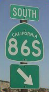
State Route 86S (California)
Encyclopedia
State Route 86S is an expressway
in the U.S. state
of California
that runs through the Coachella Valley
. In the future this will become State Route 86; however, this is currently a bypass of it. State Route 195 was supposed to be removed from the state highway system when this road was completed. The S stands for supplemental.
, from which it heads north as a divided expressway. SR 86S turns away from the Salton Sea
as it heads through farmland. The route then meets SR 111
, and turns northwest, running parallel to that highway. As it nears Indio
, the expressway turns into a freeway. SR 86S ends at an interchange with I-10
.
The entire route is in Riverside County
.
{| class=wikitable
!Location
!Postmile
!Destinations
!Notes
|-
|
|R3.48
|
|
|-
|
|R12.48
|
|
|-
|
|
|62nd Avenue
|
|-
|rowspan=5|Coachella
|R16.74
|Airport Boulevard
|
|-
|
|52nd Avenue
|
|-
|
|50th Avenue, Tyler Street
|
|-
|colspan=3 align=center|South end of freeway
|-
|rowspan=2|R22.16
|rowspan=2|.svg.png) Dillon Road (I-10 Bus.) to I-10 east
Dillon Road (I-10 Bus.) to I-10 east
|rowspan=2|
|-
|rowspan=2|Indio
|-bgcolor=#ffdddd
|R23.00
|
|Northbound exit and southbound entrance
Limited-access road
A limited-access road known by various terms worldwide, including limited-access highway, dual-carriageway and expressway, is a highway or arterial road for high-speed traffic which has many or most characteristics of a controlled-access highway , including limited or no access to adjacent...
in the U.S. state
U.S. state
A U.S. state is any one of the 50 federated states of the United States of America that share sovereignty with the federal government. Because of this shared sovereignty, an American is a citizen both of the federal entity and of his or her state of domicile. Four states use the official title of...
of California
California
California is a state located on the West Coast of the United States. It is by far the most populous U.S. state, and the third-largest by land area...
that runs through the Coachella Valley
Coachella Valley
Coachella Valley is a large valley landform in Southern California. The valley extends for approximately 45 miles in Riverside County southeast from the San Bernardino Mountains to the saltwater Salton Sea, the largest lake in California...
. In the future this will become State Route 86; however, this is currently a bypass of it. State Route 195 was supposed to be removed from the state highway system when this road was completed. The S stands for supplemental.
Route description
The route begins at an intersection with SR 86California State Route 86
State Route 86 is a north–south state highway in the southeastern desert region of Southern California, United States. It runs from State Route 111, near the Mexican border crossing at Calexico, north through the Imperial Valley via El Centro and Brawley, and around the west side of the...
, from which it heads north as a divided expressway. SR 86S turns away from the Salton Sea
Salton Sea
The Salton Sea is a shallow, saline, endorheic rift lake located directly on the San Andreas Fault, predominantly in California's Imperial Valley. The lake occupies the lowest elevations of the Salton Sink in the Colorado Desert of Imperial and Riverside counties in Southern California. Like Death...
as it heads through farmland. The route then meets SR 111
California State Route 111
State Route 111 is a state highway in the U.S. state of California. It is the main north/south state highway and retail corridor through the Coachella Valley, a part of the Colorado Desert in the southeastern corner of the state and famous as a resort destination...
, and turns northwest, running parallel to that highway. As it nears Indio
Indio, California
Indio is a city in Riverside County, California, United States, located in the Coachella Valley of Southern California's Colorado Desert region. It lies east of Palm Springs, east of Riverside, and east of Los Angeles. It is about north of Mexicali, Baja California on the U.S.-Mexican border...
, the expressway turns into a freeway. SR 86S ends at an interchange with I-10
Interstate 10 in California
Interstate 10 , the major east–west Interstate Highway in the Southern United States, runs in the U.S. state of California east from Santa Monica, on the Pacific Ocean, through Los Angeles and San Bernardino to the border with Arizona...
.
Major intersections
- Note: Postmiles do not necessarily reflect current mileage.
The entire route is in Riverside County
Riverside County, California
Riverside County is a county in the U.S. state of California. One of 58 California counties, it covers in the southern part of the state, and stretches from Orange County to the Colorado River, which forms the state border with Arizona. The county derives its name from the city of Riverside,...
.
{| class=wikitable
!Location
!Postmile
!Destinations
!Notes
|-
|
|R3.48
|
|
|-
|
|R12.48
|
|
|-
|
|
|62nd Avenue
|
|-
|rowspan=5|Coachella
Coachella, California
Coachella is a city in Riverside County, California; it is the easternmost city in the region collectively known as the Coachella Valley...
|R16.74
|Airport Boulevard
|
|-
|
|52nd Avenue
|
|-
|
|50th Avenue, Tyler Street
|
|-
|colspan=3 align=center|South end of freeway
|-
|rowspan=2|R22.16
|rowspan=2|
|rowspan=2|
|-
|rowspan=2|Indio
Indio, California
Indio is a city in Riverside County, California, United States, located in the Coachella Valley of Southern California's Colorado Desert region. It lies east of Palm Springs, east of Riverside, and east of Los Angeles. It is about north of Mexicali, Baja California on the U.S.-Mexican border...
|-bgcolor=#ffdddd
|R23.00
|
|Northbound exit and southbound entrance