
Snyder County, Pennsylvania
Encyclopedia
Snyder County is a county
located in the U.S. state
of Pennsylvania
. As of 2010, the population was 39,702. Snyder County was formed in 1855 from parts of Union County
. The county seat
is Middleburg
.
, who was governor of Pennsylvania for three terms, from 1808 to 1817, and made his home in Selinsgrove. The county seat of Middleburg was laid out in 1800 and incorporated in 1864.
, the county has a total area of 332 square miles (860 km²), of which 331 square miles (858 km²) is land and 1 square miles (2 km²) (0.29%) is water. Snyder County is in the Appalachian Mountain Section of the Ridge and Valley Province. Two parallel mountain ridges run southwest to northeast. The Susquehanna River is the eastern border. Between the ridges are steep hills, gently rolling hills, and flat creek valleys. With over 400 active farms in the county, agriculture plays an important role in the economy and environment. Roughly half the county remains forested with both softwoods and hardwoods. These woods provide a place for wildlife to roam which provides for the sport of hunting.
of 2000, there were 37,546 people, 13,654 households, and 9,981 families residing in the county. The population density
was 113 people per square mile (44/km²). There were 14,890 housing units at an average density of 45 per square mile (17/km²). The racial makeup of the county was 97.93% White
, 0.82% Black
or African American
, 0.05% Native American
, 0.42% Asian
, 0.01% Pacific Islander
, 0.30% from other races
, and 0.48% from two or more races. 0.98% of the population were Hispanic
or Latino
of any race. 48.2% were of German, 17.2% American
and 5.5% English
ancestry according to Census 2000. 4.19% report speaking Pennsylvania German
at home.http://www.mla.org/map_data_results&state_id=42&county_id=109&mode=geographic&zip=&place_id=&cty_id=&ll=&a=&ea=&order=r
There were 13,654 households out of which 32.10% had children under the age of 18 living with them, 62.00% were married couples
living together, 7.40% had a female householder with no husband present, and 26.90% were non-families. 22.40% of all households were made up of individuals and 10.30% had someone living alone who was 65 years of age or older. The average household size was 2.58 and the average family size was 3.02.
In the county, the population was spread out with 24.00% under the age of 18, 11.20% from 18 to 24, 27.40% from 25 to 44, 23.30% from 45 to 64, and 14.00% who were 65 years of age or older. The median age was 37 years. For every 100 females there were 95.60 males. For every 100 females age 18 and over, there were 93.10 males.
The Average Wage per job reported for 2003 was $26,650. County population in 2003 had risen to 37,965.
Jobs in 2003 were 17,907 with a Total labor force in 2004 of 19,863. The unemployment rate in 2004 was reported at 4.8%.
Average household size in Snyder County in 2004 was 2.58.
 Under Pennsylvania law, there are four types of incorporated municipalities: cities, boroughs, townships, and, in at most two cases, towns. The following boroughs and townships are located in Snyder County:
s are geographical areas designated by the U.S. Census Bureau
for the purposes of compiling demographic data. They are not actual jurisdictions under Pennsylvania law. Other unincorporated
communities, such as villages, may be listed here as well.
County Major Employers and Industry Sector as reported by Pennsylvania Department of Labor and Industry December 2006.
Wood Mode Manufacturing
Susquehanna University Educational Services
Conestoga Wood Specialties Corp Manufacturing
Selinsgrove Area School District Educational Services
Midd West School District Educational Services
Apex Homes Inc Manufacturing
Wal-Mart Associates Inc Retail Trade
National Beef Wholesale Trade
Penn Lyon Homes Inc
Manufacturing
Professional Building Systems Manufacturing
In 2005 manufacturing was the largest of 20 major sectors. It had an average wage per job of $34,042. Per capita income grew by 7.7% between 1994 and 2004 (adjusted for inflation).
Two Selinsgrove based manufacturing facilities announced closings in Spring 2007. Both are building related manufacturing facilities. Together they represent a loss of over 250 jobs.
During the Spring of 2008 a new manufacturing facility, Legacy Custom Modular Homes, opened in Selinsgrove, PA adding 100 jobs to the local economy.
The county and region are struggling economically. The reasons include: a lack of inter-municipal coordination and cooperation, a changing employment base and a dearth of jobs paying a living wage, out-migration of young people, an aging population, the need for workforce development, and an inequitable local tax structure.
Between 2000 and 2005, a total of two businesses in Snyder County received funds totaling $550,000 through the Pennsylvania Department of Community and Economic Development’s Opportunity Grant Program.
U.S. Rte 522 begins in Selinsgrove and travels west through Kreamer, Middleburg and on to Lewistown. Route 35 begins on 11/15 south of Selinsgrove borough and runs roughly parallel to Route 522 crossing through Freeburg and Mount Pleasant Mills then westward to McAllisterville and Richfield, in western Snyder County.
Snyder County is in Pennsylvania Department Of Transportation District 3. According to PennDOT there are 240 state owned bridges in the county. In 2007, 27 of the bridges are rated structurally deficient and 4 are posted with weight limits. The bridge that spans Middle Creek in Kreamer has been deemed structurally deficient by the state.
State routes 235, 104 and 204 cross the county in a north - south direction. State route 104 joins State Route 45 with U.S. Rtes 11/15 in Juniata County.
Snyder County’s water supply includes wells, springs/streams, reservoirs, the Susquehanna River, treatment plants, and pumping stations. Water distribution can be affected in three ways: the amount of water available; the quality of the water; and the viability of the physical components of the distribution systems. The quantity of water usually depends on nature. Humans, on the other hand, are primarily responsible for the maintenance of water quality. Water contamination can occur naturally, by human error or intentionally. Occasionally, releases of manure and milk into the water supply can cause contamination. There are also times when accidental spills and releases of hazardous materials contaminate water. Water supplies along transportation routes have been affected by hazardous materials spills.
Water – Water service in Snyder County is provided by various municipal and regional authorities, private water providers, and private well water sources.
Gas – UGI Penn Natural Gas is the only natural gas provider in Snyder County, providing service to Jackson,
Middlecreek, Monroe, and Penn Townships, as well as Selinsgrove and Shamokin Dam Boroughs. Several propane dealers
exist to service the rural community.
Communications – Verizon provides telephone service and EvenLink provides VoIP telephone
service to all 21 municipalities in Snyder County.
Cable television service is provided by Service Electric Cablevision, Nittany Media, Inc., Zampelli Electronics, and Beaver Springs Community TV Association.
High-speed Internet access is principally provided by Verizon, EvenLink, and Service Electric Cablevision.
There are several restaurants featuring high speed wireless internet in Snyder County. Dunkin Donuts and Applebee's provide fee-based services provided by PenTeleData Unleashed. The White House Deli in MP Mills provides a free service.
. In 2008 John McCain
received 64% of the county's vote. Snyder County was one of the only counties in Pennsylvania to go for Barry Goldwater
. The last Republican presidential candidate to lose Snyder County was incumbent president William Howard Taft
when he split the Republican vote with challenger and former president Theodore Roosevelt
, who took the county for the insurgent Progressive Party. In fact, no Democratic presidential candidate has been able to claim the county since Pennsylvania native James Buchanan
won the presidency in 1856. The only county in Pennsylvania to be more steadfastly Republican (or indeed, remain so one-sidedly partisan for either party in Pennsylvania) in presidential contests has been Snyder County's neighbor to the north, Union County
, which voted for John C. Fremont
over Buchanan in 1856.
The county is located in Pennsylvania's 10th congressional district
, which has a Cook Partisan Voting Index
of R+8 and is represented by Republican Tom Marino
. As part of Pennsylvania Senate, District 27
it is represented by Republican John Gordner
. The county contains locations in Pennsylvania House of Representatives, District 82
, Pennsylvania House of Representatives, District 85
, and Pennsylvania House of Representatives, District 108
. All of these have been represented by Republicans since 1989.
Of "Straight Party" voters in Snyder 73.2% are Republican and 24.65% are Democratic. In the 2008 election Republicans won in all races and in most they won by over 20%. Chris Carney
lost by roughly 13% in the county while winning by 12% in the district.
County (United States)
In the United States, a county is a geographic subdivision of a state , usually assigned some governmental authority. The term "county" is used in 48 of the 50 states; Louisiana is divided into parishes and Alaska into boroughs. Parishes and boroughs are called "county-equivalents" by the U.S...
located in the U.S. state
U.S. state
A U.S. state is any one of the 50 federated states of the United States of America that share sovereignty with the federal government. Because of this shared sovereignty, an American is a citizen both of the federal entity and of his or her state of domicile. Four states use the official title of...
of Pennsylvania
Pennsylvania
The Commonwealth of Pennsylvania is a U.S. state that is located in the Northeastern and Mid-Atlantic regions of the United States. The state borders Delaware and Maryland to the south, West Virginia to the southwest, Ohio to the west, New York and Ontario, Canada, to the north, and New Jersey to...
. As of 2010, the population was 39,702. Snyder County was formed in 1855 from parts of Union County
Union County, Pennsylvania
-Demographics:As of the census of 2000, there were 41,624 people, 13,178 households, and 9,211 families residing in the county. The population density was 131 people per square mile . There were 14,684 housing units at an average density of 46 per square mile...
. The county seat
County seat
A county seat is an administrative center, or seat of government, for a county or civil parish. The term is primarily used in the United States....
is Middleburg
Middleburg, Pennsylvania
Middleburg is a borough in Snyder County, Pennsylvania, United States. The population was 1,382 at the 2000 census. It is the county seat of Snyder County.-History:...
.
History
Snyder County was settled in the 1740’s by Pennsylvania Germans from Berks and Lancaster Counties, and became an independent political unit on March 2, 1855 when formed under part of Union County. Snyder County took its name in honor of the famous citizen and political figure, Simon SnyderSimon Snyder
Simon Snyder was the third Governor of the Commonwealth of Pennsylvania from 1808 to 1817. A Jeffersonian Democrat, he served three terms as speaker of the Pennsylvania House of Representatives before becoming governor...
, who was governor of Pennsylvania for three terms, from 1808 to 1817, and made his home in Selinsgrove. The county seat of Middleburg was laid out in 1800 and incorporated in 1864.
Geography
According to the U.S. Census BureauUnited States Census Bureau
The United States Census Bureau is the government agency that is responsible for the United States Census. It also gathers other national demographic and economic data...
, the county has a total area of 332 square miles (860 km²), of which 331 square miles (858 km²) is land and 1 square miles (2 km²) (0.29%) is water. Snyder County is in the Appalachian Mountain Section of the Ridge and Valley Province. Two parallel mountain ridges run southwest to northeast. The Susquehanna River is the eastern border. Between the ridges are steep hills, gently rolling hills, and flat creek valleys. With over 400 active farms in the county, agriculture plays an important role in the economy and environment. Roughly half the county remains forested with both softwoods and hardwoods. These woods provide a place for wildlife to roam which provides for the sport of hunting.
Adjacent counties
- Union CountyUnion County, Pennsylvania-Demographics:As of the census of 2000, there were 41,624 people, 13,178 households, and 9,211 families residing in the county. The population density was 131 people per square mile . There were 14,684 housing units at an average density of 46 per square mile...
(north) - Northumberland CountyNorthumberland County, PennsylvaniaThere were 38,835 households out of which 27.30% had children under the age of 18 living with them, 52.40% were married couples living together, 9.60% had a female householder with no husband present, and 34.10% were non-families. 30.20% of all households were made up of individuals and 15.50% had...
(east) - Juniata CountyJuniata County, PennsylvaniaJuniata County is a county located in the U.S. state of Pennsylvania. As of 2010, the population was 24,636. Juniata County was created on March 2, 1831, from part of Mifflin County and named for the Juniata River. Its county seat is Mifflintown....
(south) - Mifflin CountyMifflin County, PennsylvaniaMifflin County is a county located in the U.S. state of Pennsylvania. As of 2010, the population was 46,682. Its county seat is Lewistown. It is named after Thomas Mifflin, the first Governor of Pennsylvania.-Geography:...
(west)
Demographics
As of the censusCensus
A census is the procedure of systematically acquiring and recording information about the members of a given population. It is a regularly occurring and official count of a particular population. The term is used mostly in connection with national population and housing censuses; other common...
of 2000, there were 37,546 people, 13,654 households, and 9,981 families residing in the county. The population density
Population density
Population density is a measurement of population per unit area or unit volume. It is frequently applied to living organisms, and particularly to humans...
was 113 people per square mile (44/km²). There were 14,890 housing units at an average density of 45 per square mile (17/km²). The racial makeup of the county was 97.93% White
Race (United States Census)
Race and ethnicity in the United States Census, as defined by the Federal Office of Management and Budget and the United States Census Bureau, are self-identification data items in which residents choose the race or races with which they most closely identify, and indicate whether or not they are...
, 0.82% Black
Race (United States Census)
Race and ethnicity in the United States Census, as defined by the Federal Office of Management and Budget and the United States Census Bureau, are self-identification data items in which residents choose the race or races with which they most closely identify, and indicate whether or not they are...
or African American
Race (United States Census)
Race and ethnicity in the United States Census, as defined by the Federal Office of Management and Budget and the United States Census Bureau, are self-identification data items in which residents choose the race or races with which they most closely identify, and indicate whether or not they are...
, 0.05% Native American
Race (United States Census)
Race and ethnicity in the United States Census, as defined by the Federal Office of Management and Budget and the United States Census Bureau, are self-identification data items in which residents choose the race or races with which they most closely identify, and indicate whether or not they are...
, 0.42% Asian
Race (United States Census)
Race and ethnicity in the United States Census, as defined by the Federal Office of Management and Budget and the United States Census Bureau, are self-identification data items in which residents choose the race or races with which they most closely identify, and indicate whether or not they are...
, 0.01% Pacific Islander
Race (United States Census)
Race and ethnicity in the United States Census, as defined by the Federal Office of Management and Budget and the United States Census Bureau, are self-identification data items in which residents choose the race or races with which they most closely identify, and indicate whether or not they are...
, 0.30% from other races
Race (United States Census)
Race and ethnicity in the United States Census, as defined by the Federal Office of Management and Budget and the United States Census Bureau, are self-identification data items in which residents choose the race or races with which they most closely identify, and indicate whether or not they are...
, and 0.48% from two or more races. 0.98% of the population were Hispanic
Race (United States Census)
Race and ethnicity in the United States Census, as defined by the Federal Office of Management and Budget and the United States Census Bureau, are self-identification data items in which residents choose the race or races with which they most closely identify, and indicate whether or not they are...
or Latino
Race (United States Census)
Race and ethnicity in the United States Census, as defined by the Federal Office of Management and Budget and the United States Census Bureau, are self-identification data items in which residents choose the race or races with which they most closely identify, and indicate whether or not they are...
of any race. 48.2% were of German, 17.2% American
United States
The United States of America is a federal constitutional republic comprising fifty states and a federal district...
and 5.5% English
English people
The English are a nation and ethnic group native to England, who speak English. The English identity is of early mediaeval origin, when they were known in Old English as the Anglecynn. England is now a country of the United Kingdom, and the majority of English people in England are British Citizens...
ancestry according to Census 2000. 4.19% report speaking Pennsylvania German
Pennsylvania German language
The Pennsylvania German language is a variety of West Central German possibly spoken by more than 250,000 people in North America...
at home.http://www.mla.org/map_data_results&state_id=42&county_id=109&mode=geographic&zip=&place_id=&cty_id=&ll=&a=&ea=&order=r
There were 13,654 households out of which 32.10% had children under the age of 18 living with them, 62.00% were married couples
Marriage
Marriage is a social union or legal contract between people that creates kinship. It is an institution in which interpersonal relationships, usually intimate and sexual, are acknowledged in a variety of ways, depending on the culture or subculture in which it is found...
living together, 7.40% had a female householder with no husband present, and 26.90% were non-families. 22.40% of all households were made up of individuals and 10.30% had someone living alone who was 65 years of age or older. The average household size was 2.58 and the average family size was 3.02.
In the county, the population was spread out with 24.00% under the age of 18, 11.20% from 18 to 24, 27.40% from 25 to 44, 23.30% from 45 to 64, and 14.00% who were 65 years of age or older. The median age was 37 years. For every 100 females there were 95.60 males. For every 100 females age 18 and over, there were 93.10 males.
The Average Wage per job reported for 2003 was $26,650. County population in 2003 had risen to 37,965.
Jobs in 2003 were 17,907 with a Total labor force in 2004 of 19,863. The unemployment rate in 2004 was reported at 4.8%.
Average household size in Snyder County in 2004 was 2.58.
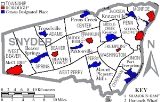
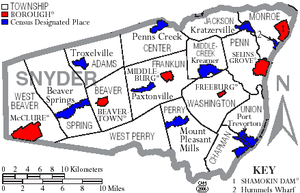
Municipalities
Boroughs
|
Middleburg, Pennsylvania Middleburg is a borough in Snyder County, Pennsylvania, United States. The population was 1,382 at the 2000 census. It is the county seat of Snyder County.-History:... Selinsgrove, Pennsylvania Selinsgrove is a borough in Snyder County, Pennsylvania, United States. It was founded in 1787 by Captain Anthony Selin, who fought with Washington in the Revolutionary War.... Shamokin Dam, Pennsylvania Shamokin Dam is a small borough in Snyder County, Pennsylvania, United States. The name is derived from a dam that was built across the Susquehanna River in the 19th century. The dam supported steamboat ferries run by Ira T. Clement, which transported goods and people between Shamokin Dam and the... |
Townships
|
Jackson Township, Snyder County, Pennsylvania Jackson Township is a township in Snyder County, Pennsylvania, United States. The population was 1,276 at the 2000 census.-Geography:According to the United States Census Bureau, the township has a total area of , all of it land.... Middlecreek Township, Snyder County, Pennsylvania Middlecreek Township is a township in Snyder County, Pennsylvania, United States. The population was 1,971 at the 2000 census.-Geography:According to the United States Census Bureau, the township has a total area of 14.4 square miles , of which, 14.3 square miles of it is land and... Monroe Township, Snyder County, Pennsylvania Monroe Township is a township in Snyder County, Pennsylvania, United States. The population was 4,012 at the 2000 census.-Geography:According to the United States Census Bureau, the township has a total area of 15.8 square miles , of which, 15.6 square miles of it is land and... Penn Township, Snyder County, Pennsylvania Penn Township is a township in Snyder County, Pennsylvania, United States. The population was 3,781 at the 2000 census.Penn Township is home to the Selinsgrove Speedway, a 1/2-mile high-banked oval dirt track.-Geography:... Perry Township, Snyder County, Pennsylvania Perry Township is a township in Snyder County, Pennsylvania, in the United States. As of the 2000 census, the township population was 1,973.-Geography:... |
Spring Township, Snyder County, Pennsylvania Spring Township is a township in Snyder County, Pennsylvania, United States. The population was 1,563 at the 2000 census.-Geography:According to the United States Census Bureau, the township has a total area of 37.0 square miles , of which, 37.0 square miles of it is land and... Union Township, Snyder County, Pennsylvania Union Township is a township in Snyder County, Pennsylvania, United States. The population was 1,519 at the 2000 census.-Geography:According to the United States Census Bureau, the township has a total area of 14.6 square miles , of which, 14.6 square miles of it is land and... Washington Township, Snyder County, Pennsylvania Washington Township is a township in Snyder County, Pennsylvania, United States. The population was 1,532 at the 2000 census.-Geography:According to the United States Census Bureau, the township has a total area of 24.5 square miles , of which, 24.5 square miles of it is land and... |
Census-designated places
Census-designated placeCensus-designated place
A census-designated place is a concentration of population identified by the United States Census Bureau for statistical purposes. CDPs are delineated for each decennial census as the statistical counterparts of incorporated places such as cities, towns and villages...
s are geographical areas designated by the U.S. Census Bureau
United States Census Bureau
The United States Census Bureau is the government agency that is responsible for the United States Census. It also gathers other national demographic and economic data...
for the purposes of compiling demographic data. They are not actual jurisdictions under Pennsylvania law. Other unincorporated
Unincorporated area
In law, an unincorporated area is a region of land that is not a part of any municipality.To "incorporate" in this context means to form a municipal corporation, a city, town, or village with its own government. An unincorporated community is usually not subject to or taxed by a municipal government...
communities, such as villages, may be listed here as well.
|
Kreamer, Pennsylvania Kreamer is a census-designated place in Snyder County, Pennsylvania, United States. The population was 773 at the 2000 census.-Geography:Kreamer is located at .... Mount Pleasant Mills, Pennsylvania Mount Pleasant Mills is a census-designated place in Snyder County, Pennsylvania, United States. The population was 342 at the 2000 census.-Geography:Mount Pleasant Mills is located at .... Paxtonville, Pennsylvania Paxtonville is a census-designated place in Snyder County, Pennsylvania, United States. The population was 221 at the 2000 census.-Geography:Paxtonville is located at .... |
Penns Creek, Pennsylvania Penns Creek is a census-designated place in Snyder County, Pennsylvania.Its ZIP code is 17862.-Geography:Penns Creek is located at , bordered on the north by its namesake creek, Penns Creek... Port Trevorton, Pennsylvania Port Trevorton is a census-designated place in Snyder County, Pennsylvania, United States. The population was 451 at the 2000 census.-Geography:Port Trevorton is located at .... Troxelville, Pennsylvania Troxelville is a census-designated place in Snyder County, Pennsylvania, United States. The population was 192 at the 2000 census.-Geography:Troxelville is located at near Walker Lake.... |
Economics
Manufacturing since the year 2001 was faced with the largest loss in employment in Snyder County. The sector dealt with a loss of 427 jobs, or 7.2 percent of the employment in the industry. This made up a total of 36 percent of all county employment losses since 2001. Employment Report for Snyder County, Pennsylvania. U.S. Department of Labor. Bureau of Labor Statistics.County Major Employers and Industry Sector as reported by Pennsylvania Department of Labor and Industry December 2006.
Wood Mode Manufacturing
Susquehanna University Educational Services
Conestoga Wood Specialties Corp Manufacturing
Selinsgrove Area School District Educational Services
Midd West School District Educational Services
Apex Homes Inc Manufacturing
Wal-Mart Associates Inc Retail Trade
National Beef Wholesale Trade
Penn Lyon Homes Inc
Penn Lyon Homes
Penn Lyon Homes is a construction firm specializing in modular home design, systems-built homes, and commercial modular buildings with its products being distributed through independent builders, developers, and dealers. The company was founded in 1981 and today operates out of Selinsgrove,...
Manufacturing
Professional Building Systems Manufacturing
In 2005 manufacturing was the largest of 20 major sectors. It had an average wage per job of $34,042. Per capita income grew by 7.7% between 1994 and 2004 (adjusted for inflation).
Two Selinsgrove based manufacturing facilities announced closings in Spring 2007. Both are building related manufacturing facilities. Together they represent a loss of over 250 jobs.
During the Spring of 2008 a new manufacturing facility, Legacy Custom Modular Homes, opened in Selinsgrove, PA adding 100 jobs to the local economy.
The county and region are struggling economically. The reasons include: a lack of inter-municipal coordination and cooperation, a changing employment base and a dearth of jobs paying a living wage, out-migration of young people, an aging population, the need for workforce development, and an inequitable local tax structure.
Between 2000 and 2005, a total of two businesses in Snyder County received funds totaling $550,000 through the Pennsylvania Department of Community and Economic Development’s Opportunity Grant Program.
Transportation
Snyder County has two main arteries. U.S. Routes 11/15 travel through the county on the east end generally following the path of the Susquehanna River. The highway is a major travel artery through the region. Flow is constant (truck and vehicle) with very heavy loads and backups on Fridays (especially in the afternoon) and holiday weekends. There is a proposed major highway bypass project called the Central Susquehanna Valley Thruway. It is meeting with funding challenges that have delayed the project for decades. The proposed thruway would cross Monroe Township just north of Shamokin Dam. Many residential properties are designated for eminent domain actions. Residents along the proposed route have expressed concerns about the negative impact on their quality of life that the thruway would mean. Pro development forces have been successful in overwhelming their objections. Others are concerned that, like the town of Selinsgrove which is in decline, the bypass will mean the loss of local revenue and jobs that the traffic brings to the many local restaurants and hotels that are located along the current U.S. Rtes 11 & 15 highway. In June 2007 another two year delay was announced by the Pennsylvania Department of Transportation. The primary roadblock is a lack of funding for the estimated over $300 million dollar project. The state's transportation has historically been grossly underfunded. This has resulted in hundreds of bridges and roads in need of repair. PennDOT report on Snyder County roads and bridges in need of repair.U.S. Rte 522 begins in Selinsgrove and travels west through Kreamer, Middleburg and on to Lewistown. Route 35 begins on 11/15 south of Selinsgrove borough and runs roughly parallel to Route 522 crossing through Freeburg and Mount Pleasant Mills then westward to McAllisterville and Richfield, in western Snyder County.
Snyder County is in Pennsylvania Department Of Transportation District 3. According to PennDOT there are 240 state owned bridges in the county. In 2007, 27 of the bridges are rated structurally deficient and 4 are posted with weight limits. The bridge that spans Middle Creek in Kreamer has been deemed structurally deficient by the state.
State routes 235, 104 and 204 cross the county in a north - south direction. State route 104 joins State Route 45 with U.S. Rtes 11/15 in Juniata County.
Colleges and Universities
- Susquehanna UniversitySusquehanna UniversitySusquehanna University is a liberal arts college in Selinsgrove, Pennsylvania, United States, north of the state capital, Harrisburg.-Academics:...
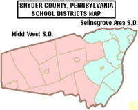
Public School Districts
- Midd-West School DistrictMidd-West School DistrictMidd-West School District is a midsized, rural, public school district located in the borough of Middleburg in Snyder County, Pennsylvania, in the United States. The Midd-West School District encompasses approximately 226 square miles. According to 2000 federal census data, it serves a resident...
- Selinsgrove Area School DistrictSelinsgrove Area School DistrictSelinsgrove Area School District is a school district centered in Selinsgrove, Pennsylvania. Enrollment has declined to approximately 2700 students clustered on a campus located in Selinsgrove borough. The Pennsylvania Department of Education projects a continued decline in enrollment to 2500 in 2010...
- SusQ-Cyber Charter School
Early Child Education
According to the Office of Child Development and Early Learning of the Pennsylvania Department of Education June 2007 report, Snyder County is rated low to moderate risk level for children who are “at risk” and therefore might benefit from more taxpayer funded services. Snyder County was rated 1.86 ARL, in the lowest 25% of counties for average risk level.Head Start PreSchool Programs
Head Start is a federally and state funded preschool program for low income children. The program serves 3 and 4 year olds. In order to participate the family income must be below federal poverty guidelines.- Middleburg Head Start Center
Private schools
As reported by the National Center for Educational Statistics- Bannerville School, Mcclure, Grades 2-8
- Chapman Parochial School, Port Trevorton, Grades 1-9
- Gospel Christian Academy, Selinsgrove, Grades KG-11
- Jacks Mountain School, Mcclure, Grades 1-8
- Kantz Church School, Middleburg, Grades 1-8
- Lakeview School, Port Trevorton, Grades 1-8
- Leaning Oak School, Mount Pleasant Mills, Grades 1-9
- Locust Grove School, Mount Pleasant Mills, Grades 1-8
- Meadow View School, Trevorton, Grades 1-8
- Palace Creek School, Mount Pleasant Mills, Grades 1-8
- Penn View Christian Academy, Penns Creek, Grades PK-12
- Shady Grove Parochial School, Port Trevorton, Grades 1-8
- White Oak School Liverpool, Grades 1-8
Boards and Agencies
- Snyder County Conservation District The conservation district is governed by a seven member board of volunteer directors. The Conservation District is a delegated authority to administer in Snyder County the state Erosion and Sediment Pollution Control (ESPC) program under PA Code Title 25 Chapter 102 and Chapter 105 Rules and Regulations and the Clean Streams Law. Act 217, the Conservation District law, permits conservation districts to charge fees for services, under certain circumstances. Their motto is Conservation Through Education. They offer programs regarding nutrient management, erosion prevention, Improving Dirt & Gravel Roads, and Watershed Protection. SCCD location map.
- Snyder County Cooperative Extension Board Snyder County Courthouse, Middleburg, PA. Through educational programs, publications, and events, cooperative extension agents deliver unbiased, research-based information to Snyder County citizens.
- Snyder County Geographical Information System (GIS) 44 Universal Road, off Rte 522, Selinsgrove, PA. This agency produces maps of county locations with additional layers of information like watershedDrainage basinA drainage basin is an extent or an area of land where surface water from rain and melting snow or ice converges to a single point, usually the exit of the basin, where the waters join another waterbody, such as a river, lake, reservoir, estuary, wetland, sea, or ocean...
data or building addressing. These maps are used in development planning, dispatching timely emergency services, flood plain tracking and epidemiologyEpidemiologyEpidemiology is the study of health-event, health-characteristic, or health-determinant patterns in a population. It is the cornerstone method of public health research, and helps inform policy decisions and evidence-based medicine by identifying risk factors for disease and targets for preventive...
.
- Snyder County Housing Authority's mission is to promote safe, sanitary, and affordable housing, and maintain a good quality of life for Snyder County residents. Provides rental assistance to low income county residents using a voucher system for renting suitable housing. The authority meets at 9 am on the third Monday of each month in the conference room of its Administrative offices located at 103 Drake Court, Middleburg, PA 17842. Denise Miller is the Executive Director. Phone: 570-837-3979
- Emergency Management Agency is run by a Coordinator. The office is located at 30 Universal Rd. Route 522, Selinsgrove , PA 17870 Office: 570-372-0535 Snyder County Hazard Mitigation Plan
- Columbia, Montour, Snyder and Union Joinder Board and Local Emergency Planning Committee
- Snyder County Agricultural Land Preservation Board
- Tourism Fund Review Panel for Snyder County
- SEDA-Council of Governments Board of Directors
- Central Pennsylvania Workforce Development Corp. board
- Snyder County Prison Board
- Snyder County Waste Management Authority 713 Bridge Street, Suite 9, Selinsgrove, Pa 17870 The Authority is charged with the planning of how to manage the solid waste in the County. A recycling program is available throughout the county with a varying schedule. Additionally, it is examining the issue of a single waste hauler contract for the county or to continue to allow individuals to contract privately with individual haulers.
- Snyder County Amateur Radio Emergency Communications provide vital communication resources during a crisis or disaster. Efforts go through the County's Emergency Management Coordinator.
Environmental Issues
In 2002, Snyder County ranked among the dirtiest/worst 10% of all counties in the U.S. in terms of cancer risk score (air and water releases). In 1999, this county ranked among the dirtiest/worst 10% of all counties in the U.S. in terms of sulfur dioxide emissions.Snyder County’s water supply includes wells, springs/streams, reservoirs, the Susquehanna River, treatment plants, and pumping stations. Water distribution can be affected in three ways: the amount of water available; the quality of the water; and the viability of the physical components of the distribution systems. The quantity of water usually depends on nature. Humans, on the other hand, are primarily responsible for the maintenance of water quality. Water contamination can occur naturally, by human error or intentionally. Occasionally, releases of manure and milk into the water supply can cause contamination. There are also times when accidental spills and releases of hazardous materials contaminate water. Water supplies along transportation routes have been affected by hazardous materials spills.
- Ongoing pollution and soil erosion in the region continue to degrade the water quality and the environment locally as well as regionally. Farming, wastewater treatment facilities and industrial spills are cited as contributing factors to loss of water quality. Local pollution and erosion also contributes to the pollution of the Chesapeake BayChesapeake BayThe Chesapeake Bay is the largest estuary in the United States. It lies off the Atlantic Ocean, surrounded by Maryland and Virginia. The Chesapeake Bay's drainage basin covers in the District of Columbia and parts of six states: New York, Pennsylvania, Delaware, Maryland, Virginia, and West...
. Controlling the wastewater discharges alone is expected to cost local taxpayers billions of dollars.
- Ground water is being monitored by the USGS. Ground-Water-Quality Data in Pennsylvania - A Compilation of Computerized Electronic Databases, 1979-2004
- Groundwater - A Primer for Pennsylvanians is provided by the Water Resources Education Network to encourage safeguarding the quality of the groundwater.
- Department of Environmental Protection Bureau of Water supply and Wastewater Management has a Northcentral Region office at 208 W. Third St., Suite 101 Williamsport, Pa 17701
- The Master Well Owner Network is a network of trained volunteers dedicated to promoting the proper construction and maintenance of private water systems in Pennsylvania. There are 286 trained Master Well Owner Volunteers in 60 counties in Pennsylvania. They have provided assistance to over 8,000 homeowners with private water systems. MWON is facilitated by Penn State Cooperative Extension.
- The Lower Penns Creek Watershed Association’s central purpose is to protect, conserve, and improve the Lower Penn’s Creek watershed by promoting the wise stewardship of the land and aquatic resources. The organization is open to all citizens. The organization has sponsored a main stream assessment The Lower Penns Creek watershed is approximately 163 square miles (422.2 km²) within Snyder and Union Counties. It drains into the Susquehanna River on the northern border of the community of Selinsgrove, Pennsylvania. It is located within the Lower Susquehanna subbasin. LPCWA’s efforts contribute to the success of the missions of the Susquehanna Greenway Partnership and the Susquehanna River Basin Commission. The Snyder County Conservation District and the Union County Conservation District both have watershed specialists that participate in LPCWA. Growing Greener grants support watershed specialists who provide technical assistance and coordination of watershed restoration and protection efforts.
- Private Landowners Assistance Program (PLAP), helps landowners develop habitat management plans, increasing its value to wildlife and helping to keep at bay the ongoing decline in habitat quality and loss of wildlife habitat on lands in private ownership. There is no charge for participating in PLAP, nor is there a public access requirement. Southcentral: Adams, Bedford, Blair, Cumberland, Franklin, Fulton, Huntingdon, Juniata, Mifflin, Perry and Snyder counties - Game Commission Bureau of Wildlife Management Biologist Dan Mummert at 814-542-8759.
- Natural Resources Extension provides information for sound wood lot and forest stewardship of private lands.
Utilities
Electric – All 21 municipalities within Snyder County receive electric service from PPL Electric Utilities, Inc. According to the U.S. Department of Energy, a 500 kilovolt line runs through Snyder County. Three 138 kilovolt lines stem from this 500 kilovolt line at the Sunbury Generation coal-fired power plant in Shamokin Dam, which is capable of producing roughly 400 megawatts of electrical power.Water – Water service in Snyder County is provided by various municipal and regional authorities, private water providers, and private well water sources.
Gas – UGI Penn Natural Gas is the only natural gas provider in Snyder County, providing service to Jackson,
Middlecreek, Monroe, and Penn Townships, as well as Selinsgrove and Shamokin Dam Boroughs. Several propane dealers
exist to service the rural community.
Communications – Verizon provides telephone service and EvenLink provides VoIP telephone
service to all 21 municipalities in Snyder County.
Cable television service is provided by Service Electric Cablevision, Nittany Media, Inc., Zampelli Electronics, and Beaver Springs Community TV Association.
High-speed Internet access is principally provided by Verizon, EvenLink, and Service Electric Cablevision.
There are several restaurants featuring high speed wireless internet in Snyder County. Dunkin Donuts and Applebee's provide fee-based services provided by PenTeleData Unleashed. The White House Deli in MP Mills provides a free service.
Politics
The county is strongly Republican in presidential elections. The last Republican nominee to receive less than 60% of the county's vote was Bob DoleBob Dole
Robert Joseph "Bob" Dole is an American attorney and politician. Dole represented Kansas in the United States Senate from 1969 to 1996, was Gerald Ford's Vice Presidential running mate in the 1976 presidential election, and was Senate Majority Leader from 1985 to 1987 and in 1995 and 1996...
. In 2008 John McCain
John McCain
John Sidney McCain III is the senior United States Senator from Arizona. He was the Republican nominee for president in the 2008 United States election....
received 64% of the county's vote. Snyder County was one of the only counties in Pennsylvania to go for Barry Goldwater
Barry Goldwater
Barry Morris Goldwater was a five-term United States Senator from Arizona and the Republican Party's nominee for President in the 1964 election. An articulate and charismatic figure during the first half of the 1960s, he was known as "Mr...
. The last Republican presidential candidate to lose Snyder County was incumbent president William Howard Taft
William Howard Taft
William Howard Taft was the 27th President of the United States and later the tenth Chief Justice of the United States...
when he split the Republican vote with challenger and former president Theodore Roosevelt
Theodore Roosevelt
Theodore "Teddy" Roosevelt was the 26th President of the United States . He is noted for his exuberant personality, range of interests and achievements, and his leadership of the Progressive Movement, as well as his "cowboy" persona and robust masculinity...
, who took the county for the insurgent Progressive Party. In fact, no Democratic presidential candidate has been able to claim the county since Pennsylvania native James Buchanan
James Buchanan
James Buchanan, Jr. was the 15th President of the United States . He is the only president from Pennsylvania, the only president who remained a lifelong bachelor and the last to be born in the 18th century....
won the presidency in 1856. The only county in Pennsylvania to be more steadfastly Republican (or indeed, remain so one-sidedly partisan for either party in Pennsylvania) in presidential contests has been Snyder County's neighbor to the north, Union County
Union County, Pennsylvania
-Demographics:As of the census of 2000, there were 41,624 people, 13,178 households, and 9,211 families residing in the county. The population density was 131 people per square mile . There were 14,684 housing units at an average density of 46 per square mile...
, which voted for John C. Fremont
John C. Frémont
John Charles Frémont , was an American military officer, explorer, and the first candidate of the anti-slavery Republican Party for the office of President of the United States. During the 1840s, that era's penny press accorded Frémont the sobriquet The Pathfinder...
over Buchanan in 1856.
The county is located in Pennsylvania's 10th congressional district
Pennsylvania's 10th congressional district
Pennsylvania's 10th congressional district is located primarily in the northeast corner of the state. The district was one of the 12 original districts created prior to the 4th Congress. It is currently represented by Republican Tom Marino, who defeated Democratic incumbent Chris Carney during the...
, which has a Cook Partisan Voting Index
Cook Partisan Voting Index
The Cook Partisan Voting Index , sometimes referred to as simply the Partisan Voting Index , is a measurement of how strongly an American congressional district or state leans toward one political party compared to the nation as a whole...
of R+8 and is represented by Republican Tom Marino
Tom Marino
Thomas Anthony Marino is the U.S. Representative for . He is a member of the Republican Party.The district, located in Northeastern Pennsylvania, includes Lackawanna and Luzerne Counties outside of Scranton and Wilkes-Barre as well as all or most of...
. As part of Pennsylvania Senate, District 27
Pennsylvania Senate, District 27
Pennsylvania's 27th Senatorial district includes parts of Columbia, Dauphin, Luzerne, Montour, Northumberland, and Snyder CountiesAll of Columbia CountyDauphin County* Berrysburg* Elizabethville* Gratz* Lykens* Lykens Township* Mifflin Township...
it is represented by Republican John Gordner
John Gordner
John R. Gordner is an American politician in the state of Pennsylvania. He currently serves in the Pennsylvania State Senate and represents the 27th senatorial district. His district includes all of Montour County, Snyder County, Northumberland County, Columbia County and parts of Dauphin County...
. The county contains locations in Pennsylvania House of Representatives, District 82
Pennsylvania House of Representatives, District 82
The 82nd Pennsylvania House of Representatives District is made up of parts of Mifflin County, Snyder County and all of Juniata County. The district includes the following areas:* Juniata County** Entire county* Mifflin County** Burnham** Derry Township...
, Pennsylvania House of Representatives, District 85
Pennsylvania House of Representatives, District 85
The 85th Pennsylvania House of Representatives District is made up of parts of Snyder County and all of Union County. The district includes the following areas:* Snyder County** Center Township** Chapman Township** Freeburg** Jackson Township...
, and Pennsylvania House of Representatives, District 108
Pennsylvania House of Representatives, District 108
The 108th District is an electoral district for the Pennsylvania House of Representatives and is currently represented by Republican Lynda Schlegel-Culver...
. All of these have been represented by Republicans since 1989.
Of "Straight Party" voters in Snyder 73.2% are Republican and 24.65% are Democratic. In the 2008 election Republicans won in all races and in most they won by over 20%. Chris Carney
Chris Carney
Christopher P. "Chris" Carney is the former U.S. Representative for , serving from 2007 until 2011. He is a member of the Democratic Party and was a prominent member of the conservative Blue Dog Coalition....
lost by roughly 13% in the county while winning by 12% in the district.
County Commissioners
- Joseph Kantz, Chairman
- Malcolm DerkMalcolm DerkMalcolm L. Derk, III is a Republican Commissioner of Snyder County, Pennsylvania. He is the youngest person ever elected to this position. Snyder County is located in Central Pennsylvania and has a population of approximately 38,200 people....
, Vice-Chair - Peggy Chamberlain Roup, Secretary
Row Offices
- Teresa J. Berger, Prothonotary and Clerk of Courts
- Michael Piecuch, District Attorney
- Stacy Zerbe, Register and Recorder
- Joseph Reigle Jr, Sheriff
Cultural Elements
Snyder County is well known for its unmistakable Pennsylvania German language and culture, agricultural heritage, as well as its fraktur, Kentucky rifles, wood products industries, Middleswarth chip factory, and the annual fairs, festivals, and auctions that keep the local heritage alive. Some of the more famous historical structures of the county are the Governor Snyder Mansion, Pomfret’s Castle, Schoch Block House, ruins of the Pennsylvania Canal, and its covered bridges. Snyder County is also home to Snyder-Middleswarth State Park, the Tall Timbers Natural Area, and thirteen Pennsylvania State Historical markers.Historical Markers
- Pennsylvania Canal (Susquehanna Division)Pennsylvania Canal (Susquehanna Division)The only canal of the Susquehanna Division of the Pennsylvania Canal ran along the west bank of the main stem of the Susquehanna River between a lock near the mouth of the Juniata River and the canal basin at Northumberland...
– US 11 & 15 at Port Trevorton. - Simon Snyder – SR 2017 (old US 11 & 15) just S of Selinsgrove.
- Simon Snyder Mansion (Plaque) – 121 N. Market St. (old US 11 & 15), Selinsgrove.
- Coxey’s Army – 814 N. Market St. (old US 11 & 15), Selinsgrove.
- Penns Creek Massacre – SR 2017 (old US 11 & 15) just N of Selinsgrove.
- Penns Creek Massacre (Plaque) – S end Old Trail (just E of US 11 & 15), Penns Creek N of Selinsgrove.
- Schoch Blockhouse – US 522 at Kreamer.
- Susquehanna UniversitySusquehanna UniversitySusquehanna University is a liberal arts college in Selinsgrove, Pennsylvania, United States, north of the state capital, Harrisburg.-Academics:...
– US 522, .5 mile W of old US 11 & 15, Selinsgrove. - Albany Purchase – US 522 (old US 11 & 15) 1 mile N of Selinsgrove.
- Harris Ambush (Plaque) – At the Old Bridge, 1/2 mile W of Selinsgrove.
- Sunbury – U.S. 11 & 15, 4 miles N of Selinsgrove
- ShikellamyShikellamyShikellamy , also known as Swatana, was an Oneida chief and overseer for the Iroquois confederacy. In his position as chief and overseer, Shikellamy served as a supervisor for the Six Nations, overseeing the Shawnee and Lenape tribes in central Pennsylvania along the Susquehanna River and...
– US 11, 5.4 miles N of Selinsgrove entrance to Shikellamy State Park - Snyder County – County courthouse, 9 W. Market St. (US 522), Middleburg
See also
- List of municipal authorities in Snyder County, Pennsylvania
- National Register of Historic Places listings in Snyder County, PennsylvaniaNational Register of Historic Places listings in Snyder County, PennsylvaniaThis is a list of the National Register of Historic Places listings in Snyder County, Pennsylvania.This is intended to be a complete list of the properties and districts on the National Register of Historic Places in Snyder County, Pennsylvania, United States...
External links
- Snyder County travel guide from WikitravelWikitravel-External links:* *...
- Snyder County
- [ftp://ftp.dot.state.pa.us/public/pdf/BPR_pdf_files/Maps/GHS/Roadnames/union_snyder_GHSN.PDF Pennsylvania Department of Transportation, Bureau of Planning and Research, Geographic Information Division, "2005 General Highway Map of Union and Snyder Counties".] Note: shows boroughs, townships, roads, villages, some streams. URL accessed on April 5, 2006.
- Hazardous Air Pollutant Report
- Central Susquehanna Valley Thruway
- Public Hunting Map. Snyder County
- Governor's Center for Local Government Services