
Beaver Springs, Pennsylvania
Encyclopedia
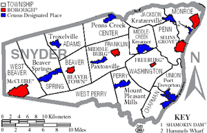
Beaver Springs is a census-designated place
in Spring Township
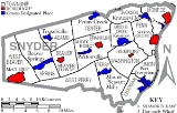
, Snyder County
, Pennsylvania
, United States
. The population was 634 at the 2000 census.
 Beaver Springs was first called Reigertown before the name was changed by the post office. It was named for Adam Reiger. He was given the land as a land grant from the Penn proprietors. The town was also known for a time as Adamsburg. The current name was based on the beavers who were active in a local stream and an important spring that was along its main street. In 2006, Beaver Springs celebrated its bicentennial.
According to the United States Census Bureau
, the community has a total area of 2.5 square miles (6.5 km²), all of it land.
of 2000, there were 634 people, 267 households, and 190 families residing in the community. The population density
was 256.4 people per square mile (99.1/km²). There were 274 housing units at an average density of 110.8/sq mi (42.8/km²). The racial makeup of the community was 98.58% White, 0.32% African American, 0.16% Asian, and 0.95% from two or more races.
There were 267 households out of which 30.7% had children under the age of 18 living with them, 58.8% were married couples
living together, 9.4% had a female householder with no husband present, and 28.5% were non-families. 25.5% of all households were made up of individuals and 14.6% had someone living alone who was 65 years of age or older. The average household size was 2.37 and the average family size was 2.83.
The population is spread out with 22.2% under the age of 18, 5.8% from 18 to 24, 27.0% from 25 to 44, 26.7% from 45 to 64, and 18.3% who were 65 years of age or older. The median age was 42 years. For every 100 females there were 83.8 males. For every 100 females age 18 and over, there were 87.5 males.
The median income for a household in Beaver Springs is $30,000, and the median income for a family was $35,987. Males had a median income of $27,120 versus $18,125 for females. The per capita income
for the CDP was $14,796. About 7.3% of families and 7.9% of the population were below the poverty line, including 6.1% of those under age 18 and 9.9% of those age 65 or over.
Census-designated place
A census-designated place is a concentration of population identified by the United States Census Bureau for statistical purposes. CDPs are delineated for each decennial census as the statistical counterparts of incorporated places such as cities, towns and villages...
in Spring Township
Spring Township, Snyder County, Pennsylvania
Spring Township is a township in Snyder County, Pennsylvania, United States. The population was 1,563 at the 2000 census.-Geography:According to the United States Census Bureau, the township has a total area of 37.0 square miles , of which, 37.0 square miles of it is land and...
, Snyder County
Snyder County, Pennsylvania
Snyder County is a county located in the U.S. state of Pennsylvania. As of 2010, the population was 39,702. Snyder County was formed in 1855 from parts of Union County...
, Pennsylvania
Pennsylvania
The Commonwealth of Pennsylvania is a U.S. state that is located in the Northeastern and Mid-Atlantic regions of the United States. The state borders Delaware and Maryland to the south, West Virginia to the southwest, Ohio to the west, New York and Ontario, Canada, to the north, and New Jersey to...
, United States
United States
The United States of America is a federal constitutional republic comprising fifty states and a federal district...
. The population was 634 at the 2000 census.
Geography
Beaver Springs is located at 40°44′40"N 77°12′53"W (40.744464, -77.214598).According to the United States Census Bureau
United States Census Bureau
The United States Census Bureau is the government agency that is responsible for the United States Census. It also gathers other national demographic and economic data...
, the community has a total area of 2.5 square miles (6.5 km²), all of it land.
Demographics
As of the censusCensus
A census is the procedure of systematically acquiring and recording information about the members of a given population. It is a regularly occurring and official count of a particular population. The term is used mostly in connection with national population and housing censuses; other common...
of 2000, there were 634 people, 267 households, and 190 families residing in the community. The population density
Population density
Population density is a measurement of population per unit area or unit volume. It is frequently applied to living organisms, and particularly to humans...
was 256.4 people per square mile (99.1/km²). There were 274 housing units at an average density of 110.8/sq mi (42.8/km²). The racial makeup of the community was 98.58% White, 0.32% African American, 0.16% Asian, and 0.95% from two or more races.
There were 267 households out of which 30.7% had children under the age of 18 living with them, 58.8% were married couples
Marriage
Marriage is a social union or legal contract between people that creates kinship. It is an institution in which interpersonal relationships, usually intimate and sexual, are acknowledged in a variety of ways, depending on the culture or subculture in which it is found...
living together, 9.4% had a female householder with no husband present, and 28.5% were non-families. 25.5% of all households were made up of individuals and 14.6% had someone living alone who was 65 years of age or older. The average household size was 2.37 and the average family size was 2.83.
The population is spread out with 22.2% under the age of 18, 5.8% from 18 to 24, 27.0% from 25 to 44, 26.7% from 45 to 64, and 18.3% who were 65 years of age or older. The median age was 42 years. For every 100 females there were 83.8 males. For every 100 females age 18 and over, there were 87.5 males.
The median income for a household in Beaver Springs is $30,000, and the median income for a family was $35,987. Males had a median income of $27,120 versus $18,125 for females. The per capita income
Per capita income
Per capita income or income per person is a measure of mean income within an economic aggregate, such as a country or city. It is calculated by taking a measure of all sources of income in the aggregate and dividing it by the total population...
for the CDP was $14,796. About 7.3% of families and 7.9% of the population were below the poverty line, including 6.1% of those under age 18 and 9.9% of those age 65 or over.