
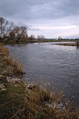
River Ribble
Encyclopedia
The River Ribble is a river that runs through North Yorkshire
and Lancashire
, in northern England
. The river's drainage basin
also includes parts of Greater Manchester
around Wigan
.
of the Gayle Beck and Cam Beck near the famous viaduct
at Ribblehead
, in the shadow of the Yorkshire three peaks
.
It flows through Settle
, Clitheroe
, Ribchester
and Preston, before emptying into the Irish Sea
between Lytham St. Annes and Southport
, a length of 75 miles (120.7 km).
The main tributaries of the Ribble are the Hodder
and Calder
which join the river near Great Mitton, the River Darwen
which joins at Walton-le-Dale
and the River Douglas
which joins near Hesketh Bank
.
The Ribble Way
is a long-distance footpath which follows the river for much of its course. The Ribble marked the northernmost extent of the ancient kingdom of Mercia
. At the time of the Domesday Book
, the river formed the northern boundary of an area of land (known as Inter Ripam et Mersam) that was included in the Domesday information for Cheshire
, though it was probably not formally part of the county of Cheshire.
The river is connected to both the Leeds and Liverpool Canal
and the Lancaster Canal
(via the Ribble Link
). The river downstream of Preston was actively dredged when Preston was an active port; this is no longer done and silt from the river is now spreading more widely over the (sand) beaches around Fairhaven and St. Annes.
Its estuary forms part of the Ribble and Alt Estuaries
Special Protection Area
for wildlife.
The Normal Tidal Limit (NTL) of the river is at Fishwick Bottoms, between Preston and Walton-le-Dale
.
, a partnership which was established in 1985 to improve water quality and encourage waterside regeneration.
Preston City Council have published controversial plans to build a barrage across the River Ribble, in their 'Riverworks' proposals. The aim of these proposals is to build a water sports park on a section of the Ribble, coupled with over 4000 units of high quality housing and businesses in the river's flood plain. Some local residents are opposing these plans, arguing that they endanger wildlife, increase flood risk to local housing and damage greenbelt areas. These residents have set up the 'Save The Ribble' campaign. Parts of the river are a County Biological Heritage Site.
The Ribble would appear to have been known in Roman
times as the Belisama
, possibly giving its name to Samlesbury
. Ptolemy
's "Belisama aest." seems to represent the estuary of the Ribble.
's tenth battle, on the banks of a river "Tribruit", as alluded to in his Historia Brittonum by Nennius
.
and the Ribble Valley parliamentary constituency
, as well as the Borough of South Ribble
. The Ribble Bus Company
once operated throughout North West England
. The Ribble also lends its name to the Ribble Steam Railway
, Ribble Cycles, a bicycle manufacturer based in Preston, and Ribble Valley Inns.
North Yorkshire
North Yorkshire is a non-metropolitan or shire county located in the Yorkshire and the Humber region of England, and a ceremonial county primarily in that region but partly in North East England. Created in 1974 by the Local Government Act 1972 it covers an area of , making it the largest...
and Lancashire
Lancashire
Lancashire is a non-metropolitan county of historic origin in the North West of England. It takes its name from the city of Lancaster, and is sometimes known as the County of Lancaster. Although Lancaster is still considered to be the county town, Lancashire County Council is based in Preston...
, in northern England
Northern England
Northern England, also known as the North of England, the North or the North Country, is a cultural region of England. It is not an official government region, but rather an informal amalgamation of counties. The southern extent of the region is roughly the River Trent, while the North is bordered...
. The river's drainage basin
Drainage basin
A drainage basin is an extent or an area of land where surface water from rain and melting snow or ice converges to a single point, usually the exit of the basin, where the waters join another waterbody, such as a river, lake, reservoir, estuary, wetland, sea, or ocean...
also includes parts of Greater Manchester
Greater Manchester
Greater Manchester is a metropolitan county in North West England, with a population of 2.6 million. It encompasses one of the largest metropolitan areas in the United Kingdom and comprises ten metropolitan boroughs: Bolton, Bury, Oldham, Rochdale, Stockport, Tameside, Trafford, Wigan, and the...
around Wigan
Wigan
Wigan is a town in Greater Manchester, England. It stands on the River Douglas, south-west of Bolton, north of Warrington and west-northwest of Manchester. Wigan is the largest settlement in the Metropolitan Borough of Wigan and is its administrative centre. The town of Wigan had a total...
.
Geography
The Ribble begins at the confluenceConfluence
Confluence, in geography, describes the meeting of two or more bodies of water.Confluence may also refer to:* Confluence , a property of term rewriting systems...
of the Gayle Beck and Cam Beck near the famous viaduct
Ribblehead Viaduct
Ribblehead Viaduct is a railway viaduct across the valley of the River Ribble at Ribblehead, in North Yorkshire, northern England. The viaduct is a Grade II* listed building and a Scheduled Ancient Monument.-Description:...
at Ribblehead
Ribblehead
Ribblehead is the area of moorland at the head of the River Ribble in the area known as Ribblesdale, in the Yorkshire Dales National Park, England....
, in the shadow of the Yorkshire three peaks
Yorkshire three peaks
The mountains of Whernside , Ingleborough and Pen-y-ghent are collectively known as the Three Peaks. The peaks, which form part of the...
.
It flows through Settle
Settle
Settle is a small market town and civil parish within the Craven district of North Yorkshire, England. It is served by the Settle railway station, which is located near the town centre, and Giggleswick railway station which is a mile away. It is from Leeds Bradford Airport...
, Clitheroe
Clitheroe
Clitheroe is a town and civil parish in the Borough of Ribble Valley in Lancashire, England. It is 1½ miles from the Forest of Bowland and is often used as a base for tourists in the area. It has a population of 14,697...
, Ribchester
Ribchester
Ribchester is a village and civil parish within the Ribble Valley district of Lancashire, England. It lies on the banks of the River Ribble, northwest of Blackburn and east of Preston.The village has a long history with evidence of Bronze Age beginnings...
and Preston, before emptying into the Irish Sea
Irish Sea
The Irish Sea separates the islands of Ireland and Great Britain. It is connected to the Celtic Sea in the south by St George's Channel, and to the Atlantic Ocean in the north by the North Channel. Anglesey is the largest island within the Irish Sea, followed by the Isle of Man...
between Lytham St. Annes and Southport
Southport
Southport is a seaside town in the Metropolitan Borough of Sefton in Merseyside, England. During the 2001 census Southport was recorded as having a population of 90,336, making it the eleventh most populous settlement in North West England...
, a length of 75 miles (120.7 km).
The main tributaries of the Ribble are the Hodder
River Hodder
The River Hodder is a river in Lancashire, England. The river is a County Biological Heritage Site.It rises on White Hill and flows for approximately 23 miles to the River Ribble, of which it is the largest tributary...
and Calder
River Calder, Lancashire
The River Calder is a major tributary of the River Ribble, starting in Cliviger close to Burnley in Lancashire, England and is around 24 km / 15 miles in length. Its source is very close to that of the West Yorkshire river with the same name, and that of the River Irwell. It flows through...
which join the river near Great Mitton, the River Darwen
River Darwen
The River Darwen is a river running through Darwen and Blackburn in Lancashire.The river was seriously polluted with human and industrial effluent during the Industrial Revolution, up to the early 1970s. The river often changed colour dramatically as a result of paper and paint mills routinely...
which joins at Walton-le-Dale
Walton-le-Dale
Walton-le-Dale is a village in the Borough of South Ribble, in Lancashire, England. It lies on south bank of the River Ribble, and the south-side of the city of Preston, adjacent to Bamber Bridge.-Toponymy:...
and the River Douglas
River Douglas
The River Douglas, also known as the River Asland or Astland, is a river that flows through Lancashire and Greater Manchester in the north-west of England...
which joins near Hesketh Bank
Hesketh Bank
-Economy:Due to the village's position on the West Lancashire Coastal Plain it has a rich soil, suitable for the farming of flowers and vegetables - this is still the main economic activity in the area.A Booths supermarket opened on 11 November 2010.-Transport:...
.
The Ribble Way
Ribble Way
The Ribble way is a long distance walk between the Lancashire coast and the Yorkshire Dales National Park largely following the course of the River Ribble....
is a long-distance footpath which follows the river for much of its course. The Ribble marked the northernmost extent of the ancient kingdom of Mercia
Mercia
Mercia was one of the kingdoms of the Anglo-Saxon Heptarchy. It was centred on the valley of the River Trent and its tributaries in the region now known as the English Midlands...
. At the time of the Domesday Book
Domesday Book
Domesday Book , now held at The National Archives, Kew, Richmond upon Thames in South West London, is the record of the great survey of much of England and parts of Wales completed in 1086...
, the river formed the northern boundary of an area of land (known as Inter Ripam et Mersam) that was included in the Domesday information for Cheshire
Cheshire
Cheshire is a ceremonial county in North West England. Cheshire's county town is the city of Chester, although its largest town is Warrington. Other major towns include Widnes, Congleton, Crewe, Ellesmere Port, Runcorn, Macclesfield, Winsford, Northwich, and Wilmslow...
, though it was probably not formally part of the county of Cheshire.
The river is connected to both the Leeds and Liverpool Canal
Leeds and Liverpool Canal
The Leeds and Liverpool Canal is a canal in Northern England, linking the cities of Leeds and Liverpool. Over a distance of , it crosses the Pennines, and includes 91 locks on the main line...
and the Lancaster Canal
Lancaster Canal
The Lancaster Canal is a canal in the north of England, originally planned to run from Westhoughton in Lancashire to Kendal in south Cumbria...
(via the Ribble Link
Ribble Link
The Millennium Ribble Link is a Linear Water Park and new navigation which links the once-isolated Lancaster Canal in Lancashire, England to the River Ribble...
). The river downstream of Preston was actively dredged when Preston was an active port; this is no longer done and silt from the river is now spreading more widely over the (sand) beaches around Fairhaven and St. Annes.
Its estuary forms part of the Ribble and Alt Estuaries
Ribble and Alt Estuaries
The Ribble and Alt Estuaries lie on the Irish Sea coast of the counties of Lancashire and Merseyside in north-west England, and form the boundaries of a number of nature preservation schemes. -Protected area:...
Special Protection Area
Special Protection Area
A Special Protection Area or SPA is a designation under the European Union Directive on the Conservation of Wild Birds.Under the Directive, Member States of the European Union have a duty to safeguard the habitats of migratory birds and certain particularly threatened birds.Together with Special...
for wildlife.
The Normal Tidal Limit (NTL) of the river is at Fishwick Bottoms, between Preston and Walton-le-Dale
Walton-le-Dale
Walton-le-Dale is a village in the Borough of South Ribble, in Lancashire, England. It lies on south bank of the River Ribble, and the south-side of the city of Preston, adjacent to Bamber Bridge.-Toponymy:...
.
Public works
The River Ribble catchment is covered by the Mersey Basin CampaignMersey Basin Campaign
The Mersey Basin Campaign worked within the catchments of the River Mersey and the River Ribble, in the counties of Lancashire, Merseyside, Greater Manchester and Cheshire and in the High Peak area of Derbyshire in the UK...
, a partnership which was established in 1985 to improve water quality and encourage waterside regeneration.
Preston City Council have published controversial plans to build a barrage across the River Ribble, in their 'Riverworks' proposals. The aim of these proposals is to build a water sports park on a section of the Ribble, coupled with over 4000 units of high quality housing and businesses in the river's flood plain. Some local residents are opposing these plans, arguing that they endanger wildlife, increase flood risk to local housing and damage greenbelt areas. These residents have set up the 'Save The Ribble' campaign. Parts of the river are a County Biological Heritage Site.
The Ribble would appear to have been known in Roman
Roman Empire
The Roman Empire was the post-Republican period of the ancient Roman civilization, characterised by an autocratic form of government and large territorial holdings in Europe and around the Mediterranean....
times as the Belisama
Belisama
In Celtic polytheism, Belisama or ' was a goddess worshipped in Gaul and Britain. She was connected with lakes and rivers, fire, crafts and light. Belisama was identified with Minerva/Athena and has been compared with Brigid. She has been claimed to be the consort of Belenus, with whom she shared...
, possibly giving its name to Samlesbury
Samlesbury
Samlesbury is a small village and civil parish in the South Ribble borough of Lancashire, England. Samlesbury Hall, a historic house, is located in the village as well as Samlesbury Aerodrome...
. Ptolemy
Ptolemy
Claudius Ptolemy , was a Roman citizen of Egypt who wrote in Greek. He was a mathematician, astronomer, geographer, astrologer, and poet of a single epigram in the Greek Anthology. He lived in Egypt under Roman rule, and is believed to have been born in the town of Ptolemais Hermiou in the...
's "Belisama aest." seems to represent the estuary of the Ribble.
History
The banks of the Ribble have been posited as a possible location for King ArthurKing Arthur
King Arthur is a legendary British leader of the late 5th and early 6th centuries, who, according to Medieval histories and romances, led the defence of Britain against Saxon invaders in the early 6th century. The details of Arthur's story are mainly composed of folklore and literary invention, and...
's tenth battle, on the banks of a river "Tribruit", as alluded to in his Historia Brittonum by Nennius
Nennius
Nennius was a Welsh monk of the 9th century.He has traditionally been attributed with the authorship of the Historia Brittonum, based on the prologue affixed to that work, This attribution is widely considered a secondary tradition....
.
Settlements
North Yorkshire
- Horton in RibblesdaleHorton in RibblesdaleHorton in Ribblesdale is a small village and civil parish in the Craven district of North Yorkshire, England. It is situated in Ribblesdale on the Settle–Carlisle Railway to the west of Pen-y-ghent....
- StainforthStainforth, North YorkshireStainforth is a village and civil parish in the Craven district of North Yorkshire, England. It is situated very near Settle; only about 1 mile north there is a waterfall, , where the river falls over limestone ledges into a deep, broad pool which can be accessed by walking a short way from the...
- Stackhouse
- LangcliffeLangcliffeLangcliffe is a village and civil parish in the Craven district of North Yorkshire, England it is situated to the immediate north of Settle.Notable residents or former residents of this village include authors Leah Fleming and Marina Fiorato-External links:...
- GiggleswickGiggleswickGiggleswick is a village and civil parish in the Craven district of North Yorkshire, England near the town of Settle. It is the site of Giggleswick School.-Origin of name:A Dictionary of British Place Names contains the entry:...
- SettleSettleSettle is a small market town and civil parish within the Craven district of North Yorkshire, England. It is served by the Settle railway station, which is located near the town centre, and Giggleswick railway station which is a mile away. It is from Leeds Bradford Airport...
- Halton WestHalton WestHalton West is a village and civil parish in the Craven district of North Yorkshire, England. it is situated on the River Ribble and about 7 miles north of Barnoldswick....
- NappaNappa, North YorkshireNappa is a hamlet and civil parish in the Craven district of North Yorkshire, England. It is on the A682 road and 6 miles north west of Barnoldswick and 10.5 miles west of Skipton....
Lancashire
- PaythornePaythornePaythorne is a small village and civil parish in Ribble Valley, Lancashire, England. It is situated alongside the River Ribble, north-east of Clitheroe, and on the boundary with North Yorkshire. Other parishes adjacent to Paythorne are Halton West, Nappa , Newsholme, Horton, Gisburn, Sawley,...
- SawleySawley, LancashireSawley is a village and civil parish in the Borough of Ribble Valley in Lancashire, England. It is situated north-east of Clitheroe, on the River Ribble. It is historically part of the West Riding of Yorkshire....
- West BradfordWest Bradford, LancashireWest Bradford is a village and civil parish Lancashire, England, 27 miles west of the larger city of Bradford, West Yorkshire and 2.5 miles north of Clitheroe. It covers some 2000 acres of the Forest of Bowland. In Domesday, it is recorded as Bradeford and in the thirteenth century,...
- Horrocksford
- ClitheroeClitheroeClitheroe is a town and civil parish in the Borough of Ribble Valley in Lancashire, England. It is 1½ miles from the Forest of Bowland and is often used as a base for tourists in the area. It has a population of 14,697...
- Great MittonGreat MittonGreat Mitton is a village and a civil parish in the Ribble Valley, Lancashire, England. It is separated from the civil parish of Little Mitton by the River Ribble, both lie about 3 miles from the town of Clitheroe...
- Little Town
- RibchesterRibchesterRibchester is a village and civil parish within the Ribble Valley district of Lancashire, England. It lies on the banks of the River Ribble, northwest of Blackburn and east of Preston.The village has a long history with evidence of Bronze Age beginnings...
- SamlesburySamlesburySamlesbury is a small village and civil parish in the South Ribble borough of Lancashire, England. Samlesbury Hall, a historic house, is located in the village as well as Samlesbury Aerodrome...
- Walton-le-DaleWalton-le-DaleWalton-le-Dale is a village in the Borough of South Ribble, in Lancashire, England. It lies on south bank of the River Ribble, and the south-side of the city of Preston, adjacent to Bamber Bridge.-Toponymy:...
- Preston
- PenworthamPenwortham-Landmarks:Penwortham Priory was built for the Rawsthorne family and redesigned by the Cumbrian architect George Webster. The priory was demolished due to the rapid expansion of the area and the need for new housing...
- TarletonTarleton-Population :-Economy:As a result of soil on the former mossland, a major economic activity in Tarleton is market gardening, particularly growing salad crops....
- Hundred EndHundred EndThere is an enclosed salt marsh that is used for grazing cattle and the marshes are managed by the RSPB.-Religion:Hesketh Moss Methodist Church is a small chapel which was built by the local farmers of the hamlet, the nearest Church of England Church are in Tarleton and Banks.-Education:The hamlet...
- BanksBanks, LancashireBanks is a large coastal village in Lancashire, England. It lies just south of the Ribble estuary and four miles north-east of the town of Southport. The village is administered by West Lancashire Borough Council, and by North Meols parish council for parochial matters. It falls in the South...
- Lytham
Main Tributaries
- River DouglasRiver DouglasThe River Douglas, also known as the River Asland or Astland, is a river that flows through Lancashire and Greater Manchester in the north-west of England...
or River Asland - Savick BrookRibble LinkThe Millennium Ribble Link is a Linear Water Park and new navigation which links the once-isolated Lancaster Canal in Lancashire, England to the River Ribble...
- River DarwenRiver DarwenThe River Darwen is a river running through Darwen and Blackburn in Lancashire.The river was seriously polluted with human and industrial effluent during the Industrial Revolution, up to the early 1970s. The river often changed colour dramatically as a result of paper and paint mills routinely...
- Stydd BrookStydd BrookStydd Brook is a watercourse in Lancashire, England.Rising on Gannow Fell south west of the Forest of Bowland, the river flows southward, meeting the River Ribble at Ribchester....
- Dinckley BrookDinckley BrookDinckley Brook is a minor river of Lancashire, England. The stream rises at the confluence of several minor watercourses at Wheatley Farm close to Copster Green and flows northwards, through Cunliffe House Wood and under Dinckley Bridge...
- River CalderRiver Calder, LancashireThe River Calder is a major tributary of the River Ribble, starting in Cliviger close to Burnley in Lancashire, England and is around 24 km / 15 miles in length. Its source is very close to that of the West Yorkshire river with the same name, and that of the River Irwell. It flows through...
- River HodderRiver HodderThe River Hodder is a river in Lancashire, England. The river is a County Biological Heritage Site.It rises on White Hill and flows for approximately 23 miles to the River Ribble, of which it is the largest tributary...
Name
The River Ribble gives its name to the local government borough of Ribble ValleyRibble Valley
Ribble Valley is a local government district with borough status within the non-metropolitan county of Lancashire, England. Its council is based in Clitheroe. Other places include Whalley, Longridge and Ribchester. The area is so called due to the River Ribble which flows in its final stages...
and the Ribble Valley parliamentary constituency
Ribble Valley (UK Parliament constituency)
Ribble Valley is a county constituency represented in the House of Commons of the Parliament of the United Kingdom. It elects one Member of Parliament by the first past the post system of election....
, as well as the Borough of South Ribble
South Ribble
South Ribble is a non-metropolitan district and borough of Lancashire, England. Its council is based in Leyland.In May 2007, the council was officially declared "Excellent" by the Audit Commission, gaining its place among the best 5 district councils in the country,-Overview:On 4 October 2007, a...
. The Ribble Bus Company
Ribble Motor Services
Ribble Motor Services was a large regional bus operator in the North West of England, based in Preston. The company was started in 1919, and grew to be the largest operator in the region, with a territory stretching from Carlisle to south Lancashire...
once operated throughout North West England
North West England
North West England, informally known as The North West, is one of the nine official regions of England.North West England had a 2006 estimated population of 6,853,201 the third most populated region after London and the South East...
. The Ribble also lends its name to the Ribble Steam Railway
Ribble Steam Railway
The Ribble Steam Railway is a standard gauge preserved railway in Lancashire, in the United Kingdom. It was opened to the public on 17 September 2005, running along Preston Docks,...
, Ribble Cycles, a bicycle manufacturer based in Preston, and Ribble Valley Inns.
External links
- Riverworks
- http://save-the-ribble.blogspot.com/
- http://www.ribbletrust.org.uk/