

TomTom
Encyclopedia
Netherlands
The Netherlands is a constituent country of the Kingdom of the Netherlands, located mainly in North-West Europe and with several islands in the Caribbean. Mainland Netherlands borders the North Sea to the north and west, Belgium to the south, and Germany to the east, and shares maritime borders...
manufacturer of automotive navigation system
Automotive navigation system
An automotive navigation system is a satellite navigation system designed for use in automobiles. It typically uses a GPS navigation device to acquire position data to locate the user on a road in the unit's map database. Using the road database, the unit can give directions to other locations...
s, including both stand-alone units and software for personal digital assistant
Personal digital assistant
A personal digital assistant , also known as a palmtop computer, or personal data assistant, is a mobile device that functions as a personal information manager. Current PDAs often have the ability to connect to the Internet...
s and mobile telephones. It is the leading manufacturer of navigation systems in Europe. TomTom's customer service is located in Amsterdam
Amsterdam
Amsterdam is the largest city and the capital of the Netherlands. The current position of Amsterdam as capital city of the Kingdom of the Netherlands is governed by the constitution of August 24, 1815 and its successors. Amsterdam has a population of 783,364 within city limits, an urban population...
, Netherlands
Netherlands
The Netherlands is a constituent country of the Kingdom of the Netherlands, located mainly in North-West Europe and with several islands in the Caribbean. Mainland Netherlands borders the North Sea to the north and west, Belgium to the south, and Germany to the east, and shares maritime borders...
. TomTom was a follow-up of Palmtop Software, founded by Peter-Frans Pauwels
Peter-Frans Pauwels
Peter-Frans Pauwels is a Dutch entrepreneur.In 1991, soon after he completed his studies in Business and Computer Science at the Universiteit van Amsterdam, he founded, with his former university mate Pieter Geelen, a company called Palmtop Software, which was later renamed to TomTom...
and Pieter Geelen in 1991.
In 2008, TomTom acquired Tele Atlas
Tele Atlas
Tele Atlas is a Netherlands-based company founded in 1984 which delivers digital maps and other dynamic content for navigation and location-based services, including personal and in-car navigation systems, and provides data used in a wide range of mobile and Internet map applications...
, a digital map maker, for €2.9 billion.
History
The company was founded in 1991 and until 1996 developed b2b applications such as meter reading and bar-code reading. Subsequently the company moved its focus to PDA software for the consumer market. Early mapping software included EnRoute and Citymaps.The company released its first navigator product, TomTom Navigator in 2002, for Windows CE
Windows CE
Microsoft Windows CE is an operating system developed by Microsoft for embedded systems. Windows CE is a distinct operating system and kernel, rather than a trimmed-down version of desktop Windows...
-powered PDAs, bundled with car cradle and GPS receiver.
Version 2 of Navigator followed in 2003.
TomTom Navigator 3 for Windows CE followed in March 2004. This added live Traffic data (a chargeable subscription service), which used the phone/PDA's data connection to access up-to-date traffic information
January 2004 saw the first release of TomTom's NavCore product, TomTom Navigator for PalmOS. NavCore, still used in current products, is a cross-platform navigation engine. Their first all-in-one device, the TomTom Go, was released based on NavCore (version 4.1) in March 2004. It featured a 3.5" 320x240 screen, 200 MHz CPU, 32MB of RAM and integrated SD reader. It substantially undercut the cost of competing all-in-one solutions (priced at £499 in the UK), and by year-end formed 60% of the company's revenue. Compared with Navigator 3, some features were still missing from NavCore.
TomTom Mobile (for non-touch-screen Windows CE devices) was released in Q3 2004, based on NavCore.
NavCore 5 was released in March 2005, unifying the TomTom feature and codebase. NavCore 5 products were: Navigator 5 for Windows CE and PalmOS, TomTom Mobile 5, and the updated GO models, the 300, 500 and 700.
For the version 5 release, the Traffic subscription service was expanded and rebranded 'TomTom Plus', which added weather information as well as the ability to download new voices and other content.
All the new GO models featured Bluetooth in order to connect to a mobile phone for TomTomPlus. The 500 and 700 added hands-free calling, a faster CPU and expanded mapping and storage.
TomTom expanded their range of NavCore 5 devices with the ruggedized Rider (for motorcycle users), and the budget ONE, in late 2005. Both devices featured the SirfStar III GPS chipset, for radically improved GPS reception over previous devices. The ONE was also significantly slimmer than the earlier GO devices, although this did come at the expense of reduced battery life.
NavCore 6 was released in April 2006, in the shape of the GO 510, 710 and 910. The 910 surpassed the previous x00 series in functionality by providing MP3 player and text-to-speech for road names, while all models featured hands-free calling via bluetooth, new RDS-TMC traffic support and 4" wide screens. The 510 and 710 stored maps on SD card, while the 910 featured a 20GB hard drive. TomTom HOME, software for managing a TomTom from a PC was first released to accompany the x10 series.
NavCore 6 was made available as an update to v5 all-in-one devices in summer 2006, while Navigator users had to wait until August 2006, an indication that PDA navigation software, highly vulnerable to piracy, was no longer a priority for TomTom. Navigator users were not given text-to-speech, a feature restricted to 910 users.
September 2006 saw the release of the revised NavCore v6-powered ONE. An updated RIDER was released in May 2007, alongside a 4.3" widescreen ONE XL. Aside from the larger screen, this added support for an RDS-TMC receiver to the existing ONE offering. The primary difference between the ONE XL and the 510 and 710 was that the ONE XL lacked hands-free calling capabilities but had a slightly larger screen, a slower CPU, fewer bundled accessories and a lower pricepoint.
NavCore v7 first emerged in the GO x20 range in Q3 2007. The x20s introduced the 4.3" screen of the ONE XL to the GO range and added built-in flash storage along with the SD card slot. New features in v7 included Map Share, allowing drivers to notify TomTom of closed roads, and for other drivers to share those updates and speech recognition. In addition, all x20s included FM transmitter and an MP3 player. Launch models were the 520 and 720, while the 920, released Q4 2007, added Enhanced Positioning Technology, which estimated vehicle position when out of GPS range such as when travelling through tunnels. Text-to-speech was standard across the range.
The v7-powered ONE third edition removed Bluetooth, and hence TomTom PLUS, from the v2 ONE, relying on FM-TMC for traffic. It included Map Share but lacked both text-to-speech and speech recognition. The ONE XL HD Traffic, featuring integrated Vodafone
Vodafone
Vodafone Group Plc is a global telecommunications company headquartered in London, United Kingdom. It is the world's largest mobile telecommunications company measured by revenues and the world's second-largest measured by subscribers , with around 341 million proportionate subscribers as of...
GSM SIM card for internet-linked 'HD Traffic' data, and the ONE XL-S, which included text-to-speech, were released year-end 2007. In addition, NavCore 7 was released for all older TomTom all-in-one devices (subject to purchasing a new, compatible map).
Some versions of the HTC Touch Diamond
HTC Touch Diamond
The HTC Touch Diamond, also known as the HTC P3700 or its codename the HTC Diamond, is a Windows Mobile 6.1-powered Pocket PC designed and manufactured by HTC. It is the first device to feature TouchFLO 3D - a new version of the TouchFLO interface, unique to the Touch family. The HTC Touch Diamond...
phone came with TomTom Navigator 7, from May 2008. TomTom said that they would not make a standalone release of the software, but in 2009 reversed this policy and Navigator 7 was made available for general sale. Navigator 7 does not support text-to-speech or speech recognition. TomTom have not produced any further versions of Navigator.
TomTom released the GO x30 range in April 2008 based on NavCore 8. New software features included IQ Routes, which routes based on average recorded speeds, rather than speed limits, and Advanced Lane Guidance, an on-screen representation of the correct lane to take. As with the x20, the 930 was distinguished by the inclusion of Enhanced Positioning Technology. GSM HD Traffic receivers, plugging into the car's cigarette lighter, added HD Traffic to the GO range.
Refreshed ONE and XL models were released in May 2008, still based on NavCore 7, featuring an improved speaker.
NavCore 8 updates for NavCore 7 devices, including the ONE v3 and v4, were released in June 2008, giving x20 users (only) IQ Routes and Advanced Lane Guidance, subject to purchasing new maps.
The GO x40 series was released in Autumn 2008 featuring NavCore 8.2. The x40 series was branded 'LIVE' with built-in GSM SIM card, for connected features including HD Traffic, Google Local search, real time speed camera updates, and the facility to search for the cheapest fuel on route. In addition, IQ Routes were made time-sensitive, so that historic speeds were recorded by time of day. x20 and x30 users were given a free update, subject to purchasing an up-to-date map, to support the new IQ Routes 24/7.
The GO range was updated again in September 2009 with the 550, 750 and 950 LIVE featuring NavCore 9. Compared with the x40, changes were relatively minor, and indeed both MP3 player and FM transmitter were removed from the 940 to the 950.
TomTom have released a variety of lower-end models, including a 5" XXL, featuring variously many of the features from the GO x40 and x50, including LIVE, IQ Routes and Advanced Lane Guidance. Each lack (micro)SD slot, being restricted to a maximum of 2GB of internal storage, bluetooth hands-free, and voice control.
TomTom Business Solutions is the business-to-business division of TomTom and has been operating since 2005. This arm of TomTom specialises in telematics; providing vehicle tracking, navigation, two-way communications, job scheduling and report log capabilities to organisations. In 2010, it announced it was providing its service to over 125,000 vehicles operating in Europe.
Tele Atlas purchase
On 23 July 2007, TomTom made a €2 billion1000000000 (number)
1,000,000,000 is the natural number following 999,999,999 and preceding 1,000,000,001.In scientific notation, it is written as 109....
offer for Tele Atlas
Tele Atlas
Tele Atlas is a Netherlands-based company founded in 1984 which delivers digital maps and other dynamic content for navigation and location-based services, including personal and in-car navigation systems, and provides data used in a wide range of mobile and Internet map applications...
, a digital map maker, which was accepted by the Tele Atlas board. This was then trumped by a €2.3 billion offer from Cayman Islands
Cayman Islands
The Cayman Islands is a British Overseas Territory and overseas territory of the European Union located in the western Caribbean Sea. The territory comprises the three islands of Grand Cayman, Cayman Brac, and Little Cayman, located south of Cuba and northwest of Jamaica...
-based rival Garmin
Garmin
Garmin Ltd. , incorporated in Schaffhausen, Switzerland, is the parent company of a group of companies founded in 1989 by Gary Burrell and Min Kao , that develops consumer, aviation, and marine technologies for the Global Positioning System...
on 31 October 2007, effectively initiating a bidding war for Tele Atlas. TomTom responded by upping their bid to €2.9 billion, an offer which was again approved by the board of Tele Atlas. Garmin had been expected to counterbid once again: with Tele Atlas' main global rival Navteq
NAVTEQ
Navteq is a Chicago, Illinois-based provider of Geographic Information Systems data and is a dominant company in providing the base electronic navigable maps...
subject to a takeover bid from Nokia
Nokia
Nokia Corporation is a Finnish multinational communications corporation that is headquartered in Keilaniemi, Espoo, a city neighbouring Finland's capital Helsinki...
, the company had stated that it did not wish both companies to fall into the hands of rivals. However, after striking a content agreement with Navteq through to the year 2015, Garmin withdrew its takeover offer, clearing the way for TomTom. On 4 December 2007, TomTom shareholders approved the takeover.
Patent infringement lawsuit
In February 2009, MicrosoftMicrosoft
Microsoft Corporation is an American public multinational corporation headquartered in Redmond, Washington, USA that develops, manufactures, licenses, and supports a wide range of products and services predominantly related to computing through its various product divisions...
filed a patent infringement
Patent infringement
Patent infringement is the commission of a prohibited act with respect to a patented invention without permission from the patent holder. Permission may typically be granted in the form of a license. The definition of patent infringement may vary by jurisdiction, but it typically includes using or...
lawsuit against TomTom alleging that the device maker's products infringe on patents related to Microsoft's FAT32
File Allocation Table
File Allocation Table is a computer file system architecture now widely used on many computer systems and most memory cards, such as those used with digital cameras. FAT file systems are commonly found on floppy disks, flash memory cards, digital cameras, and many other portable devices because of...
filesystem. As some TomTom products are based on Linux
Linux
Linux is a Unix-like computer operating system assembled under the model of free and open source software development and distribution. The defining component of any Linux system is the Linux kernel, an operating system kernel first released October 5, 1991 by Linus Torvalds...
, this marked the first time that Microsoft tried to enforce its patents against the Linux platform. On 19 March TomTom filed a countersuit alleging Microsoft is infringing 3 of its patents.
The two parties announced an out-of-court settlement on 30 March 2009. TomTom paid Microsoft an undisclosed sum and will reduce functionality in its products, while Microsoft did not have to pay for the TomTom patents.
Today TomTom uses native Linux filesystems such as ext2 rather than the older FAT32 which had the patent issue.
According to open-source evangelist Jeremy Allison
Jeremy Allison
Jeremy Allison is a computer programmer known for his contributions to the free software community, notably to Samba, a re-implementation of SMB/CIFS networking protocol, released under the GNU General Public License....
, other vendors who used Linux and FAT32 were not sued by Microsoft because of secret cross-licensing
Cross-licensing
A cross-licensing agreement is a contract between two or more parties where each party grants rights to their intellectual property to the other parties.-Patent law:...
agreements, covered by NDA
Non-disclosure agreement
A non-disclosure agreement , also known as a confidentiality agreement , confidential disclosure agreement , proprietary information agreement , or secrecy agreement, is a legal contract between at least two parties that outlines confidential material, knowledge, or information that the parties...
s, whereas such secret clauses are forbidden by the General Public license
GNU General Public License
The GNU General Public License is the most widely used free software license, originally written by Richard Stallman for the GNU Project....
.
In 2002 TeleAtlas expansion into Africa led them to buying 51% of the local South African digital map provider MapIT. Following the takeover in 2007 TomTom Africa now remains a shareholder of MapIT and is the business partner in the B2B/enterprise segment, Internet and fleet management markets. MapIT supplies technologies enabling asset tracking, fleet management, business intelligence, marketing analysis, geocoding, address validation, mobile applications and web services.
Products
TomTom offers three types of products: navigation devices, in-dashboard navigation and car control services and navigation software for installation on mobile devices. In-dashboard systems are released for the automotive market. The navigation devices and portable devices with installed software are referred to as units. TomTom Business Solutions products offer telematics services for fleet management, aimed at the business market. The latest of these is the GO 9000 which provides telematics services in a portable unit the same size as the TomTom sat navs.TomTom units provide a flying interface with an oblique bird's-eye view
Bird's-eye view
A bird's-eye view is an elevated view of an object from above, with a perspective as though the observer were a bird, often used in the making of blueprints, floor plans and maps.It can be an aerial photograph, but also a drawing...
of the road, as well as a direct-overhead map view. They use a GPS receiver to show the precise location and provide visual and spoken directions on how to drive to the chosen destination. Certain TomTom systems also integrate with mobile phone
Mobile phone
A mobile phone is a device which can make and receive telephone calls over a radio link whilst moving around a wide geographic area. It does so by connecting to a cellular network provided by a mobile network operator...
s using Bluetooth
Bluetooth
Bluetooth is a proprietary open wireless technology standard for exchanging data over short distances from fixed and mobile devices, creating personal area networks with high levels of security...
, traffic congestion map
Traffic congestion map
A traffic congestion map is a graphical, realtime or near-realtime representation of traffic flow for some particular area. Data is typically collected via loop sensors embedded in the roadways, then processed by computer at a central facility and distributed as a map view to users.Many web sites...
s or to actually take calls and read aloud SMS messages
Short message service
Short Message Service is a text messaging service component of phone, web, or mobile communication systems, using standardized communications protocols that allow the exchange of short text messages between fixed line or mobile phone devices...
.
In most cases, the differences between the different models is on a software level. The hardware (at least inside the unit) is relatively similar across the entire range, with the exception of certain functionality such as FM transmission, Bluetooth, handsfree calling (requires microphone) and enhanced positioning technology (done through motion sensors in the device).
Because of the restriction being mostly software based, some people have been able to upgrade their software to a top end model, using low end hardware (such as a ONE XL or GO 510), and getting most of the functionality of a brand new top of the range GO 940.
The global slogan for TomTom is "the smart choice in personal navigation". In the United States
United States
The United States of America is a federal constitutional republic comprising fifty states and a federal district...
and Canada
Canada
Canada is a North American country consisting of ten provinces and three territories. Located in the northern part of the continent, it extends from the Atlantic Ocean in the east to the Pacific Ocean in the west, and northward into the Arctic Ocean...
, they currently use "Go confidently". The UK slogan is "Find your way the easy way". A past slogan used in the United States was "The number one-one GPS-S in the world-world".
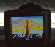
TomTom GO
The TomTom GO is an all-in-one GPS navigation device. It has a touch screen, speaker, USB port, internal Lithium ion batteryLithium ion battery
A lithium-ion battery is a family of rechargeable battery types in which lithium ions move from the negative electrode to the positive electrode during discharge, and back when charging. Chemistry, performance, cost, and safety characteristics vary across LIB types...
, and comes with TomTom HOME software. It charges, synchronizes, and updates its data by connecting to a Windows or Mac PC running the TomTom HOME software via USB cable. Most models (and all new models) have Bluetooth
Bluetooth
Bluetooth is a proprietary open wireless technology standard for exchanging data over short distances from fixed and mobile devices, creating personal area networks with high levels of security...
transceivers that allow connection to a smartphone
Smartphone
A smartphone is a high-end mobile phone built on a mobile computing platform, with more advanced computing ability and connectivity than a contemporary feature phone. The first smartphones were devices that mainly combined the functions of a personal digital assistant and a mobile phone or camera...
. This allows it to make and receive calls. Bluetooth equipped models are able to receive traffic
Traffic
Traffic on roads may consist of pedestrians, ridden or herded animals, vehicles, streetcars and other conveyances, either singly or together, while using the public way for purposes of travel...
(using TMC
Traffic Message Channel
Traffic Message Channel is a technology for delivering traffic and travel information to drivers. It is typically digitally coded using the FM-RDS system on conventional FM radio broadcasts...
, as the TomTom Go Live 1000) and weather updates using the TomTom Plus service on phones with DUN data service.
TomTom ONE and ONE XL
The TomTom One is the base model for automobile navigationAutomotive navigation system
An automotive navigation system is a satellite navigation system designed for use in automobiles. It typically uses a GPS navigation device to acquire position data to locate the user on a road in the unit's map database. Using the road database, the unit can give directions to other locations...
. The difference between the TomTom One XL and the TomTom One is the size of the touch screen (4.3 in (109.2 mm) vs 3.5 in (88.9 mm)). Neither model of the One contains the added functions included in the Go models, such as Bluetooth hands-free calling and MP3 Jukebox. However, the One is able to receive traffic and weather updates using the TomTom Plus service when paired via Bluetooth with a mobile phone with a DUN data service. The reduced software capability means less demand on the hardware, which allows the One to be sold at a significantly lower price than the Go.
The XL is also available as a Live version with integrated LIVE services.
TomTom NAVIGATOR
TomTom Navigator is a GPS navigation software product for personal digital assistantPersonal digital assistant
A personal digital assistant , also known as a palmtop computer, or personal data assistant, is a mobile device that functions as a personal information manager. Current PDAs often have the ability to connect to the Internet...
s (PDAs), Palm devices, Pocket PC
Pocket PC
A Pocket PC is also known by Microsoft as a 'Windows Mobile Classic device'. It is a hardware specification for a handheld-sized computer, personal digital assistant , that runs the Microsoft 'Windows Mobile Classic' operating system...
s, and some smartphone
Smartphone
A smartphone is a high-end mobile phone built on a mobile computing platform, with more advanced computing ability and connectivity than a contemporary feature phone. The first smartphones were devices that mainly combined the functions of a personal digital assistant and a mobile phone or camera...
s. TomTom Navigator 6 replaced the earlier TomTom Mobile 5.2. It can use GPS receivers built into the device or external (e.g., Bluetooth
Bluetooth
Bluetooth is a proprietary open wireless technology standard for exchanging data over short distances from fixed and mobile devices, creating personal area networks with high levels of security...
-connected) receivers..
Navigator 7 is the latest release of this software, released as a part of the software that came with the June 2008 HTC Touch Diamond. Frequently used functions can be added to the main screen of the program, and users can report map corrections and share them with other users.
Navigator supports touch screens; devices without touch screens use a cursor to input data. The software is available on SD card and DVD. It runs on a number of devices listed on the TomTom website, but will run successfully on many unlisted devices using the Windows Mobile
Windows Mobile
Windows Mobile is a mobile operating system developed by Microsoft that was used in smartphones and Pocket PCs, but by 2011 was rarely supplied on new phones. The last version is "Windows Mobile 6.5.5"; it is superseded by Windows Phone, which does not run Windows Mobile software.Windows Mobile is...
operating system
Operating system
An operating system is a set of programs that manage computer hardware resources and provide common services for application software. The operating system is the most important type of system software in a computer system...
.
The DVD version includes a DVD, printed 15-character product code, Quick Start Guide, Licensing Agreement, a poster with a picture diagram for setup procedure of DVD version and SD card version, and an advertisement for associated TomTom PLUS services. The DVD contains installation software for TomTom Home, software for mobile devices, licenses, manuals, maps, and voices. The software for mobile devices includes CAB files for Palm, PPC, Symbian, and UIQ3.
List of TomTom navigational devices
| Product | Release date | GPS chipset | CPU | RAM | Internal flash memory | Memory card slot | Screen | Bluetooth | TMC Traffic Message Channel Traffic Message Channel is a technology for delivering traffic and travel information to drivers. It is typically digitally coded using the FM-RDS system on conventional FM radio broadcasts... connection | FM transmitter FM transmitter (personal device) An FM transmitter is a portable device that plugs into the headphone jack or proprietary output port of a portable audio or video device, such as a portable media player, CD player, or satellite radio system. The sound is then broadcast through the transmitter, and plays through an FM broadcast... | Other |
|---|---|---|---|---|---|---|---|---|---|---|---|
| GO | SiRFstarII | 200 MHz | 32 MB | None | SD / MMC | 3.5" 4:3 320 × 240 pixels 4,096 colours | No | No | No | ||
| GO 300 | SiRFstarII | 200 MHz | 32 MB | None | SD / MMC | 3.5" 4:3 320 × 240 pixels 4,096 colours | Yes | No | No | ||
| GO 500 | SiRFstarII | 400 MHz | 32 MB | None | SD / MMC | 3.5" 4:3 320 × 240 pixels 4,096 colours | Yes | No | No | ||
| GO 700 | SiRFstarII | 400 MHz | 64 MB | 2.5 GB hard drive | None | 3.5" 4:3 320 × 240 pixels 4,096 colours | Yes | No | No | ||
| Rider | SiRFstarIII | 380 MHz | 32 MB | None | SD | 3.5" 4:3 320 × 240 pixels | Yes | Yes | No | Water resistant | |
| Rider2 | SiRFstarIII | 380 MHz | 32 MB | None | SD | 3.5" 4:3 320 × 240 pixels | Yes | Yes | No | Water resistant | |
| ONE V1 | SiRFstarIII | 380 MHz | 32 MB | none | SD | 3.5" 4:3 320 × 240 pixels | Yes | Yes(USB) | No | ||
| GO 510 | SiRFstarIII | 400 MHz | 64 MB | None | SD / MMC | 4.0" 16:9 480 × 272 pixels 64,000 colours | Yes | Yes | No | ||
| GO 710 | SiRFstarIII | 400 MHz | 64 MB | None | SD / MMC | 4.0" 16:9 480 × 272 pixels 64,000 colours | Yes | Yes | No | Voice input, MP3 | |
| GO 910 | SiRFstarIII | 400 MHz | 64 MB | 20 GB hard drive | None | 4.0" 16:9 480 × 272 pixels 64,000 colours | Yes | Yes | No | Voice input, MP3 | |
| ONE V2 | SiRFstarIII | 266 MHz | 32 MB | none, 512 MB, 1 GB | SD / MMC | 3.5" 4:3 320 × 240 pixels 64,000 colours | Yes | Yes | No | ||
| ONE XL | Global Hammerhead v1 | 266 MHz | 32 MB | none, 512 MB, 1 GB | SD / MMC | 4.3" 16:9 480 × 272 pixels | Yes (not for cellphone) | Yes | No | ||
| GO 520 | SiRFstarIII | 400 MHz | 64 MB | 512 MB, 1 GB | SDHC / MMC | 4.3" 16:9 480 × 272 pixels | Yes | Yes | Yes | ||
| GO 720 | SiRFstarIII | 400 MHz | 64 MB | 2 GB | SDHC / MMC | 4.3" 16:9 480 × 272 pixels 64,000 colours | Yes | Yes | Yes | Voice input, MP3 | |
| GO 920 | SiRFstarIII | 400 MHz | 64 MB | 4 GB | SDHC / MMC | 4.3" 16:9 480 × 272 pixels 64,000 colours | Yes | Yes | Yes | Voice input, MP3, EPT | |
| ONE Third Edition | Global Hammerhead v1 | 266 MHz | 32 MB | 512 MB, 1 GB | none | 3.5" 320 × 240 pixels 64,000 colours | No | Yes | No | ||
| ONE XL HDT | Global Hammerhead v1 | 266 MHz | 32 MB | 1GB | SD / MMC | 4.3" 16:9 480 × 272 pixels | No | Yes | No | ||
| ONE XL-S | Global Hammerhead v1 | 266 MHz | 64 MB | 1GB | SD / MMC | 4.3" 16:9 480 × 272 pixels | Yes (not for cellphone) | Yes | No | ||
| GO 530 | SiRFstarIII | 400 MHz | 64 MB | 1 GB, 2 GB | SDHC / MMC | 4.3" 16:9 480 × 272 pixels | Yes | Yes | Yes | Voice input, MP3 | |
| GO 730 | SiRFstarIII | 400 MHz | 64 MB | 1 GB, 2 GB, 4 GB | SDHC / MMC | 4.3" 16:9 480 × 272 pixels | Yes | Yes | Yes | Voice input, MP3 | |
| GO 930 | SiRFstarIII | 400 MHz | 64 MB | 4 GB | SDHC / MMC | 4.3" 16:9 480 × 272 pixels | Yes | Yes | Yes | Voice input, MP3, EPT | |
| ONE V4 | Global Hammerhead v1 | 266 MHz | 32 MB | 512 MB, 1 GB, 2 GB | None | 3.5" 4:3 320 × 240 pixels 64,000 colours | No | Yes(USB) | No | ||
| XL | Global Hammerhead v1 | 266 MHz | 32 MB | 512 MB, 1 GB, 2 GB | None | 4.3" 16:9 480 × 272 pixels | No | Yes(USB) | No | ||
| GO 630 | SiRFstarIII | 400 MHz | 64 MB | 2 GB | SDHC / MMC | 4.3" 16:9 480 × 272 pixels | Yes | Yes | No | Voice input | |
| GO 540 LIVE | Broadcom BCM4750 | 400 MHz | 64 MB | 1 GB ,2 GB | microSD | 4.3" 16:9 480 × 272 pixels | Yes | Yes(USB) | No | Voice input | |
| GO 740 LIVE | Broadcom BCM4750 | 400 MHz | 64 MB | 1 GB, 2 GB, 4 GB | microSD | 4.3" 16:9 480 × 272 pixels | Yes | Yes(USB) | No | Voice input | |
| GO 940 LIVE | Broadcom BCM4750 | 400 MHz | 64 MB | 2 GB, 4 GB, 8 GB | microSD | 4.3" 16:9 480 × 272 pixels | Yes | Yes(USB) | Yes | Voice input, MP3, EPT | |
| ONE IQ Routes Edition | Broadcom BCM4750 | 266 MHz | 64 MB | 2 GB | None | 3.5" 4:3 320 × 240 pixels 64,000 colours | No | Yes(USB) | No | ||
| ONE 140 | Global Hammerhead v1 | 266 MHz | 32 MB | 512 MB, 1 GB, 2 GB | None | 3.5" 4:3 320 × 240 pixels 64,000 colours | No | Yes(USB) | No | ||
| ONE XL340 | Global Hammerhead v1 | 266 MHz | 32 MB | 512 MB, 1 GB, 2 GB | None | 4.3" 16:9 480 × 272 pixels 64,000 colours | No | Yes(USB) | No | ||
| XL IQ Routes Edition | Broadcom BCM4750 | 266 MHz | 64 MB | 2 GB | None | 4.3" 16:9 480 × 272 pixels 64,000 colours | No | Yes(USB) | No | ||
| XXL530S | SiRFstarIV | 266 MHz | 64 MB | 2 GB | None | 5" 16:9 480 × 272 pixels 64,000 colours | No | Yes(USB) | No | Text-to-speech | |
| XXL540S | Broadcom BCM4750 | 266 MHz | 64 MB | 2 GB | None | 5" 16:9 480 × 272 pixels 64,000 colours | No | Yes(USB) | No | ||
| GO 550 LIVE | Broadcom BCM4750 | 400 MHz | 64 MB | 1 GB | microSD | 4.3" 16:9 480 × 272 pixels | Yes | Yes(USB) | No | Voice input | |
| GO 750 LIVE | Broadcom BCM4750 | 400 MHz | 64 MB | 2 GB | microSD | 4.3" 16:9 480 × 272 pixels | Yes | Yes(USB) | No | Voice input | |
| GO 950 LIVE | Broadcom BCM4750 | 400 MHz | 64 MB | 4 GB | microSD | 4.3" 16:9 480 × 272 pixels | Yes | Yes(USB) | No | Voice input, EPT | |
| GO 1000 LIVE | Broadcom GoGPS BARRACUDA | 500 MHz ARM11 | 128 MB | 4 GB | None | 4.3" 16:9 480 × 272 pixels | Yes | Yes(USB) | No | Text-to-speech, Voice input | |
| GO 1005 LIVE | Broadcom GoGPS BARRACUDA | 500 MHz ARM11 | 128 MB | 4 GB | None | 5" 16:9 480 × 272 pixels | Yes | Yes(USB) | No | Text-to-speech, Voice input | |
| XL IQ Routes Edition 2 | Broadcom BCM4750 | 266 MHz | 64 MB | 1 GB | None | 4.3" 16:9 480 × 272 pixels 64,000 colours | No | Yes(USB) | No | Text-to-speech | |
| Urban Rider | Broadcom BCM4750 | 380 MHz | 32 MB | 2 GB | None | 3.5" 4:3 320 × 240 pixels | Yes | No | No | Water resistant | |
| Start | Broadcom BCM4750 | 266 MHz | 32 MB | 2 GB | None | 3.5" 4:3 320 × 240 pixels 64,000 colours | No | No | No | ||
| Start2 | Broadcom BCM4750 | 266 MHz | 64 MB | 2 GB | None | 3.5" 4:3 320 × 240 pixels 64,000 colours | No | Yes(USB) | No | Black or white, Text-to-speech | |
| Via 110 | Broadcom GoGPS BARRACUDA | 500 MHz | 128 MB | 2 GB | None | 4.3" 16:9 480 × 272 pixels 64,000 colours | No | Yes(USB) | No | Text-to-speech | |
| Via 120 | Broadcom GoGPS BARRACUDA | 500 MHz | 128 MB | 4 GB | None | 4.3" 16:9 480 × 272 pixels 64,000 colours | Yes | Yes(USB) | No | Text-to-speech | |
| Via 125 | Broadcom GoGPS BARRACUDA | 500 MHz | 128 MB | 4 GB | None | 5" 16:9 480 × 272 pixels 64,000 colours | Yes | Yes(USB) | No | Text-to-speech | |
| TomTom App for iPhone | Assisted GPS chip in the iPhone | N/A | N/A | N/A | N/A | N/A | N/A | N/A | No | Voice Input | |
| TomTom Car Kit For iPhone | SiRFstarIII | N/A | N/A | N/A | N/A | N/A | N/A | N/A | No | Voice Input |
SD Secure Digital (max. 2 GB)
SDHC Secure Digital High Capacity (4-32 GB)
Micro-SD Micro Secure Digital High Capacity (max. 32 GB)
TomTom HOME
TomTom HOME is a 32-bit PC application that allows synchronization/updates to be sent to the mobile device. The container states that it is compatible with Mac OS × v10.3 or greater and Windows ME/2000/XP/Vista/7 (see above reference). After installation it performs an automatic software update. It then has options to choose a device to be associated to and activate the software. A caution is given that the software only allows one device to be associated to an email address and the associated device can be changed only after six months since the previous association. TomTom HOME version 2.0 and above is implemented on the XulrunnerXULRunner
XULRunner is a runtime environment developed by the Mozilla Foundation to provide a common back-end for XUL-based applications. It replaced the Gecko Runtime Environment, a stalled project with a similar purpose....
platform. With version 2.2, TomTom HOME added a content-sharing platform where users can download and upload content to personalize their device such as voices, start-up images, POI sets, etc.
Despite it being based on the cross-platform Xulrunner, TomTom Home currently lacks support for Linux
However the devices can still be read in a Linux OS as a disk drive. There is even software made by the community to manage some functions of
the TomTom.
TomTom Mobile
Navigation software for several mobile phones. Discontinued after release 5.2; Navigator, which does not support all the phones that Mobile did, is the nearest equivalent. Mobile 5.2 cannot use maps later than v6.60 build 1223; this and earlier program versions are not compatible with all map versions, particularly other builds of version 6.TomTom for iOS devices
A version for the iPhone was announced at the Apple WWDC Keynote speech in early June 2009, and released internationally on 15 August 2009 in the Apple App Store, with various map packs for different regions. TomTom Vice President of Marketing Development gave information in an interview by MacworldMacworld
Macworld is a web site and monthly computer magazine dedicated to Apple Macintosh products. It is published by Mac Publishing, which is headquartered in San Francisco, California...
in July 2009.
Currently the app works with both the iPhone (models 3G, 3GS, 4, and 4S), and the iPod Touch (all models), and there are two separate TomTom car kits for each device. The current maps available in each countries' app stores varies according to language availability of the app itself, the country of the app store, and thus differing region group map packs are available. The current sets available in English (via the UK & US app stores) are as follows:
Africa
- Mauritius: Mauritius.
- Morocco: Morocco
- Southern Africa (formally Zuid-Afrika): (full coverage at street level) South Africa, Swaziland, Lesotho. (other countries covered in major towns and cities) Namibia, Botswana, Zimbabwe Basic Attributed, Mozambique, Malawi and Zambia.
Australasia
- Australia: Australia.
- New Zealand: New Zealand.
Asia
- Malaysia & Singapore: Malaysia, Singapore and Brunei.
- Thailand: Thailand.
- Hong Kong: Hong Kong and Macau.
Europe
- Europe: Andorra, Austria, Belgium, Czech Republic, Denmark, Finland, France, Estonia, Germany, Great Britain, Italy, Liechtenstein, Lithuania, Luxembourg, Hungary, Malta, Monaco, Norway, Poland, Portugal, San Marino, Slovakia, Slovenia, Spain, Sweden, Switzerland, the Republic of Ireland, the Netherlands, the Canary Islands, the Vatican City, Russia up to the Ural mountainsUral MountainsThe Ural Mountains , or simply the Urals, are a mountain range that runs approximately from north to south through western Russia, from the coast of the Arctic Ocean to the Ural River and northwestern Kazakhstan. Their eastern side is usually considered the natural boundary between Europe and Asia...
(33%), Bulgaria (54%), Latvia (63%) and Croatia (42%, including major cities and coastal areas).
- Western Europe: Great Britain, the Republic of Ireland, Germany, Austria, Switzerland, Liechtenstein, France, Monaco, Italy, Malta, San Marino, the Vatican City, Spain, Portugal, Andorra, Belgium, the Netherlands, Luxemburg, Sweden, Denmark, Norway, Finland and the Canary Islands.
- Eastern Europe: Czech Republic, Estonia, Hungary, Lithuania, Poland, Slovakia, Slovenia, Bulgaria (54%), Latvia (63%) and Croatia (42%).
- Alps: Austria, Switzerland, Liechtenstein, major roads of Western Europe, Northern Italy, Southern Germany and Eastern France.
- Benelux: Belgium, Netherlands and Luxemburg.
- D-A-CH: Germany, Austria and Switzerland.
- France: France.
- Greece: Greece.
- Iberia: Spain and Portugal.
- Italy: Italy.
- Nordic: Denmark, Finland, Norway, and Sweden.
- Turkey: Turkey.
- UK & Ireland: UK and Ireland.
Middle East
- Middle East: Bahrain, Kuwait, Oman, Qatar, Saudi Arabia and the United Arab Emirates.
North & South America
- Argentina & Uruguay: Argentina and Uruguay.
- Brazil: Brazil.
- Canada & Alaska: Canada and Alaska.
- Chile: Chile.
- Mexico: Mexico.
- USA: USA.
- US & Canada: USA and Canada.
- US & Mexico: USA and Mexico.
Some keen observers have noted that both Turkey, but more especially Greece, are missing from the larger Europe map pack, most likely bacause of the AppStore's App size limitation of 2 GB. Both maps are available separately. Furthermore, Iceland is missing altogether and is not available in any map package sold by TomTom.
TomTom PLUS
The company offers a line of fee-based services under the name TomTom PLUS, which include services to warn drivers about speed cameras, provide weather updates, change voices and provide traffic alerts. Currently the fees are only for European countries.Traffic data is also available to subscribers in many parts of Europe and the US via a bluetooth-enabled cell phone with Internet service or an add-on aerial, which picks up RDS
Traffic Message Channel
Traffic Message Channel is a technology for delivering traffic and travel information to drivers. It is typically digitally coded using the FM-RDS system on conventional FM radio broadcasts...
data (broadcast on FM
Frequency modulation
In telecommunications and signal processing, frequency modulation conveys information over a carrier wave by varying its instantaneous frequency. This contrasts with amplitude modulation, in which the amplitude of the carrier is varied while its frequency remains constant...
radio frequencies) offering traffic information without the requirement for a data connection. The TomTom plus service is not compatible with Apple's iPhone
IPhone
The iPhone is a line of Internet and multimedia-enabled smartphones marketed by Apple Inc. The first iPhone was unveiled by Steve Jobs, then CEO of Apple, on January 9, 2007, and released on June 29, 2007...
.
TomTom LIVE Services
In October 2008 the company released LIVE Services on the GO 940 LIVE. These allow users to receive updates over the mobile telephone network using the SIM card in the device. These services include HD Traffic, Safety Alerts, Local Search with Google and Fuel Prices.On May 12, 2011, TomTom announced that it is offering up its real-time traffic products to "industry partners" in the United States.
Map Share
Map Share is a proprietary map technology launched by TomTom in June 2007. Map Share allows users to make changes to the maps on their navigation devices and share them with others.It allows drivers to make changes to their maps directly on their navigation devices. Drivers can block or unblock streets, change the direction of traffic, edit street names and add, edit or remove points of interest (POIs).
Improvements can be shared with other users. Users who connect their devices to their computers can download and upload map corrections on a daily basis. This is done through TomTom HOME, TomTom’s content management software.
Users can select various 'levels of trust', only receiving improvements that have been verified by TomTom or changes that have been submitted by trusted sources, by many, or by some people.
TomTom has announced the release of an open source
Open source
The term open source describes practices in production and development that promote access to the end product's source materials. Some consider open source a philosophy, others consider it a pragmatic methodology...
encoding technology named OpenLR
OpenLR
OpenLR is a royalty-free open standard for "procedures and formats for the encoding, transmission, and decoding of local data irrespective of the map" developed by TomTom....
, which would provide a data format for the same purpose in an interoperable map-independent way.
HD Traffic
A traffic monitoring service that uses multiple sources to provide traffic information. The service does this by combining data from:- traditional sources: Governmental/third party data such as induction loops in the roads, cameras and traffic surveillance
- new sources: traffic flow of 16.7 million anonymous mobile phone users
The information is merged by TomTom and algorithms are used to improve the data and filter out anomalous readings. The system sends updates to all HD Traffic users every three minutes. Users can receive the service through a connected navigation device, or through a specially designed antenna. Most current devices receive the updated road congestion conditions automatically. Rerouting can be set to be transparent to the user with the only sign that the route has been changed due to a traffic jam being a sound indication from the device and a changed ETA.
The system was first launched in the Netherlands in 2007, and expanded to the United Kingdom, France, Germany and Switzerland in 2008. In mid 2011 TomTom live services, including HD Traffic are available in the United States, South Africa, New Zealand and the following 17 European countries: Austria, Belgium, Denmark, Finland, France, Germany, Ireland, Italy, Luxembourg, Netherlands, Norway, Poland, Portugal, Spain, Sweden, Switzerland and the United Kingdom.
IQ Routes
IQ Routes, developed by TomTom and available since spring 2008 on the TomTom GO 730 & 930, uses anonymous travel time data accumulated by users of TomTom satnav devices. Newer TomTom devices use this data to take into account the time and day when determining the fastest route.Travel time data is stored in Historical Speed Profiles, one for each road segment, covering large motorways, main roads and also small local roads. Historic Speed Profiles are part of the digital map and are updated with every new map release. They give insight into real-world traffic patterns. This is a fact-based routing system based on measured travel times, compared to most other methods which use speed limits or ‘assumed’ speeds.
In September 2008, map upgrade v8.10 was released for x20 series models, extending the IQ Routes feature to those devices as well. To enable IQ Routes on these older devices, users must not only update their map, but also apply the free v8 application software update using TomTom Home.
Enhanced Positioning Technology
Offers continuous navigation, even when a navigation device can’t receive GPS satellite signals (e.g. in tunnels or amongst high buildings).Mapping
TomTom products use Tele AtlasTele Atlas
Tele Atlas is a Netherlands-based company founded in 1984 which delivers digital maps and other dynamic content for navigation and location-based services, including personal and in-car navigation systems, and provides data used in a wide range of mobile and Internet map applications...
based maps. Map errors are handled using Tele Atlas map insight. Map errors are reported using the Tele Atlas map insight map feedback page. Maps are not universally compatible across TomTom devices; while most maps are available for most modern devices, a compatible version must be used. Version numbers are of the form 865.2442.
TomTom offers mapping for:
- Australia - 99.9% coverage
- East Africa - street-level coverage for major cities, plus connecting roads, for Kenya, Tanzania and Uganda
- Europe 99.9% coverage (Andorra, Austria, Belgium, Czech Republic, Denmark, Eire, Estonia, Finland, France, Germany, Hungary, Italy, Liechtenstein, Lithuania, Luxembourg, Malta, Monaco, the Netherlands, Norway, Poland, Portugal, San Marino, Slovakia, Slovenia, Spain (inc. Canaries), Sweden, Switzerland, UK, Vatican City), 95% for Greece, 37% for Russia, 54% for Bulgaria, 60% for Croatia and 63% of Latvia; connecting roads but no detailed mapping for other Central European countries. No mapping at all for Iceland.
- French Antilles - 99% coverage for Guadelope, St Barts, St. Martin
- Hong Kong - 99.9% coverage for Hong Kong and Macau
- Malaysia and Singapore - 77% of Malaysia, 84% of Brunei, 99.9% of Singapore; all connecting roads
- Mauritius, Mayotte and Reunion - full street-level coverage in major cities, plus connecting roads.
- Mexico - 40% of population has street-level coverage, plus all connecting roads.
- Middle East - 99.9% coverage for Bahrain, Kuwait, Qatar and UAE. 80% for Oman, and 82% for Saudi Arabia.
- Morocco - 36% of coverage, including all connecting roads.
- New Zealand - 99.9% coverage
- North America - 99.9% coverage for Canada and USA including Alaska and Puerto Rico
- South America - Argentina (57% street-level coverage), Brazil (413 of 1379 municipalities have street-level coverage), Chile (95% street-level coverage), Uruguay (42% street-level coverage). Plus connecting roads.
- Southern Africa - 99% coverage for South Africa, Swaziland and Lesotho. Connecting roads and major cities in Angola, Botswana, Malawi, Mozambique, Namibia, Zambia and Zimbabwe.
- Turkey - 63% of streets, 11% of house numbers.
- Thailand - 99% coverage
- West Africa - 23% of Nigerian streets, major cities in Benin, Cameroon, Ghana and Togo, plus connecting roads.
Maps are not necessarily for the entire regions listed; there are many maps for individual countries or parts of countries, and groups of countries.
IndyCar
TomTom has sponsored Dario FranchittiDario Franchitti
George Dario Marino Franchitti is a Scottish racing driver. He formerly competed in the CART series before switching to the IndyCar Series where he was 2007 champion, and won the rain-shortened 2007 Indianapolis 500. Franchitti is also a former NASCAR driver for Chip Ganassi Racing, competing...
in the 2009 IndyCar Series season
2009 IndyCar Series season
The 2009 IndyCar Series season was the 14th season of the IndyCar Series. The 17-race season began on April 5, and its premier event, the 93rd Indianapolis 500 was held May 24. All races were broadcast on ABC or Versus in high-definition...
in some races, he won at the 2009 Iowa Corn Indy 250
2009 Iowa Corn Indy 250
The 2009 Iowa Corn Indy 250 was the seventh round of the 2009 IndyCar Series season. The race was held on June 21, 2009 at the Iowa Speedway in Newton, Iowa. The race was broadcast on ABC...
with TomTom as the main sponsor.
NASCAR
TomTom has also sponsored the #1 Chevy Impala of Martin Truex Jr.Martin Truex Jr.
Martin Lee Truex Jr. is a NASCAR driver. He drives the #56 NAPA Auto Parts Toyota Camry for Michael Waltrip Racing in the Sprint Cup Series. Truex is a two-time Nationwide Series champion; having won the title in 2004 and 2005. His younger brother, Ryan is a champion in the K&N Pro Series East...
for a select number of 2009 Sprint Cup races.
Controversy
In April 2011, TomTom "apologized for supplying driving data collected from customers to police to use in catching speeding motorists"; the company collected the data from its Dutch customers, which Dutch police subsequently used to set targeted speed traps. In May 2011, the company announced that it was planning to sell aggregated customer information to the Australian Roads and Traffic AuthorityRoads and Traffic Authority
The Roads and Traffic Authority is a former New South Wales government agency that was responsible for major road infrastructure, licensing of drivers, and registration of motor vehicles. The RTA directly managed State roads and provided funding to local councils for regional and local roads...
, which could also potentially be used for targeted speed enforcement.
See also
- Automotive navigation systemAutomotive navigation systemAn automotive navigation system is a satellite navigation system designed for use in automobiles. It typically uses a GPS navigation device to acquire position data to locate the user on a road in the unit's map database. Using the road database, the unit can give directions to other locations...
- GarminGarminGarmin Ltd. , incorporated in Schaffhausen, Switzerland, is the parent company of a group of companies founded in 1989 by Gary Burrell and Min Kao , that develops consumer, aviation, and marine technologies for the Global Positioning System...
- GPS
- Magellan NavigationMagellan NavigationMagellan Navigation, Inc. is a producer of consumer and professional grade global positioning system receivers. Headquartered in Santa Clara, California, with European sales and engineering centers in Nantes, France and Moscow, Russia, Magellan also produces aftermarket automotive GPS units,...
- NavigonNavigonNavigon GmbH is a Hamburg, Germany-based manufacturer of GPS devices and GPS navigation software. It is privately owned, however in June 2011 it was announced that Navigon is to be acquired by a subsidiary of Garmin...
- NDriveNDriveNDrive Navigation Systems, SA is a worldwide provider of navigation services to mobile platforms. Founded in 2001, the company has a staff of 60 people and is headquartered in Porto, Portugal with sales offices on all continents....
- Point of InterestPoint of interestA point of interest, or POI, is a specific point location that someone may find useful or interesting. An example is a point on the Earth representing the location of the Space Needle, or a point on Mars representing the location of the mountain, Olympus Mons.The term is widely used in...