

Automotive navigation system
Encyclopedia
Global Navigation Satellite System
A satellite navigation or SAT NAV system is a system of satellites that provide autonomous geo-spatial positioning with global coverage. It allows small electronic receivers to determine their location to within a few metres using time signals transmitted along a line-of-sight by radio from...
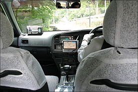
designed for use in automobiles. It typically uses a GPS navigation device
GPS navigation device
A GPS navigation device is any device that receives Global Positioning System signals for the purpose of determining the device's current location on Earth...
to acquire position data to locate the user on a road
Road
A road is a thoroughfare, route, or way on land between two places, which typically has been paved or otherwise improved to allow travel by some conveyance, including a horse, cart, or motor vehicle. Roads consist of one, or sometimes two, roadways each with one or more lanes and also any...
in the unit's map database
Database
A database is an organized collection of data for one or more purposes, usually in digital form. The data are typically organized to model relevant aspects of reality , in a way that supports processes requiring this information...
. Using the road database, the unit can give directions to other locations along roads also in its database. Dead reckoning
Dead reckoning
In navigation, dead reckoning is the process of calculating one's current position by using a previously determined position, or fix, and advancing that position based upon known or estimated speeds over elapsed time, and course...
using distance data from sensors attached to the drivetrain
Powertrain
In a motor vehicle, the term powertrain or powerplant refers to the group of components that generate power and deliver it to the road surface, water, or air. This includes the engine, transmission, drive shafts, differentials, and the final drive...
, a gyroscope and an accelerometer
Accelerometer
An accelerometer is a device that measures proper acceleration, also called the four-acceleration. This is not necessarily the same as the coordinate acceleration , but is rather the type of acceleration associated with the phenomenon of weight experienced by a test mass that resides in the frame...
can be used for greater reliability, as GPS signal loss and/or multipath can occur due to urban canyon
Urban canyon
An urban canyon is an artefact of an urban environment similar to a natural canyon. It is manifested by streets cutting through dense blocks of structures, especially skyscrapers, which causes a canyon effect...
s or tunnels.
Some sorts can be taken out of the car and used hand-held while walking.
History
Automotive navigation systems were the subject of extensive experimentation, including some efforts to reach mass markets, prior to the availability of commercial GPS.Most major technologies required for modern automobile navigation were already established when the microprocessor emerged in the 1970s to support their integration and enhancement by computer software. These technologies subsequently underwent extensive refinement, and a variety of system architectures had been explored by the time practical systems reached the market in the late 1980s. Among the other enhancements of the 1980s was the development of color displays for digital maps and of CD-ROMs for digital map storage.
However, there is some question about who made the first commercially available automotive navigation system. There seems to be little room for doubt that Etak
Etak
Etak, Inc. was an independent US-based vendor of automotive navigation system equipment, digital maps, and mapping software. It was founded in 1983....
was first to make available a digital system that used map-matching to improve on dead reckoning
Dead reckoning
In navigation, dead reckoning is the process of calculating one's current position by using a previously determined position, or fix, and advancing that position based upon known or estimated speeds over elapsed time, and course...
instrumentation. Etak's systems, which accessed digital map information stored on standard cassette tapes, arguably made car navigation systems practical for the first time. However, Japanese efforts on both digital and analog systems predate Etak's founding.
Steven Lobbezoo developed the first commercially available satellite navigation system for cars. It was produced in Berlin from start 1984 to January 1986. Publicly presented first at the Hannover fair in 1985 in Germany, the system was shown in operation on the evening news (item in the Hannover fair) from the first German television channel in that year. It used a modified IBM PC, a large disc for map data and a flat screen, built into the glove compartment. It was called Homer (after the device from a James Bond movie).
Alpine
Alpine Electronics
is traditionally known as an aftermarket car audio and navigation systems manufacturer, famed for their high quality, premium in-car audio units commonly known as headunits. It is a subsidiary of Alps Electric Co. and its registered head office is in Tokyo, Japan. However its main offices, or the...
claims to have created the first automotive navigation system in 1981. However, according to the company's own historical timeline, the company claims to have co-developed an analog automotive navigation product called the Electro Gyrocator
Electro Gyrocator
The Electro Gyrocator was claimed to be the world's first automated commercially available automotive navigation system. It was co-developed by Honda and Alpine. Unlike most navigation systems of today, it did not use GPS Satellites to maintain its position and discern movement of the vehicle...
, working with Honda
Honda
is a Japanese public multinational corporation primarily known as a manufacturer of automobiles and motorcycles.Honda has been the world's largest motorcycle manufacturer since 1959, as well as the world's largest manufacturer of internal combustion engines measured by volume, producing more than...
. This engineering effort was abandoned in 1985. Although there are reports of the Electro Gyrocator being offered as a dealer option on the Honda Accord in 1981, it's not clear whether an actual product was released, whether any customers took delivery of an Electro Gyrocator-equipped Accord, or even whether the unit appeared in any dealer showrooms; Honda's own official history appears to pronounce the Electro Gyrocator as not practical. See below for Honda's history of the project.
Honda
Honda
is a Japanese public multinational corporation primarily known as a manufacturer of automobiles and motorcycles.Honda has been the world's largest motorcycle manufacturer since 1959, as well as the world's largest manufacturer of internal combustion engines measured by volume, producing more than...
claims to have created the first navigation system starting in 1983, and culminating with general availability in the 1990 Acura Legend
Acura Legend
The Acura Legend, sold as the Honda Legend outside the U.S., Canada, and parts of China, was a luxury vehicle sold from 1986 to 1995 as both a sedan and coupe. It was the first flagship sedan sold under the Acura nameplate, until being renamed in 1996 as the Acura 3.5RL. The 3.5RL was North...
. The original analog
Analog computer
An analog computer is a form of computer that uses the continuously-changeable aspects of physical phenomena such as electrical, mechanical, or hydraulic quantities to model the problem being solved...
Electro Gyrocator system used an accelerometer
Accelerometer
An accelerometer is a device that measures proper acceleration, also called the four-acceleration. This is not necessarily the same as the coordinate acceleration , but is rather the type of acceleration associated with the phenomenon of weight experienced by a test mass that resides in the frame...
to navigate using inertial navigation
Inertial navigation system
An inertial navigation system is a navigation aid that uses a computer, motion sensors and rotation sensors to continuously calculate via dead reckoning the position, orientation, and velocity of a moving object without the need for external references...
, as the GPS system was not yet generally available. However, it appears from Honda's concessions in their own account of the Electro Gyrocator project that Etak actually trumped Honda's analog effort with a truly practical digital system, albeit one whose effective range of operation was limited by the availability of appropriately digitized street map data.
[...] progress in digital technology would not stop simply because Honda had turned its attention to analog. In 1985, for example, the U.S. company ETAK introduced its own digital map navigation system. Although the system's effective range-the area of geographical coverage-was limited, the announcement was a dour one for Nakamura and his staff. Therefore, ultimately the development of a practical analog system was shelved. The staff experienced indescribable feelings of disappointment.
The development of [Honda's] digital map navigation system resumed in 1987, following a three-year hiatus.
Both Mitsubishi Electric
Mitsubishi Electric
is a multinational electronics and information technology company headquartered in Tokyo, Japan. It is one of the core companies of the Mitsubishi Group....
and Pioneer
Pioneer Corporation
is a multinational corporation that specializes in digital entertainment products, based in Kawasaki, Kanagawa, Japan. The company was founded in 1938 in Tokyo as a radio and speaker repair shop...
claim to be the first with a GPS-based auto navigation system, in 1990. Also in 1990, a draft patent application was filed within Digital Equipment Co. Ltd. for a multi-function device called PageLink that had real-time maps for use in a car listed as one of its functions.
Magellan
Magellan Navigation
Magellan Navigation, Inc. is a producer of consumer and professional grade global positioning system receivers. Headquartered in Santa Clara, California, with European sales and engineering centers in Nantes, France and Moscow, Russia, Magellan also produces aftermarket automotive GPS units,...
, a GPS navigation system manufacturer, claims to have created the first GPS-based vehicle navigation system in the U.S. in 1995.
In 1995, Oldsmobile
Oldsmobile
Oldsmobile was a brand of American automobile produced for most of its existence by General Motors. It was founded by Ransom E. Olds in 1897. In its 107-year history, it produced 35.2 million cars, including at least 14 million built at its Lansing, Michigan factory...
introduced the first GPS navigation system available in a production car, called GuideStar. There also was an Oldsmobile navigation system available as an option as early as 1994 called the Oldsmobile Navigation/Information System. It was an option on the Oldsmobile Eighty Eight.
However it was not until 2000 that the United States made a more accurate GPS signal available for civilian use.
Visualization
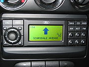
Navigation systems may (or may not) use a combination of any of the following:- top view for the map
- top view for the map with the map rotating with the automobile (so that "up" on the map always corresponds to "forward" in the vehicle)
- bird's-eye viewBird's-eye viewA bird's-eye view is an elevated view of an object from above, with a perspective as though the observer were a bird, often used in the making of blueprints, floor plans and maps.It can be an aerial photograph, but also a drawing...
for the map or the next curve - linear gauge for distance, which is redundant if a rotating map is used
- numbers for distance
- schematic pictograms
- voice prompts
Contents
The road database is a vector mapVector Map
The Vector Map , also called Vector Smart Map, is a vector-based collection of Geographic information system data about Earth at various levels of detail. Level 0 coverage is global and entirely in the public domain...
of some area of interest. Street names or numbers and house numbers are encoded as geographic coordinates so that the user can find some desired destination by street address (see map database management
Map database management
Map database management stems from navigation units becoming more common in automotive vehicles . They serve to perform usual navigation functions, such as finding a route to a desired destination and guiding the driver to it or determining the vehicle’s location and providing information about...
).
Points of interest
Point of interest
A point of interest, or POI, is a specific point location that someone may find useful or interesting. An example is a point on the Earth representing the location of the Space Needle, or a point on Mars representing the location of the mountain, Olympus Mons.The term is widely used in...
(waypoint
Waypoint
A waypoint is a reference point in physical space used for purposes of navigation.-Concept:Waypoints are sets of coordinates that identify a point in physical space. Coordinates used can vary depending on the application. For terrestrial navigation these coordinates can include longitude and...
s) will also be stored with their geographic coordinates. Point of interest specialties include speed cameras, fuel stations, public parking
Parking
Parking is the act of stopping a vehicle and leaving it unoccupied for more than a brief time. Parking on one or both sides of a road is commonly permitted, though often with restrictions...
, and "parked here" (or "you parked here").
Contents can be produced by the user base as their cars drive along existing streets (Wi-Fi
Wi-Fi
Wi-Fi or Wifi, is a mechanism for wirelessly connecting electronic devices. A device enabled with Wi-Fi, such as a personal computer, video game console, smartphone, or digital audio player, can connect to the Internet via a wireless network access point. An access point has a range of about 20...
) and communicating via the internet, yielding a free and up-to-date map.
Map formats
Formats are almost uniformly proprietary; there is no industry standard for satellite navigation maps, although NavteqNAVTEQ
Navteq is a Chicago, Illinois-based provider of Geographic Information Systems data and is a dominant company in providing the base electronic navigable maps...
are currently trying to address this with S-Dal (see below).
The map data vendors such as Tele Atlas
Tele Atlas
Tele Atlas is a Netherlands-based company founded in 1984 which delivers digital maps and other dynamic content for navigation and location-based services, including personal and in-car navigation systems, and provides data used in a wide range of mobile and Internet map applications...
and Navteq create the base map in a standard format GDF
Geographic Data Files
Geographic Data Files or GDF is an interchange file format for geographic data.In contrast with generic GIS formats, GDF provides detailed rules for data capture and representation, and an extensive catalog of standard features, attributes and relationships...
, but each electronics manufacturer compiles it in an optimized, usually proprietary format. GDF is not a CD standard for car navigation systems. GDF is used and converted onto the CD-ROM in the internal format of the navigation system.
CARiN
CARiN Database Format (CDF) is a proprietary navigation map format created by Philips
Philips
Koninklijke Philips Electronics N.V. , more commonly known as Philips, is a multinational Dutch electronics company....
Car Systems (this branch was sold to Mannesman VDO, VDO/Dayton in 1998, to Siemens VDO in 2002, and Continental in 2007.) and is used in a number of navigation-equipped vehicles. The 'CARiN' portmanteau is derived from Car Information and Navigation.
S-Dal
This is a proprietary map format published by Navteq
NAVTEQ
Navteq is a Chicago, Illinois-based provider of Geographic Information Systems data and is a dominant company in providing the base electronic navigable maps...
, who released it royalty free
Royalty free
Royalty-Free, or RF, refers to the right to use copyrighted material or intellectual property without the need to pay royalties for each use or per volume sold, or some time period of use or sales.-Computer standards:...
in the hope that it would become an industry standard for digital navigation maps. Vendors currently using this format include:
- MicrosoftMicrosoftMicrosoft Corporation is an American public multinational corporation headquartered in Redmond, Washington, USA that develops, manufactures, licenses, and supports a wide range of products and services predominantly related to computing through its various product divisions...
- MagellanMagellan NavigationMagellan Navigation, Inc. is a producer of consumer and professional grade global positioning system receivers. Headquartered in Santa Clara, California, with European sales and engineering centers in Nantes, France and Moscow, Russia, Magellan also produces aftermarket automotive GPS units,...
- PioneerPioneer Corporationis a multinational corporation that specializes in digital entertainment products, based in Kawasaki, Kanagawa, Japan. The company was founded in 1938 in Tokyo as a radio and speaker repair shop...
- PanasonicPanasonicPanasonic is an international brand name for Japanese electric products manufacturer Panasonic Corporation, which was formerly known as Matsushita Electric Industrial Co., Ltd...
- ClarionClarion (car audio)is a Japanese manufacturer of car audio, automotive navigation systems, AutoPCs, visual equipment, bus equipment, and communication equipment.Up until the end of 2005, products in Japan were marketed under the brand name AddZest, while outside of Japan the same product typically carried the Clarion...
- InfoGation
The format has not been very widely adopted by the industry.
Physical Storage Format
The Physical Storage Format (PSF) initiative is an industry grouping of car manufacturers, navigation system suppliers and map data suppliers whose objective is the standardization of the data format used in car navigation systems, as well as allow a map update capability. Standardization would improve interoperability, specifically by allowing the same navigation maps to be used in navigation systems from 19 manufacturers. Companies involved include BMW
BMW
Bayerische Motoren Werke AG is a German automobile, motorcycle and engine manufacturing company founded in 1916. It also owns and produces the Mini marque, and is the parent company of Rolls-Royce Motor Cars. BMW produces motorcycles under BMW Motorrad and Husqvarna brands...
, Volkswagen
Volkswagen
Volkswagen is a German automobile manufacturer and is the original and biggest-selling marque of the Volkswagen Group, which now also owns the Audi, Bentley, Bugatti, Lamborghini, SEAT, and Škoda marques and the truck manufacturer Scania.Volkswagen means "people's car" in German, where it is...
, Daimler, Renault
Renault
Renault S.A. is a French automaker producing cars, vans, and in the past, autorail vehicles, trucks, tractors, vans and also buses/coaches. Its alliance with Nissan makes it the world's third largest automaker...
, ADIT, Aisin AW, Alpine Electronics
Alpine Electronics
is traditionally known as an aftermarket car audio and navigation systems manufacturer, famed for their high quality, premium in-car audio units commonly known as headunits. It is a subsidiary of Alps Electric Co. and its registered head office is in Tokyo, Japan. However its main offices, or the...
, Navigon
Navigon
Navigon GmbH is a Hamburg, Germany-based manufacturer of GPS devices and GPS navigation software. It is privately owned, however in June 2011 it was announced that Navigon is to be acquired by a subsidiary of Garmin...
, Bosch
Robert Bosch GmbH
Robert Bosch GmbH is a multinational engineering and electronics company headquartered in Gerlingen, near Stuttgart, Germany. It is the world's largest supplier of automotive components...
, DENSO
DENSO
is a global automotive components manufacturer headquartered in the city of Kariya, Aichi Prefecture, Japan. Established December 16, 1949 as , in 1996 the company became DENSO Corporation worldwide...
, Mitsubishi
Mitsubishi
The Mitsubishi Group , Mitsubishi Group of Companies, or Mitsubishi Companies is a Japanese multinational conglomerate company that consists of a range of autonomous businesses which share the Mitsubishi brand, trademark and legacy...
, Harman Becker, Panasonic
Panasonic
Panasonic is an international brand name for Japanese electric products manufacturer Panasonic Corporation, which was formerly known as Matsushita Electric Industrial Co., Ltd...
, PTV, Continental AG
Continental AG
Continental AG, internally often called Conti for short, is a worldwide leading German manufacturer of tires, brake systems, vehicle stability control systems, engine injection systems, tachographs and other parts for the automotive and transport industries. The company is based in Hanover, Germany...
, Clarion
Clarion (car audio)
is a Japanese manufacturer of car audio, automotive navigation systems, AutoPCs, visual equipment, bus equipment, and communication equipment.Up until the end of 2005, products in Japan were marketed under the brand name AddZest, while outside of Japan the same product typically carried the Clarion...
, Navteq
NAVTEQ
Navteq is a Chicago, Illinois-based provider of Geographic Information Systems data and is a dominant company in providing the base electronic navigable maps...
, Tele Atlas
Tele Atlas
Tele Atlas is a Netherlands-based company founded in 1984 which delivers digital maps and other dynamic content for navigation and location-based services, including personal and in-car navigation systems, and provides data used in a wide range of mobile and Internet map applications...
and Zenrin
Zenrin
Zenrin Co. Ltd. is a Japanese map publisher. Founded in 1948, the company is known as a maker of residential maps and software used in personal computers and Automotive navigation systems...
.
Media
The road database may be stored in solid state read-only memory (ROM)Read-only memory
Read-only memory is a class of storage medium used in computers and other electronic devices. Data stored in ROM cannot be modified, or can be modified only slowly or with difficulty, so it is mainly used to distribute firmware .In its strictest sense, ROM refers only...
, optical media (CD or DVD
DVD
A DVD is an optical disc storage media format, invented and developed by Philips, Sony, Toshiba, and Panasonic in 1995. DVDs offer higher storage capacity than Compact Discs while having the same dimensions....
), solid state flash memory
Flash memory
Flash memory is a non-volatile computer storage chip that can be electrically erased and reprogrammed. It was developed from EEPROM and must be erased in fairly large blocks before these can be rewritten with new data...
, magnetic media (hard disk
Hard disk
A hard disk drive is a non-volatile, random access digital magnetic data storage device. It features rotating rigid platters on a motor-driven spindle within a protective enclosure. Data is magnetically read from and written to the platter by read/write heads that float on a film of air above the...
), or a combination. A common scheme is to have a base map permanently stored in ROM that can be augmented with detailed information for a region the user is interested in. A ROM is always programmed at the factory; the other media may be preprogrammed, downloaded from a CD or DVD
DVD
A DVD is an optical disc storage media format, invented and developed by Philips, Sony, Toshiba, and Panasonic in 1995. DVDs offer higher storage capacity than Compact Discs while having the same dimensions....
via a computer
Computer
A computer is a programmable machine designed to sequentially and automatically carry out a sequence of arithmetic or logical operations. The particular sequence of operations can be changed readily, allowing the computer to solve more than one kind of problem...
or wireless
Wireless
Wireless telecommunications is the transfer of information between two or more points that are not physically connected. Distances can be short, such as a few meters for television remote control, or as far as thousands or even millions of kilometers for deep-space radio communications...
connection (bluetooth
Bluetooth
Bluetooth is a proprietary open wireless technology standard for exchanging data over short distances from fixed and mobile devices, creating personal area networks with high levels of security...
, Wi-Fi
Wi-Fi
Wi-Fi or Wifi, is a mechanism for wirelessly connecting electronic devices. A device enabled with Wi-Fi, such as a personal computer, video game console, smartphone, or digital audio player, can connect to the Internet via a wireless network access point. An access point has a range of about 20...
), or directly used utilizing a card reader
Card reader
A card reader is a data input device that reads data from a card-shaped storage medium. Historically, paper or cardboard punched cards were used throughout the first several decades of the computer industry to store information and programs for computer system, and were read by punched card readers...
.
Some navigation device makers provide free map updates for their customers. These updates are
often obtained from the vendor's website, which is accessed by connecting the navigation device to a PC.
Real-time data
Some newer systems can not only give precise driving directions, they can also receive and display information on traffic congestionTraffic congestion map
A traffic congestion map is a graphical, realtime or near-realtime representation of traffic flow for some particular area. Data is typically collected via loop sensors embedded in the roadways, then processed by computer at a central facility and distributed as a map view to users.Many web sites...
and suggest alternate routes. These may use either TMC
Traffic Message Channel
Traffic Message Channel is a technology for delivering traffic and travel information to drivers. It is typically digitally coded using the FM-RDS system on conventional FM radio broadcasts...
, which delivers coded traffic information using radio RDS
Radio Data System
Radio Data System, or RDS, is a communications protocol standard for embedding small amounts of digital information in conventional FM radio broadcasts. RDS standardises several types of information transmitted, including time, station identification and programme information.Radio Broadcast Data...
, or by GPRS/3G data transmission via mobile phones.
One key type of real-time data is traffic information, which includes:
- Real-time data about free/full parkings;
- Nearest public transportPublic transportPublic transport is a shared passenger transportation service which is available for use by the general public, as distinct from modes such as taxicab, car pooling or hired buses which are not shared by strangers without private arrangement.Public transport modes include buses, trolleybuses, trams...
lines and prices, to go to a destination, when there is a jamTraffic congestionTraffic congestion is a condition on road networks that occurs as use increases, and is characterized by slower speeds, longer trip times, and increased vehicular queueing. The most common example is the physical use of roads by vehicles. When traffic demand is great enough that the interaction...
.
Other real-time data includes weather broadcasting, etc.
Integration and other functions
- The color LCD screens on some automotive navigation systems can also be used to display televisionTelevisionTelevision is a telecommunication medium for transmitting and receiving moving images that can be monochrome or colored, with accompanying sound...
broadcasts or DVDDVDA DVD is an optical disc storage media format, invented and developed by Philips, Sony, Toshiba, and Panasonic in 1995. DVDs offer higher storage capacity than Compact Discs while having the same dimensions....
movieFilmA film, also called a movie or motion picture, is a series of still or moving images. It is produced by recording photographic images with cameras, or by creating images using animation techniques or visual effects...
s. - A few systems integrate (or communicate) with mobile phoneMobile phoneA mobile phone is a device which can make and receive telephone calls over a radio link whilst moving around a wide geographic area. It does so by connecting to a cellular network provided by a mobile network operator...
s for hands-free talking and SMS messagingSMSSMS is a form of text messaging communication on phones and mobile phones. The terms SMS or sms may also refer to:- Computer hardware :...
(i.e., using BluetoothBluetoothBluetooth is a proprietary open wireless technology standard for exchanging data over short distances from fixed and mobile devices, creating personal area networks with high levels of security...
or Wi-FiWi-FiWi-Fi or Wifi, is a mechanism for wirelessly connecting electronic devices. A device enabled with Wi-Fi, such as a personal computer, video game console, smartphone, or digital audio player, can connect to the Internet via a wireless network access point. An access point has a range of about 20...
). - Automotive navigation systems can include personal information managementPersonal information managementPersonal information management refers to the practice and the study of the activities people perform in order to acquire, organize, maintain, retrieve and use information items such as documents , web pages and email messages for everyday use to complete tasks and fulfill a person’s various...
for meetingMeetingIn a meeting, two or more people come together to discuss one or more topics, often in a formal setting.- Definitions :An act or process of coming together as an assembly for a common purpose....
s, which can be combined with a traffic and public transport information system.
Safety features
Vehicles produced by SubaruSubaru
; is the automobile manufacturing division of Japanese transportation conglomerate Fuji Heavy Industries .Subaru is internationally known for their use of the boxer engine layout popularized in cars by the Volkswagen Beetle and Porsche 911, in most of their vehicles above 1500 cc as well as...
and Lexus
Lexus
is the luxury vehicle division of Japanese automaker Toyota Motor Corporation. First introduced in 1989 in the United States, Lexus is now sold globally and has become Japan's largest-selling make of premium cars. The Lexus marque is marketed in over 70 countries and territories worldwide, and has...
, as well as Lexus' parent company, Toyota, lock out many of the features when the vehicle is in motion. The manufacturers claim this is a safety feature to avoid the driver being distracted
Distracted driving
Distracted driving, a replacement phrase for the more popular terms "texting while driving" and "talking while driving," is what occurs when a driver has something other than driving on his mind. Driving becomes subsequent in importance to another activity that is happening inside the car, truck...
.
Misdirection
A number of road accidents in the UK have been attributed to misdirection by satellite navigation systems. On May 11, 2007, a driver followed satellite navigation instructions in the dark and her car was hit by a train on a rail crossing that was not shown on the system. In Exton, HampshireExton, Hampshire
Exton is a small village and civil parish in the City of Winchester district of Hampshire, England. The village lies in the South Downs National Park, on the west bank of the River Meon, immediately to the north of Corhampton. It is located two miles north east of Droxford and five miles north...
, the County Council erected a sign warning drivers to ignore their "sat nav" system and to take another route, because the street was too narrow for vehicular traffic and property damage resulted from vehicles getting stuck.
On March 25, 2009, a man drove down a steep mountain path and almost off of a cliff after he was allegedly directed by his portable GPS system. He was finally stopped by a wire fence.
Misdirection can also occur when a road is altered either permanently or temporarily, such as during road re-construction.
GPS vs speed camera accuracy
In July 2007, an Australian man successfully overturned a speeding conviction after evidence from a GPS navigational track proved that he did not exceed the speed limit.Other functions
- Golf Carts may have integrated GPS rangefinders tailored to specific golf courses, providing interactive course maps and live readings of distance measurements to the green.
- Many systems can give information on nearby points of interestPoint of interestA point of interest, or POI, is a specific point location that someone may find useful or interesting. An example is a point on the Earth representing the location of the Space Needle, or a point on Mars representing the location of the mountain, Olympus Mons.The term is widely used in...
(POIs), such as restaurants, cash machineCash Machine"Cash Machine" is the debut single by English indie rock band Hard-Fi, taken from their debut album Stars of CCTV. It was originally released on 24 January 2005, where it was ineligible in the UK Singles Chart due to the inclusion of a sticker...
s and gas stations. Some navigation devices use this feature to store the location of known speed trapSpeed TrapSpeed Trap is a live jazz album by Peter King, recorded at Ronnie Scott's Jazz Club in September 1994, and released in 1996 under the Ronnie Scotts Jazz House label...
s or speed cameras, and can alert the driver in much the same way as a radar detectorRadar detectorA radar detector is an electronic device used by motorists to detect if their speed is being monitored by police or law enforcement using a radar gun. Most radar detectors are used so the driver can reduce the car's speed before being ticketed for speeding...
. GPS may also be integrated into actual radar detection devices to enhance accuracy, and in some cases, implement a logic system where the system only alerts if the driver is traveling above the speed limit or in the direction to be 'caught.' Unlike radar detectorRadar detectorA radar detector is an electronic device used by motorists to detect if their speed is being monitored by police or law enforcement using a radar gun. Most radar detectors are used so the driver can reduce the car's speed before being ticketed for speeding...
s, GPS-based speed trap warnings are currently legal in many countries. - Some systems feature internet connectivity, either via Bluetooth to a mobile phone (in which case the device can typically also be used for hands-free calling), or with a built in GSM SIM card. This connectivity can be used for up-to-date trafficTrafficTraffic on roads may consist of pedestrians, ridden or herded animals, vehicles, streetcars and other conveyances, either singly or together, while using the public way for purposes of travel...
information, to find fuel prices, as well as to search for local distances. Such devices include the TomTom LIVE series, and the Garmin nüvi 1690. - The radio dispatching of taxicabs have been phased out in several countries in favor of GPS technology plus some form of mobile networking with on board computers. The central dispatch computer keeps track of all vehicles in its fleet, and automatically selects the nearest cab to respond to a passenger request.
- Advanced car security vehicle tracking systemVehicle tracking systemA vehicle tracking system combines the installation of an electronic device in a vehicle, or fleet of vehicles, with purpose-designed computer software at least at one operational base to enable the owner or a third party to track the vehicle's location, collecting data in the process from the...
s can relay the vehicle's location via cellular phone services in case of loss or theft. The technology can also be used to manage fleet vehicles, in which case it's known as automatic vehicle locationAutomatic vehicle locationAutomatic vehicle location is a means for automatically determining the geographic location of a vehicle and transmitting the information to a requester....
. - In TaipeiTaipeiTaipei City is the capital of the Republic of China and the central city of the largest metropolitan area of Taiwan. Situated at the northern tip of the island, Taipei is located on the Tamsui River, and is about 25 km southwest of Keelung, its port on the Pacific Ocean...
, GPS receivers have several applications on city buses. They enable automatic station approach announcements, provides ETA information for passengers waiting at bus stops or using mobile devices. Finally, GPS data is recorded along with video surveillance footage, which is helpful when investigating traffic incidents.
Retrofitting of GPS
A vehicle can be retrofitRetrofit
Retrofitting refers to the addition of new technology or features to older systems.* power plant retrofit, improving power plant efficiency / increasing output / reducing emissions...
ted with a GPS navigation device
GPS navigation device
A GPS navigation device is any device that receives Global Positioning System signals for the purpose of determining the device's current location on Earth...
unit if it did not originally have one. There are three approaches that can be taken here:
Portable GPS
This type of GPS navigation deviceGPS navigation device
A GPS navigation device is any device that receives Global Positioning System signals for the purpose of determining the device's current location on Earth...
is not permanently integrated into the vehicle, having only a simple bracket to mount the device on the surface of the dashboard
Dashboard
A dashboard is a control panel placed in front of the driver of an automobile, housing instrumentation and controls for operation of the vehicle....
and powered via the car cigarette lighter. This class of GPS unit does not require professional installation and can typically be used as handheld device, too.
Benefits of this type of GPS unit include low cost as well as the ability to move them easily to other vehicles. Their portability means they are easily stolen if left inside the vehicle. Furthermore, not having a compass
Compass
A compass is a navigational instrument that shows directions in a frame of reference that is stationary relative to the surface of the earth. The frame of reference defines the four cardinal directions – north, south, east, and west. Intermediate directions are also defined...
, accelerometer
Accelerometer
An accelerometer is a device that measures proper acceleration, also called the four-acceleration. This is not necessarily the same as the coordinate acceleration , but is rather the type of acceleration associated with the phenomenon of weight experienced by a test mass that resides in the frame...
or inputs from the vehicle's speed sensors
Wheel speed sensor
A wheel speed sensor or vehicle speed sensor is a type of tachometer. It is a sender device used for reading the speed of a vehicle's wheel rotation...
, means that they cannot navigate as accurately by dead reckoning
Dead reckoning
In navigation, dead reckoning is the process of calculating one's current position by using a previously determined position, or fix, and advancing that position based upon known or estimated speeds over elapsed time, and course...
as some built-in devices when there's no GPS signal. More modern portable devices such as the TomTom 920, have an inbuilt accelerometer
Accelerometer
An accelerometer is a device that measures proper acceleration, also called the four-acceleration. This is not necessarily the same as the coordinate acceleration , but is rather the type of acceleration associated with the phenomenon of weight experienced by a test mass that resides in the frame...
to try to address this.
A portable automotive navigation system kit generally includes:
- Mini-USB sync cable
- AC adaptor
- Car chargerCigar lighter receptacleThe cigarette lighter receptacle in an automobile, initially designed to power an electrically heated lighter, became a de-facto standard DC connector to supply electrical power for portable accessories used in or near an automobile...
- Car mount kit
- Pouch
- WristWristIn human anatomy, the wrist is variously defined as 1) the carpus or carpal bones, the complex of eight bones forming the proximal skeletal segment of the hand;...
band - External antennaAntenna (radio)An antenna is an electrical device which converts electric currents into radio waves, and vice versa. It is usually used with a radio transmitter or radio receiver...
(optional by model) - StylusStylus (computing)In computing, a stylus is a small pen-shaped instrument that is used to input commands to a computer screen, mobile device or graphics tablet...
- BatteryBattery (electricity)An electrical battery is one or more electrochemical cells that convert stored chemical energy into electrical energy. Since the invention of the first battery in 1800 by Alessandro Volta and especially since the technically improved Daniell cell in 1836, batteries have become a common power...
pack - Document kit
- SD card with preload map (sometimes capable of shufflingShuffle playShuffle play is a mode of music playback in which songs are played in a randomized order that is decided upon for all tracks at once. It is commonly found on CD players, digital audio players and media player software...
MP3MP3MPEG-1 or MPEG-2 Audio Layer III, more commonly referred to as MP3, is a patented digital audio encoding format using a form of lossy data compression...
playlistPlaylistIn its most general form, a playlist is simply a list of songs. They can be played in sequential or shuffled order. The term has several specialized meanings in the realms of radio broadcasting and personal computers.-In radio:...
s) - Companion CD-ROMCD-ROMA CD-ROM is a pre-pressed compact disc that contains data accessible to, but not writable by, a computer for data storage and music playback. The 1985 “Yellow Book” standard developed by Sony and Philips adapted the format to hold any form of binary data....
- Navigation software CD-ROMCD-ROMA CD-ROM is a pre-pressed compact disc that contains data accessible to, but not writable by, a computer for data storage and music playback. The 1985 “Yellow Book” standard developed by Sony and Philips adapted the format to hold any form of binary data....
Original factory equipment
Many vehicle manufacturers offer a GPS navigation deviceGPS navigation device
A GPS navigation device is any device that receives Global Positioning System signals for the purpose of determining the device's current location on Earth...
as an option in their vehicles. Customers whose vehicles did not ship with GPS can therefore purchase and retrofit
Retrofit
Retrofitting refers to the addition of new technology or features to older systems.* power plant retrofit, improving power plant efficiency / increasing output / reducing emissions...
the original factory-supplied GPS unit. In some cases this can be a straightforward "plug-and-play" installation if the required wiring harness is already present in the vehicle. However, with some manufacturers, new wiring is required, making the installation more complex.

Gyrocompass
A gyrocompass is a type of non-magnetic compass which bases on a fast-spinning disc and rotation of our planet to automatically find geographical direction...
or accelerometer
Accelerometer
An accelerometer is a device that measures proper acceleration, also called the four-acceleration. This is not necessarily the same as the coordinate acceleration , but is rather the type of acceleration associated with the phenomenon of weight experienced by a test mass that resides in the frame...
and may accept input from the vehicle's speed sensors
Wheel speed sensor
A wheel speed sensor or vehicle speed sensor is a type of tachometer. It is a sender device used for reading the speed of a vehicle's wheel rotation...
, thereby allowing them to navigate via dead reckoning
Dead reckoning
In navigation, dead reckoning is the process of calculating one's current position by using a previously determined position, or fix, and advancing that position based upon known or estimated speeds over elapsed time, and course...
when a GPS signal is temporarily unavailable. However, the costs can be considerably higher than other options. In some cases, it may even be more economical to buy a similar vehicle that already has a factory-fitted GPS.
Aftermarket
A number of manufacturers supply aftermarketAftermarket (automotive)
The automotive aftermarket is the secondary market of the automotive industry, concerned with the manufacturing, remanufacturing, distribution, retailing, and installation of all vehicle parts, chemicals, tools, equipment and accessories for light and heavy vehicles, after the sale of the...
GPS navigation device
GPS navigation device
A GPS navigation device is any device that receives Global Positioning System signals for the purpose of determining the device's current location on Earth...
s that can be integrated permanently into the vehicle. A typical location for such an installation is the DIN
Din
DIN or Din or din can have several meanings:* A din is a loud noise.* Dīn, an Arabic term meaning "religion" or "way of life".* Din is one of the ten aspects of the Ein Sof in Kabbalah ....
slot for the radio/tape/CD. However, in extreme cases, the dashboard may also be remodeled to accommodate the unit.
This approach can be considered a trade off between the previous two options. Benefits include a more secure and better cosmetic finish than a portable device, and lower cost compared to the installation of an original factory-supplied GPS.
Alternatives
SmartphoneSmartphone
A smartphone is a high-end mobile phone built on a mobile computing platform, with more advanced computing ability and connectivity than a contemporary feature phone. The first smartphones were devices that mainly combined the functions of a personal digital assistant and a mobile phone or camera...
s with GPS, and other navigation devices, may also be used without installing in a car.
SMS
Establishing points of interest in real-time and transmitting them via GSM cellular telephone networks using the Short Message ServiceSMS
SMS is a form of text messaging communication on phones and mobile phones. The terms SMS or sms may also refer to:- Computer hardware :...
(SMS
SMS
SMS is a form of text messaging communication on phones and mobile phones. The terms SMS or sms may also refer to:- Computer hardware :...
) is referred to as Gps2sms. Some vehicles and vessels are equipped with hardware that is able to automatically send an SMS
SMS
SMS is a form of text messaging communication on phones and mobile phones. The terms SMS or sms may also refer to:- Computer hardware :...
text message when a particular event happens, such as theft, anchor
Anchor
An anchor is a device, normally made of metal, that is used to connect a vessel to the bed of a body of water to prevent the vessel from drifting due to wind or current. The word derives from Latin ancora, which itself comes from the Greek ἄγκυρα .Anchors can either be temporary or permanent...
drift or breakdown. The receiving party (e.g., a tow truck
Tow truck
A tow truck is a vehicle used to transport motor vehicles to another location , or to recover vehicles which are no longer on a drivable surface.Towing services are generally provided by an emergency road service operator...
) can store the waypoint
Waypoint
A waypoint is a reference point in physical space used for purposes of navigation.-Concept:Waypoints are sets of coordinates that identify a point in physical space. Coordinates used can vary depending on the application. For terrestrial navigation these coordinates can include longitude and...
in a computer system, draw a map indicating the location, or see it in an automotive navigation system.
Example systems
- Acer e300 series
- ClarionClarion (car audio)is a Japanese manufacturer of car audio, automotive navigation systems, AutoPCs, visual equipment, bus equipment, and communication equipment.Up until the end of 2005, products in Japan were marketed under the brand name AddZest, while outside of Japan the same product typically carried the Clarion...
- EB street directorElektrobitElektrobit Corporation is a Finnish company headquartered in Oulu.Elektrobit, EB is an engineering company in Wireless and Automotive businesses...
- GarminGarminGarmin Ltd. , incorporated in Schaffhausen, Switzerland, is the parent company of a group of companies founded in 1989 by Gary Burrell and Min Kao , that develops consumer, aviation, and marine technologies for the Global Positioning System...
- GizmondoGizmondoThe Gizmondo is a handheld gaming console which was released by Tiger Telematics in March 2005. The electronics design was undertaken by Plextek Limited and the industrial design by Rick Dickinson....
- Hertz Neverlost
- iGO (software)IGo (software)iGO is a Global Positioning System navigation software package for personal digital assistants and personal navigation assistants devices, developed by Hungary-based Nav N Go Kft. Nav N Go iGO is a popular choice for several PNA OEM manufacturers...
- MapmyIndiaMapmyIndiaMapmyIndia is a company from New Delhi, India, specializing in GPS navigation, online maps and various enterprise solutions. The company head quartered in New Delhi, India with regional offices in Mumbai, India and Bangalore India....
- Kenwood DNX-5120
- Magellan NavigationMagellan NavigationMagellan Navigation, Inc. is a producer of consumer and professional grade global positioning system receivers. Headquartered in Santa Clara, California, with European sales and engineering centers in Nantes, France and Moscow, Russia, Magellan also produces aftermarket automotive GPS units,...
- Mio TechnologyMio TechnologyMio Technology Corporation, a subsidiary of Mitac Int'l Corp., is a Taiwanese electronics maker that manufactures and markets Pocket PCs, Personal Digital Assistants , smartphones and Personal Navigation Devices...
- NavigonNavigonNavigon GmbH is a Hamburg, Germany-based manufacturer of GPS devices and GPS navigation software. It is privately owned, however in June 2011 it was announced that Navigon is to be acquired by a subsidiary of Garmin...
- NDriveNDriveNDrive Navigation Systems, SA is a worldwide provider of navigation services to mobile platforms. Founded in 2001, the company has a staff of 60 people and is headquartered in Porto, Portugal with sales offices on all continents....
- Navman iCN seriesICN GPSThe iCNxxx series is a range of automotive navigation systems from Navman. These include the iCN320, iCN330, iCN510, iCN520, iCN530, iCN550, iCN610, iCN630, iCN635, and iCN650....
- Ovi Maps
- PioneerPioneer Corporationis a multinational corporation that specializes in digital entertainment products, based in Kawasaki, Kanagawa, Japan. The company was founded in 1938 in Tokyo as a radio and speaker repair shop...
- Teletype SoftwareTeleType Co.TeleType Co., Inc. is a privately held company in the United States, specialized in developing software for GPS devices. It was founded in 1981, under the name TeleTypesetting Company and it is based in Boston, Massachusetts. The company's product line includes automotive and commercial GPS...
- TomTomTomTomTomTom NV is a Dutch manufacturer of automotive navigation systems, including both stand-alone units and software for personal digital assistants and mobile telephones. It is the leading manufacturer of navigation systems in Europe. TomTom's customer service is located in Amsterdam, Netherlands...
- VDO DaytonSiemens VDOVDO , is a manufacturer of information and cockpit systems, navigation, telematics, communication and audio systems, and control and fuel systems....
- Sygic Mobile MapsSygicSygic is a Slovak brand of automotive navigation systems for mobile telephones.Sygic develops and sells turn-by-turn voice guided GPS navigation for a wide range of mobile devices...
/Tele AtlasTele AtlasTele Atlas is a Netherlands-based company founded in 1984 which delivers digital maps and other dynamic content for navigation and location-based services, including personal and in-car navigation systems, and provides data used in a wide range of mobile and Internet map applications... - Wayfinder NavigatorWayfinderWayfinder Systems AB is a wholly owned subsidiary of Vodafone specializing in creating mobile navigation systems for a number of platforms such as Symbian 2nd and 3rd edition, UIQ, Windows Mobile and some other smartphones. An external Bluetooth GPS receiver is required for non GPS enabled phones...
- WazeWazeWaze is a free GPS application featuring turn-by-turn navigation, developed by the Israeli start-up Waze Mobile for mobile phones. It currently supports iOS, Android, Windows Mobile, Symbian, and BlackBerry. Waze differs from traditional GPS navigation software as it is a community-driven...
See also
- Automatic vehicle locationAutomatic vehicle locationAutomatic vehicle location is a means for automatically determining the geographic location of a vehicle and transmitting the information to a requester....
- Exif
- GPXGPXGPX, or GPS eXchange Format is an XML schema designed as a common GPS data format for software applications.It can be used to describe waypoints, tracks, and routes. The format is open and can be used without the need to pay license fees. Its tags store location, elevation, and time and can in this...
- GPS navigation deviceGPS navigation deviceA GPS navigation device is any device that receives Global Positioning System signals for the purpose of determining the device's current location on Earth...
- Global Positioning SystemGlobal Positioning SystemThe Global Positioning System is a space-based global navigation satellite system that provides location and time information in all weather, anywhere on or near the Earth, where there is an unobstructed line of sight to four or more GPS satellites...
(GPS) - Map database managementMap database managementMap database management stems from navigation units becoming more common in automotive vehicles . They serve to perform usual navigation functions, such as finding a route to a desired destination and guiding the driver to it or determining the vehicle’s location and providing information about...
- Mapscape BVMapscape BVMapscape BV is a Netherlands-based independent Business-to-business digital maps service provider. The company is active in the navigation and automotive market. Mapscape is involved in content aggregation, compilation and testing of digital maps for navigation purposes. The maps are targeted for...
- Mobile data terminalMobile data terminalA mobile data terminal is a computerized device used in public transit vehicles, taxicabs, courier vehicles, service trucks, commercial trucking fleets, military logistics, fishing fleets, warehouse inventory control, and emergency vehicles to communicate with a central dispatch office...
- NavPixNavPixNavPix is the proprietary name applied by Navman to its technology that combines an image with geographical data.The "NavPix" name is used for both the software and the geo-referenced image that results from that software.-NavPix software:...
- NavteqNAVTEQNavteq is a Chicago, Illinois-based provider of Geographic Information Systems data and is a dominant company in providing the base electronic navigable maps...
- Point of interestPoint of interestA point of interest, or POI, is a specific point location that someone may find useful or interesting. An example is a point on the Earth representing the location of the Space Needle, or a point on Mars representing the location of the mountain, Olympus Mons.The term is widely used in...
(POI) - Personal navigation assistantPersonal navigation assistantA Personal Navigation Assistant also known as Personal Navigation Device or Portable Navigation Device is a portable electronic product which combines a positioning capability and navigation functions....
(PNA) - Radio Data SystemRadio Data SystemRadio Data System, or RDS, is a communications protocol standard for embedding small amounts of digital information in conventional FM radio broadcasts. RDS standardises several types of information transmitted, including time, station identification and programme information.Radio Broadcast Data...
(RDS) - Traffic Message ChannelTraffic Message ChannelTraffic Message Channel is a technology for delivering traffic and travel information to drivers. It is typically digitally coded using the FM-RDS system on conventional FM radio broadcasts...
(TMC) - TelematicsTelematicsTelematics typically is any integrated use of telecommunications and informatics, also known as ICT...