
Pennsylvania Route 191
Encyclopedia
Pennsylvania Route 191 is a 111.54 mi (179.51 km)-long state highway
in the U.S. state
of Pennsylvania
. The route, a major non-freeway corridor connecting the Lehigh Valley
to The Poconos
in eastern Pennsylvania, is designated from U.S. Route 22
in Brodhead
to the New York state line over the Delaware River
at Hancock, New York
.
Commissioned in 1961, the route replaced the PA 12 and PA 90 numbers that were in place from the late 1920s to the 1960s. From 1961 to 1976, PA 191 was routed south of US 22 through Bethlehem and terminated at Pennsylvania Route 309
in Center Valley
. Pennsylvania Route 378
replaced the designation from Center Valley to the Lehigh River
crossing in Bethlehem.
, as the Nazareth-Bethlehem Pike, a continuation of Linden Street from downtown Bethlehem. From there, PA 191 runs north-east past some rural and agricultural regions of Northampton County
. Along the way, it intersects the eastern terminus of Pennsylvania Route 946
in Lower Nazareth Township
.
Route 191 runs west of Nazareth Speedway
, at the southern tip of Nazareth. The road enters the small borough from the south, while overlapping Pennsylvania Route 248
for one block
. North of 248, Route 191 runs northward as Broad Street for three blocks and turns east onto Center Street for one block. The route then turns northward onto New Street in the northern sectors of Nazareth.
Outside of the borough, Route 191 is referenced as East Lawn Avenue, running eastward. Lawn Avenue becomes Industrial Boulevard where Route 191 interchanges Pennsylvania Route 33
. The route turns north onto Main Street, then northeast on Bangor Road in Stockertown. The route traverses several hills and more rural land in Washington Township
. Between Stockertown and Bangor the road runs northeast. In Bangor, Route 191 becomes 1st Street, while intersecting Pennsylvania Route 512
.
Outside of Bangor, Route 191 is known as Valley View Drive. The road traverses the Blue Mountain
range at the Northampton-Monroe county line.
. Traffic from 611 north has access only to I-80 east and US 209
northbound. Traffic from 191 north has access to I-80 west and US 209 southbound.
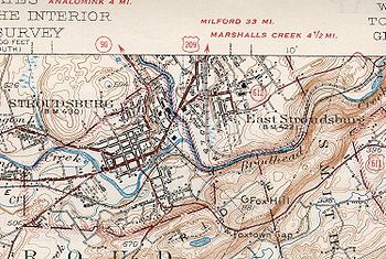
North of the I-80 overpass in downtown Stroudsburg, Route 191 intersects U.S. Route 209 Business, split into one-way couplets. Route 191 departs the downtown area as 5th Street, running north and entering a more mountainous region of The Poconos
. In the northern suburbs of the borough, the route briefly overlaps Pennsylvania Route 447
along the western banks of the Brodhead Creek
. North of the 447 overlap, 191 intersects Pennsylvania Route 715
, while the elevation along Route 191 rises northward. In Paradise Valley
, the road turns north north at the eastern terminus of Pennsylvania Route 940
.
Route 191 then begins an overlap with Pennsylvania Route 390
. The overlap ends in Mountainhome
and 191 runs northwest along Chestnut Mountain. In Pike County, the route is known as La Anna Road for less than a mile.
, Route 191 enters the final county of its course – Wayne. The route enters the county in South Sterling, where it intersects the northern terminus of Pennsylvania Route 423
. Route 191 overlaps Pennsylvania Route 507
in the village of Newfoundland; Pennsylvania Route 447
terminates at the overlap. Away from the overlap with 507, Route 191 runs northwest. In the small village of Collapoose, 191 interchanges with Interstate 84
, at exit 17.
Briefly north of I-84, Route 191 begins a concurrency with Pennsylvania Route 196
. In Hamlin, the overlap intersects Pennsylvania Route 590
. North of the village, Route 191 runs northeast from 196. In Lake Ariel
, Pennsylvania Route 296
terminates at 191. Outside of the hamlet, Route 191 runs northeast as the Lake Ariel Highway.
In Honesdale, Route 191 enters the borough as Erie Street. Main Street, the main arterial of Honesdale, serves as the overlap for U.S. Route 6
and Route 191, for two blocks. North of the overlap, 191 intersects the southern end of Pennsylvania Route 670
. Outside of Honesdale, Route 191 runs northeast, traversing mostly mountainous and rural land. In Rileyville, Route 191 becomes the Hancock Highway and intersects Pennsylvania Route 371
. The Hancock Highway continues northward and begins to parallel the Delaware River
.
Pennsylvania Route 370
, is the final junction of the route in Pennsylvania, approximately two to four miles (6 km) southeast of Hancock, New York
. The Hancock Highway becomes Pennsylvania Avenue, as Route 191 crosses the Delaware River and enters New York
. In Hancock, the short Pennsylvania Avenue intersects New York State Route 97
, less than a mile from exit 87 of New York State Route 17
.
 In the 1920s and 1930s, the first 191 number was designated from the Baltimore Pike
in Clifton Heights
to Penrose Avenue in southwest Philadelphia. The first state highway
numbers to be assigned on the modern Route 191 were Pennsylvania Route 12 and Pennsylvania Route 90. PA 90 was designated from Stroudsburg to the New York-Pennsylvania border. PA 12 was designated from Center Valley
to Stockertown
. From the 1920s to the 1940s, the designation between Stockertown and Stroudsburg had no signed traffic route. When both routes were commissioned, several spurs were as well. For Route 90, the following spurs were assigned in The Poconos
region: Pennsylvania Routes 190, 290
, 390
, 490, and 590
. For Route 12, the following spurs were assigned in The Poconos
and Lehigh Valley
regions: Pennsylvania Routes 212
, 312, 412
, 512
, 612, and 712.
By 1950, PA 90 was designated on the missing non-numbered gap between Stroudsburg and Stockertown. In 1961, Route 191 was commissioned from the New York
state line to U.S. Route 309 in Center Valley. The route replaced the entire designations of PA 12 and PA 90. In Bethlehem, PA 191 was designated onto Wyandotte Street, crossed the Lehigh River
, went onto Main Street, turned onto Elizabeth Avenue, and turned onto Linden Street or Nazareth-Bethlehem Pike north of the city.
By 1970, when Pennsylvania Route 378
was commissioned, PA 191 moved designations slightly in Bethlehem. Southbound 191 came from Nazareth, as Linden Street, and in Bethlehem, it turned west onto Union Boulevard. After it passed underneath I-378, the route turned south onto 3rd Street then onto the I-378 freeway. I-378 terminated at the bridge that crosses the Lehigh River and it continued as PA 191 (Wyandotte Street). By 1976, PA 191 was truncated to end at its current location and Pennsylvania Route 378
(formerly I-378) replaced its former routing from the Lehigh River bridge to Pennsylvania Route 309
in Center Valley.
Pike
No junctions
The New York
state line.
State highway
State highway, state road or state route can refer to one of three related concepts, two of them related to a state or provincial government in a country that is divided into states or provinces :#A...
in the U.S. state
U.S. state
A U.S. state is any one of the 50 federated states of the United States of America that share sovereignty with the federal government. Because of this shared sovereignty, an American is a citizen both of the federal entity and of his or her state of domicile. Four states use the official title of...
of Pennsylvania
Pennsylvania
The Commonwealth of Pennsylvania is a U.S. state that is located in the Northeastern and Mid-Atlantic regions of the United States. The state borders Delaware and Maryland to the south, West Virginia to the southwest, Ohio to the west, New York and Ontario, Canada, to the north, and New Jersey to...
. The route, a major non-freeway corridor connecting the Lehigh Valley
Lehigh Valley
The Lehigh Valley, known officially by the United States Census Bureau as the Allentown-Bethlehem-Easton, PA-NJ metropolitan area and referred to locally as The Valley and A-B-E, is a metropolitan region consisting of Lehigh, Northampton, Berks, and Carbon counties in eastern Pennsylvania and...
to The Poconos
The Poconos
The Pocono Mountains is a region located in northeastern Pennsylvania, United States. The Poconos, located chiefly in Monroe and Pike counties , are an upland of the larger Allegheny Plateau...
in eastern Pennsylvania, is designated from U.S. Route 22
U.S. Route 22 in Pennsylvania
U.S. Route 22 is an east–west route stretching from Cincinnati, Ohio in the west to Newark, New Jersey in the east. In Pennsylvania, the route runs for between the West Virginia state line at Washington County, where it is a limited-access expressway-grade route through the western suburbs...
in Brodhead
Bethlehem Township, Pennsylvania
Bethlehem Township is a township in Northampton County, Pennsylvania, United States. Bethlehem Township is located in the Lehigh Valley region of the state and is a suburb of Bethlehem, Pennsylvania....
to the New York state line over the Delaware River
Delaware River
The Delaware River is a major river on the Atlantic coast of the United States.A Dutch expedition led by Henry Hudson in 1609 first mapped the river. The river was christened the South River in the New Netherland colony that followed, in contrast to the North River, as the Hudson River was then...
at Hancock, New York
Hancock (village), New York
Hancock is a village in Delaware County, New York, United States. The population was 1,189 at the 2000 census.The Village of Hancock is in the west part of the Town of Hancock at the junction of NY Routes 17 and 97....
.
Commissioned in 1961, the route replaced the PA 12 and PA 90 numbers that were in place from the late 1920s to the 1960s. From 1961 to 1976, PA 191 was routed south of US 22 through Bethlehem and terminated at Pennsylvania Route 309
Pennsylvania Route 309
Pennsylvania Route 309 is a major highway which runs for 134 miles through Pennsylvania in the United States. It connects Philadelphia and its northern suburbs to Allentown, Hazleton, and Wilkes-Barre. A limited-access highway portion of PA 309 in the Wilkes-Barre area is known as the North...
in Center Valley
Center Valley, Pennsylvania
Center Valley is an unincorporated village one mile north of Coopersburg, Pennsylvania, at the intersection of Pennsylvania Route 309 and Pennsylvania Route 378 in Upper Saucon Township, Lehigh County, Pennsylvania, in the United States....
. Pennsylvania Route 378
Pennsylvania Route 378
Pennsylvania Route 378 is a north-to-south road in Lehigh and Northampton counties. Its northern terminus is at U.S. Route 22 in Bethlehem and the portion north of the Lehigh River is a freeway. The highway was once Interstate 378 but when Interstate 78 was rerouted from U.S...
replaced the designation from Center Valley to the Lehigh River
Lehigh River
The Lehigh River, a tributary of the Delaware River, is a river located in eastern Pennsylvania, in the United States. Part of the Lehigh, along with a number of its tributaries, is designated a Pennsylvania Scenic River by the state's Department of Conservation and Natural Resources...
crossing in Bethlehem.
Northampton County
Route 191 begins at an interchange with U.S. Route 22 in Bethlehem TownshipBethlehem Township, Pennsylvania
Bethlehem Township is a township in Northampton County, Pennsylvania, United States. Bethlehem Township is located in the Lehigh Valley region of the state and is a suburb of Bethlehem, Pennsylvania....
, as the Nazareth-Bethlehem Pike, a continuation of Linden Street from downtown Bethlehem. From there, PA 191 runs north-east past some rural and agricultural regions of Northampton County
Northampton County, Pennsylvania
As of the 2010 census, the county was 86.3% White, 5.0% Black or African American, 0.2% Native American or Alaskan Native, 2.4% Asian, 0.0% Native Hawaiian, 2.2% were two or more races, and 3.8% were some other race. 10.5% of the population were of Hispanic or Latino ancestry.As of the census of...
. Along the way, it intersects the eastern terminus of Pennsylvania Route 946
Pennsylvania Route 946
Pennsylvania Route 946 is a rural Pennsylvania highway that runs approximately from Berlinsville, Pennsylvania to Newburg, Pennsylvania in Northampton County, Pennsylvania.-Route description:...
in Lower Nazareth Township
Lower Nazareth Township, Pennsylvania
Lower Nazareth Township is a township in Northampton County, Pennsylvania, United States. Lower Nazareth Township is located in the Lehigh Valley region of the state.The population of Lower Nazareth Township was 5,259 at the 2000 census.-Geography:...
.
Route 191 runs west of Nazareth Speedway
Nazareth Speedway
Nazareth Speedway was an auto racing track in Lehigh Valley, Pennsylvania which operated from 1910 to 2004. The track is often associated with local drivers Mario and Michael Andretti. It was associated with Frankie Schneider in its earlier dirt track history....
, at the southern tip of Nazareth. The road enters the small borough from the south, while overlapping Pennsylvania Route 248
Pennsylvania Route 248
Pennsylvania Route 248 is a long state highway in eastern portions of the U.S. state of Pennsylvania. The western terminus of the route is at U.S. Route 209 in Weissport. The eastern terminus is at Pennsylvania Route 611 in Easton....
for one block
City block
A city block, urban block or simply block is a central element of urban planning and urban design. A city block is the smallest area that is surrounded by streets. City blocks are the space for buildings within the street pattern of a city, they form the basic unit of a city's urban fabric...
. North of 248, Route 191 runs northward as Broad Street for three blocks and turns east onto Center Street for one block. The route then turns northward onto New Street in the northern sectors of Nazareth.
Outside of the borough, Route 191 is referenced as East Lawn Avenue, running eastward. Lawn Avenue becomes Industrial Boulevard where Route 191 interchanges Pennsylvania Route 33
Pennsylvania Route 33
Pennsylvania Route 33 is a -long limited-access state highway in eastern Pennsylvania, United States. South of the US 22 interchange, the route is called the Gen. Anthony Clement McAuliffe 101st Airborne Memorial Highway....
. The route turns north onto Main Street, then northeast on Bangor Road in Stockertown. The route traverses several hills and more rural land in Washington Township
Washington Township, Northampton County, Pennsylvania
Washington Township is a township in Northampton County, Pennsylvania, United States. Washington Township is located in the Lehigh Valley region of the state...
. Between Stockertown and Bangor the road runs northeast. In Bangor, Route 191 becomes 1st Street, while intersecting Pennsylvania Route 512
Pennsylvania Route 512
Pennsylvania Route 512 is a long state route in eastern Pennsylvania. The southern terminus is at U.S. Route 22 north of Bethlehem. The northern terminus is at Pennsylvania Route 611 in Upper Mount Bethel Township.-Route description:...
.
Outside of Bangor, Route 191 is known as Valley View Drive. The road traverses the Blue Mountain
Blue Mountain (Pennsylvania)
Blue Mountain is a ridge that forms the eastern edge of the Appalachian mountain range in the U.S. state of Pennsylvania. It cuts across the eastern half of the state from New Jersey to Maryland, providing a distinct boundary between a number of Pennsylvania's geographical and cultural regions...
range at the Northampton-Monroe county line.
Monroe and Pike Counties
Route 191 enters the county at the summit of Blue Mountain as Godfrey Ridge Road. Upon entering Stroudsburg as Broad Street, the road intersects Pennsylvania Route 611Pennsylvania Route 611
Pennsylvania Route 611 is a major state highway in Pennsylvania, United States, running from Interstate 95 south of downtown Philadelphia north to Interstate 380 in Coolbaugh Township, Pennsylvania in The Poconos....
. Traffic from 611 north has access only to I-80 east and US 209
U.S. Route 209
U.S. Route 209 is a long U.S. highway in the states of Pennsylvania and New York. Although the route is a spur of U.S. Route 9, US 209 never intersects US 9, making the connection via U.S. Route 9W instead. The southern terminus of the route is at Pennsylvania...
northbound. Traffic from 191 north has access to I-80 west and US 209 southbound.
North of the I-80 overpass in downtown Stroudsburg, Route 191 intersects U.S. Route 209 Business, split into one-way couplets. Route 191 departs the downtown area as 5th Street, running north and entering a more mountainous region of The Poconos
The Poconos
The Pocono Mountains is a region located in northeastern Pennsylvania, United States. The Poconos, located chiefly in Monroe and Pike counties , are an upland of the larger Allegheny Plateau...
. In the northern suburbs of the borough, the route briefly overlaps Pennsylvania Route 447
Pennsylvania Route 447
Pennsylvania Route 447 is a 26.3 mile long north–south state route located in northeast Pennsylvania in The Poconos. The southern terminus of the route is at Interstate 80 and U.S. Route 209 in Smithfield Township. The northern terminus is at Pennsylvania Route 191 and Pennsylvania Route...
along the western banks of the Brodhead Creek
Brodhead Creek
Brodhead Creek is a tributary of the Delaware River in the Poconos of eastern Pennsylvania in the United States. It is formed by the union of Middle and Levitt branches in Barrett Township in Monroe County. The native name was "Analomink". The present name was given for Daniel Brodhead, a...
. North of the 447 overlap, 191 intersects Pennsylvania Route 715
Pennsylvania Route 715
Pennsylvania Route 715 is a long north–south state route located entirely in Monroe County, Pennsylvania. Its southern terminus is at U.S. Route 209 in the Chestnuthill Township hamlet of Brodheadsville...
, while the elevation along Route 191 rises northward. In Paradise Valley
Paradise Township, Monroe County, Pennsylvania
Paradise Township is a township in Monroe County, Pennsylvania in the Pocono Mountains. The population was 2,671 at the 2000 census.-Geography:...
, the road turns north north at the eastern terminus of Pennsylvania Route 940
Pennsylvania Route 940
Pennsylvania Route 940 is a long Pennsylvania highway located in the sparsely-developed Poconos. It runs from Pennsylvania Route 309 in Hazleton to Pennsylvania Route 191 in Paradise Valley. Large segments of PA 940 are located in densely forested areas....
.
Route 191 then begins an overlap with Pennsylvania Route 390
Pennsylvania Route 390
Pennsylvania Route 390 is an long state highway located in Monroe, and Pike counties in Pennsylvania. The southern terminus is at PA 940 near Paradise Township. The major routes that PA 390 joins are PA 191, PA 447, and I-84. The northern terminus is at PA 507 in Tafton View.Along the route, PA...
. The overlap ends in Mountainhome
Mountainhome, Pennsylvania
Mountainhome is a census-designated place in Monroe County, Pennsylvania, United States. The population was 1,169 at the 2000 census.-Geography:Mountainhome is located at ....
and 191 runs northwest along Chestnut Mountain. In Pike County, the route is known as La Anna Road for less than a mile.
Wayne County
In the upper regions of The PoconosThe Poconos
The Pocono Mountains is a region located in northeastern Pennsylvania, United States. The Poconos, located chiefly in Monroe and Pike counties , are an upland of the larger Allegheny Plateau...
, Route 191 enters the final county of its course – Wayne. The route enters the county in South Sterling, where it intersects the northern terminus of Pennsylvania Route 423
Pennsylvania Route 423
Pennsylvania Route 423 is a state route in Monroe and Wayne Counties in Pennsylvania. It runs for , crossing through the Wyoming Valley from Route 940 in Pocono Pines to Route 191 in South Sterling.Route 423 was established in 1965...
. Route 191 overlaps Pennsylvania Route 507
Pennsylvania Route 507
Pennsylvania Route 507 is a long state highway located in Monroe, Wayne, and Pike counties in Pennsylvania. The southern terminus is at I 380 near Gouldsboro. The northern terminus is at US 6 in Palmyra Township. PA 507 runs nearly parallel to Lake Wallenpaupack for the northern section. In...
in the village of Newfoundland; Pennsylvania Route 447
Pennsylvania Route 447
Pennsylvania Route 447 is a 26.3 mile long north–south state route located in northeast Pennsylvania in The Poconos. The southern terminus of the route is at Interstate 80 and U.S. Route 209 in Smithfield Township. The northern terminus is at Pennsylvania Route 191 and Pennsylvania Route...
terminates at the overlap. Away from the overlap with 507, Route 191 runs northwest. In the small village of Collapoose, 191 interchanges with Interstate 84
Interstate 84 (east)
Interstate 84 is an Interstate Highway extending from Dunmore, Pennsylvania at an interchange with Interstate 81 to Sturbridge, Massachusetts, at an interchange with the Massachusetts Turnpike . I-84 has mile-log junction numbering in Pennsylvania; otherwise, exit numbers are roughly sequential...
, at exit 17.
Briefly north of I-84, Route 191 begins a concurrency with Pennsylvania Route 196
Pennsylvania Route 196
Pennsylvania Route 196 is a major highway in the Pennsylvania Highway System with a length of . It runs from Pennsylvania Route 940 and Pennsylvania Route 611 in Mount Pocono to Pennsylvania Route 296 in Varden.-Route description:...
. In Hamlin, the overlap intersects Pennsylvania Route 590
Pennsylvania Route 590
Pennsylvania Route 590 is a long state highway located in Lackawanna, Wayne, and Pike counties in Pennsylvania. The western terminus is at PA 435 in Elmhurst Township. The eastern terminus is at PA 434 in Lackawaxen Township....
. North of the village, Route 191 runs northeast from 196. In Lake Ariel
Lake Ariel, Pennsylvania
Lake Ariel is an unincorporated community in Wayne County, Pennsylvania, United States. It was once the site of an amusement park. The main intersection is dominated by Saint Thomas More Roman Catholic Church, lake elementary school, and the Howe Convenient Market.Located in northeastern...
, Pennsylvania Route 296
Pennsylvania Route 296
Pennsylvania Route 296 is an long state highway located in Wayne County in Pennsylvania. The southern terminus is at Route 191 in Lake Ariel...
terminates at 191. Outside of the hamlet, Route 191 runs northeast as the Lake Ariel Highway.
In Honesdale, Route 191 enters the borough as Erie Street. Main Street, the main arterial of Honesdale, serves as the overlap for U.S. Route 6
U.S. Route 6
U.S. Route 6 , also called the Grand Army of the Republic Highway, a name that honors an American Civil War veterans association, is a main route of the U.S. Highway system, running east-northeast from Bishop, California to Provincetown, Massachusetts. Until 1964, it continued south from Bishop to...
and Route 191, for two blocks. North of the overlap, 191 intersects the southern end of Pennsylvania Route 670
Pennsylvania Route 670
Pennsylvania Route 670 is an long state highway located in Wayne County in Pennsylvania. The southern terminus is at Route 191 in Honesdale...
. Outside of Honesdale, Route 191 runs northeast, traversing mostly mountainous and rural land. In Rileyville, Route 191 becomes the Hancock Highway and intersects Pennsylvania Route 371
Pennsylvania Route 371
Pennsylvania Route 371 is a 23.45-mile long state highway located in Susquehanna and Wayne Counties. The western terminus is at Route 171 / Route 374 near the community of Union Dale in Herrick Center...
. The Hancock Highway continues northward and begins to parallel the Delaware River
Delaware River
The Delaware River is a major river on the Atlantic coast of the United States.A Dutch expedition led by Henry Hudson in 1609 first mapped the river. The river was christened the South River in the New Netherland colony that followed, in contrast to the North River, as the Hudson River was then...
.
Pennsylvania Route 370
Pennsylvania Route 370
Pennsylvania Route 370 is an long state highway located in Susquehanna and Wayne counties in Pennsylvania. The western terminus is at Route 171 in East Ararat. The eastern terminus is at Route 191 in Buckingham Township near Hancock, New York...
, is the final junction of the route in Pennsylvania, approximately two to four miles (6 km) southeast of Hancock, New York
Hancock (town), New York
Hancock is a town in Delaware County, New York, United States. The town contains a village, also named Hancock. The town is in the southwest part of the county...
. The Hancock Highway becomes Pennsylvania Avenue, as Route 191 crosses the Delaware River and enters New York
New York
New York is a state in the Northeastern region of the United States. It is the nation's third most populous state. New York is bordered by New Jersey and Pennsylvania to the south, and by Connecticut, Massachusetts and Vermont to the east...
. In Hancock, the short Pennsylvania Avenue intersects New York State Route 97
New York State Route 97
New York State Route 97 is a north–south scenic route in southern New York, United States. It runs from U.S. Route 6 and US 209 in Port Jervis to NY 17 in Hancock. Its most famous feature is the Hawk's Nest, a tightly winding section of the road along the Delaware River,...
, less than a mile from exit 87 of New York State Route 17
New York State Route 17
New York State Route 17 is a state highway that extends for through the Southern Tier and Downstate regions of New York in the United States...
.
History
Baltimore Pike
thumb|[[SEPTA]]'s [[SEPTA Route 34|Route 34]] streetcar line runs through the 4500 block of Baltimore Avenue in [[West Philadelphia]]The Baltimore Pike was an auto trail in the United States, connecting Baltimore, Maryland with Philadelphia, Pennsylvania....
in Clifton Heights
Clifton Heights, Pennsylvania
Clifton Heights is a borough in Delaware County, Pennsylvania, six miles west of downtown Philadelphia and on Darby Creek. The population was at 2,330 in 1900, and 3,155 in 1910...
to Penrose Avenue in southwest Philadelphia. The first state highway
State highway
State highway, state road or state route can refer to one of three related concepts, two of them related to a state or provincial government in a country that is divided into states or provinces :#A...
numbers to be assigned on the modern Route 191 were Pennsylvania Route 12 and Pennsylvania Route 90. PA 90 was designated from Stroudsburg to the New York-Pennsylvania border. PA 12 was designated from Center Valley
Center Valley, Pennsylvania
Center Valley is an unincorporated village one mile north of Coopersburg, Pennsylvania, at the intersection of Pennsylvania Route 309 and Pennsylvania Route 378 in Upper Saucon Township, Lehigh County, Pennsylvania, in the United States....
to Stockertown
Stockertown, Pennsylvania
Stockertown is a borough in Northampton County, Pennsylvania, United States. It is located in the Lehigh Valley region of the state.The small borough contains large industries, such as, Hercules Cement, Polymer Products, and Praxair. The Borough is located within a 2-mile radius and provides...
. From the 1920s to the 1940s, the designation between Stockertown and Stroudsburg had no signed traffic route. When both routes were commissioned, several spurs were as well. For Route 90, the following spurs were assigned in The Poconos
The Poconos
The Pocono Mountains is a region located in northeastern Pennsylvania, United States. The Poconos, located chiefly in Monroe and Pike counties , are an upland of the larger Allegheny Plateau...
region: Pennsylvania Routes 190, 290
Pennsylvania Route 290
Pennsylvania Route 290 is a long state highway located in the city of Erie, Pennsylvania. The western terminus of the route is at Interstate 79 and Pennsylvania Route 5 in the neighborhood of Dock Junction...
, 390
Pennsylvania Route 390
Pennsylvania Route 390 is an long state highway located in Monroe, and Pike counties in Pennsylvania. The southern terminus is at PA 940 near Paradise Township. The major routes that PA 390 joins are PA 191, PA 447, and I-84. The northern terminus is at PA 507 in Tafton View.Along the route, PA...
, 490, and 590
Pennsylvania Route 590
Pennsylvania Route 590 is a long state highway located in Lackawanna, Wayne, and Pike counties in Pennsylvania. The western terminus is at PA 435 in Elmhurst Township. The eastern terminus is at PA 434 in Lackawaxen Township....
. For Route 12, the following spurs were assigned in The Poconos
The Poconos
The Pocono Mountains is a region located in northeastern Pennsylvania, United States. The Poconos, located chiefly in Monroe and Pike counties , are an upland of the larger Allegheny Plateau...
and Lehigh Valley
Lehigh Valley
The Lehigh Valley, known officially by the United States Census Bureau as the Allentown-Bethlehem-Easton, PA-NJ metropolitan area and referred to locally as The Valley and A-B-E, is a metropolitan region consisting of Lehigh, Northampton, Berks, and Carbon counties in eastern Pennsylvania and...
regions: Pennsylvania Routes 212
Pennsylvania Route 212
Pennsylvania Route 212 is a state highway in Bucks County, Pennsylvania. The route runs from Pennsylvania Route 313 in Quakertown northeast to Pennsylvania Route 611 in Durham Township, just south of the borough of Riegelsville.-Route description:...
, 312, 412
Pennsylvania Route 412
Pennsylvania Route 412 is a long north–south state route located in Northampton and Bucks counties in southeastern Pennsylvania. Its southern terminus is at Pennsylvania Route 611 in the Nockamixon Township community of Harrow...
, 512
Pennsylvania Route 512
Pennsylvania Route 512 is a long state route in eastern Pennsylvania. The southern terminus is at U.S. Route 22 north of Bethlehem. The northern terminus is at Pennsylvania Route 611 in Upper Mount Bethel Township.-Route description:...
, 612, and 712.
By 1950, PA 90 was designated on the missing non-numbered gap between Stroudsburg and Stockertown. In 1961, Route 191 was commissioned from the New York
New York
New York is a state in the Northeastern region of the United States. It is the nation's third most populous state. New York is bordered by New Jersey and Pennsylvania to the south, and by Connecticut, Massachusetts and Vermont to the east...
state line to U.S. Route 309 in Center Valley. The route replaced the entire designations of PA 12 and PA 90. In Bethlehem, PA 191 was designated onto Wyandotte Street, crossed the Lehigh River
Lehigh River
The Lehigh River, a tributary of the Delaware River, is a river located in eastern Pennsylvania, in the United States. Part of the Lehigh, along with a number of its tributaries, is designated a Pennsylvania Scenic River by the state's Department of Conservation and Natural Resources...
, went onto Main Street, turned onto Elizabeth Avenue, and turned onto Linden Street or Nazareth-Bethlehem Pike north of the city.
By 1970, when Pennsylvania Route 378
Pennsylvania Route 378
Pennsylvania Route 378 is a north-to-south road in Lehigh and Northampton counties. Its northern terminus is at U.S. Route 22 in Bethlehem and the portion north of the Lehigh River is a freeway. The highway was once Interstate 378 but when Interstate 78 was rerouted from U.S...
was commissioned, PA 191 moved designations slightly in Bethlehem. Southbound 191 came from Nazareth, as Linden Street, and in Bethlehem, it turned west onto Union Boulevard. After it passed underneath I-378, the route turned south onto 3rd Street then onto the I-378 freeway. I-378 terminated at the bridge that crosses the Lehigh River and it continued as PA 191 (Wyandotte Street). By 1976, PA 191 was truncated to end at its current location and Pennsylvania Route 378
Pennsylvania Route 378
Pennsylvania Route 378 is a north-to-south road in Lehigh and Northampton counties. Its northern terminus is at U.S. Route 22 in Bethlehem and the portion north of the Lehigh River is a freeway. The highway was once Interstate 378 but when Interstate 78 was rerouted from U.S...
(formerly I-378) replaced its former routing from the Lehigh River bridge to Pennsylvania Route 309
Pennsylvania Route 309
Pennsylvania Route 309 is a major highway which runs for 134 miles through Pennsylvania in the United States. It connects Philadelphia and its northern suburbs to Allentown, Hazleton, and Wilkes-Barre. A limited-access highway portion of PA 309 in the Wilkes-Barre area is known as the North...
in Center Valley.
Major intersections
Pike County, Pennsylvania
-National protected areas:* Delaware Water Gap National Recreation Area * Middle Delaware National Scenic River * Upper Delaware Scenic and Recreational River -Demographics:...
New York
New York is a state in the Northeastern region of the United States. It is the nation's third most populous state. New York is bordered by New Jersey and Pennsylvania to the south, and by Connecticut, Massachusetts and Vermont to the east...
state line.