
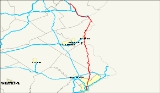
Pennsylvania Route 611
Overview
State highway
State highway, state road or state route can refer to one of three related concepts, two of them related to a state or provincial government in a country that is divided into states or provinces :#A...
in Pennsylvania
Pennsylvania
The Commonwealth of Pennsylvania is a U.S. state that is located in the Northeastern and Mid-Atlantic regions of the United States. The state borders Delaware and Maryland to the south, West Virginia to the southwest, Ohio to the west, New York and Ontario, Canada, to the north, and New Jersey to...
, United States
United States
The United States of America is a federal constitutional republic comprising fifty states and a federal district...
, running from Interstate 95
Interstate 95 in Pennsylvania
Interstate 95 is an Interstate highway running from Miami, Florida north to Houlton, Maine. In the U.S. state of Pennsylvania, the route is known by many as the Delaware Expressway, but is officially named The Vietnam Veterans Memorial Highway. and locally known as "95"...
south of downtown Philadelphia
Philadelphia, Pennsylvania
Philadelphia is the largest city in the Commonwealth of Pennsylvania and the county seat of Philadelphia County, with which it is coterminous. The city is located in the Northeastern United States along the Delaware and Schuylkill rivers. It is the fifth-most-populous city in the United States,...
north to Interstate 380
Interstate 380 (Pennsylvania)
Interstate 380 is a spur highway in northeast Pennsylvania that connects Interstate 80 with Interstate 81 and Interstate 84. The northern terminus of I-380 is at Interstate 84 near Elmhurst, PA; the southern terminus is in Tunkhannock Township at the junction with Interstate 80. The entire length...
in Coolbaugh Township, Pennsylvania
Coolbaugh Township, Pennsylvania
Coolbaugh Township is a township in Monroe County, Pennsylvania, United States. The population was 15,205 at the 2000 census. Tobyhanna State Park is in Coolbaugh Township.-Geography:...
in The Poconos
The Poconos
The Pocono Mountains is a region located in northeastern Pennsylvania, United States. The Poconos, located chiefly in Monroe and Pike counties , are an upland of the larger Allegheny Plateau...
.
Within Philadelphia, PA 611 is also Broad Street
Broad Street (Philadelphia)
Broad Street is a major arterial street in Philadelphia, Pennsylvania, and is nearly 13 miles long.It is Pennsylvania Route 611 along its entire length with the exception of its northernmost part between Old York Road and Pennsylvania Route 309 and the southernmost part south of Interstate 95...
(except for the five blocks just south of Cheltenham Avenue, where PA 611 bears right onto Old York Road), the main north–south street in Philadelphia and the traditional route for the annual Mummers Parade
Mummers Parade
The Mummers Parade is held each New Year's Day in Philadelphia, Pennsylvania. Local clubs compete in one of four categories . They prepare elaborate costumes and moveable scenery, which take months to complete...
.
PA 611 is mostly Broad Street
Broad Street (Philadelphia)
Broad Street is a major arterial street in Philadelphia, Pennsylvania, and is nearly 13 miles long.It is Pennsylvania Route 611 along its entire length with the exception of its northernmost part between Old York Road and Pennsylvania Route 309 and the southernmost part south of Interstate 95...
in Philadelphia, a major avenue that runs north and south through Central Philadelphia
Center City, Philadelphia
Center City, or Downtown Philadelphia includes the central business district and central neighborhoods of the City of Philadelphia, Pennsylvania, United States. As of 2005, its population of over 88,000 made it the third most populous downtown in the United States, after New York City's and Chicago's...
.