
City block
Encyclopedia

Urban planning
Urban planning incorporates areas such as economics, design, ecology, sociology, geography, law, political science, and statistics to guide and ensure the orderly development of settlements and communities....
and urban design
Urban design
Urban design concerns the arrangement, appearance and functionality of towns and cities, and in particular the shaping and uses of urban public space. It has traditionally been regarded as a disciplinary subset of urban planning, landscape architecture, or architecture and in more recent times has...
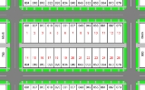
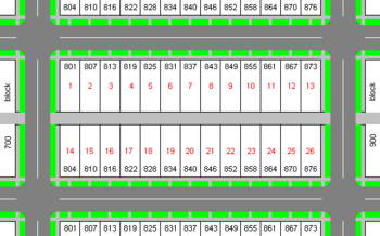
. A city block is the smallest area that is surrounded by street
Street
A street is a paved public thoroughfare in a built environment. It is a public parcel of land adjoining buildings in an urban context, on which people may freely assemble, interact, and move about. A street can be as simple as a level patch of dirt, but is more often paved with a hard, durable...
s. City blocks are the space for buildings within the street pattern of a city, they form the basic unit of a city's urban fabric. City blocks may be subdivided into any number of smaller lots or parcels of land
Lot (real estate)
In real estate, a lot or plot is a tract or parcel of land owned or meant to be owned by some owner. A lot is essentially considered a parcel of real property in some countries or immovable property in other countries...
usually in private ownership, though in some cases, it may be other forms of tenure. City blocks are usually built-up to varying degrees and thus form the physical containers or 'streetwalls' of public space. Most cities are composed of a greater or lesser variety of sizes and shapes of urban block. For example, many pre-industrial cores of cities in Europe, Asia and the Middle-east tend to have irregularly shaped street patterns and urban blocks, while cities based on grids have much more regular arrangements.
Grid plan
In most cities of the world that were planned, rather than developing gradually over a long period of time, streets are typically laid out on a grid planGrid plan
The grid plan, grid street plan or gridiron plan is a type of city plan in which streets run at right angles to each other, forming a grid...
, so that city blocks are square or rectangular. Using the perimeter block development principle, city blocks are developed so that building
Building
In architecture, construction, engineering, real estate development and technology the word building may refer to one of the following:...
s are located along the perimeter of the block, with entrances facing the street
Street
A street is a paved public thoroughfare in a built environment. It is a public parcel of land adjoining buildings in an urban context, on which people may freely assemble, interact, and move about. A street can be as simple as a level patch of dirt, but is more often paved with a hard, durable...
, and semi-private courtyard
Courtyard
A court or courtyard is an enclosed area, often a space enclosed by a building that is open to the sky. These areas in inns and public buildings were often the primary meeting places for some purposes, leading to the other meanings of court....
s in the rear of the buildings. This arrangement is intended to provide good social interaction among people.
Since the spacing of streets in grid plans varies so widely among cities, or even within cities, it is difficult to generalize about the size of a city block. However, as reference points,the standard square blocks of Portland, Houston and Sacramento are 260 by 260 ft (79.2 by 79.2 m), 330 by 330 ft (100.6 by 100.6 m) and 410 by 410 ft (125 by 125 m) respectively (to the street center line). Oblong blocks range considerably in width and length. The standard block in Manhattan
Commissioners' Plan of 1811
The Commissioners' Plan of 1811 was the original design plan for the streets of Manhattan, which put in place the grid plan that has defined Manhattan to this day....
is about 264 by 900 ft (80.5 by 274.3 m); and in some U.S. cities standard blocks are as wide as 660 feet (201.2 m). The blocks in central Melbourne, Australia, are 660 by 330 ft (201.2 by 100.6 ), formed by splitting the square blocks in an original grid
Hoddle Grid
The Hoddle Grid is the layout of the streets in the centre of the central business district of Melbourne. Named after its designer, Robert Hoddle, the Grid was laid out in 1837, and later extended...
with a narrow street down the middle.
Many world cities have grown by accretion over time rather than being planned from the outset. For this reason, a regular pattern of even, square or rectangular city blocks is not so common among European cities, for example. Following the example of Philadelphia, New York City adopted the Commissioners' Plan of 1811
Commissioners' Plan of 1811
The Commissioners' Plan of 1811 was the original design plan for the streets of Manhattan, which put in place the grid plan that has defined Manhattan to this day....
for a more extensive grid plan
Grid plan
The grid plan, grid street plan or gridiron plan is a type of city plan in which streets run at right angles to each other, forming a grid...
. By the middle of the 20th century, the adoption of the uniform, rectilinear block, subsides almost completely and more picturesque layouts prevailed, with random sized and either curvilinear or non-orthogonal blocks and corresponding street patterns.
In much of the United States
United States
The United States of America is a federal constitutional republic comprising fifty states and a federal district...
and Canada
Canada
Canada is a North American country consisting of ten provinces and three territories. Located in the northern part of the continent, it extends from the Atlantic Ocean in the east to the Pacific Ocean in the west, and northward into the Arctic Ocean...
, the addressing systems
Address (geography)
An address is a collection of information, presented in a mostly fixed format, used for describing the location of a building, apartment, or other structure or a plot of land, generally using political boundaries and street names as references, along with other identifiers such as house or...
follow a block and lot number system, in which each block of a street is allotted 100 building numbers.
Use of block as a unit of distance
In North American EnglishNorth American English
North American English is the variety of the English language of North America, including that of the United States and Canada. Because of their shared histories and the similarities between the pronunciation, vocabulary and accent of American English and Canadian English, the two spoken languages...
the term block is used as an informal unit of distance; for example, when giving directions (e.g. "It's three blocks from here.").
In British English
British English
British English, or English , is the broad term used to distinguish the forms of the English language used in the United Kingdom from forms used elsewhere...
the term is scarcely used to convey a measure of distance due to the lack of 'blocks' in most cities; it is, however, used when making short trips around a nearby road of an estate. (e.g. "I'm taking the dog out for a walk around the block")
Superblock
Superblocks were popular during the early and mid-20th century, arising from modernistModernism
Modernism, in its broadest definition, is modern thought, character, or practice. More specifically, the term describes the modernist movement, its set of cultural tendencies and array of associated cultural movements, originally arising from wide-scale and far-reaching changes to Western society...
ideas in architecture and urban planning. A superblock is much larger than a traditional city block, with greater setback for buildings, and is typically bounded by widely spaced, high-speed, arterial or circulating routes rather than by local streets.
Superblocks are often associated with suburb
Suburb
The word suburb mostly refers to a residential area, either existing as part of a city or as a separate residential community within commuting distance of a city . Some suburbs have a degree of administrative autonomy, and most have lower population density than inner city neighborhoods...
s, planned cities
New town
A new town is a specific type of a planned community, or planned city, that was carefully planned from its inception and is typically constructed in a previously undeveloped area. This contrasts with settlements that evolve in a more ad hoc fashion. Land use conflicts are uncommon in new...
, and the urban renewal
Urban renewal
Urban renewal is a program of land redevelopment in areas of moderate to high density urban land use. Renewal has had both successes and failures. Its modern incarnation began in the late 19th century in developed nations and experienced an intense phase in the late 1940s – under the rubric of...
of the mid-20th century; that is, in areas in which a street hierarchy
Street hierarchy
The street hierarchy is an urban design technique for laying out road networks that exclude automobile through-traffic from developed areas. It is conceived as a hierarchy of roads that embeds the link importance of each road type in the network topology...
has replaced the traditional grid. In a residential area of a suburb, the interior of the superblock is typically served by cul-de-sac
Cul-de-sac
A cul-de-sac is a word of French origin referring to a dead end, close, no through road or court meaning dead-end street with only one inlet/outlet...
or looped streets. Superblocks can also be found in central city areas, where they are more often associated with institutional, educational, recreational and corporate rather than residential uses.
Urban planner Clarence Perry argued for use of superblocks and related ideas in his "neighborhood unit" plan, which aimed to organize space in a way that is more pedestrian
Pedestrian
A pedestrian is a person traveling on foot, whether walking or running. In some communities, those traveling using roller skates or skateboards are also considered to be pedestrians. In modern times, the term mostly refers to someone walking on a road or footpath, but this was not the case...
-friendly and provided open plaza
Plaza
Plaza is a Spanish word related to "field" which describes an open urban public space, such as a city square. All through Spanish America, the plaza mayor of each center of administration held three closely related institutions: the cathedral, the cabildo or administrative center, which might be...
s and other space for residents to socialize. The same intention to facilitate pedestrian movement and socializing is captured by an influential 1989 conceptual design of a Pedestrian Pocket
Peter Calthorpe
Peter Calthorpe is a San Francisco-based architect, urban designer and urban planner. He is a founding member of the Congress for New Urbanism, a Chicago-based advocacy group formed in 1992 that promotes sustainable building practices.-Biography:...
(see diagram). It is, similarly, a superblock composed of nine normal city blocks clustered around a light rail station and a central open space. Its circulation pattern consists primarily of a dense pedestrian network which is complementary to but independent from the car network. Access by car is provided by means of three loops. This superblock differs from Perry’s concept in that it makes it impossible for cars to traverse it rather than very difficult; it is car-impermeable.
In the 1930s, superblocks were often used in urban renewal public housing
Public housing
Public housing is a form of housing tenure in which the property is owned by a government authority, which may be central or local. Social housing is an umbrella term referring to rental housing which may be owned and managed by the state, by non-profit organizations, or by a combination of the...
projects in American cities. In using superblocks, housing projects aimed to eliminate back alley
Alley
An alley or alleyway is a narrow lane found in urban areas, often for pedestrians only, which usually runs between or behind buildings. In older cities and towns in Europe, alleys are often what is left of a medieval street network, or a right of way or ancient footpath in an urban setting...
s, which were often associated with slum
Slum
A slum, as defined by United Nations agency UN-HABITAT, is a run-down area of a city characterized by substandard housing and squalor and lacking in tenure security. According to the United Nations, the percentage of urban dwellers living in slums decreased from 47 percent to 37 percent in the...
conditions.
Superblocks are also used when functional units such as rail yards or shipyards, inherited from the 19th and early 20th centuries, are too big to fit in an average city block. A contemporary function which reflects ancient practices that also requires larger than typical blocks is the sports stadium or arena. Just as the Coliseum in ancient Rome, sports complexes require superblocks. The PGE Stadium in Portland, for example, takes up six normal city blocks as does the equally large Greensboro Coliseum
Greensboro Coliseum
The Greensboro Coliseum Complex is an entertainment complex located in College Hill neighborhood of Greensboro, North Carolina. Opening in 1959, the arena was one of the largest venues in the South, with a seating capacity of over 7,000...
in North Carolina. Other contemporary institutions, establishments or functions that require superblocks are: city halls, as in Boston and Toronto; regional general hospitals or specialized medical centres; convention and exhibition centers, as the CNE in Toronto and Boston; and downtown enclosed Shopping Malls such as Eaton Centre in Toronto, echoing the large gallerias
Galleria Vittorio Emanuele II
The Galleria Vittorio Emanuele II is a double arcade in the center of Milan, Italy. The structure is formed by two glass-vaulted arcades intersecting in an octagon covering the street connecting Piazza del Duomo to Piazza della Scala....
of the 19th century. Cultural complexes, such as the Lincoln Centre in NY, often occupy a superblock achieved through the consolidation of regular city blocks. A recent superblock user is the merchandise distribution centre. These centres can range in area from one to ten city blocks.
Most notably, however, the largest superblocks in contemporary cities are used by university and college campuses such as Massachusetts Institute of Technology, the University of Illinois at Chicago the City College of New York
City College of New York
The City College of the City University of New York is a senior college of the City University of New York , in New York City. It is also the oldest of the City University's twenty-three institutions of higher learning...
, Columbia University and the University of Alberta
University of Alberta
The University of Alberta is a public research university located in Edmonton, Alberta, Canada. Founded in 1908 by Alexander Cameron Rutherford, the first premier of Alberta and Henry Marshall Tory, its first president, it is widely recognized as one of the best universities in Canada...
in Edmonton. The “campus” impact on the city block structure is quite prominent particularly in small university towns such as Waterloo, Ontario or Ithaca, NY where the university superblock counts for a sizeable portion of the total city area. Campuses, in general, are fully walkable and sociable environments within the superblock structure.
Additional users of the superblock concept are contemporary large national or multinational corporations who followed the “campus” model and introduced their own superblocks in cities, as Google did in Mountain view, CA, IBM in Somers, NY and Apple and HP in San Jose, CA.
Social and housing agencies in the US, Canada and the UK used the superblock model for large housing projects such as Regent Park in Toronto and Benny Farm in Montreal, Canada. In New York City, the Stuyvesant Town
Stuyvesant Town
Stuyvesant Town—Peter Cooper Village is a large private residential development on the East Side of the borough of Manhattan in New York City, and one of the most iconic and successful post-World War II private housing communities...
private market, residential development superblock takes up about 18 normal city blocks and provides a large green amenity for its residents and neighbours. It uses crescent (loop) rather than cul-de-sac streets inside the superblock and an extensive network of paths that provide excellent connectivity within the block and to the neighbouring areas (see drawing).
A well-known example of a superblock is the World Trade Center
World Trade Center
The original World Trade Center was a complex with seven buildings featuring landmark twin towers in Lower Manhattan, New York City, United States. The complex opened on April 4, 1973, and was destroyed in 2001 during the September 11 attacks. The site is currently being rebuilt with five new...
site in New York City
New York City
New York is the most populous city in the United States and the center of the New York Metropolitan Area, one of the most populous metropolitan areas in the world. New York exerts a significant impact upon global commerce, finance, media, art, fashion, research, technology, education, and...
, where several streets of Manhattan's downtown grid were removed and de-mapped to make room for the center.
Where the superblock is used for housing projects, such as the Stuyvesant Town the advantages sought are an improved separation of vehicular and pedestrian circulation, enhanced tranquility and reduced accident risk within the neighbourhood. This separation has been achieved with exemplary environmental and social benefits in a new (2003), internationally recognized, rail suburb of Freiburg,Germany - Vauban
Vauban, Freiburg
Vauban is a new neighborhood of 5,000 inhabitants and 600 jobs 4 km to the south of the town center in Freiburg, Germany. It was built as "a sustainable model district" on the site of a former French military base, and is named after Sébastien Le Prestre de Vauban, the 17th century French...
. Its site layout consists mainly of a superblock with a central pedestrian spine and a few narrow looped and cul-de-sac streets. The same separation can be found on many university and college campuses which are generally considered as vibrant, socially thriving communities. On some university campuses the extensive and exclusive pedestrian path network at grade is supplemented with below grade paths. New Urbanists would argue that separating circulation modes effectively kills the social interaction that bolsters urban areas.
The British new town
New town
A new town is a specific type of a planned community, or planned city, that was carefully planned from its inception and is typically constructed in a previously undeveloped area. This contrasts with settlements that evolve in a more ad hoc fashion. Land use conflicts are uncommon in new...
of Milton Keynes
Milton Keynes
Milton Keynes , sometimes abbreviated MK, is a large town in Buckinghamshire, in the south east of England, about north-west of London. It is the administrative centre of the Borough of Milton Keynes...
is built around a grid of one-kilometre square superblocks.(see drawing)
For functional, organizational, economic and planning reasons the superblock model continues to be used extensively.
Unplanned, emergent superblocks
Virtual, unplanned superblocks have emerged in many cities worldwide as the inevitable outcome of stepwise modifications to streets and traffic. Most such superblocks have occurred in European city centres where the street network originates in the medieval or earlier periods. Not only is the street pattern labyrinthine, but also numerous streets that constitute it have dimensions incapable of accommodating two crossing cars or one car and pedestrians, excluding the need for parking or emergency access. Such geometric constraints and the resulting chaotic traffic conditions, along with deteriorating air quality, forced cities to remove motorized traffic from such streets. In certain cases, such as the city of Bremen, Germany, the cumulative effect of excluding motorized traffic from a number of streets made it impossible to cross the old city centre by car. The centre, however, remains completely traversable on foot or bicycle; a condition that resembles in principle the planned superblock and incorporates its design intentions. Some cities, such as Montpellier, France expanded the exclusion of traffic from the entire old centre.
The superblock concept has also been applied retroactively in Barcelona’s Ribera and Gracia districts with positive outcomes. In these two cases it resulted in an increase of journeys on foot (>10%) and by bicycle (>15%) and in higher level of commercial and service activity. The concept is now being considered for application on Idelfonse Cerdà
Cerdà
Cerdà is a municipality in the comarca of Costera in the Valencian Community, Spain....
’s grid.
Perimeter block
A perimeter block is a type of city block which is built up on all sides surrounding a central space that is semi-private. They may contain a mixture of uses, with commercial or retail functions on the ground floor. Perimeter blocks are a key component of many European cities and are an urban form that allows very high urban densitiesUrban density
Urban density is a term used in urban planning and urban design to refer to the number of people inhabiting a given urbanized area. As such it is to be distinguished from other measures of population density. Urban density is considered an important factor in understanding how cities function...
to be achieved without high-rise buildings.
Online uses of blocks
There have been online innovations and websites such as msnbc.com owned EveryBlock which uses geo-specific feeds from neighborhood blogs, Flickr, Yelp, Craigslist, Youtube, Twitter, Facebook and other aggregated data to give readers a picture of what is going on in their town or neighborhood down to the block.See also
- Census blockCensus blockA census block is the smallest geographic unit used by the United States Census Bureau for tabulation of 100-percent data . Several blocks make up block groups, which again make up census tracts. There are on average about 39 blocks per block group, but there are variations...
- Manhattan distance
- Mixed-use developmentMixed-use developmentMixed-use development is the use of a building, set of buildings, or neighborhood for more than one purpose. Since the 1920s, zoning in some countries has required uses to be separated. However, when jobs, housing, and commercial activities are located close together, a community's transportation...
- Urban designUrban designUrban design concerns the arrangement, appearance and functionality of towns and cities, and in particular the shaping and uses of urban public space. It has traditionally been regarded as a disciplinary subset of urban planning, landscape architecture, or architecture and in more recent times has...
- Urban planningUrban planningUrban planning incorporates areas such as economics, design, ecology, sociology, geography, law, political science, and statistics to guide and ensure the orderly development of settlements and communities....
- Mile Road System of Metro Detroit Region
Further reading
- Jacobs, Jane (1961). The Death and Life of Great American CitiesThe Death and Life of Great American CitiesThe Death and Life of Great American Cities, by Jane Jacobs, is a greatly influential book on the subject of urban planning in the 20th century...
. Random House.